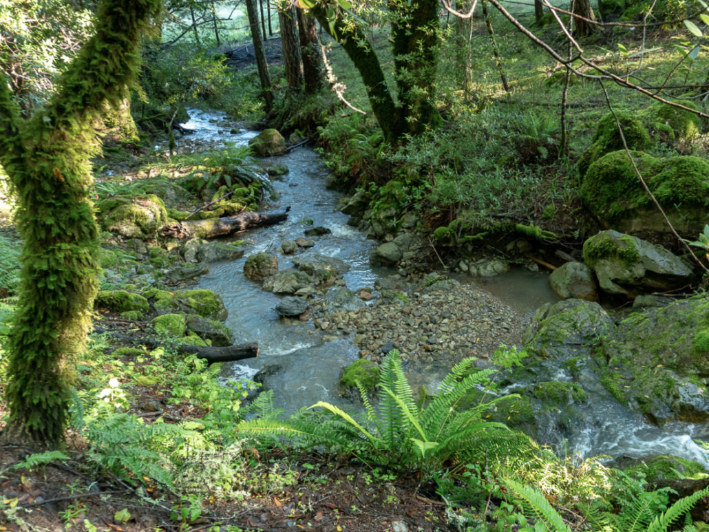
I just love exploring creeks in the Bay Area’s rainy season (roughly November through March). Finally, FINALLY, empty creek beds are filled with water and, for a limited time, we get to hike in water-filled forests. When I’m on a creek hike, everything calms down and tunes in to the shhh sounds of a rushing water, fluttering rain-wet leaves, and glowy green moss. Watching water flow, for just a moment, makes me feel calm and peaceful.
As with waterfalls, timing counts. I try to wait until a few storms have come through, or at least a decent rainfall, to optimize my chances of seeing creeks at their fullest (and stave off the disappointment of a dry creek bed). Later in the wintertime and early spring, after a season’s worth of storms, is also a great time for creek hikes. There is always a chance of mud, so I usually bring a pair of Crocs or sneakers to change into afterward.
Parks can close during strong storms, so I find it helpful to check park websites and social media for trail conditions and closures. Weather, too. When you do find a creek trail that suits you, I hope you will take advantage of this special season and enjoy the restorative power of creeks. Here are 15 creek hike ideas around the Bay Area to get you started:
North Bay
1. Webb Creek, Mount Tamalpais
Steep Ravine is a gorgeous (and steep!) hike on the western slopes of Mount Tam. Begin the inverse, 3.0-mile round-trip from the Pantoll Ranger Station, descending the Steep Ravine Trail into a redwood-filled ravine along Webb Creek. Alternatively, begin at Stinson Beach and head up the Dipsea and Steep Ravine Trails for a 6.4-mile round-trip. Continue up to Mount Tam’s East Peak for an epic 15-mile round-trip adventure. parks.ca.gov, $8 parking fee, no dogs on trails
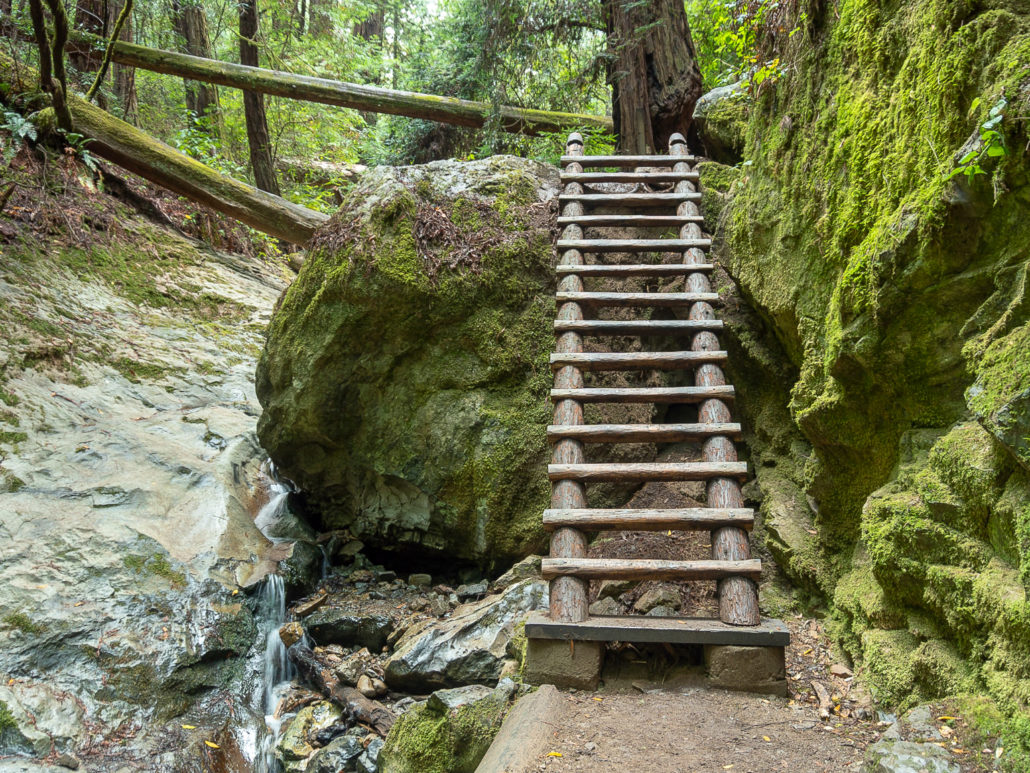
A ladder along the Steep Ravine Trail in Mount Tamalpais State Park
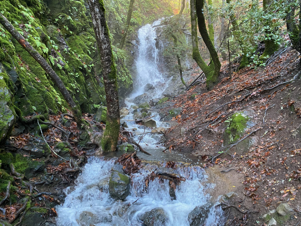
2. Cataract Creek, Mount Tamalpais
Cataract Creek descends the northern slopes of Mount Tamalpais down a beautiful series of waterfalls in the Marin Municipal Water District. The 6.4-mile Cataract Creek – Benstein Loop descends Cataract Creek to the upper waterfall and then loops around quieter trails with more creeks and mountainside vistas. Alternatively, the 3.0-mile Cataract Falls hike ascends Cataract Creek along scenic waterfalls. marinwater.org, free parking, leashed dogs allowed
Cataract Creek descends the northern slopes of Mount Tamalpais
3. Cascade Creek, Mill Valley
If you happen to be in Mill Valley, it’s worth a stop to see Cascade Falls, a short and sweet 0.3-mile round-trip hike on Mount Tam’s southeastern foothills. Begin at a narrow dirt pullout at the entrance to Cascade Park, continuing into a pretty ravine along Cascade Creek to Cascade Falls. For a bit more mileage, start at Old Mill Park and walk about a mile up neighborly Cascade Drive to the park, with more creek views along the way. As a bonus, the Mill Valley Public Library, with floor-to-ceiling windows tucked into a redwood forest, is a stone’s throw away. cityofmillvalley.org, free street parking, leashed dogs allowed
Cascade Falls in Mill Valley
San Francisco
4. Islais Creek, Glen Canyon Park
The Creeks to Peaks hike is a 4.1-mile round-trip hike along eucalyptus-lined Islais Creek in South San Francisco. After hiking through Glen Canyon Park, the route continues up city streets to Twin Peaks, the second-highest peak in San Francisco after Mount Davidson. Just beyond the peak is a 180-degree San Francisco panorama at Christmas Tree Point. sfrecpark.org, free street parking, leashed dogs allowed.
The Creeks to Peaks hike in Glen Canyon Park
East Bay
5. Pine Creek, Diablo Foothills Regional Park
Pine Creek flows through pretty rolling grassland in Walnut Creek’s Diablo Foothills Regional Park. Beginning at the foothills’ parking area, the Stage Road Trail travels south along Pine Creek beneath high sandstone formations, home to nesting peregrine falcons. After a mile, the trail passes through four creek crossings that can be up to a foot deep after heavy rain…you may have to do some creative rock-hopping. At the 1.6-mile mark, turn right onto the Little Yosemite Trail to see a seasonal waterfall. ebparks.org, free parking, leashed dogs allowed up to the seasonal waterfall, before the trail crosses into Mount Diablo State Park
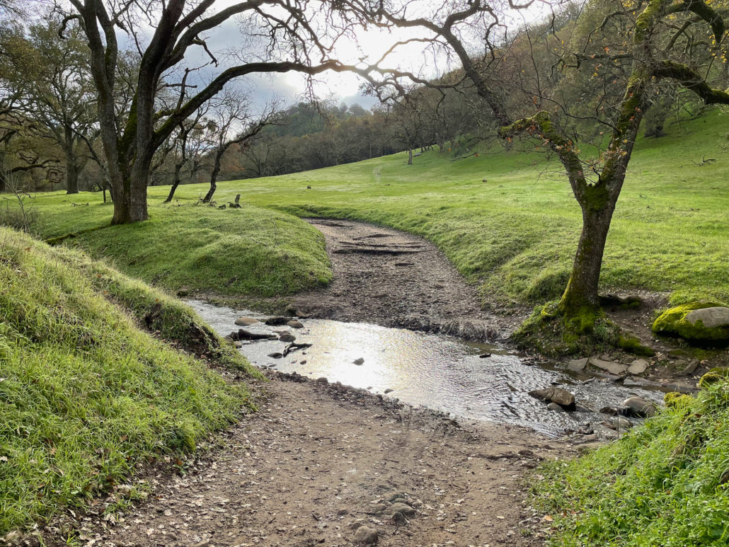
Pine Creek crossing over a trail in Diablo Foothills Regional Park
6. Horseshoe Creek, Leona Heights Park
Horseshoe Creek is a short and sweet hike in Oakland with delightful mini-waterfalls and cascades. Begin the 2.8-mile round-trip hike on the narrow York Trail and climb a rocky ravine along the creek. (There are some steep drop-offs: Please take care of children and pups.) Then merge onto a wide dirt road towards Merritt College to see vistas of the San Francisco Bay. oaklandparks.org, free street parking, leashed dogs allowed
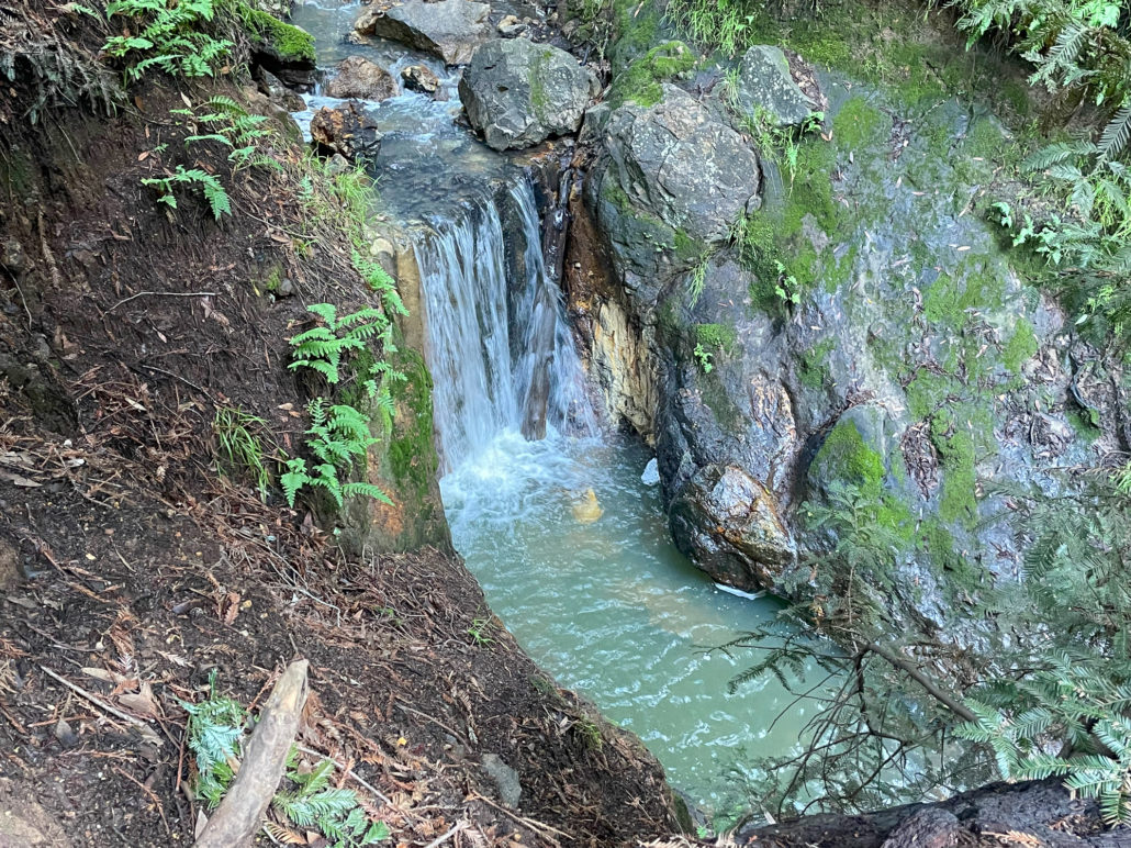
A waterfall along Horseshoe Creek in Leona Heights Park
7. Alameda Creek, Sunol Regional Wilderness
Alameda Creek flows along the Sunol Valley Floor below hilly green pastures in Sunol Regional Wilderness. Beginning at the Sunol Visitor Center, a 3.3-mile round-trip hike traces its path along Camp Ohlone Road to Alameda Creek Overlook, formerly known as Little Yosemite. The overlook is a scenic, boulder-filled gorge with Alameda Creek’s cascades. Swimming isn’t allowed, but it makes a nice rest spot and picnic break. For a longer hike, visit the overlook as part of the 8.2-mile Sunol Grand Loop. ebparks.org, $5 parking fee on weekends and holidays, leashed dogs allowed – $2 per dog
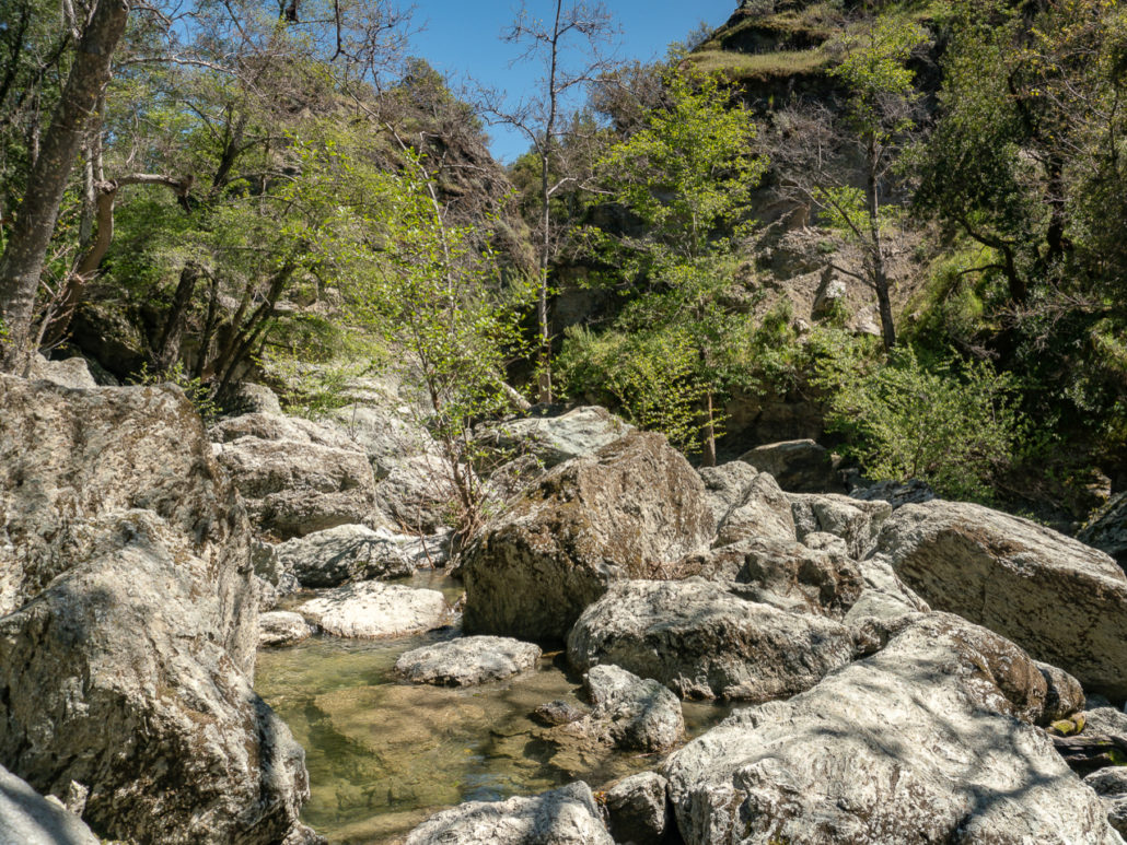
Alameda Creek Overlook in Sunol
Peninsula & South Bay
8. Swanson Creek, Uvas Canyon County Park
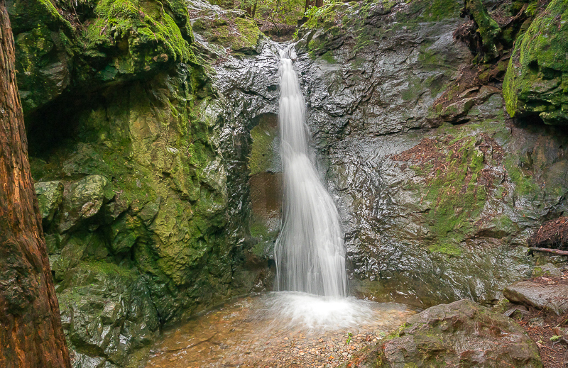
We owe the beautiful waterfalls in Uvas Canyon County Park to Swanson Creek and its tributaries in Morgan Hill. Follow signs for the Waterfall Loop on a 2.0-mile round-trip hike along the creek. A picnic table near Upper Falls at Myrtle Flats is an excellent spot for a hot cocoa break. Alternatively, hike the full 5.2-mile loop to see all six waterfalls. parks.sccgov.org, $6 parking reservation required, leashed dogs allowed
Waterfall off the 2.0-mile Waterfall Loop in Uvas Canyon County Park
9. Los Alamitos Creek, Almaden Lake Park
The Los Alamitos Creek Trail is a 4.7-mile paved urban trail alongside Los Alamitos Creek in San Jose’s Almaden Valley. The willow-lined trail runs south from Almaden Lake Park to McKean Road, with occasional scenic bridges and migrating birds. It’s a good option for getting outside on a drizzly day without muddying up your shoes. sanjoseca.gov, leashed dogs allowed, free parking at multiple entrances along the trail
A view of Los Alamitos Creek from the Los Alamitos Creek Trail
10. Stevens Creek, McClellan Ranch Preserve
Take a mid-day break at McClellan Ranch Preserve, in Cupertino, on a 2.0-mile round-trip urban hike with views of Stevens Creek. The flat, paved Stevens Creek Trail begins near the Santa Clara Valley Audubon Society’s Nature Shop and Library, and continues past a 4-H farm with alpacas to Stevens Creek Boulevard, the turnaround point. cupertino.org, free parking, leashed dogs allowed on Stevens Creek Trail
Stevens Creek seen from a bridge next to the Stevens Creek Trail
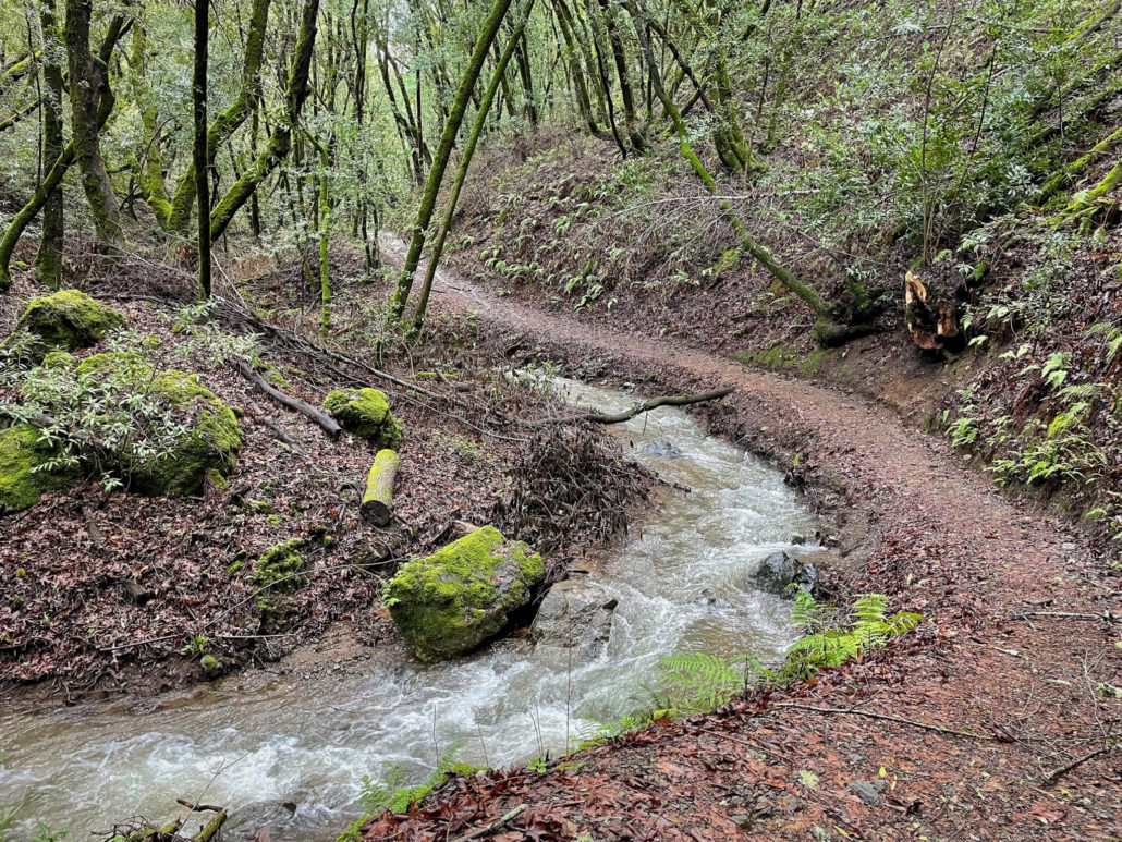
11. Peters Creek, Long Ridge Preserve
Peters Creek is a lovely, rushing creek in Long Ridge Preserve in the Santa Cruz Mountains near Saratoga. Descend 0.5 miles from the Peters Creek Trailhead to the mossy forest surrounding Peters Creek with bubbling cascades. Make it a 4.6-mile loop by adding on the Long Ridge Trail and Wallace Stegner bench. openspace.org, free parking, no dogs allowed on Peters Creek Trail
Peters Creek in Long Ridge Preserve
12. Adobe Creek, Hidden Villa
Hidden Villa’s hiking trails follow along Adobe Creek’s West, Middle, and East Forks for creekside hiking beneath beautiful bay trees in Los Altos Hills. Take the 5.4-mile Grand Loop to visit the creeks and hike up to Santa Clara Valley vistas. Shorten it to the 1.8-mile Creek Trail-Pipeline Trail hike for a scenic alternative. hiddenvilla.org, $10 parking fee, no dogs allowed on hiking trails
Adobe Creek in Hidden Villa
13. Dennis Martin Creek, Thornewood Preserve
Dennis Martin Creek’s photogenic cascades flow down a redwood forest at Thornewood Preserve in Woodside. Explore the preserve’s 1.5 miles of trails on a 3.0-mile round-trip hike to see spring wildflowers, redwoods, Schilling Lake, and of course, the pretty creek. There are two entrances to the preserve, a lower entrance on Old La Honda Road and an upper entrance off Highway 84. The lower entrance offers a bottoms-up approach, however, a creek crossing near the entrance can be challenging when the water flow is high. The upper entrance has more parking and descends to the creek. openspace.org, free parking, leashed dogs allowed
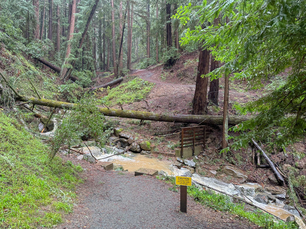
A creek crossing near the Old La Honda Road entrance can be challenging to cross when the water level is high.
Santa Cruz
14. Eagle Creek, Henry Cowell State Park – Hiking alongside the San Lorenzo River and its tributary, Eagle Creek, are highlights of the 5.0-mile Henry Cowell Observation Deck Loop. The hike begins from the Main Unit of Henry Cowell State Park, with its famous 40-acre grove of ancient redwoods. Next, it climbs up a redwood ravine beside Eagle Creek, topping off at a picnic-perfect observation deck surrounded by spring wildflowers. parks.ca.gov, $10 parking fee, no dogs allowed on this loop, okay on select trails
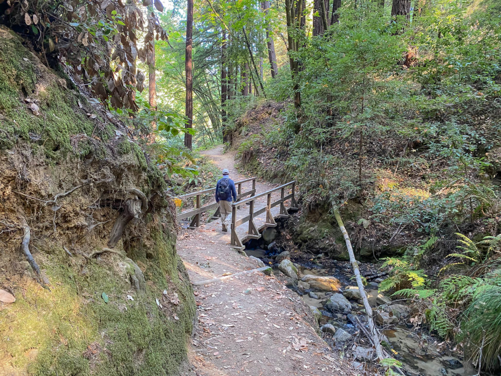
A bridge over Eagle Creek in the Main Unit of Henry Cowell State Park
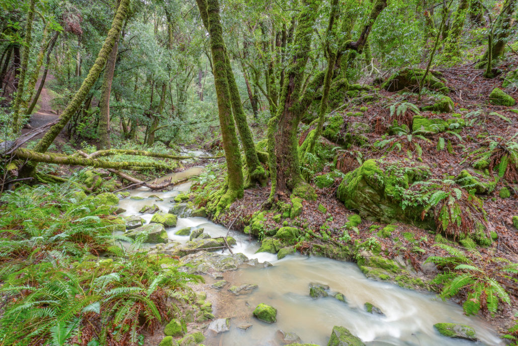
15. Fall Creek, Henry Cowell State Park
Fall Creek is a stunner of a hike through a redwood forest in Henry Cowell State Park. The Fall Creek Trail follows Fall Creek along the bottom of a redwood canyon for over two miles. After about a mile, the South Fork Trail leads to the remains of lime kilns from the late 19th and early 20th centuries. Add on a visit to Big Ben, an ancient redwood, on the 8.9-mile Big Ben-Fall Creek Loop. parks.ca.gov, free parking, no dogs allowed
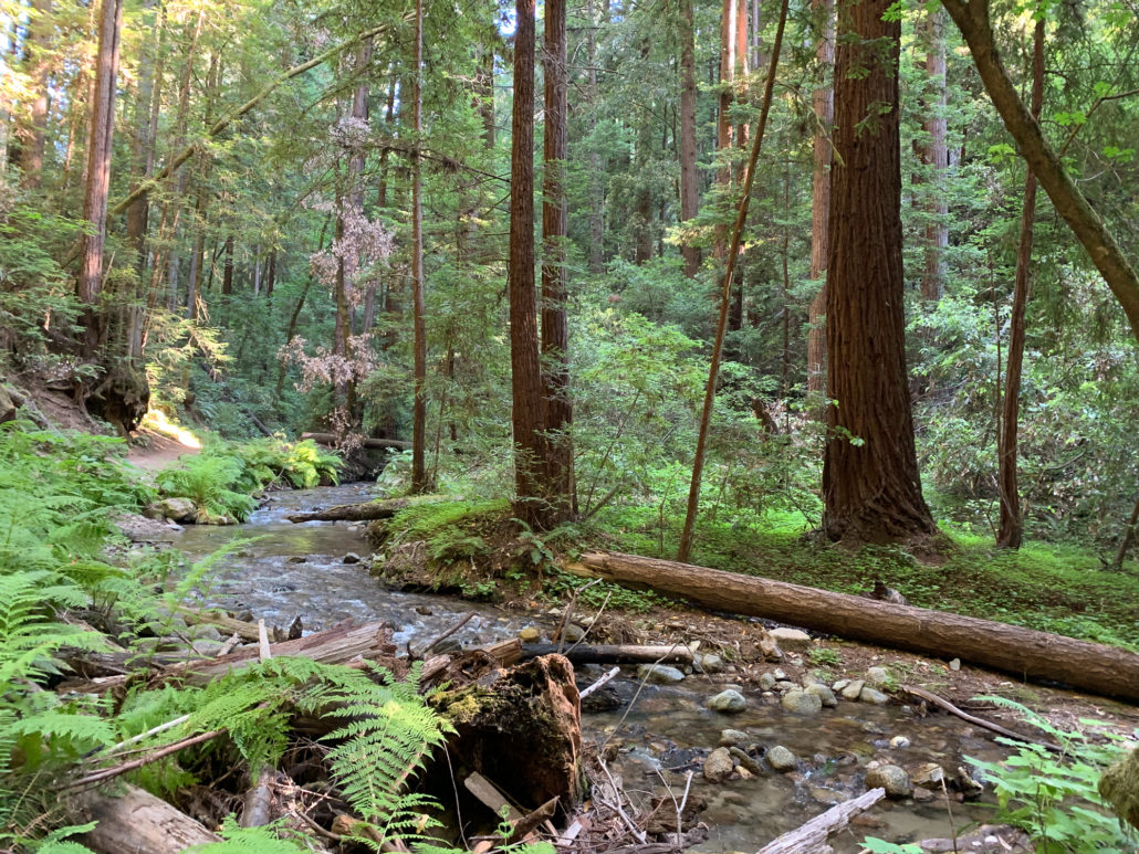
Redwoods and Fall Creek in the Fall Creek Unit of Henry Cowell State Park
Tags: bay area, creek hikes, creeks, Diablo Range, east bay, Mount Tamalpais, North Bay, peninsula, redwoods, san francisco, Santa Cruz, Santa Cruz mountains, South Bay, waterfalls, wildflowers