Sunol Regional Wilderness is a stunning East Bay park in southern Alameda County that blends pioneer and ranching heritage with hiking, camping, and horseback riding. Steep hiking trails, grazing cattle, wildflowers, and Ireland-like grasslands (well—in spring, anyway) roll up to an amphitheater surrounding High Valley, with Alameda Creek carving a path along the park’s southwestern boundary. This loop hike is a challenging tour through Sunol’s grasslands and peaks, with stops at Flag Hill, Vista Grande, Cerro Este Overlook, and Alameda Creek Overlook.
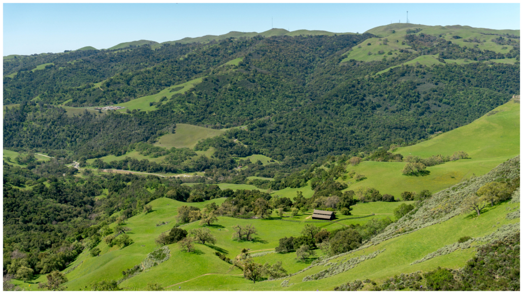
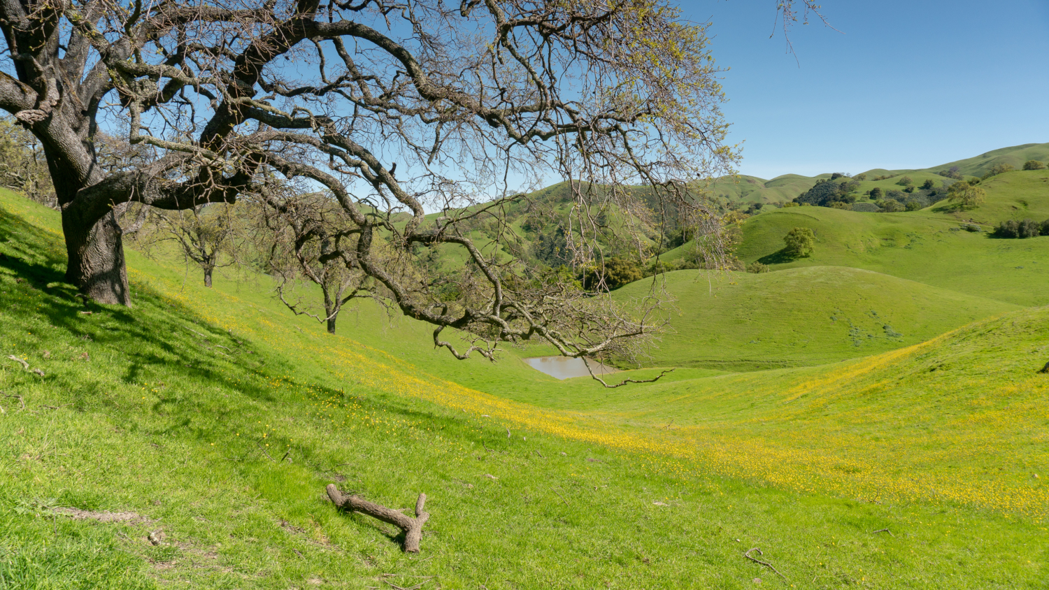
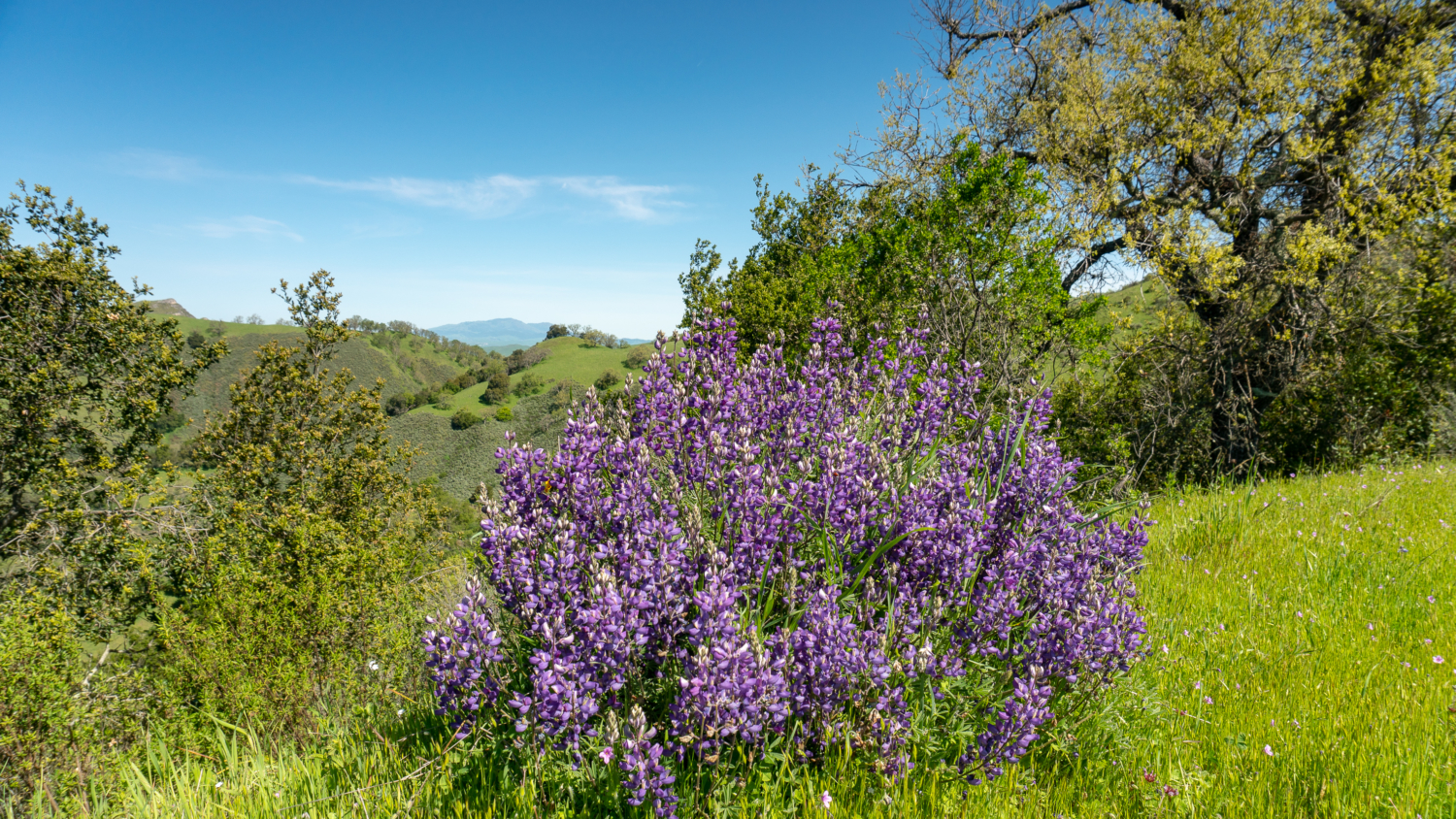
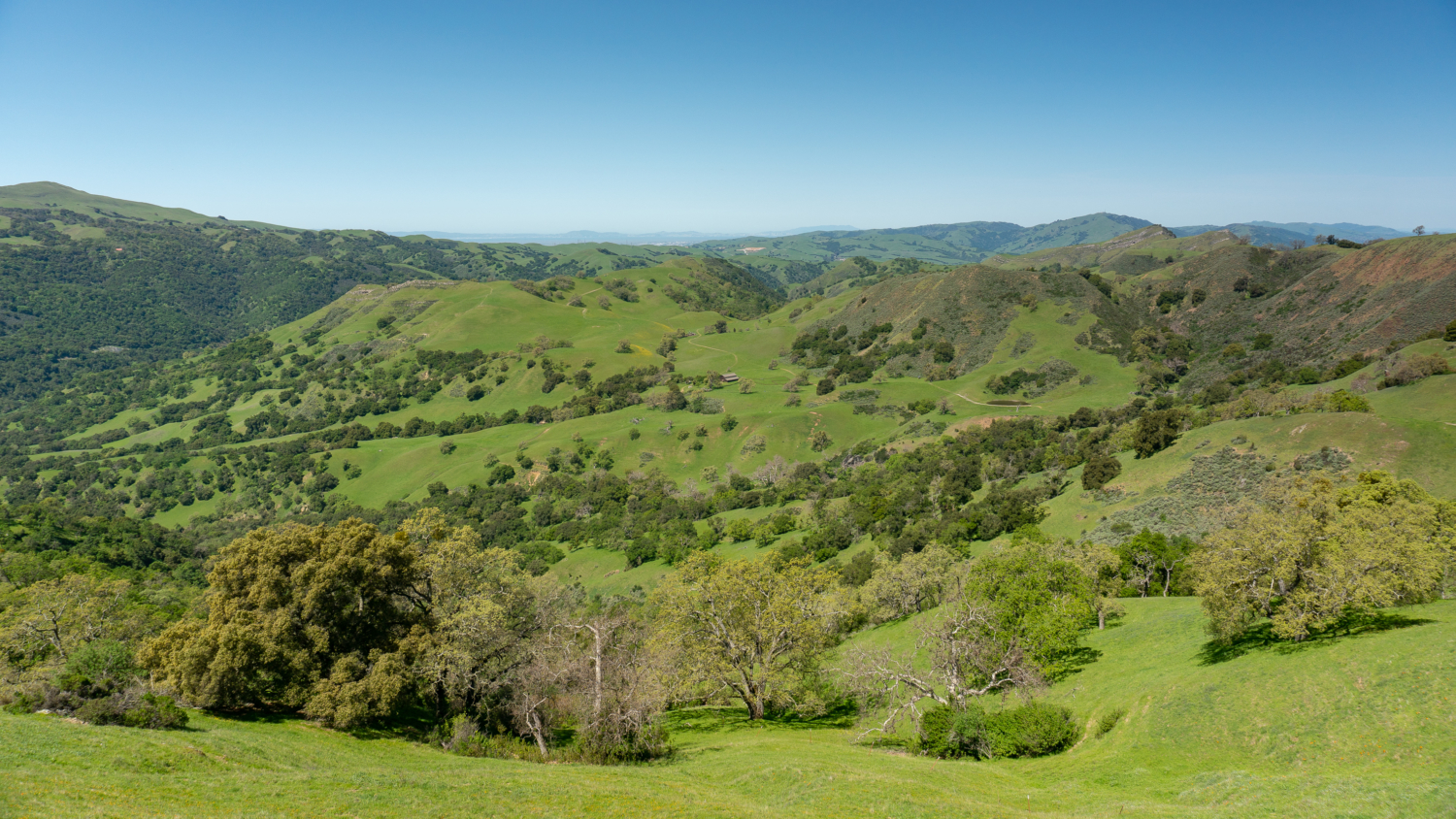
Stunning views of High Valley and nearby peaks are one of the best rewards of hiking in Sunol Regional Wilderness
The Chochenyo Ohlone-speaking Taunans were early inhabitants of Sunol Regional Wilderness, and lived there for generations. In the mid-1860s, Mary Ann and Patrick Geary built a homestead near Indian Joe Creek, farmed, and raised their eleven children there. Their son, Maurice Geary, built a home nearby for his wife in 1895 on the banks of Alameda Creek. After a fire, the home was rebuilt in 1954 and today it serves as the park’s interpretive offices and visitor center.
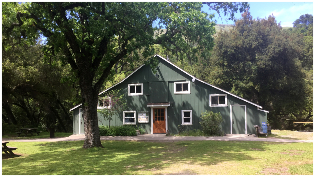
Old Green Barn Visitor Center, Sunol Regional Wilderness
In 1939, Willis Brinker bought homesteads from families and created JB Ranch on 3,383 acres. Tragically, Brinker died fighting a fire on the ranch in 1959. After that, the East Bay Regional Parks District purchased the land and opened the park in 1962. Today, the Sunol Regional Wilderness honors its pioneer and ranching heritage with an annual Cowboy Hootenanny in the fall.
Ranching and pioneer heritage aside, Sunol Regional Wilderness is also famous for its painted hills of wildflowers in springtime. Each year, the park hosts the Sunol Wildflower Festival in mid-April and offers free naturalist-led wildflower hikes, among other nature activities. To identify wildflowers, check out the free Sunol wildflower guide on the East Bay Regional Parks’ website. The park also sells a pocket-sized booklet of 75 common wildflowers at the visitor center. To see a schedule of nature activities in the park, check out the park’s activity calendar.
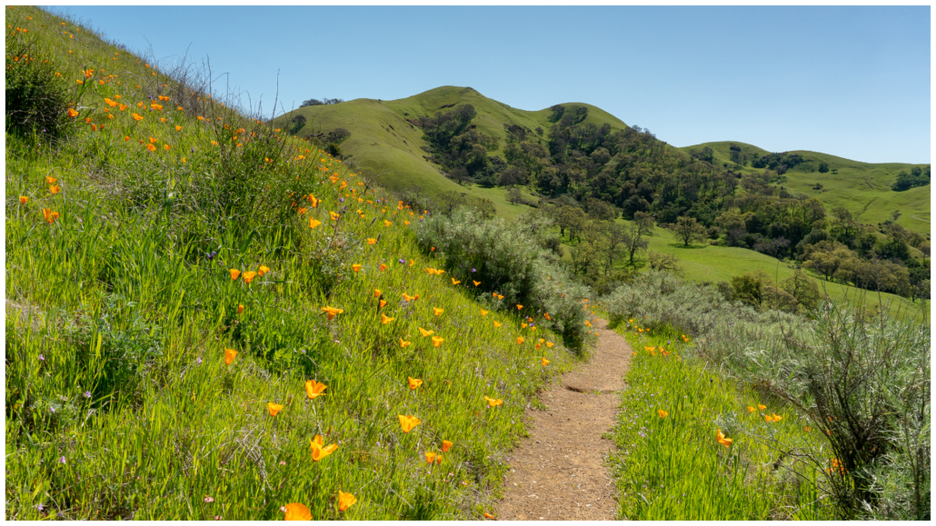
California poppies dance in springtime at Sunol Regional Wilderness
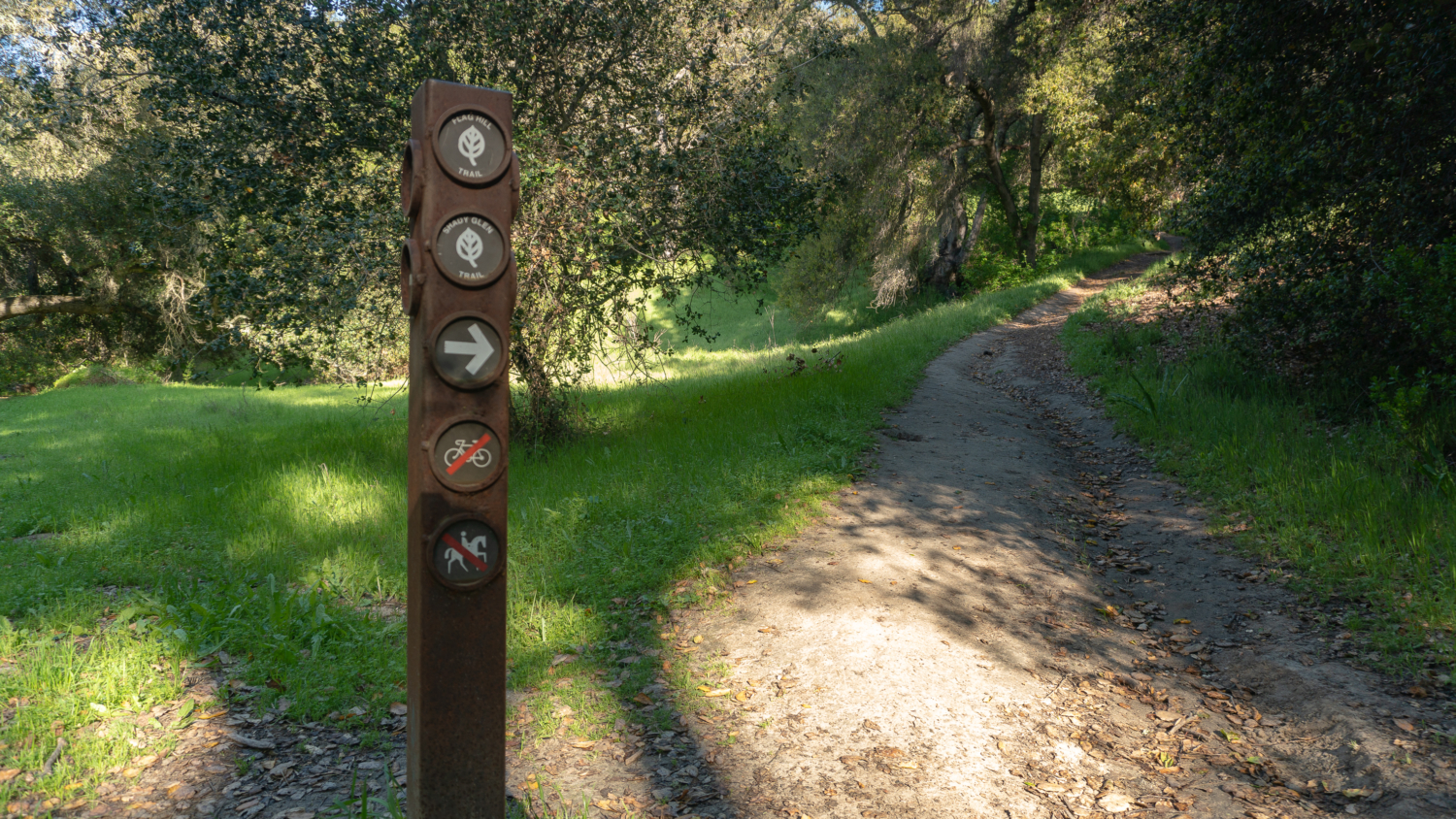
All right, let’s hike! Start your hike from the parking lot, spotting red discs on the fence and signposts. The discs mark the path of the Ohlone Regional Wilderness Trail, a 28-mile one-way hike through four East Bay Regional Parks: Mission Peak Regional Preserve, Sunol Regional Wilderness, Ohlone Regional Wilderness, and Del Valle Regional Park.
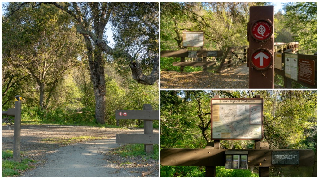
Red discs throughout the park mark the Ohlone Regional Wilderness Trail
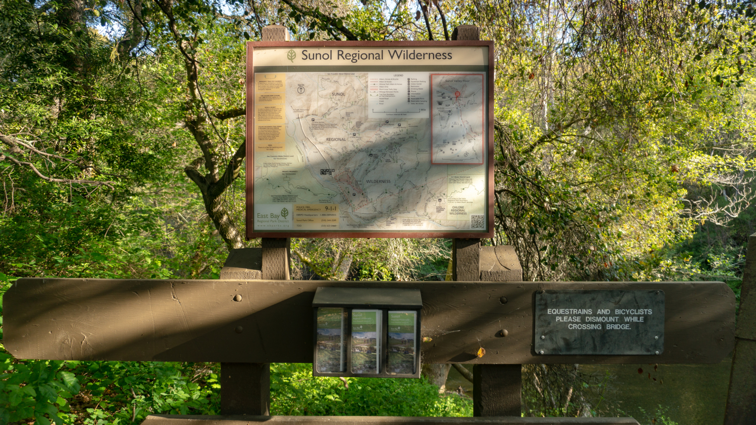
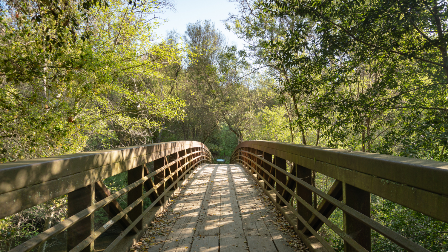
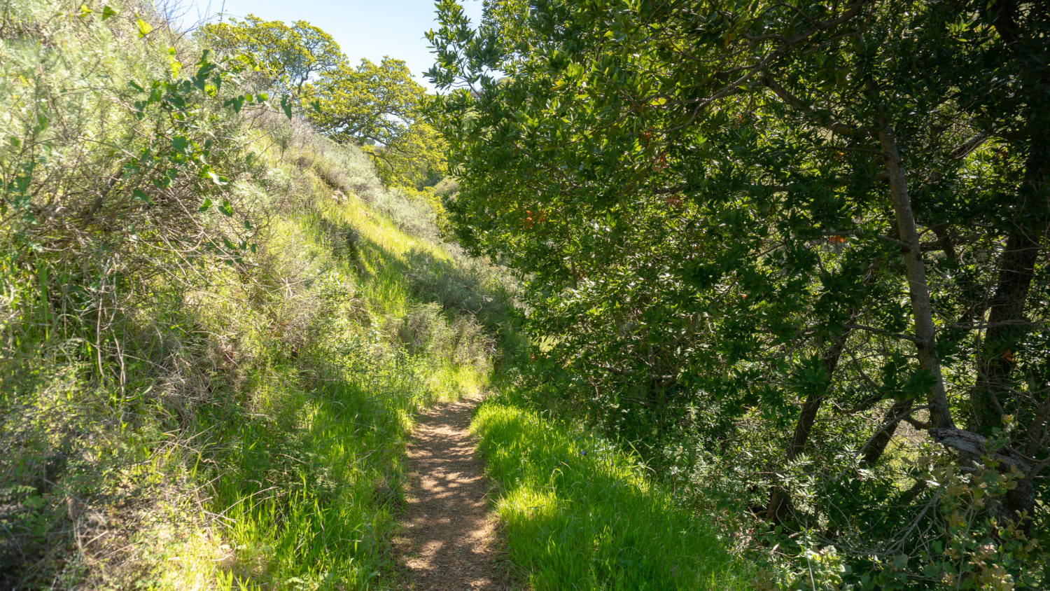
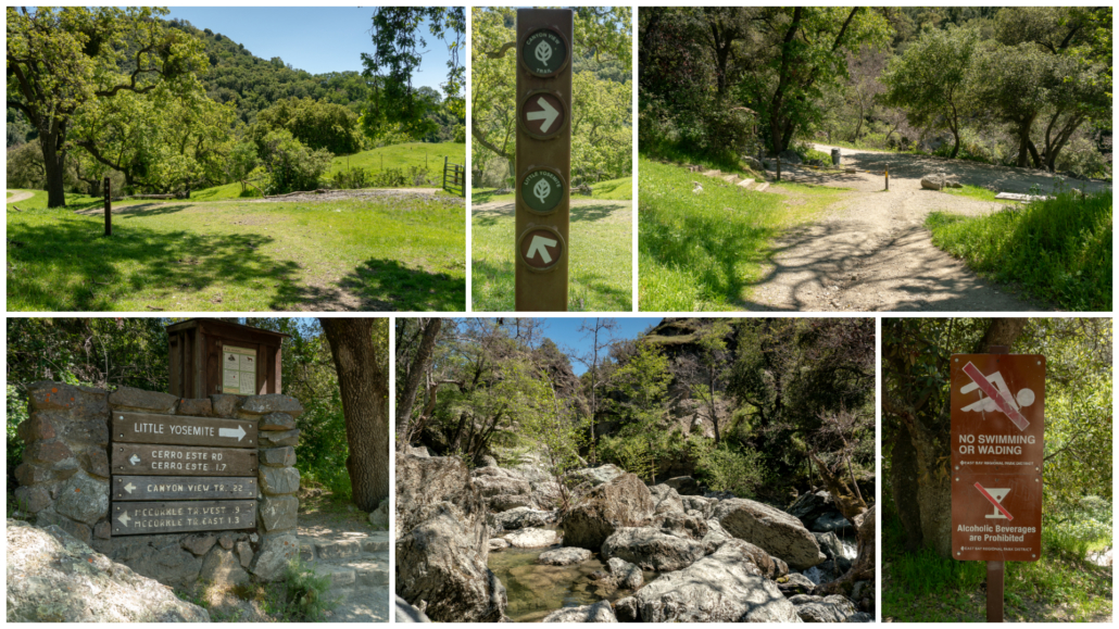
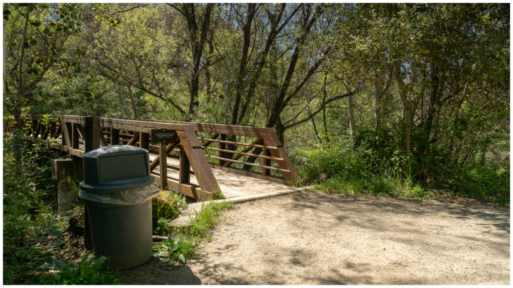
Arrive at a footbridge over Alameda Creek in 50 feet. Here there is a large Sunol Regional Wilderness map, free trail maps, and park information. Cross the bridge and then turn left onto a dirt trail for 0.2 miles, heading northwest. The mostly shady trail wanders beside Alameda Creek. Leafy alder, willow, and buckeye brush the space like feather dusters.
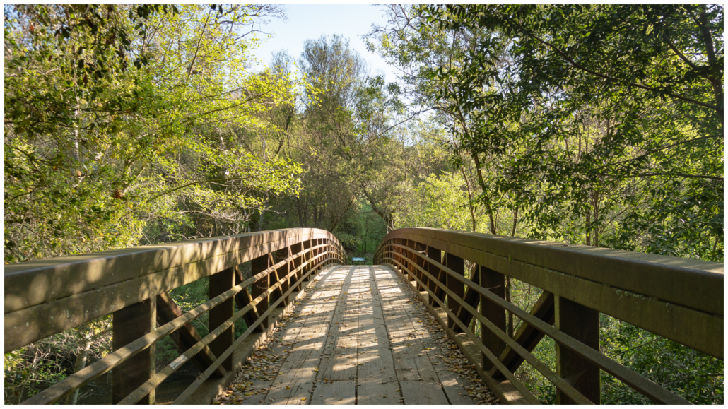
Bridge over Alameda Creek
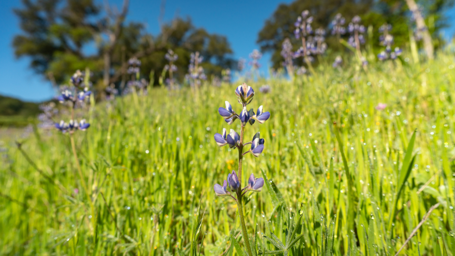
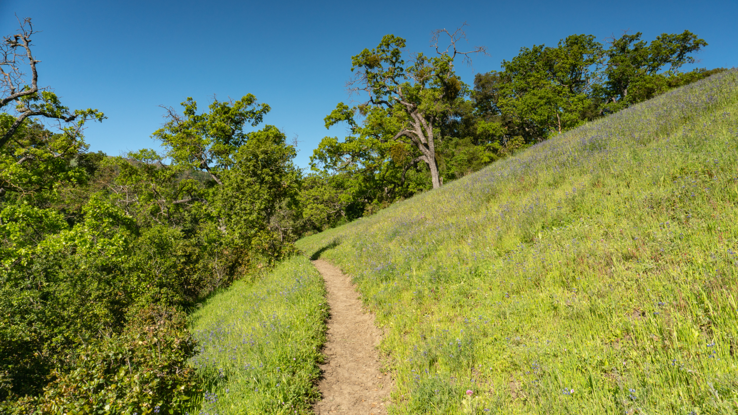
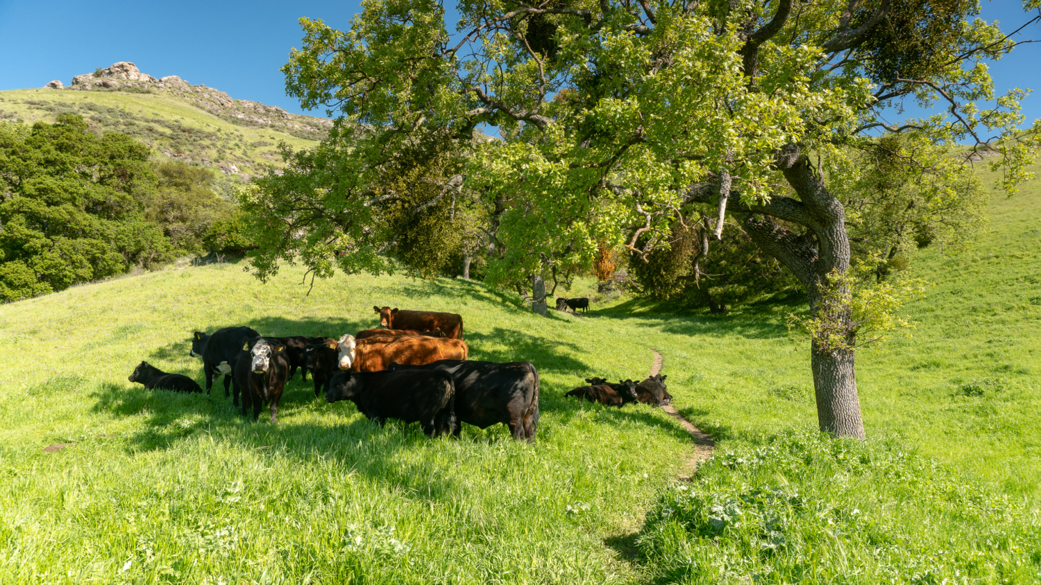
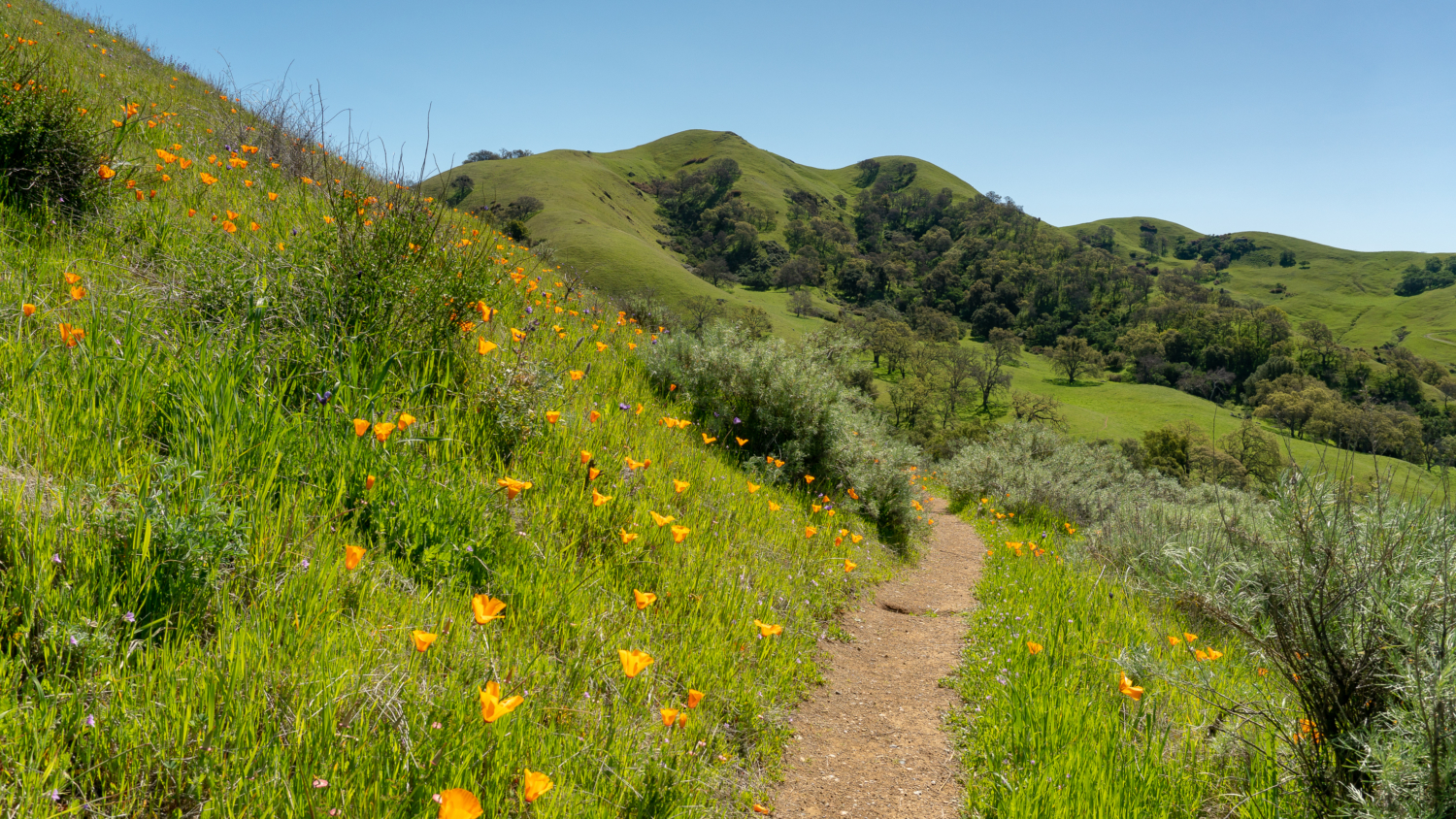
At the next junction, turn right, and then in 200 feet, make a quick left, following signs for the Flag Hill Trail. Climb sharply north, gaining over 900 feet in the next 1.1 miles. The single-track trail weaves in and out of shady oaks, and passes through grasslands and a cattle gate. Hillsides burst with lupine, buttercup, vetch, and poppies in spring. Grazing cows are common, sometimes resting right on the trail. Although they can be intimidating, the trick is to talk normally and simply walk past them.
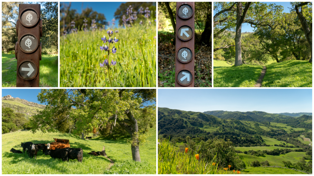
Stunning grasslands, lupine, and grazing cows on the Flag Hill Trail
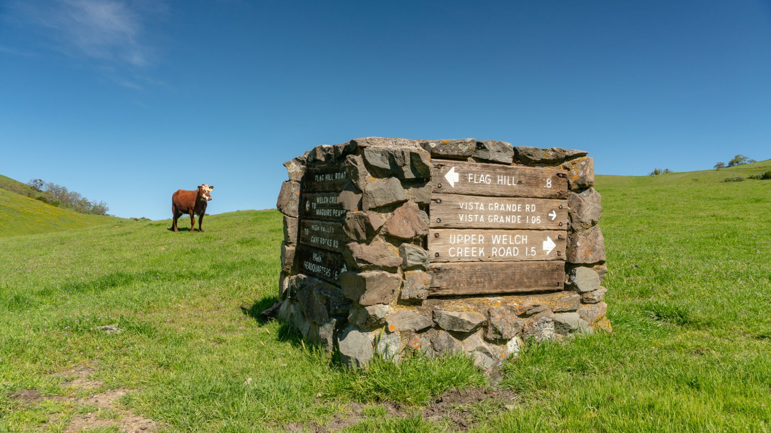
At 1.4 miles, arrive at Flag Hill, marked with a stone monument. Wooden trail signs are embedded within the squat, square monument, and a unique kind of marker in Sunol Regional Wilderness. Our loop continues to the right on Flag Hill Road, but before you head that way, turn left towards the outcrop of fossiliferous sandstone. An overlook here offers a prime view of the beautiful green pastures, oak woodland, and the valley below. Calaveras Reservoir peeks out between ridges to the south, and there is a bench here where you can catch your breath.
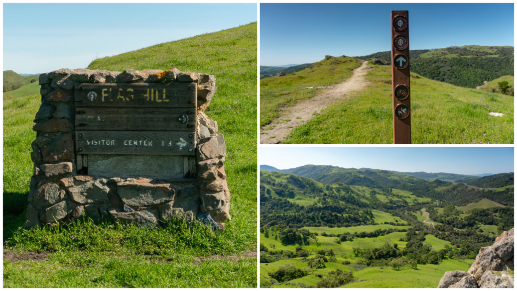
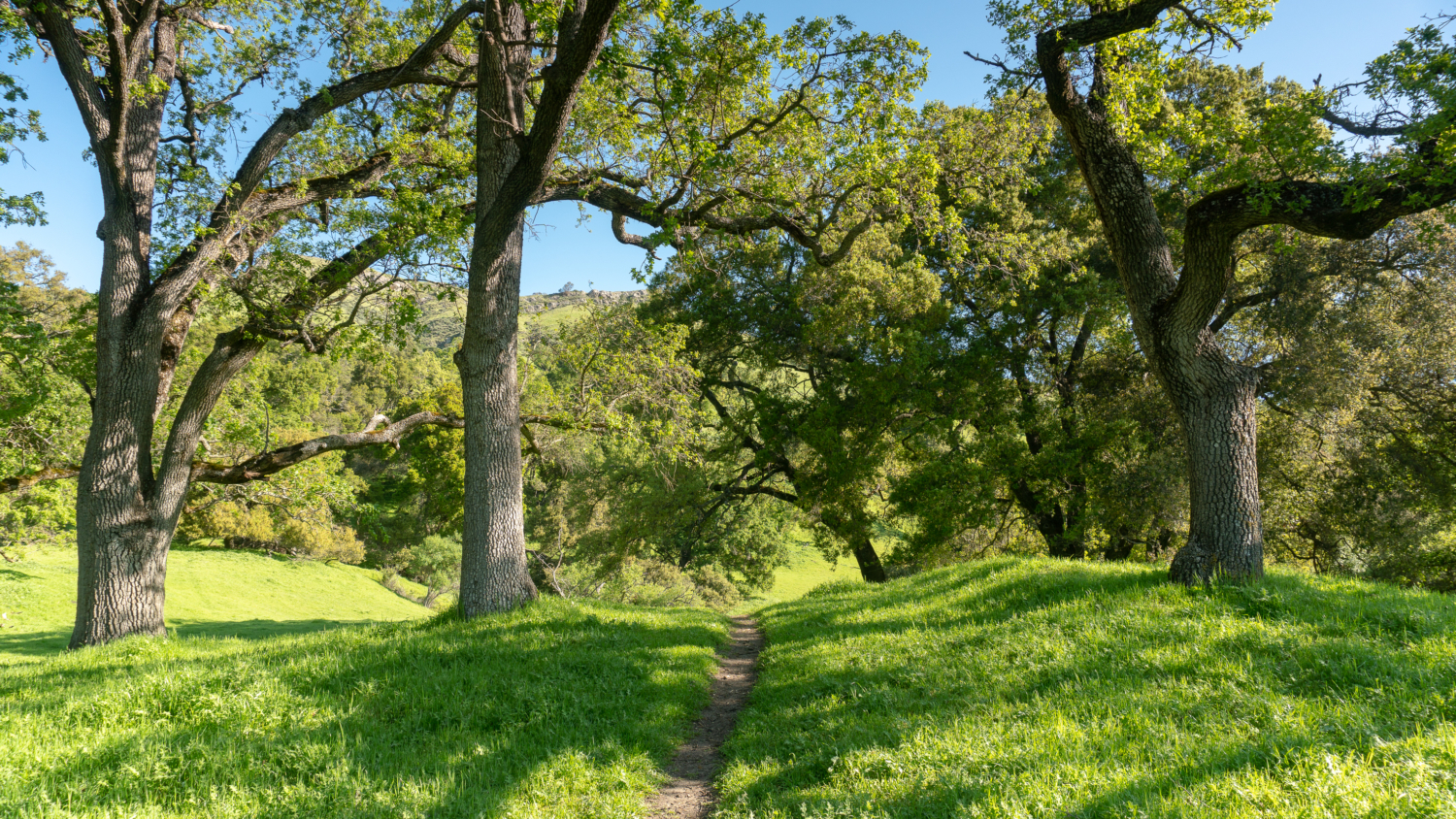
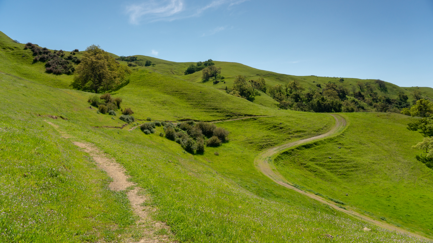
When ready, return to the stone monument and turn left, heading north on Flag Hill Road towards High Valley. Bear sharp right at a grey tank, descending 250 feet to High Valley. The view from this grassy road is spectacular; you might see ground squirrels scurrying to and from their underground nests and fields of buttercups in the meadows.
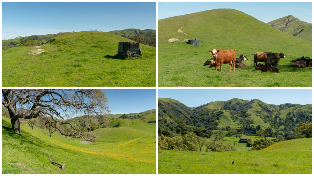
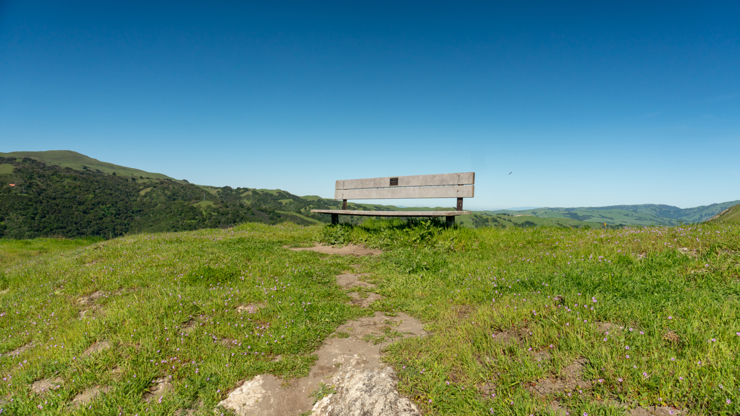
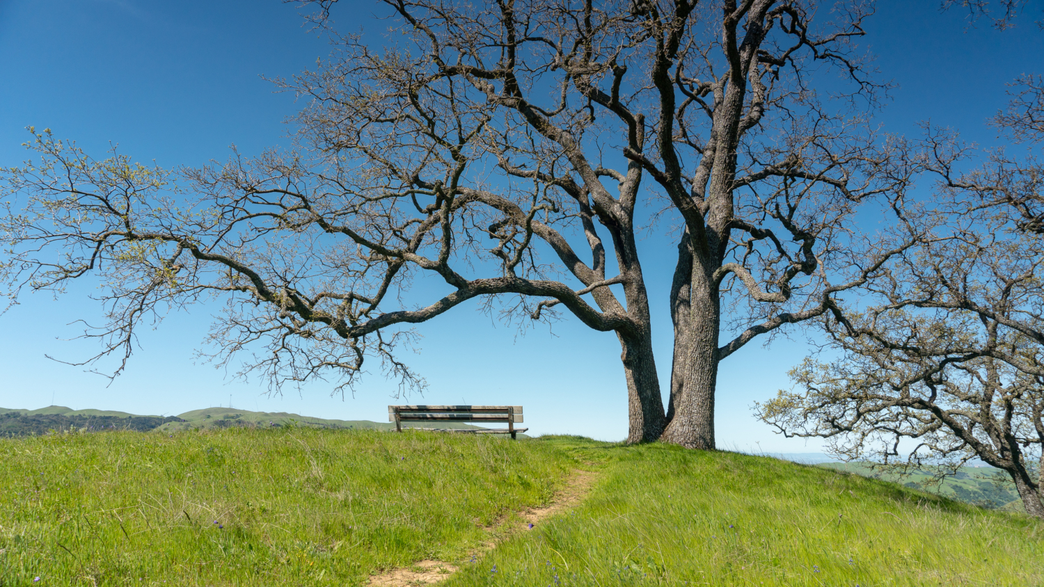
At 2.4 miles, stay straight at a four-way junction onto Vista Grande Road. Ascend a stiff 430 feet over the next 0.6 miles. Hiking east, you have gorgeous views of the Santa Cruz Mountains to the southwest, San Bruno Mountain to the northwest, and Mount Diablo to the north. Johnny jump-ups, lupine, and popcorn flower dust the roadside. Two small knolls have spur trails leading to quiet benches overlooking the valley. Overhead you might see turkey vultures and hawks riding thermals, searching for food.
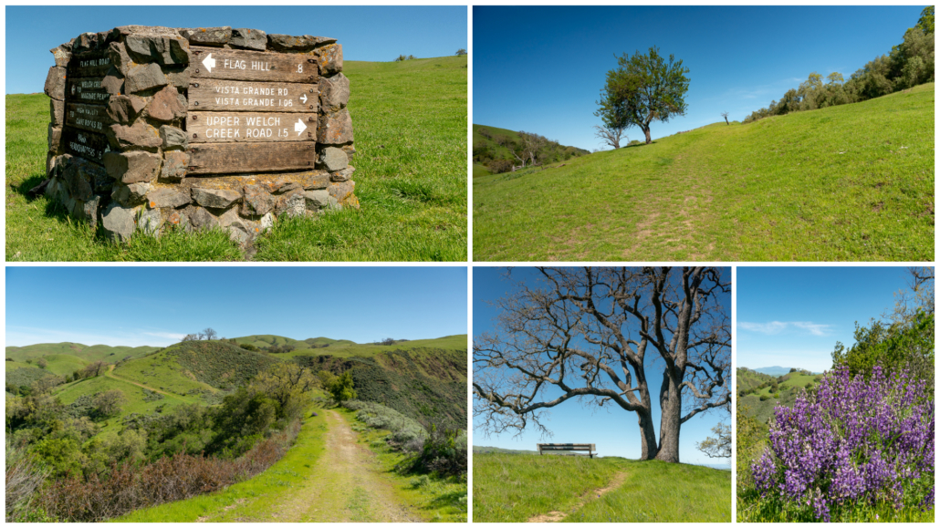
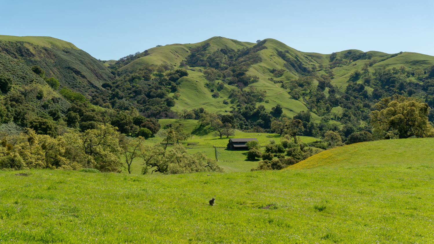
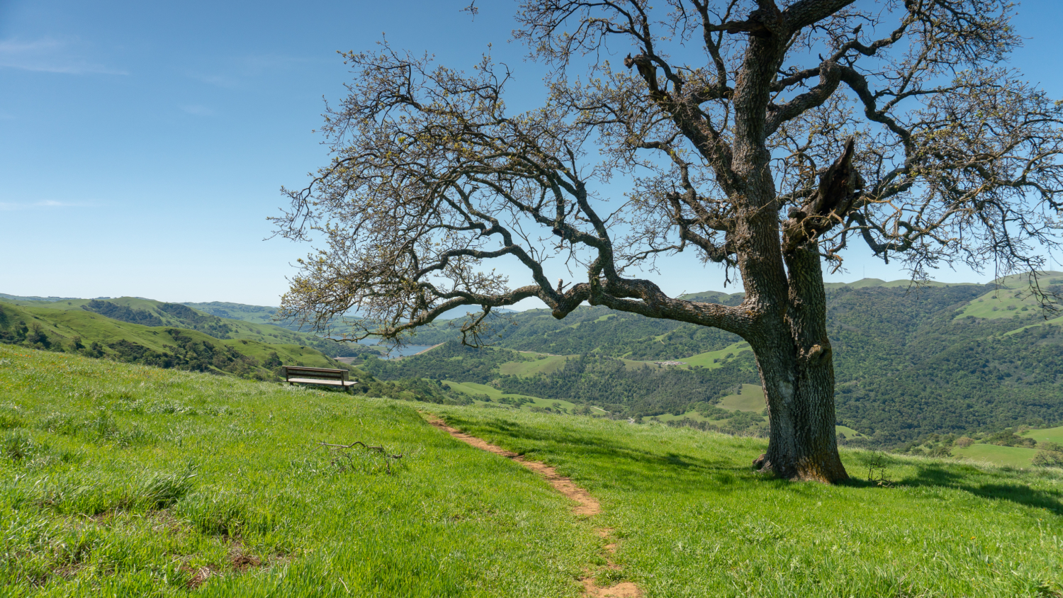
Reach Vista Grande Overlook at 3.5 miles, marked with a stone monument. Turn right onto the single-track Eagle View Trail towards Cerro Este. Another lovely bench here overlooks the big brown barn in High Valley, and above it, Monument Peak and Mount Allison to the west. The Eagle View Trail descends beneath the ridge among poppies, lupine, blue dicks, and gray-green sagebrush. Cross Indian Joe Creek beneath shady California bay, emerging back out into the open.
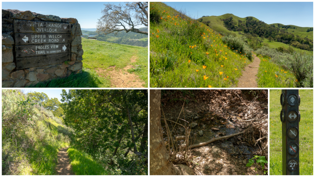
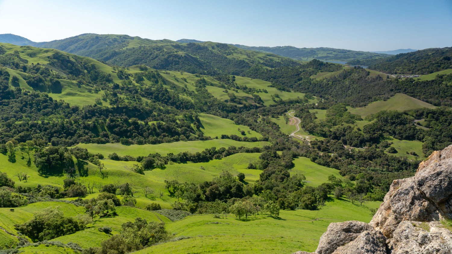
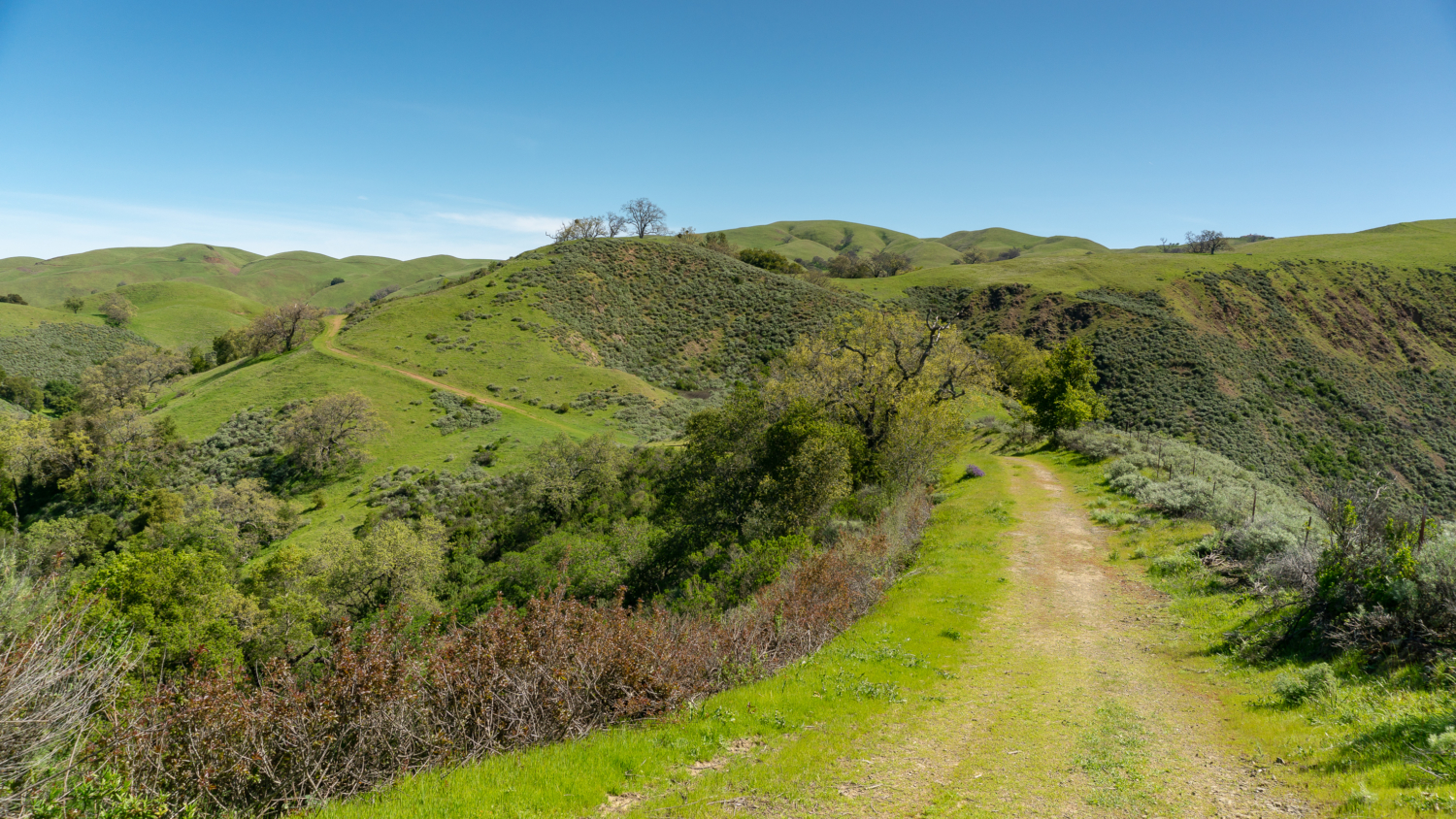
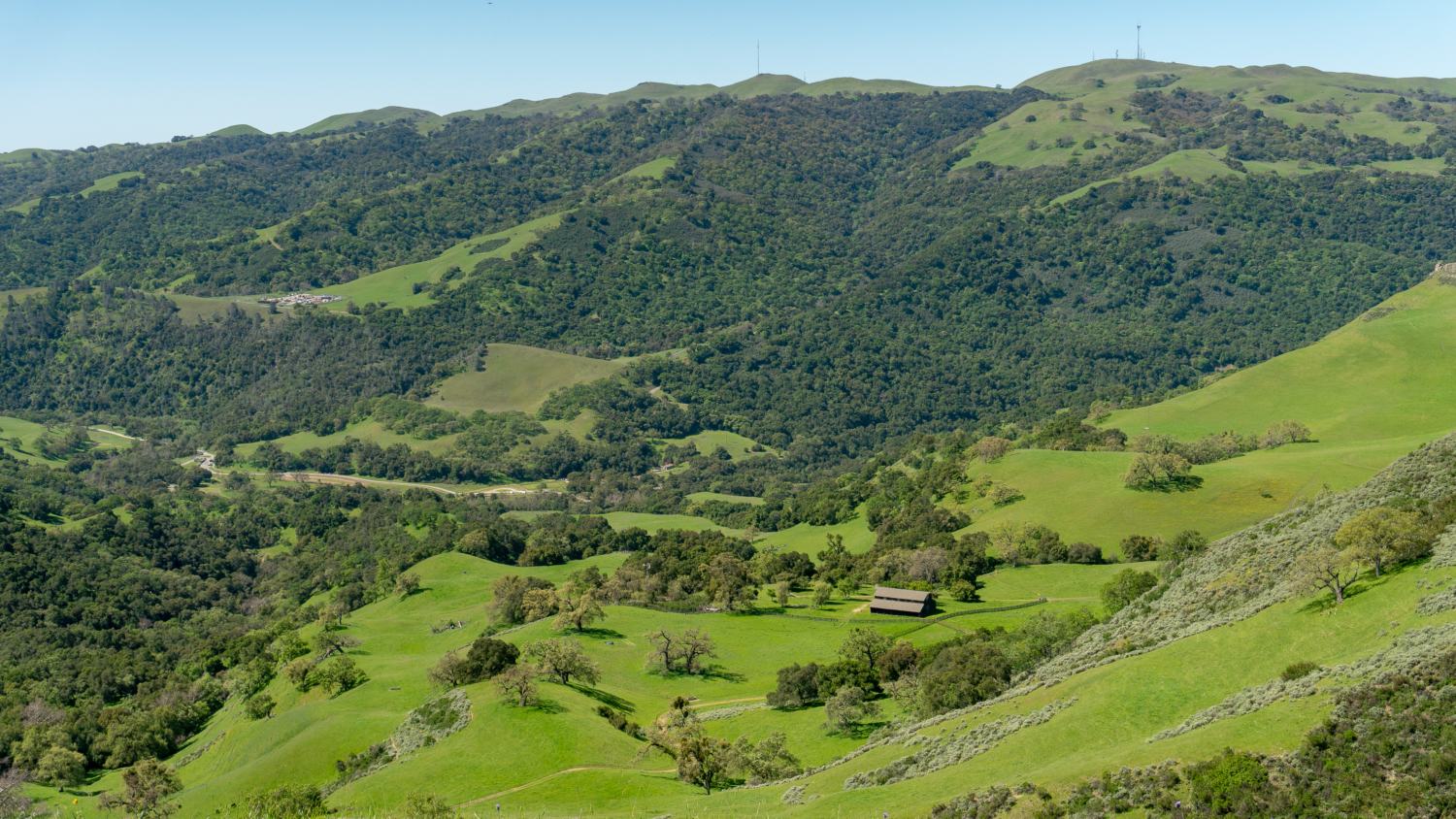
At 4.4 miles, turn left to merge onto Cave Rocks Road, climbing 275 feet over the next 0.6 miles to Cerro Este Overlook. A stone monument marks the overlook, the high point of the hike at 1730 feet. It is one of the most sweeping panoramas in the whole park, with a bird’s eye view of High Valley, Mission Peak, Flag Hill, and a sliver of the San Francisco Bay. A bench here is a great spot for your snack or lunch break.
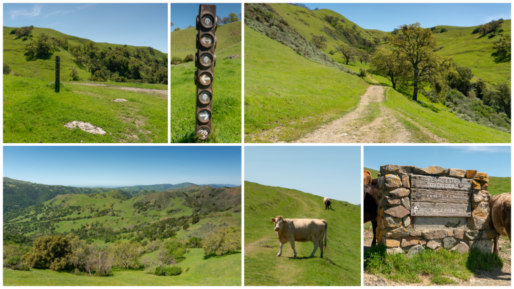
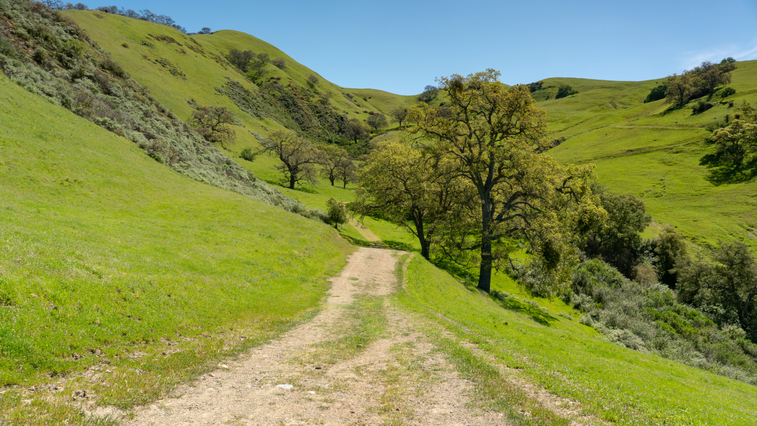
When ready, continue past the overlook onto Cerro Este Road, descending a sharp 1000 feet south over the next 1.5 miles to the Canyon View Trail. Although this is a steep descent, once again, you are rewarded with wonderful views—a ridgeline above Alameda Creek that rises over 3,000 feet to the south, clearer views of the Calaveras Reservoir, and the Santa Cruz Mountains to the southwest. Monkey flower, scarlet pimpernel, morning glory, and oh yes—poison oak—are part of the trail’s edges here.
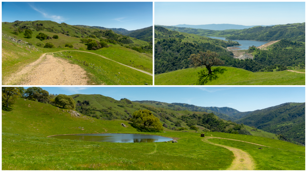
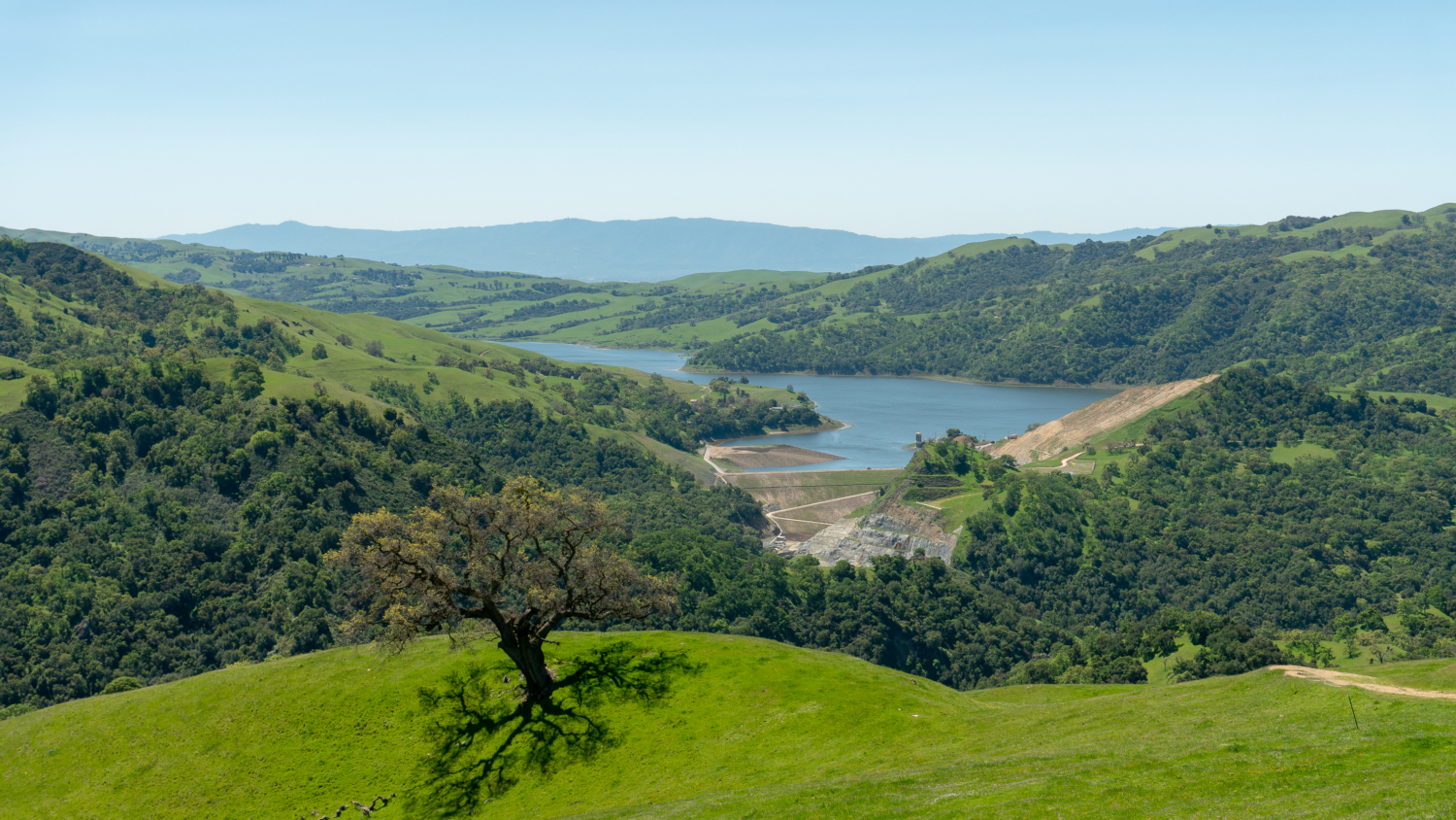
Steep ridges, the Calaveras Reservoir, and a cow pond on the way to Alameda Creek
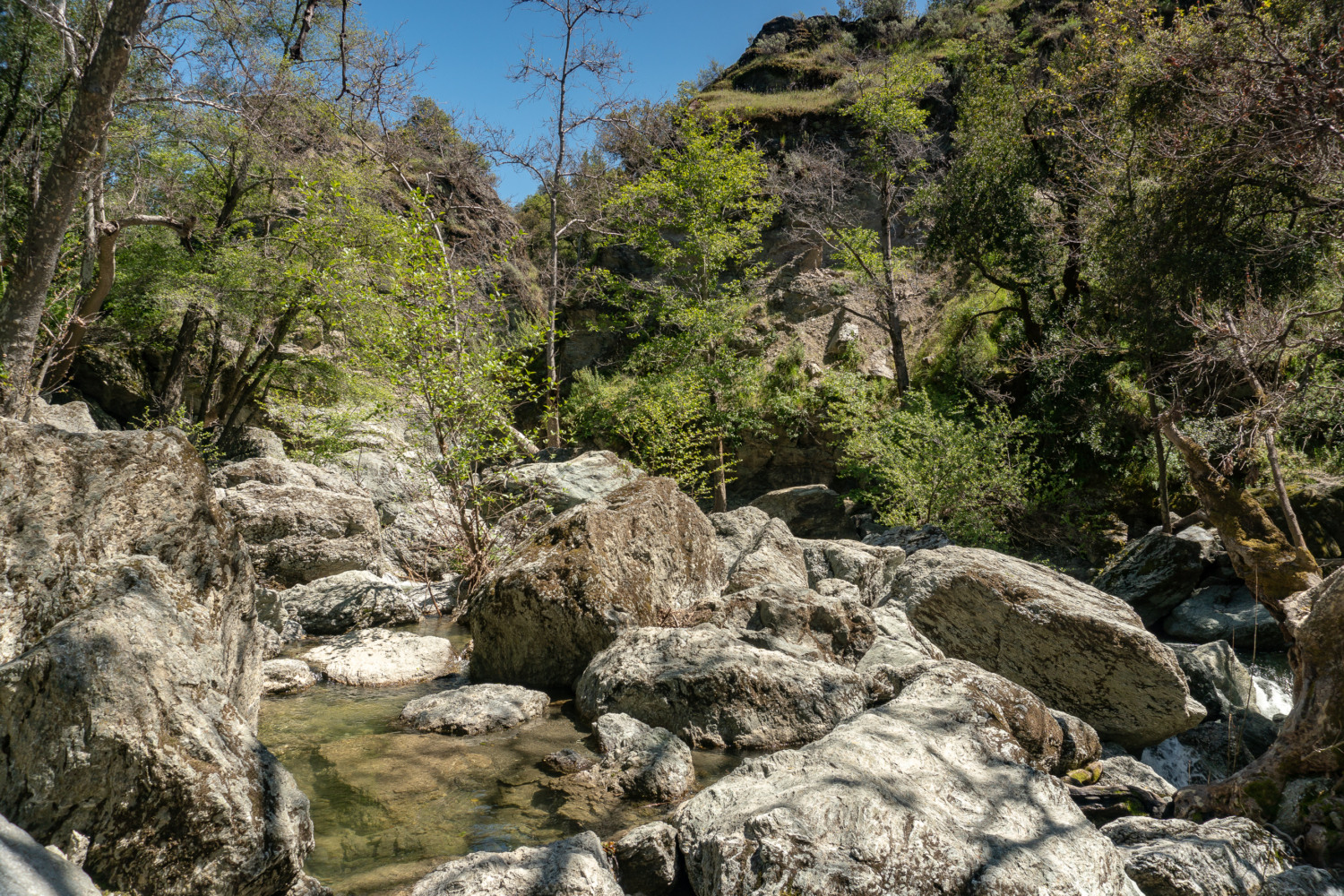
Arrive at the Canyon View Trail junction at 6.5 miles. You could turn right here and skip the Alameda Creek Overlook, but it is a fun and popular part of the park—a gorge with Alameda Creek running through it, two miles upstream from the visitor center. To see it, stay straight on Cerro Este Road and cross Camp Ohlone Road. Scramble down to the water’s edge from here. Swimming is not allowed; please follow posted signs.
Retrace your steps back to the Canyon View Trail at 6.9 miles. Turn left onto the Canyon View Trail, heading northwest towards park headquarters. The single-track trail climbs 100 feet, rounding a bend and then descending back to the bridge over Alameda Creek. Poppies, lupine, lotus, owl’s clover, and bird’s eye gilia surround the trail in wildflower season. Flag Hill dominates the view to the northwest.
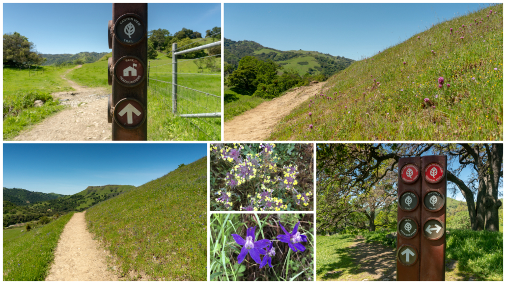
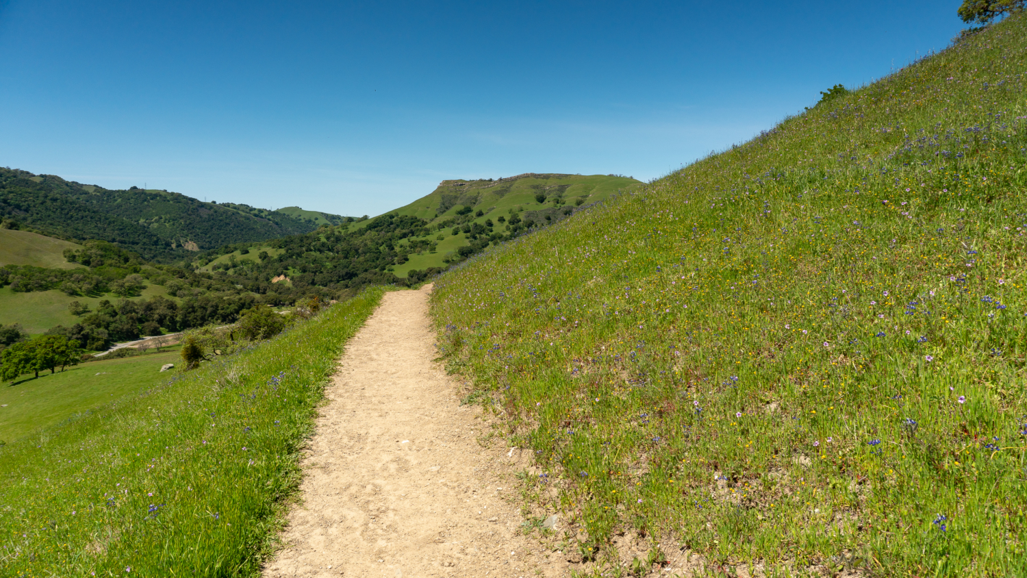
Wildflower grasslands, butter and eggs, and spreading larkspur along the Canyon View Trail
Pass a junction with the McCorkle Trail at the 7.5-mile mark, descending among oaks, acorn woodpeckers, and mule ears. Just past Hayfield Road, turn left to re-cross Alameda Creek on the footbridge. Picnic tables dot the meadow, where you can rest and soak up more of the day.
Notes:
- Sunol Regional Wilderness opens at 8:00 a.m. and closes at dusk. See the Sunol Regional Wilderness webpage for seasonal hours.
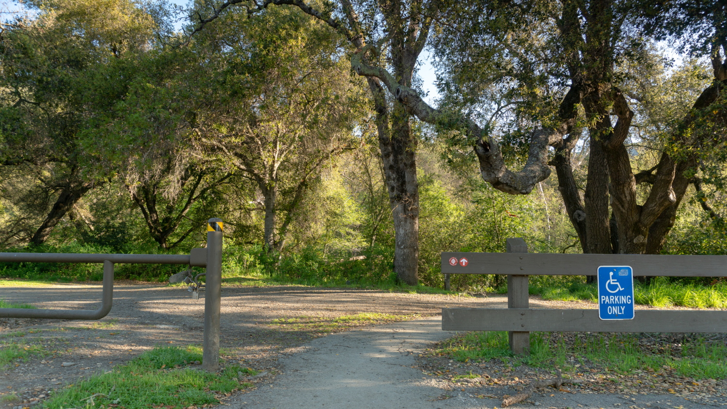
- Parking is free during the week, $5 per vehicle on weekends (seasonally).
- Sunol Visitor Center is open Saturdays and Sundays from 8:30 a.m. – 4:00 p.m. with the exception of Thanksgiving and Christmas Day.
- A free trail map is available online and at trailheads.
- Dogs are allowed on trails in the daytime ($2 per dog, guide/service dogs free); they are not allowed overnight at campsites.
- Mountain bikes and horses are allowed on designated trails.
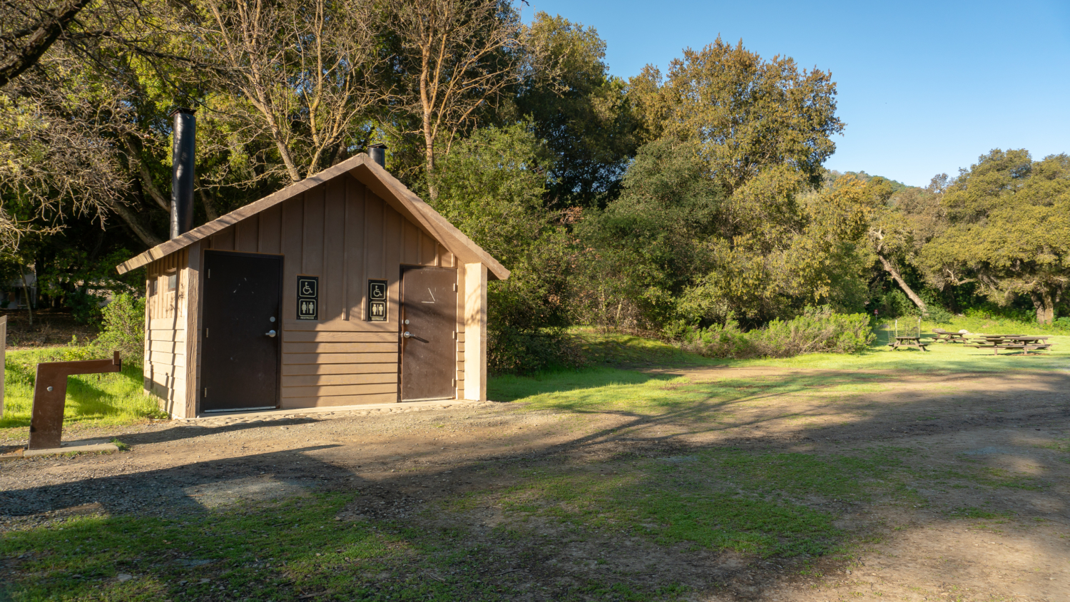
- Restrooms are located next to the trailhead.
- Cows graze year-round at Sunol. If you encounter cows on the trail, keep moving and speak normally. Do not touch the cows. Here are a few safety tips and videos for hiking near cows.
- To volunteer or become a Sunol docent, check out the East Bay Regional Park’s volunteer page.
- For more information about events and activities, like the Cowboy Hootenanny, April Wildflower Festival, and naturalist-led wildflower hikes, check the Sunol activity calendar and follow Sunol Regional Wilderness’s Facebook page for announcements.
Tarantulas
In late summer and early fall, male tarantulas scurry from their burrows in search of females, often popping up on park roads and wide, exposed fire roads. Despite their horror movie reputation, tarantulas are gentle and are not poisonous or dangerous to humans. Keep an eye out for their quarter–sized burrow entrances, often lined with silk, as well as their hairy brown bodies, about 4-5 inches long with 8 legs. After mating season, the males perish; however, females can live up to 25 years. A good time to try to see them is early morning and evening before sunset. Check event calendars for tarantula programs and guided hikes, often occurring in September and October.
Tags: alameda county, Backpacking, cows, east bay, East Bay Regional Parks, san francisco, wildflower hikes, wildflowers