Mount Tamalpais, literally meaning “west” or “coastal” (tamal) “hill” or “mountain” (pais) in the Coast Miwok language, is the highest point in Marin County with panoramic views of the San Francisco Bay and Pacific Ocean. At 2,571 feet, East Peak is the highest of three peaks on Mount Tam, with an active fire lookout at her summit. While you can drive to East Peak, hiking to it from Stinson Beach is a fantastic way to experience Mount Tam’s diverse ecosystems, railroad history, coastal views, and beautiful Stinson Beach when you are finished.
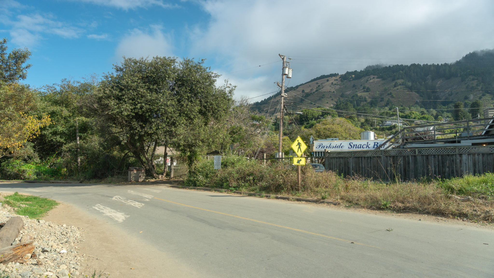
Start your hike from the Central Lot at Stinson Beach, heading north towards the Parkside Snack Bar. Pass under a wooden archway, then turn right onto Arenal Avenue. Walk east for 0.2 miles on paved Arenal Avenue towards Highway 1.


At the end of Arenal Avenue, spot a trail sign across Highway 1 to your right. Carefully cross the road onto the Dipsea Trail towards Muir Woods. On your left is the Stinson Beach Fire Station, where you’ll pop out at at the end of your hike.

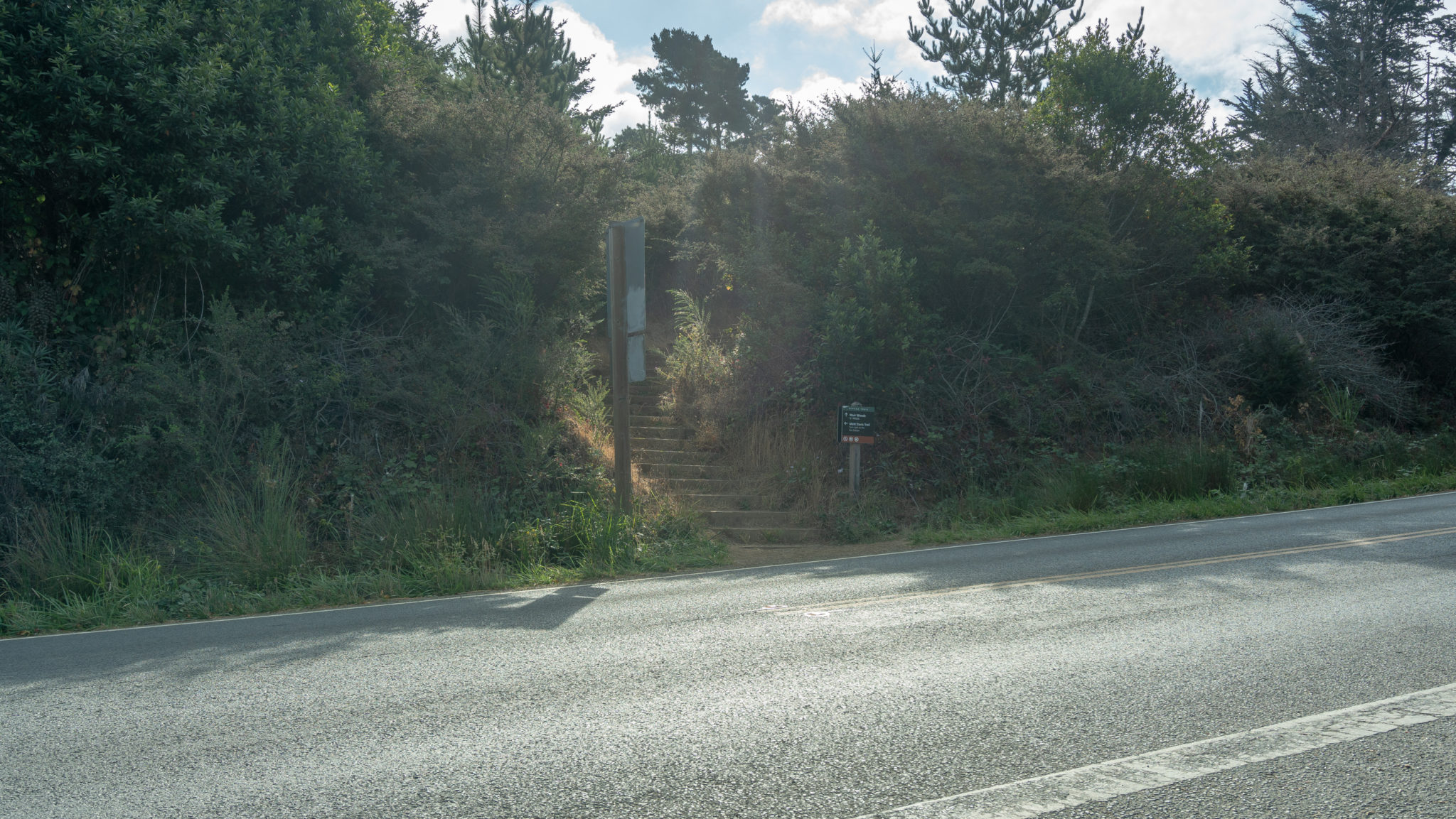
Ascend 0.1 mile though pine trees and blackberries, emerging on a wide parking shoulder off Panoramic Highway. This is a good parking alternative for this hike (see Notes below for details).

Carefully cross the road to stay on the Dipsea Trail towards the Steep Ravine Trail.

Wooden steps lead into a beautiful coastal forest. On your right, spot a stone mile-marker that says “Dipsea Race 7.” The Dipsea is a 7.4-mile annual race from Mill Valley to Stinson Beach. It is the oldest trail race in America, founded in 1905. In an unusual twist on conventional race rules, the slowest runners start first based on handicaps for age and gender. The fastest runners start last, in the back of a 1500-person pack, and must overcome the slower runners to win the race. In another twist, runners can take shortcuts through Mount Tamalpais to get to the finish—if they prefer to sprint up a steep hill versus taking a longer, flatter traverse, they can!

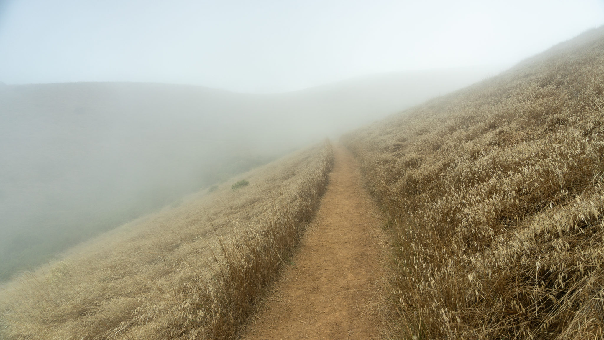
Emerging from the forest, climb southeast on a hillside of coast scrub. A gorgeous panorama of Stinson Beach and the Pacific Ocean comes into view at the 1.0-mile mark.

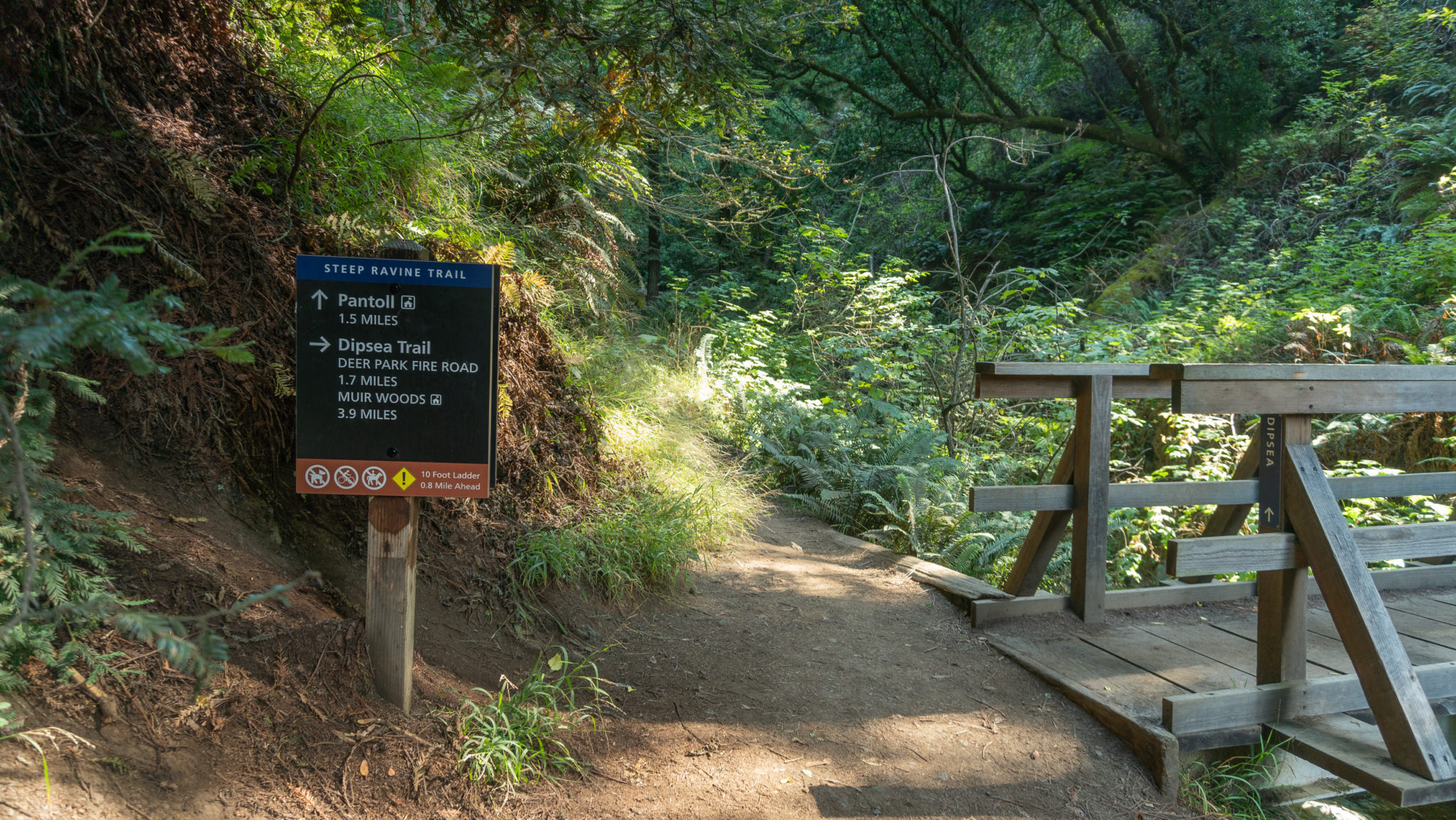
Over the next 0.5 miles, continue east on the Dipsea Trail towards the Steep Ravine Trail and the Pantoll Ranger Station. The trail descends over 100 feet, but soon climbs again when you reach the Steep Ravine Trail.

At the 1.5-mile mark, reach a junction for the Steep Ravine Trail and the Dipsea Trail. Stay straight onto the Steep Ravine Trail, continuing northeast towards the Pantoll Ranger Station. If you’d like to see the Dipsea mile-marker 6, it’s just across the wooden bridge on the other side of the creek.

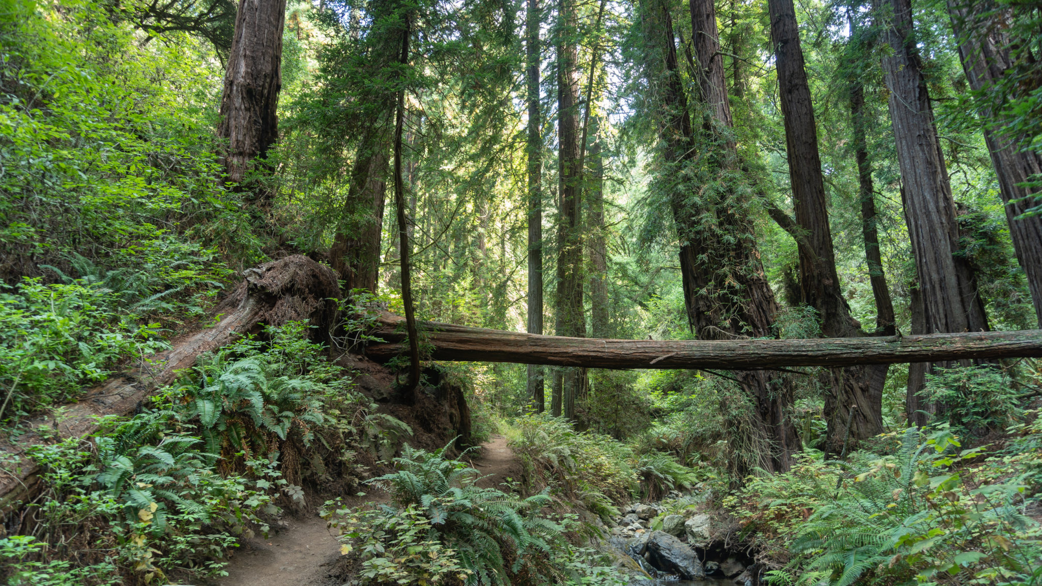
A narrow dirt trail leads through fairy-like forest with coast redwoods, Webb Creek, sword fern, elk clover, and multiple wooden footbridges. It is a worthy hike in its own right, and many people hike down from the Pantoll Ranger Station to experience it. It is also true to it’s name: steep! You’ll ascend nearly 1000 feet over the next 1.7 miles.

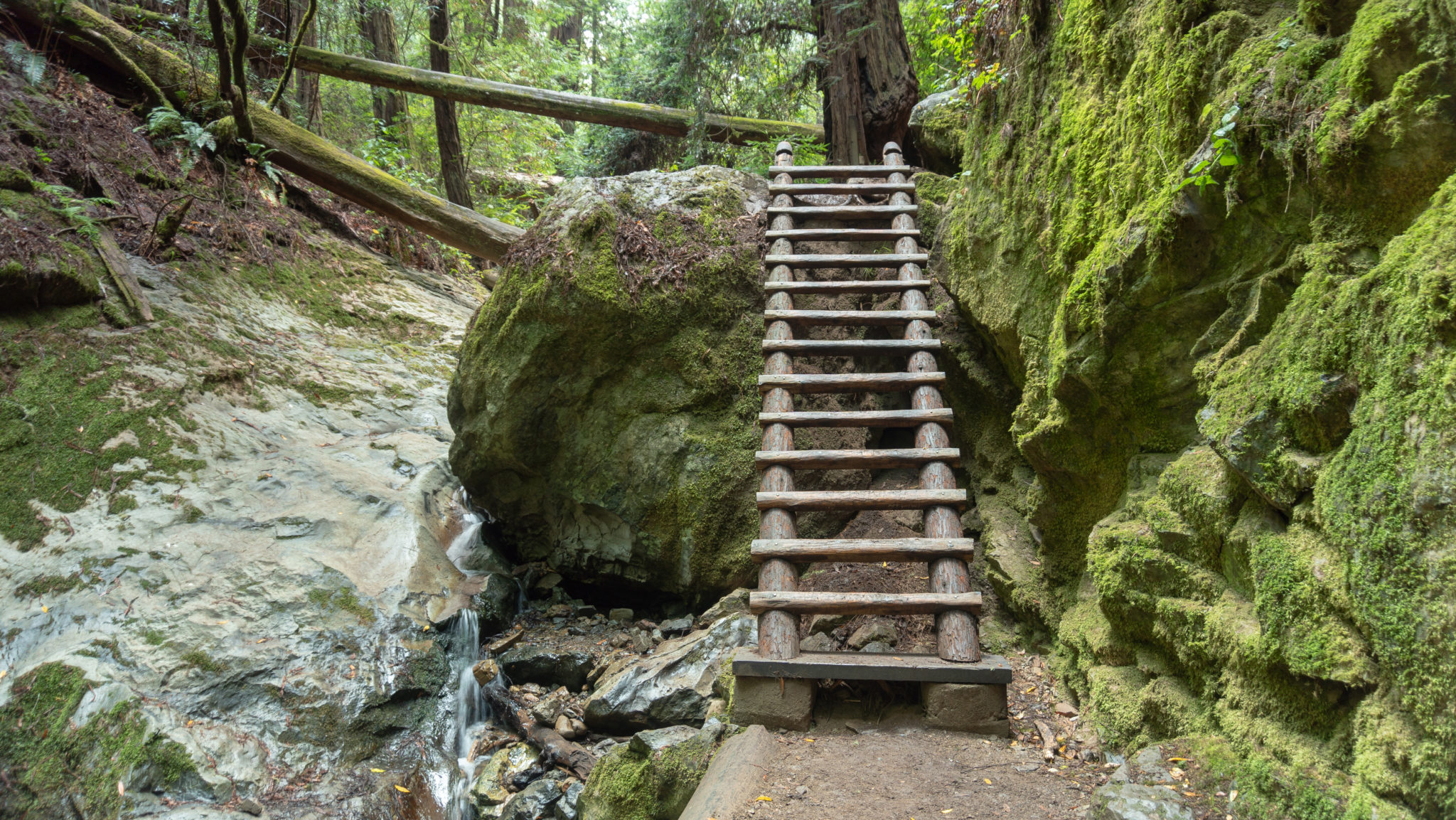
Halfway through the Steep Ravine Trail, climb a wooden ladder beside Webb Creek.

At the 3.2-mile mark, emerge at the Pantoll ranger station and parking lot. Pantoll has picnic tables, restrooms, a water fountain, and a campground. It is a good spot for a quick break. At the ranger station, you can pick up a free Mount Tam brochure that includes a trail map.

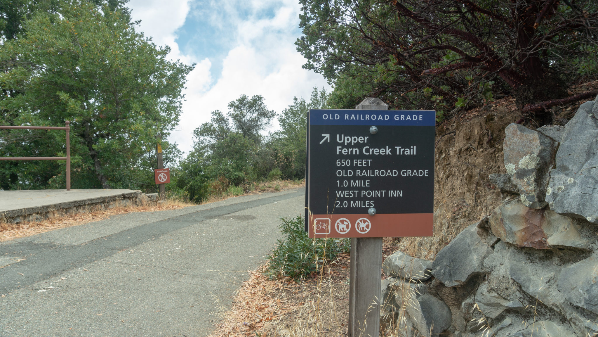
Past the ranger station, head straight up the driveway towards Panoramic Highway. Carefully cross Panoramic Highway to pick up Old Stage Road, heading northeast for 1.9 miles towards West Point Inn. Old Stage Road is a multi-use trail popular with mountain bikers; you will likely see several zooming down the mountain as you climb.

In 0.3 miles, the teeny tiny fire lookout is visible to the northeast on clear days. There’s also a nice view southeast to Mount Diablo, the San Francisco Bay Bridge, Treasure Island, Angel Island, and Alcatraz Island.

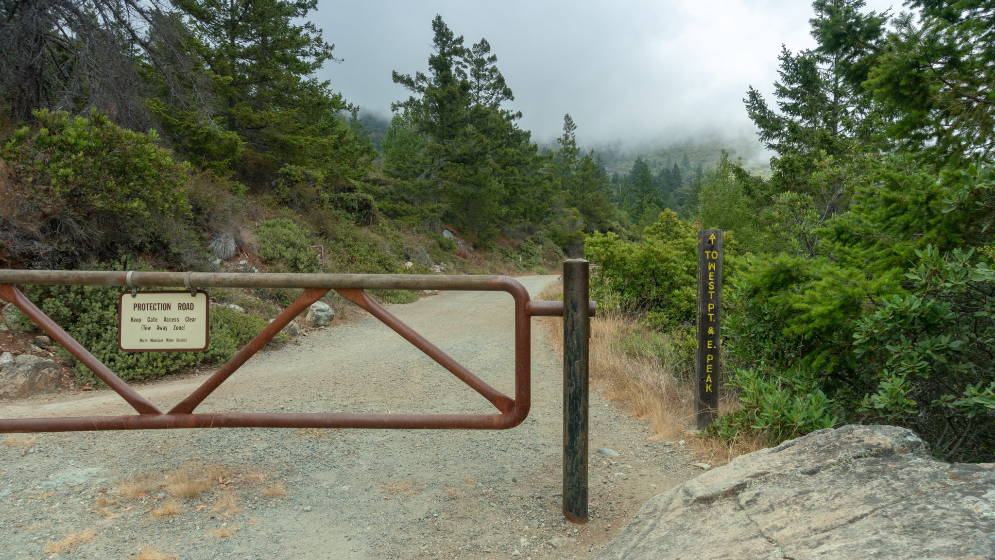
At the 3.7-mile mark, just over halfway to the lookout, pass a gate and boundary for the Marin Municipal Water District.

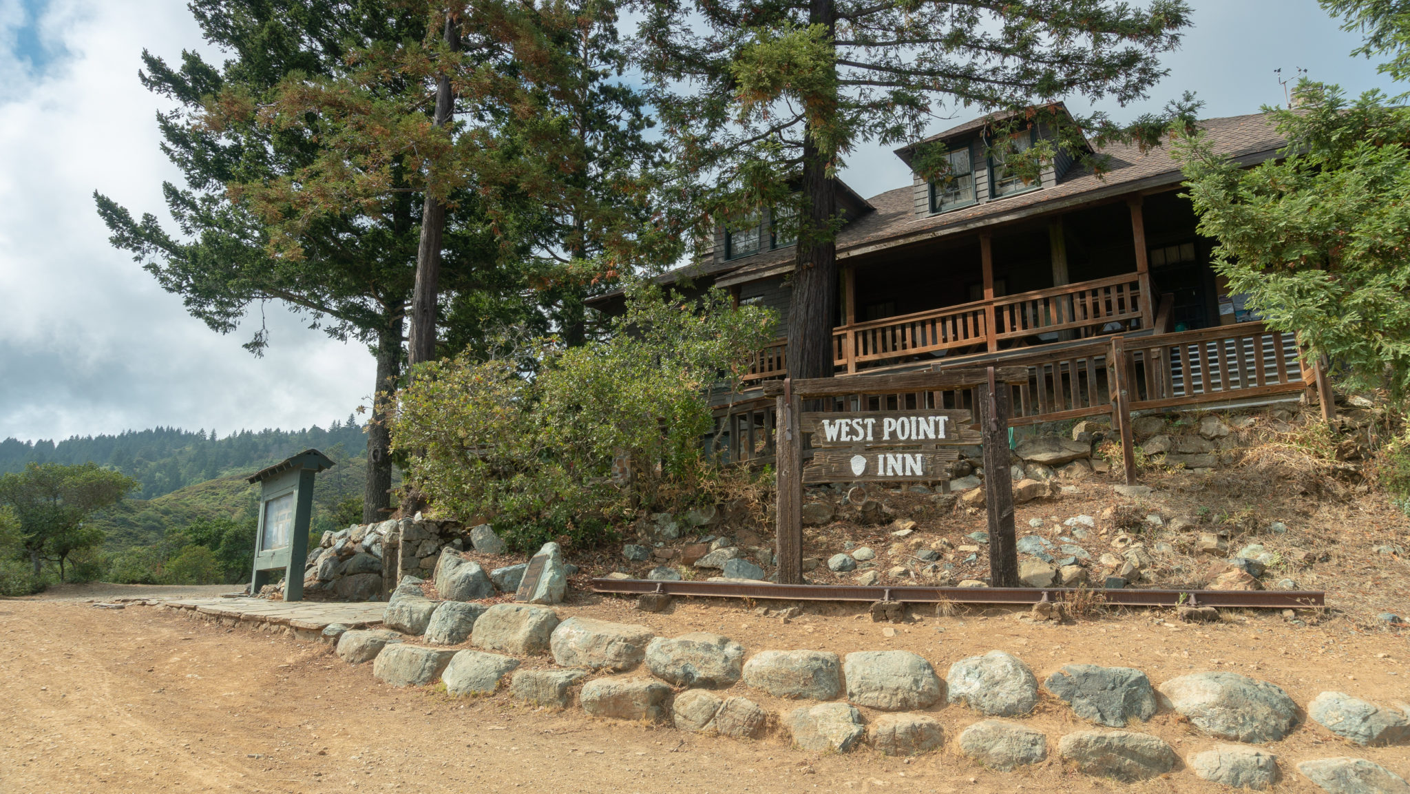
At the 5.1 mile mark, arrive at West Point Inn. Head up the stairs to take a break on the wrap-around porch. Hummingbird feeders, picnic tables, and rocking chairs overlook the slopes of Mount Tamalpais and San Francisco Bay. Inside the Inn’s main entryway to the left is a modest hiker store with granola bars, hot water, tea, cocoa, and more for purchase. It’s run on the honor system, so drop a buck (or whatever the suggested price is for the item you’d like) in the labeled buckets and help yourself. Proceeds go towards maintaining the Inn.

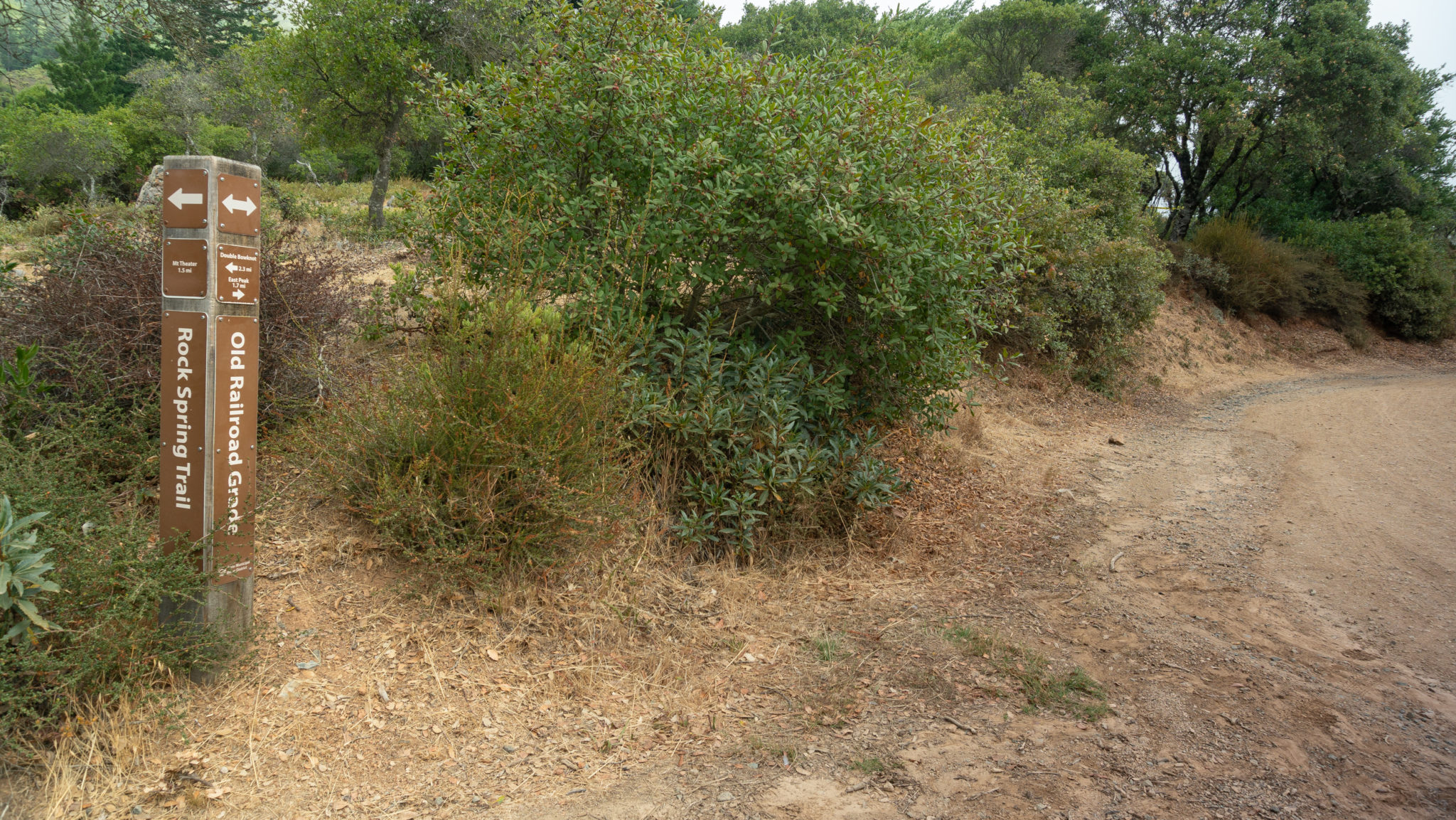
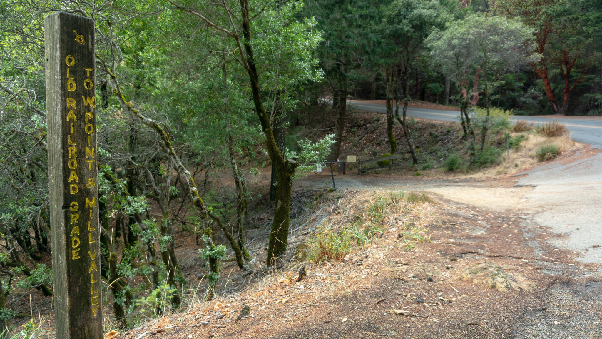
Built in 1904, West Point Inn was originally a transfer stop. Railroad passengers arrived on the Mill Valley & Mount Tamalpais Scenic Railway, which operated from 1896-1929, and then took a horse-drawn stagecoach to Stinson Beach, then known as Willow Camp. The name “West Point” refers to the Inn being the westernmost point on the railroad’s route. Notice how the wide dirt road encircles West Point Inn: this is Old Railroad Grade, the path of the railroad as it came up from Mill Valley to the east, wrapped around the Inn, and continued northeast to East Peak.

Today, people hike or bike to the Inn to reach it—it is also ADA accessible and folks can arrange for car access if needed. Volunteers with the West Point Inn Association run the Inn, and it has rooms upstairs as well as rustic cabins. In the summertime, the Inn hosts pancake breakfasts on the second Sunday of the month from July to October, as well as Mother’s Day and Father’s Day.

When you’re ready to head to the summit, hop on Old Railroad Grade around the left (western) side of Inn for 1.7 miles towards East Peak. Keep an eye out to the northeast for views of the fire lookout at East Peak among shrubby green chaparral.

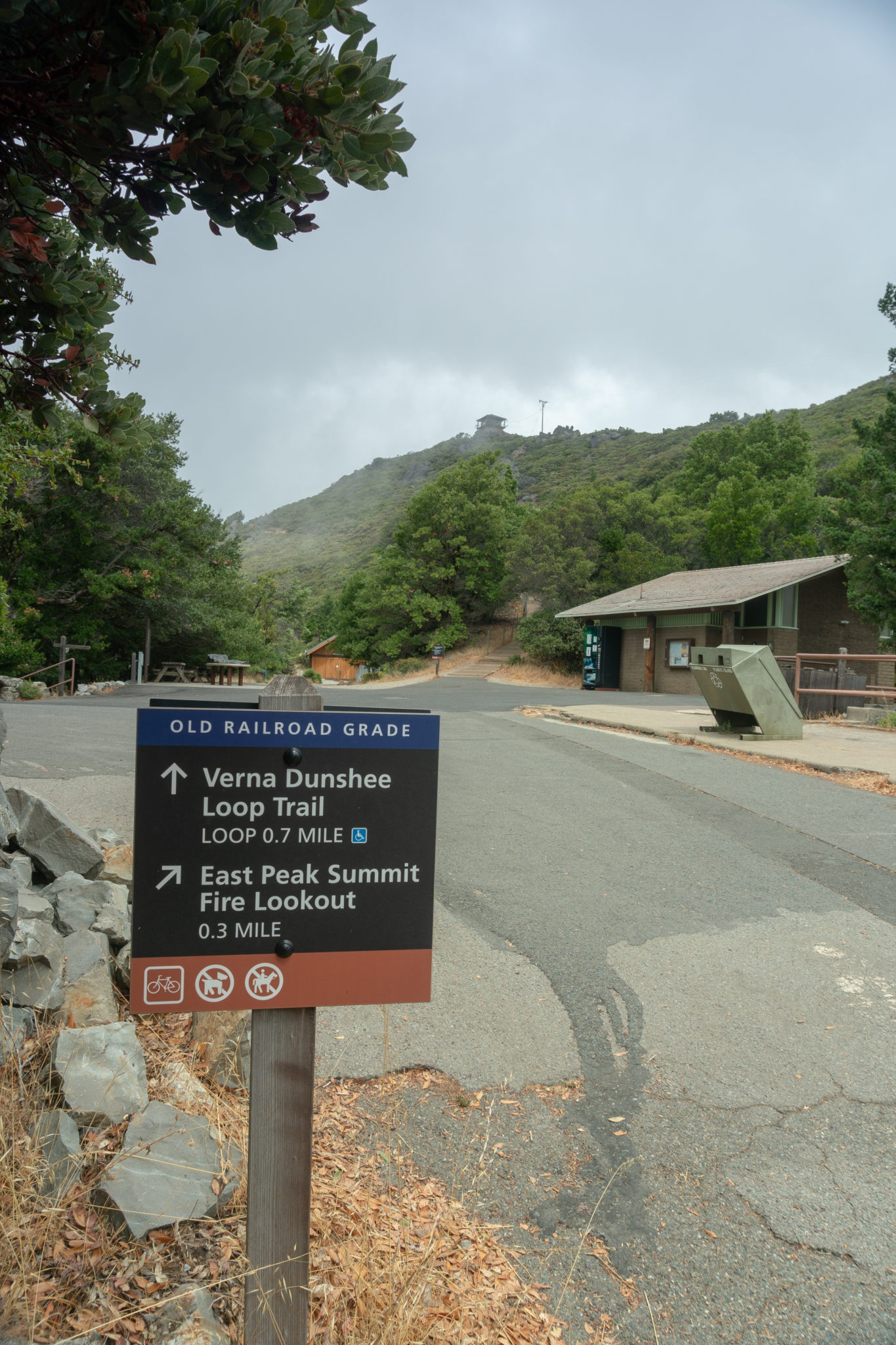
At the 6.5-mile mark, pass a gate and turn right onto paved Ridgecrest Boulevard. Bear right again at a visitor parking sign to stay on Old Railroad Grade to East Peak.


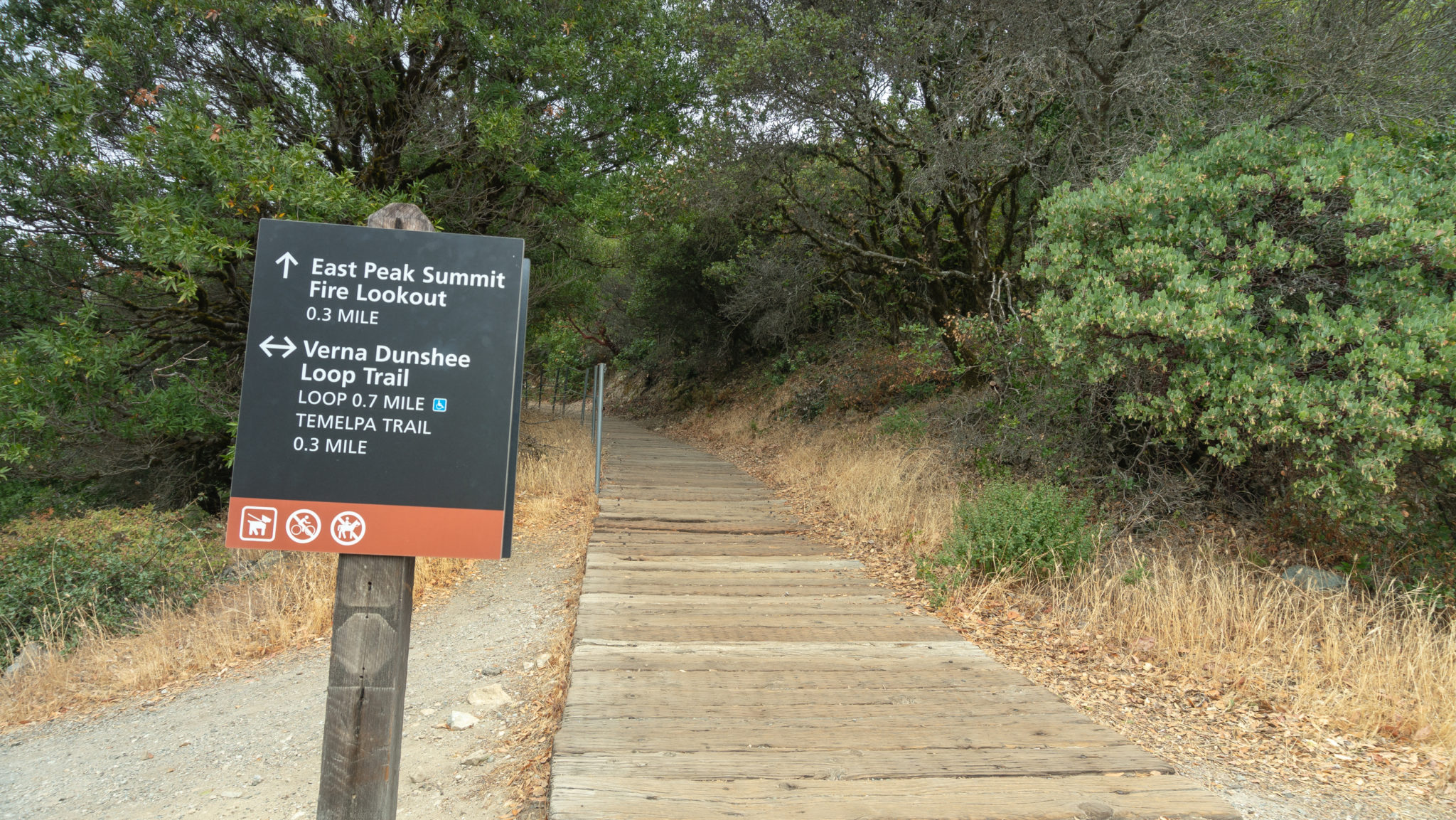
In another 0.3 miles, arrive at a welcome area just below East Peak. The small house-like structure beyond the main display is the Gravity Car Barn, which contains a replica of the gravity cars that used to transport 30 people at a time to Muir Woods in the early 1900s. There are also educational displays, restrooms, and a vending machine with drinks. The Verna Dunshee Trail is flat and paved 0.7-mile trail encircling East Peak.

Follow signs towards the East Peak Summit Fire Lookout on the Plank Trail. The trail starts on wooden planks, then transitions to an uneven, rocky tread to the lookout.

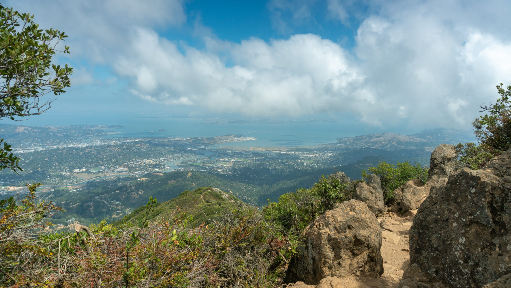
At the 7.1-mile mark, reach an active fire lookout staffed by the Marin County Fire Department. Built in 1935 and 1936 by the Civilian Conservation Corp, the lookout is closed to the public, but this cool video, created by keeper Gary Yost, takes you inside the lookout experience.

Several rocky outcroppings at the summit make good spots for resting and taking in the views: Mount Diablo, the Richmond-San Rafael Bridge, and Corte Madera Creek to the east, San Francisco, the Marin Headlands, and Santa Cruz Mountains to the south, the Pacific Ocean to the west, and Bon Tempe Lake and Mount Saint Helena to the north.

When you are ready to head back, retrace your steps southwest for 3.9 miles, taking Old Railroad Grade to West Point Inn, then Old Stage Road towards the Pantoll Ranger Station.


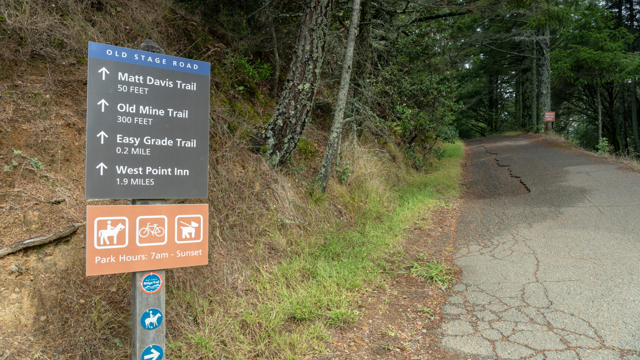
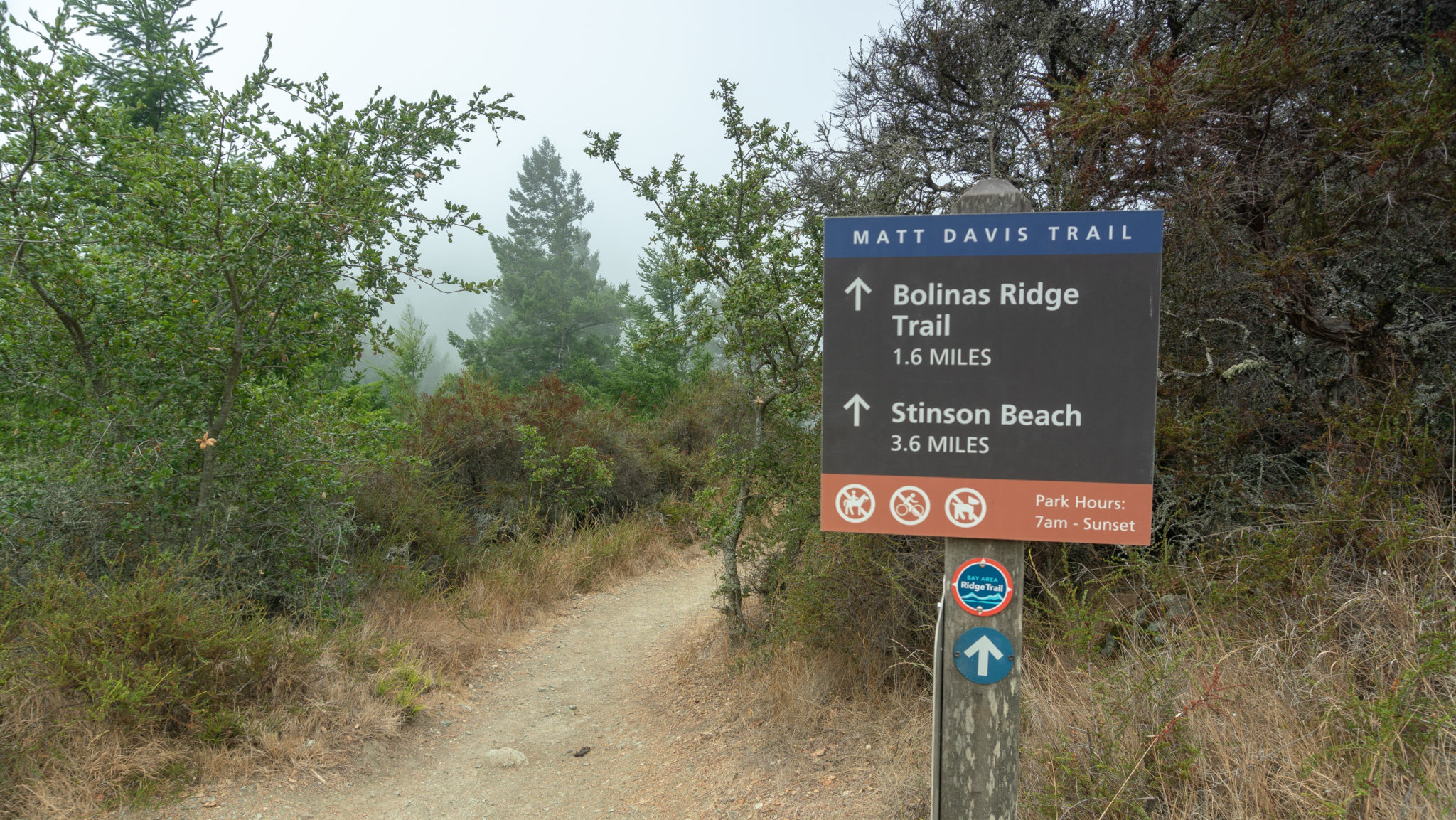
At the 11.0-mile mark, 50 feet before Panoramic Highway, turn right onto the Matt Davis Trail towards Stinson Beach. Although slightly longer than the Steep Ravine Trail, Matt Davis has gorgeous views of the coast and is a scenic, alternative way to loop back to the beach. If you’re looking for some shade, or are just ready to get back sooner, you can also just keep retracing your steps on the Steep Ravine and Dipsea Trails back to Stinson Beach.

Back on the Matt Davis Trail, carefully cross Pantoll Road to stay on the Matt Davis Trail towards Stinson Beach. The next 1.7 miles are a rolling westward traverse, gently climbing 200 feet. The trail alternates between grasslands and beautiful evergreen forests.

The trail’s namesake, Matt Davis, was an Eagle Scout, upholsterer, and avid trail builder on Mount Tamalpais. Born in 1875, he built this trail as well as his own cabin on the mountain near the Cushing Memorial Amphitheater.

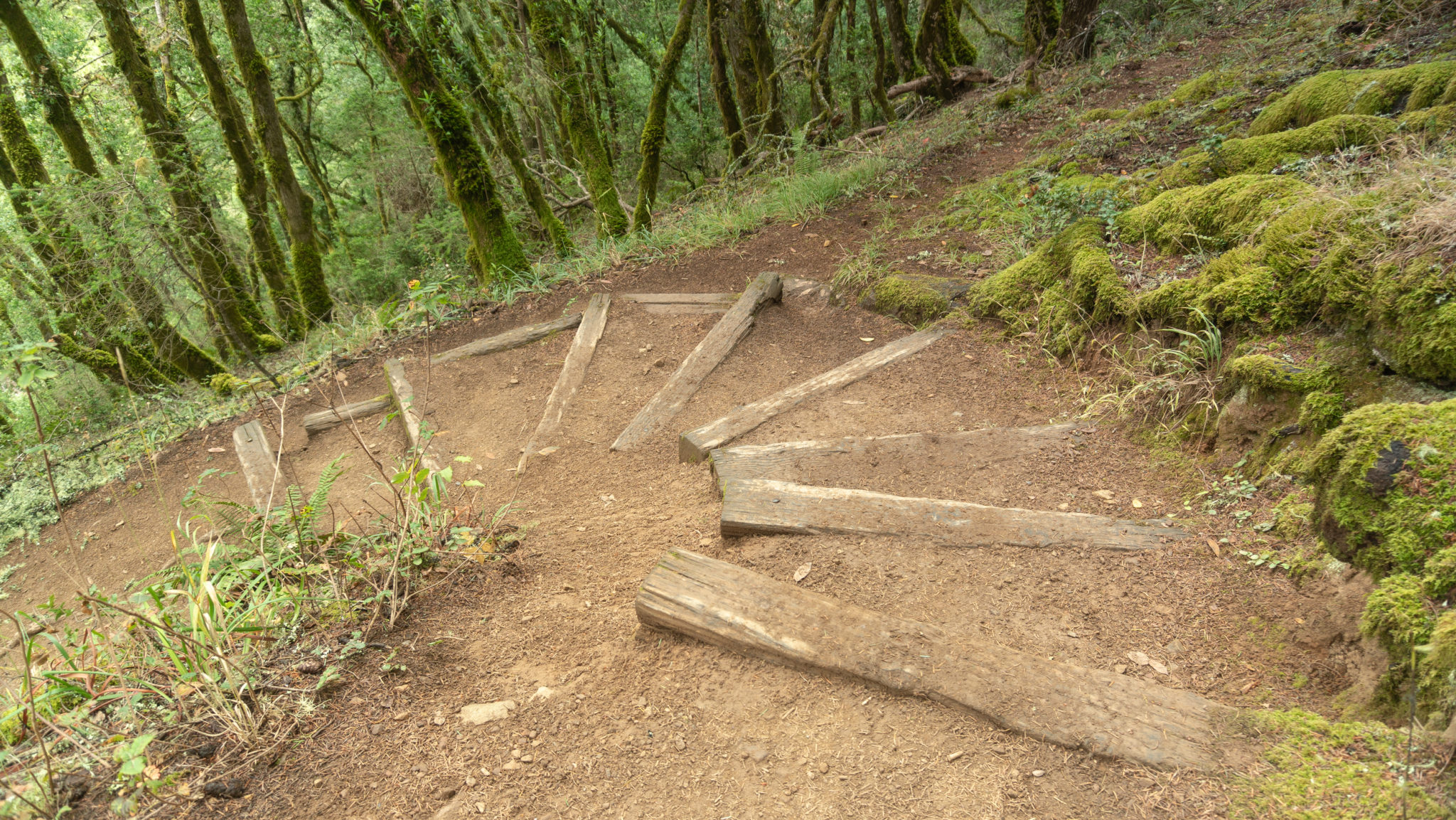
At the 12.7-mile mark, bear left at junction with the Bolinas Ridge Trail to descend on the Matt Davis Trail towards Stinson Beach. Enter a shady forest, zigzagging down sharp switchbacks reinforced with wooden stairs at corners.

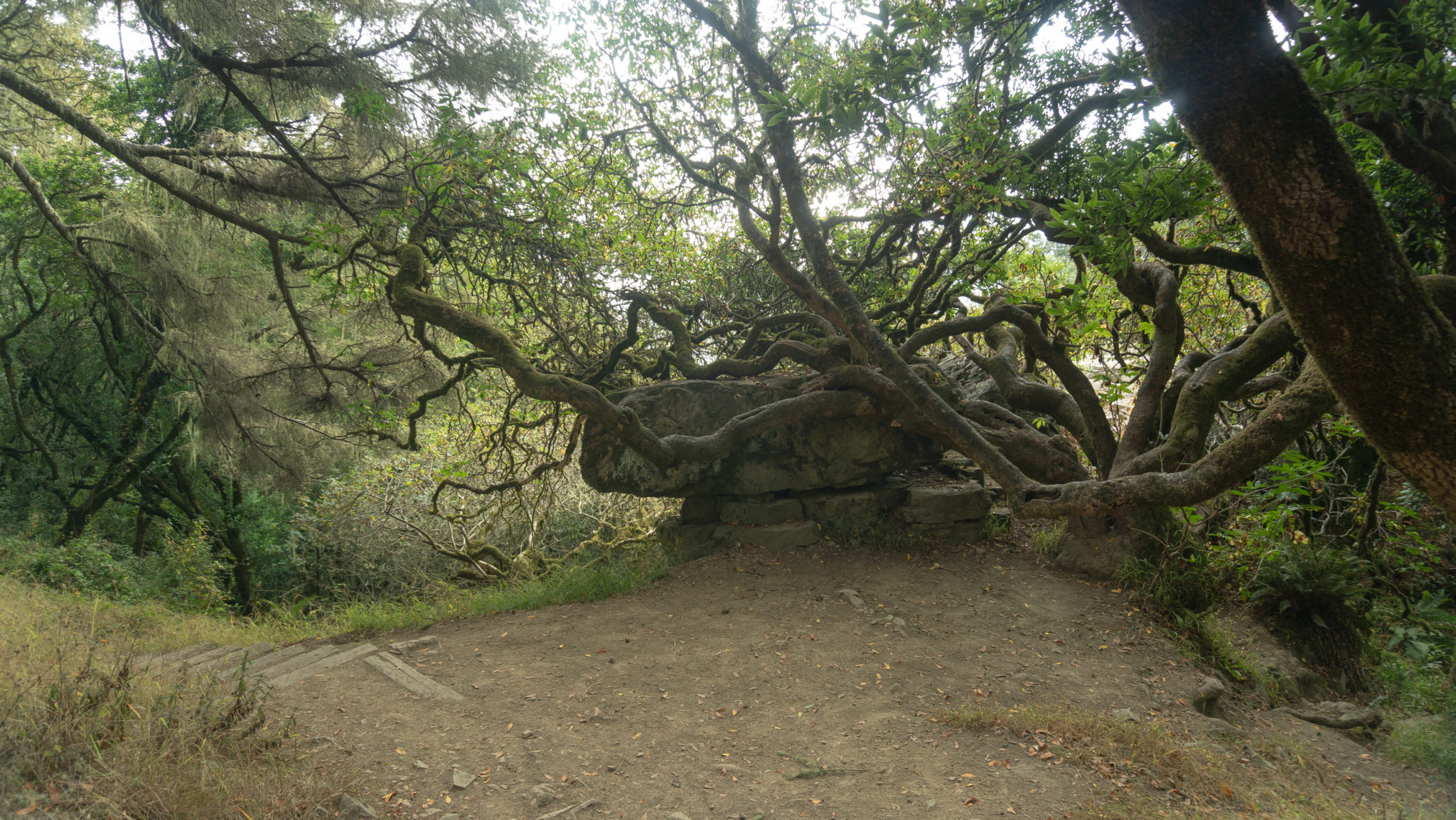
After 1.3 miles, at the 14-mile mark, spot Table Rock on the right-hand side of the trail. A spur trail beside it leads to views of Stinson Beach and the Pacific Ocean.

Past Table Rock, cross several wooden bridges and streams, bearing right at an unsigned Y-junction to stay on the Matt Davis Trail.

Emerge onto Belvedere Avenue, a one-way residential street, at the 14.7-mile mark. Turn left and walk 400 feet south on the shoulder of Belvedere Avenue.

The Stinson Beach Fire Station is at the end of the road on the corner of Belvedere Avenue and Highway 1. Turn left and carefully cross Highway 1 to return to Arenal Avenue. Retrace your steps back to the beach, heading west on Arenal Avenue towards the Parkside Snack Bar and Stinson Beach.

The Pacific Ocean is waiting for you! The water temperature is frigid, so you may want to wade in rather than swim. But in the summertime, after a hot day on Mount Tam, it’s just bearable to dive once or twice beneath the salty waves.

Notes:
- The gate to the Stinson Beach parking area opens at 9:00 a.m. Parking is free, and the gate closes an hour after sunset.
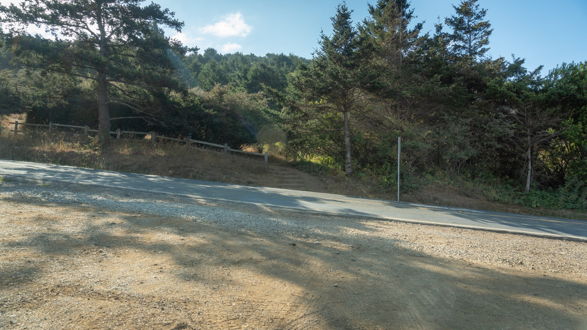
- If you’re looking to start earlier than 9:00 a.m., park on the dirt shoulder northeast of the intersection of Highway 1 and Panoramic Highway. You can pick up the Dipsea Trail across the road to the southeast.
- Bring a dollar or two to purchase drinks and snacks at the hiker canteen in West Point Inn.
- The pancake breakfasts at the West Point Inn are held on the second Sunday of the month between July and October, as well as Mother’s Day and Father’s Day. The cost is $10 for an adult portion and $5 for a kids portion. Pancakes are served from 9:00 a.m. – 1:00 p.m. Check the website for more details and to confirm dates.
- Learn more about volunteering at the East Peak Fire Lookout on Marin County’s website.
- The Gravity Car Barn at the East Peak is open on Saturdays and Sundays from 12:00 p.m. – 4:00 p.m.
- East Peak Visitor Center is open as staffing allows, generally on Saturdays and Sundays from 11:00 a.m. – 4:00 p.m.
- Flip-flops and a towel (and maybe even a swimsuit and change of clothes) will come in handy for the beach.
- The Parkside Snack Bar has burgers, sandwiches, and ice cream. Their berry smoothie, a mix of berries and banana, was a delicious cold treat after our hike.
Tags: coast, coast redwoods, creek, Fire Lookout, Marin County, Mount Tamalpais, mountains, redwood forest, redwoods, san francisco, Stinson Beach