There is a big, beautiful world out there filled with old-growth redwoods, jewel toned wildflowers, cascading waterfalls, and misty forests. If you are new to hiking, or simply new to the Bay Area, you may be surprised to learn that you don’t need to hike far to experience the Bay Area’s best natural features.
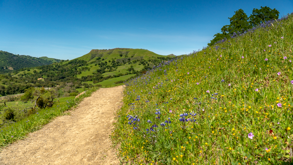
Spectacular spring wildflowers along the Canyon View Trail in Sunol Regional Wilderness
To start, think about what excites you. Is it waterfalls, wildflowers, or maybe redwoods? Which one motivates you the most? Here are a few of my favorite hikes in those categories to help you get started. I hope they will give you a refreshing burst of nature and inspire you to protect it by leaving no trace. Happy exploring!
Waterfalls
Uvas Canyon Waterfall Loop Nature Trail, 1.6-miles round-trip, 375 feet elevation gain, is a pleasant hike along Swanson Creek and peaceful falls in Uvas Canyon County Park. Pick up the Waterfall Loop Nature Trail Guide in the parking lot and follow the Waterfall Loop Nature Trail signs. To see more waterfalls, try the 5.2-mile Waterfall Loop, Waterfall Loop Nature Trail Guide
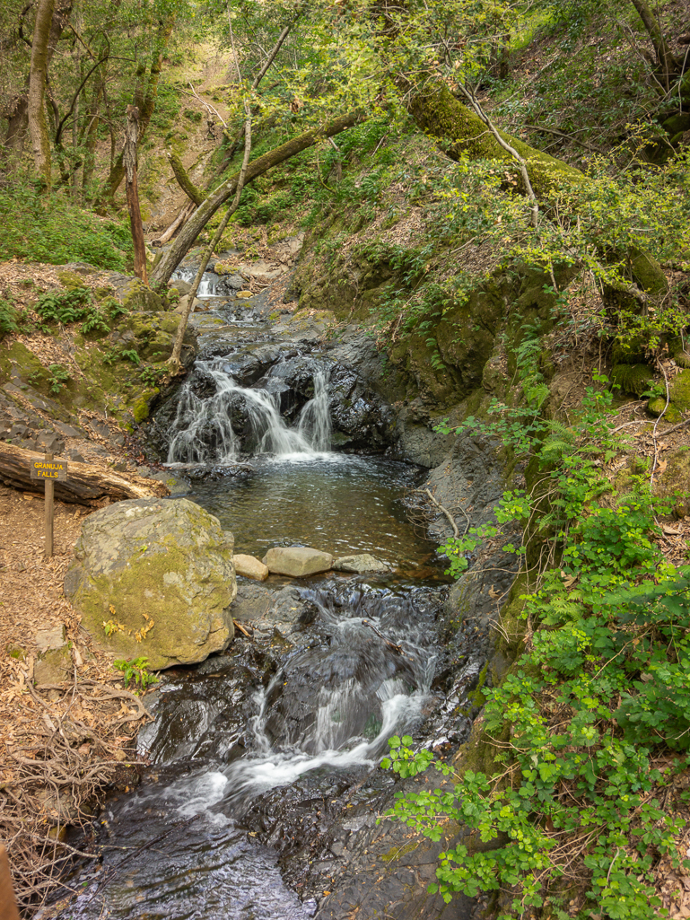
Granuja Falls near the start of the Waterfall Loop Nature Trail in Uvas Canyon County Park
Castle Rock Falls, 1.3 miles round-trip, 350 feet elevation gain, descends into a forest on the Saratoga Gap Trail to a top-down view of Castle Rock Falls in Castle Rock State Park. Continue past the falls on the 5.1-mile Castle Rock Loop for 180-degree views of the Santa Cruz Mountains.
Cataract Falls via Cataract Creek, 3.5 miles round-trip, 450 feet elevation gain, is a forest-bathing style hike along a shady creek to Cataract Falls in the Marin Municipal Water District. Take the Cataract Trail northwest for 1.75 miles to Cataract Falls. After taking pictures, retrace your steps back to the trailhead. Alternatively, keep going on the 6.4-mile Cataract Creek-Benstein Loop to see more waterfalls, Marin County views, and wildflowers.
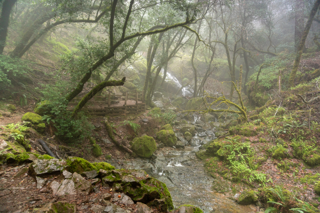
Cataract Falls spills through the misty forest in the Marin Municipal Water District
Little Yosemite, 3.2 miles round-trip, 725 feet elevation gain, climbs through green pastures in Sunol Regional Wilderness, then descends to Alameda Creek in a rugged, rocky gorge. Begin your hike on the Canyon View Trail, climbing southeast. At the 1.4-mile mark, turn right onto Cerro Este Road and descend 150 feet over the next 0.2 miles, following signs for Little Yosemite. For an easier hike, take Camp Ohlone Road 0.9 miles southeast to Little Yosemite.
Wildflowers
Borel Hill, 1.8 miles round-trip, 325 feet elevation gain, features Sound of Music-like ridgelines and wildflowers in Russian Ridge Preserve. Hike northwest on the Ridge Trail, passing poppies and lupine in springtime. To extend your hike, continue on the 3.8-mile Russian Ridge Loop. Alternatively, return to the parking lot and follow signs for 0.2 miles to Alpine Pond.
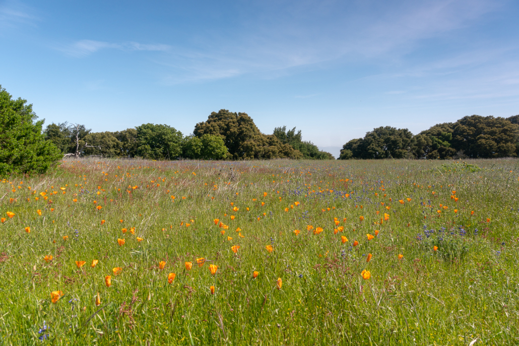
An explosion of orange poppies and purple lupine in Russian Ridge Preserve
McCorkle – Canyon View Loop, 2.4 miles round-trip, 415 feet elevation gain, is a family-friendly wildflower hike through Sunol Regional Wilderness. Start at the Old Green Barn, hiking south along Geary Road and Camp Ohlone Road towards Little Yosemite. At 0.9 miles, turn left onto the McCorkle Trail. Hike 0.7 miles, and then turn left again onto the Canyon View Trail to return. Look for Johnny jump-up, fiddleneck, purple owl’s clover, shooting star, and mule’s ears in spring. Map, Trailhead
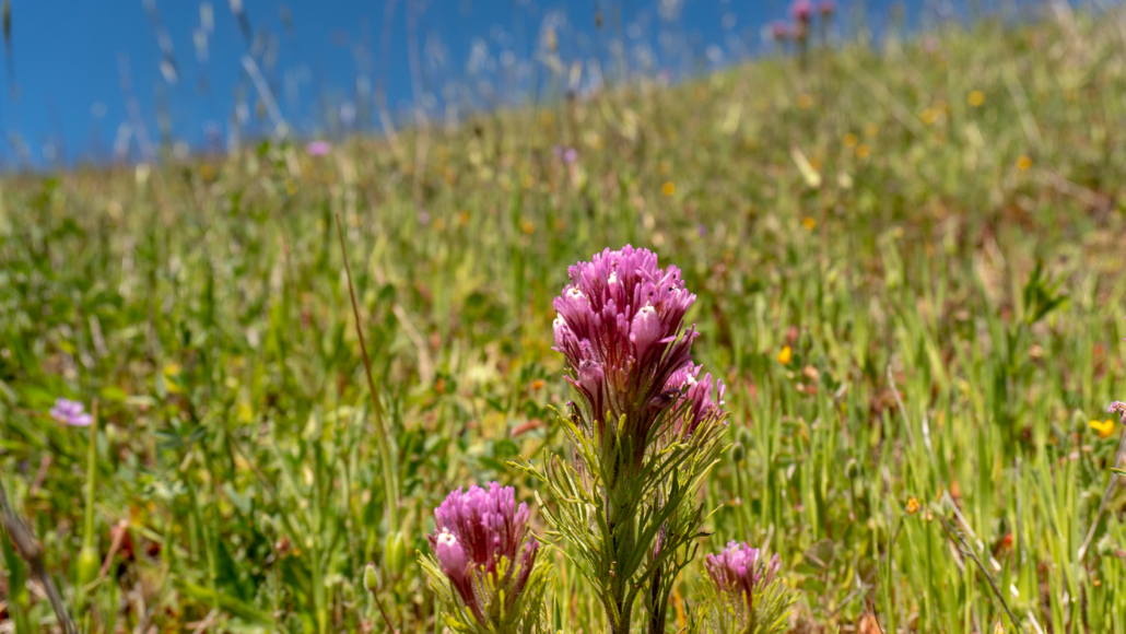
Purple owl’s clover in Sunol Regional Wilderness
Mitchell Canyon Road, 2.6 miles round-trip, 325 feet elevation gain, features vivid wildflowers in an oak-studded canyon in Mount Diablo State Park. Hike south on Mitchell Canyon Road and pick up a free interpretive guide that matches plants to corresponding signposts. Turn around at signpost 10. Alternatively, keep going for a challenging ascent to Eagle Peak. Map, Trailhead
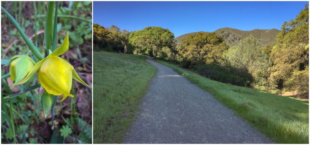
Wildflowers like the Mount Diablo globe lily are a highlight along Mitchell Canyon Road
Thornewood Preserve, 3.0 miles round-trip, 600 feet elevation gain, is a quiet hike through a conifer and oak forest with pops of hound’s tongue, trillium, and warrior’s plume. A bonus is a short jaunt along Dennis Martin Creek under a redwood forest canopy. Thornewood’s 1.5 mile trail system can be explored in a couple hours for an easy morning or late afternoon outing. Map, Trailhead
Redwoods
Stream Trail to Trail’s End, 1.8 miles round-trip, 145 feet elevation gain, is a paved, ADA-accessible hike beside Redwood Creek in Reinhardt Redwood Regional Park. Begin at the Canyon Meadow Staging Area and hike northwest for 0.9 miles on the Stream Trail to Trail’s End. Hidden in the redwood forest are treasures like Old Church, a reservable picnic area with benches. After 0.9 miles, turn around at Trail’s End or continue northwest on the Stream Trail towards the Skyline Gate Staging Area. Map, Trailhead
Muir Woods Loop, 2.4-mile loop, 125 feet elevation gain, is a partially ADA-accessible, family-friendly hike in Muir Woods National Monument. This gentle, popular hike circles Redwood Creek underneath tranquil and soothing redwoods. Follow the Redwood Creek Trail northwest for 1.2 miles. Across Bridge 4, turn left onto the Hillside Trail and follow signs back to the trailhead. Map, Trailhead
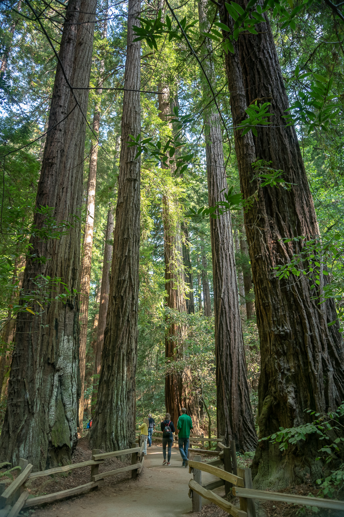
Muir Woods is an excellent place to see the Bay Area’s gentle giants
Lime Kiln Loop, 2.6 miles round-trip, 500 feet elevation gain, is a delightfully shady hike under a second-growth redwood forest featuring historic lime kilns and peaceful Fall Creek in Henry Cowell Redwoods State Park. To hike it, follow the first 1.2 miles of the 8.9-mile Fall Creek-Big Ben Loop. After exploring the lime kilns, retrace your steps back to the trailhead. Map, Trailhead
Heritage Grove to Hiker’s Hut, 2.8 miles round-trip, 650 feet elevation gain, is a moderate ascent through an old growth redwood forest in Sam McDonald Park. Begin at the Heritage Grove Trailhead, and hike south for 1.4 miles to the Ollie Mayer Hiker’s Hut. When ready, retrace your steps back to the trailhead. Map, Trailhead
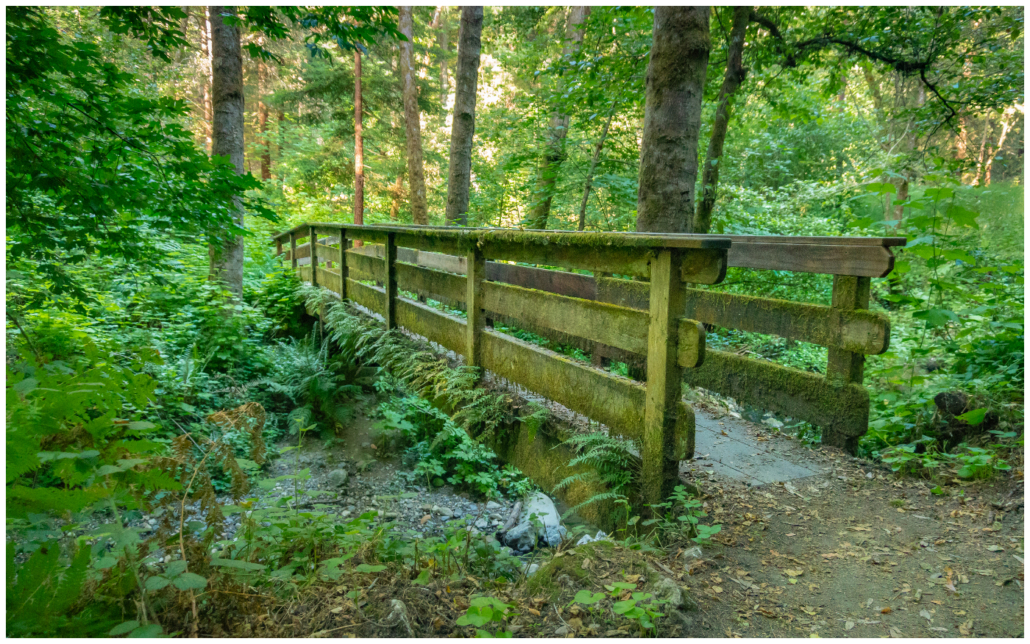
A pedestrian footbridge leads over Alpine Creek to Heritage Grove in Sam McDonald Park
Bonus: Golden Gate Bridge
We can’t talk about San Francisco without mentioning the Golden Gate Bridge 🙂 Here are a few of my favorite hikes to see the bridge in all its glory.
Batteries to Bluffs, 1.7 miles round-trip, 500 feet elevation gain, is a rolling, coastal hike past historic batteries to a secret beach and waterfront Golden Gate Bridge views. Map, Trailhead
Lands End Coastal Trail, 4.0 miles round-trip, 675 feet elevation gain, traces a former rail bed above the Golden Gate with stops at a cave, a beach, and the Lands End Labyrinth. Map, Trailhead
East Beach to Fort Point, 4.5 miles round-trip, 100 feet elevation gain, strolls along East Beach and Crissy Field to Civil War era Fort Point, with bridge views the entire way. Map, Trailhead
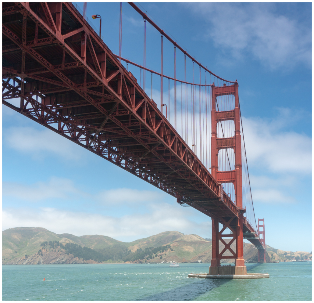
Intimate views of the Golden Gate Bridge from Fort Point
I hope you enjoyed these hiking suggestions! For more ideas, please check out:
Find Great Wildflower Hikes in the Bay Area
10 Beautiful Waterfall Hikes Near San Francisco
7 Shady Redwood Hikes near San Francisco
Six Hikes with Spectacular Golden Gate Bridge Views
Tags: Castle Rock State Park, coast redwoods, Golden Gate Bridge, Henry Cowell Redwoods State Park, marin municipal water district, Mount Diablo State Park, Muir Woods National Monument, redwoods, Reinhardt Redwood Regional Park, Russian Ridge Preserve, Sam McDonald Park, San Francisco Bay Area, Santa Cruz mountains, sunol regional wilderness, The Presidio, Thornewood Preserve, Uvas Canyon County Park, waterfalls, wildflowers