There are so many extraordinary features of the Bay Area—coast redwoods! national parks! geology! military history! Golden Gate Bridge vistas!—it can be hard to decide where to take your out-of-town guests.
No problem—we’ve got you covered! Here are eight hikes that showcase something special about the Bay Area, including four—FOUR!—national park sites with an optional side trip to a fifth, a car-free island with getaway beaches, a hidden treasure in the Santa Cruz mountain foothills, a Mediterranean villa with gardens and sculptures, and a redwood-filled state park with a…beach at the top? Yes, friends, it exists!
Hikes can be shortened or lengthened depending on what you feel like tackling for the day, and several have ADA-accessible trails as part of the route. Whichever you choose, you can be sure your guests will see something truly special and unique to the Bay Area.
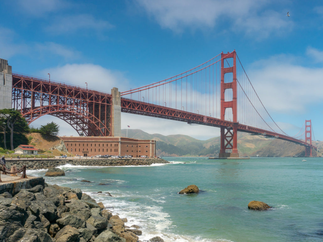
Fort Point National Historic Site
North Bay
Point Reyes Lighthouse
1.4 miles round-trip, 340-foot elevation gain, 1.5 hours
Point Reyes National Seashore, Point Reyes Station
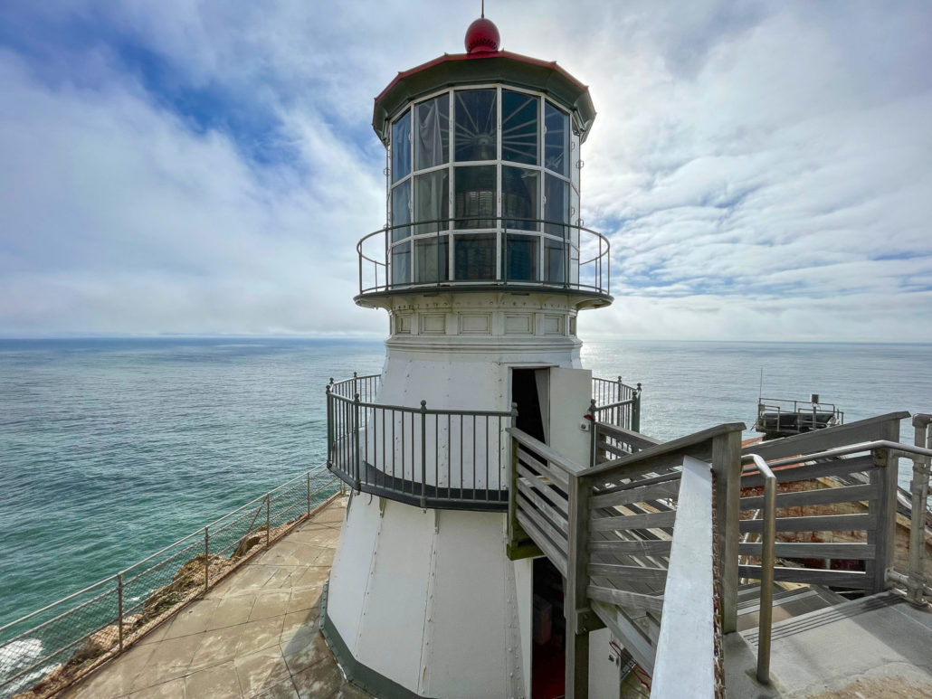
The Point Reyes Lighthouse is a beautiful destination through rolling green pastures, beaches, and ranchlands in Point Reyes National Seashore. This 1.4-mile round-trip hike is ADA-accessible for the first 0.6 miles until you reach the Observation Deck, where 313 steps lead down to the Point Reyes Lighthouse. Inside, a first-order Fresnel lens contains over 1,000 prisms that were used to beam light nearly 24 miles out to sea. Although decommissioned in 1975, visitors can still visit the lighthouse when wind speeds are below 40 miles per hour and the stairs are open.
Point Reyes Lighthouse on the tip of the Point Reyes Peninsula in Point Reyes National Seashore
Before you take the long drive out, be sure to check the Point Reyes Lighthouse website for the latest visiting hours, as well as the forecast for wind speed. A tip I learned from a ranger is to add 10 mph to the highest wind speed prediction, as values are usually underpredicted. It’s quite a drive to the Point Reyes Peninsula, so a great way to maximize your time is to add scenic stops like Cypress Tree Lane and Sea Lion Overlook. There is no entrance fee. Dogs are not allowed on the trail to the lighthouse, with the exception of service dogs.
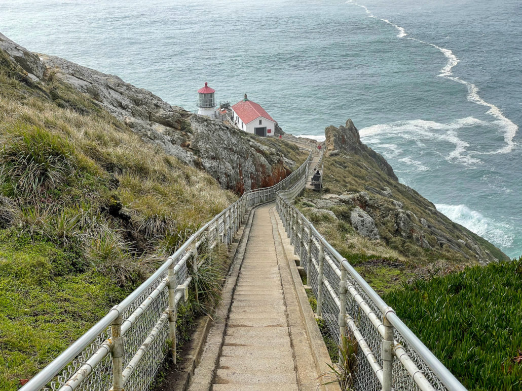
A steep descent of 313 steps leads down to the lighthouse. The stairway closes when winds are above 40 mph.
Canopy View – Fern Creek Loop
3.8-mile loop, 750-foot elevation gain, 2.5 hours
Muir Woods National Monument, Mill Valley
Muir Woods National Monument is a federally protected old-growth redwood forest on the southern slopes of Mount Tamalpais in Marin County, 15 miles northwest of San Francisco. This shady 3.8-mile Canopy View-Fern Creek Loop takes you on a balloon loop to the park’s ancient redwoods, creeks, historic plaques, canyon vistas, and the cafe and gift shop. Trails in Muir Woods connect to Mount Tamalpais State Park, making it easy to extend your hike (for example, on the Redwood-Bootjack-Ben Johnson Loop).
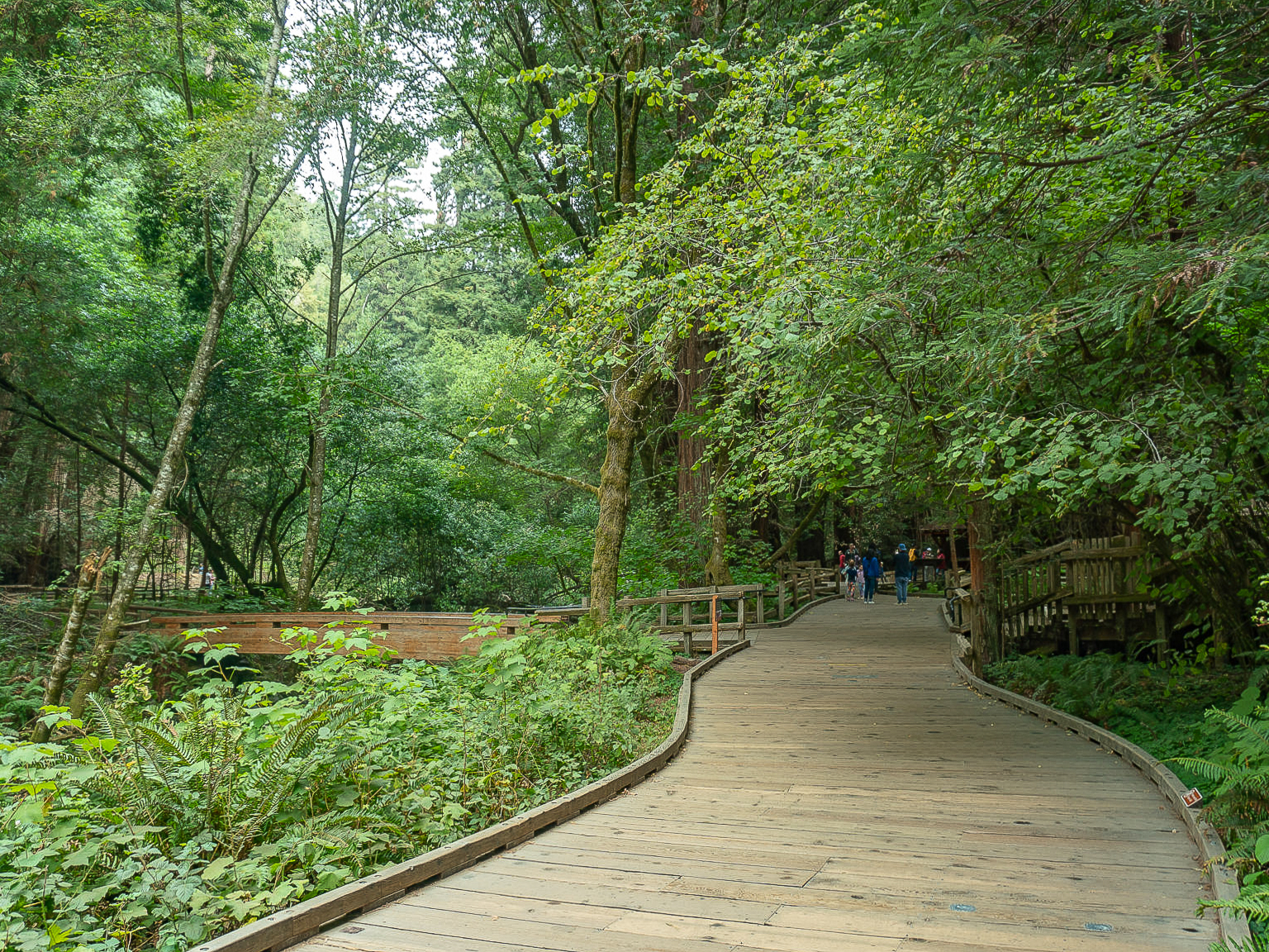
An accessible boardwalk on the Main Trail in Muir Woods National Monument
The route can also be shortened by following the mostly flat Main Trail along Redwood Creek at the beginning of the hike. A Muir Woods entrance fee applies. Dogs are not allowed, with the exception of service dogs. Advance reservations are required to park at the main entrance to Muir Woods via gomuirwoods.com. Alternatively, park along the Panoramic Highway, near the Mountain Home Inn, and pick up the Canopy View Trail the back way into Muir Woods.
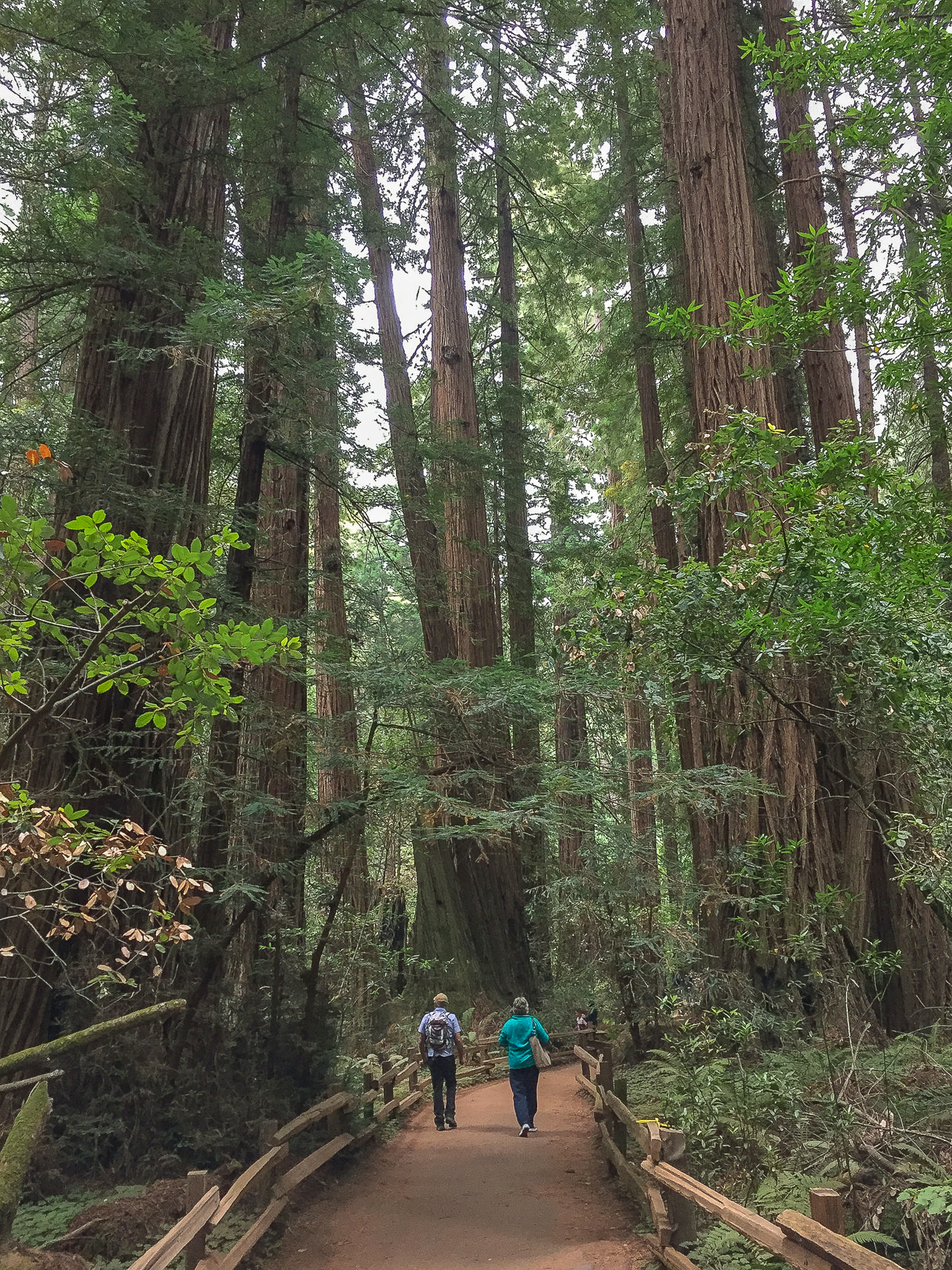
The mostly flat Main Trail leads through ancient coast redwoods up to 258 feet tall
San Francisco
Mt Livermore-Angel Island
5.1-mile loop, 1100-foot elevation gain, 2.5 hours
Angel Island State Park, Tiburon
Named for Marin conservationist Caroline Sealy Livermore, Mount Livermore is Angel Island State Park’s highest point at 788 feet elevation. The 740-acre park, with picnic tables and campgrounds, is located three miles north of San Francisco in the San Francisco Bay. The vistas on this 5.1-mile loop are straight-up gorgeous, with panoramic views of San Francisco, the Golden Gate Bridge, Sausalito, Mount Tamalpais, Alcatraz, and the Bay Bridge. The island’s history is revealed through the remains of gun batteries and military posts, as well as the Angel Island Immigration Station. Add on an optional 3.0-mile round-trip to tucked-away Quarry Beach for a mid-hike siesta.
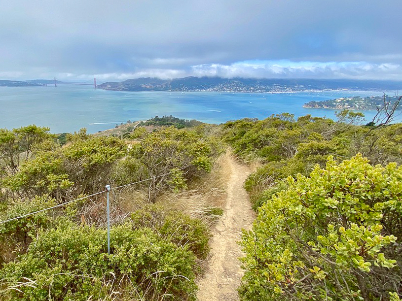
Views of the Golden Gate Bridge, Marin Headlands, and Sausalito from Mount Livermore on Angel Island
Cars aren’t allowed on Angel Island, with the exception of trams and some maintenance vehicles, so one of the joys of reaching it (unless you have a private boat) is taking the ferry. Ferries are wheelchair accessible and run from San Francisco and Tiburon, a small town northwest of Angel Island in Marin County. The park entrance fee is included in your ferry ticket. Dogs are not allowed on Angel Island, with the exception of service dogs.
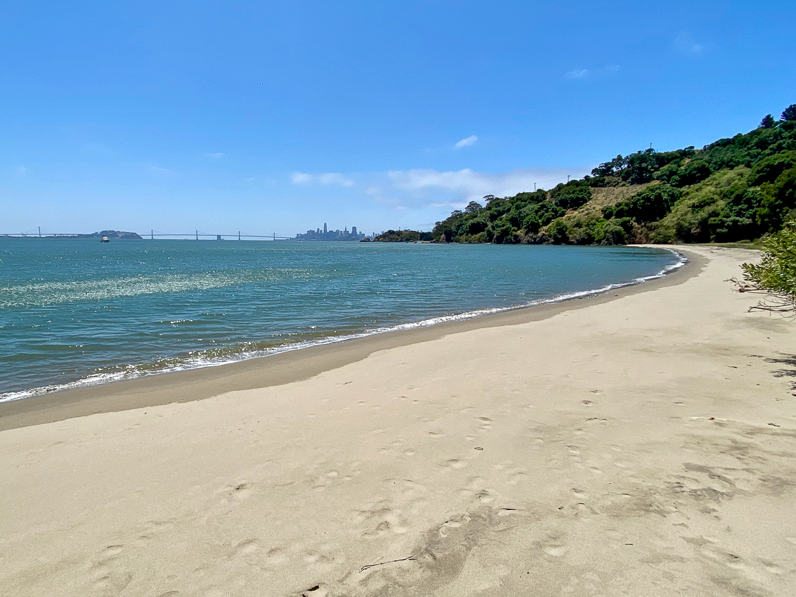
Quiet, sandy, Quarry Beach is an excellent side trip on an Angel Island hike
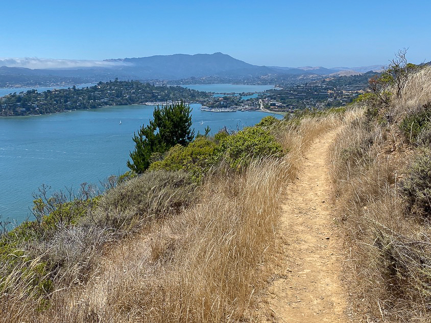
Vista of Mount Tamalpais from Angel Island
Presidio Loop
5.8-mile loop, 600-foot elevation gain, 4.5 hours
The Presidio, San Francisco
The renaissance of the Presidio, a former Spanish fort turned U.S. military base and now national park site, is an exceptional experience. This 5.8-mile loop encompasses the best of it: a tour through the Main Lawn with views of the Golden Gate Bridge, sculptures by Andy Goldsworthy, poignant memorials, coastal bluffs, historic WWII batteries, a short jaunt beneath the Golden Gate Bridge, and overlooks of the Pacific Ocean and San Francisco Bay. Be sure to stop by the new Presidio Tunnel Tops, next to the Presidio Visitor Center, to gaze at the picturesque Golden Gate Bridge vistas from a red Adirondack chair.
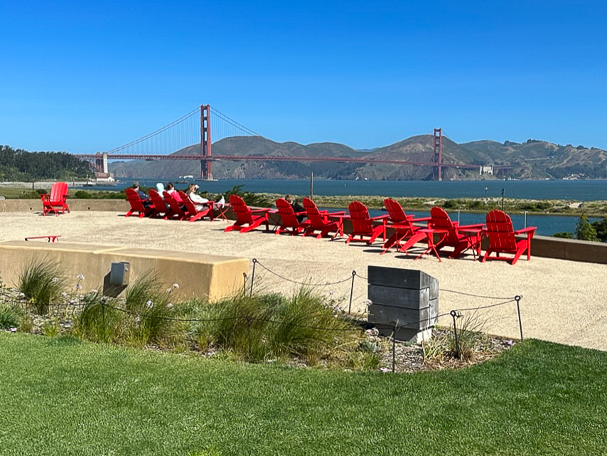
Golden Gate Bridge, Marin Headlands, and San Francisco Bay views from the Presidio Tunnel Tops
If you have an extra kick in your step, add on an extra 1.0-mile round-trip to the Civil War-era Fort Point, a national historic site. Alternatively, take the eye-popping East Beach to Fort Point hike (4.5 miles round-trip) for a shorter outing. There is no entrance fee for the Presidio or Fort Point. Many parking lots in the developed areas of the Presidio charge a fee, but there are a few options for free parking along the route. See the hike for details. Leashed dogs are allowed on Presidio grounds; they are not allowed inside Fort Point with the exception of service dogs.
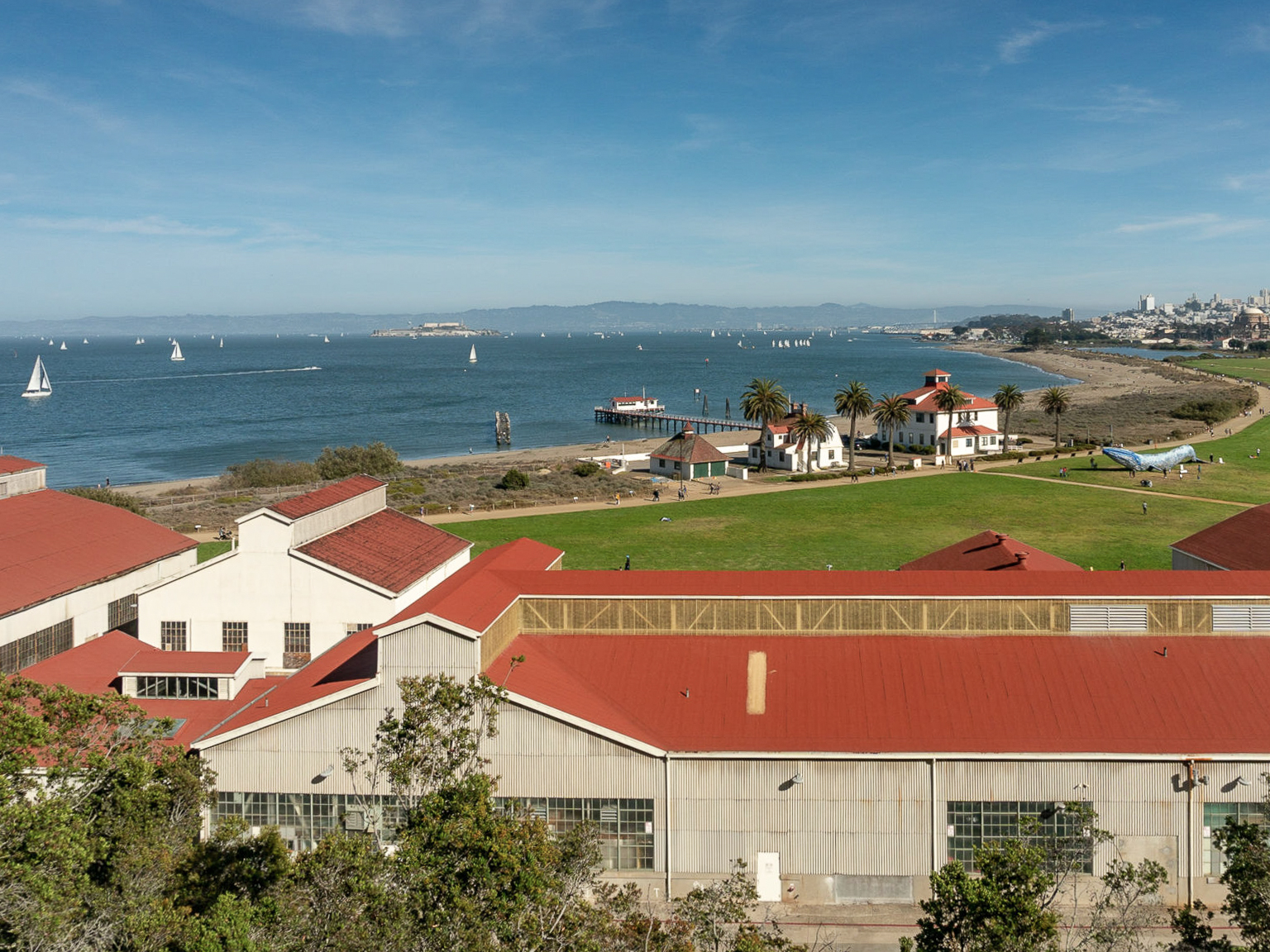
Overlooking Crissy Field and Alcatraz on the Presidio Loop
South Bay
Hidden Villa Grand Loop
5.4-mile loop, 1,575-foot elevation gain, 3 hours
Hidden Villa, Los Altos Hills
Hidden Villa is a small treasure in Los Altos Hills, with eight miles of hiking trails in the Santa Cruz mountain foothills and a working farm with sheep, goats, and chickens. This 5.4-mile loop takes you through Hidden Villa’s farm, trails, and creeks, with vistas of the San Francisco Bay, Stanford campus, and Santa Clara Valley. My favorite time of year to visit is winter when the creeks are full and splashing with cascades.
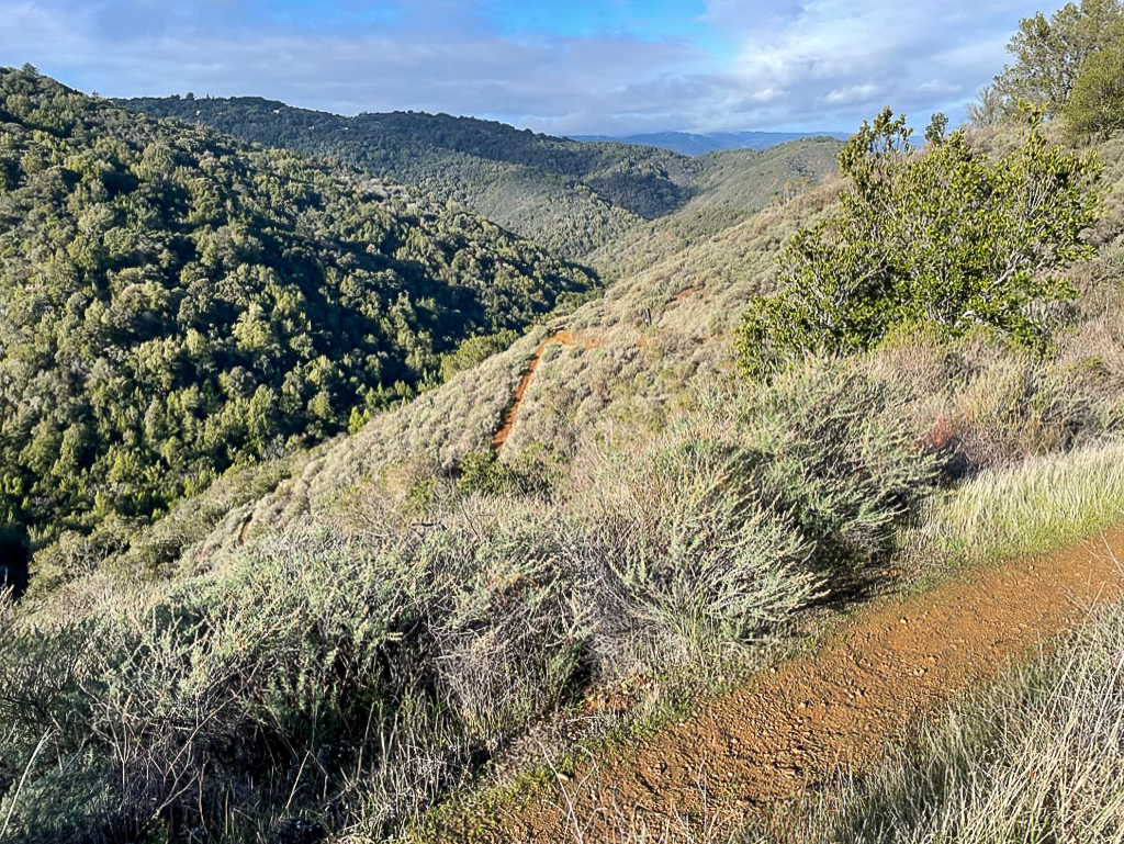
Hiking through the beautiful and wild foothills of the Santa Cruz Mountains on the Hidden Villa Grand Loop
Check Hidden Villa’s website before you go, especially in summer, as it closes to the public most weeks during their summer camp sessions. Extend your hike up to Black Mountain in Monte Bello Preserve, or shorten it by exploring the picturesque Creek Trail. Guests are asked to pay a $10 entrance fee and make a reservation on hiddenvilla.org. Leashed dogs are welcome and allowed on the farm but not on the wilderness trails.

Passing by a curious lamb at Hidden Villa’s farm on the way to the hiking trails
Villa Montalvo Loop
2.5-mile loop, 500-foot elevation gain, 1.5 hours
Montalvo Arts Center, Saratoga
The Montalvo Arts Center, also known as Villa Montalvo, has an unusually breathtaking combination of a Mediterranean-style villa, hiking trails through a redwood forest, art sculptures, California history, and beautiful gardens. The name Montalvo is a nod to Spanish author Garci Ordóñez de Montalvo, who is credited with creating the name “California.” Keep an eye out for concerts at the Center’s Carriage House Theatre, which host a range of musicians in the intimate space.
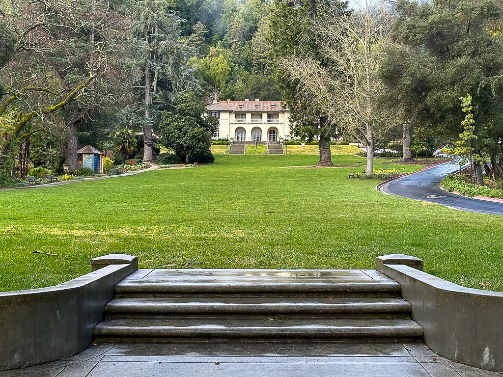
View of the Great Lawn, a great picnicking spot at the Montalvo Arts Center
This short but sweet 2.5-mile loop covers the highlights of the Montalvo Arts Center and hiking trails, leading up to a vista point overlooking the Santa Clara Valley. Bring a picnic for the big green lawn in front of the villa, or stop by nearby downtown Saratoga for a bite at Big Basin Cafe. There is no entrance fee. Leashed dogs are allowed on the hiking trails but not on the Montalvo Arts Center grounds.
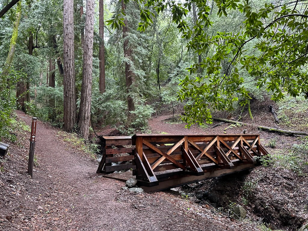
A wooden bridge over Wildcat Creek in a redwood forest is a scenic spot on the Villa Montalvo Loop
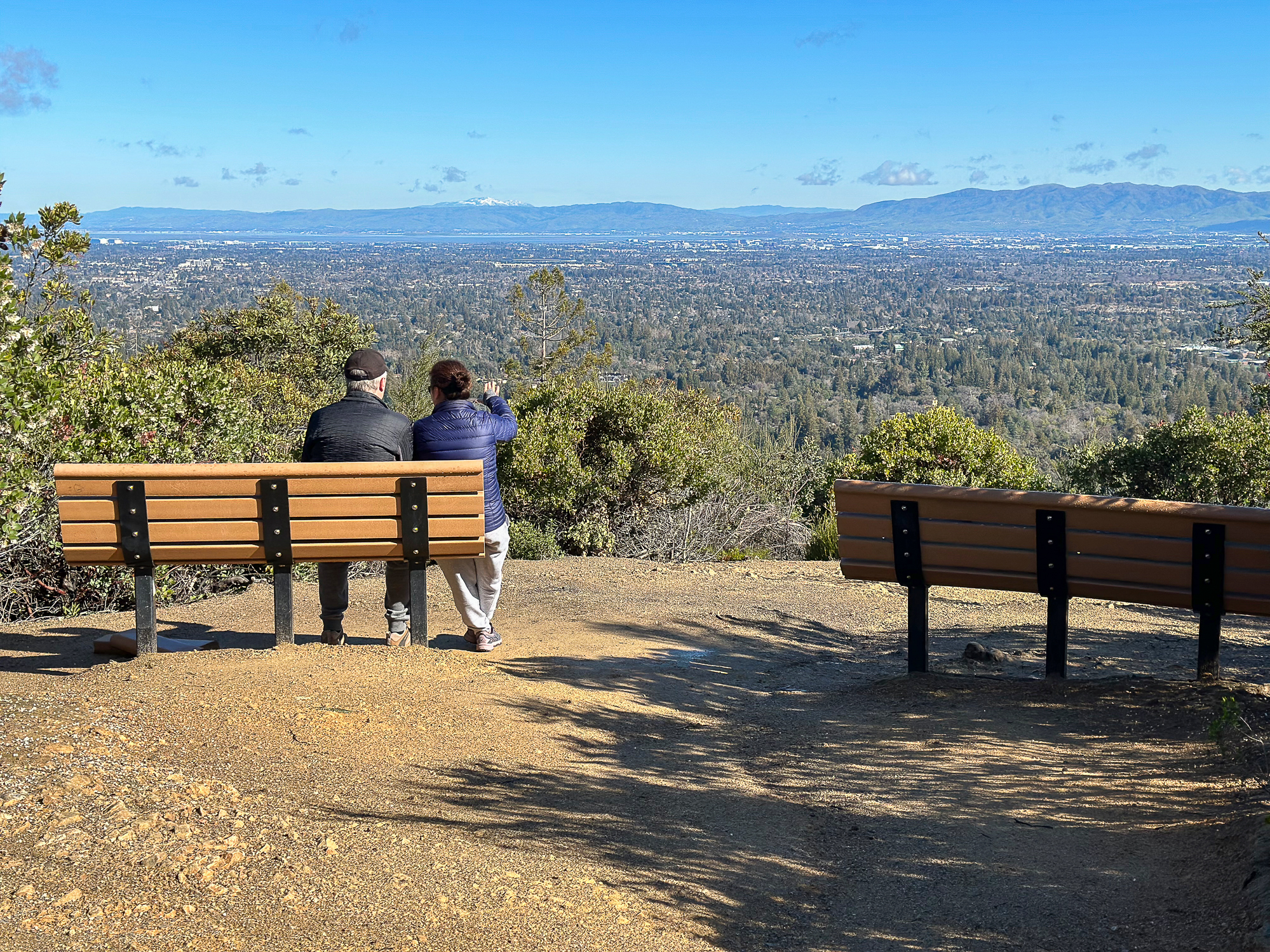
Santa Clara Valley and Diablo Range vistas from Villa Montalvo’s Lookout Point
Santa Cruz and Central Coast Region
Henry Cowell Observation Deck Loop
5.0-mile loop, 700-foot elevation gain, 2.5 hours
Henry Cowell Redwoods State Park, Felton
Henry Cowell Redwoods has a beautiful 0.8-mile ADA-accessible loop through an ancient redwood grove at the start of this hike. Aside from its beauty, the historic grove inspired the protection of redwoods in California State Parks and the creation of Big Basin Redwoods State Park. Beyond it, this 5.0-mile loop hike threads through second-growth redwoods, along the peaceful San Lorenzo River, and up to the Observation Deck, the highest point in the park at 805 feet elevation.
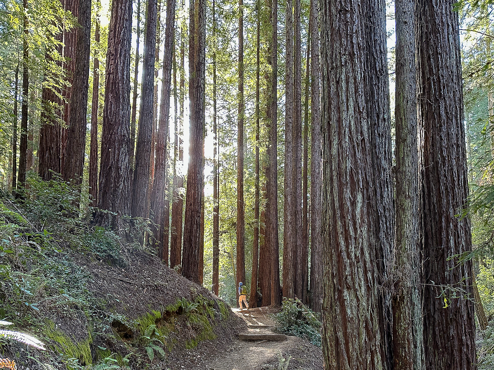
Hiking through coast redwoods on the way to the Observation Deck
Not only are there picnic tables on the deck to enjoy the Santa Cruz Mountains and Monterey Bay, but a sandy, beach-like habitat surrounding it called the Santa Cruz Sandhills that was once the bottom of the ocean floor 10 million years ago. If you’re craving more beaches and the ocean, downtown Santa Cruz is only a 20-minute drive away. The Henry Cowell day-use fee is $10 per carload. Leashed dogs are allowed on a few select trails.
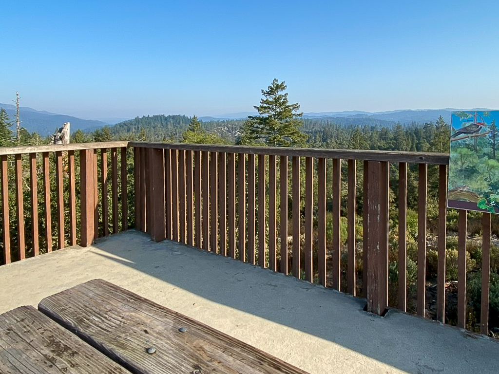
Views of the Santa Cruz Mountains from the Observation Deck, the highest point in the park at 805 feet elevation
Bear Gulch Caves-High Peaks-Condor Gulch Loop
6.1-mile loop, 1850-foot elevation gain, 3.5 hours
Pinnacles National Park, Paicines
Pinnacles is our favorite hike to take out-of-town guests because of its memorable and adventuresome talus caves, beautiful reservoir, endangered California Condors, striking 23-million-year-old pinnacles, and glittering springtime wildflowers. This route begins with a hike through the family-friendly talus caves for which you will need a flashlight or headlamp. If your time is limited, the caves are a must-do. The caves do close seasonally, so be sure to check their status before you go.
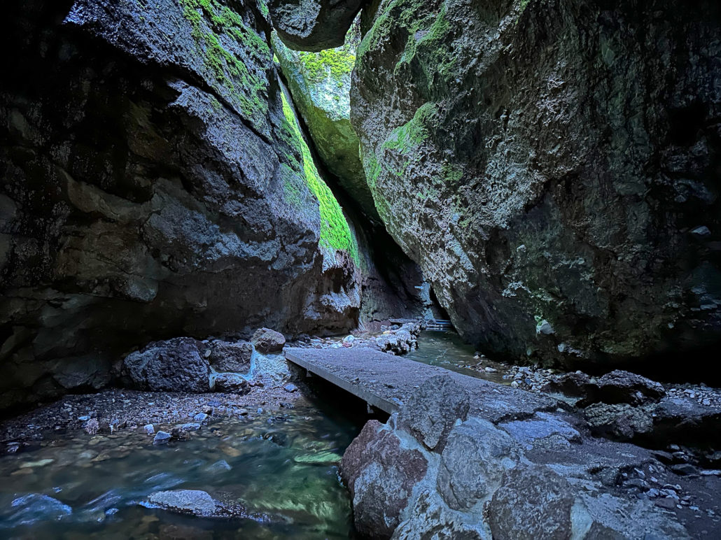
Entering rare talus caves at Pinnacles National Park
After the talus caves, the route climbs on a moderately strenuous grade to the fun, obstacle course-like High Peaks, with steep steps and railings built into the rock and overhanging ledges to duck under. The exhilaration from the cold and creepy talus caves to the narrow stairways and vistas from the High Peaks make it an unforgettable trip. Pinnacles National Park entrance fee applies. Dogs are not allowed on hiking trails.
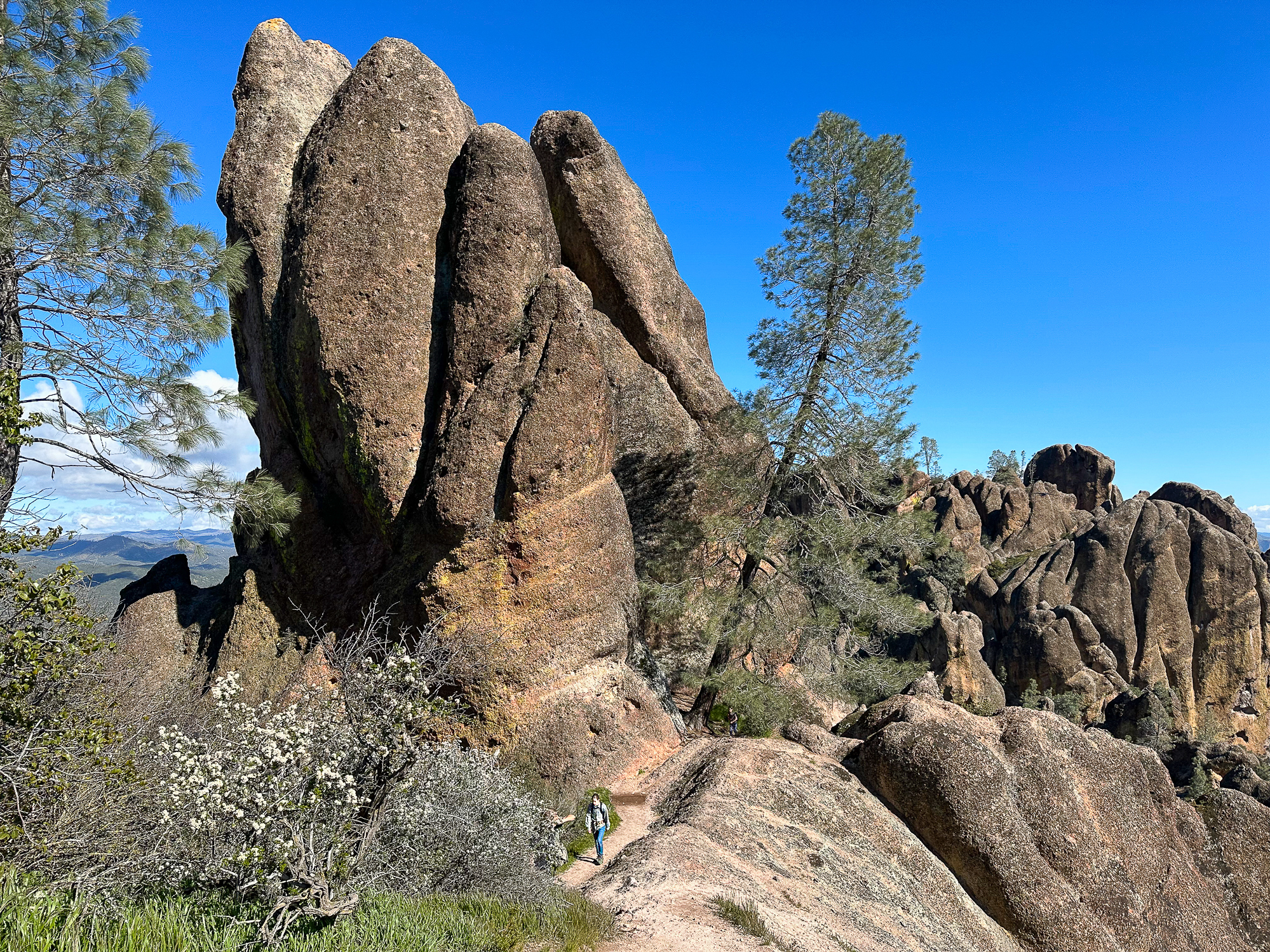
Hiking through millions-year-old pinnacles in the High Peaks area
Tags: Angel Island, Angel Island State Park, Central Coast, coast redwoods, condors, farm animals, ferry, Golden Gate Bridge, Marin County, military history, Monterey Bay, Muir Woods, Muir Woods National Monument, national historic site, national monument, National Parks, North Bay, pinnacles national park, Point Reyes National Seashore, san francisco, San Francisco Bay, San Francisco Bay Area, Santa Cruz, Santa Cruz mountains, South Bay, The Presidio