Pinnacles National Park, 125 miles southeast of San Francisco, is an incredibly fun and adventurous park, with rare talus caves, millions-year-old pinnacles, spring wildflowers, and California condors. This 6.1-mile loop takes you through the Bear Gulch Caves, up to the High Peaks area, and down the Condor Gulch Trail for vistas and wildflowers. The park’s inimitable geologic history makes the hike all the more special.
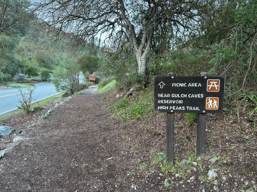
The loop begins on the east side of the park at the Bear Gulch Day Use area. It is a popular area and parking usually fills by mid-morning. The park recommends arriving by 8:00 a.m. to get a spot. The east side of Pinnacles is open 24 hours a day.
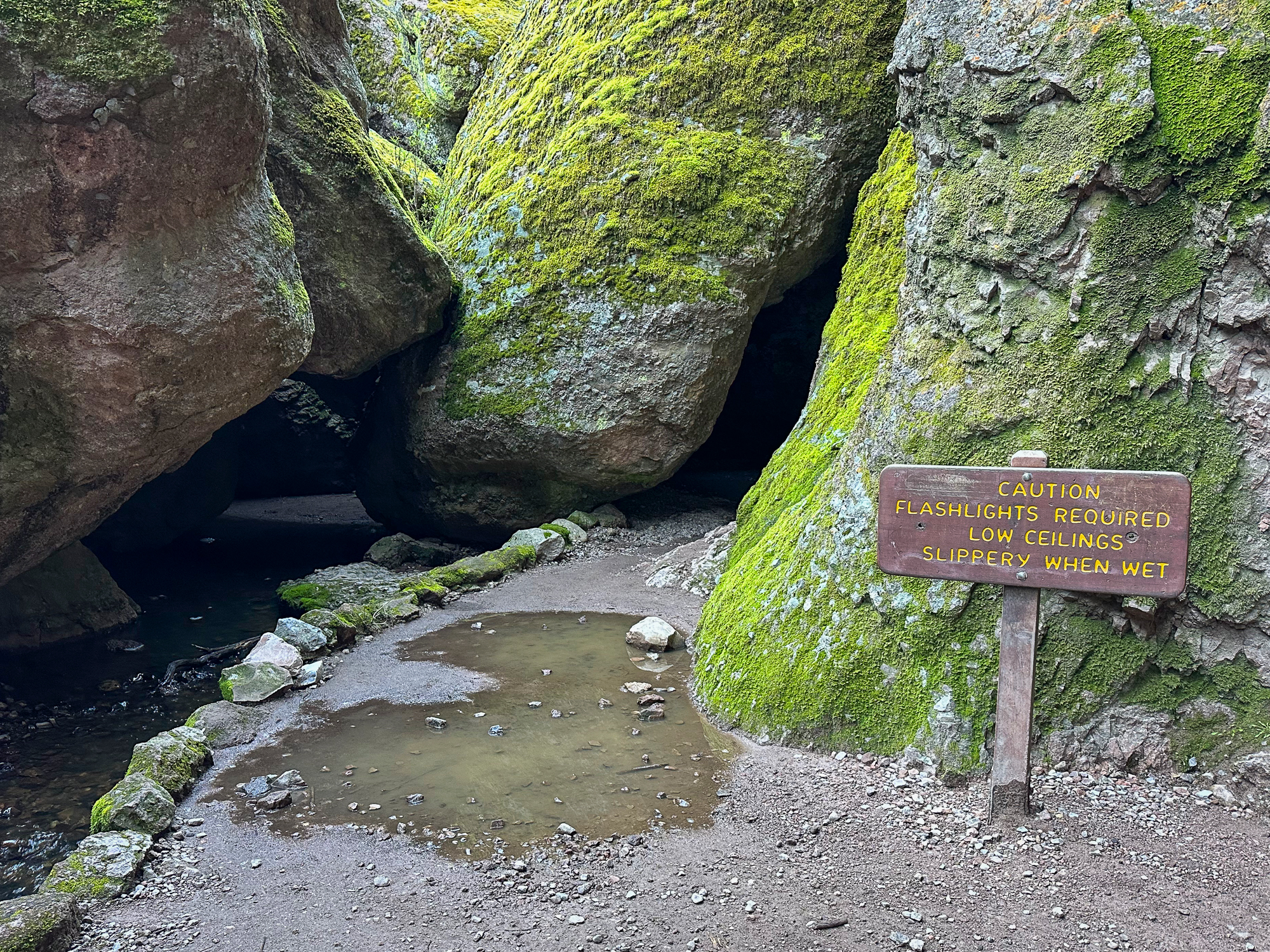
The Bear Gulch Caves are open seasonally. To find out if the caves are open, check their status on the park’s website, or call the park at (831) 389-4486. Pack a headlamp or flashlight for navigating pitch-dark spots in the caves.

Spring is a wonderful time of year to visit Pinnacles when wildflowers are blooming and temperatures are still mild. Summer temperatures average in the mid-90s, and can reach into the 100s. Bring plenty of water and sun protection and try to start your hike early to avoid those mid-day highs.
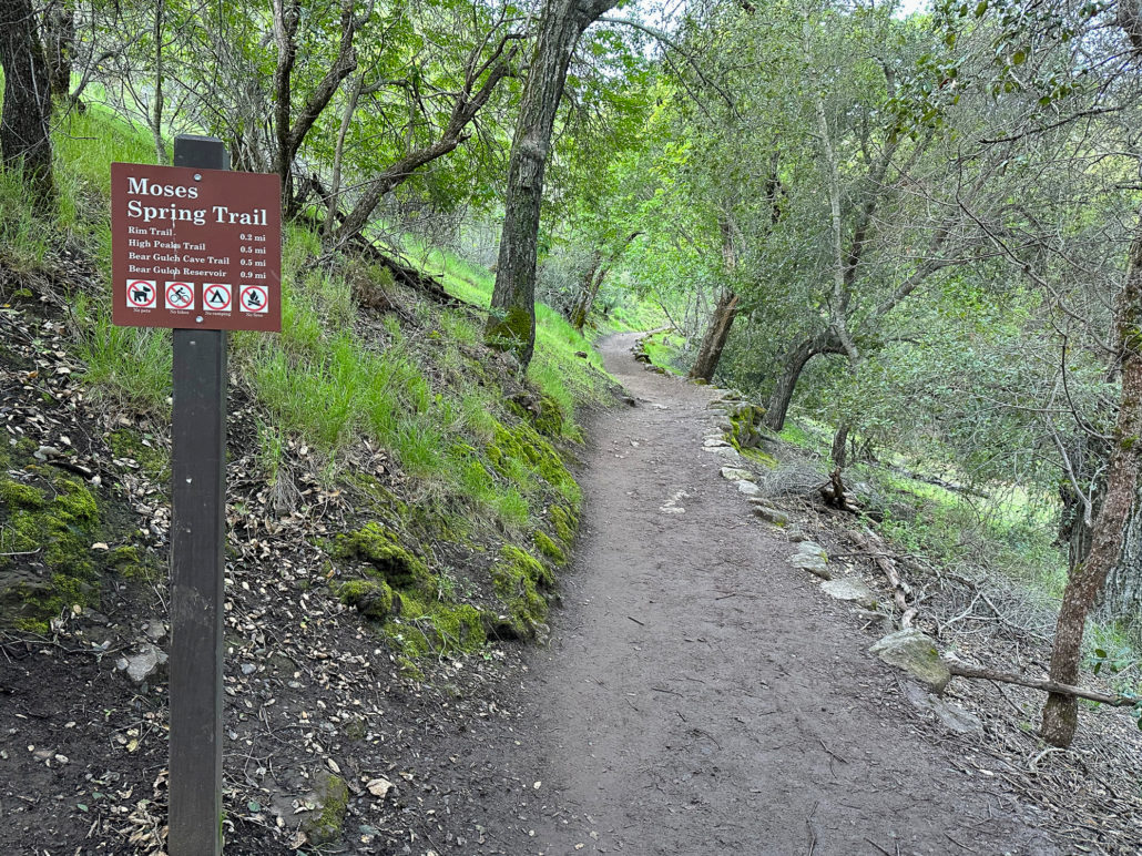
Moses Spring Trail
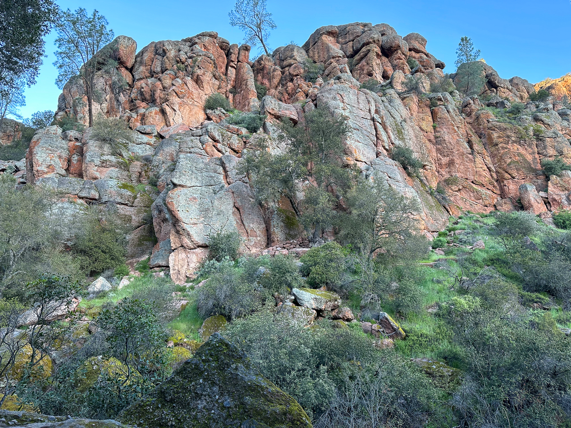
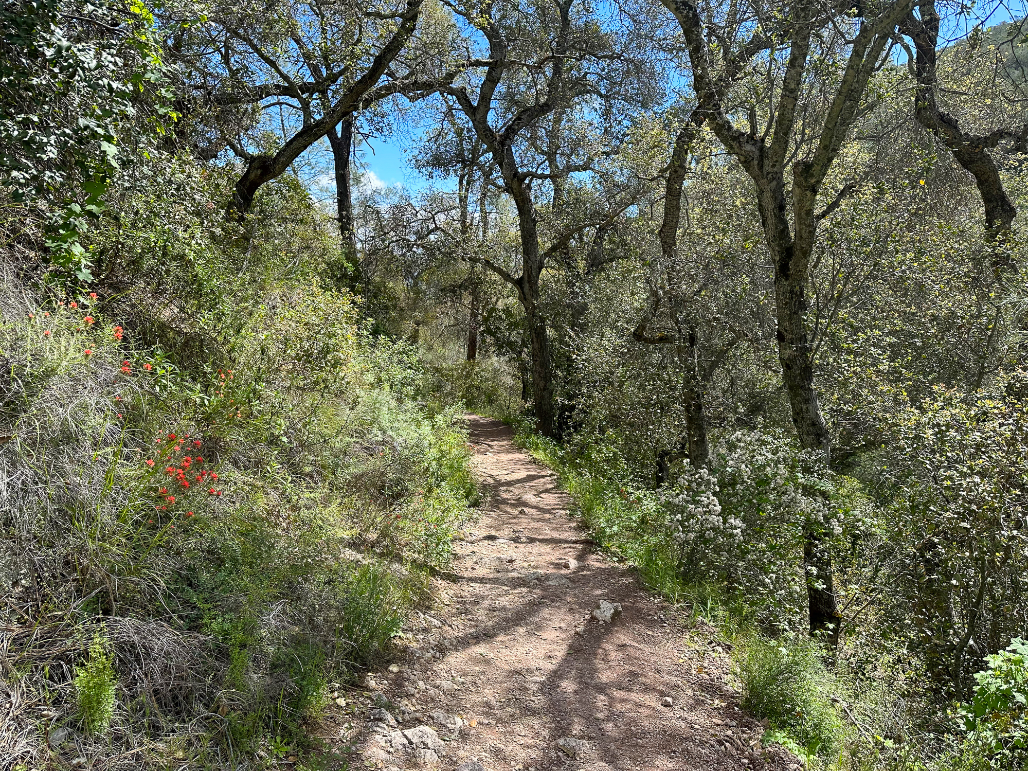
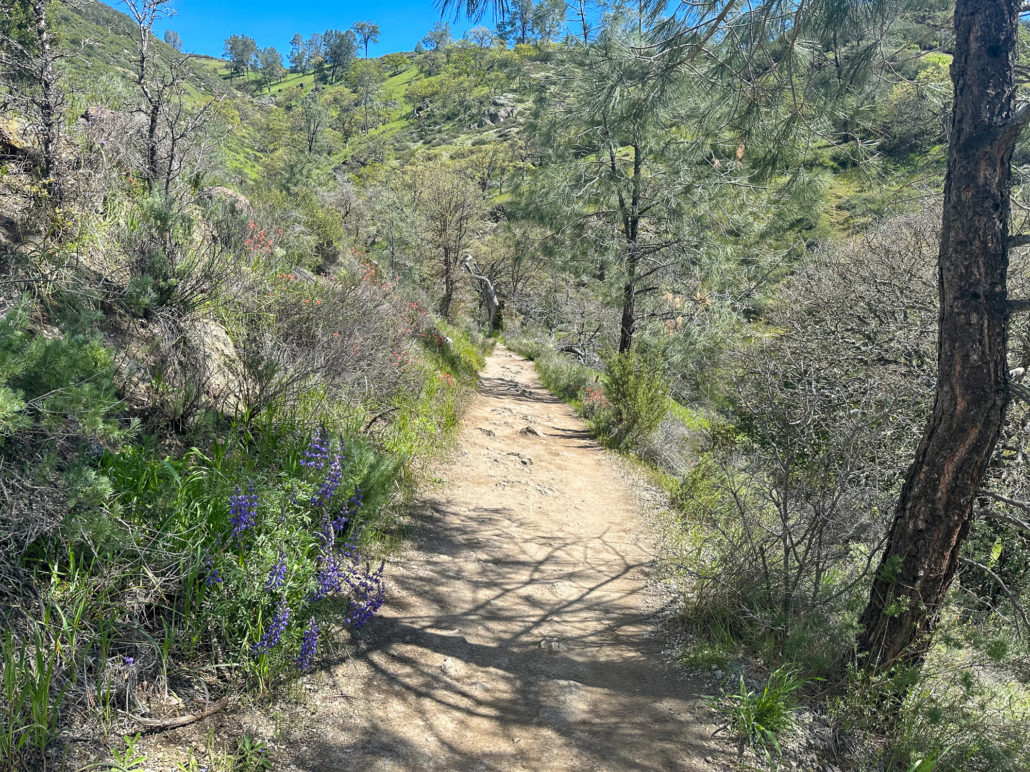
Begin at the Bear Gulch Day Use Area, heading southwest towards the Bear Gulch Caves. Join the Moses Spring Trail in 0.2 miles, entering a surprisingly lush and leafy woodland. Bear Creek trickles musically below, and dusty orange pinnacles tower overhead.

A sign with a carabiner marks a climber access trail to Tourist Trap, one of many climbing spots throughout the park. Deeper into Bear Gulch, the trail passes through a narrow tunnel in the boulders where it’s cool and breezy.
Bear Gulch Caves Trail
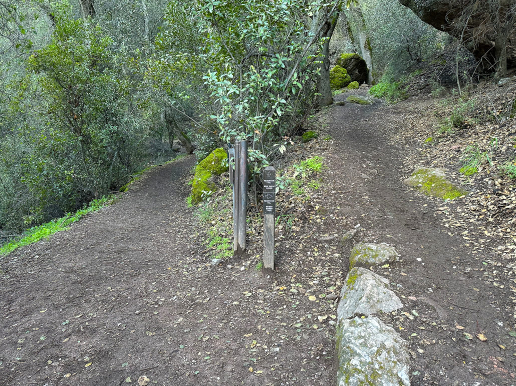
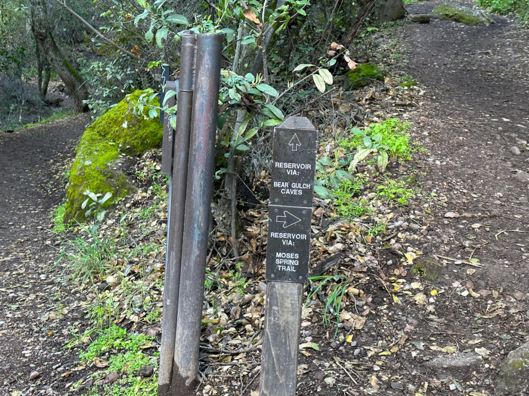
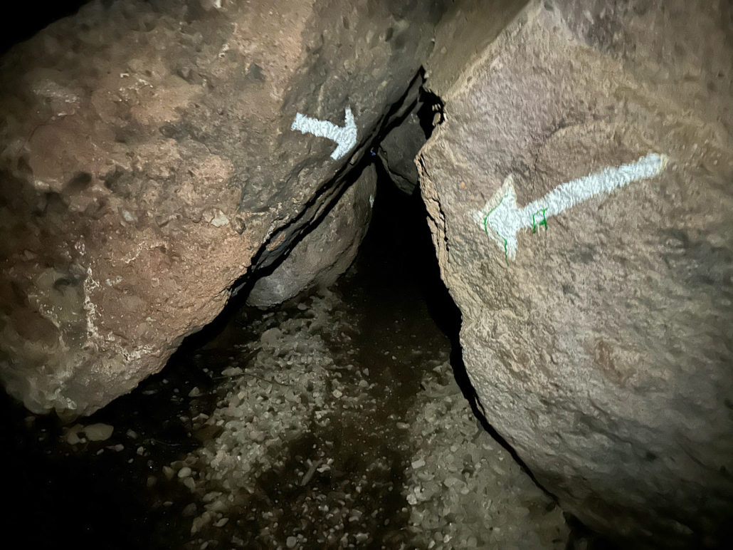
At 0.6 miles, turn left onto the Bear Gulch Caves Trail, following signs to the Bear Gulch Reservoir. If the caves are closed, turn right to detour onto the Moses Spring Trail, an equally beautiful route that meets up with Bear Gulch Cave Trail just before the reservoir.
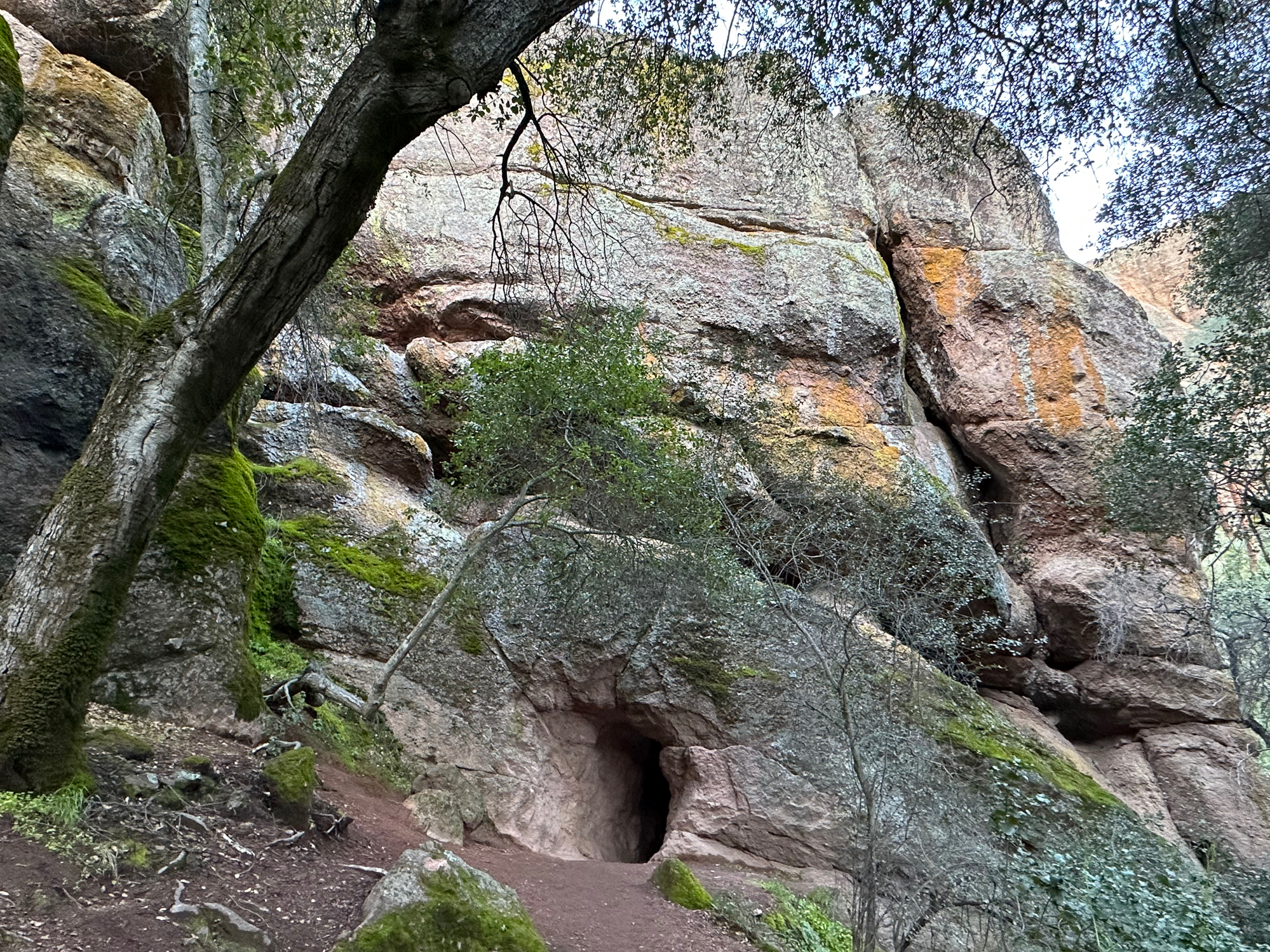
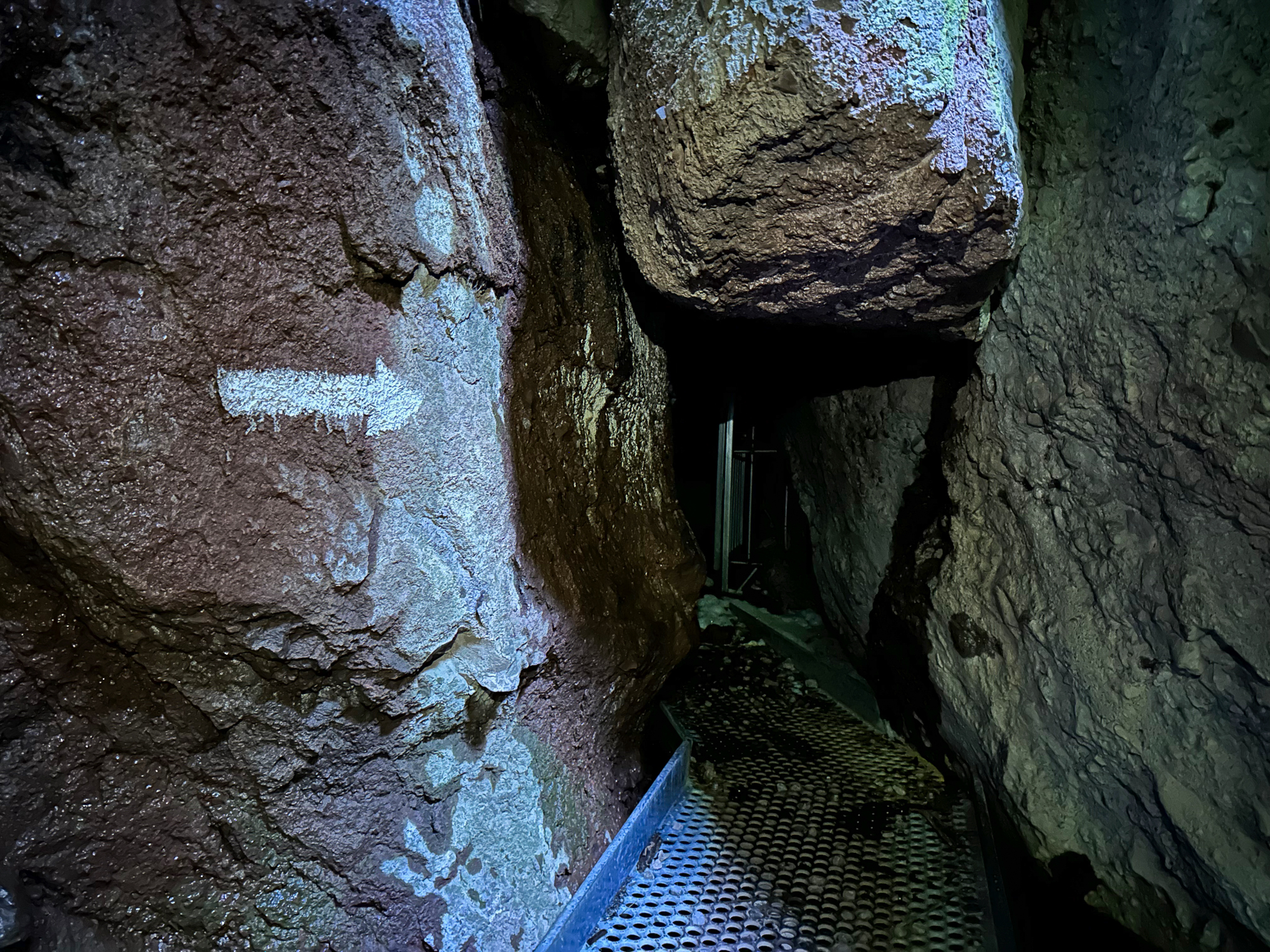
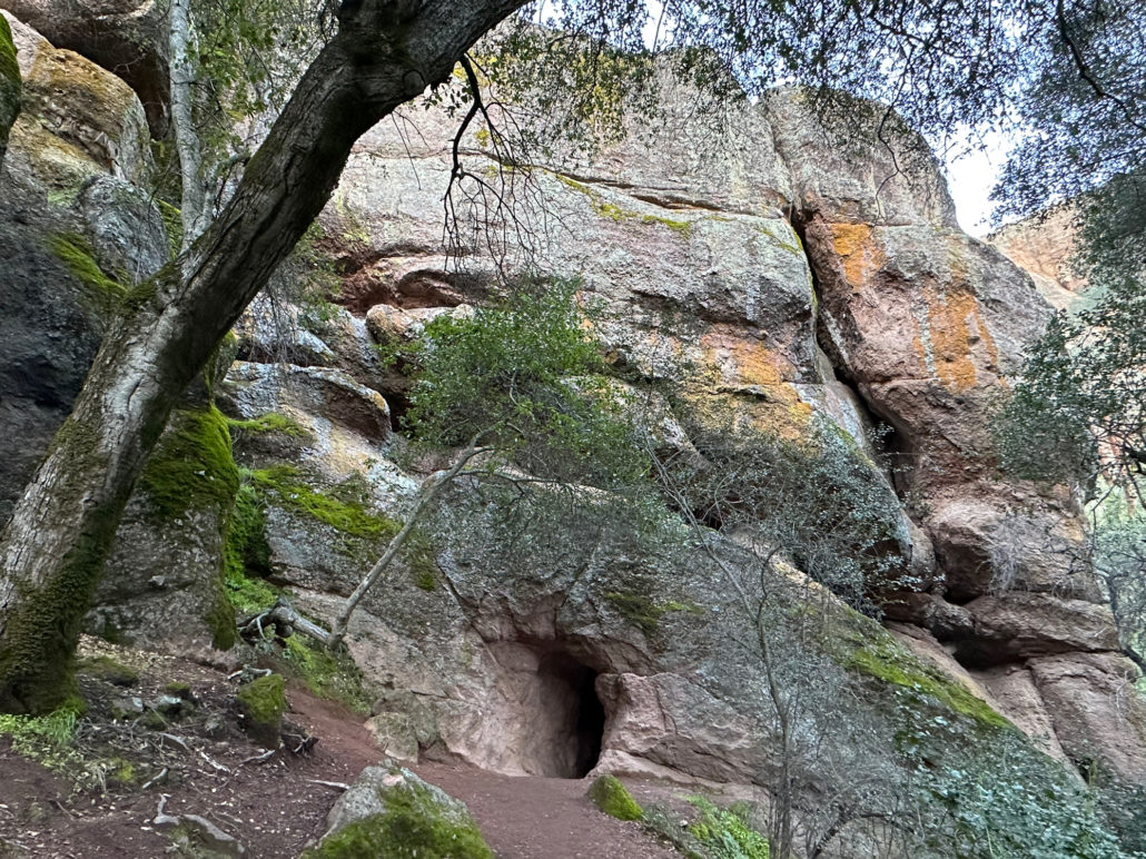
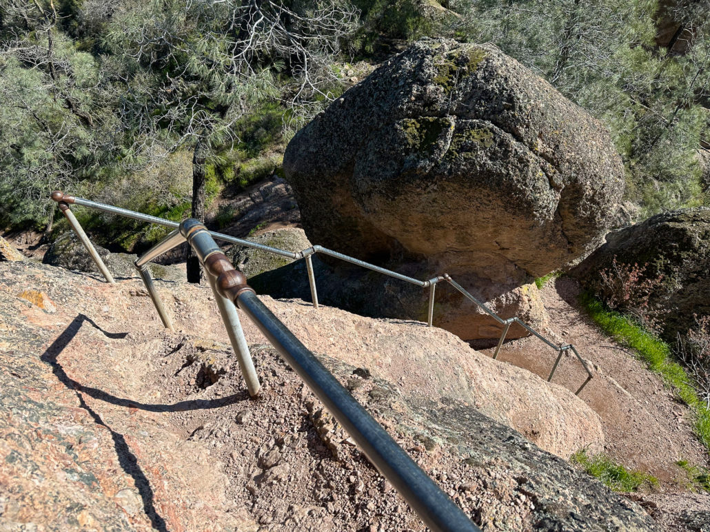
After another 0.1 miles, reach the Bear Gulch Caves entrance. The caves are divided into lower and upper caves. The lower cave is usually open most of the year except from mid-May through mid-July. The upper cave is open for short windows in March and October. A colony of Townsend’s big-eared bats calls the caves home, and the closures help protect them during their pup-rearing season.

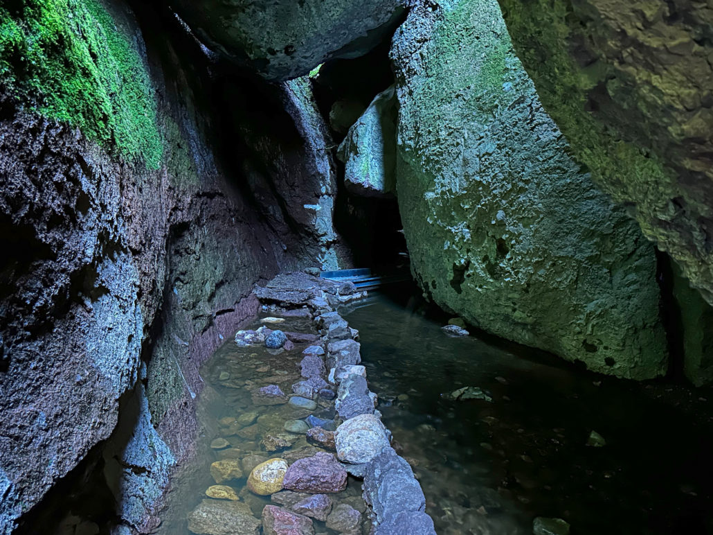
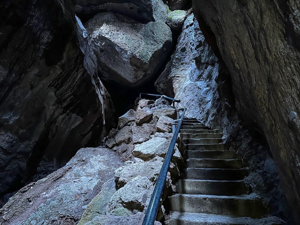
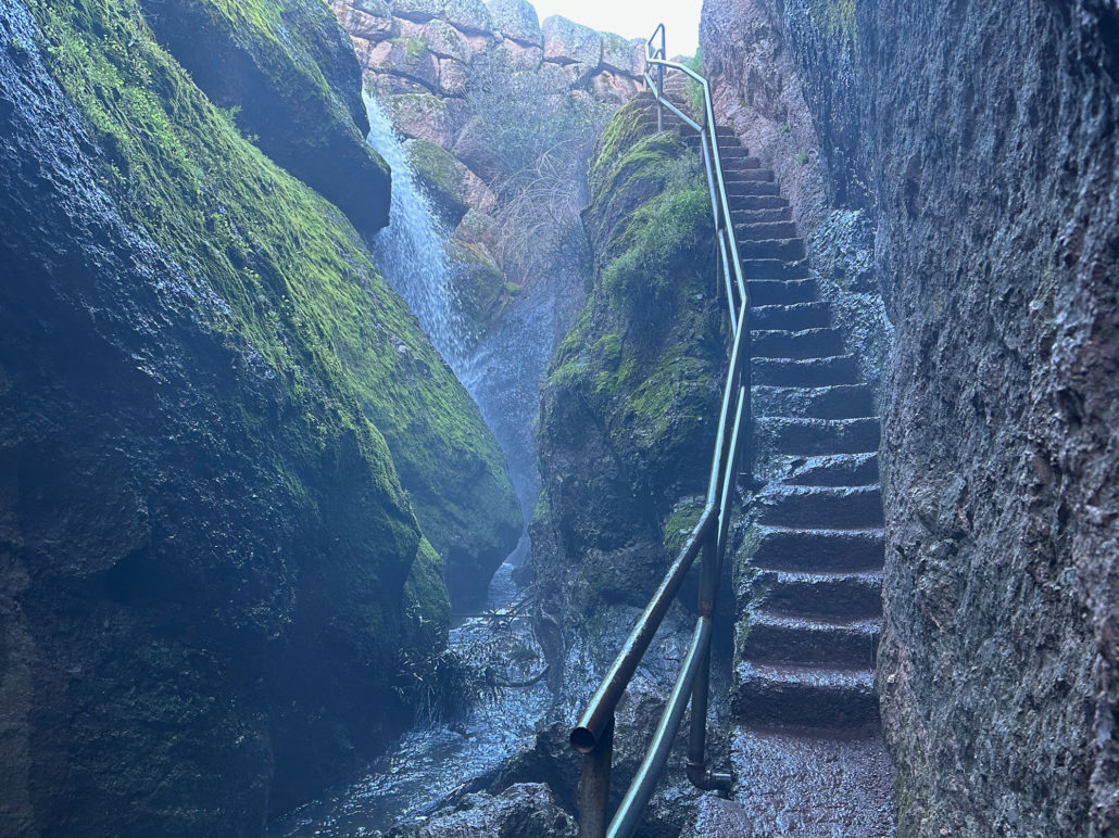
Bear Gulch Caves
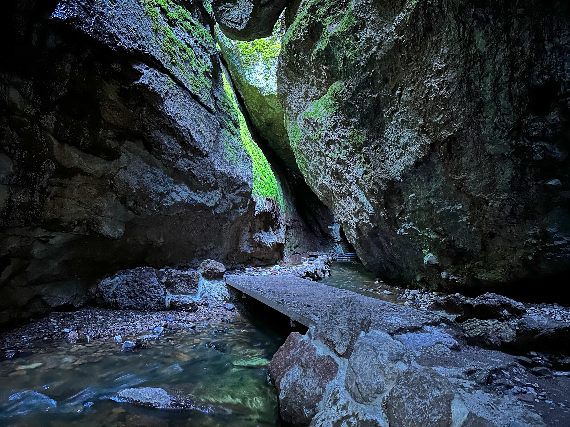
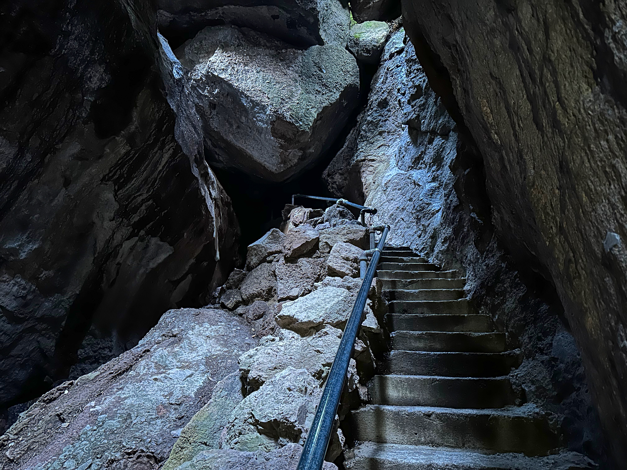
Turn on your headlamp or flashlight, and enter the lower cave. Glimpses of sky filter through enormous boulders that became lodged over time through earthquake activity and erosion, creating the talus caves. The Civilian Conservation Corps built the staircases and passageways insides the caves in the 1930s.

After ducking and hiking through the dark passageways, reach the upper cave entrance. If the upper cave is closed, bear left here at the signed Moses Spring exit, following signs to the reservoir.
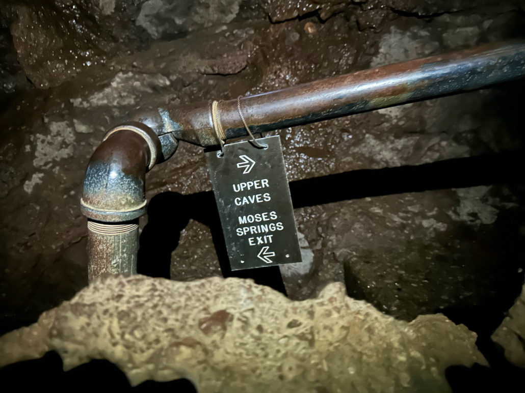
The upper cave has small, low-to-the-ground spaces that require crouching down and crawling at times. If you have sensitive knees or trouble crouching down, take the Moses Spring exit. The Moses Spring exit will lead you to the same spot as the upper cave exit.
Bear Gulch Reservoir
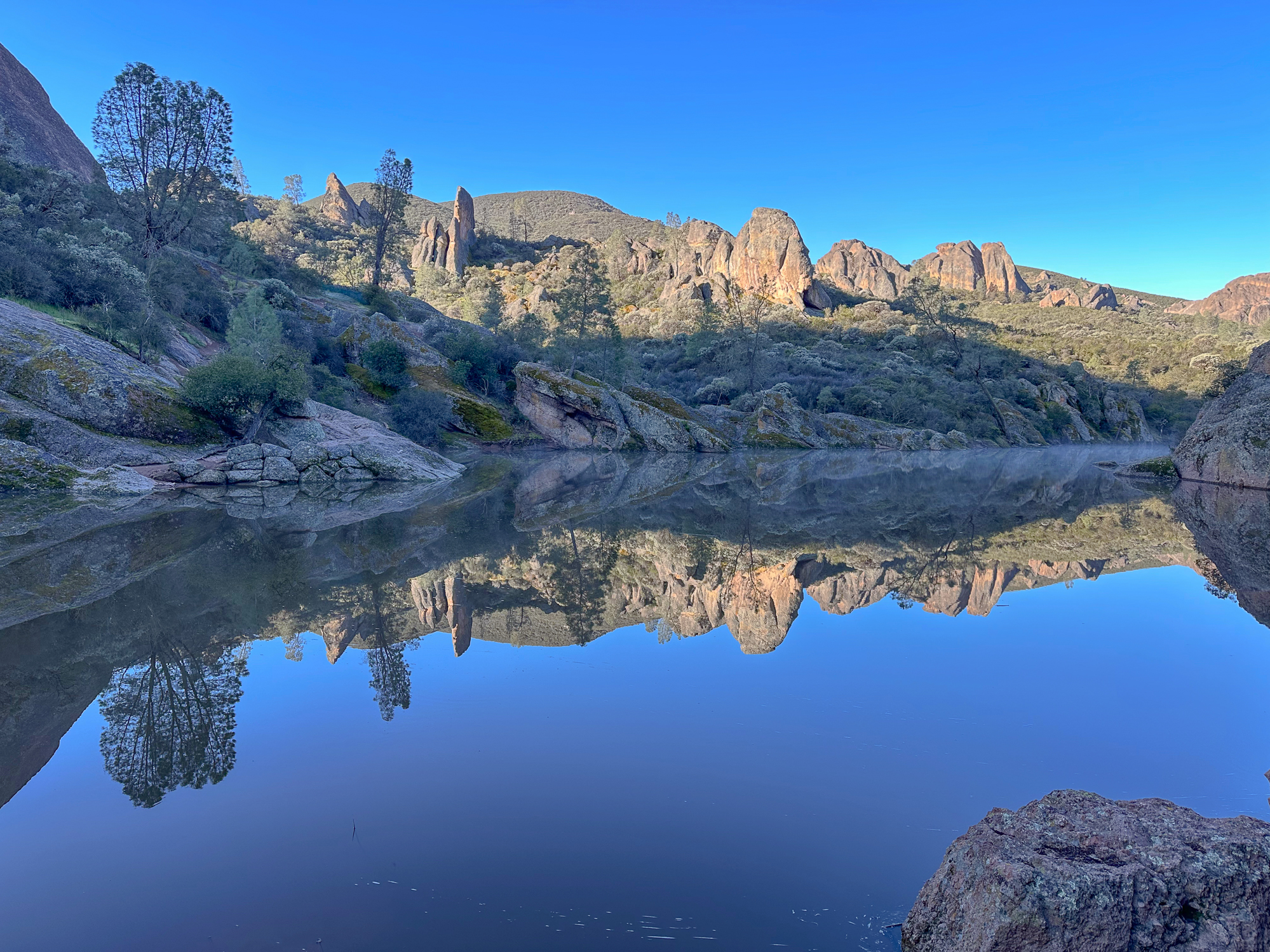
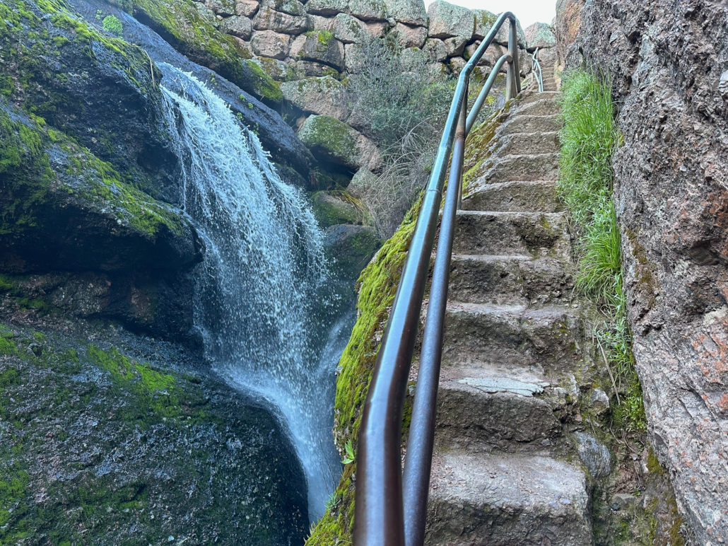
All the routes––the lower cave, upper cave, and Moses Spring Trail—converge at a stairway beneath the Bear Gulch Reservoir. A pretty seasonal waterfall flows beside the narrow stairs.
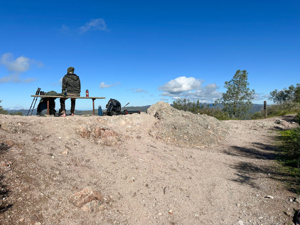
At 1.1 miles, reach the Bear Gulch Reservoir, built by the Civilian Conservation Corps in 1935. Tall pinnacles rise over their twin reflections. On the south side of the lake, the Chalone Peak Trail continues another 3.3 miles to North Chalone Peak. Early morning is especially beautiful when the reservoir is calm and clear, but no matter what time of day, it’s an excellent spot for a rest break.

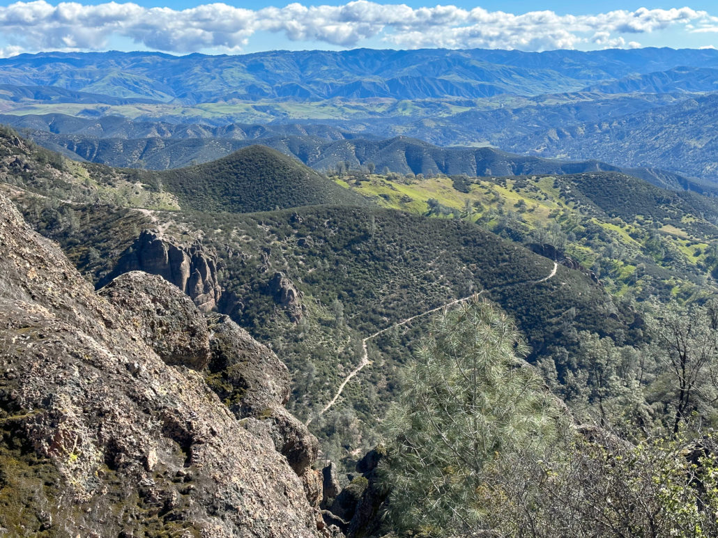
Rim Trail
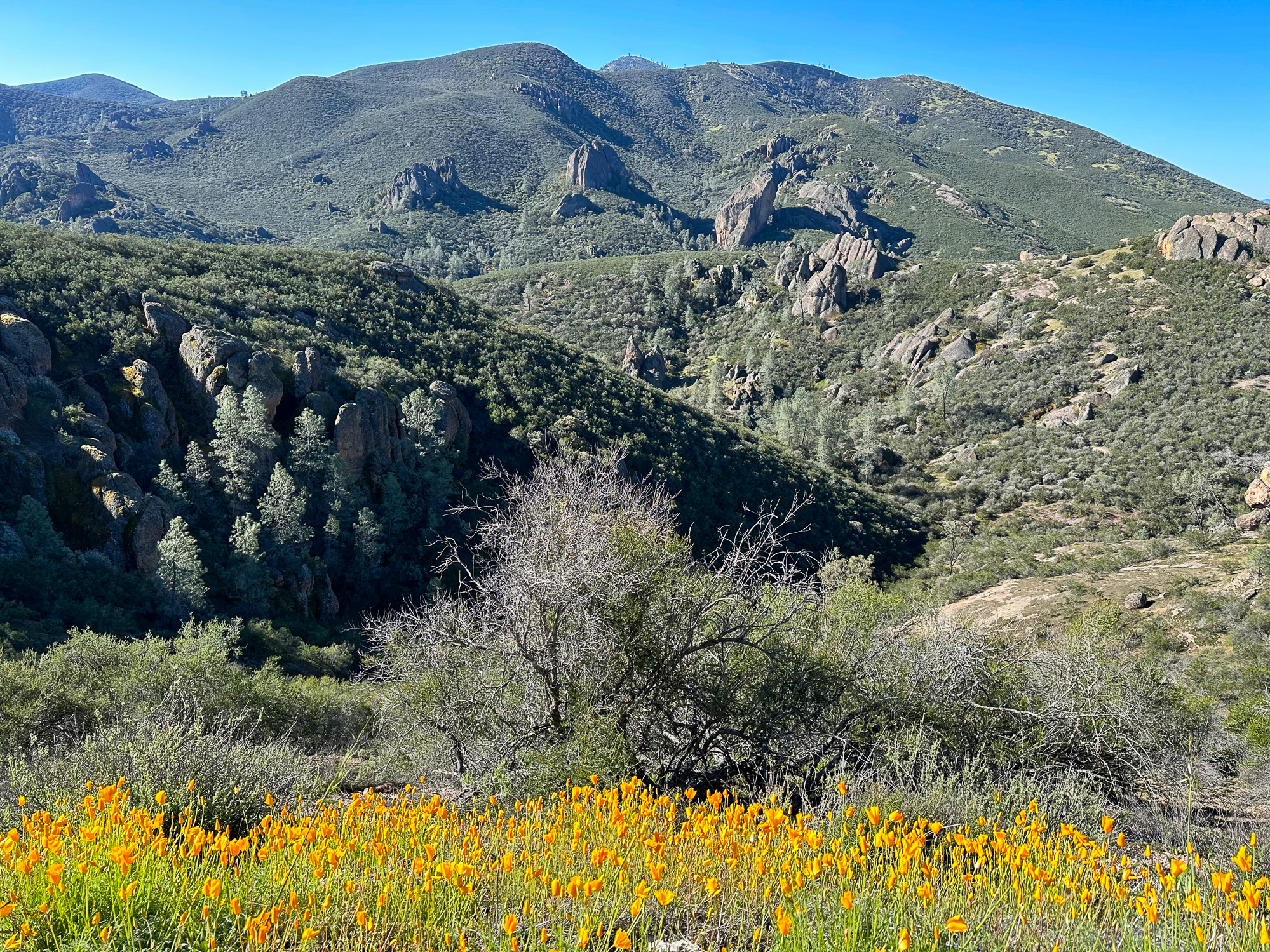
When ready, follow signs for the Rim Trail north towards the High Peaks Trail. Here and throughout the hike, is buckbrush, a shrub with tufts of tiny white flowers that look like cotton balls. They have a perfumey, lilac smell that wafts over the trail in spring. It can divide hikers on whether it’s pleasant or not (I like it!).
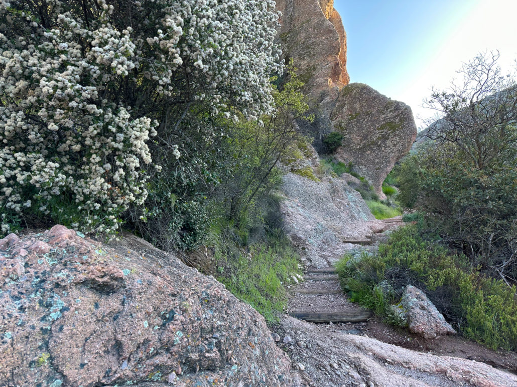
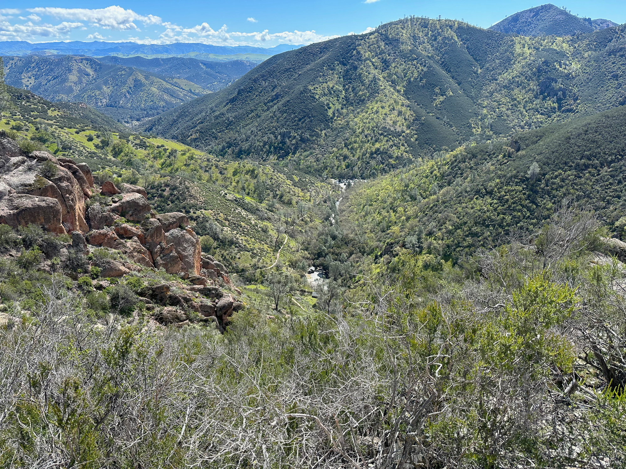
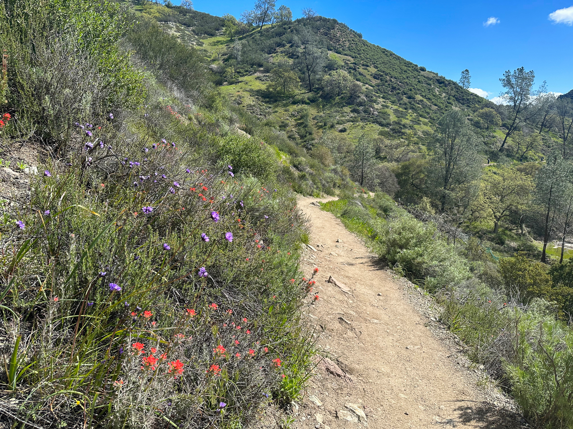
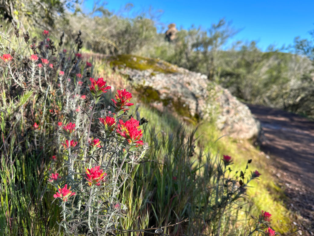
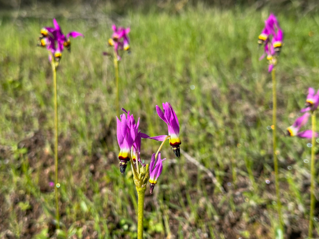
As you climb, Bear Gulch opens into a beautiful vista. Down below, you may see climbers on a prominent vertical rock called Discovery Wall. Vibrant pockets of goldfields, red paintbrush, and shooting star bloom in meadows beside the trail.
High Peaks Trail
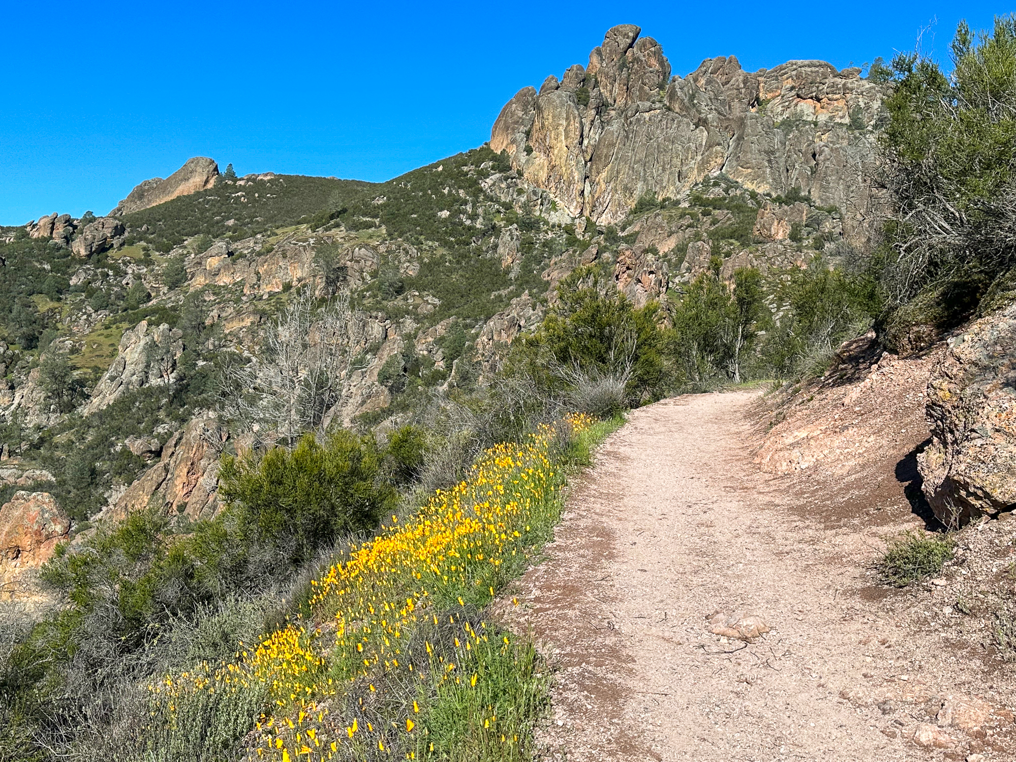
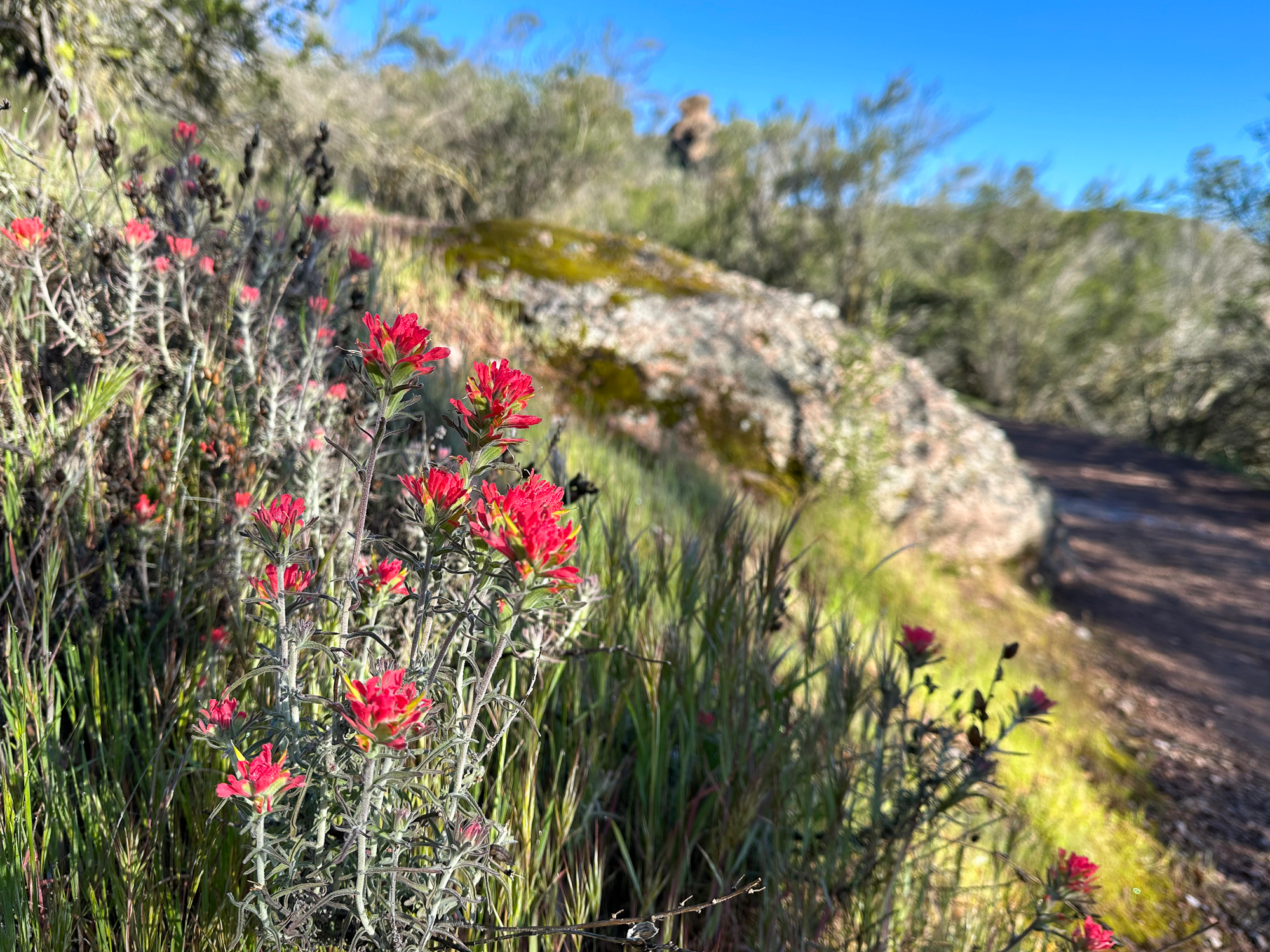
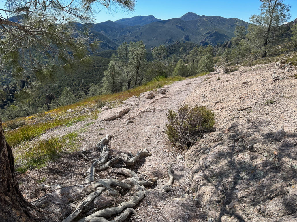
At 1.5 miles, merge onto the High Peaks Trail towards the Juniper Canyon Trail. The dirt trail is moderately wide, passing magenta warrior’s plume and yellow bush poppy. Striking, almost cartoon-shaped pinnacles rise above thickets of chamise. Chirping Spotted Towhee and trilling Bewick’s Wren create a peaceful soundtrack in the chaparral.
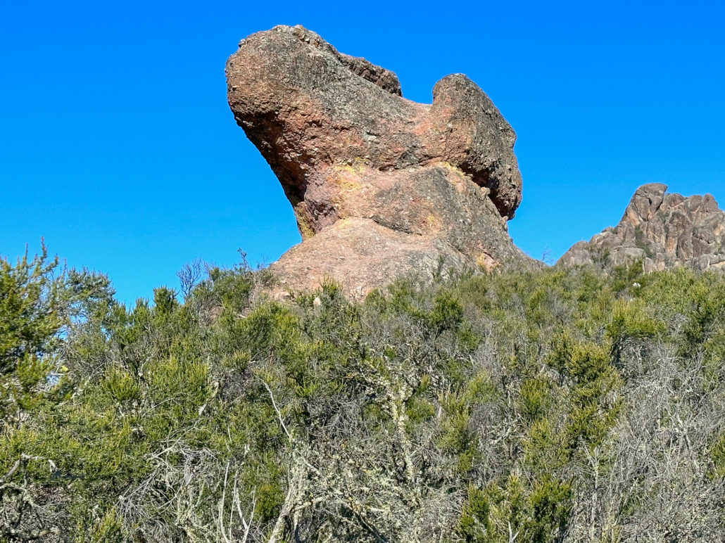
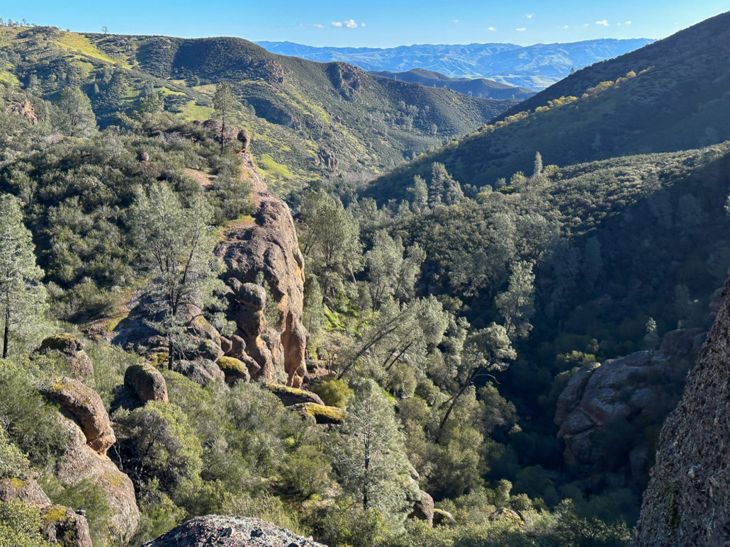
As you climb higher, vistas open to the south to North Chalone Peak, the highest point in the park at 3304 feet elevation. To the north, the higher-elevation pinnacles are so impressive, making it feel like you are in a special place.


Switchbacks gain a moderately steep 350 feet over 0.5 miles in the final approach to High Peaks. Pretty fiesta flowers, paintbrush, and purple lupine are sprinkled throughout.

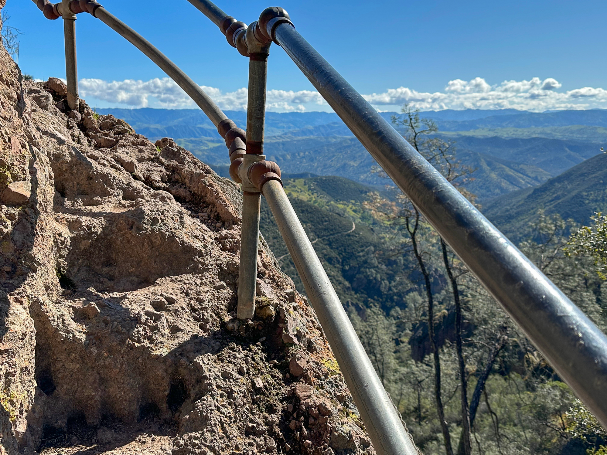
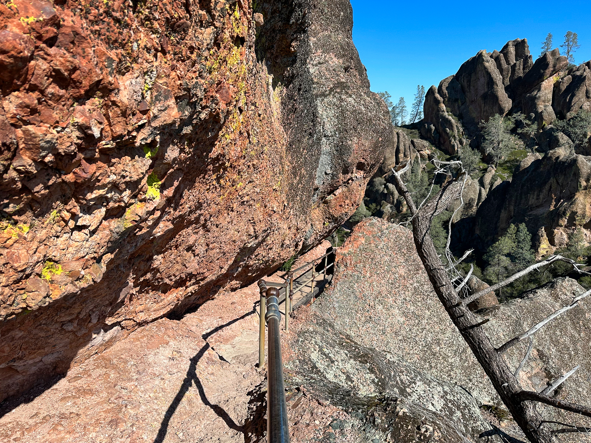
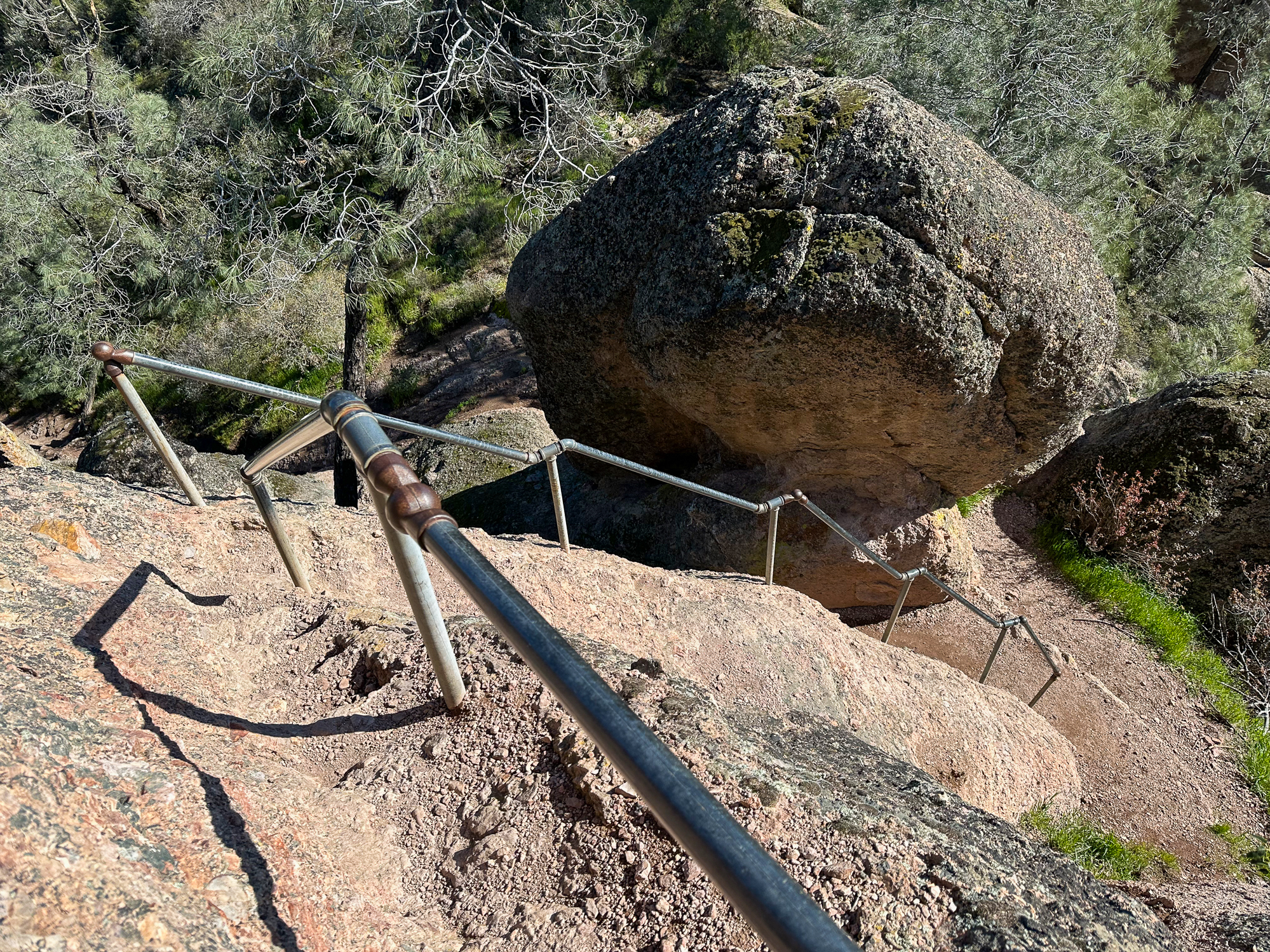
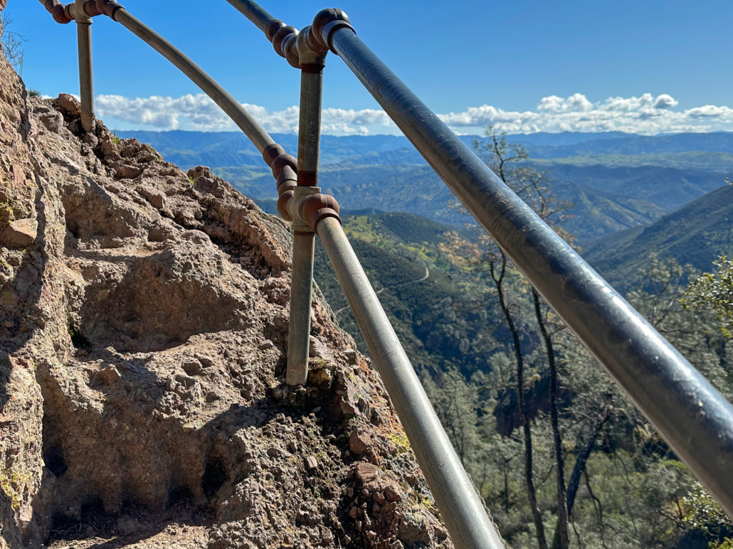
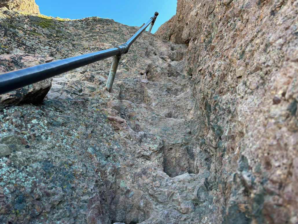
High Peaks Steep and Narrow Section
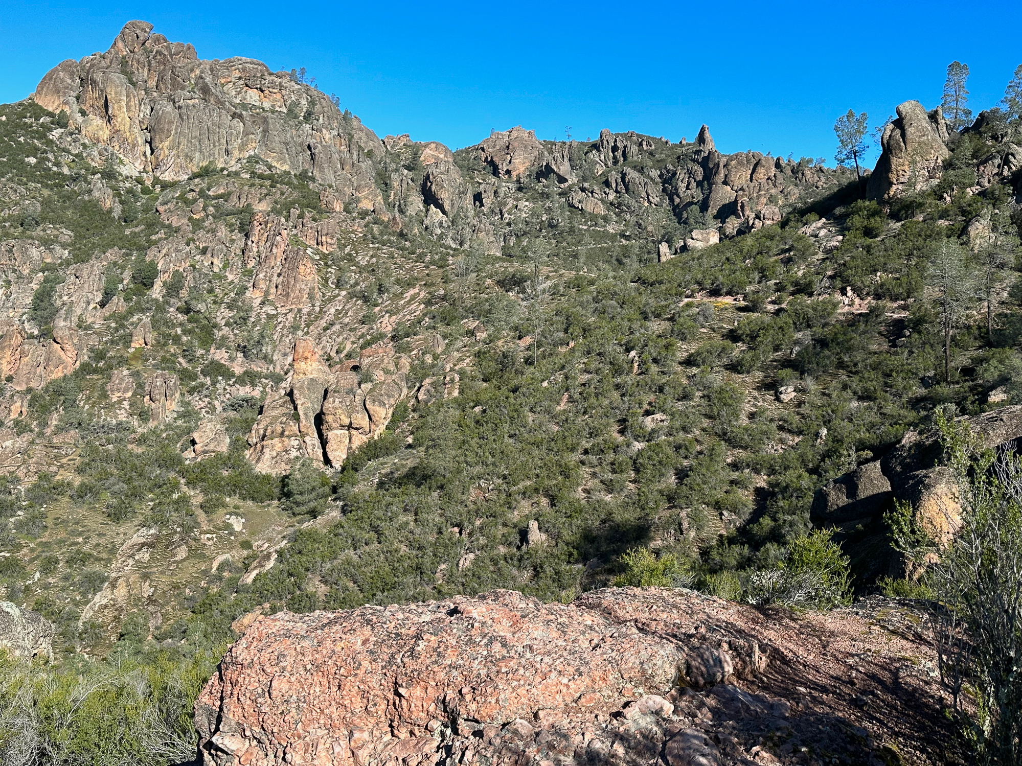
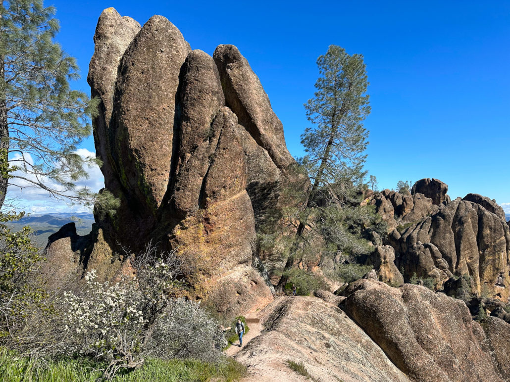
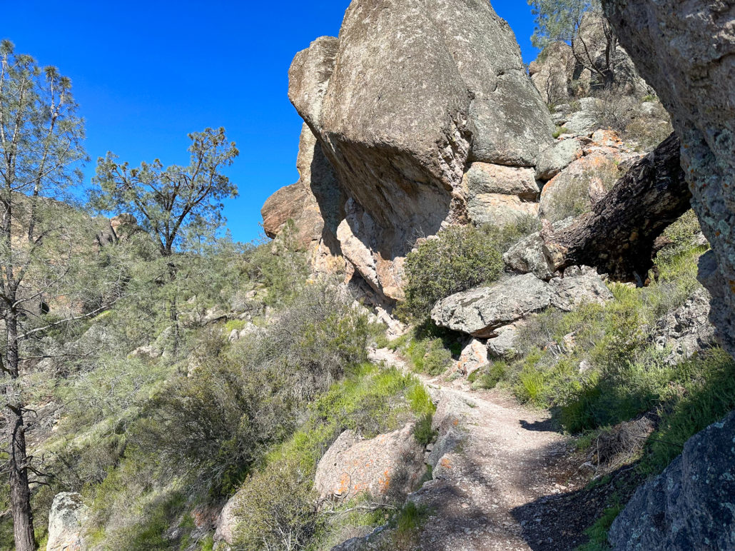
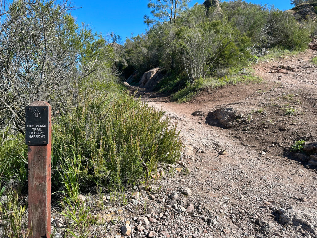
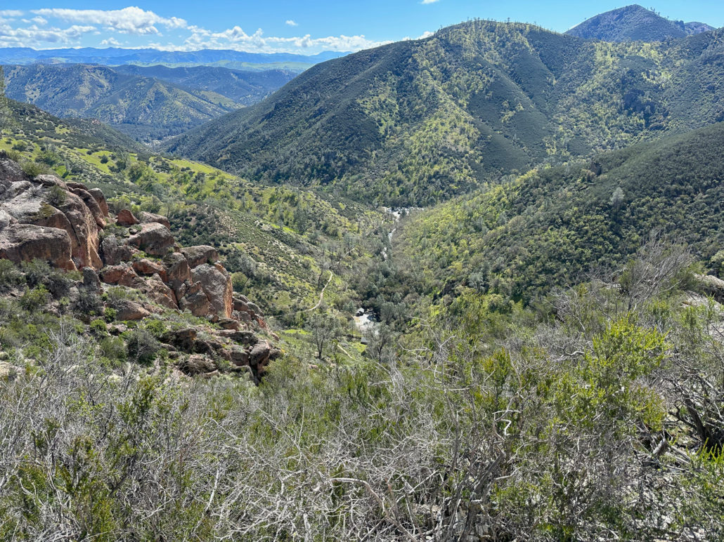
At the 3.0-mile mark, reach the top where there is a restroom and junction with the Juniper Canyon Trail. Bear right, heading north onto the High Peaks Steep and Narrow section. The trail waves on the backside of the pinnacles, with vistas over the west side of the park.
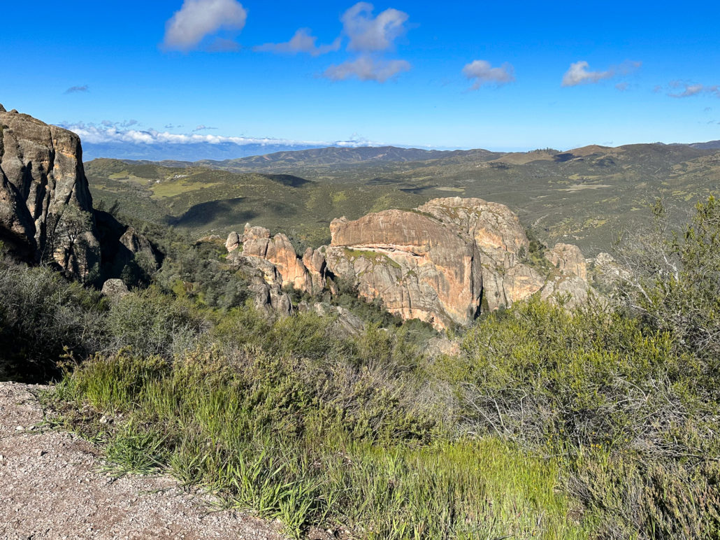
Looking around at the mountains and valleys surrounding Pinnacles National Park you can see there’s nothing else like it. Roughly twenty-three million years ago, Pinnacles was part of a large volcanic field in Southern California, near Lancaster. At the time, it straddled the Pacific Plate to the west and North American Plate to the east. When the Pacific Plate began grinding northwest along the San Andreas Fault, it broke off a large chunk of the volcanic field. Over time, it slowly ground 195 miles northwest to this spot, and through tectonic activity and erosion, became the distinctive park of pinnacles and talus caves we see today.
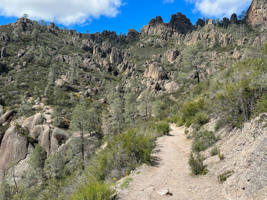
The reddish-orange rocks in the High Peaks are made up of volcanic material, like ash, rocks, and lava, that erupted, fused, and eroded over time. Amazingly, you are weaving through these preserved volcanic remains from twenty-three million years ago.
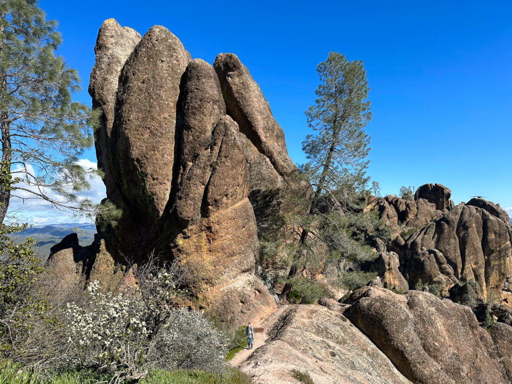
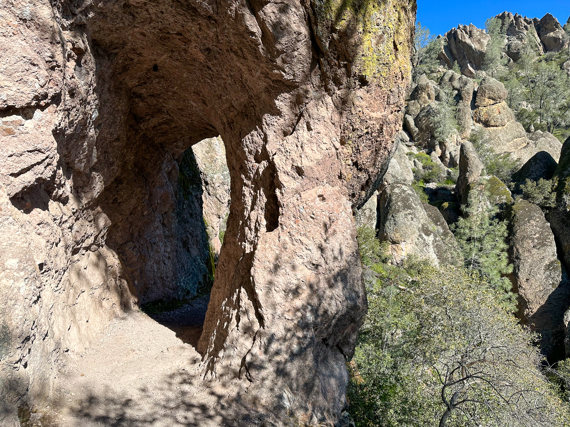
At 3.2 miles, a narrow stairway cuts into the rock, the beginning of what feels like an adventure course that weaves up narrow stairways around the tall pinnacles. Rock ledges overlook Bear Gulch, where you can have a snack or rest. Here you may also spot endangered California Condors, the largest birds in North America with 9.5-foot wingspans, yellowish-pink bald heads, and white triangles under their wings.

Condor Gulch Trail
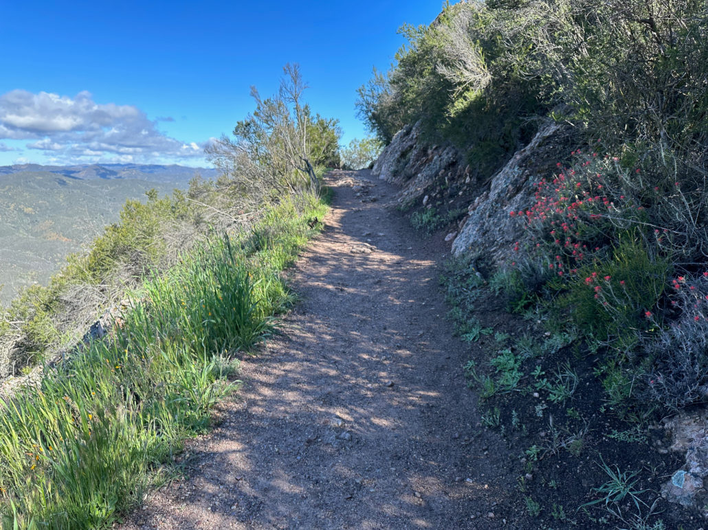
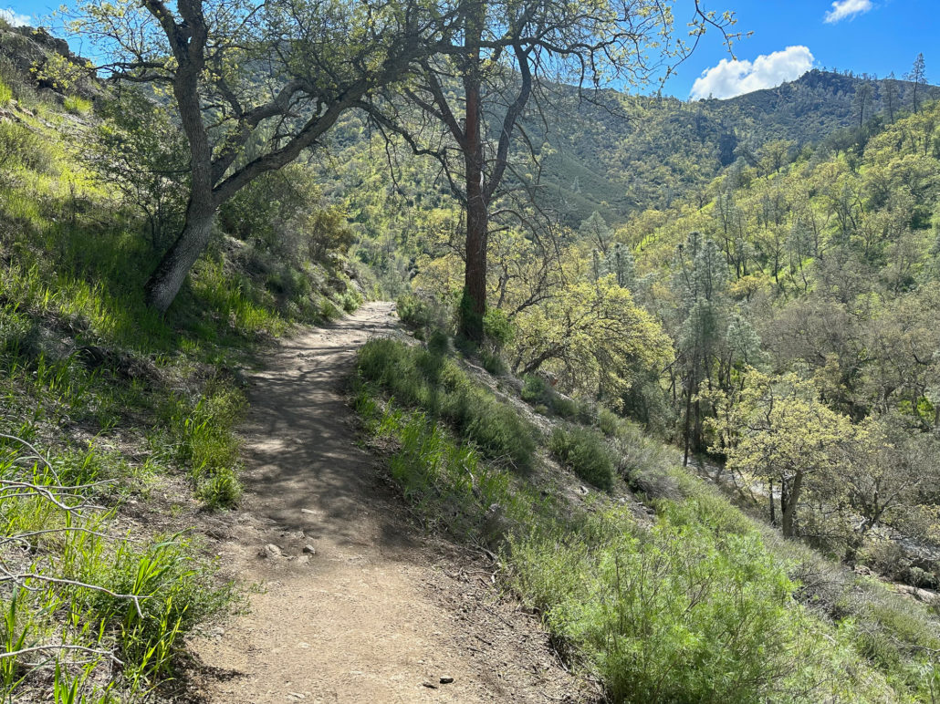
At 4.4 miles, turn right onto the Condor Gulch Trail, heading south towards the Bear Gulch parking lot. The trail is exposed and sunny, with spring wildflowers on grassy slopes below. It almost feels like hiking on a ridgeline with deep gulch vistas left and right.
The trail loops around to a beautiful vista of the High Peaks. If you look closely, you can see hikers following the route you just traversed. Black sage lines the trail with tiny bundles of white flowers and minty leaves.
The trailside becomes greener and grassier descending towards Bear Gulch. Larkspur, paintbrush, seep monkeyflower, and chia pop along the way in spring. Finish your loop back at the Bear Gulch Day Use area.


Tags: California National Parks, Camping, caves, condors, earthquake, erosion, geology, National Parks, pinnacles national park, plate tectonics, san andreas fault, water feature, wildlife