If you’ve been hiking in California for a little while, you’re eventually going to hear about Mount Whitney. It’s the tallest peak in the Lower 48 and not too far away from L.A. Additionally, if you go during the summer months, you can summit this peak without any additional tech like ice-axes or other climbing gear. I won’t mince words: it’s a very, very tough hike – one of the most difficult I’ve ever done. But with the right training and preparation it’s doable for just about everyone … and on top of that, it’s a gorgeous, life-changing experience, too!
If you’ve decided that you want to tackle this beast, there are a lot of things you need to get ready for – like a complicated permit lottery, black bears, marmots, and WAG bags (not as bad as you think they are, really). But in terms of physical conditioning, you’re mostly going to have to worry about two things: endurance and altitude.
The best things you can do to train for Whitney are to hike steep trails (preferably with your backpacking weight on) and to spend as much time above 8000 feet as possible. And lucky for you, there are a number of excellent local hikes you can do to help get yourself ready for Whitney. Unfortunately, acclimatizing doesn’t “store up” in your body – you can’t hike two 10k peaks on a weekend then expect to drive to Whitney the next week and be ready to go – but here are some great trails you can do to a). get yourself in shape for the Whitney Trail and b). find out if you’re susceptible to AMS.
Mount San Jacinto via Mountain Station is the easiest trail on this list and the simplest way to test out your altitude readiness. Since the Palm Springs Aerial Tramway takes you from 2600 feet to 8500 feet in a matter of minutes, you’ll feel firsthand what it’s like to get to altitude without acclimatizing. You may be a bit out of breath or notice that you’re not moving as quickly as you’re used to while you make the moderate ascent to the peak at 10,834 feet. Pay attention to what’s going on with your body, so you can learn the difference between regular ol’ exhaustion and the early signs of Altitude Sickness. Try doing this hike with your full pack on or better yet – camp overnight to see what it’s like sleeping at high altitude, too.
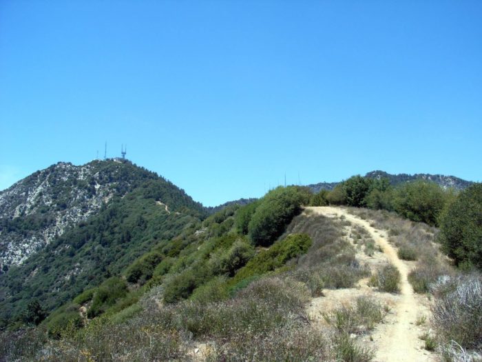
Mount Wilson has many, many ways to reach its summit – but this route over firebreaks and down the Winter Creek Trails is grueling enough that my hiking buddies have lovingly re-named it The Mount Wilson Death March. While this trek starts out on some well-graded dirt road, your legs will definitely feel it once you hit the firebreaks. You’ll ascend and descend no-nonsense, bee-line paths over several bumps on your way up to the summit. The descent to the trailhead isn’t much easier – the Winter Creek Trails are fairly steep and will put a lot of pressure on your knees on the way down. You won’t get altitude experience here, but this is a great, close hike to punish your legs and get them ready for the inclines on the Whitney Trail.
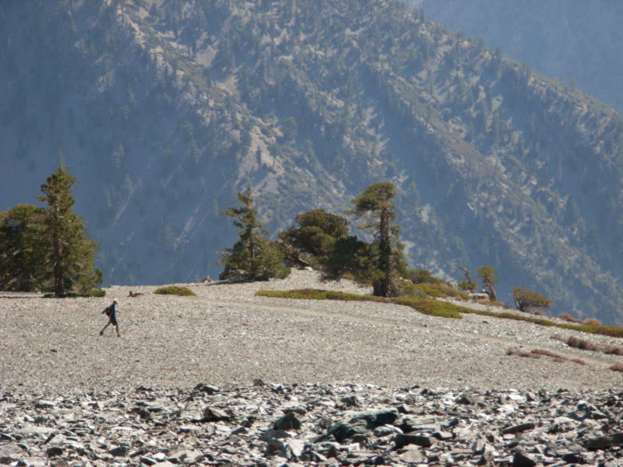
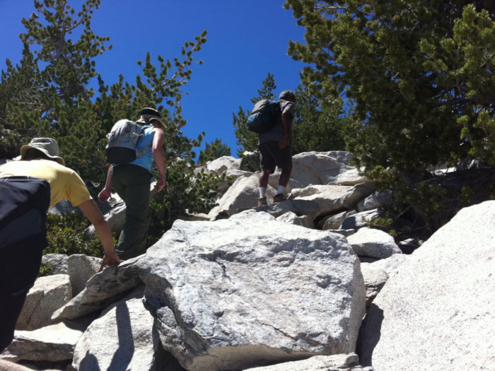
You can’t talk about good training hikes without talking about Mount Baldy (Mount San Antonio). The highest peak in Los Angeles County tops out at 10,068 feet and is a leg-busting climb no matter which way you tackle it. This route will challenge you with steep ascents, scree slopes, a probably-windy summit and a narrow section of track called the Devil’s Backbone, but it will also reward you with outstanding views and a tremendous sense of accomplishment. If you can get up the Ski Hut Trail with a heavy pack on, your legs are going to be in great shape for Whitney.
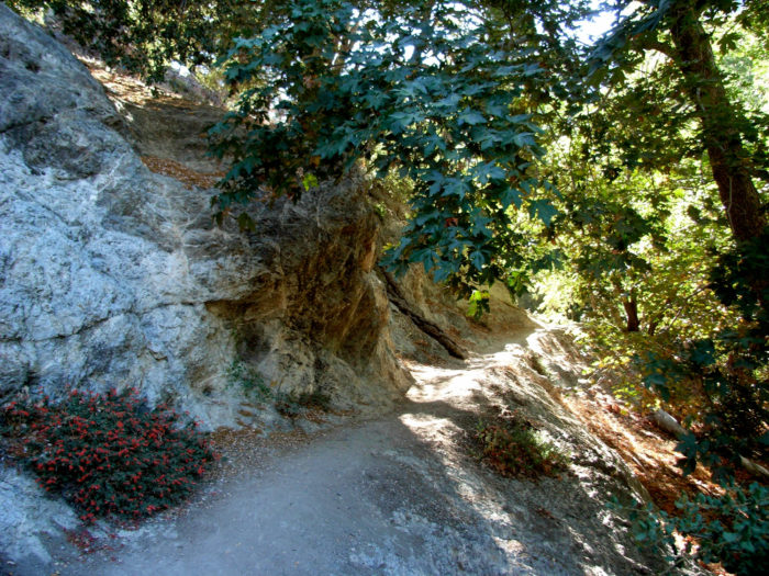
The peaks near the Icehouse Canyon area make for great day trips or overnight test-runs. The trek up Icehouse Canyon itself isn’t that tough (except for a seemingly relentless stretch up to Icehouse Saddle), but done with a heavy pack this route is more good practice for the Whitney Trail. Pitch a tent at the wilderness campsite at Kelly Camp to see what it’s like cooking food without a campfire and how you fare sleeping above 8000 feet. Tag Ontario and Bighorn Peaks in the morning and trek back down to the trailhead, or tack on the additional slog up to Cucamonga Peak for an extra challenge.
If you’re planning on hiking the tallest mountain in the lower 48, you should probably spend some time with the tallest mountain in Southern California first. Backpacking San Gorgonio Mountain will give you a good idea of the logistics and motivation needed to pack in your campsite on a long trail at high altitude. Camp at Dry Lake and make an early morning summit at 11,502 feet before packing up and heading back to the trailhead – which is exactly the way you’ll tackle Whitney if you’re spending more than a day there. The section of trail between Dry Lake and the summit is a perfect place for you to feel exactly what high-altitude exhaustion is like (hopefully without the headache indicating AMS). It’s important to be able to tell the difference between just being winded and having symptoms of AMS. I was incredibly winded on the final summit push here, but it felt exactly the same on the last push to Whitney after Trail Crest.
In terms of altitude, you’re going to have to know the signs of acute mountain sickness, or altitude sickness. Altitude sickness is caused by a combination of reduced air pressure and lower oxygen levels at high altitudes, and can be exacerbated by physical exertion (which you’ll most definitely be doing on the trail) and if you’ve spent a lot of time near sea level (which, if you live in Los Angeles, I’ll guess you do).
While you can get a prescription for Diamox, it may or may not prevent AMS on your hike. You can summit a dozen high peaks and never get it, or you can get it once, or every time. Every body is different and fitness isn’t necessarily an indicator of whether or not you’re going to get it.
The symptoms of AMS are often confused for other, more minor problems. If you’re getting it, you’ll probably notice a headache at first. If you develop ANY of the following, congratulations – you have AMS:
– Vomiting, nausea, or diarrhea
– Dizziness or lightheadedness
– Fatigue or unusual weakness (beyond what you’d expect from a grueling hike)
– Difficulty sleeping
The good news is, with most cases of AMS, you’ll improve with time. Time allows your body to acclimatize to the new altitude, and can be helped along with some rest and hydration. If the symptoms do not improve or worsen, a full-proof cure is DESCENDING. Do not be ashamed to descend if you have AMS and DO NOT get “summit fever” and attempt to try to make it up anyway – untreated AMS can progress to pulmonary or cerebral edema, both of which are potentially deadly conditions. There’s more good info on AMS here.
When my group hiked Mount Whitney, we went up to Lone Pine a few days early to help us acclimate – spending one night at Whitney Portal Campground (around 8000 ft) and the next night at nearby Horseshoe Meadows (around 10,000) feet to help us get ready for sleeping at Trail Camp (around 12,000 feet) for the summit trip. I know for me, personally, it helped a lot. I was pretty exhausted trying to sleep at 8 and 10k, but at Trail Camp I got one of the most restful nights’ sleep I’ve ever had and woke up fully energized for the pre-dawn summit push.
If you have any other questions about hiking Mount Whitney or other local trails you like to use to train for big peaks, leave ’em in the comments. And if you’re headed up to Lone Pine this summer – best of luck! Be sure to let us know how it goes!
Tags: acute mountain sickness, best hikes, elevation sickness, Hiking, Los Angeles, mount whitney, recommended hikes, training hikes