Merced Lake is a glittering, sapphire jewel tucked deep into the backcountry of Yosemite National Park. Its shoreline is rich with Sierra history, as the lake is home to the very first (and most remote) High Sierra Camp. First established as a recreational facility in 1916, the camp was originally converted from a US Cavalry Patrol outpost that dated back to 1905. In the 1920s, this spot served as a boys camp during summer months until Yosemite Park and Curry Company took over operating the camp in 1926.
The High Sierra Camps were designed to give hikers and horseback riders access to the best that the Sierra have to offer without having to carry a tent, dinner, cookware, or bedding. Think of it as a backcountry “glamping” experience. Six of the tent cabin sites are arranged in a 51-mile loop that circles the Yosemite high country, and they open from June or July until September on years with normal to low snowpack.
As Merced Lake is the lowest elevation of the camps, it is an ideal trip for early-season backpackers looking to avoid snow and summer weekend warriors who want to relax in the shaded, tree-strewn backpacker camp (adjacent to the High Sierra tent cabins) and take a dip in the lake’s chilly waters to cool down.
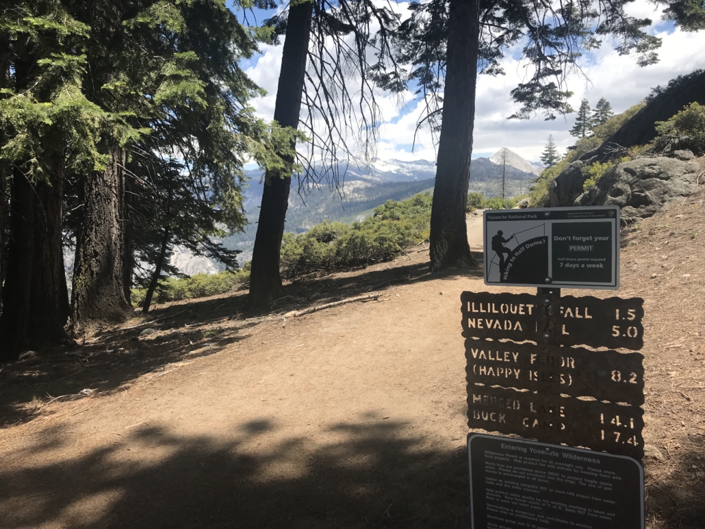
Due to the high mileage required to reach the lake, many overnight backpackers opt to break up the trek by camping a first night in Little Yosemite Valley or hiking in from Tioga Road and stopping first at Sunrise or Vogelsang High Sierra Camps. Make sure you have the corresponding wilderness permit if hiking in from the Yosemite Valley or Tioga Road!
Starting this trek at Glacier Point creates a burly, 16-mile (each way) hike, but it also offers travelers the opportunity to see a huge swath of what makes Yosemite so legendary in only a short weekend.
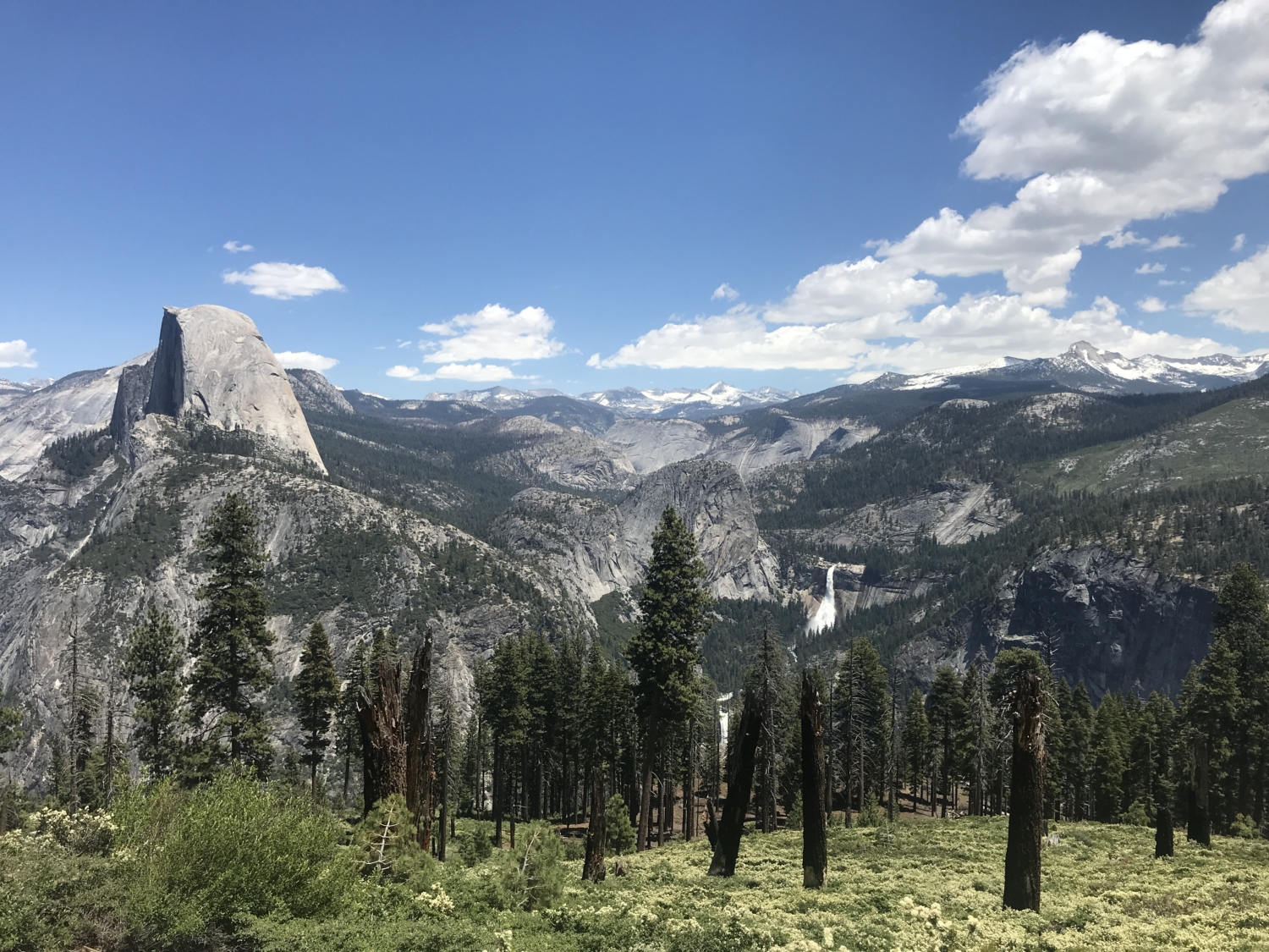
Park your car at Glacier Point, and be sure to put all extra snacks and scented items in the bear boxes nearby. Look for a large sign marking the trailhead for the Panorama Trail just east of the bathrooms and little store. From here, the trail doesn’t waste any time before serving up sweeping, postcard-quality views of some of Yosemite’s most storied landmarks. Half Dome, Nevada Falls, and the towering fin of Mt. Clark all come into view as you descend over 900 feet in 1.7 miles.

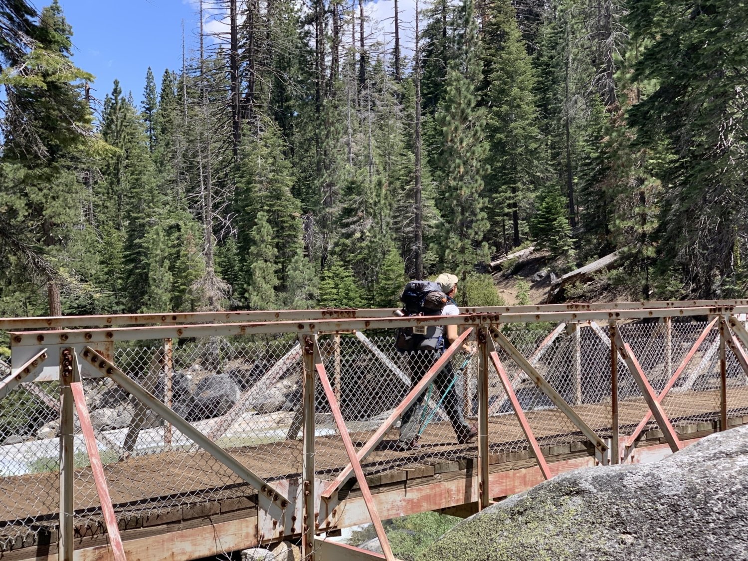
From here, a wooded set of switchbacks takes hikers down to a close-up view of Illilouette Falls, with Half Dome looming in the distance. It’s a great place to stop for a photo or a snack under the dappled shade of Sugar Pines and Ponderosas. Cross the bridge over a roaring Illilouette Creek and get ready for the day’s first big climb.
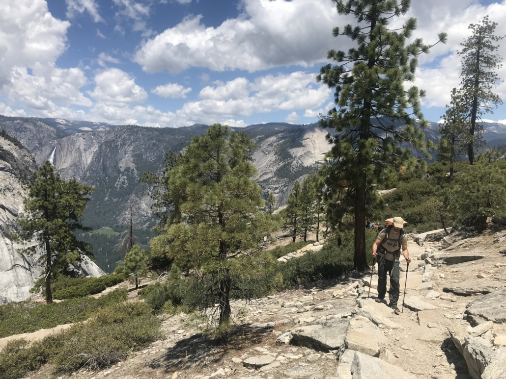
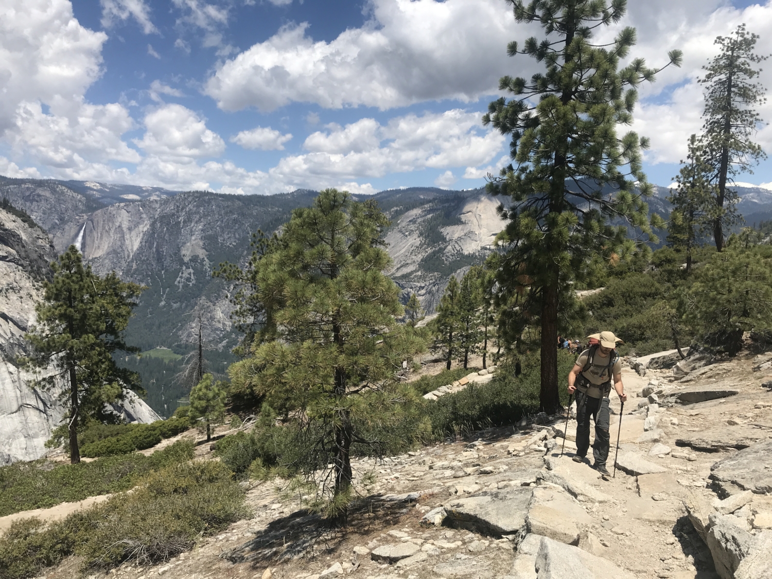
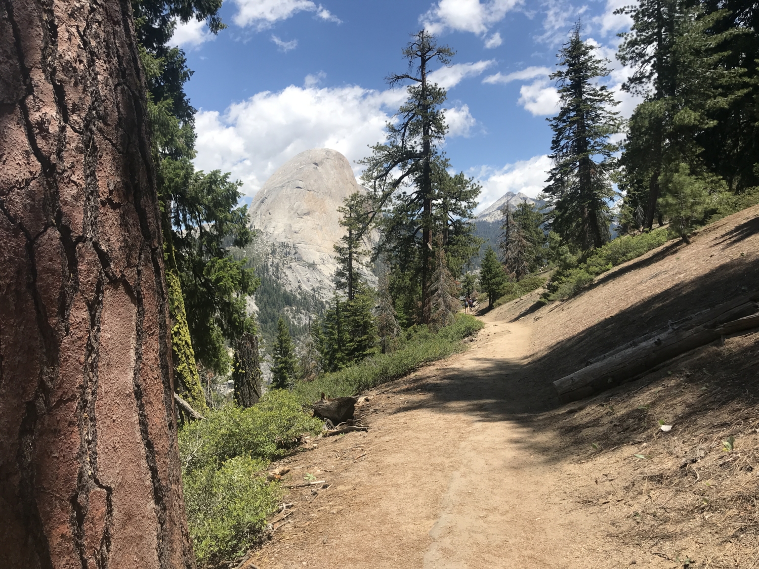
A set of wide, moderately graded switchbacks crawls up from the granite slabs of Illilouette Creek. It’s easy to put your head down here and forget to look around, but clever hikers will be rewarded for their curiosity! Turn around at almost any point on this stretch of trail, and you could be greeted with a panoramic (hence the name of the trail!) view of Yosemite Valley, Yosemite Falls, and the ever-present knob of Half Dome watching over the park like an ancient sage.
At the top of the ascent, the trail flattens out for about .75 miles before hitting a junction with the trail coming in from Mono Meadow. You’ll turn left here and quickly plunge downhill into another set of switchbacks carved into a dense pine forest. Fragrant blossoms of Western Azalea serenade the noses of sweaty hikers as they near one of the trail’s real highlights – Nevada Falls.
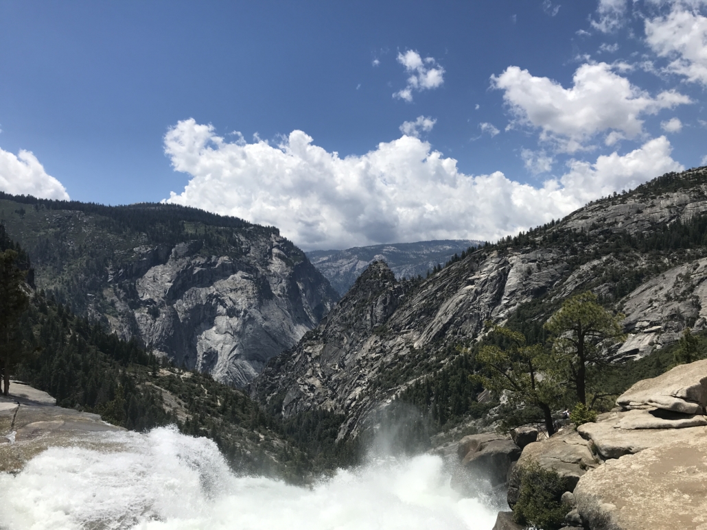
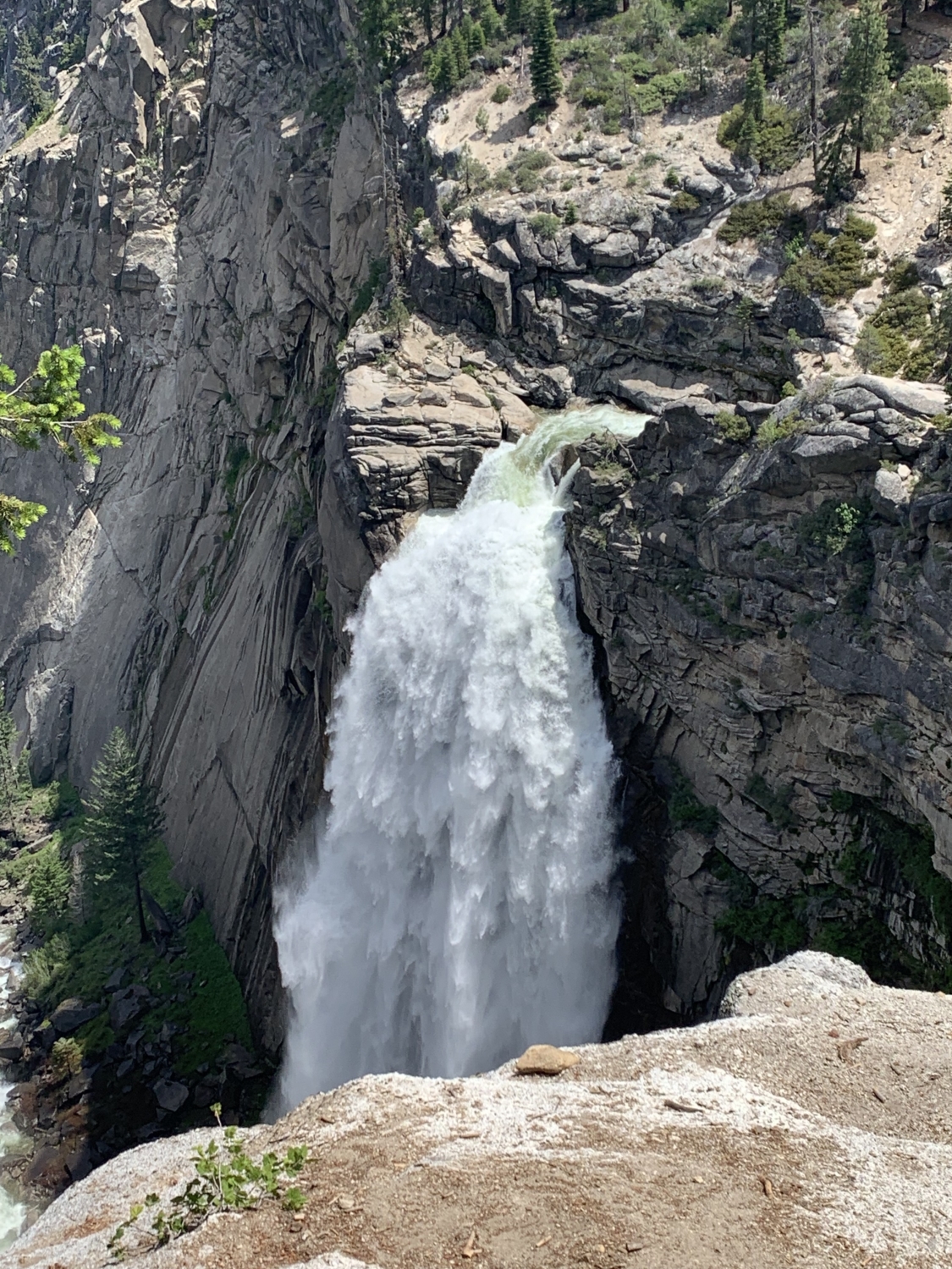
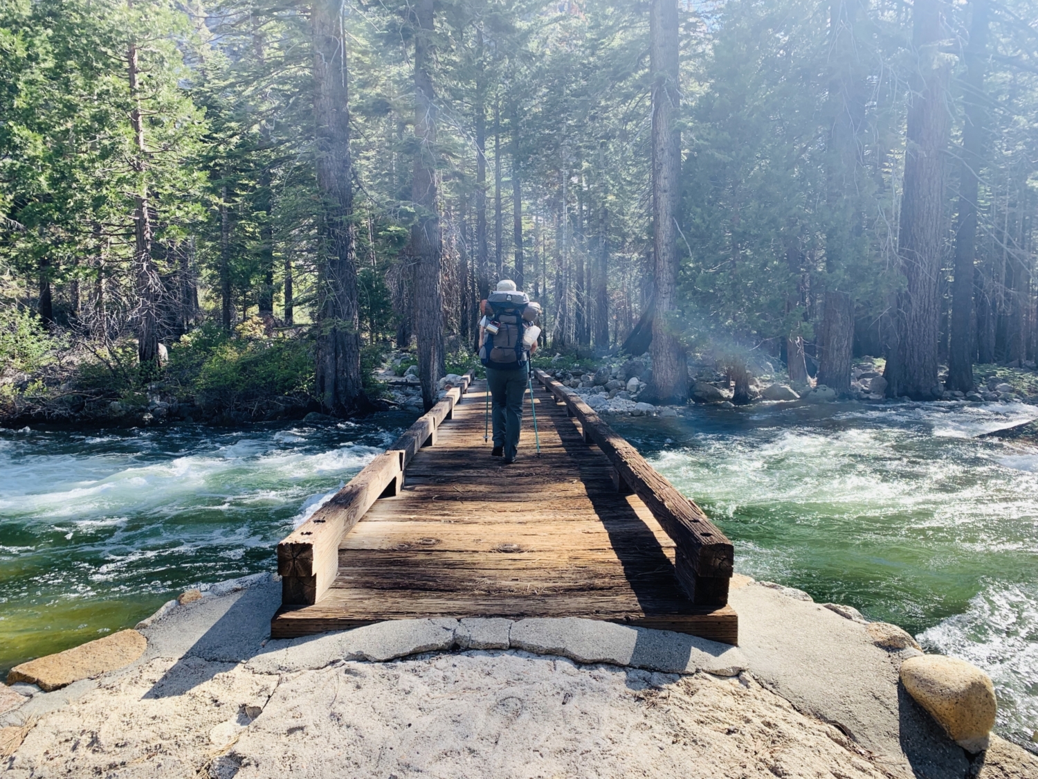
About 5.5 miles into the adventure, the rounded edge of Liberty Cap seems to suddenly appear out of the earth, like the knobby knee of some hidden, underground rock giant. Cross the bridge over Nevada Falls for a face-to-face look at the raw power of the Merced River as it dumps millions of gallons of water a day over a 594-foot tall cliff.
My partner and I opted to stop for lunch here and soak our feet in one of the safer, shallow pools just 0.1 mile northeast of the bridge. Be warned – this area can get crowded during busy summer months, as it’s located at the confluence of the Mist Trail, the John Muir Trail, and the Panorama Trail. Stay vigilant for hungry squirrels that may try to scale your backpack and steal your snacks!
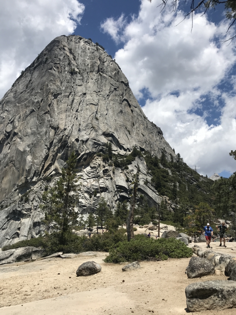
After a quick break and a water refill, continue heading to Merced Lake by trekking northeast along the John Muir Trail, towards Little Yosemite Valley. To your left, on the side of Liberty Cap, you’ll pass a marvelously engineered backcountry bathroom and begin a short but steep uphill jaunt for half a mile.
From here, veer right on the trail towards Bunnell Point, Lost Valley, and Merced Lake. If the high-mileage day is starting to make you feel nervous, I’ve got great news for you – The next 4 miles are almost completely flat.
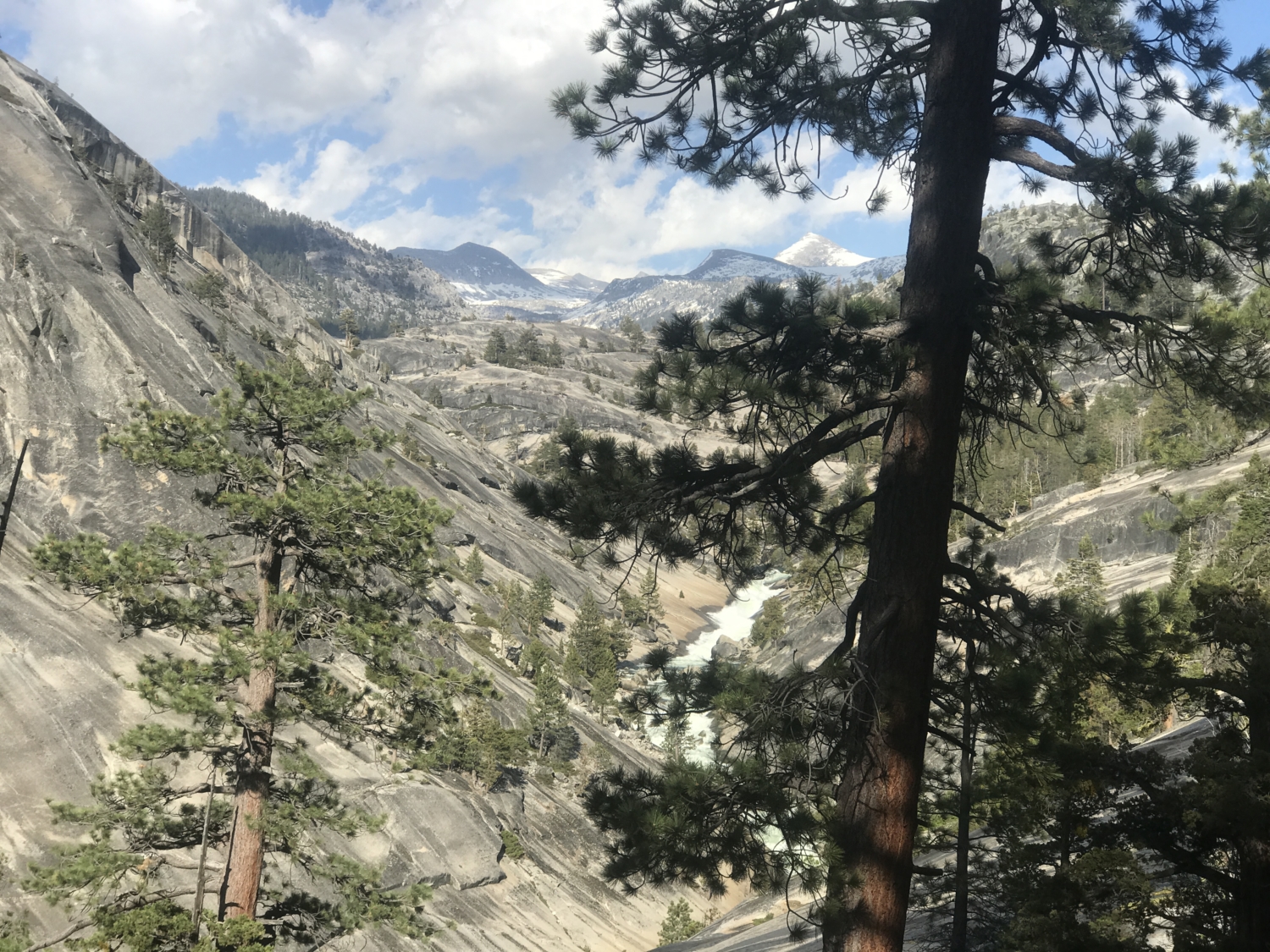
After cruising through Little Yosemite Valley, the crowds seen during the first third of this trek will melt away, and you’ll feel like you’re wandering back in time to the Yosemite of yesteryear. Lost Valley is one of the most underrated areas of Yosemite National Park, offering all the big, granite domes, cascading waterfalls, wildflowers, and granite slabs that Yosemite is famous for with none of the overcrowding you can find in its namesake valley.
The extra miles to get there are well worth it.

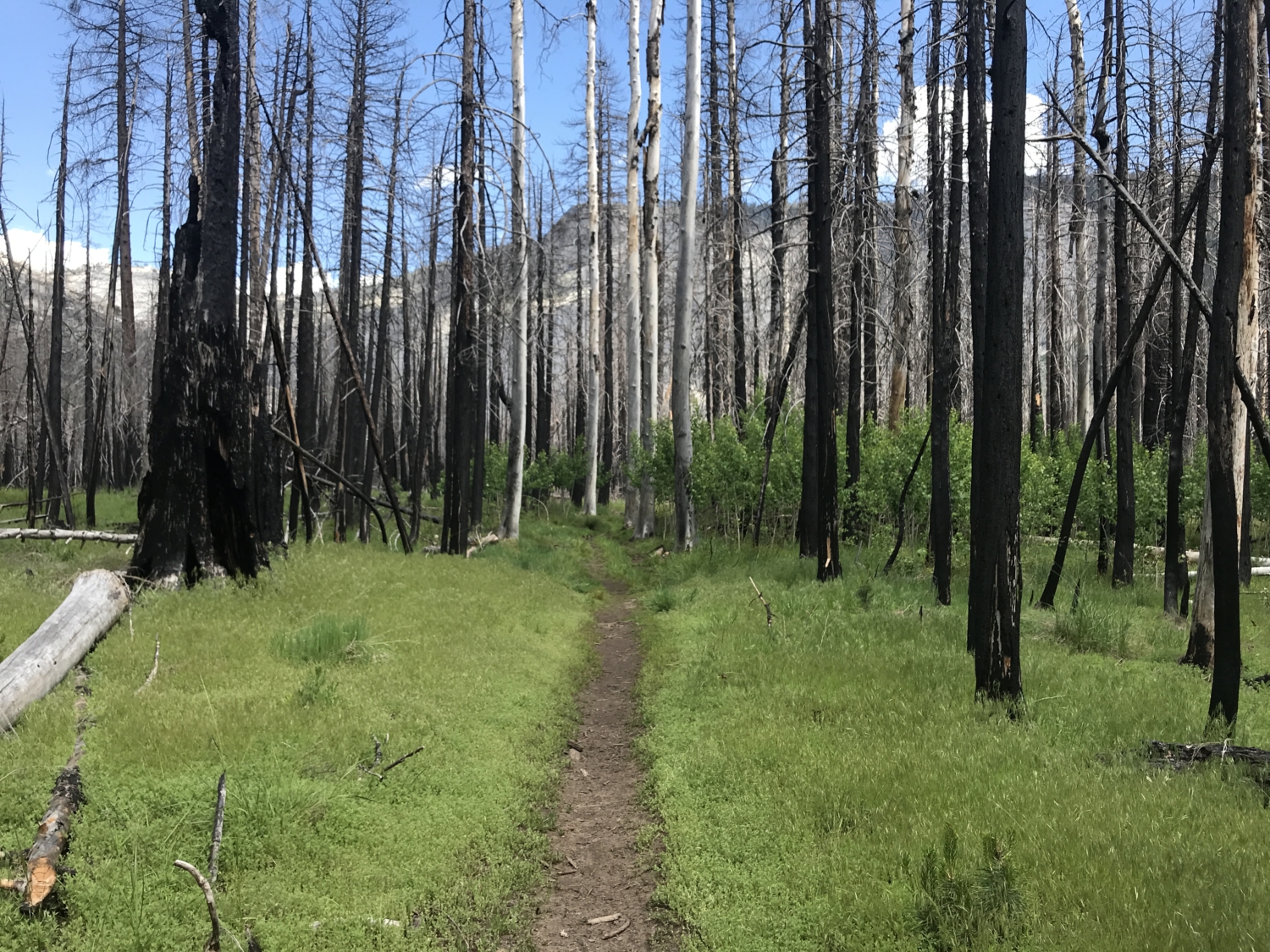
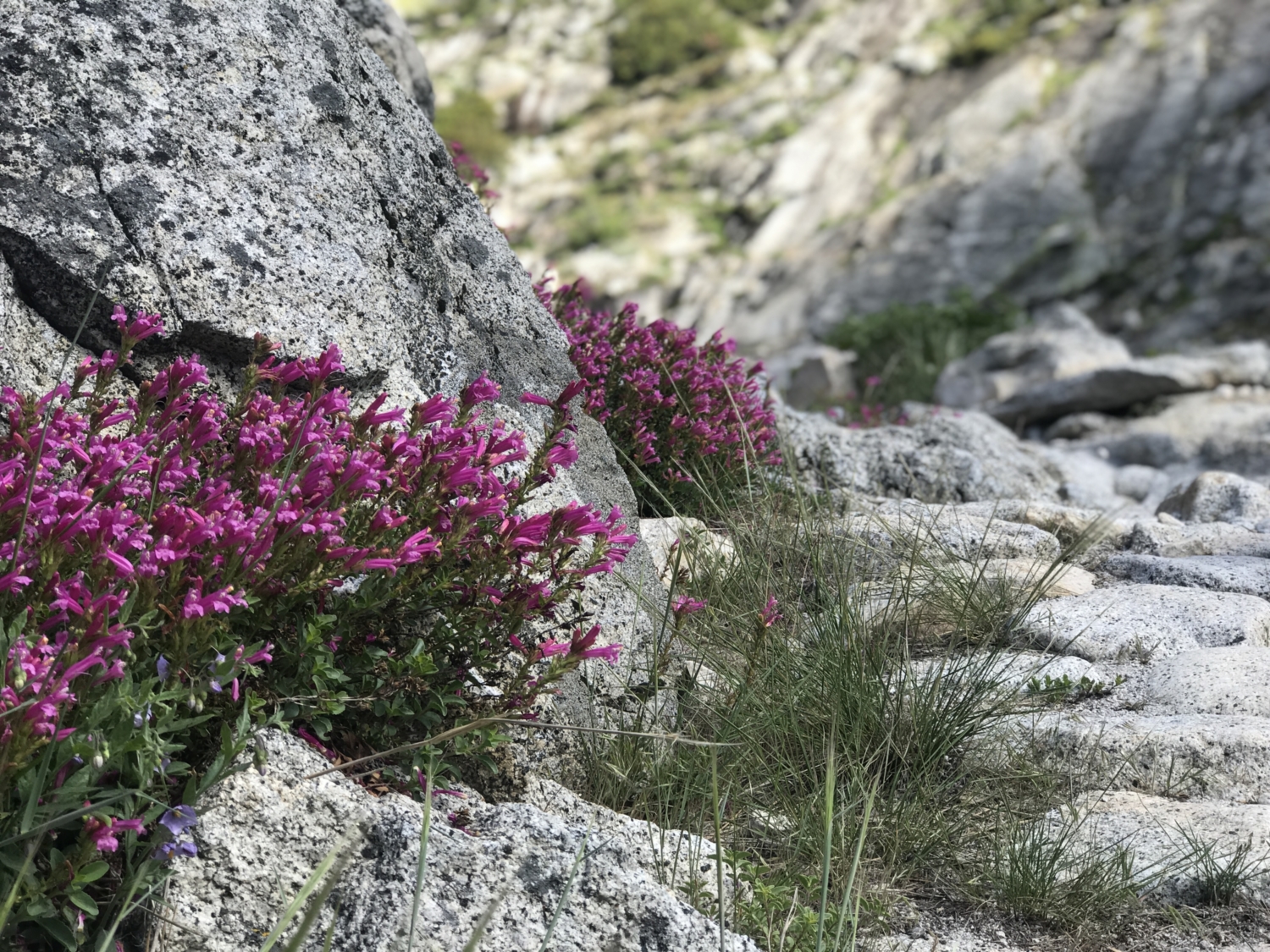
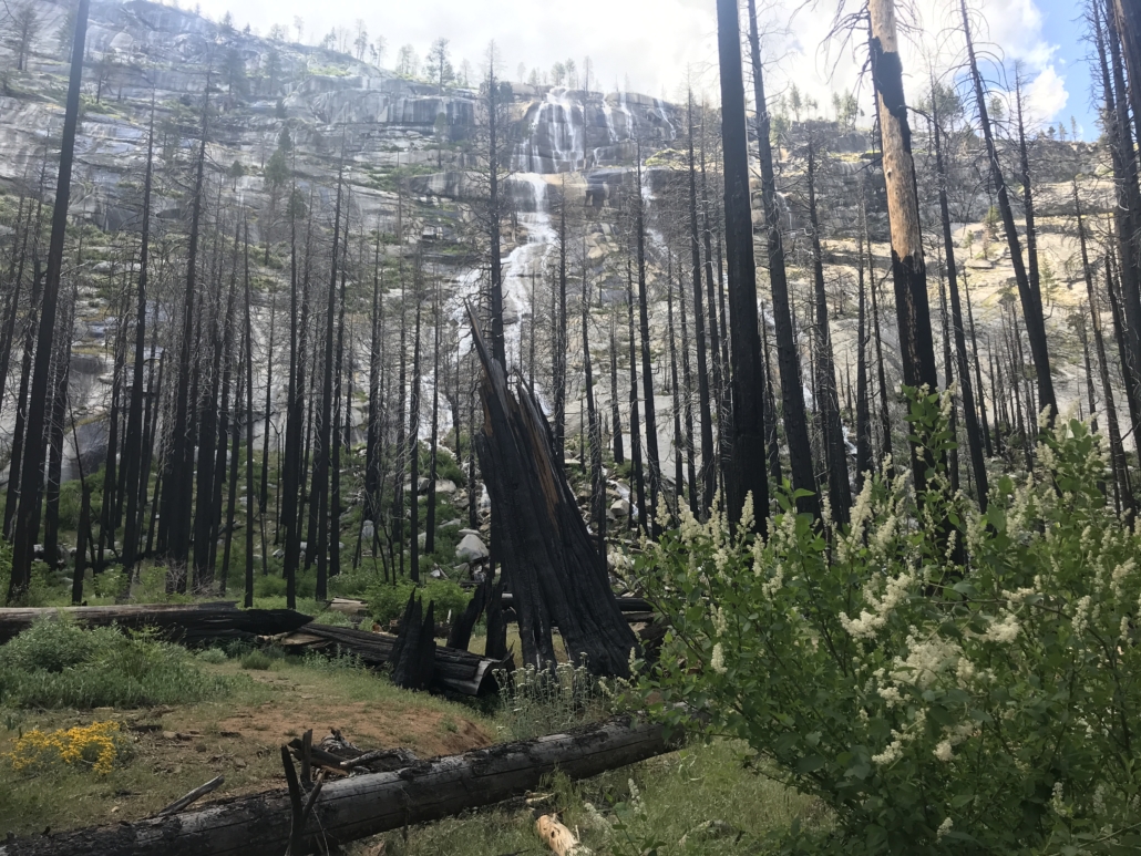
The trail winds along the banks of the Merced River for the next 4 miles, passing through a burn zone from the 2014 Meadow Fire. It’s incredible to see how quickly the ecosystem is already restoring itself – huge fields of ferns, tufts of fuchsia penstemons, and fluffy, pink pussypaws line the trail, basking in the warm rays of sunlight.
Overnight campers who are ready to drop their packs or who want a shorter day out can begin looking for camping spots along the granite slabs near Bunnell Cascades, right around the 4-mile mark – just be sure to camp at least 200 feet from the river.
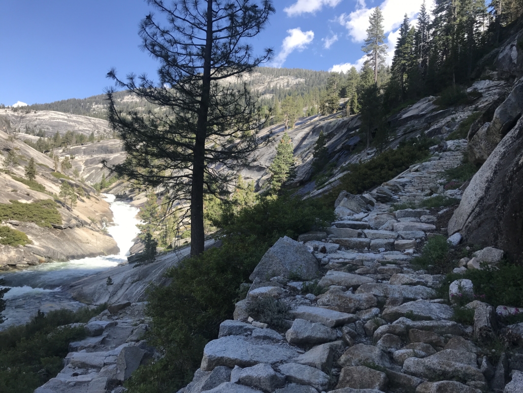
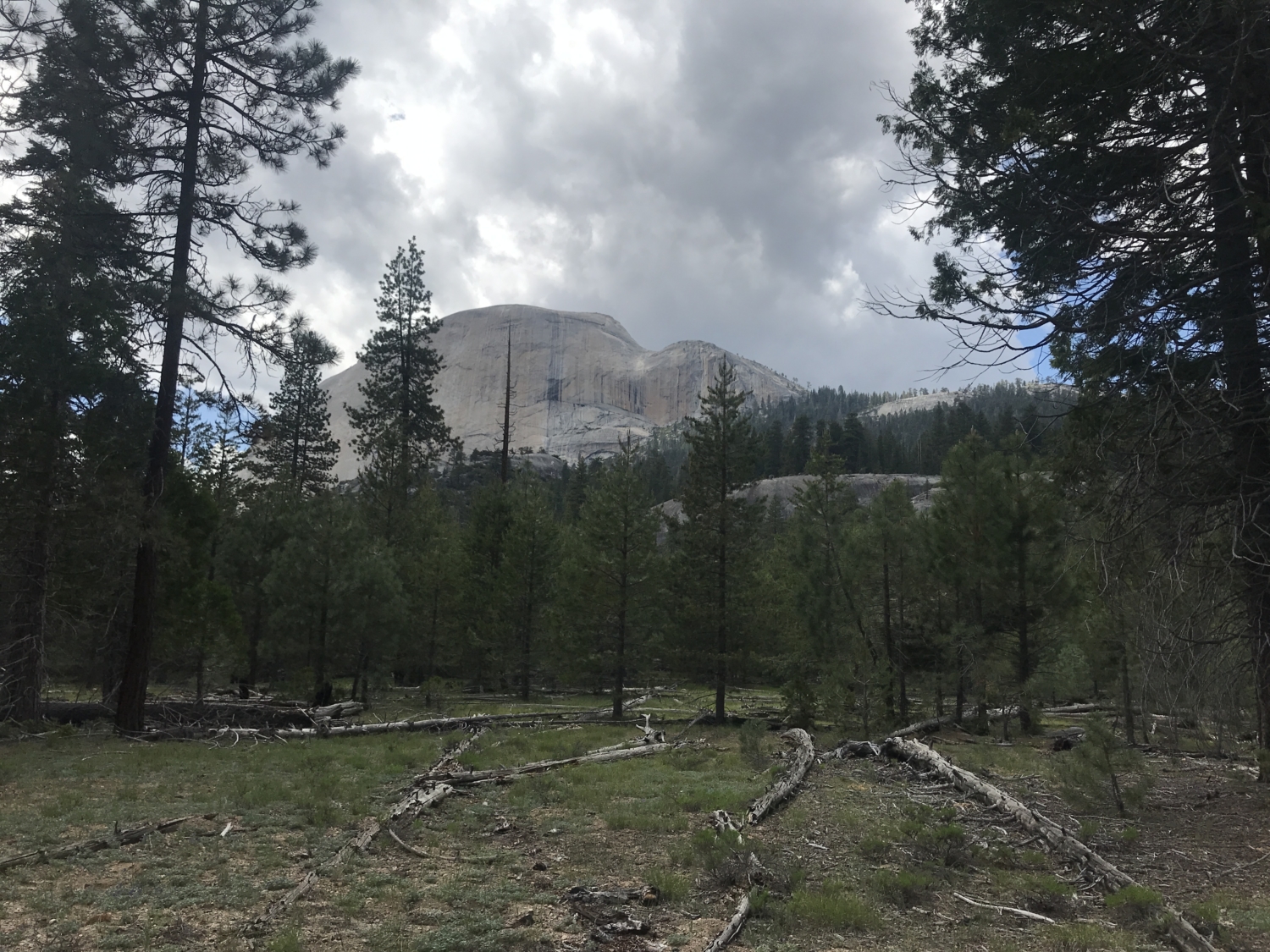
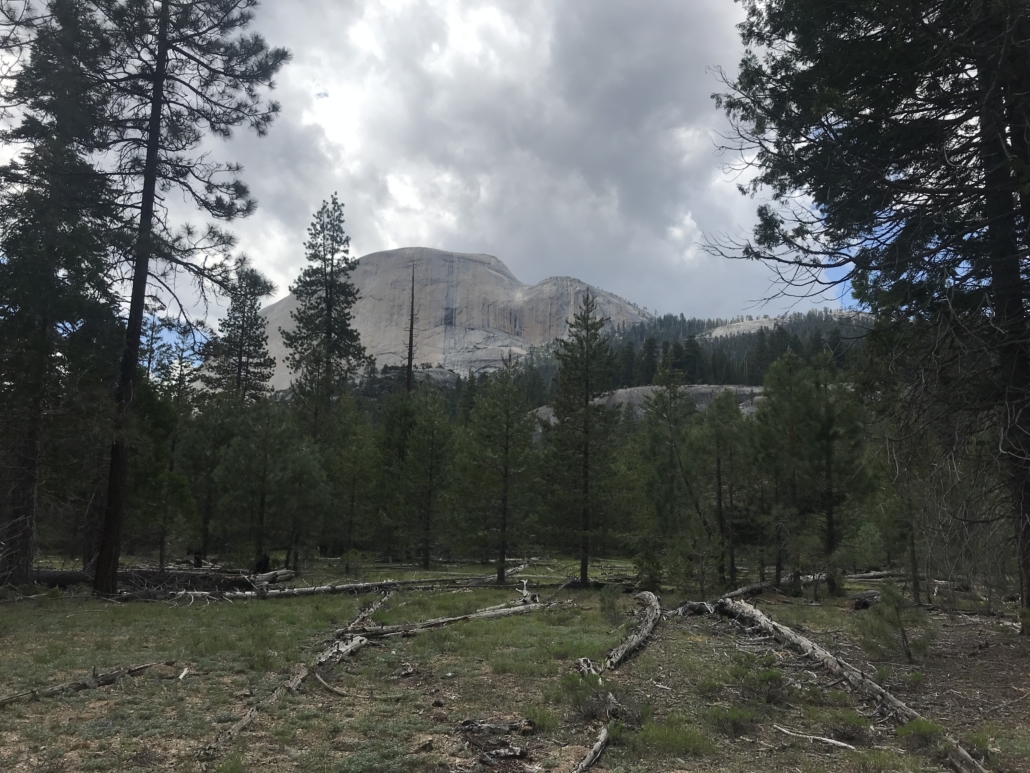
Five miles into the blissful, gently graded trail through Lost Valley, hikers will come to a set of immaculately crafted, stock-grade switchbacks that climb over 600 feet in just three-quarters of a mile. At the top of the ascent, be sure to gaze east through the trees, and you might be able to catch a glimpse of taller, snow-capped peaks like Mt. Florence and Mt. Simmons.

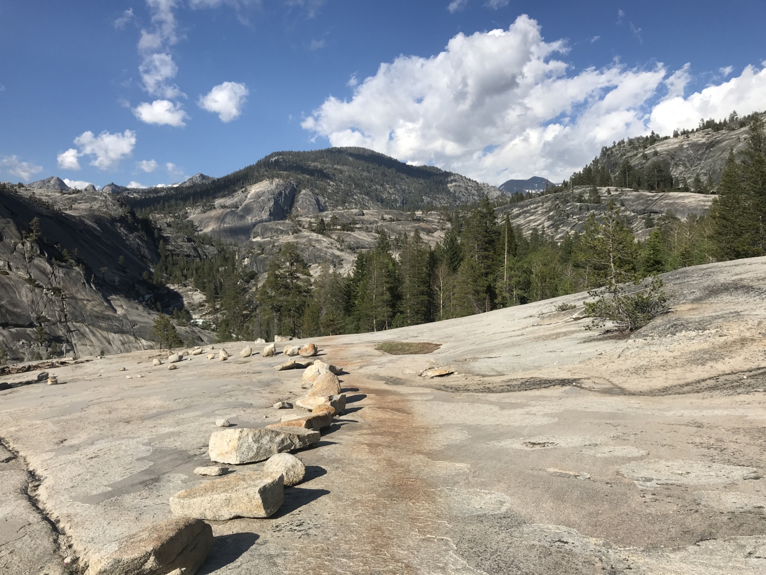
The trail is quick to descend again on a gently graded set of granite slabs with an amazing view of the valley below. Cross another small bridge and continue east on the trail through a flat, wooded area. During late spring and in years with a high snowpack, this area tends to get muddy, marshy, and thick with mosquitoes. Throw on a bug net or some insect spray and get ready for the final push.
You’ll reach a bridge and a junction for a trail that ascends towards Half Dome and Sunrise Lakes. Keep to the right at this crossing and follow a series of short bridges across lively, babbling streams.

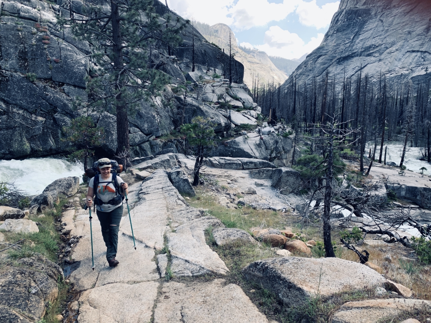
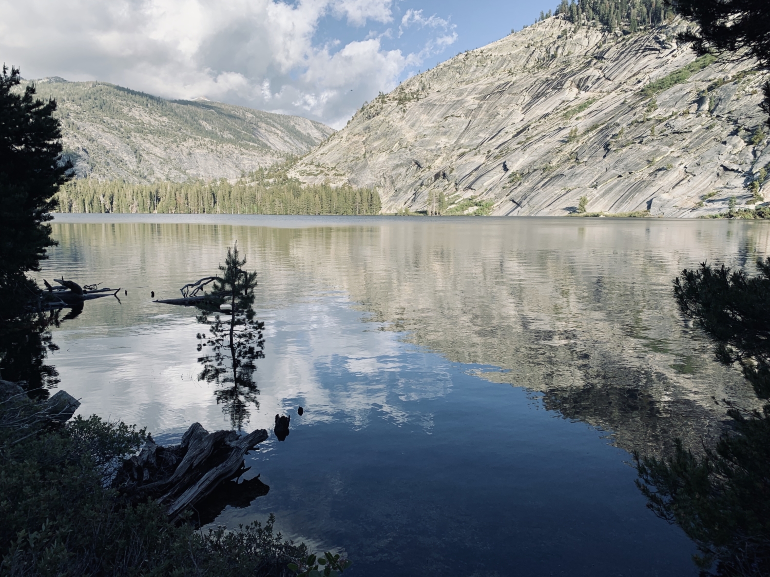
A carefully crafted set of switchbacks amble along yet another series of dense, granite slabs before the trail passes right by a rushing waterfall, hugging the edge of a smaller granite dome before spitting hikers out along the placid shore of Merced Lake.
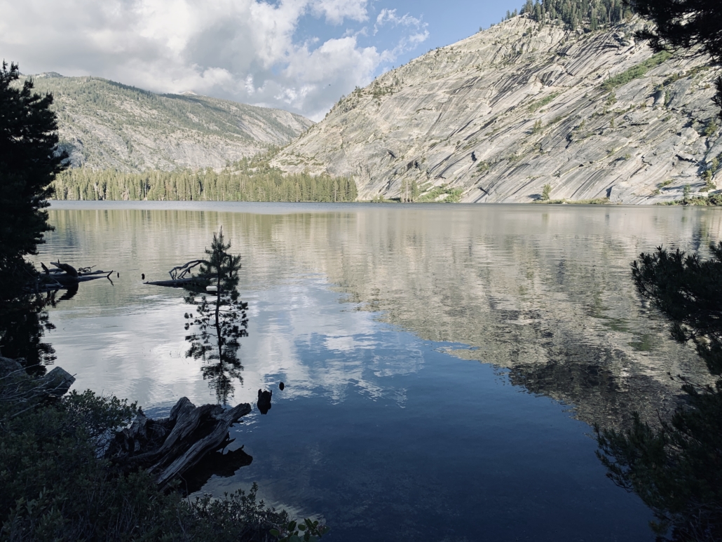
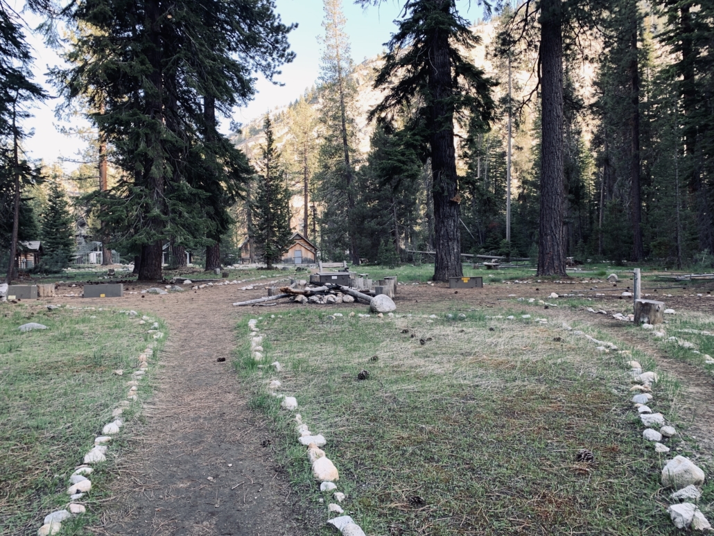
A gentle, 1.5-mile hike along the water’s edge will bring you to the shady, wooded backcountry camp located on the far east side of the lake. Try to nab a campsite with a pre-existing fire ring near the bear boxes and the backcountry toilets and then use the last of the fading sunlight to take a refreshing dip in the frigid lake before dinnertime.
In the morning, pack up camp and return the way you came or consider extending your trip and continuing on to Sunrise Lakes, Clouds Rest, or Half Dome.
Tags: alpine lake, Backpacking, Illilouette Falls, lakes, lost valley, Merced River, nevada falls, panorama trail, Yosemite, Yosemite National Park