
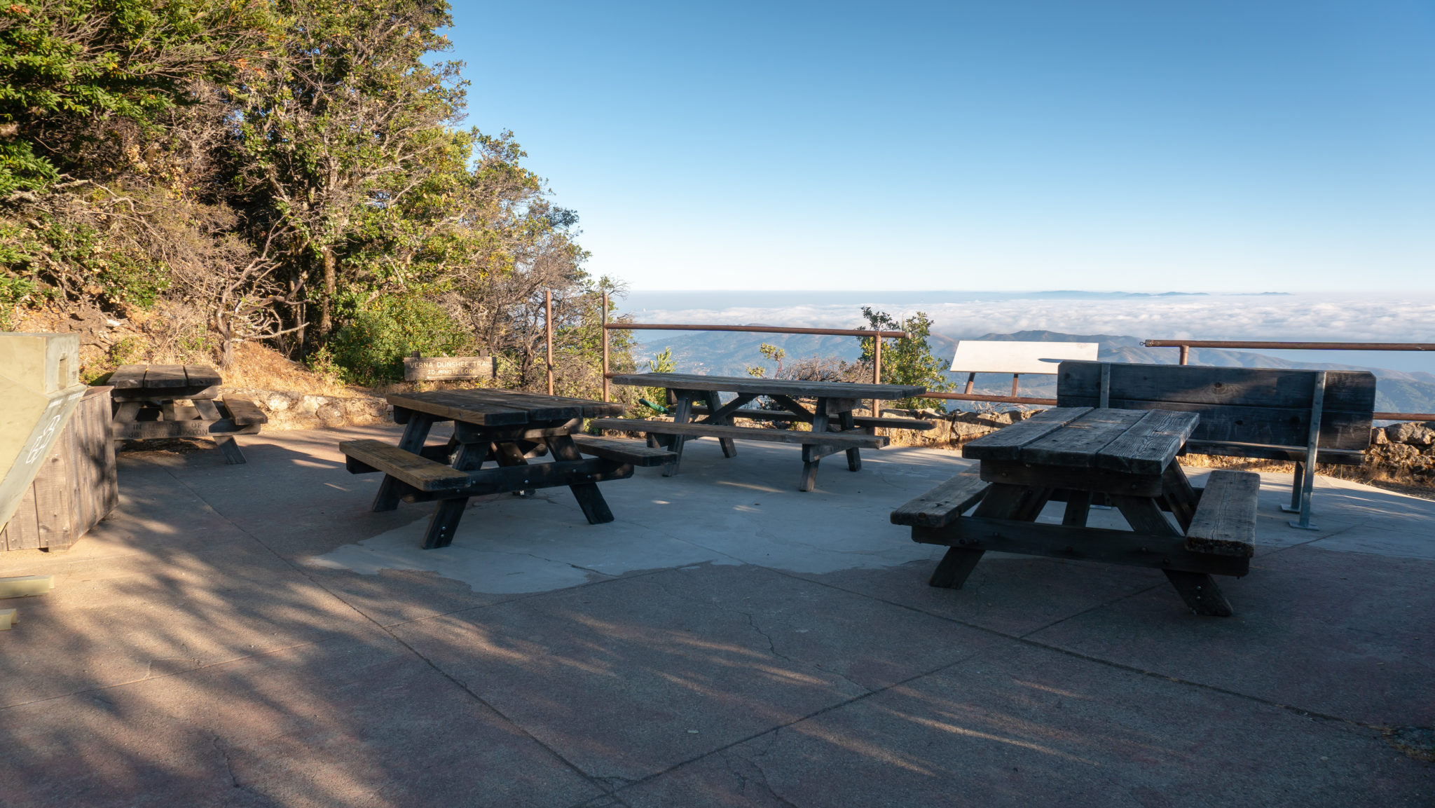
The Verna Dunshee Trail and Gardner Fire Lookout in Mount Tamalpais State Park is a family-friendly circuit around 2,571-foot East Peak with knockout views of the San Francisco Bay. The story of the Mill Valley & Tamalpais Scenic Railway, which ran on Mount Tam from 1896-1929 and whose terminus was East Peak, is as engaging as the views, and you can learn more about it at the Gravity Car Barn, visitor center, and on educational displays. There are several benches along the Verna Dunshee Trail and picnic tables at the welcome area for a rest or a picnic.
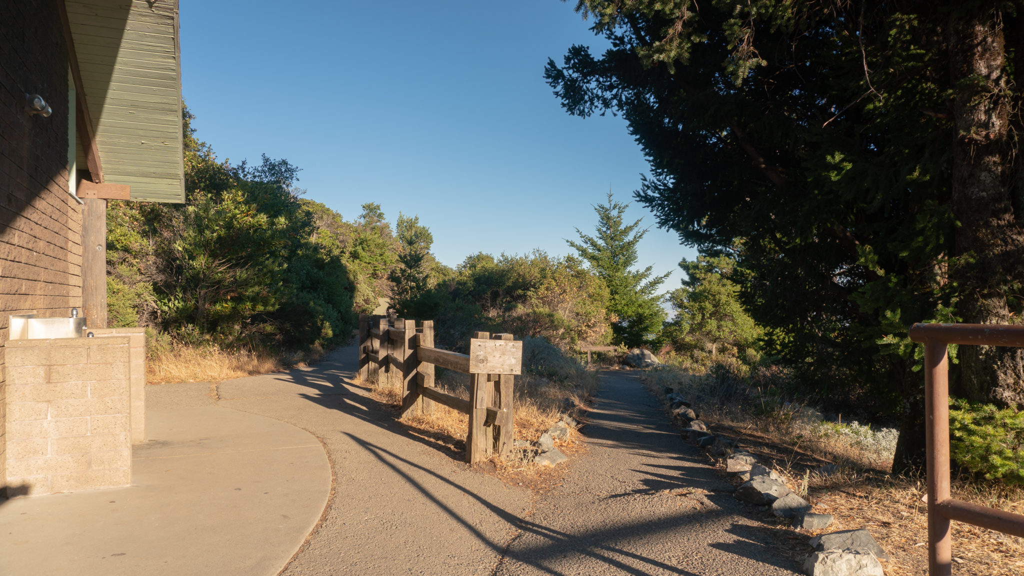
Start your hike from the parking lot, walking downhill to the welcome area at East Peak. From here, trails extend like spokes in a cogwheel: the restrooms are straight ahead with Old Railroad Grade on the far right, the Verna Dunshee Trail to the right of the restrooms, the Plank Walk Trail to the left of the restrooms, and the northern entrance to the Verna Dunshee Trail on your left. On the far left, down one level, is a visitor center run by Friends of Mount Tam, a volunteer non-profit organization that supports Mount Tamalpais State Park.
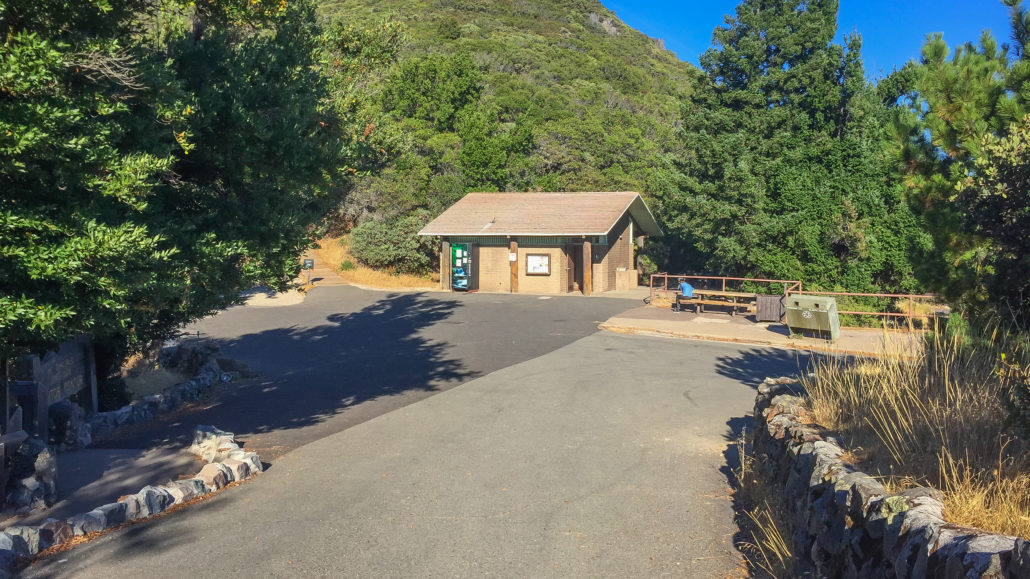
Head towards the restrooms to start your counterclockwise loop on the Verna Dunshee Trail. To your right are the crumbling remains of a tavern built in 1896 where railroad passengers traveling to East Peak on the Mill Valley & Mount Tamalpais Scenic Railway could have lunch and spend the night. There was even a dance hall located where the parking lot is now. The railroad approached East Peak from the paved Old Railroad Grade trail on your right and it was nicknamed the “Crookedest Railroad in the World” because of its 281 curves over 8.2 miles: the equivalent of 42 complete circles.
A steam locomotive pushed open-air cars—interestingly, the first one was a re-purposed San Francisco cable car—filled with passengers up the mountainside. The reason for this kind of backwards arrangement of cars being pushed rather than pulled had to do with safety and views—with the locomotive behind the cars, passengers wouldn’t have to fear being “let go” down the mountain, and their views wouldn’t be obstructed as they went up it. I believe there was also a concern about getting hot steam in people’s eyes, and that was another reason for putting the locomotive in the back, too.
A film by Thomas Edison shows the locomotive and the tavern at this location.
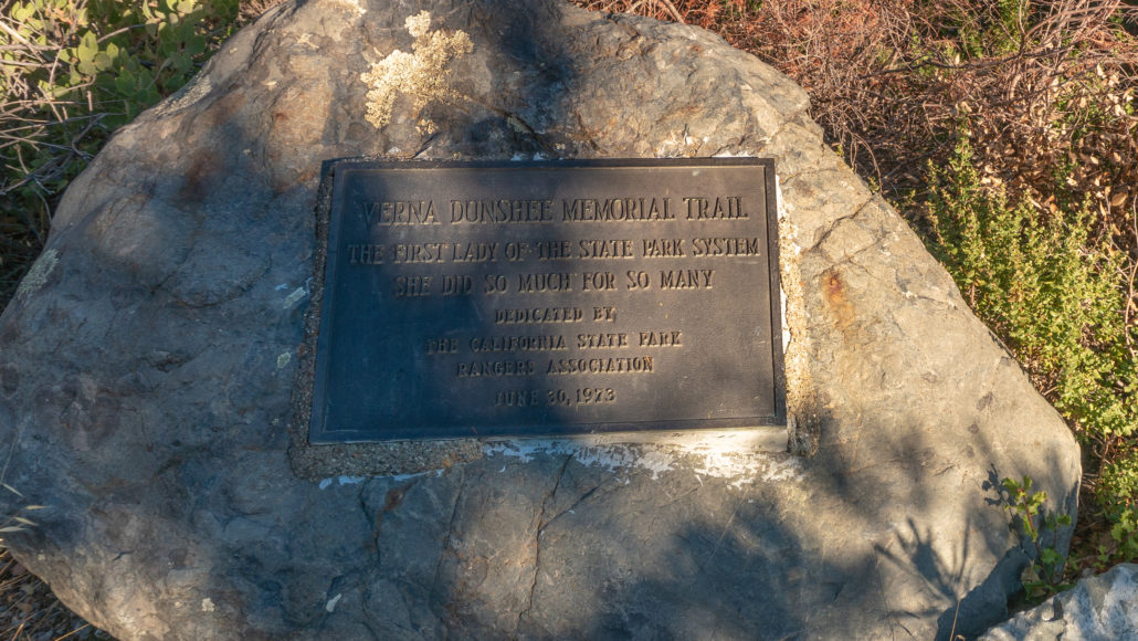
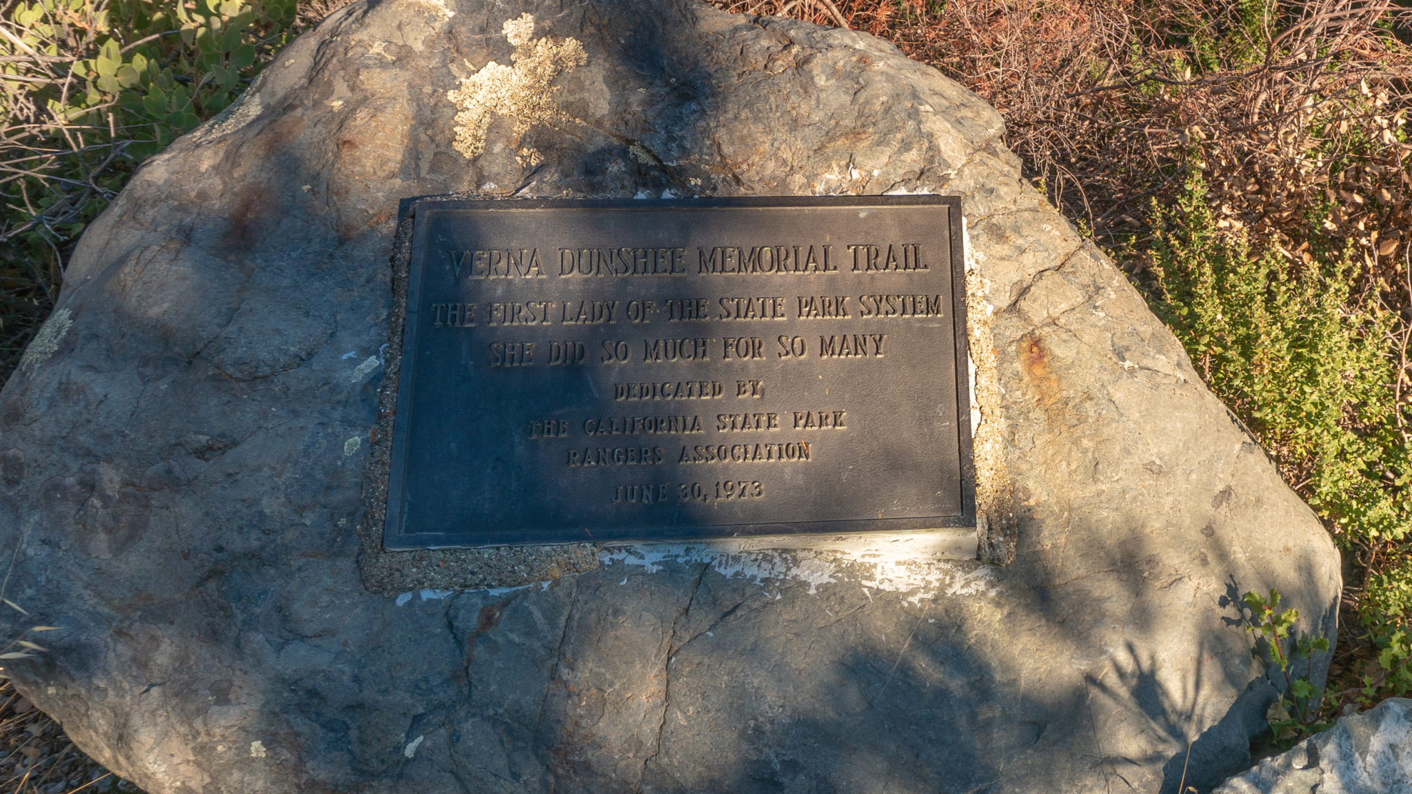
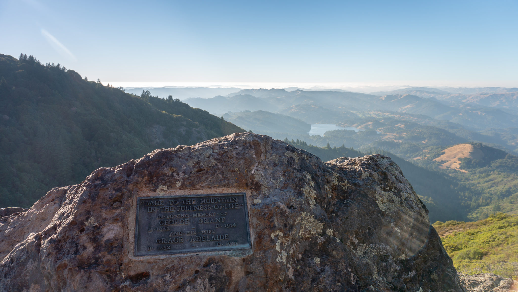
A stone-lined ADA-accessible path descends to the right, with a plaque honoring Verna Dunshee. Built in 1904, the Verna Dunshee Trail was at the time called the Racetrack Trail, created for railroad passengers to have a scenic walkabout while visiting the peak. It was later renamed the Verna Dunshee Trail in 1973 when she passed away. You’ll stay on the lefthand fork towards a picnic area.

So who was Verna Dunshee? Well, she was Marin resident, outdoorswoman, and passionate conservationist, described as a “spark plug” by her husband Bertram, a civil engineer. The two met in high school in Santa Barbara and hiked Mount Tamalpais for the first time in 1913. They both fell in love with the mountain and made a pact that if they ever had the opportunity, they would make Marin County their home. After marrying in 1917, they moved to Marin County in 1920, and purchased a home on Fallen Leaf Avenue in 1922. The story goes that while they were driving to see it, Verna had made up her mind: it was a definite “No” because of its location and the narrow road leading up to it. Once she and Bertram saw the view of Mount Tam from the house, however, it was a done deal, and they bought it!
Soon after, Verna became involved with the Tamalpais Center Women’s Club and Marin Conservation League, campaigning and raising funds to acquire land for public parks, such as Drakes Beach in Point Reyes National Seashore. She was president of the Tamalpais Conservation Club from 1950-1951, and as Bertram tells it, was influential in enlarging Mount Tamalpais State Park, encouraging William Kent, of Muir Woods National Monument fame, to donate a large tract of his land on the western side of Mount Tam to the park. She was a visionary behind Point Reyes National Seashore becoming a park, provided scholarships to California State Park Rangers, and actively supported the creation of Samuel P. Taylor State Park, Tomales Bay State Park, and Angel Island State Park, among many others.
On June 1, 1965, the California Legislature unanimously adopted Resolution 216 honoring Dunshee. It said in part, “Members express their deep appreciation to Verna Wood Dunshee . . . and commend her for outstanding leadership in the fields of conservation and preservation . . . She has wholeheartedly fought to preserve the beauty and character of the landscape and heritage of California.” That same year, California State Park Rangers Association made her an Honorary California State Park Ranger, the honor’s inaugural year.
It seems a fitting tribute that the Verna Dunshee Trail overlooks Marin County on the highest point of Mount Tamalpais, two places she loved and fought to preserve in the wake of increasing visitation from the opening of the Mill Valley & Mount Tamalpais Scenic Railway in 1896, Ridgecrest Boulevard in 1925, and the Golden Gate Bridge in 1937.
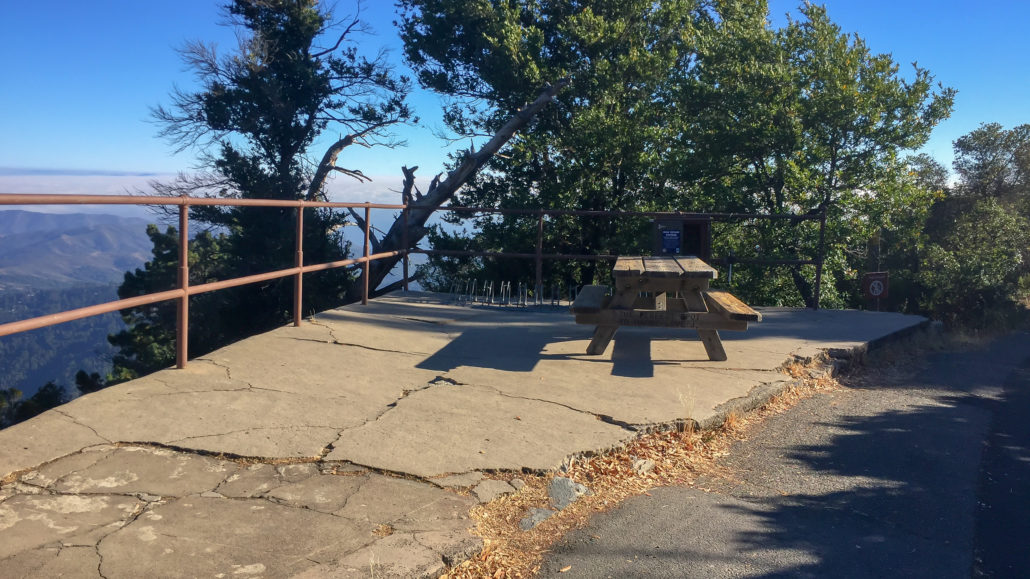
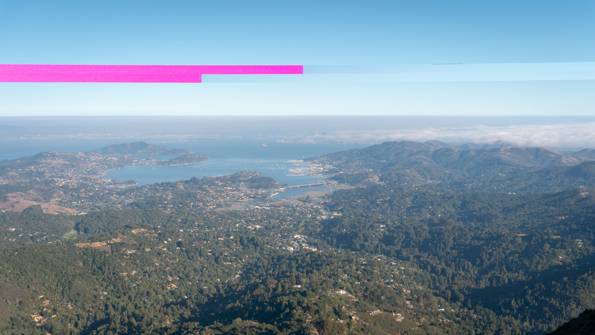
Continue east to a picnic area with a viewpoint overlooking the Tiburon Peninsula, Richardson Bay, Sausalito, San Francisco, and Marin Headlands.

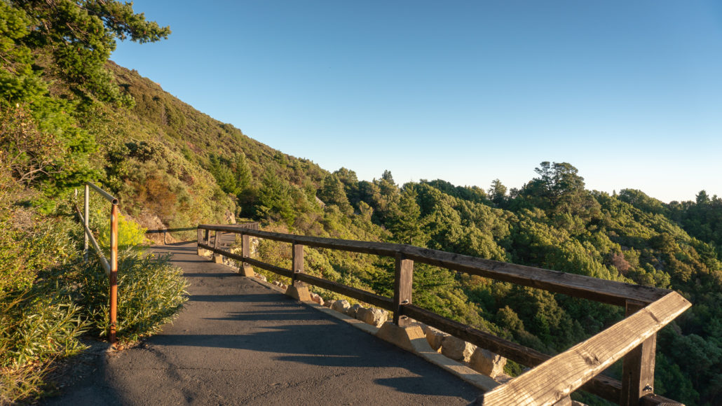
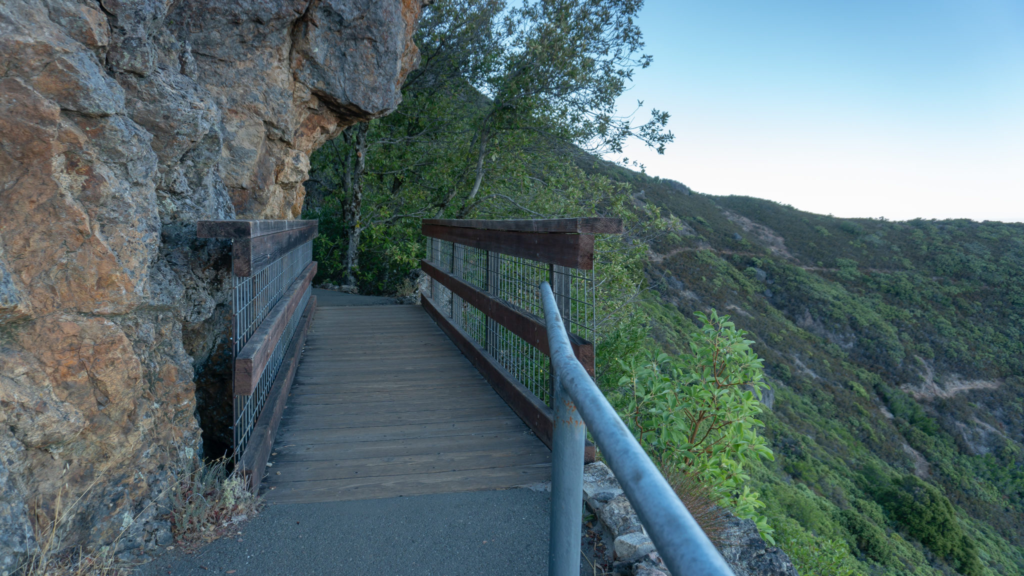
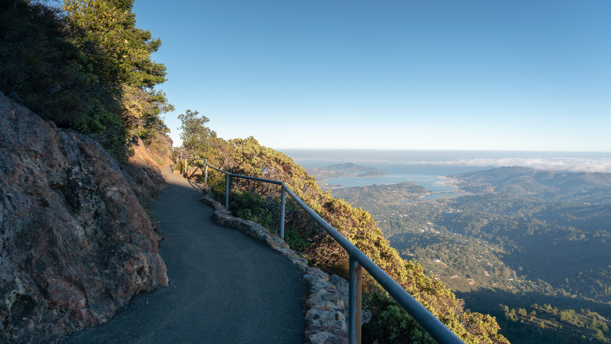
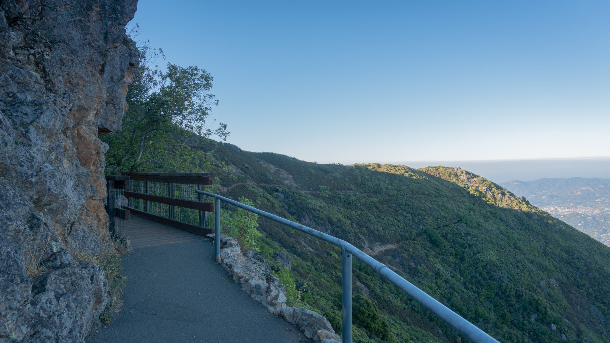
Descend the steps and turn left onto the paved trail, joining the ADA accessible entrance. Shrubby manzanita and oak grow next to cleaved hunks of rocks known as the Franciscan Assemblage. Mount Tam is part of the Coast Range in California—not a volcano, but volcanic rock and ocean floor uplifted and jumbled together by the movement of tectonic plates millions of years ago.

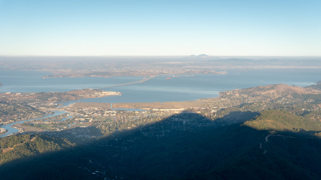
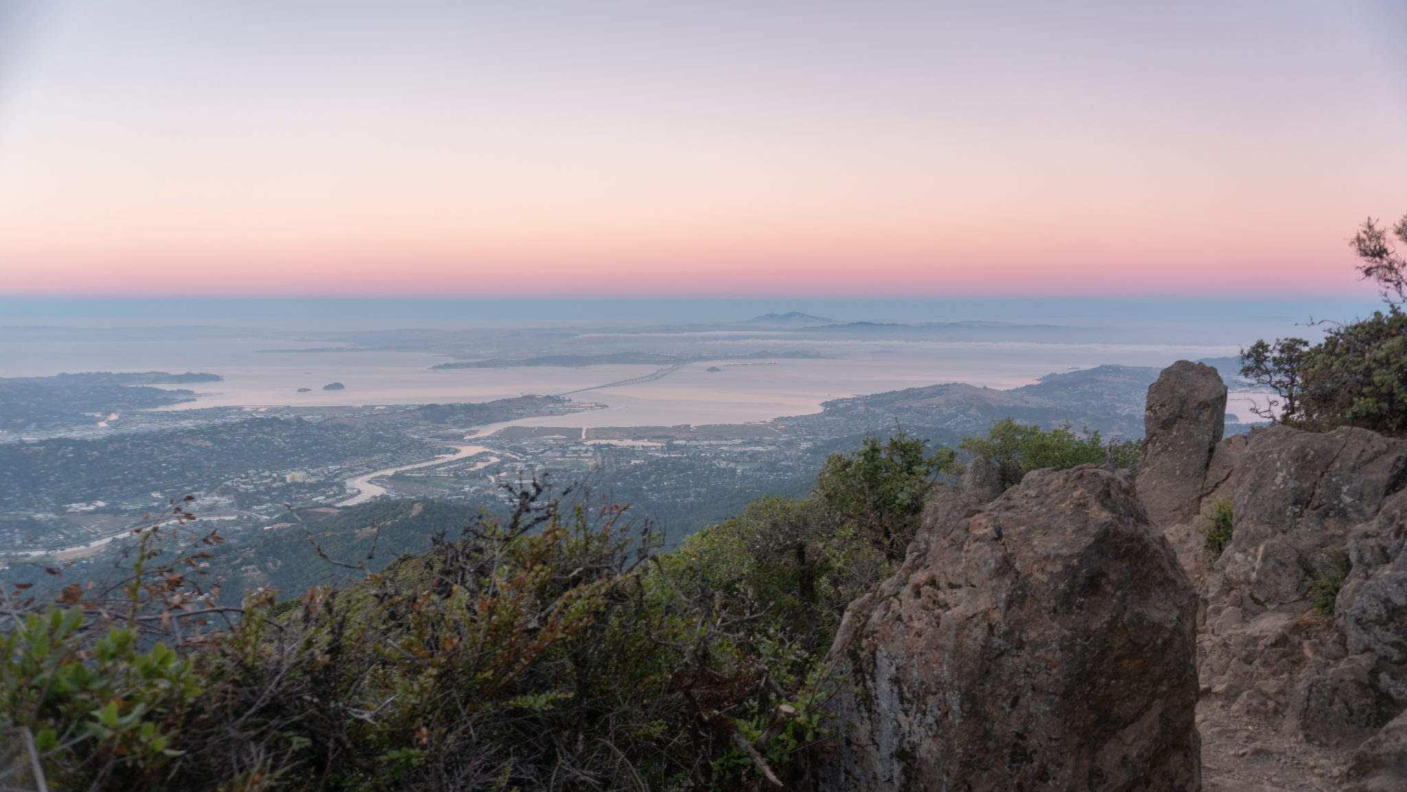
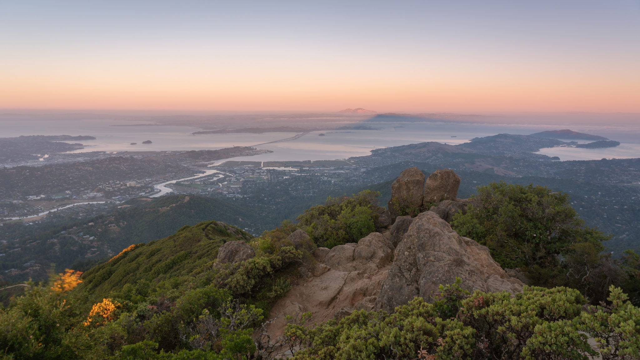
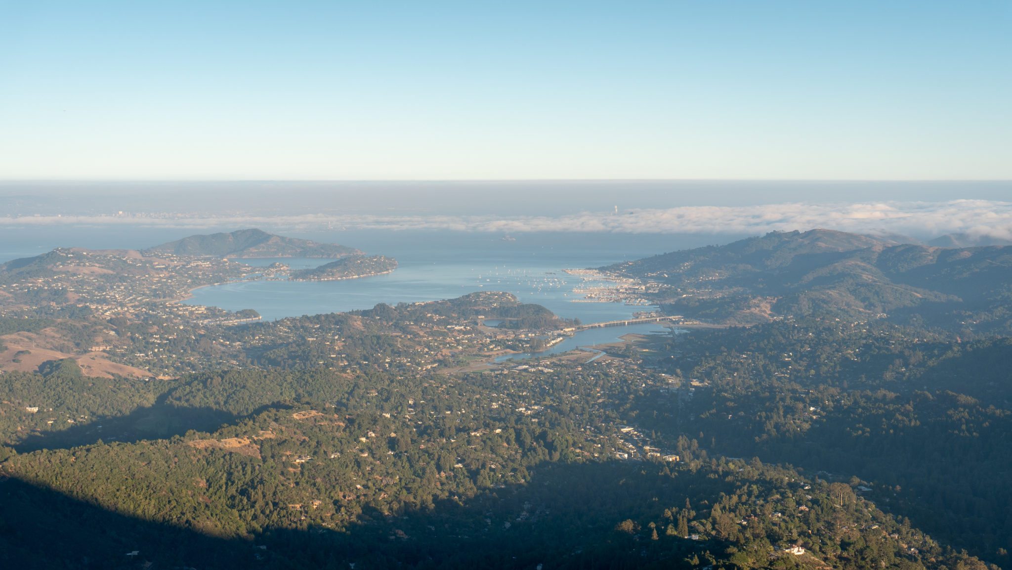
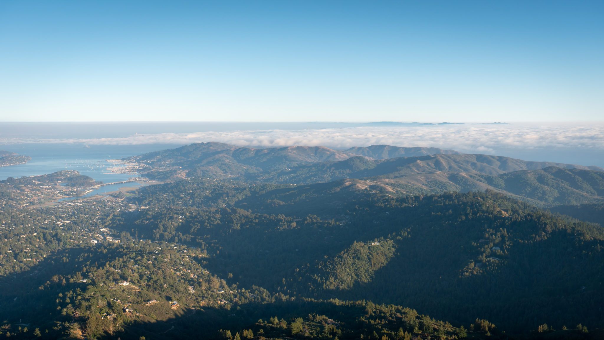
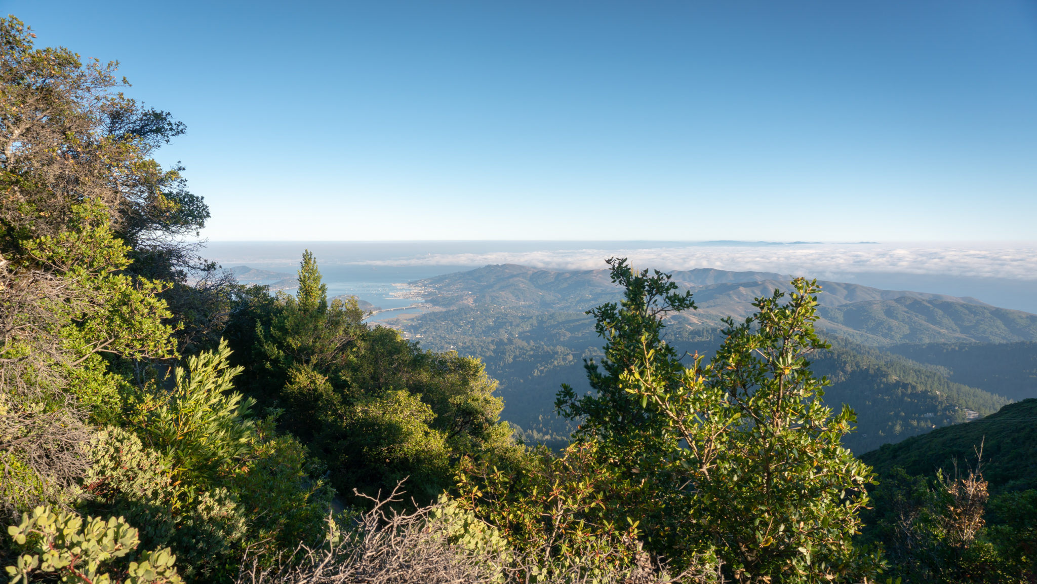
Reach an observation deck in 0.25 miles, with sweeping, panoramic views of Mount Diablo and the Richmond-San Rafael Bridge to the east and the San Francisco Bay and Santa Cruz Mountains to the south.
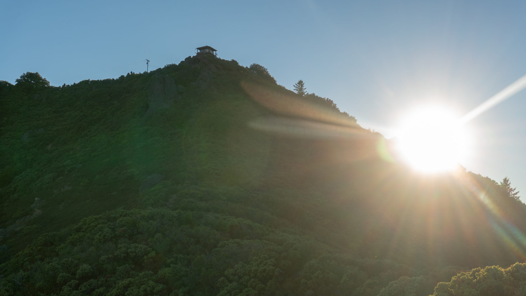
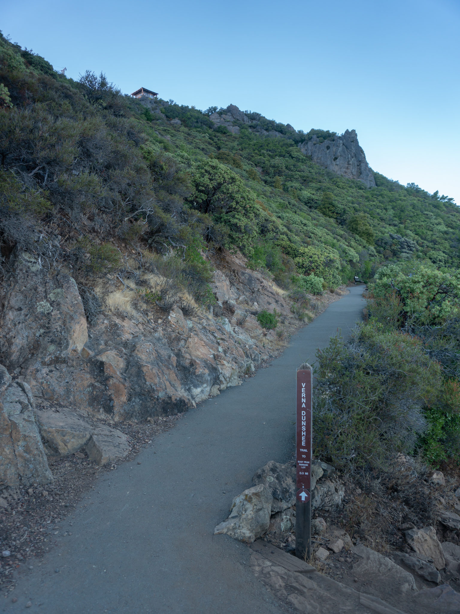
After another 0.1 mile, bear left to stay on the Verna Dunshee Trail at the Temelpa Trail junction. The Temelpa Trail descends steeply on the southeastern side of Mount Tam, intersecting with several trails and making it possible to do a loop back to the East Peak parking lot. You can see the Gardner Lookout overhead on East Peak.

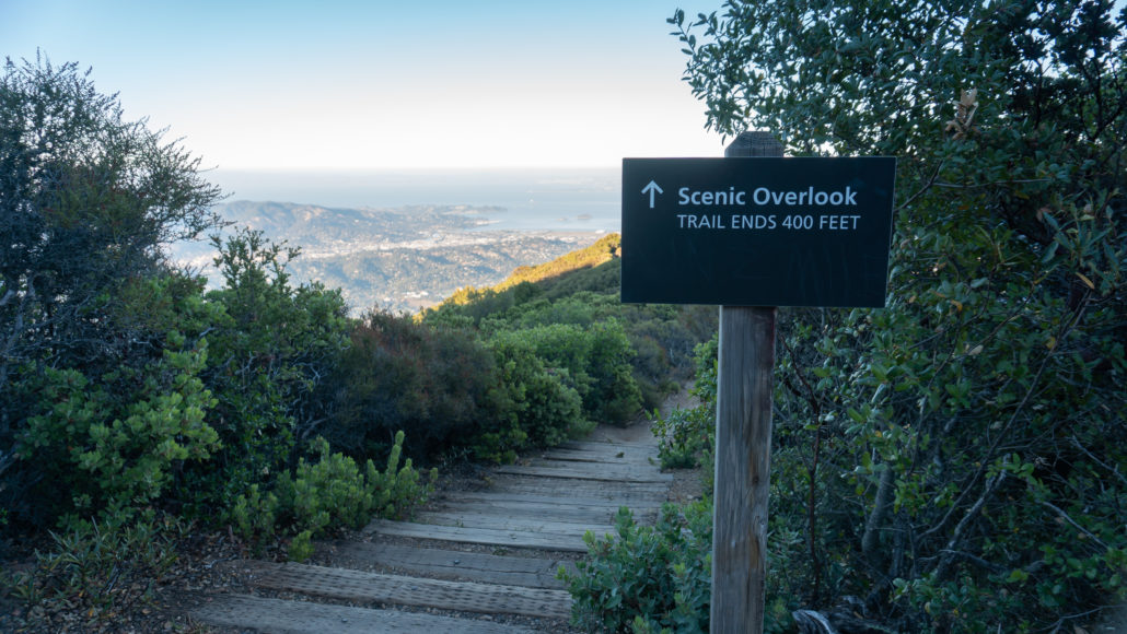
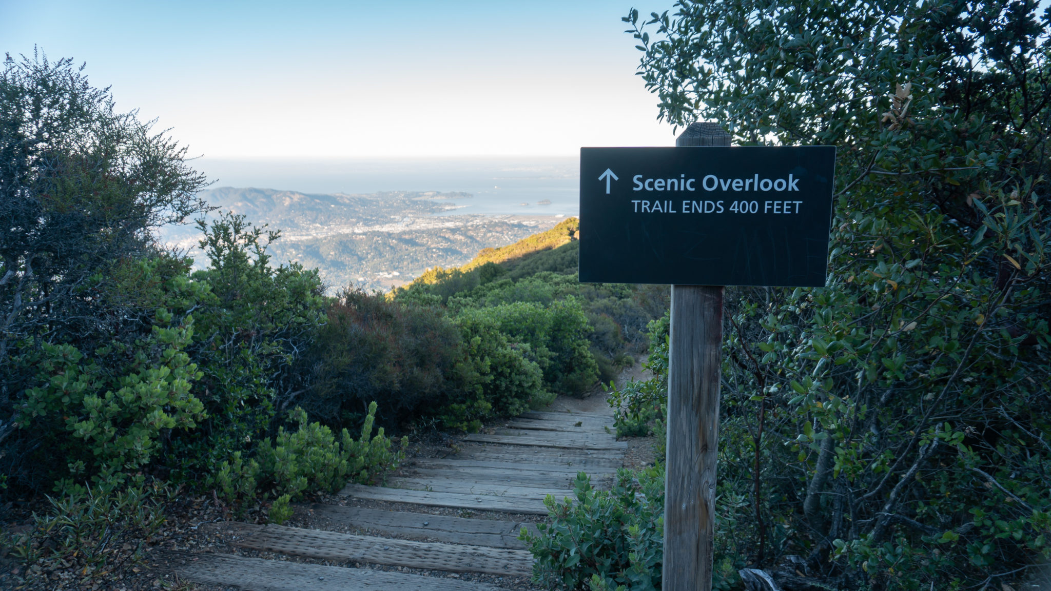
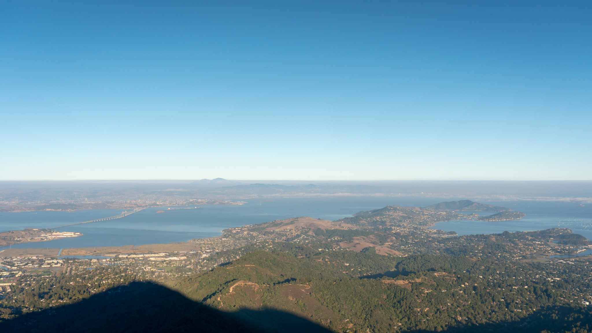
At the 0.4-mile mark, reach a sign that says Scenic Overlook with a trail on the right. The short, 0.1-mile trail descends 50 feet on rocky tread to close-up views of the Richmond-San Rafael Bridge, Corte Madera Creek, and Mount Diablo to the east. To the north is Mount Saint Helena.
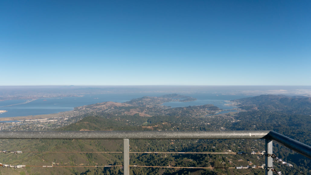
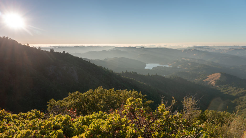
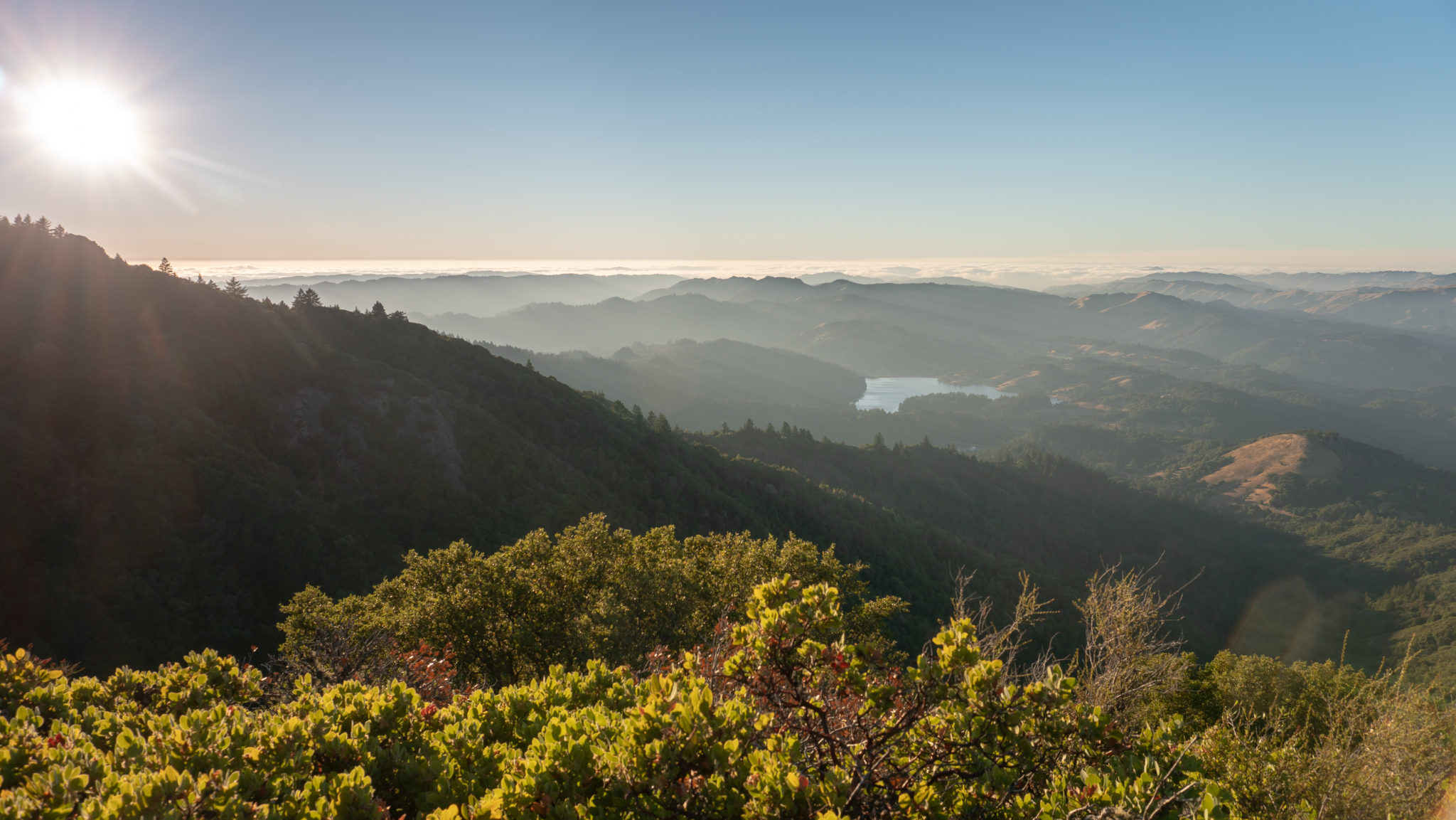
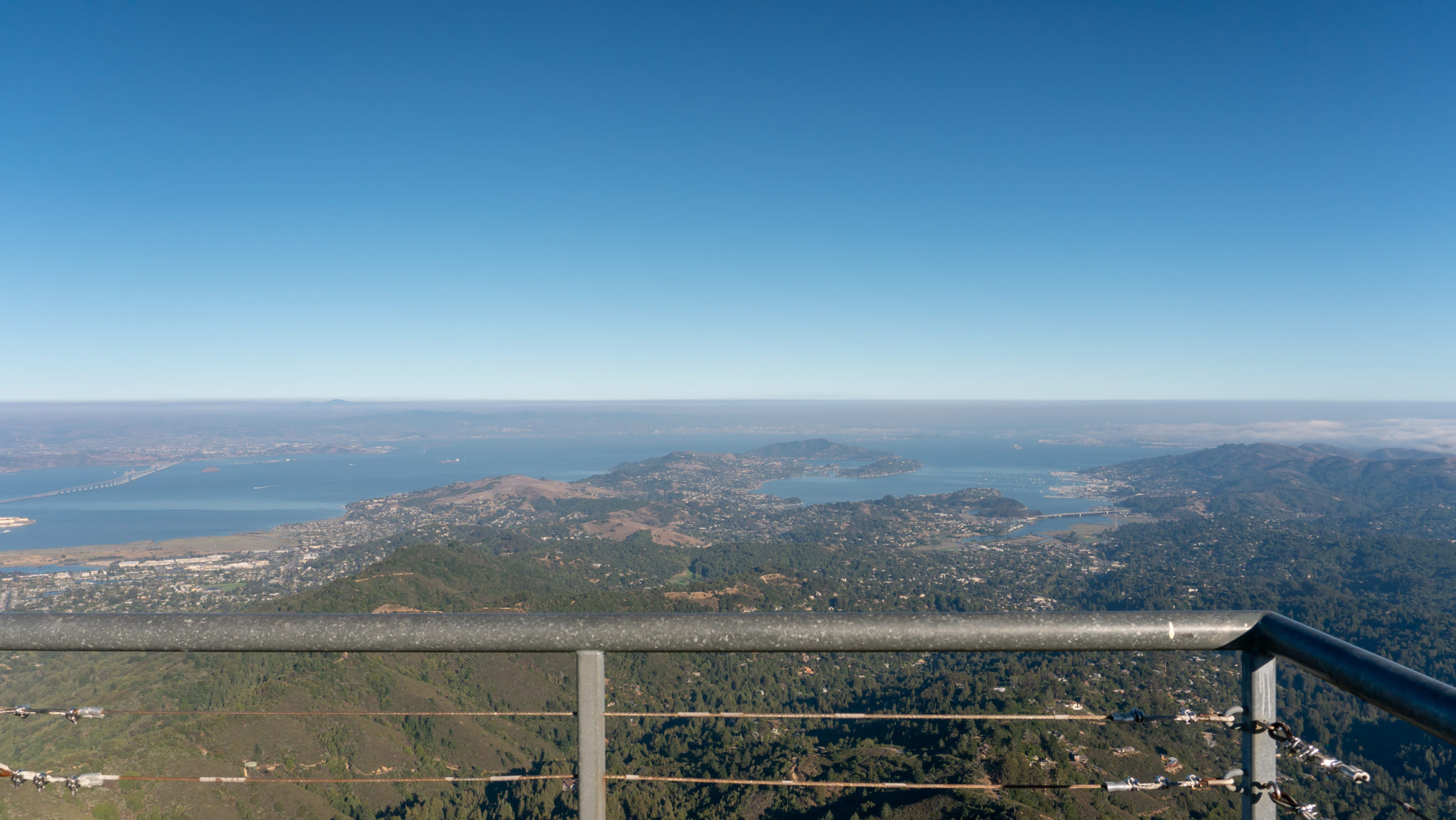
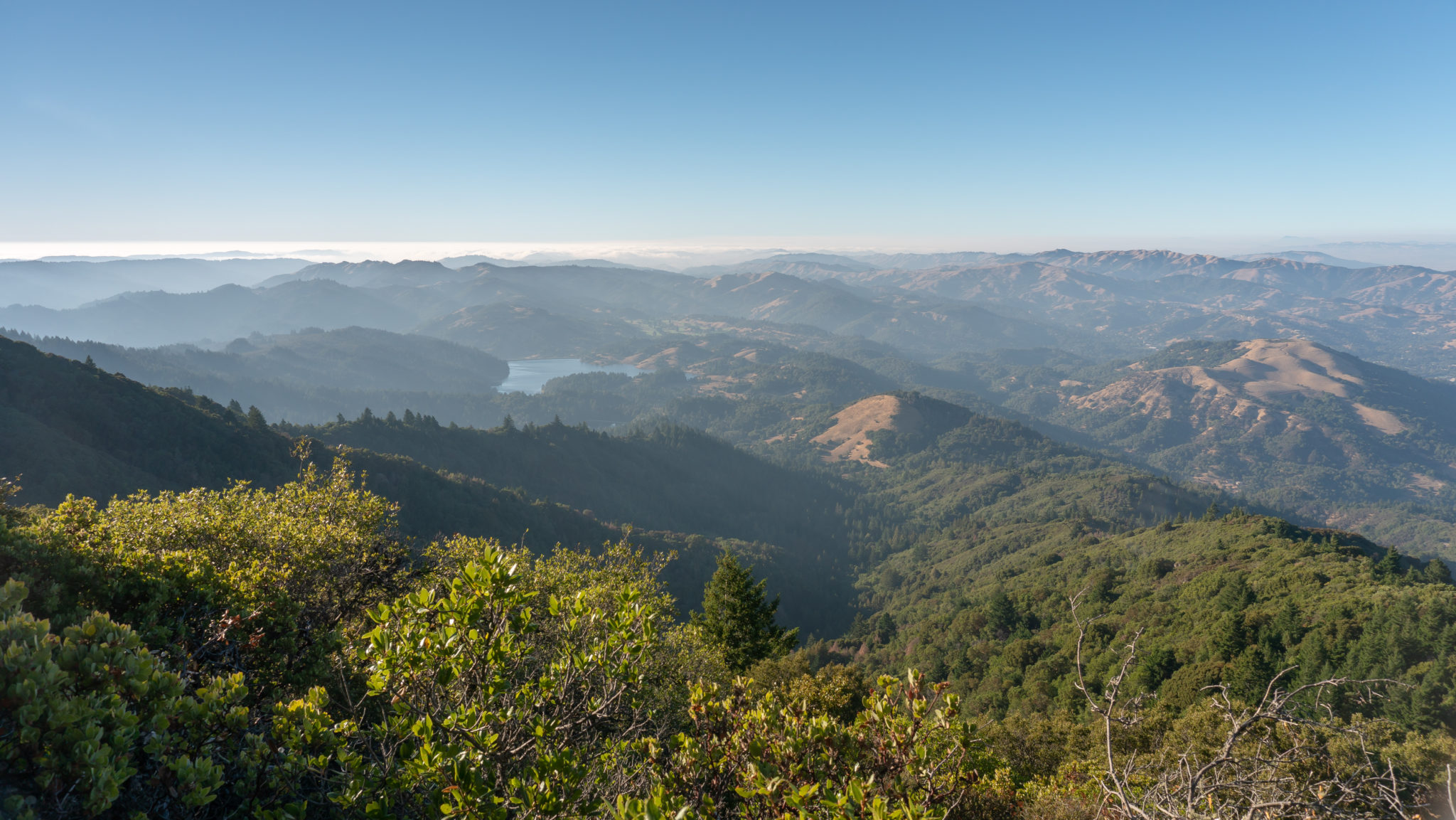
Back on the Verna Dunshee Trail, wrap around to the north to a beautiful vista of the Marin hills and Bon Tempe Lake. Bon Tempe Lake, built in 1948, is one of several reservoirs managed by the Marin Municipal Water District on Mount Tamalpais. The name Bon Tempe comes from Bauntapi, the last name of the family who ran a dairy farm on the land before it became Bon Tempe Lake.
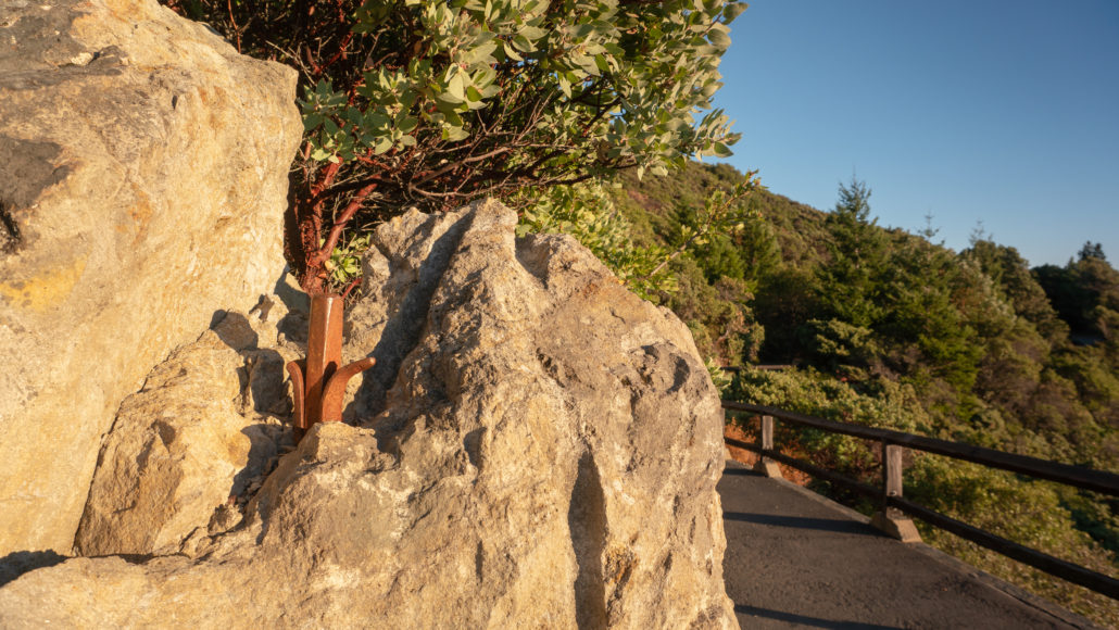
At 0.85 miles, look on the left-hand side of the trail near signpost 10 for an abandoned steel wedge sticking out of a rock. Wedges and shims (the bent “feathers” on either side of it) are primitive tools used to split rocks. After drilling a hole in the rock, the wedge and shims are placed inside and then tapped on with a mallet to split the rock. The guardrail that begins here is made of re-purposed railroad ties with the top rail rotated in a diamond shape: a style in California State Parks.
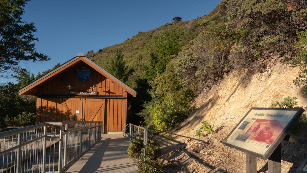
In 200 feet, arrive at the Gravity Car Barn, built to celebrate the centennial of the Mill Valley and Mount Tamalpais Scenic Railway. The barn holds a replica of a gravity car—kind of an open-air roller coaster car—that took up to 30 people at a time down the railroad tracks to either Mill Valley or Muir Woods. A brakeman sat at the front as the car glided between 10 and 12 miles per hour down the mountain from East Peak. If you can time your trip to see the barn and gravity car, it is worth it! Inside the barn are exhibits, a video, and pictures from the era.
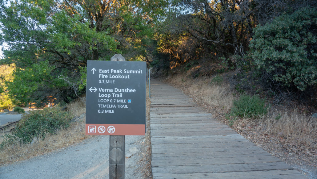
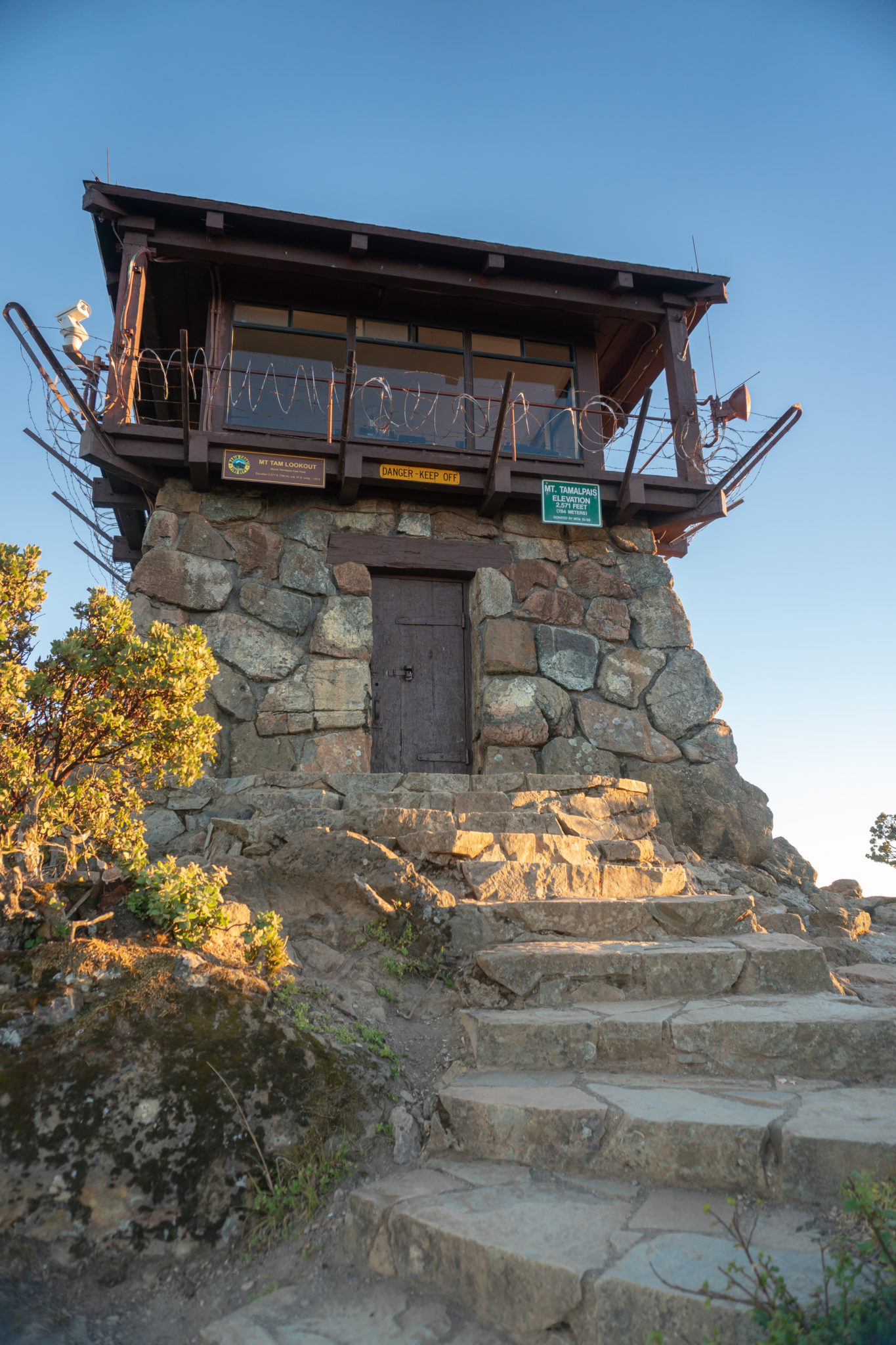
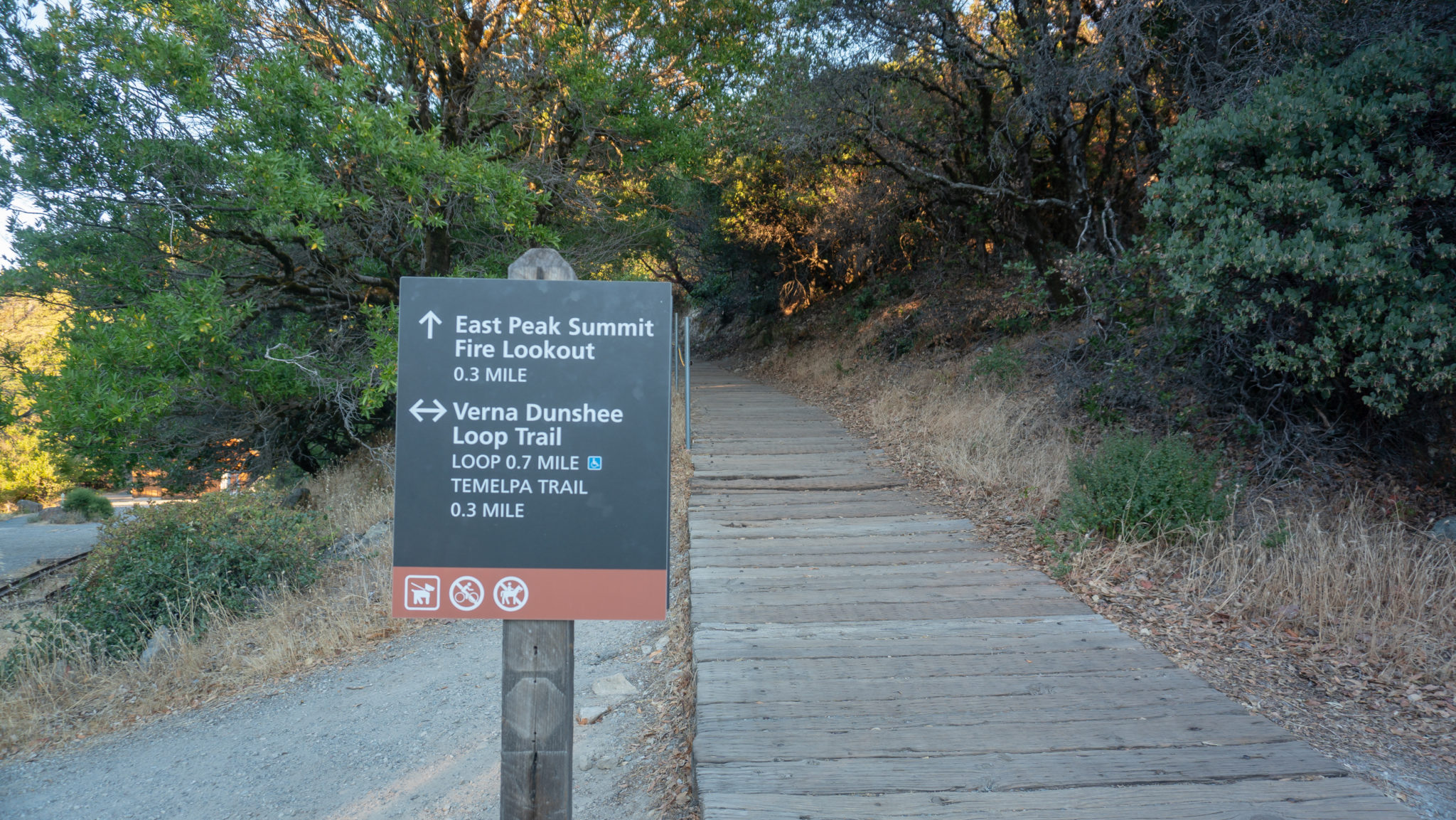
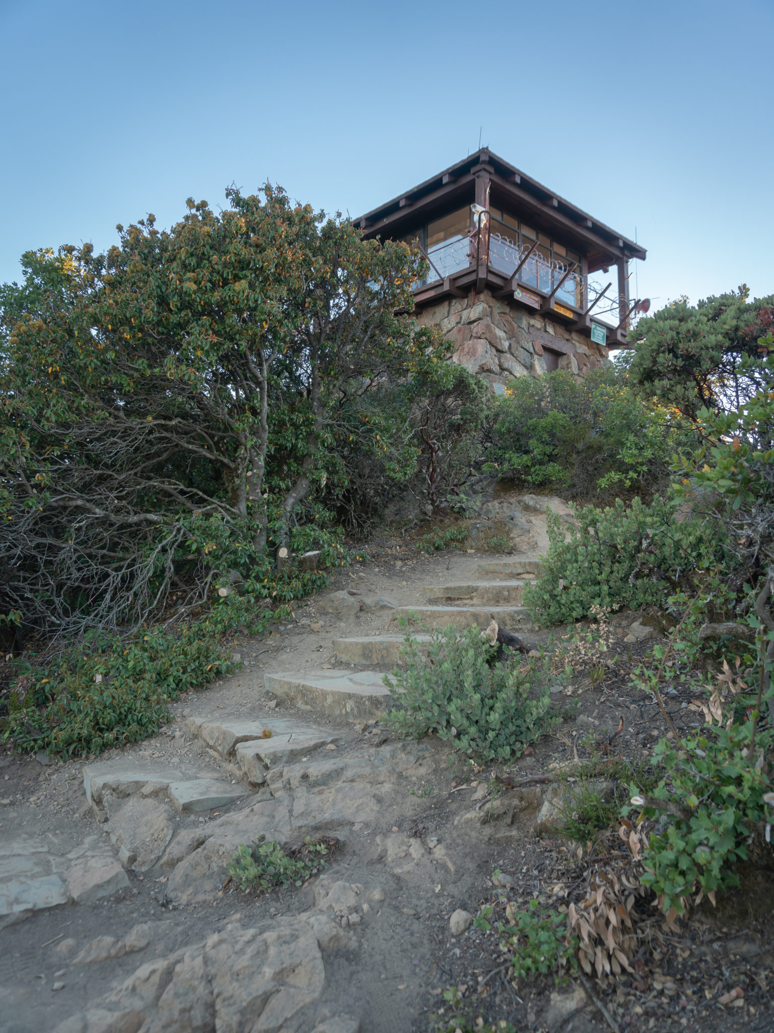
Finish the Verna Dunshee Loop back at the East Peak welcome area at 0.9 miles. To head up to the fire lookout, make a sharp left and follow the East Peak Summit Fire Lookout sign for 0.3 miles. The trail begins on wide planks, then transitions to uneven rocks and stone steps to the lookout.
The Gardner Fire Lookout was built by the Civilian Conservation Corp from 1935-1936, and is an active fire lookout staffed by Marin County Fire Department volunteers. The lookout is closed to hikers, but there are lots of rocks and boulders nearby to explore the views. (My favorite is a throne-like formation just east of the lookout.) This exceptional video created by keeper Gary Yost shows what’s it’s like manning the lookout, with beautiful shots of the nighttime sky.

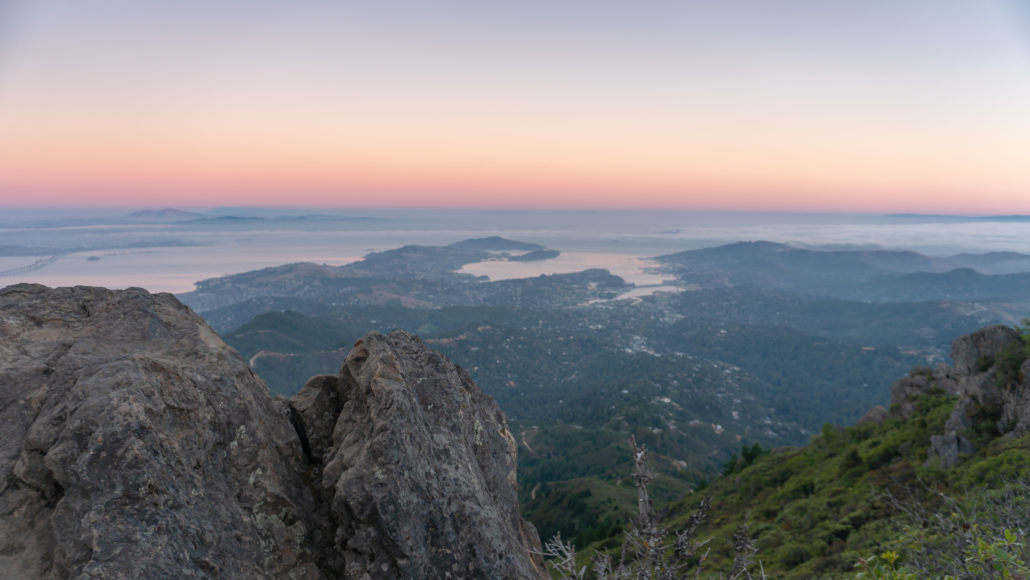
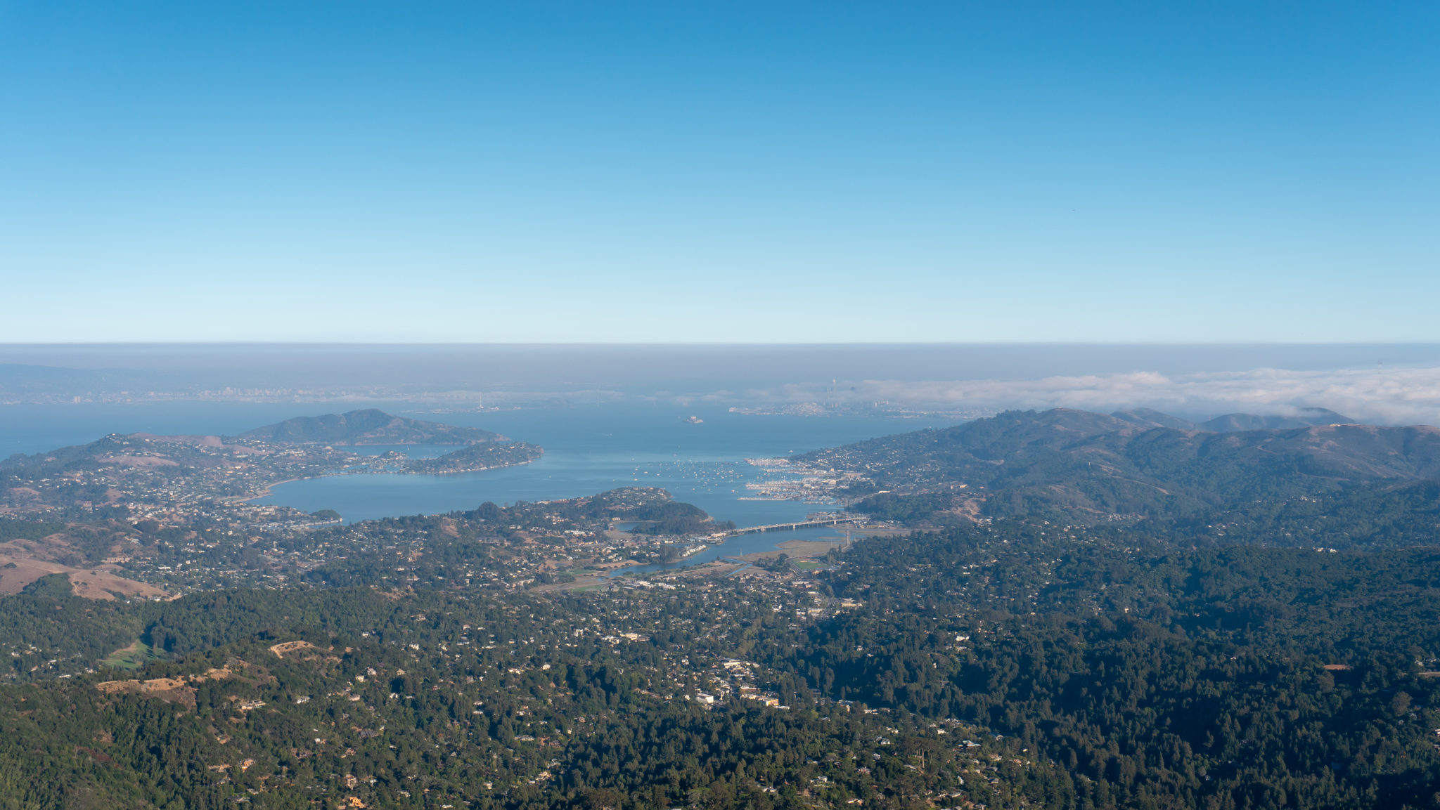
The view from the summit of East Peak is one of the best in the Bay Area: the Richmond-San Rafael Bridge, Mount Diablo, the Tiburon Peninsula, Angel Island, Richardson Bay, the Bay Bridge, Treasure Island, Alcatraz Island, San Francisco, the Marin Headlands, and the Pacific Ocean. Stay for sunset to watch the sky illuminate in rainbow sherbet layers of yellow, orange, and pink. When ready, return to the East Peak welcome area and parking lot.
Notes:
- Leashed dogs are allowed on the Verna Dunshee Trail, Scenic Overlook, and Plank Walk Trail to the Gardner Fire Lookout.
- Park hours are 7:00 a.m. – sunset.
- Parking is $8 per vehicle ($7 for seniors). Pay for parking at a self-registration kiosk in the East Peak parking lot. As of September 2018, there are no credit or debit cards accepted for parking.
- If you’re interested in volunteering at the Gardner Fire Lookout, you can learn more and contact the Marin County Fire Department on Marin County’s website here.
- The Gravity Car Barn at the East Peak is open on Saturdays and Sundays from 12:00 p.m. – 4:00 p.m.
- East Peak Visitor Center is open as staffing allows, generally on Saturdays and Sundays from 11:00 a.m. – 4:00 p.m.
- The Friends of Mount Tam have put together a brochure for the Verna Dunshee Trail that is very informative and has a lot of good information about the history, geology, animals, and plant life at East Peak. Download it here. Numbers correspond to signposts along the Verna Dunshee Trail.
Tags: bay area, california, dog-friendly, Hiking, Mount Tamalpais State Park, san francisco, sunset, Verna Dunshee Trail


