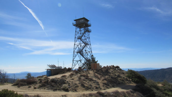
If you’ve got a few calories to spare, you want all the views, and you wish to unleash the hurt on your quadriceps, I have a great hike for you. The highest point of the Palomar Mountains, dubbed — wait for it — High Point — is a great place to get abundant doses of all of the above. The views here are so good that the Forest Service operates a fire lookout tower that, legend has it, once spotted a fire burning in Santa Barbara County 200 miles away.
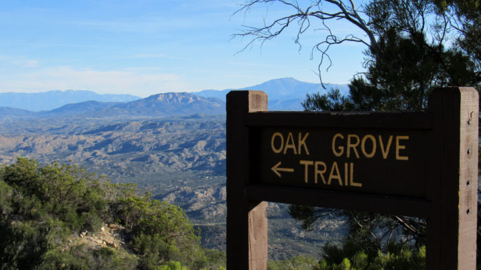
At the end of the Oak Grove Trail where your leg muscles will finally know mercy
High Point occupies a rounded knoll on the eastern edge of the gently rolling range. The route to the top starts from the base of the mountain and wastes no time in climbing. The temps on the east side of the range can be terrifically hot during the summer months, and even though it’s always temperate up top, you probably will want to sit this one out during July and August.
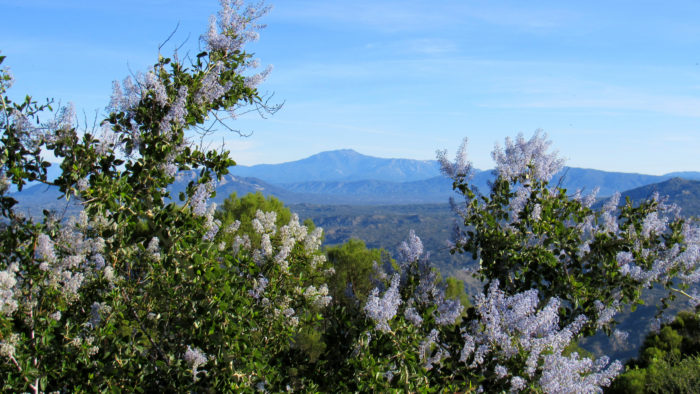
Mt. San Jacinto framed by blooming chaparral whitethorn
The mountain is also a good spot for backpacking. The Palomar District of Cleveland National Forest recently abandoned their lack of red tape backpacking policies, meaning you now have to fill out a permit request, fax it in to the Palomar District, and wait for your permit. There are a pair of seasonal water sources that might allow refilling, and there are a few different campsites at two spots on the mountain for camping.
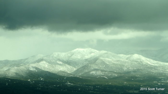
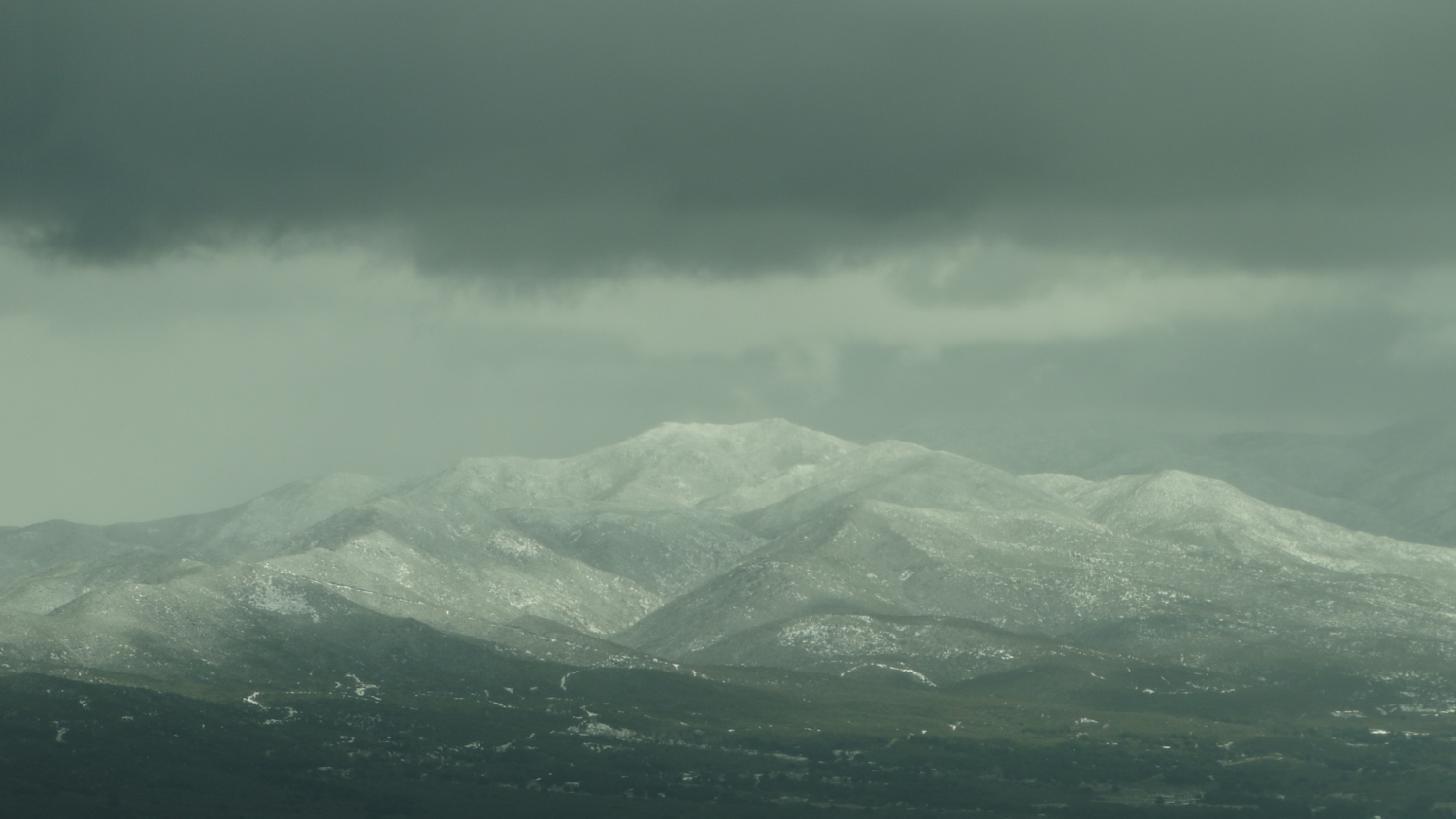
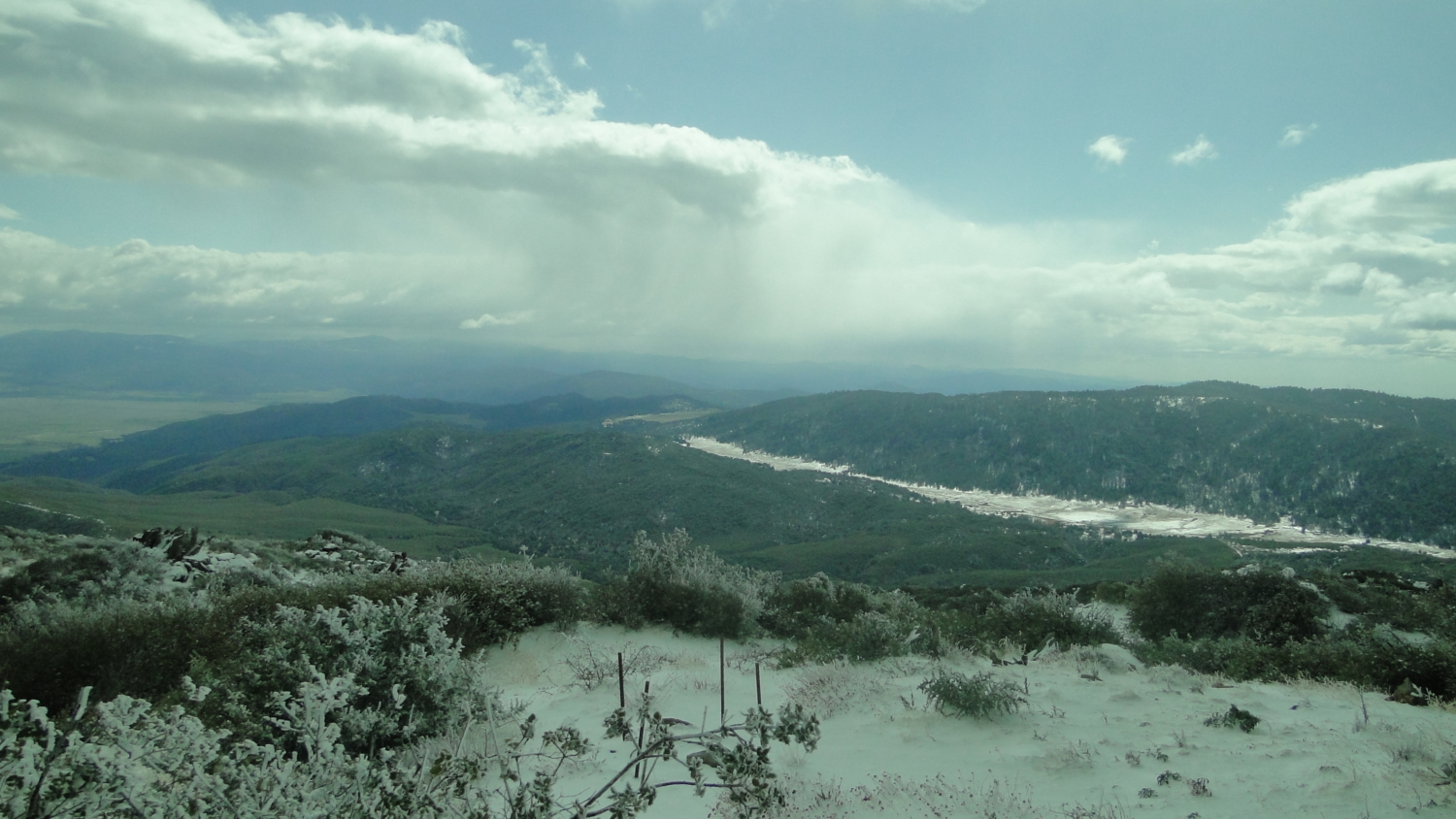
Mt. San Jacinto following a February snow storm
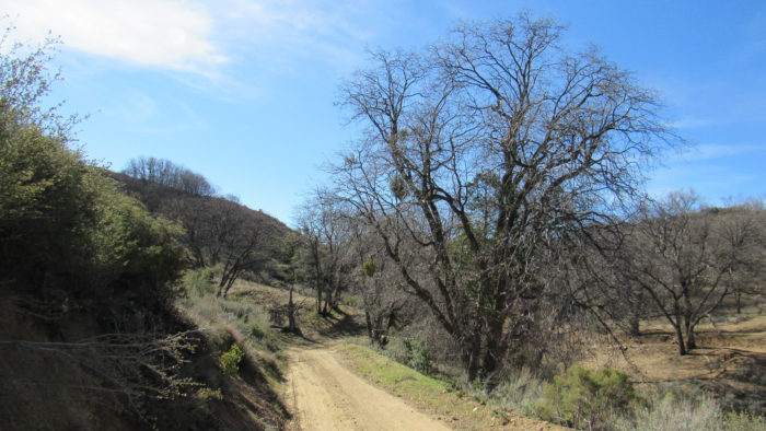
From the Oak Grove Fire Station, find and follow the sign indicating the Oak Grove Trail. This trail will cross a seasonal creek and then begin a sharp ascent along a ridge, crossing back and forth over an old fire break. This is the toughest part of the hike, as the Oak Grove Trail gains about 1500 feet over 1.8 miles. Initially, the trail climbs on the sunny side of the slope, which gets warm in a hurry. At 1.5 miles, the trail crosses over onto the north slope, where shade from dense chaparral will provide a bit of relief from the heat.
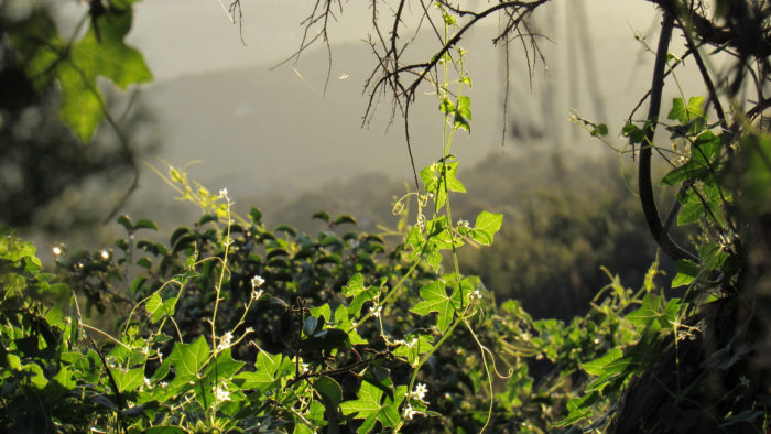
Wild cucumber on the Oak Grove Trail
At 1.8 miles, the trail reaches the Oak Grove Fire Road. East of this spot, the road is gated and enters private property. Turn right to enjoy a more reasonable grade as the road follows a ridge for another 1.5 miles to another junction with High Point Truck Trail. All along this stretch of trail, impressive views over the Inland Empire culminating in the twin giant of Mt. San Gorgonio and Mt. San Jacinto will provide interest and a bit of inspired awe as you work your way uphill.
Looking north over the Agua Tibia Wilderness toward Santiago Peak
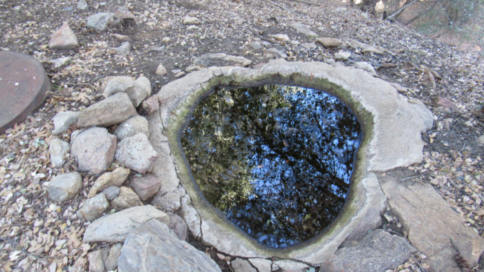
Sourdough Spring
At 3.4 miles, you’ll pass the junction for High Point Truck Trail, keeping left to continue climbing. Just past the junction, you’ll see a large, solitary pine tree at the base of the ravine. A concrete cistern lies hidden in some shrubs. This cistern is a collecting tank for a nearby spring. You can lift the lid off the top and pull water from within using a pump filter. You will definitely want to filter this water AND treat it chemically, as the water looks very unappealing.
Black Oaks in Deer Flats
High Point Truck Trail makes a sharp bend to the southeast as it progress toward the headwaters of Cottonwood Creek at Deer Flats. You’ll know you’re close to Deer Flats due to a large grove of bigcone Douglas firs that cluster outside a small gentle valley. This little valley is well-shaded by black oaks and the occasional incense cedar. You’ll be able to see the High Point lookout tower across this valley and atop a rounded hill.

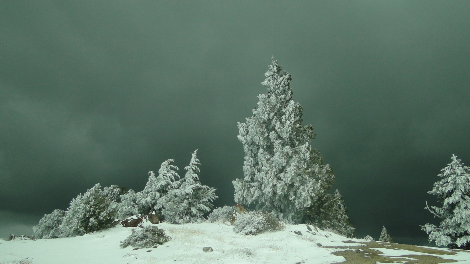
Snowbound sequoia and cypresses on the summit
At the 5 mile mark, you reach a junction with the Palomar Divide Truck Trail. Keep right here and follow the trail as it makes a wide switchback through groves of black oak whose golden leaves shimmer in the fall. As the trail begins to bend around the north flank of High Point, you encounter a gated side road leading away on your right at .5 miles. This side road will lead you down to Sourdough Spring, a seasonal water source that may provide enough water to let you tank up. This water also needs to be filtered and treated with chemicals as it becomes stagnant and riddled with algae when the spring does not have a robust flow.
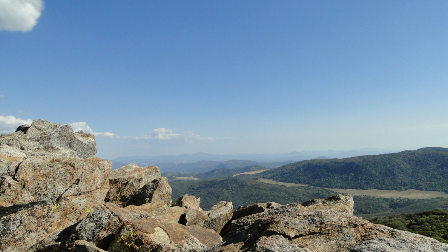
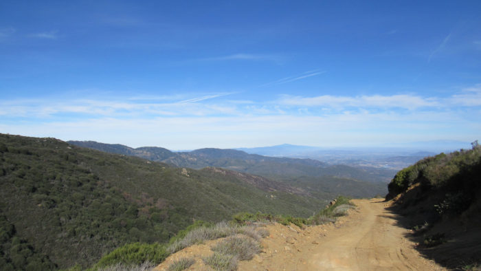
The view southeast
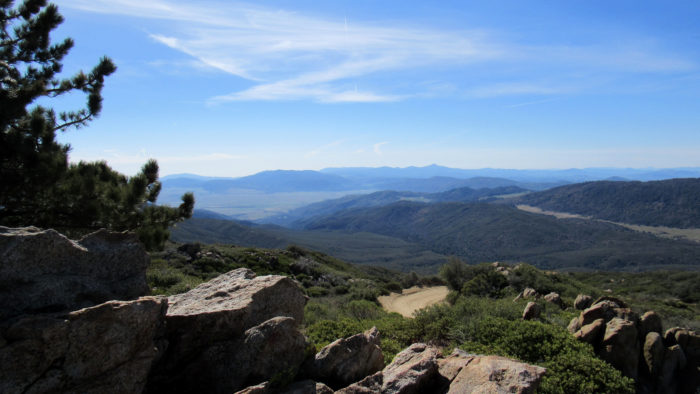
At 6.1 miles, you’ll reach a final gate with a dirt road leading circuitously to the summit. As you wrap around the western face of High Point, the view that has been obscured by the mountain’s bulk finally comes into focus. You will immediately notice the gleaming white domes of the Palomar Observatory. Soon after, you’ll take in the rolling, forested crests and tranquil valleys that dominate the highlands of the Palomar Mountains. The view southeast reveals the sprawling breadth of San Jose de Valle as it spreads out toward the Volcan Mountains.
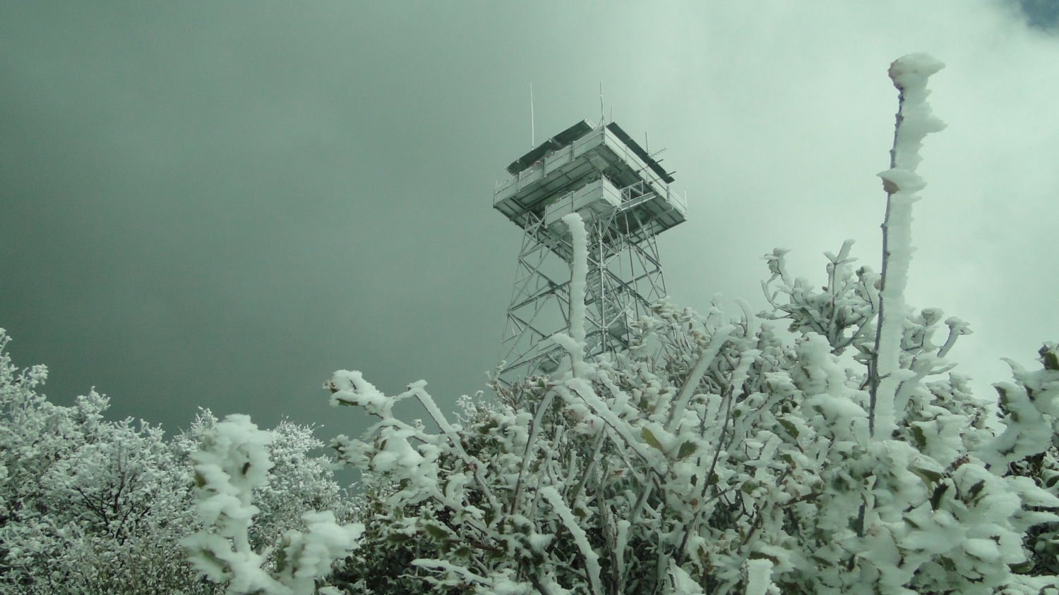
High Point
Finally, a 6.5 miles, you reach the flat summit. The High Point lookout tower dominates the summit, which also includes a few support buildings, a picnic bench, a cabin foundation with some planted sequoias, cypresses, and sugar pines, and a porta-potty. The cluster of rocks just southeast of the lookout is the true summit, and from here you can enjoy the view ranging from southeast to northwest.
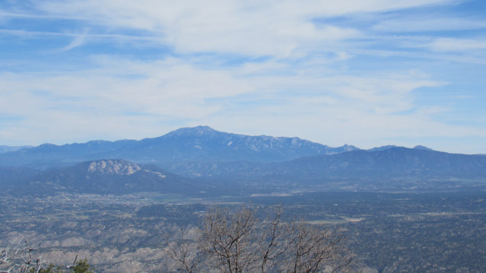
Mt. San Jacinto with Cahuilla Mountain in the center-left and Thomas Mountain on the center-right
From this spot on a clear day, you can test your geography knowledge by attempting to identify as many of the following spots as possible. From the northwest ranging to the southeast: Mt. Baldy, Mt. Baden-Powell, Santiago Peak, Lake Elsinore, Santa Margarita Peak, Agua Tibia Mountain, Boucher Hill, Birch Hill, Mendenhal Valley, Barker Valley, Otay Mountain, El Cajon Mountain, Viejas Mountain, Lyons Peak, Cuyamaca Peak, Middle Peak, Stonewall Peak, North Peak, the Laguna Mountain Escarpment, the tip of Granite Mountain, Whale Peak, Mesa Grande, Volcan Mountains, San Felipe Hills, Pinyon Ridge, Hot Springs Mountain, Dawns Peak, and Toro Peak.
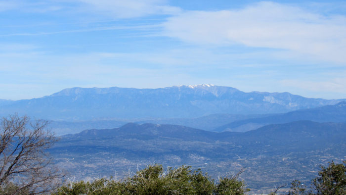
Mt. San Gorgonio
Leave your bouldery perch and stroll over to the eastern side of the summit, and see if you can spot the following, ranging east to northeast: Santa Rosa Mountain, the Desert Divide, Thomas Mountain, Mt. San Jacinto, Cahuilla Mountain, Mt. San Gorgonio, the Rim of the World, before returning finally to Mt. Baldy. It’s not hard to understand why they put a lookout tower here.
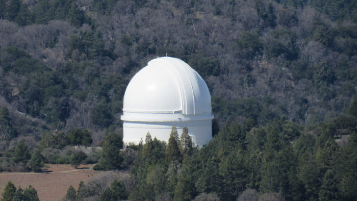
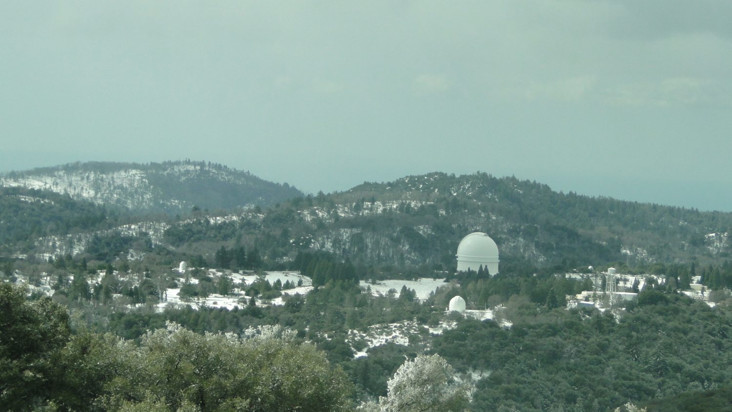
The Hale Telescope
The return route re-traces your way up to the top. If you’re backpacking, a nice sheltered spot can be found if you return back to just before the junction of High Point Truck Trail and Palomar Divide Road. A side road heading southeast (a continuation of Palomar Divide Road leading to Barker Valley) will take you through a grove of black oaks to a bare, flat spot that’s perfect for camping.
Tags: Cleveland National Forest, High Point, High Point Lookout, High Point Truck Trail, Oak Grove Trail, Oak Grove Truck Trail, Palomar District, Palomar Divide Truck Trail, Palomar Mountain