“Yeah, but it’s way too crowded. . .”
News flash: people love Zion. They love it so much that attendance continues to climb ever higher, even though we’re all pretty sure that the Department of Interior isn’t printing money for the park to accommodate all of the traffic. The park has begun considering a number of strategies to mitigate overuse and disperse visitor traffic, and they already control road traffic through the shuttle system owing to the detrimental effects of too many cars on the road in Zion Canyon. While the canyon remains an undeniably beautiful place, many people are, understandably, turned off by the crowds.
But as is the case with every National Park, solitude still remains, and it really isn’t all that hard to find. Many of the lightly traveled trails in the area are just as beautiful, if not sometimes more beautiful than the name brand destinations like Angels Landing and the Narrows. To enjoy these experiences, all it requires of you is to do some extra work with preparation, logistics, and navigation, and you can enjoy the finer aspects of Zion National Park without the maddening crowd element. Deertrap Mountain, a lofty summit atop the eastern rim of Zion Canyon, is one such spot. You have to drive to a seasonally available trailhead to hike this route, but if you’re willing to do that extra work, you can peer down on the thousands of people within the canyon from a lonely spot that’s light years from the canyon floor while being only a few horizontal miles away.
Wilderness Permits
Please note that you can camp near the summit of Deertrap Mountain, as the flat top of the mountain offers some appealing looking campsites. The park asks that, in addition to adhering to the traditional Leave No Trace principles that hikers camp at least 200 feet away from the edge of the canyon. To obtain an overnight wilderness permit, you can try your luck walking into the Wilderness Permit office at the Zion Canyon Visitor Center, or you can reserve one in advance. Visit this website to begin the process of reserving your permit in advance.
Note that advance reservations for permits become available two months prior on the 5th day of each month. So, if you were going to reserve your permit for a date in March, the permit for that time would be available on January 5th. There’s a $5 non-refundable fee to process the permit, plus an additional fee based off of your group size.
Driving Directions to Stave Spring:
From Zion National Park’s east entrance on the Zion-Mt. Carmel Highway (UT-9), continue east on Zion-Mt. Carmel Highway for 1.7 miles (2.7 km) to a junction with N. Fork County Road, and turn left. Continue for another 5.2 miles (8.4 km), and turn left at the sign for Zion Ponderosa Ranch Resort. Be sure to keep right on the unpaved road past the resort entrance, and continue on Pine Angle Rd./Twin Knolls Rd. After 0.7 mile (1.1 km), turn left to remain on Pine Angle Rd., then make an immediate right onto Buck Rd. Continue on Buck Rd. for 0.6 mile (1.0 km), and then make a left onto Beaver Rd. Beaver Rd. quickly reaches a T-junction with Pine Street. Turn right and follow Pine Street to its terminus at the Stave Springs Trailhead. Low clearance vehicles may not want to drive the last 100 yards (90 m) to the trailhead, as there’s a ditch with poor clearance that could cause you to get stuck. Look for nearby parking before the ditch.
PLEASE NOTE: The road to the Stave Spring Trailhead becomes impassable during snowstorms or when it becomes wet. Check weather conditions in advance, and only attempt this route when the weather is favorable. If the weather is not favorable, you risk stranding your car along an impassable dirt road. This is true even for 4WD vehicles, and I recommend that Jeepers don’t take this as a challenge. I’ve heard of multiple incidents where cocky Jeepers got stuck and needed an expensive assist to get back out again. You can also call Zion Ponderosa Ranch Resort ((800) 293-5444) to obtain more detailed information on road conditions.

Stave Spring Trailhead to Deertrap Mountain
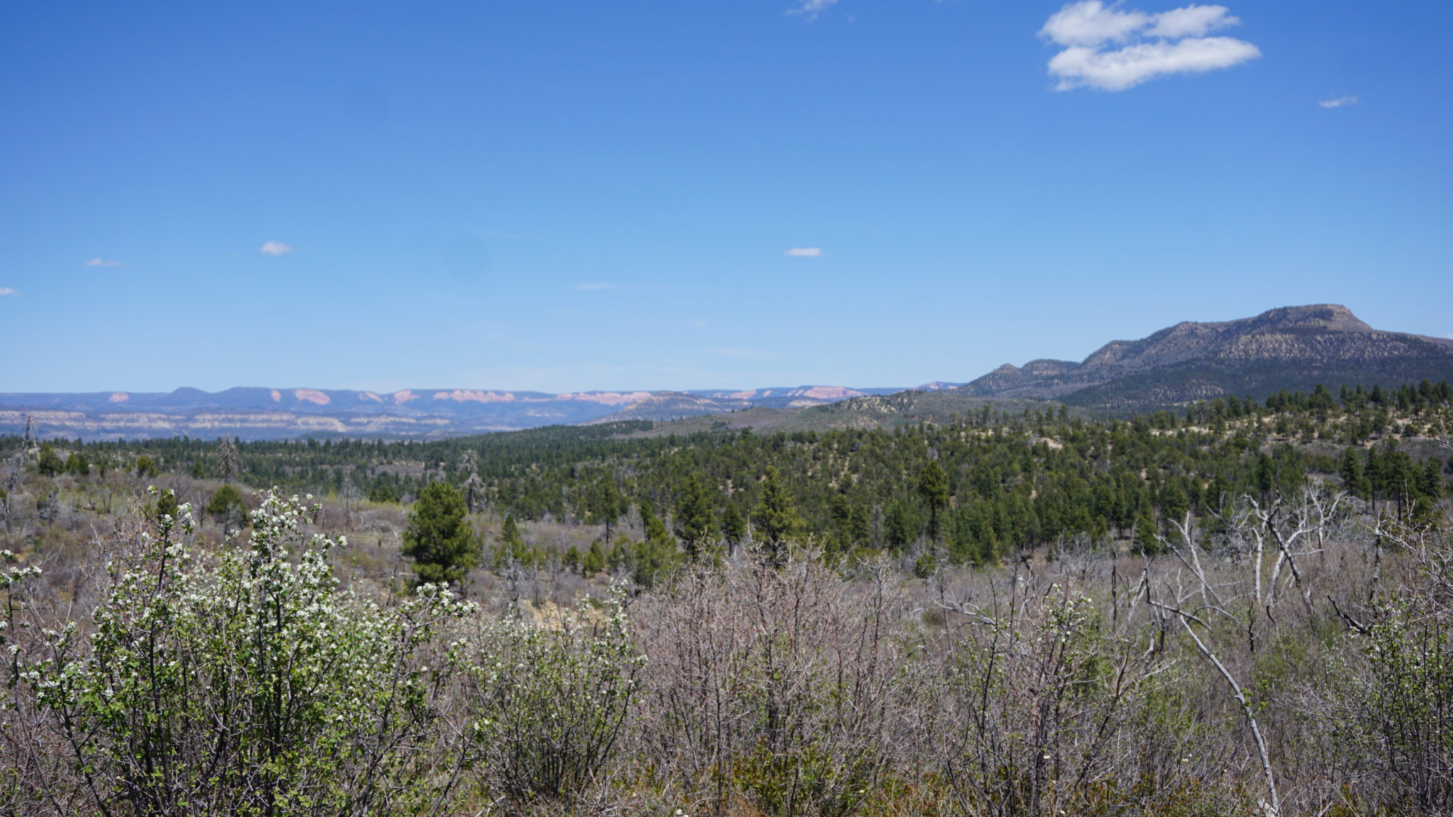
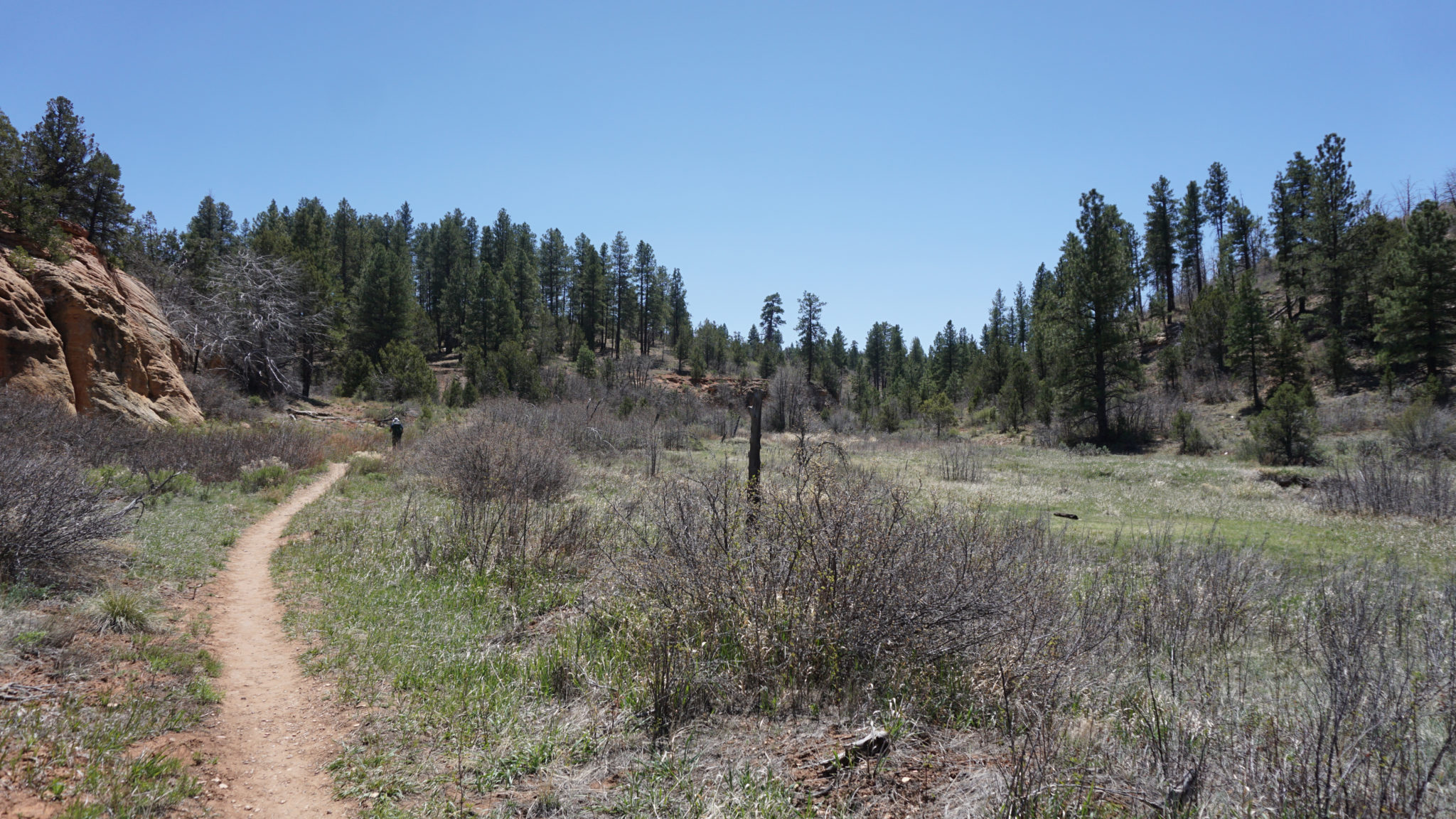
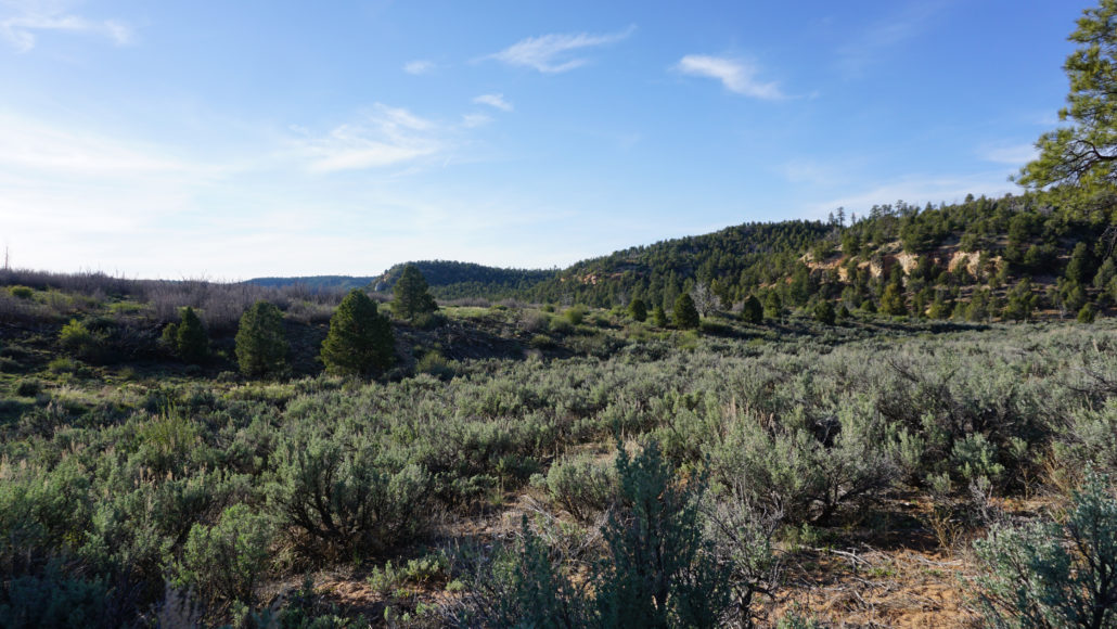
From the Stave Spring Trailhead, head west on a former dirt road that the park has reverted to a single track trail as it hugs the edge of a spacious meadow carpeted in sagebrush and rimmed with ponderosa pine. After 0.5 mile, turn left at a junction with the East Rim Trail, and begin climbing through a broad ravine toward another junction with the combined Cable Mountain/Deertrap Mountain Trails.
At 0.8 mile, the East Rim Trail splits off on the left. If you need water, you can follow the East Rim Trail for 200 yards to Stave Spring. Stave Spring is seasonal, so you will want to inquire with rangers at the Zion Canyon Visitor Center to determine whether there will be water. If you don’t need water, turn right on the combined Cable Mountain/Deertrap Mountain Trail. Continue climbing through fire-damaged forest with open views across the Zion highlands for another 1.1 mile to a junction where the Cable Mountain and Deertrap Mountain Trails diverge. Keep at 1.9 miles to continue toward Deertrap Mountain.
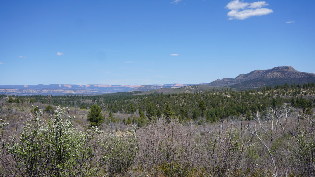
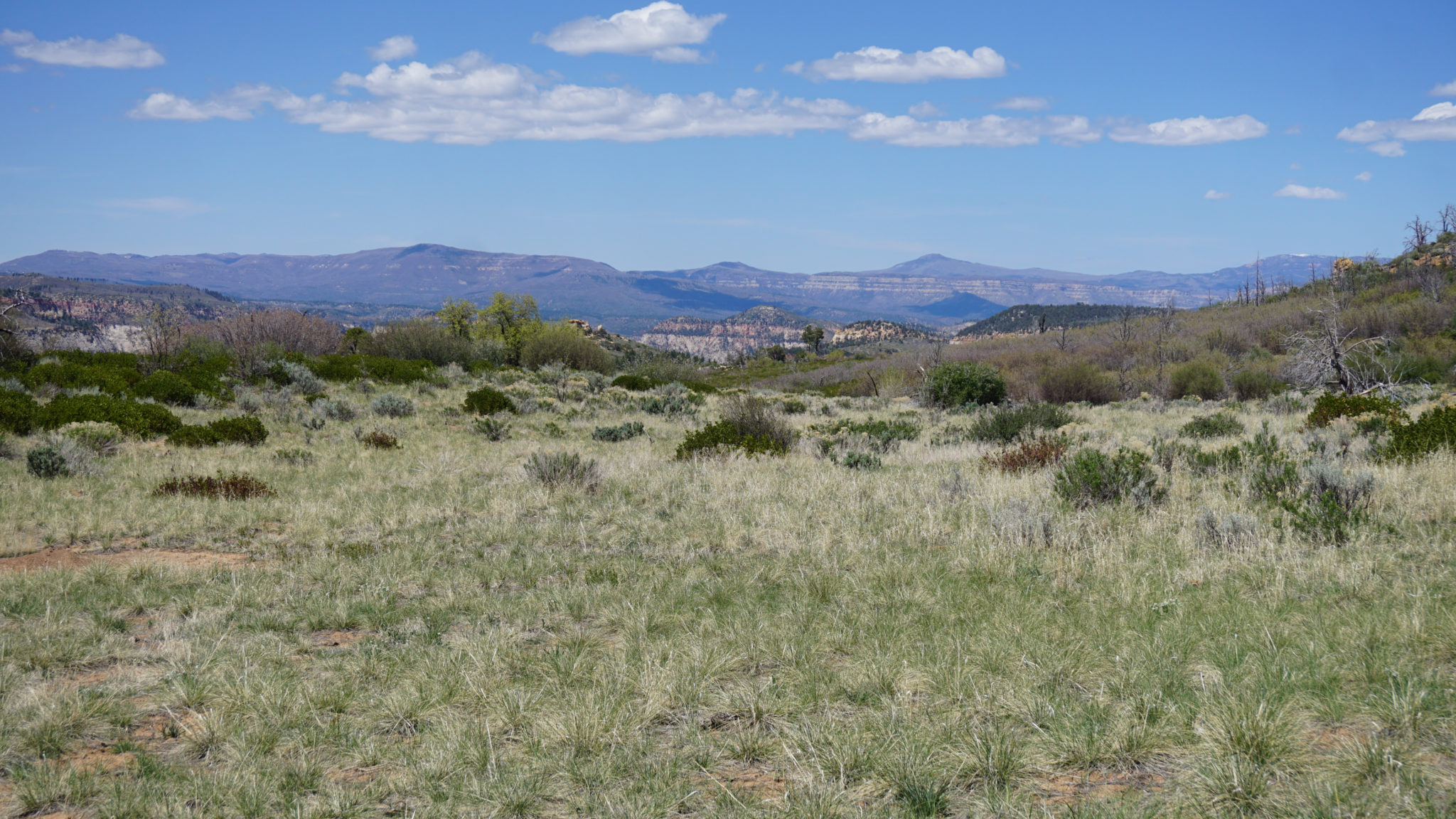
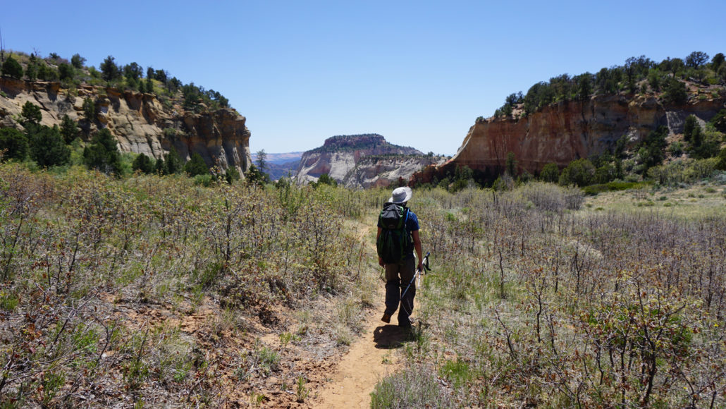
As you continue you southwest from the junction, the trail begins an extended descent through an open landscape that burned extensively in 2007. Much of the shrub vegetation is recovering nicely, but the trees are taking a lot longer to bounce back. The upshot of this means clear views across a vast landscape of endless plateaus, but the dead trees through this section do induce a sense of loss. The descent eases at 2.5 miles as the trail bends south around the flanks of Peak 6936 to contour around the headwaters of Hidden Canyon to the north. At the 3.6 mile mark, the trail reaches the southern rim of East Mesa, revealing impressive views south across Clear Creek Canyon’s convoluted array of peaks, mesas, valleys, and canyons.
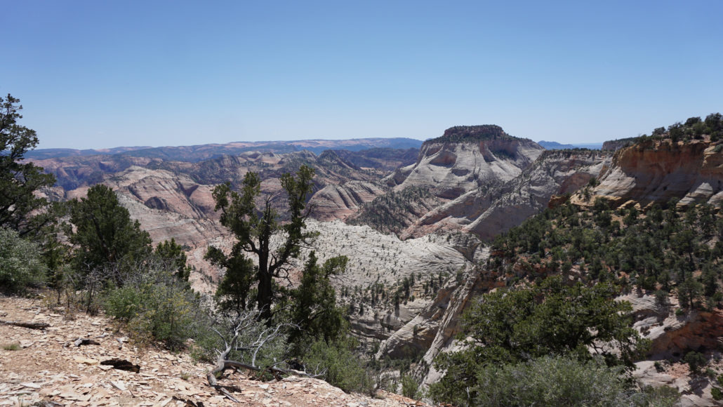
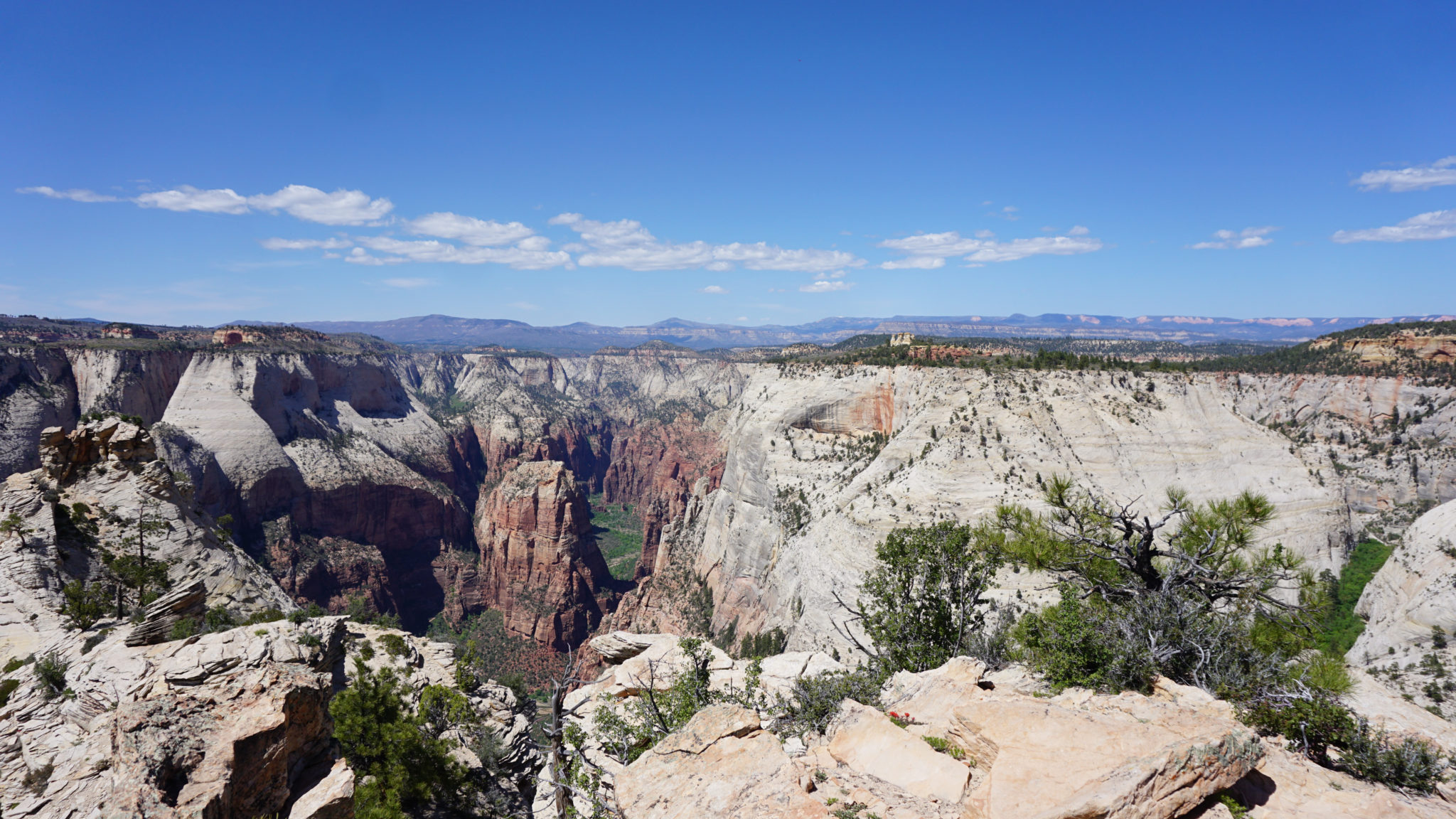
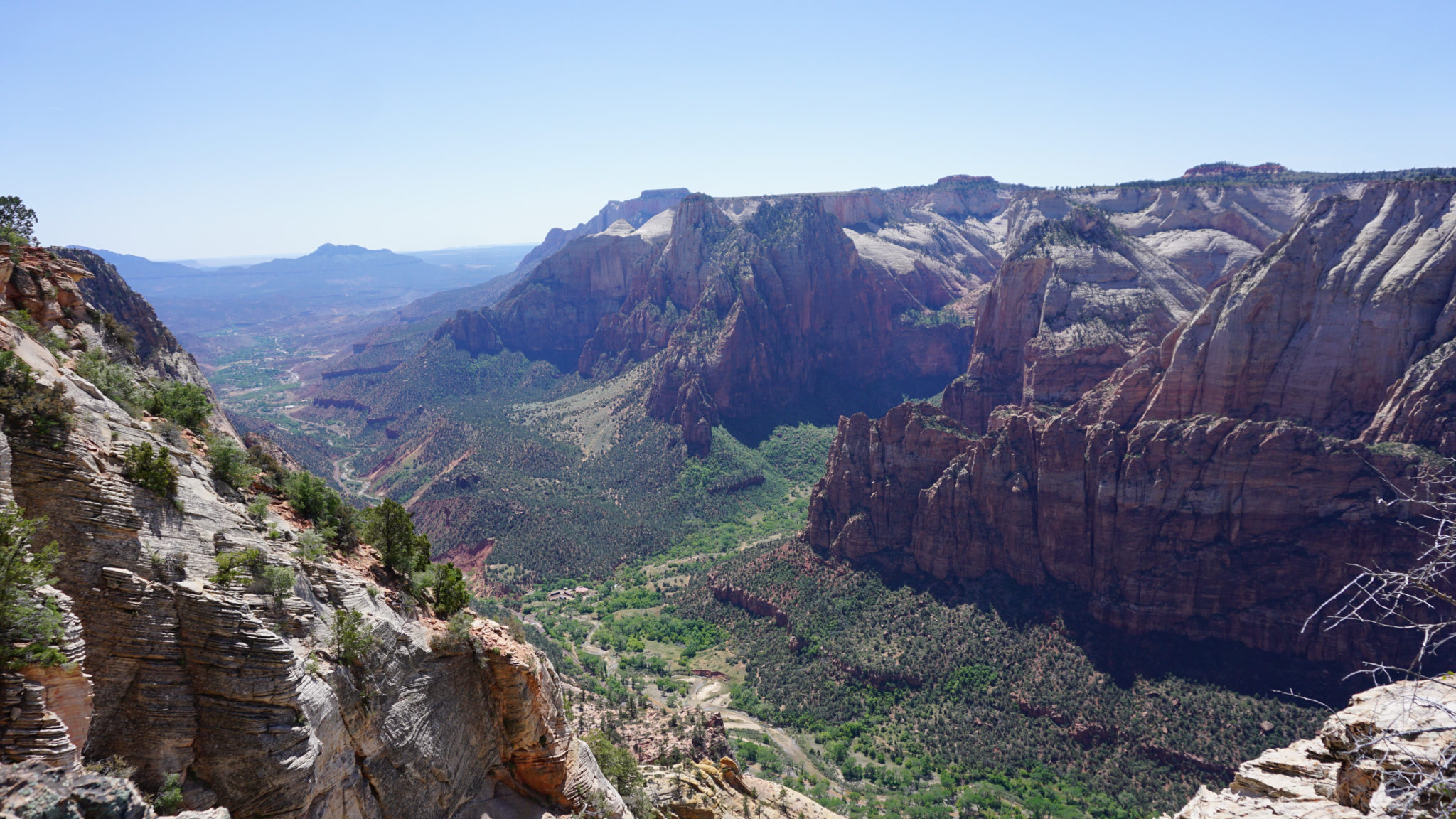
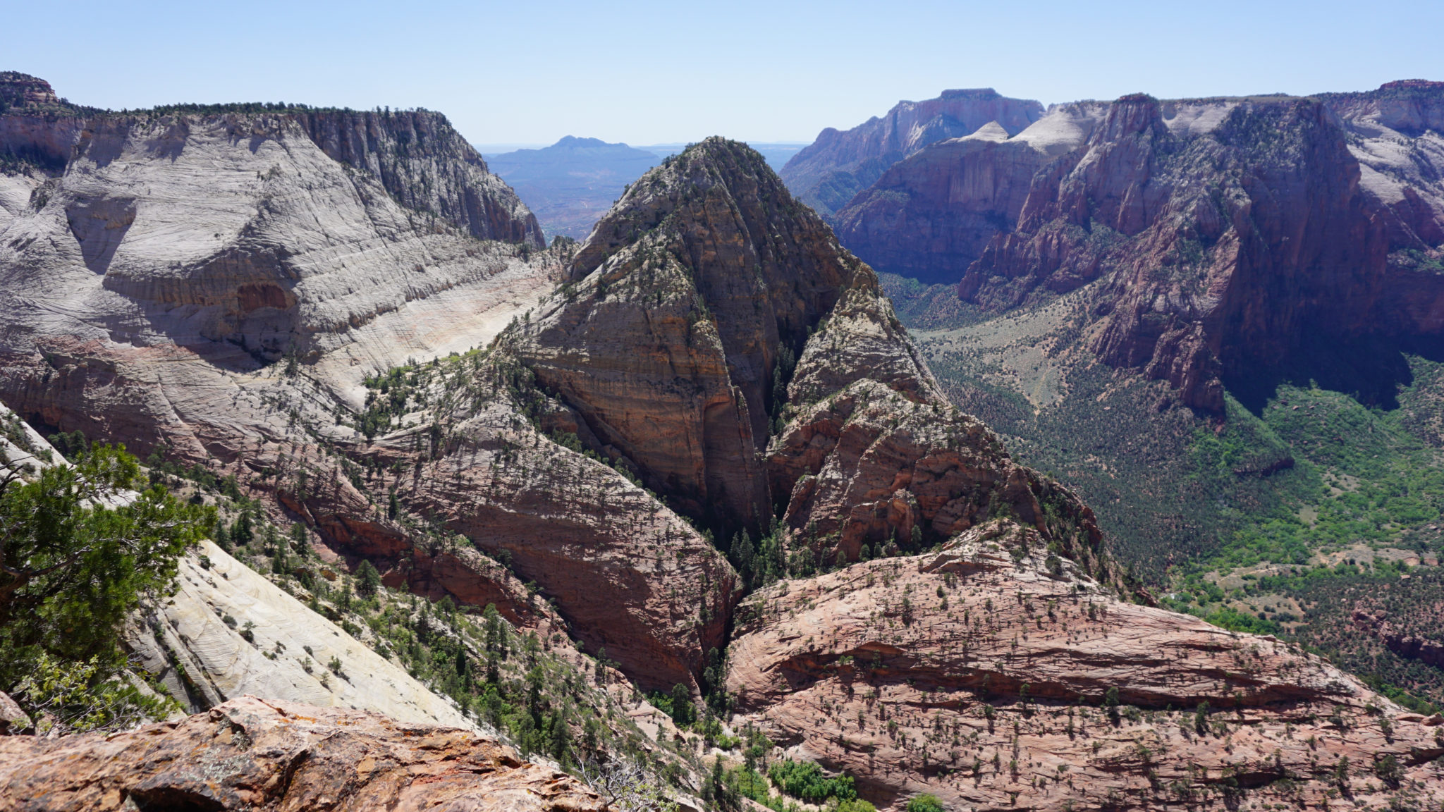
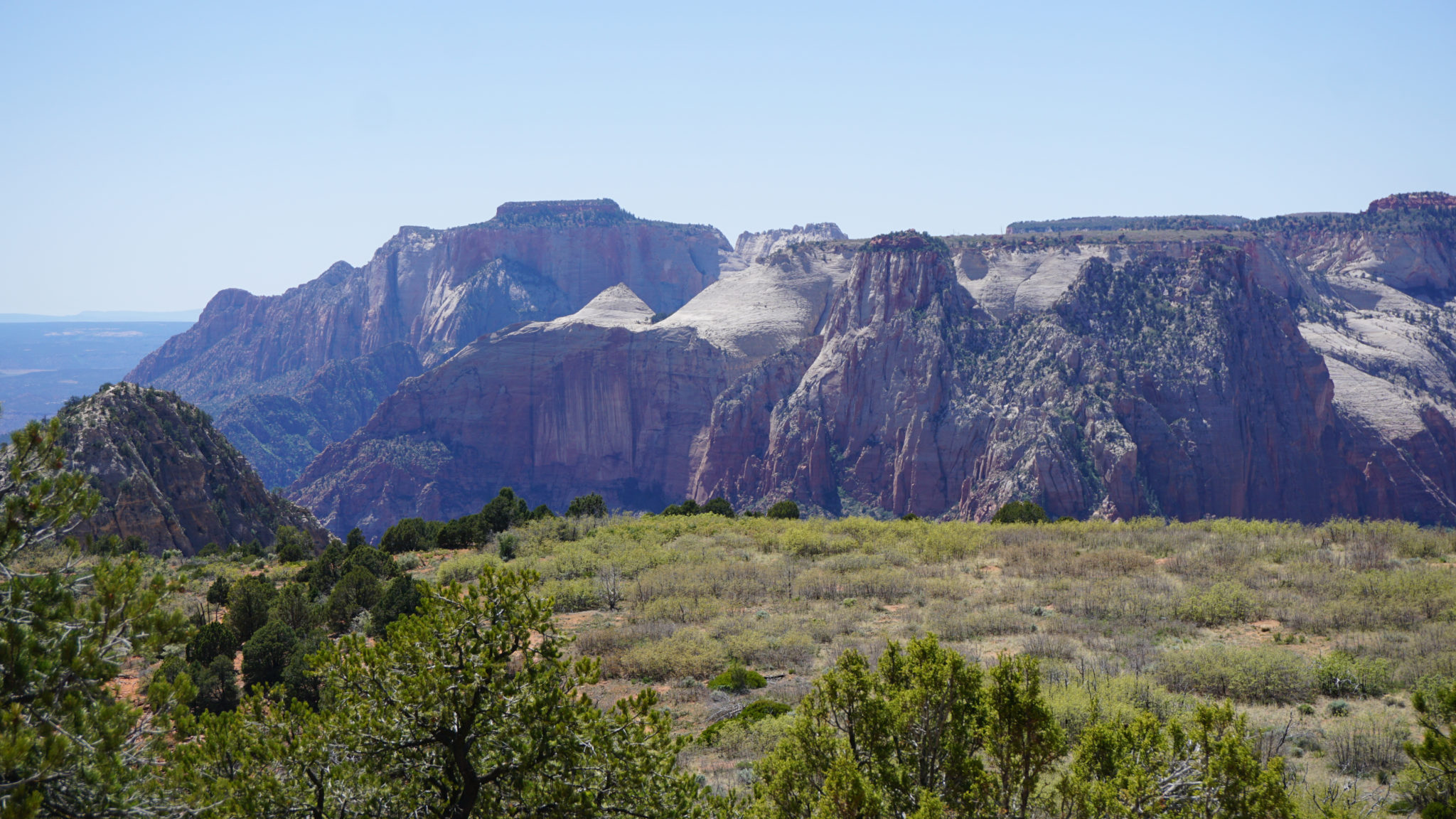
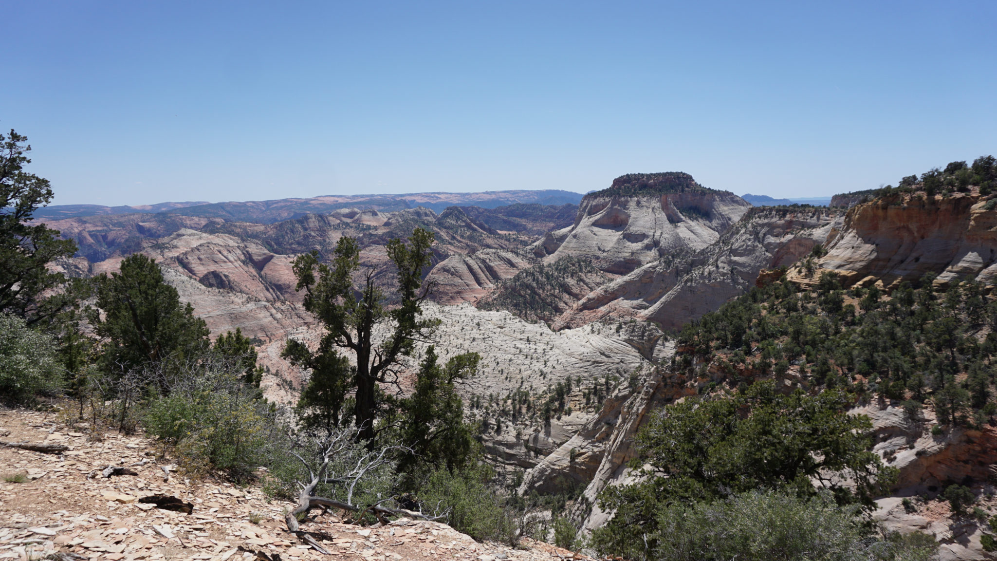
After turning northwest from this viewpoint, the trail next climbs over a mesa before dipping down into a valley perched between a second mesa just to the west. The brief flat reprieve in the valley comes to an end at 4.1 miles as the trail climbs up and over the second mesa. By this point, you’ll begin to spot a few formations on the upper level of Zion Canyon’s western wall, including the West Temple, the Beehives, the Altar of Sacrifice, and the Towers of the Virgin. However, the full reveal of the canyon awaits until the trail suddenly – shockingly, even – reaches the very rim of Zion Canyon at 4.6 miles. The sudden reveal of virtually every landmark on the southern half of the canyon is an inspired moment, and it’s not often that amazing views like this become so fully realized so suddenly.

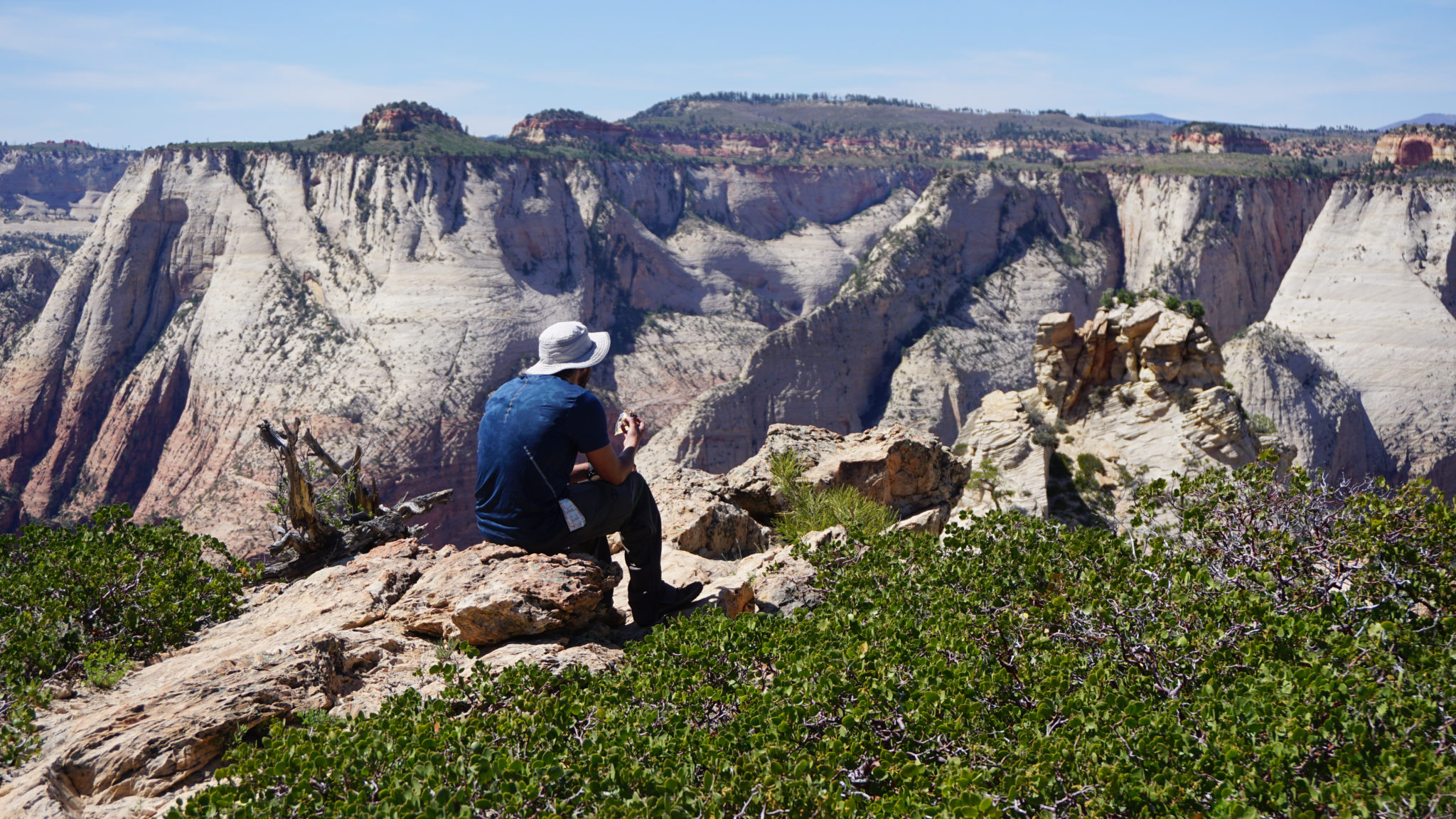
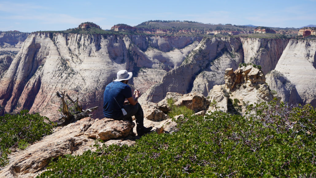
At the rim of the canyon, turn right to continue along the trail as it heads due north along the rim of the canyon. The views are absolutely stellar the entire way, but there’s a final review still to come once you reach the northern edge of Deertrap Mountain. From the northern rim, peer down into northern Zion Canyon to spot Angels Landing – looking positively quaint from this elevation – along with various features such as Observation Point, Cable Mountain, the Organ, the Horse Pasture Plateau, and parts of the Temple of Sinawava. The high, windswept plateaus bewhiskered with ponderosa pines that normally remain out of sight from the canyon floor are also visible, fully revealing the hidden world capping the sandstone showcase within the canyon. There are fewer lunch spots in Zion with such an outstanding view, and you’ll want to set aside an hour at the very least to fully enjoy the scene.
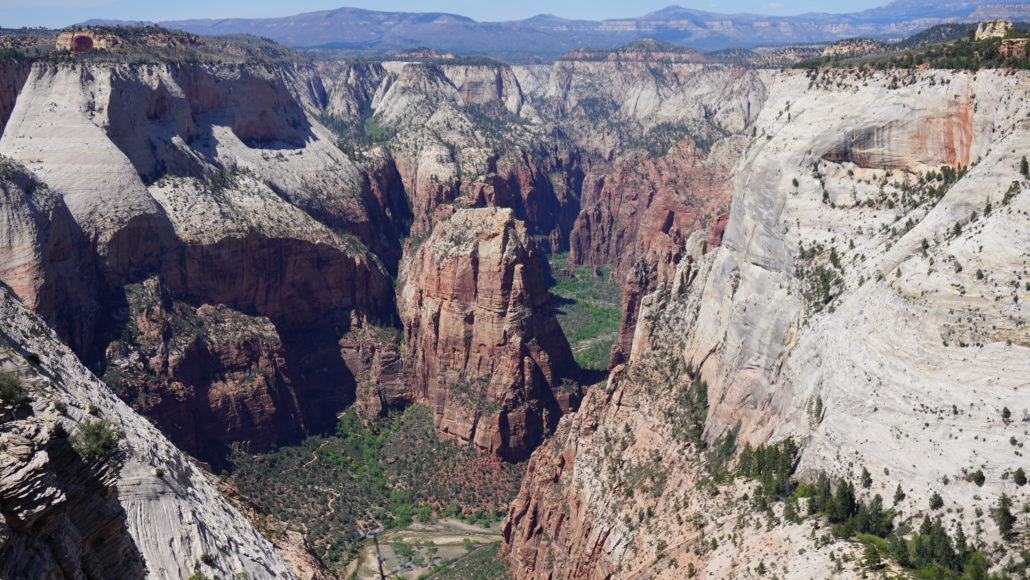
Angels Landing is in the middle of the frame
For the return, retrace your route back to return to the Stave Spring Trailhead. There aren’t any considerable challenges aside from some elevation that you’ll gain on the return journey, but that little extra bit of effort on the back half of the hike can produce a few psychological challenges that take some of the shine off of the experience.
Tags: Angel's Landing, Backpacking, Cable Mountain, Clear Creek, Court of the Patriarchs, Deertrap Mountain, East Rim Trail, East Temple, Mountain of the Sun, Stave Spring, Stave Spring Trail, West Temple, Zion Canyon, Zion Ponderosa Ranch