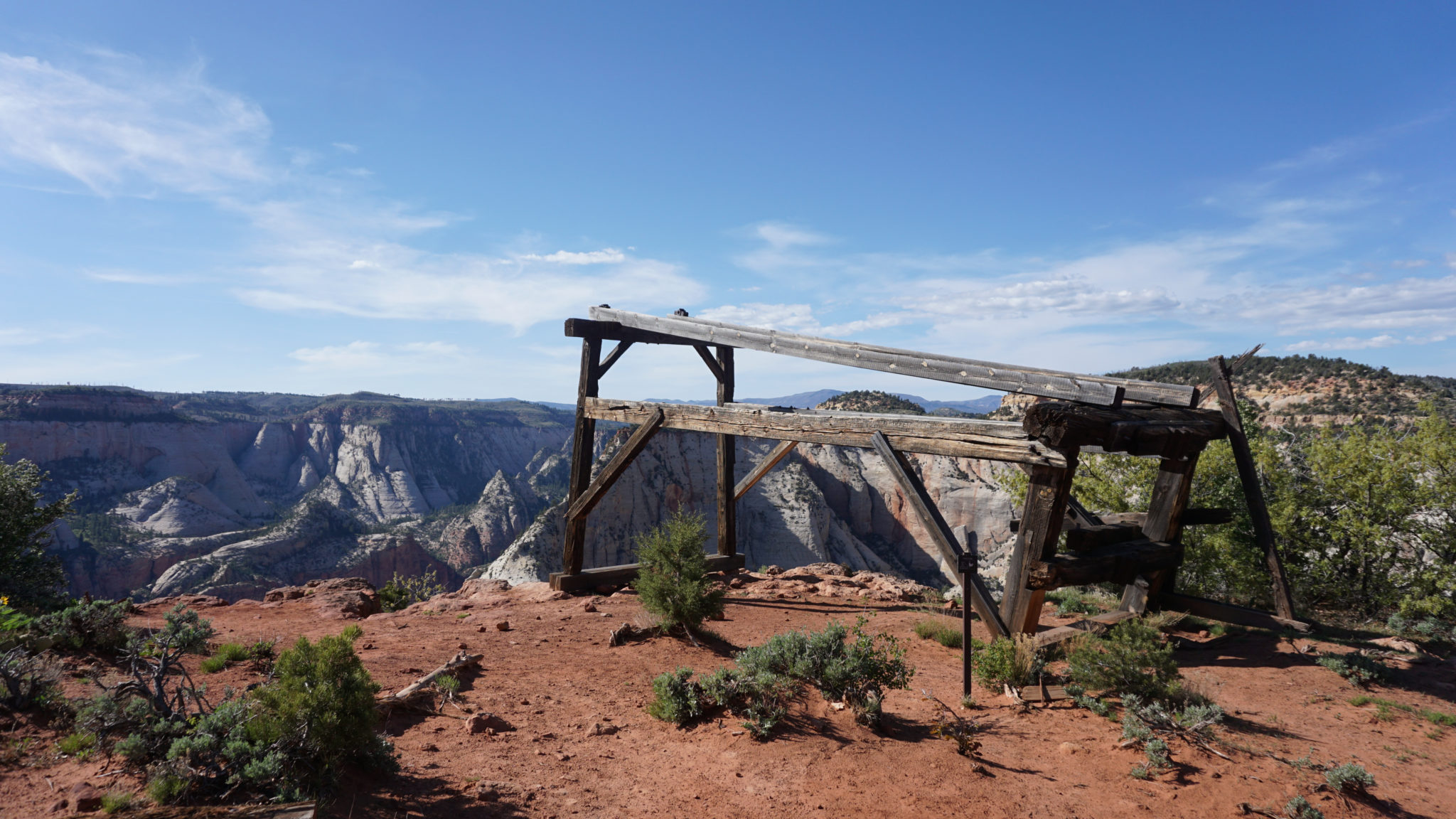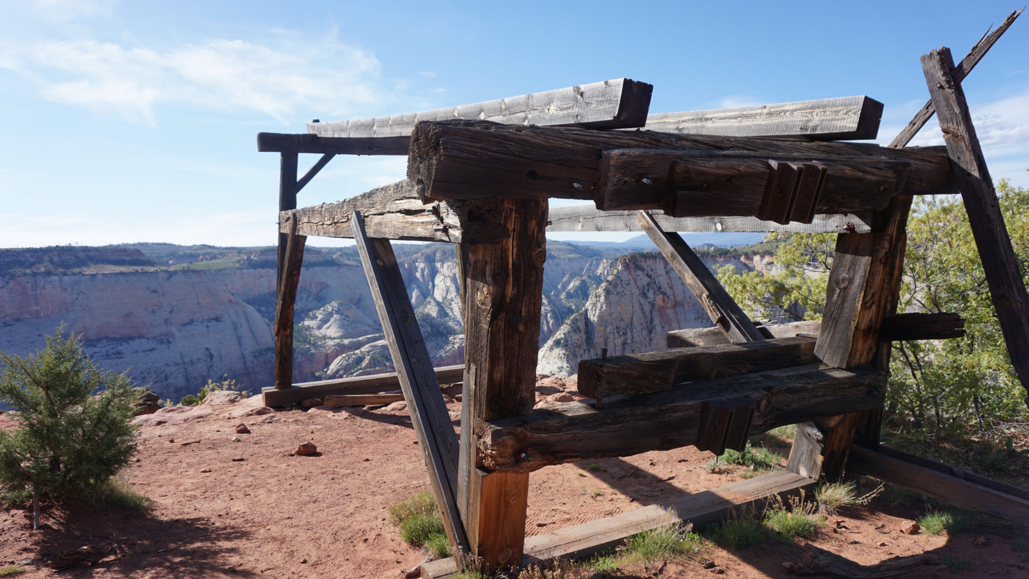
If you take the time to peer into the history of any given National Park, chances are that you will come across some slightly ridiculous scheme to solve some seemingly insurmountable challenge. At Zion National Park, such a scheme resulted in a convoluted cable works system designed to transport timber from the wooded highlands of East Mesa down to the canyon floor to aid and abet the construction of the Zion Lodge. The cable works went into use around the turn of the 20th century, and through their help, the original developers of then Mukuntuweap National Monument used the cables to lower ponderosa pine timber down a 2,300-foot sheer cliff to the relatively timber-poor canyon below. The original structure still remains standing upon the lip of Cable Mountain, and this hike leads you on a satisfying journey across a forested plateau to a point where you can tiptoe to the very rim of Zion Canyon.

The Organ, the Weeping Rock Trailhead, and the Virgin River from the edge of Cable Mountain
There are three different ways to reach Cable Mountain, and this write-up focuses on the easiest of the trio, the Stave Spring route. This route is the most direct and the easiest way to reach the cable works, and it makes for a wonderfully relaxing escape from the bustle of Zion Canyon. However, for reasons that will become apparent shortly, this route is not always available. It is also a bit of a challenge and a fairly long drive to even reach it. I therefore include a short description of how to reach Cable Mountain via Weeping Rock Trailhead and via the East Rim Trailhead.

Wilderness Permits
Please note that you can camp near the cable works, as the flat top of the mountain offers some appealing looking campsites. The park asks that, in addition to adhering to the traditional Leave No Trace principles that hikers camp at least 200 feet away from the edge of the cliff. To obtain an overnight wilderness permit, you can try your luck walking into the Wilderness Permit office at the Zion Canyon Visitor Center, or you can reserve one in advance. Visit this website to begin the process of reserving your permit in advance.
Note that advance reservations for permits become available two months prior on the 5th day of each month. So, if you were going to reserve your permit for a date in March, the permit for that time would be available on January 5th. There’s a $5 refundable fee to process the permit, plus an additional fee based off of your group size.

Driving Directions to Stave Spring:
From Zion National Park’s east entrance on the Zion-Mt. Carmel Highway (UT-9), continue east on Zion-Mt. Carmel Highway for 1.7 miles (2.7 km) to a junction with N. Fork County Road, and turn left. Continue for another 5.2 miles (8.4 km), and turn left at the sign for Zion Ponderosa Ranch Resort. Be sure to keep right on the unpaved road past the resort entrance, and continue on Pine Angle Rd./Twin Knolls Rd. After 0.7 mile (1.1 km), turn left to remain on Pine Angle Rd., then make an immediate right onto Buck Rd. Continue on Buck Rd. for 0.6 mile (1.0 km), and then make a left onto Beaver Rd. Beaver Rd. quickly reaches a T-junction with Pine Street. Turn right and follow Pine Street to its terminus at the Stave Springs Trailhead. Low clearance vehicles may not want to drive the last 100 yards (90 m) to the trailhead, as there’s a ditch with poor clearance that could cause you to get stuck. Look for nearby parking before the ditch.
PLEASE NOTE: The road to the Stave Spring Trailhead becomes impassable during snowstorms or when it becomes wet. Check weather conditions in advance, and only attempt this route when the weather is favorable. If the weather is not favorable, you risk stranding your car along an impassable dirt road. This is true even for 4WD vehicles, and I recommend that Jeepers don’t take this as a challenge. I’ve heard of multiple incidents where cocky Jeepers got stuck and needed an expensive assist to get back out again. You can also call Zion Ponderosa Ranch Resort ((800) 293-5444) to obtain more detailed information on road conditions.
Stave Spring Trailhead to Cable Mountain
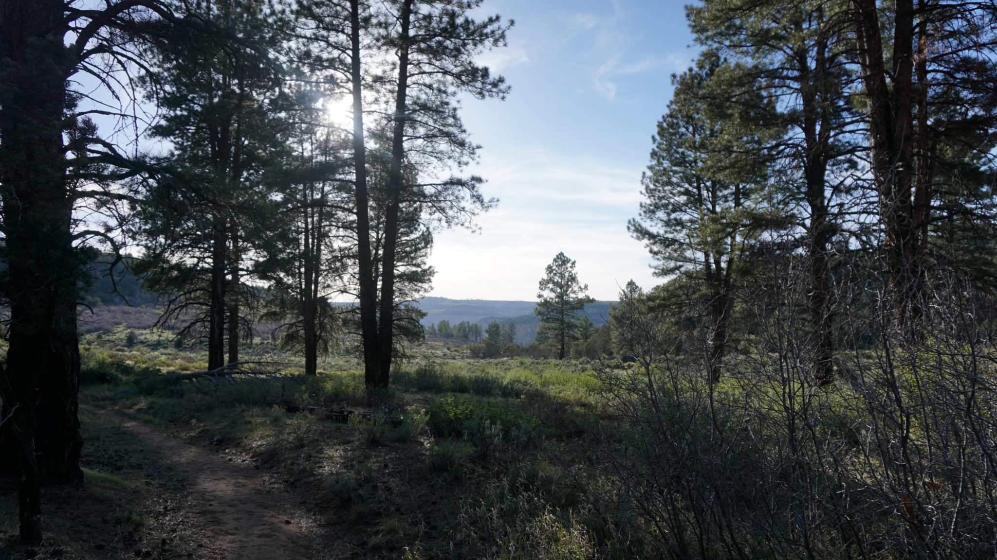
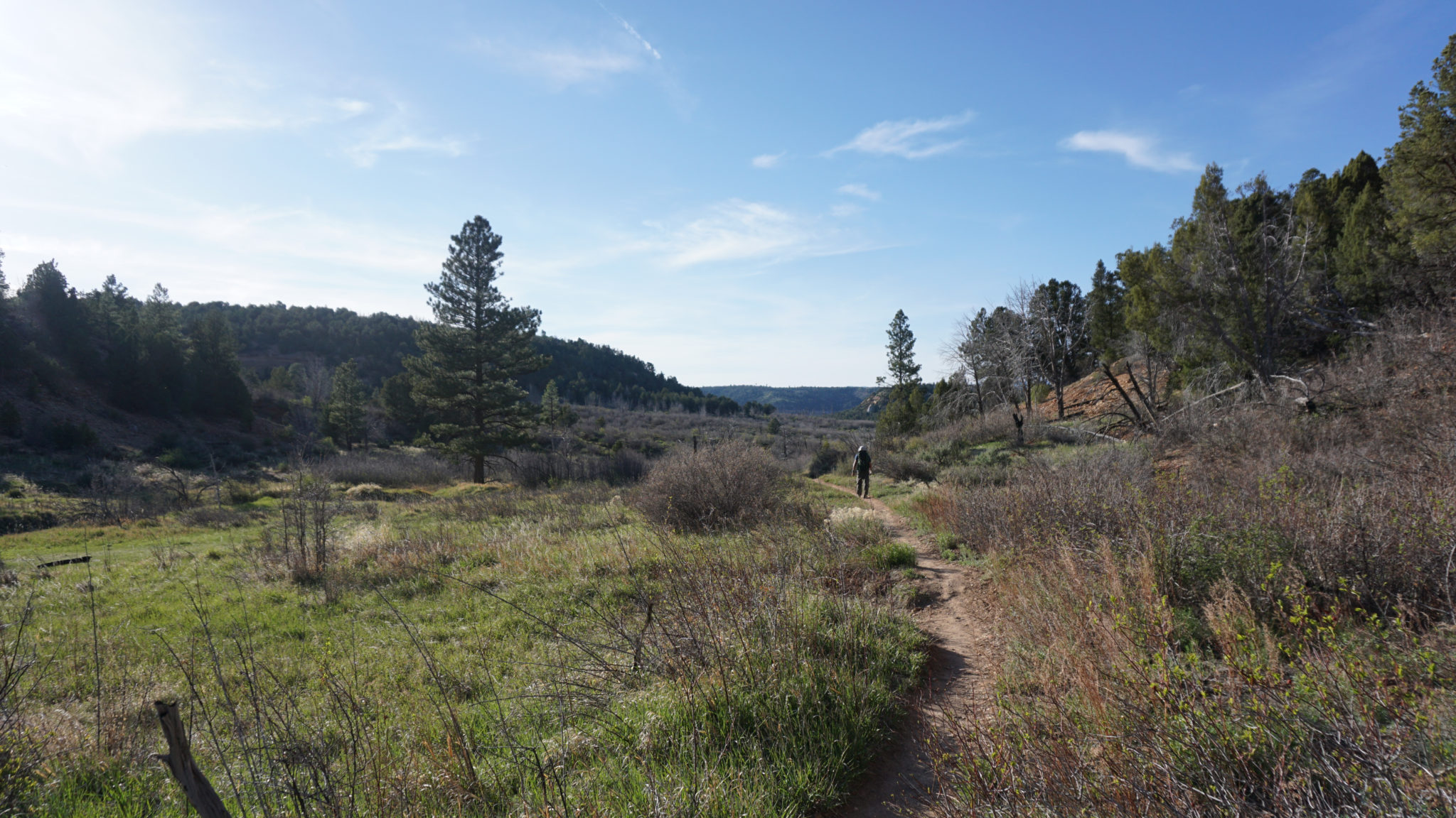
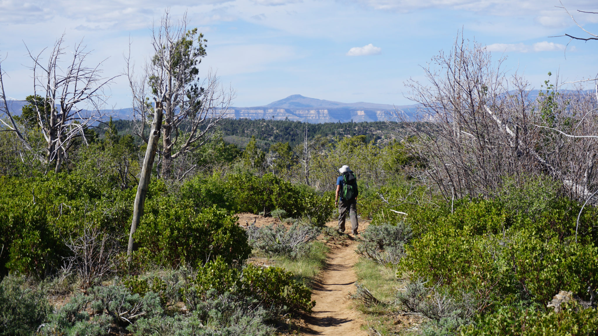
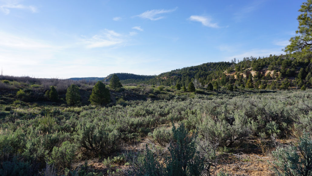
From the Stave Spring Trailhead, head west on a former dirt road that the park has reverted to a single track trail as it hugs the edge of a spacious meadow carpeted in sagebrush and rimmed with ponderosa pine. After 0.5 mile, turn left at a junction with the East Rim Trail, and begin climbing through a broad ravine toward another junction with the combined Cable Mountain/Deertrap Mountain Trails.
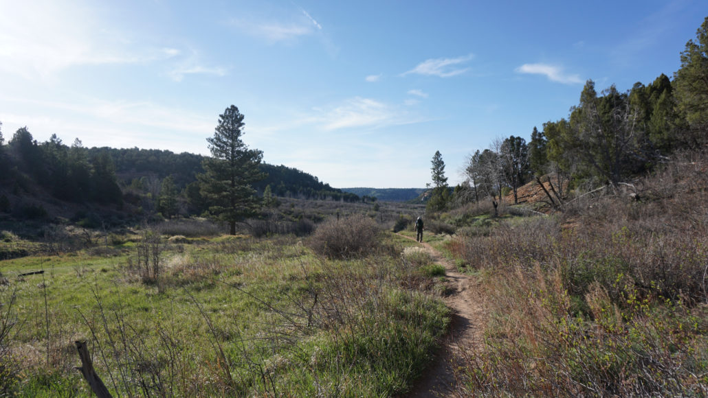
At 0.8 mile, the East Rim Trail splits off on the left. If you need water, you can follow the East Rim Trail for 200 yards to Stave Spring. Stave Spring is seasonal, so you will want to inquire with rangers at the Zion Canyon Visitor Center to determine whether there will be water. If you don’t need water, turn right on the combined Cable Mountain/Deertrap Mountain Trail. Continue climbing through fire-damaged forest with open views across the Zion highlands for another 1.1 mile to a junction where the Cable Mountain and Deertrap Mountain Trails diverge. Turn right at 1.9 miles toward Cable Mountain.
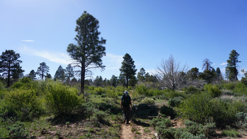
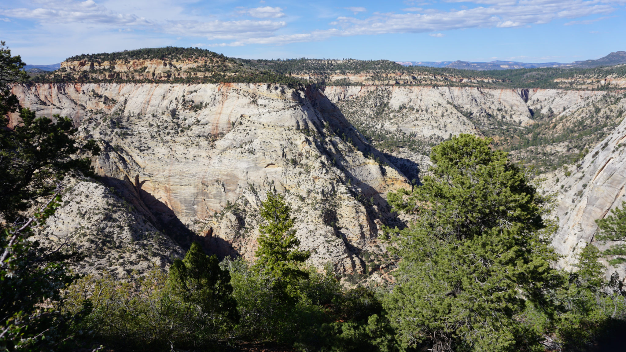
The approach to Cable Mountain is a bit unusual in that you actually descend to the top of the mountain. The trail tops out just to the east of Peak 6940 at 2.25 miles before beginning a lengthy descent. The first 0.6 mile of the descent follows a relatively mellow incline downhill through a dense forest of pinyon pine and Utah juniper. The grade steepens appreciably starting at a switchback at 3.1 miles before becoming less severe on the final descent.

The ruins of the cable works
At 3.6 miles, the trail bottoms out at a flat clearing just above the rim of Zion Canyon. At this point, you will see the cable works structure, along with several leftover beams that have been stacked around the flat former site of the cable works operation. Please do not climb on or otherwise disturb the cable works as they are a fragile historical landmark.
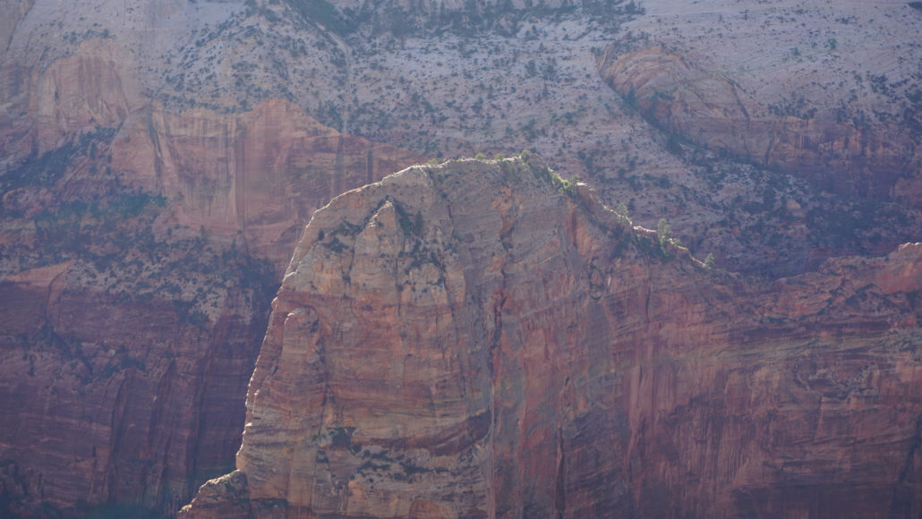
The summit of Angels Landing
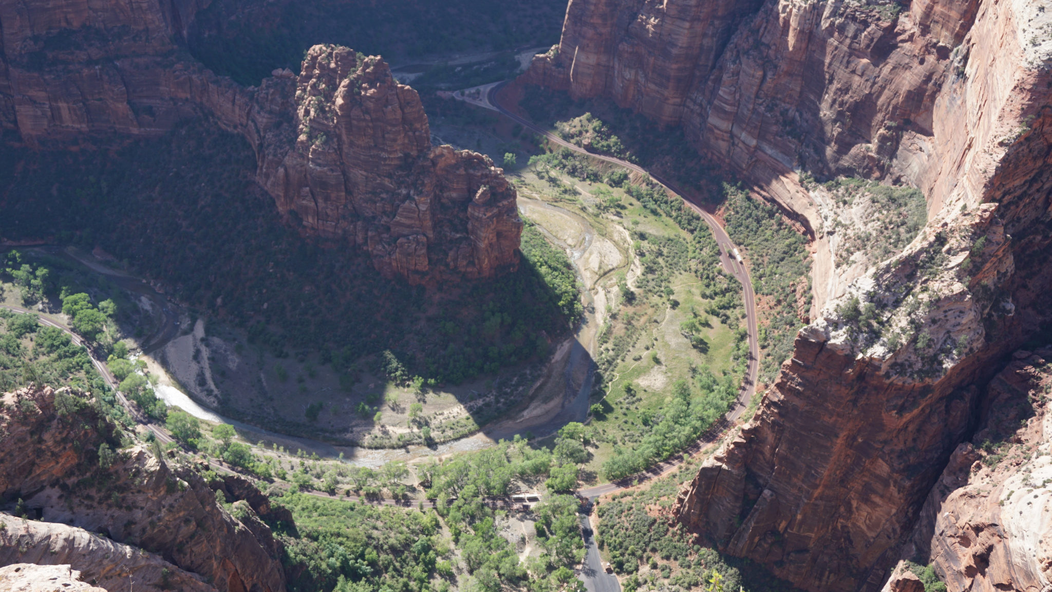
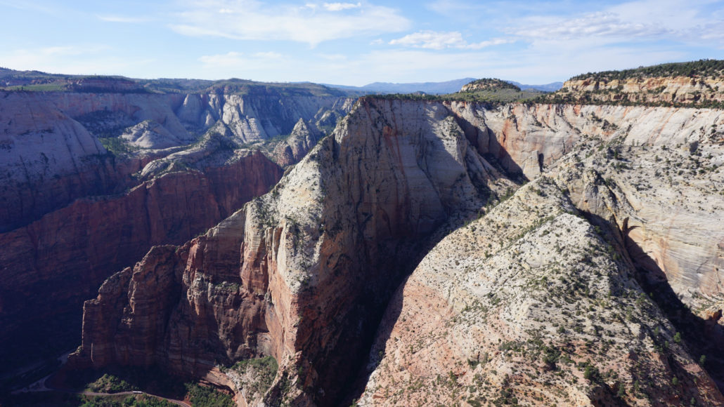
In addition to the cable works, Cable Mountain treats you to extreme views into the heart of Zion Canyon. If you have the gumption to tiptoe to the edge of the cliff, you can peer straight down to see the East Rim Trail winding uphill from Weeping Rock. Angels Landing tops out about 600 feet below you, and you have a great view directly across the canyon toward Observation Point. See if you can spot the Z-shaped trail carved into the edge of the cliffs.
Observation Point
The cable works are the end of the line, and from here you can backtrack to your car. You have a 600 foot climb from the cable works to the route’s highpoint on the way back, so hike conservatively to keep some energy in reserve. If you have time and energy for a longer trip, you can also tack on an optional journey to Deertrap Mountain, which is a brilliant hike on its own. The two routes combined add up to about 14 miles and 2,400 feet of elevation gain. This satisfying combo is a great way to spend a full day in the East Rim area.

Can you spot the Observation Point Trail in the center-left of frame?
Alternative Approaches to Cable Mountain
If you find out that the road to the Stave Spring Trailhead is impassable, you have two very challenging options for alternate approaches. Note that my wonky GPS track includes the tracks for both of these trails for your reference.
The East Rim Trail from the East Rim Trailhead begins just west of the park’s East Entrance on the Zion-Mt. Carmel Highway. The East Rim Trail climbs up from Clear Creek and continues west toward the Stave Spring Trailhead at 5.8 miles. From there, you follow the directions above from the Stave Spring junction to Cable Mountain. This is a 17.2 mile hike with about 3,000 feet of elevation gain.
The East Rim Trail from Weeping Rock Trailhead climbs from the bottom of Zion Canyon at Weeping Rock (Shuttle stop 7), and climbs up to the Observation Point Trail junction. Keep right there, and continue working through the rocky canyon until you reach a junction with the Stave Spring Trail at 4.1 miles. From there, follow the directions above to Cable Mountain, beginning from the first junction at 0.5 mile. This is a 14.5 mile hike with 4,200 feet of elevation gain.
Tags: Angel's Landing, Cable Mountain, East Rim Trail, East Rim Trailhead, Great White Throne, hidden canyon, observation point, Stave Spring, Stave Spring Trailhead, Weeping Rock Trailhead, Zion Canyon, Zion Lodge, Zion Ponderosa Ranch Resort