An epic epic of epic epicness. That’s really the only way to describe this odyssey through some of the most picturesque and magnificent scenery in a National Park already full of superlative scenery. On this massive dayhike or slightly less excruciating overnight, you will climb up and out of Zion Canyon onto the flat, wind-swept plateaus that stand apart from the dramatic scenery below. The views are “good” with a capital “Holy Mother of God,” and the experience of passing through so many remarkable settings is sure to sear this hike into your cortex for years to come.

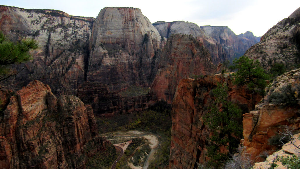
This route follows the West Rim Trail from the Grotto Trailhead through Refrigerator Canyon to Scouts Lookout and the junction for the famed and now overused Angels Landing Trail. Most hikers stop here to enjoy the iconic Angels Landing approach and views, but relatively few hikers continue beyond Angels Landing as the trail climbs up through a hidden valley high above the Temple of Sinawava before climbing through a cool canyon to reach the the Zion highcountry. A gently looping trail offers far-ranging views in all directions, sampling the layer cake landscape characterizing southwestern Utah. You will be hardpressed to find a more comprehensive single day trip anywhere in the park, with the exception perhaps of Observation Point.

Although conditioned hikers can complete this route over the span of a fairly long day, the option for backpacking may prove more inviting. Several designated sites line the route at irregular intervals beginning just beyond the junction with Telephone Canyon and continuing toward the southern junction between the West Rim and Telephone Canyon Trails.

Backpacking in Zion National Park requires a wilderness permit, which you can reserve in advance or, if you’re feeling lucky, attempt to procure the day of or before your hike. Given that even this lightly visited area can fill up during Zion’s high season (late spring through early fall), it behooves backpackers to reserve their permits in advance. Using Zion’s online permit reservation system, you can attempt to reserve a specific campsite. On the 5th day of every month at 10:00 am Mountain Time, campsite reservations become available for the month after the next month. For example, if it is January 5th, campsite reservations would become available for March.

Also remember that a permit reservation is not the same as the actual permit. Before you commence your hike, you will need to obtain your actual permit from the Zion Visitor Center. Until you actual have the paper permit in hand, and until you’ve demonstrated to the issuing ranger that you understand Leave No Trace principles and that you are ready for your endeavor, you will not be able to start your hike. Yes, this process is as convoluted as it sounds, but so it goes with National Parks as popular as Zion.

From the Grotto Trailhead, cross the road and then cross the Virgin River by following the bridge. Once on the other side, turn right and begin to climb toward Angels Landing. Initially, the climb is moderate, but the grade becomes steeper as the trail switchbacks up to Refrigerator Canyon. The grade evens out somewhat within the cool confines of Refrigerator Canyon until you reach the base of the famous Walter’s Wiggles. These tight switchbacks pull your grudging legs up to Scouts Lookout where a two-way junction offers the choice between the Angels Landing Trail on the right or the West Rim Trail on the left.

If you have time, you can tack on Angels Landing, but if you’ve been up there before, you may want to sit the opportunity out. With each year, the trail becomes more and more crowded, and the park service even had to close it temporarily in November 2016 because of vandalism committed over Veterans Day weekend. Nobody loves red tape, as it makes simple hikes more and more difficult. However, my money is on Zion NP instituting a permit system for dayhikes within the next five years to mitigate the overuse. If you do attempt Angels Landing as part of this hike, it’s best to do it on the front end. Not only will you reach the top when the trail is relatively quiet, but you will also be running on fumes by the time you get to this point on your return journey.

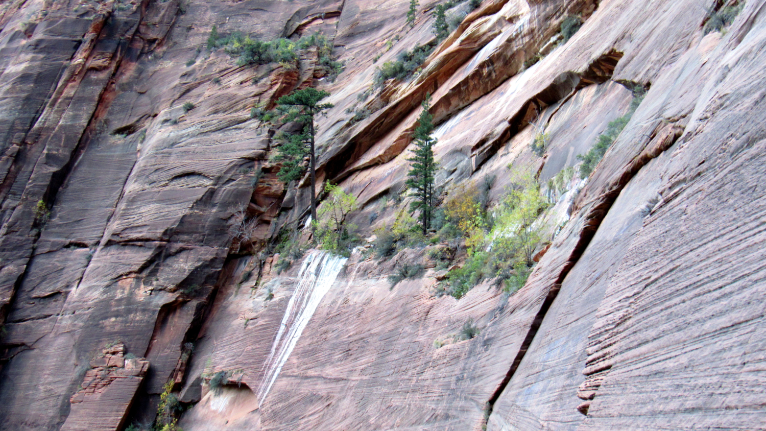
Beyond Scouts Lookout, the trail climbs away from the throngs and follows the narrow ridge dividing Refrigerator Canyon and Zion Canyon over a thousand feet below. At a handful of spots, the trail passes over slickrock where signs indicate the route. The towering massif of Cathedral Mountain dominates the skyline to your left. The intricate criss-crossing erosionay patterns reflect constantly changing wind patterns that occurred when this section of Navajo Sandstone accumulated 140+ million years ago. These criss-cross patterns are similar to those found at Checkerboard and Crazy Quilt Mesas on the east side of the park.

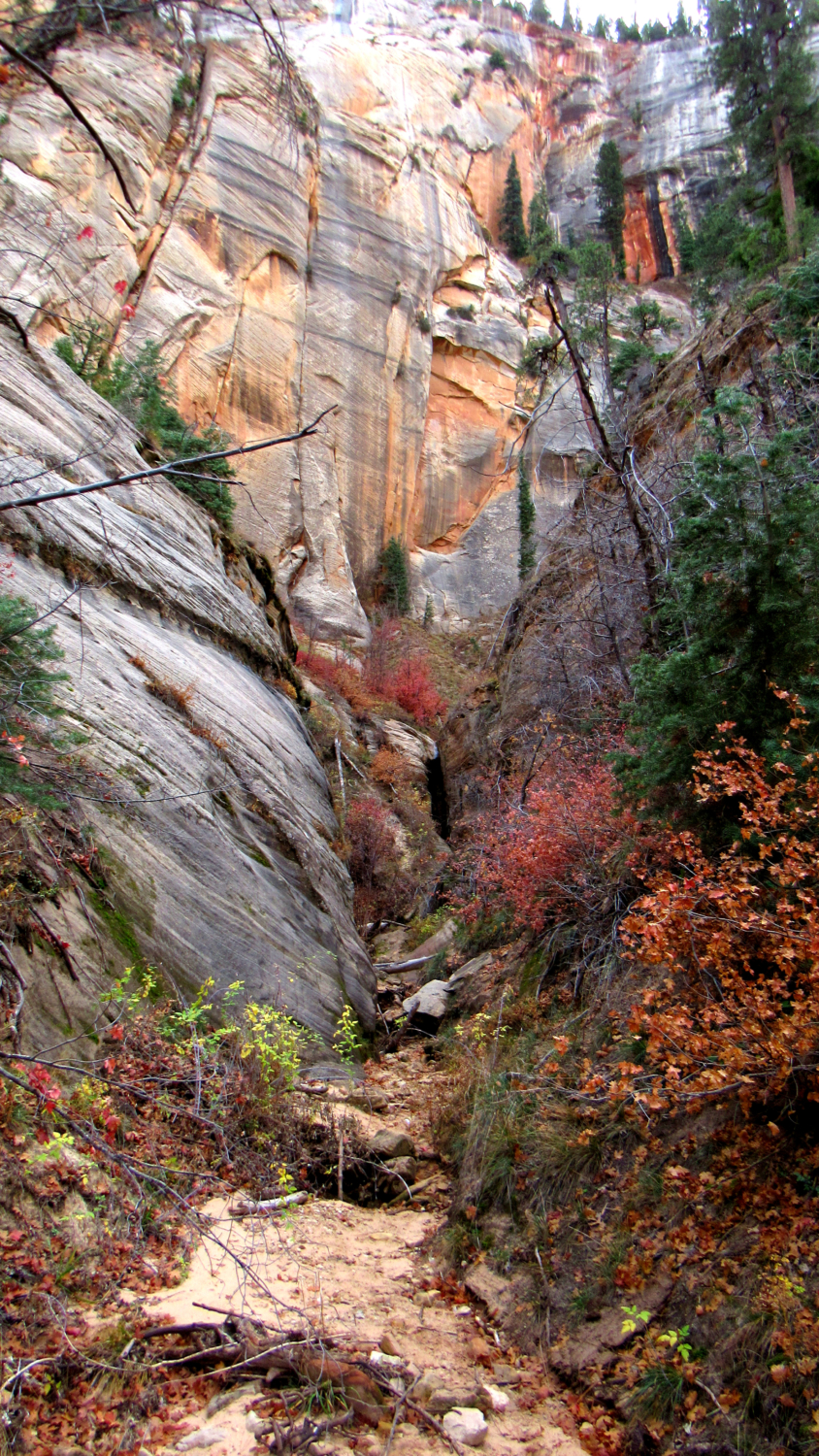
At 2.7 miles, the trail descends 250 feet into a hidden valley. After dipping into a ravine and crossing a bridge, the trail resumes climbing obliquely along the northern flank of Mount Majestic. This north-facing slope is often a full 10-15 degrees cooler than the rest of the hike, and the tendency to retain moisture thanks to less sun exposure creates a much lusher vegetation schema dominated by Douglas firs, ponderosa pines, and several deciduous shrubs that add splashes of color during fall.

The trail continues climbing in a generally westward direction until reaching a saddle overlooking the headwaters of Behunin Canyon. From the saddle, the trail turns to the northeast to make a handful of long switchbacks along the south face of the Horse Pasture Plateau. After a bit more gut-wrenching climbing, the trail tops out at a 5-way junction with a spur trail leading to a spring, a spur trail leading to a campsite, the Telephone Canyon Trail, and the continuation of the West Rim Trail. A flat, shady section beneath a large ponderosa pine offers a place to take the view-packed break you’ll so richly deserve. The bulk of the climbing is now behind you, and you can now fully enjoy the spectacular scenery looking north across the now-hidden crease of Zion Canyon.

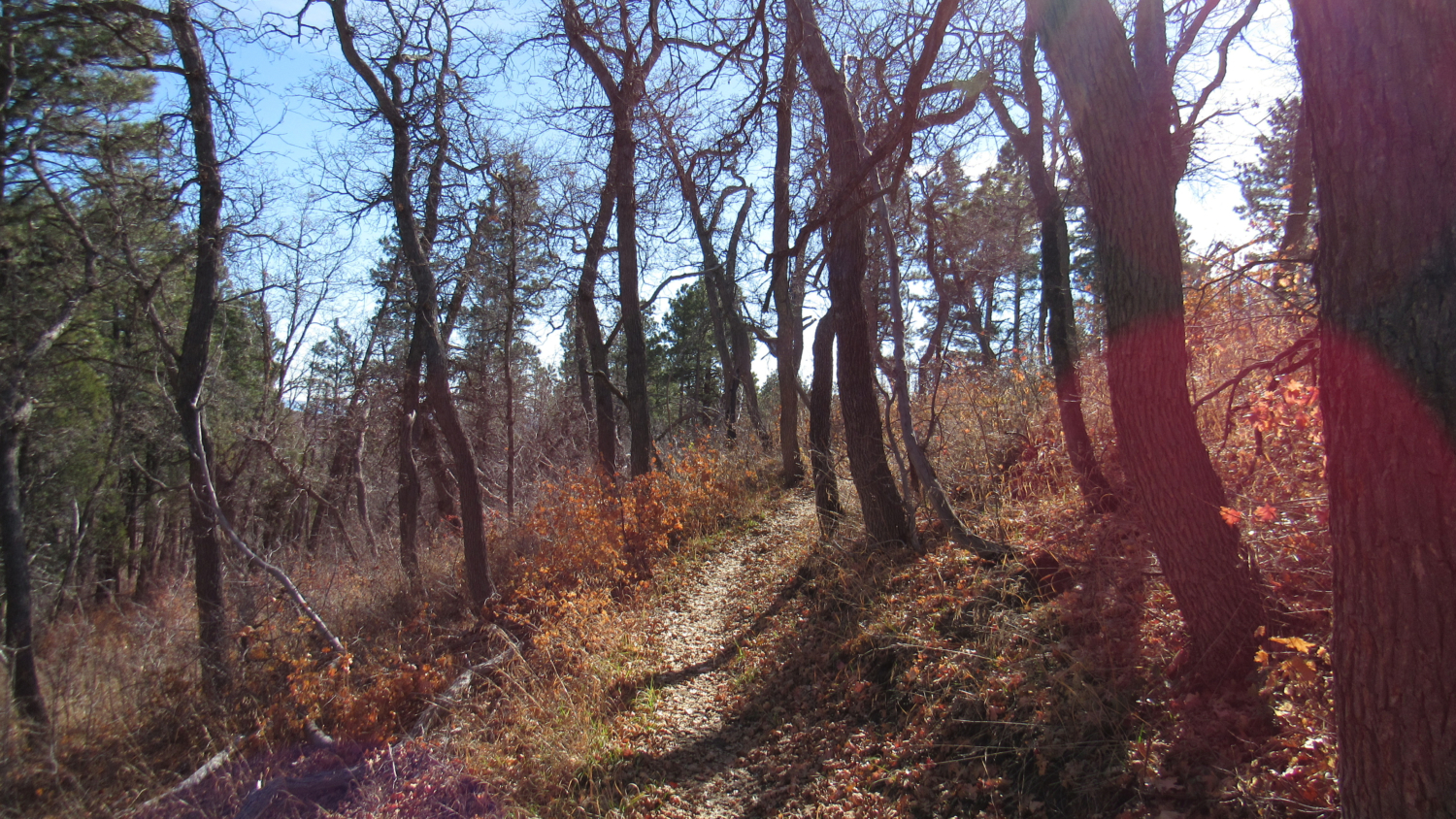
You can take the loop along the top of the plateau in either direction you prefer, but I recommend taking the Telephone Canyon Trail on the right to travel counter-clockwise. The scenery, which is mostly grasslands and thin forest recovering from a 2007 wildfire, will not drop any jaws after the phantasmagoria of sandstone you recently endured. However, the gently inclining trail, absolute lack of traffic, and cool breezes along the mellow Telephone Canyon Trail will prove a suitable reward after the serious exertion it took to reach this point.

The trail continues north along the Telephone Canyon drainage. Below the rim, Telephone Canyon is a steep, technical climb popular with canyoneers. Up top, the canyon is a gentle, broad drainage dotted with ponderosa pines. The path continues along this drainage through a dwarf forest of deciduous oaks before culminating with a junction with the West Rim Trail. The West Rim Trail continues north toward Potato Hollow (a possible water source during wetter times). Turn left at this junction to begin traveling south toward what will prove to be some of the most astonishing views you will see on the route.

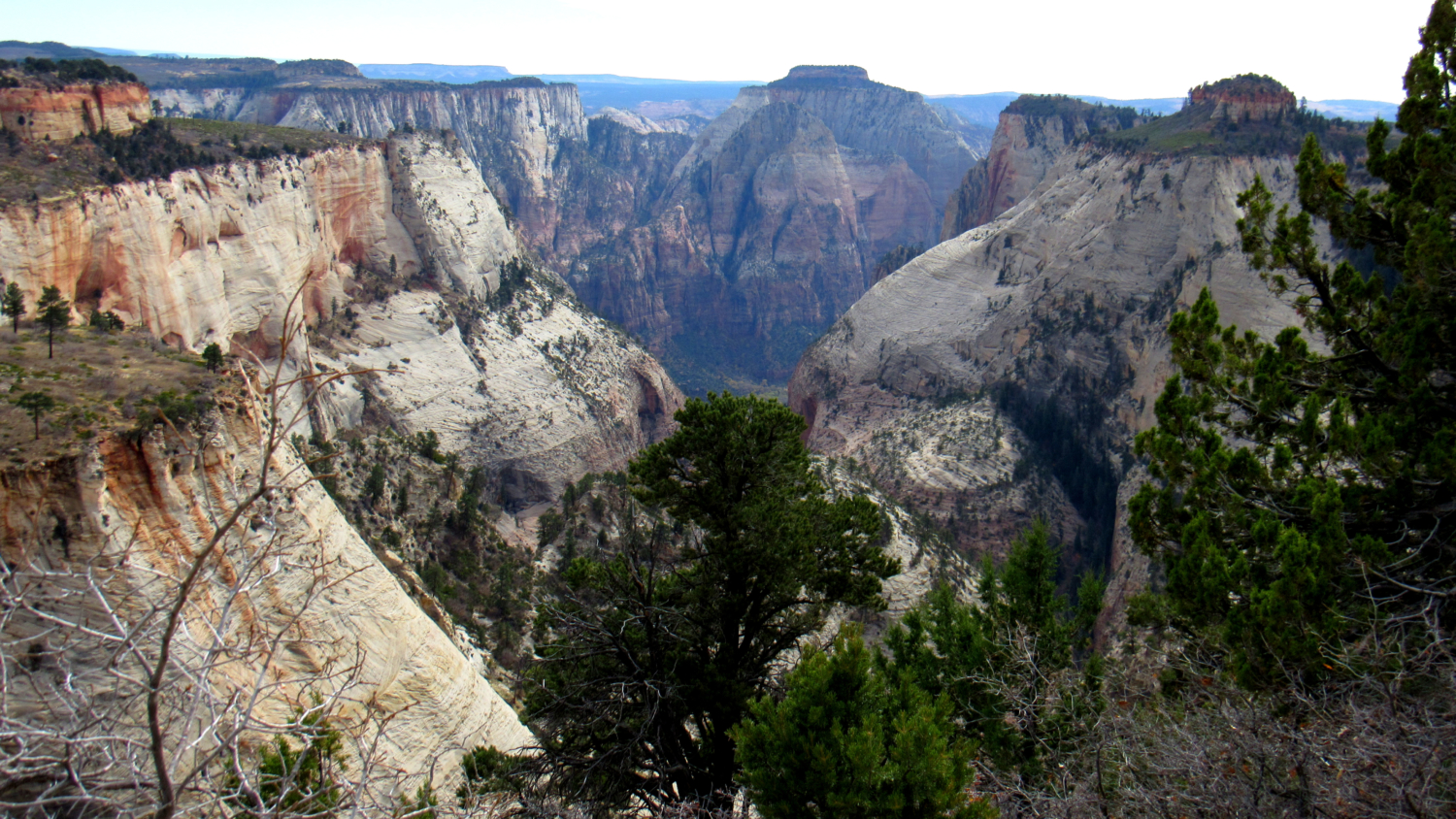
The trail approaches and soon reaches the rim of the plateau overlooking the convoluted drainage of North Creek. Several bulbous sandstone pinnacles and buttes rise up from the drainage and tower over the deep crease of the Right Fork North Creek and the broader, wooded defile of Phantom Valley. Beyond all of these formations, the landscape melts away toward the southwest desert section of the park and the broad valley of the Virgin River. Further beyond, the arid expanse of desert north of Las Vegas as well as the Pine Valley Mountains above St. George loom on the horizon during clear days.

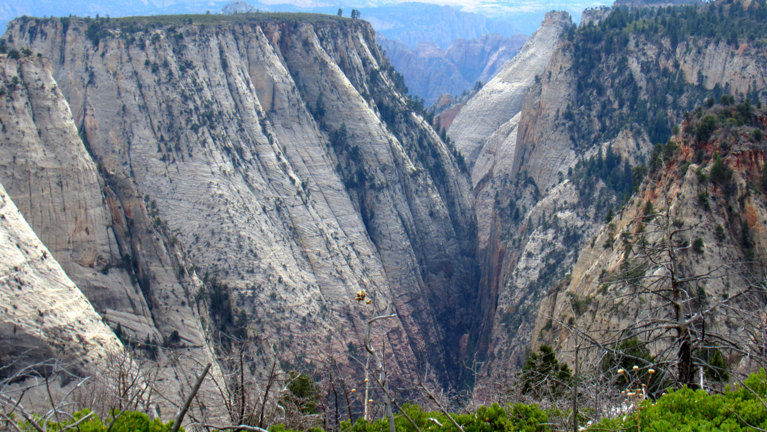
The trail continues south along the rim over several high points before veering away at 9 miles to enter a grove of pines. The bulk of the campsites (5-2) on the plateau lie along the section, and any one of them would make an outstanding place to sleep. As the trail wraps around the rim of the plateau, you will enjoy more stunning views south into Zion Canyon with some familiar formations such as the West and East Temple, Towers of the Virgin, and Mount Majestic viewed from this unusual vantage.
After winding downhill through more pine forest, the trail returns to the southern Telephone Canyon/West Rim Junction. From here, you will re-trace your steps back down into the canyon. This knee-rattling descent will be a touch more comfortable if you move slowly and use trekking poles, and you will definitely need to fight the inertia created by the desire to stuff your face with calorie dense meals in Springdale. However, slow and steady will bring you back to the bottom eventually. You will also enjoy everything you saw previously but from the reverse vantage. Many hikers bemoan out-and-back trips because the scenery gets redundant, but in a place this unbelievable, seeing the same scenery twice will hardly qualify as a tedious chore.
Tags: Angel's Landing, Backpacking, Lava Point, Navajo Sandstone, Scouts Lookout, Telephone Canyon, utah, West Rim Trail, zion