Angel’s Landing is one of the most famous trails in the National Park System and definitely one of the two marquee trails in Zion National Park. This 5 mile trail takes you from the canyon floor up a narrow, winding trail to the prominent overlook of Scout Lookout. From there, a half-mile of vertigo-inducing, chained trail along the cliffside takes you to Angel’s Landing. Even those who don’t plan on heading all the way to the Landing should do this trail – the views from Scout Lookout are phenomenal – and if you’d like you can also continue further on the West Rim Trail into the solitude of Zion’s backcountry. A must-hike.
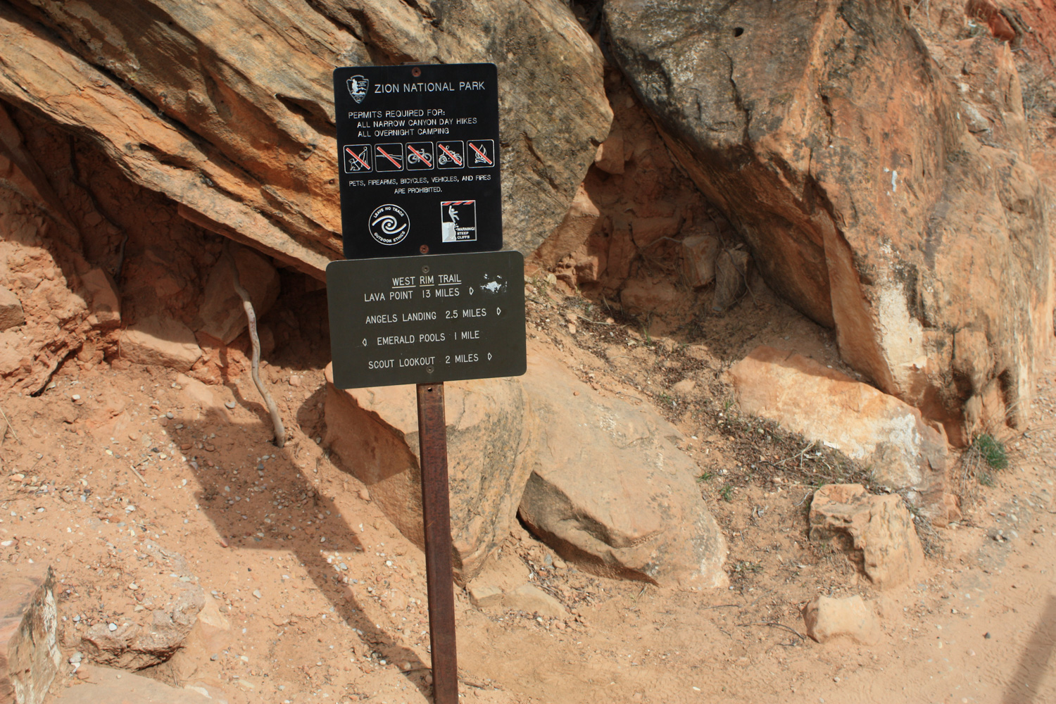
Note: Starting in 2022 as a pilot program, Zion National Park is now requiring hikers to have a permit to travel this trail.
When you get back from Zion, there are two questions every hiker will ask you: “did you do the Narrows?” and “did you make it to Angel’s Landing?” The Narrows is a multi-day canyoneering and backpacking adventure that requires a bit of planning ahead of time to do. Angel’s Landing is a steep but surprisingly accessible trail that just happens to end with a terrifying half-mile clinging to the side of an exposed rock fin.
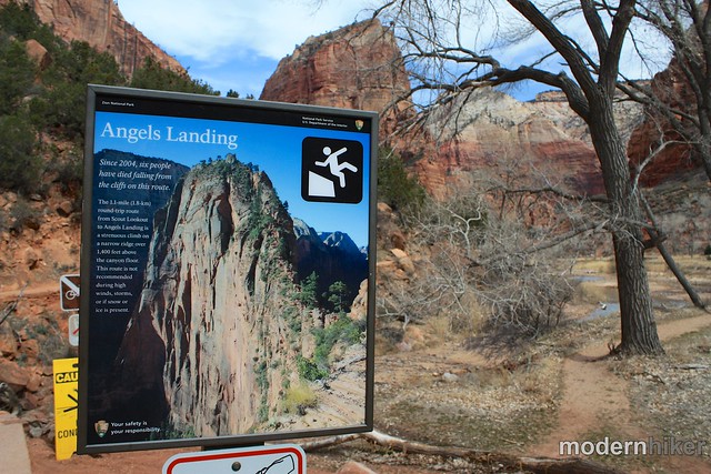
To be fair, most of the trail isn’t that scary – and for a lot of people, even that last half mile will seem like a piece of cake – but we’re a litigious society so we have to put up all sorts of warnings everywhere to make sure we can’t get sued. Naturally, then, the first thing you see when you start on this trail is a sign telling you how many people have died on it.
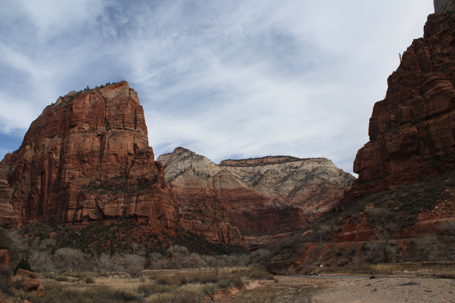
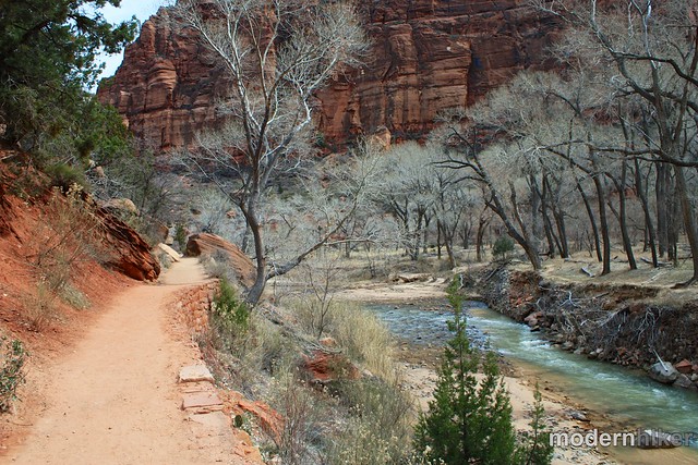
The first section of the trail starts out innocently enough – just a nice, mostly level stroll along the river bank with pleasant views of Angel’s Landing to the north.
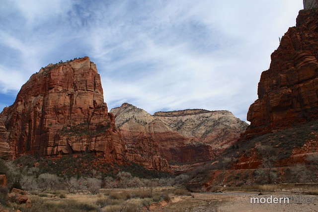
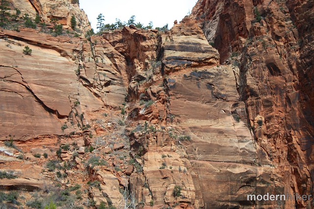
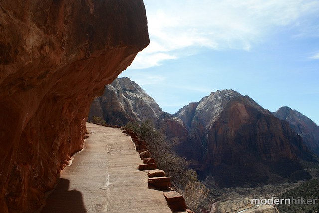
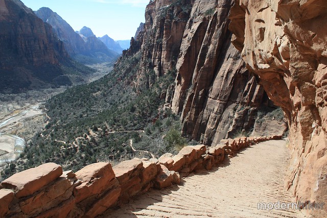
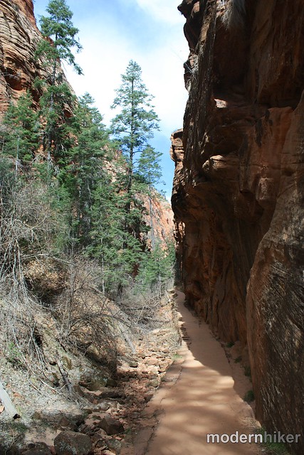
This pleasant little walk doesn’t last for long, though – if you look up at the West Rim Wall, you’ll spot Refrigerator Canyon tucked in right next to Angel’s Landing … and you’ll also spot the steep trail blasted into the cliff’s wall, too.
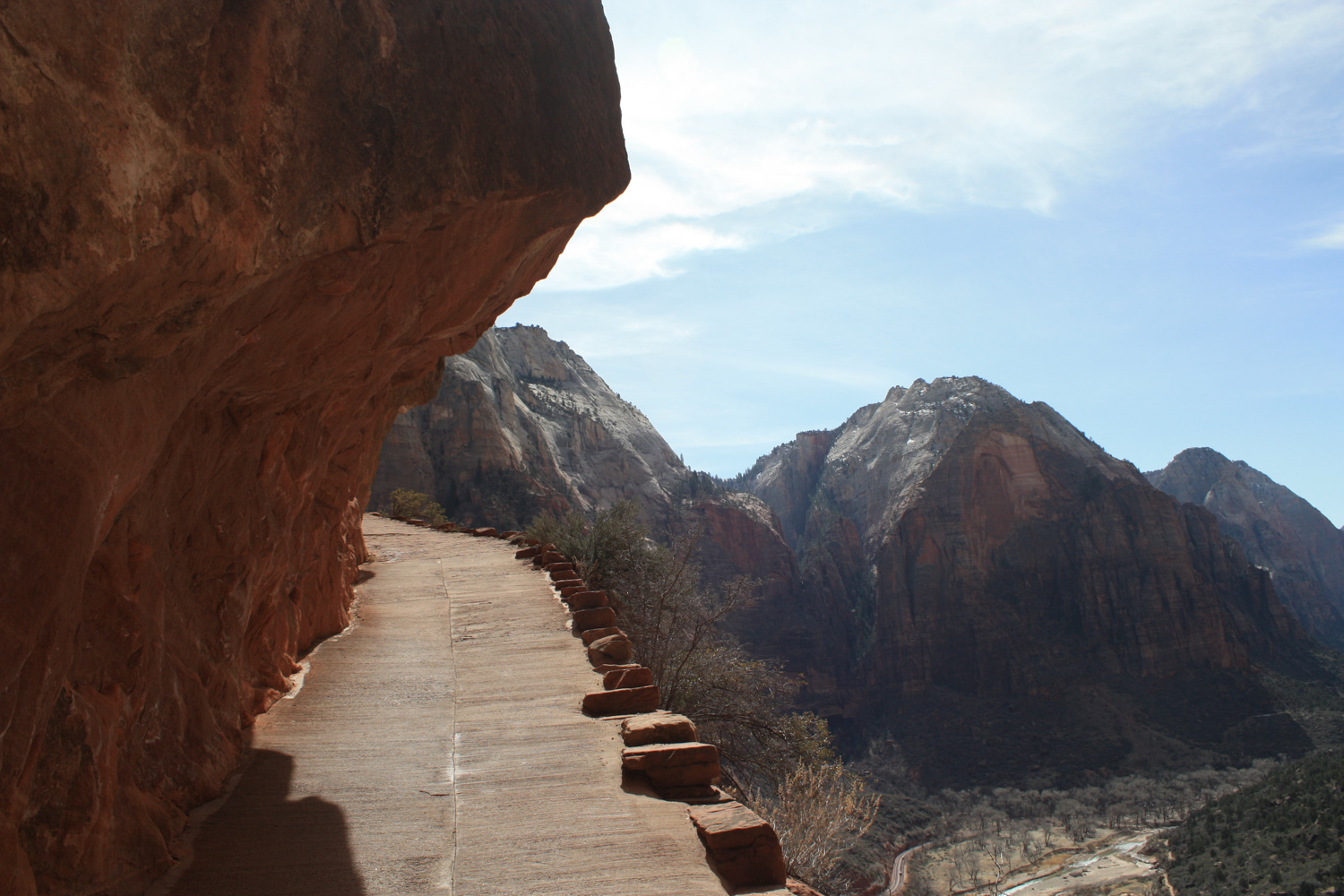
These paved, tight turns will take you up (and through) the wall of the West Rim and into the mouth of Refrigerator Canyon.
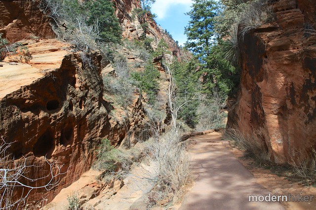
Once inside Refrigerator Canyon (and yes, it IS a bit cooler up here), the trail takes a leisurely course along the canyon floor. Douglas firs have staked their claim to this ground and their presence makes a nice contrast with the red rock canyon walls. If you time your trip to be in this area in the mid-afternoon (2-3PM), you may be able to catch Refrigerator Canyon’s “Golden Hour” – a time when sunlight from one wall is reflected onto the opposite one.
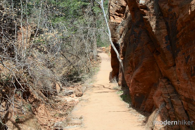
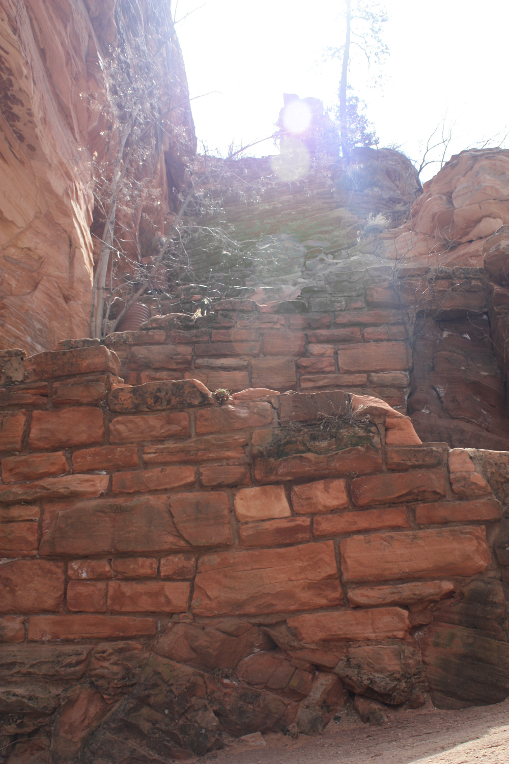
The trail stays fairly flat for about 0.4 miles inside Refrigerator Canyon before it hits another round of switchbacks. If you’re at all interested in the art of building trails – or even just the insane amount of work that goes into trailbuilding – you will gain a tremendous amount of appreciation for the people who put their backs into this route.
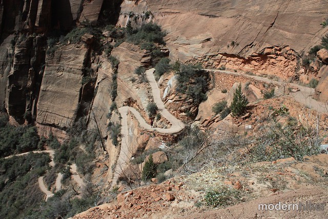
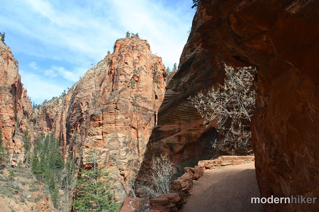
At the end of the canyon, the trail doubles back on itself before putting you face to face with Walter’s Wiggles – a steep series of 21 switchbacks named for Walter Ruesch, the first superintendant of Zion National Park.
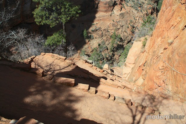
This is by far the steepest section of the trail, but just keep your head down and plow ahead and you’ll be fine. The trail is paved at this point so you really just have to get yourself into a steady rhythm and it’ll all be over before you know it!
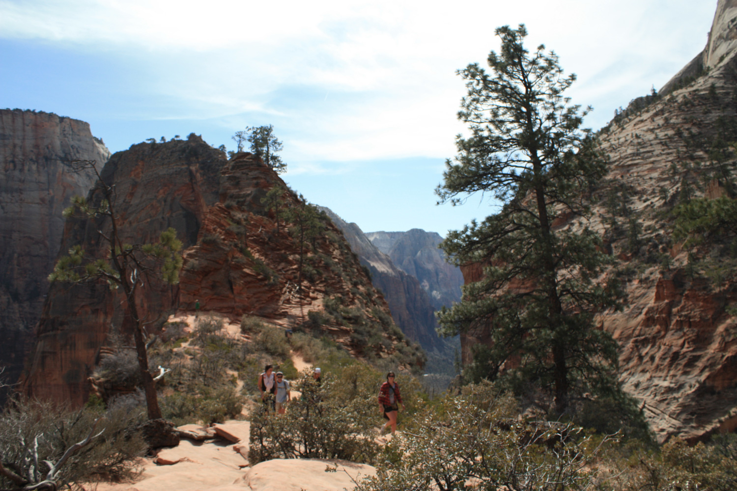
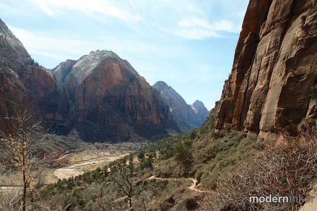
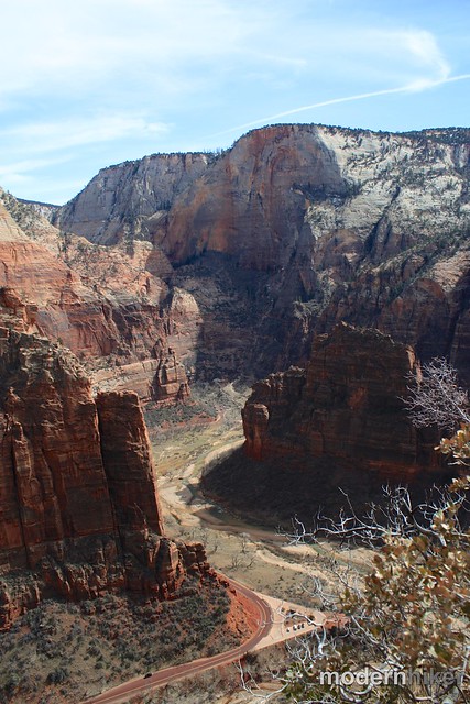
At the top of the Wiggles, you’ll come out onto the small plateau of Scout Rest. From this perch 5343 feet above sea level, you’ll have fantastic views of Zion Canyon’s Big Bend just north of Angels’ Landing and the rest of the Canyon to the south. This is a great place to have a rest or lunch before steeling yourself for the Landing itself, heading into the park’s backcountry on the West Rim Trail, or just turning around and heading back to the trailhead.

In case you were wondering – no, I did not make the full hike up to Angel’s Landing. I am not terribly fond of chain hikes and especially not fond of chain hikes that dangle you over giant cliff-drops.
That said, I have heard from many people that the trail to the Landing isn’t as bad as it looks, and maybe I’ll do it the next time I visit the park and am feeling a bit more adventurous.
(Hey there, reader! This is Scott, contributing author here at Modern Hiker, and author of Hike the Parks: Zion & Bryce Canyon National Parks. I hiked this route in May of 2018, and I hit the summit. I can can say that the actual hiking from Scout Landing to the summit is not, indeed, as hard as it appears. The bigger challenge is the tremendous volume of people you will be sharing this route with. More perhaps than dealing with vertigo, the biggest challenge is remaining patient, deferring to downhill hikers, and maintaining a good attitude about the crowds. It helps if you’re able to catch the first bus into the Canyon, or if you’re able to hike it later in the day when most people are wrapping up. Scroll down to the bottom for a couple of pictures of the top and route to the top.)
For a great account of someone who balked at the initial ascent but came back to conquer the Landing later, head to Kolby Kirk’s tale of his summer adventure from a few years ago … but be warned: his Go-Pro fish-eye lens videos of some of the more terrifying sections of trail played a large role in keeping me from heading up there myself!
*unfortunately my GPS went a little insane in Refrigerator Canyon so I didn’t get a usable track for the GPX data or Google Earth. Fortunately, this is the most-hiked trail in the park and information is out there. Here is a great site with detailed pictures of the last half mile and a GPX file to download.

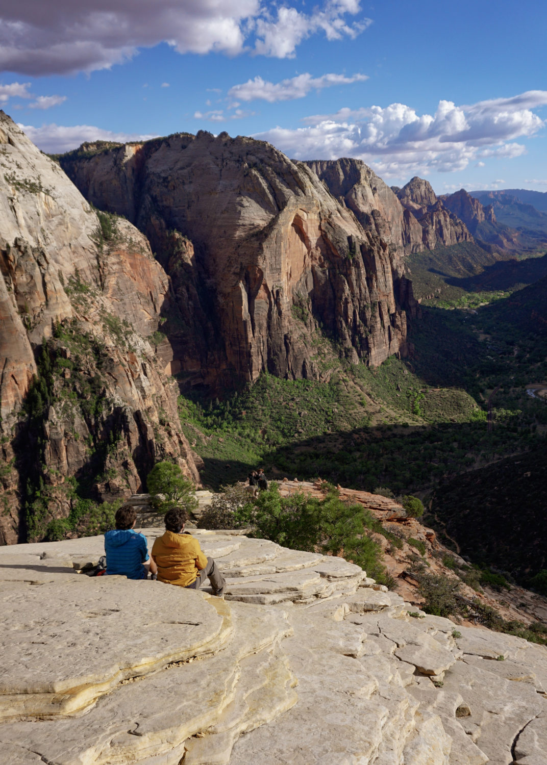
The Summit

Here be dragons. . .
Tags: Angel, Angel's Landing, Hiking, Scout Rest, utah, Virgin River, Walter's Wiggles, zion national park