
Here’s a classic, looping backpacking route that pairs spectacular high country scenery within the Cathedral Range with a bit of backcountry luxury at the Vogelsang High Sierra Camp. The full loop features spacious meadows, sweeping views, lakes, dense forests, and a beautiful river valley along with multiple options for sidetrips and extended exploration. Ambitious hikers could complete the whole thing in two days, but with the number of side trips possible, it’s best to consider three-, or even four-day trips. And for hikers who either can’t or don’t care to backpack this route, you can break the full loop into separate components (Vogelsang as an out-and-back or Lyell Canyon as an out-and-back) for day-hikes ranging from easy strolls to difficult, full-day treks.
Red Tape for Vogelsang and Lyell Canyons
For dayhikers, the only red tape on this route is the park entrance fee ($35 at the time of writing) required to access Yosemite National Park.
If you’re backpacking, you will need to obtain a permit in advance. To do so, first check the Full Trailhead Report to find out what days have permit availability. As this is a very popular route, it will behoove you to check the Wilderness Permits Reservation Window website to determine when you will be able to select your permit; early birds get the worm. After that, go to the Yosemite Conservancy website to request your permit. If your permit request is rewarded, the Conservancy will send an email allowing you to confirm your permit. After confirming your permit request, the last step is to pick up your actual paper permit from Yosemite Rangers at the nearest ranger station, which in this case is the Tuolumne Meadows Wilderness Center.
If you’re looking to camp at the fabled Vogelsang High Sierra Camp, there’s a separate reservation process. Go to the Travel Yosemite Website and enter the lottery. Unfortunately, at the time of writing this article, we were still deep into COVID-19 closures, and the camps had been closed for 2 years. I can’t provide detailed info on the lottery system since the lottery is not active. However, the above link will take you to the process when everything open backs up.
Safety
Like all hikes in the Sierra, the common dangers on this route are altitude sickness issues, bears, and water safety.
The altitude at the trailhead (8600 feet) is not terribly high by Sierra standards, but the trail does reach elevations over 10,500 feet. Some people may therefore have issues with altitude sickness. For sensitive individuals, it may help to spend a night or two at a nearby campground to get used to the elevation before starting the hike.
Bears are present throughout Yosemite, and they pose a significant threat to your food. There’s little to fear from a bear encounter as far as personal safety is concerned, but it is imperative to keep food stored in approved storage container. The park requires appropriate food storage in order to protect bears from access to human food. When bears do get into food, they look for more food, which could lead to a negative encounter with humans and potential euthanasia for the bear.
History of Vogelsang and Lyell Canyons
Vogelsang High Sierra Camp
Yosemite maintains seven of the original High Sierra Camps, two of which are road accessible (White Wolf and Tuolumne Meadows), and five of which reside within the Yosemite Wilderness (Glen Aulin, May Lake, Sunrise, Merced Lake, and Vogelsang). The park constructed the original camps between 1916. The park expanded the camps in 1923, and they’ve been in operation under a variety of park consessionaires (the current one is an Aramark subsidiary) ever since. The High Sierra Route, which strings together all 5 wilderness camps plus Tuolumne Meadows by way of several segments of various trails, remains one of the classic Yosemite wilderness experiences.
Tuolumne Meadows to Vogelsang High Sierra Camp
The Pacific Crest Trail
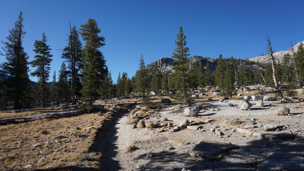
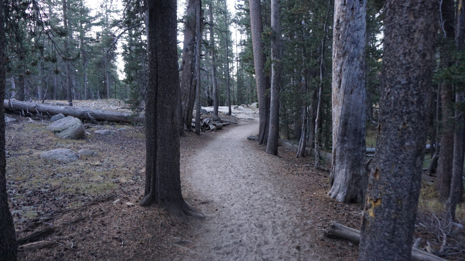
The route begins from the Lyell Canyon/Rafferty Creek Trailhead, which lies just to the west of the Tuolumne Meadows Lodge. Note that if you’re backpacking, you will begin from the Tuolumne Meadows Wilderness Center parking area, which lies due west from the Rafferty Creek/Lyell Canyon parking area. If you’re starting from the Wilderness Center, find an access point to the Pacific Crest Trail (PCT from here-on-out) on the south side of the parking area, and walk east toward the Rafferty Creek Trailhead. The PCT will reach a short connector with the Rafferty Creek Trail after 0.5 mile of walking through lodgepole forest. If you’re starting from the Rafferty Creek Trailhead on a day-hike, follow the short connector trail south from the south side of the parking area to a junction with the PCT.

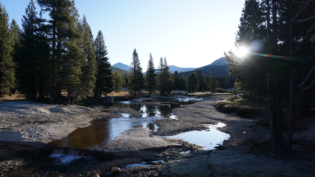
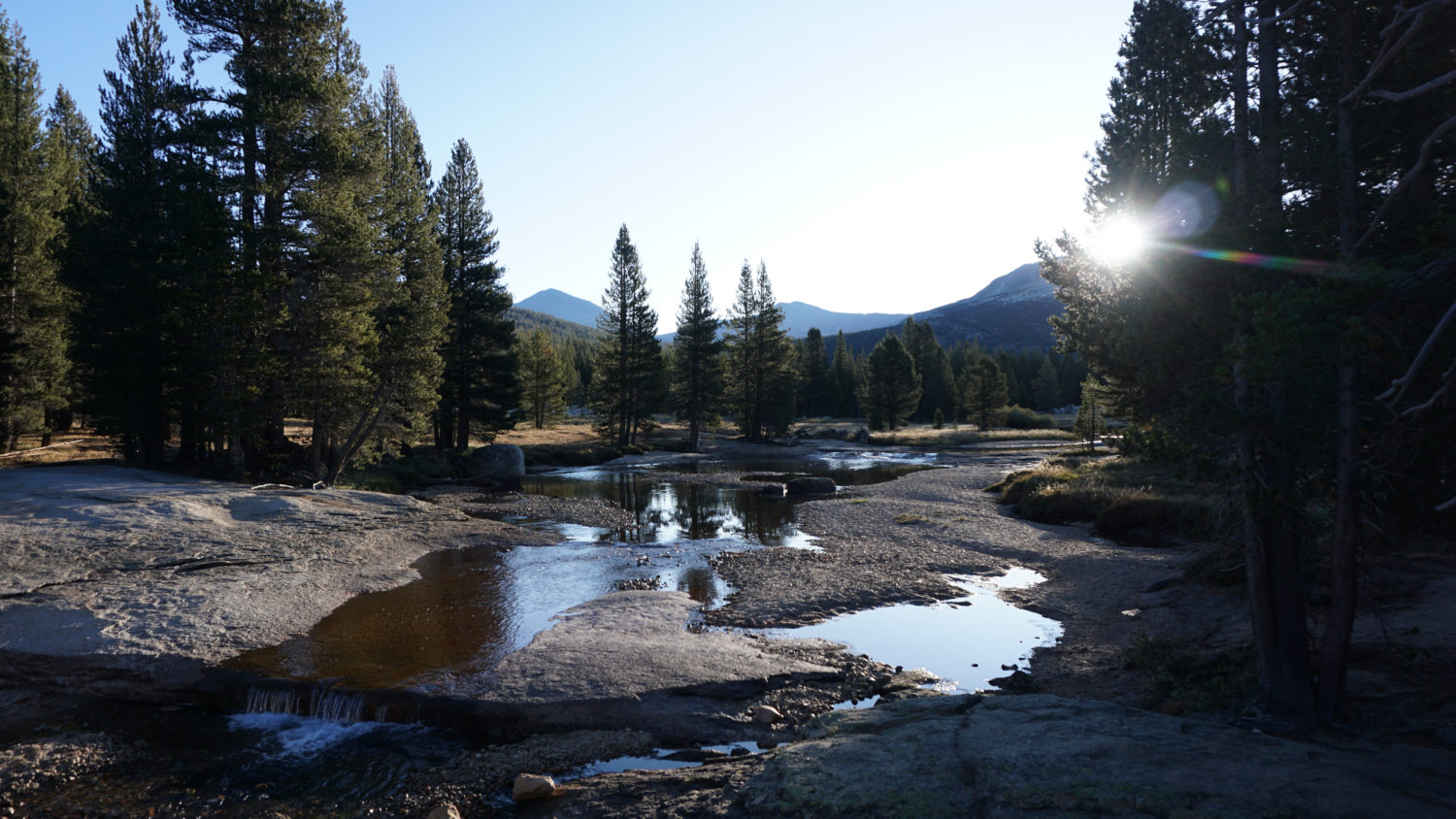
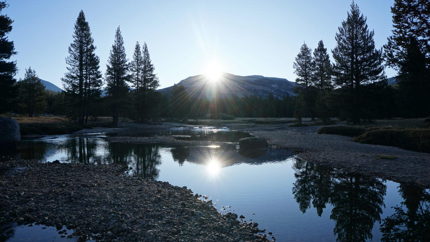
Lyell Fork Tuolumne River with the sun rising over Mt. Gibbs
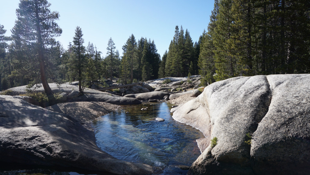
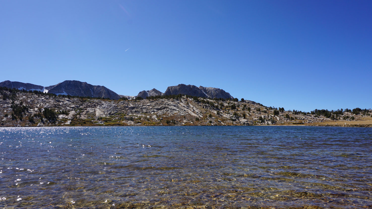
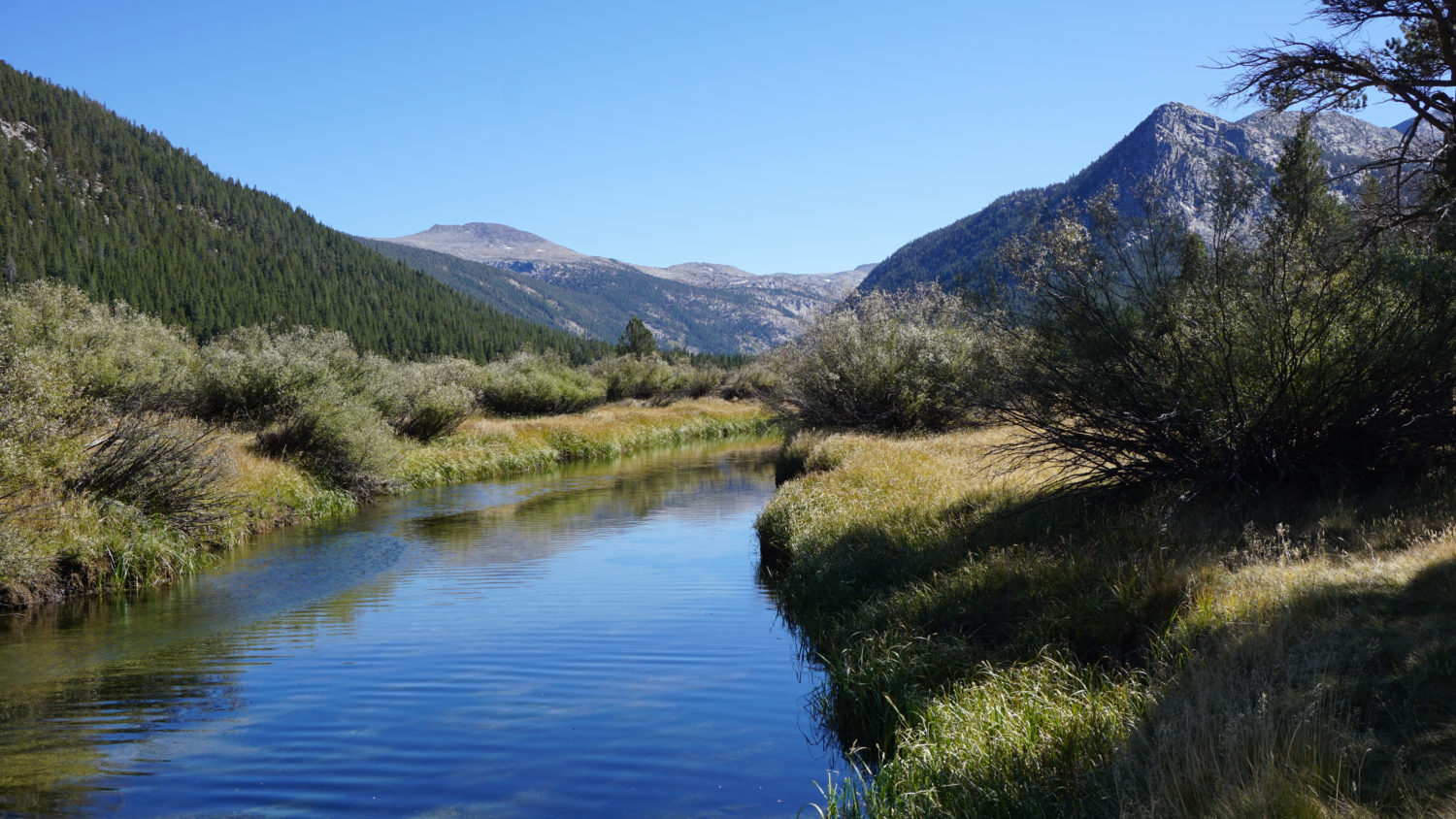
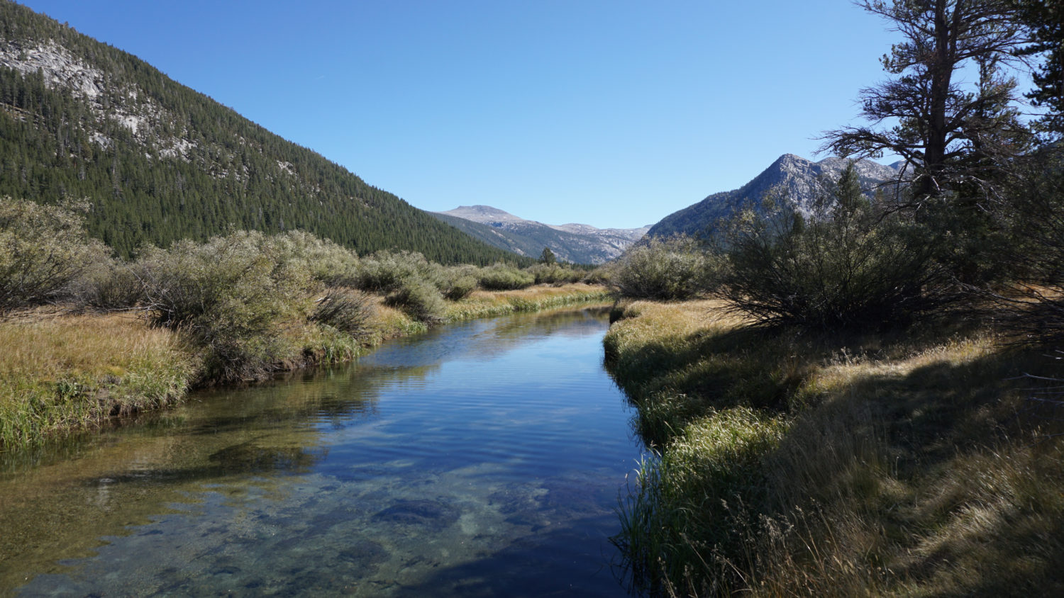
Join the PCT, heading southeast then east to a footbridge spanning the Dana Fork Tuolumne River at 0.8 mile. Cross the bridge, then continue southeast and then south as the PCT bends to the left to traverse a low ridge separating the Dana Fork from the Lyell Fork Tuolumne River. At 1.3 miles, cross a pair of wooden footbridges spanning the Lyell Fork. Later in the season (late August, early September), the river level is low enough to permit swimming in one of a several appealing-looking swimming holes. If it’s early in the year, avoid entering the river, as the swift flow and cold temperature produced by upcountry snowmelt can be fatal. For casual hikers, the Lyell Fork is a nice turnaround spot, especially since the river is a nice place to sit and contemplate the sound of rushing water for a while.
The Rafferty Creek Trail
Once across the Lyell Fork, the PCT joins the John Muir Trail (JMT), and from this point, the two trails will be inseparable as they make their way south to Mt. Whitney. The PCT/JMT continues east to a junction with the Rafferty Creek Trail at 2 miles. The hike to Vogelsang begins here with a right turn onto the Rafferty Creek Trail. Note that if you’re dayhiking, and you only want to visit Lyell Canyon, keep traveling east on the PCT/JMT as it approaches Lyell Canyon (more on that later).

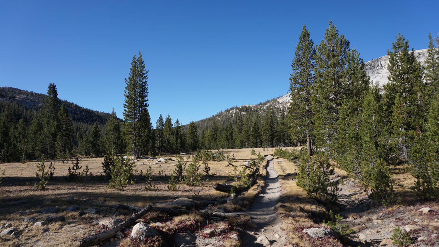
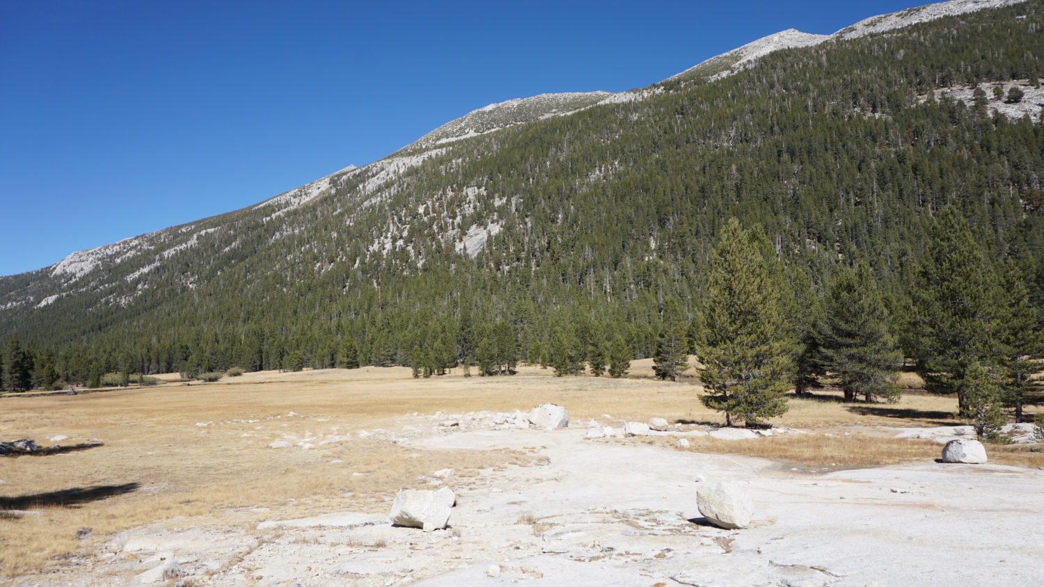
The Rafferty Creek Trail departs from the PCT/JMT, heading south through open lodgepole forest parallel to the banks of Rafferty Creek. Initially, the trail climbs up a moderately steep slope as it leaves the Tuolumne River plain, but the incline becomes more gradual at the 2.5 mile mark. The trail also nears the banks of Rafferty Creek, which rumbles in the spring and whispers in the fall. From the 2.5 mile mark, the trail settles into a relatively uneventful stretch of moderate climbing over the next 2.8 miles. There are a pair of crossings along this stretch, but otherwise the key features on this stretch are a somewhat monotonous climb through lodgepole pine forest with the occasional view east of the Kuna Crest.
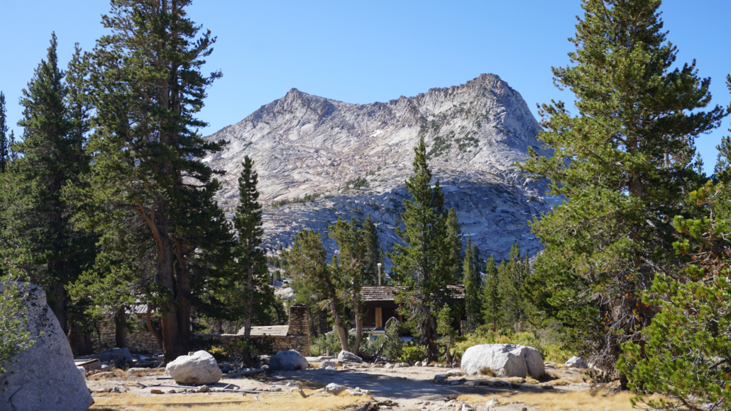
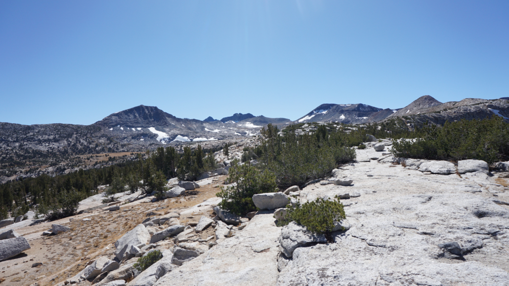
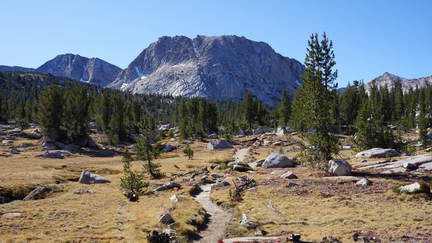
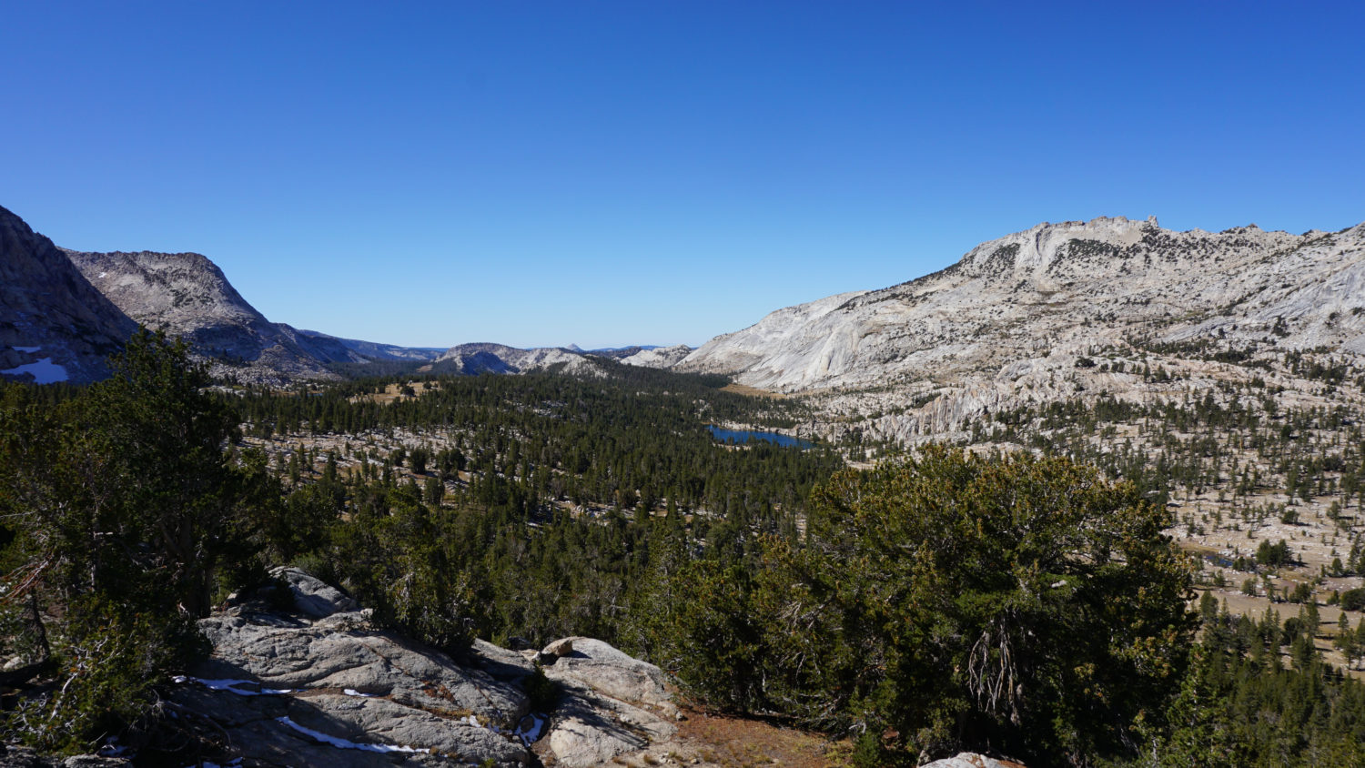
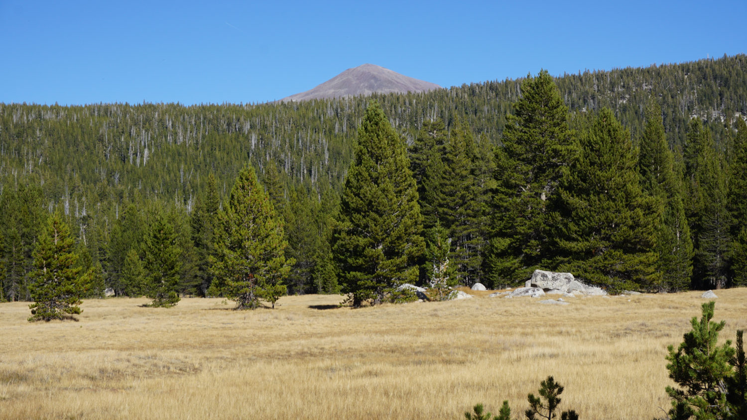
Fletcher Peak (left) and Vogelsang Peak (right)
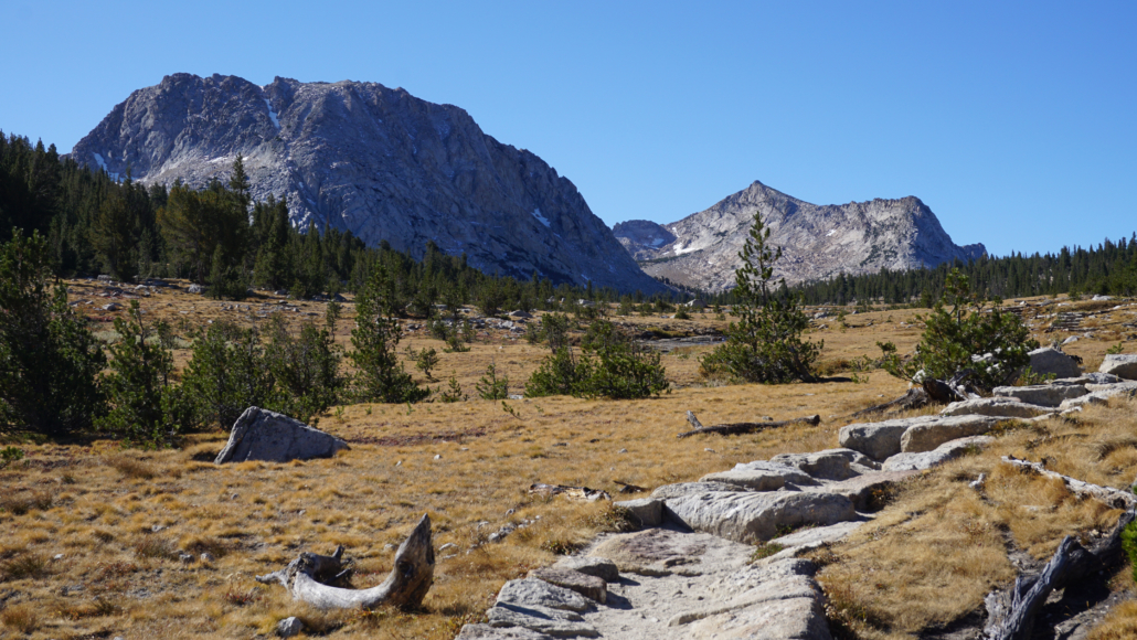
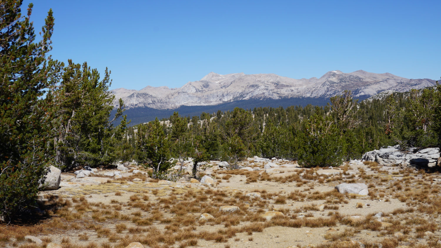
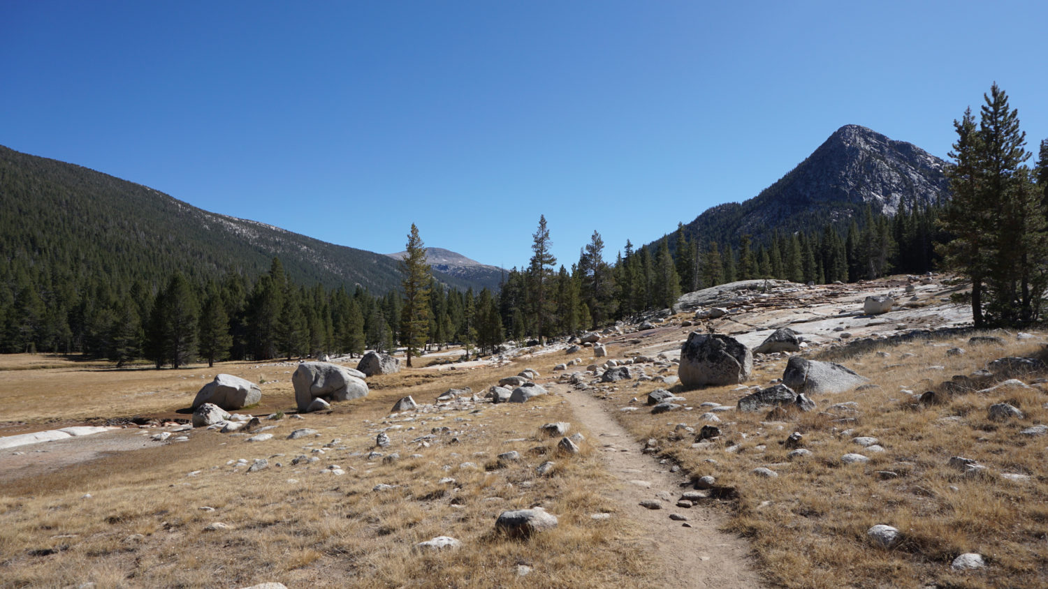
The scenery becomes more interesting at 5.3 miles as the Rafferty Creek Trail reaches the beginning of a long, linear meadow that extends all the way to Tuolumne Pass, 1.5 miles ahead. The next 1.5 miles follow the meadow, eventually entering said meadow over a raised trail showcasing the beauty of Yosemite trail construction, as the trail approaches Vogelsang. The hulking forms of Vogelsang Peak and Fletcher Peak loom ahead, signaling the location of your destination. As those peaks pull you forward, be sure to look back at the gradually improving views across the Tuolumne River Basin toward the high peaks of the Sierra Crest north of Tioga Pass.

Fletcher Lake
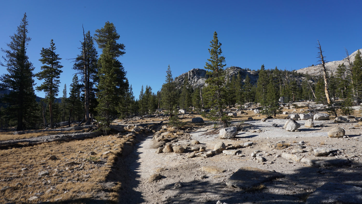
At 6.8 miles, the Rafferty Creek Trail reaches a junction with a trail leading southwest to Merced Lake. For a pleasant diversion, follow the trail to Merced Lake a short distance to Boothe Lake 0.6 mile to the southwest. Like most of the sidetrips radiating from Vogelsang, Boothe Lake is a better option if you are camping overnight here. Otherwise, keep right to climb obliquely along a wooded slope overlooking Boothe Lake en route to Vogelsang High Sierra Camp.
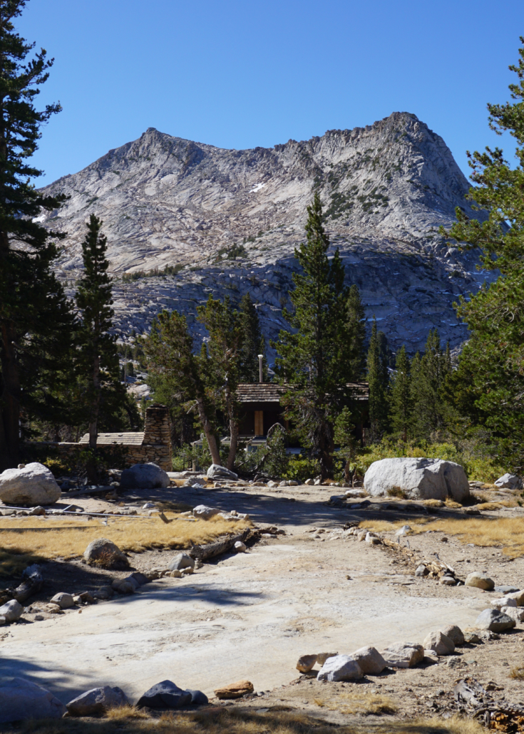
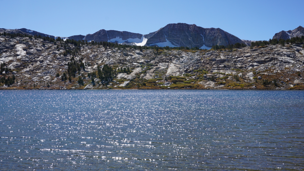
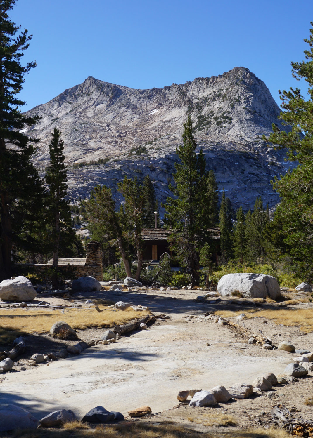
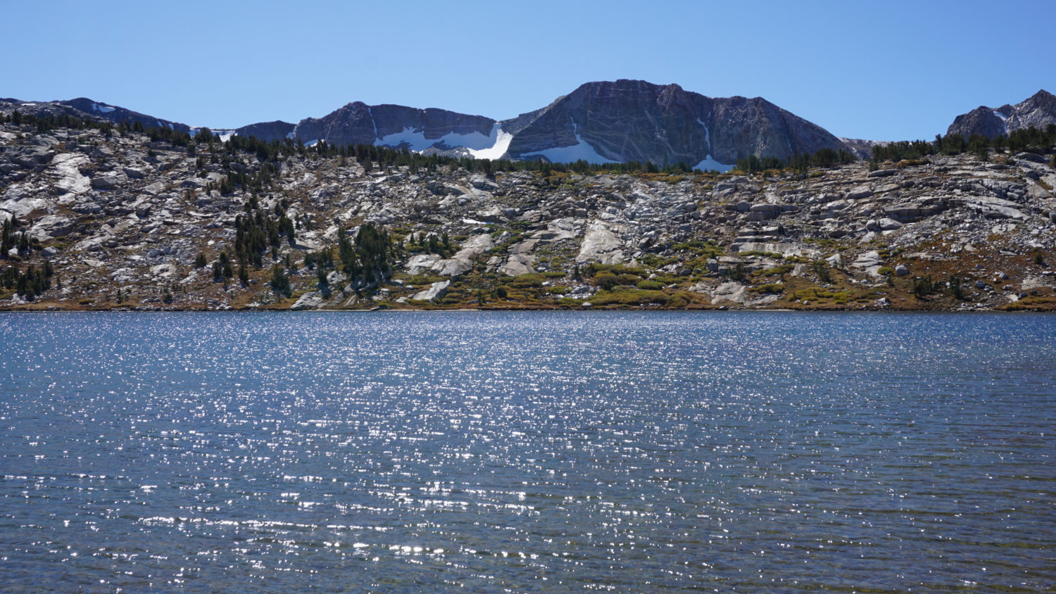
After cresting a flat ledge at 7.5 miles, the trail arrives at Vogelsang High Sierra Camp. The camp itself is nothing spectacular as far as destinations go; it’s a handful of stone structures and a network of tent cabins. However, this spot is ideal as a base camp for side trips. For example, hikers can continue south from the camp uphill for 0.5 mile to Vogelsang Lake. Determined hikers who don’t mind some class 2/3 scrambling can continue beyond the lake to Vogelsang Pass, from which point they can turn west to follow a cross-country route to the summit of Vogelsang Peak. Hikers can also follow a cross-country path from nearby Fletcher Lake to Townsley Lake, which nestles into a basin below Fletcher Peak. For day-hikers, Fletcher Lake is probably as far as you will want to go, as the rest of the destinations become significantly more involved and difficult.

Overnight hikers who aren’t staying at Vogelsang High Sierra Camp must camp at a nearby designated area for campers. To find this area, head east from the camp toward Fletcher Lake. Before reaching Fletcher Lake, follow a signed trail north leading to a set of campsites.
Vogelsang to Lyell Canyon

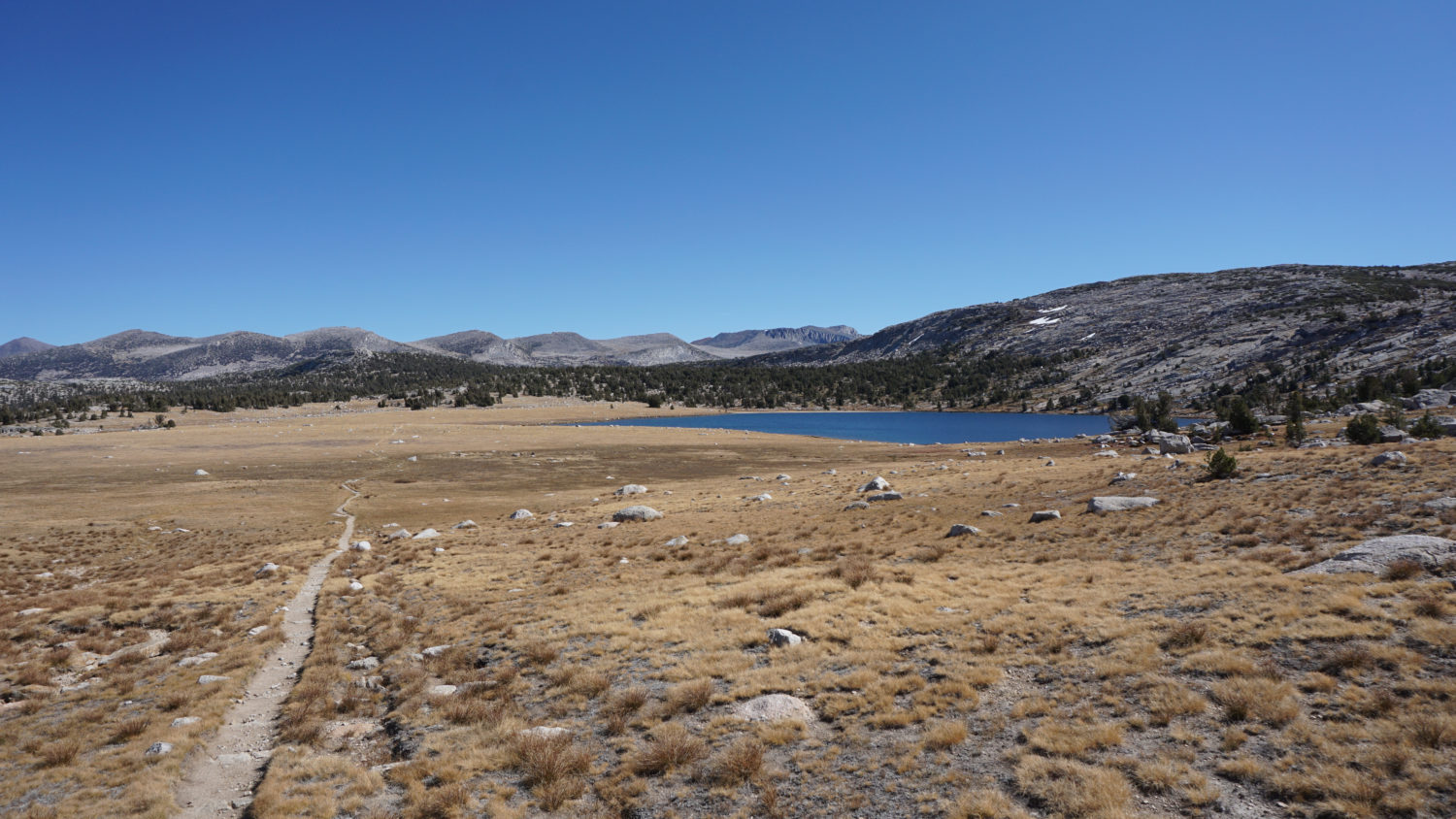
Evelyn Lake’s basin and the Sierra Crest
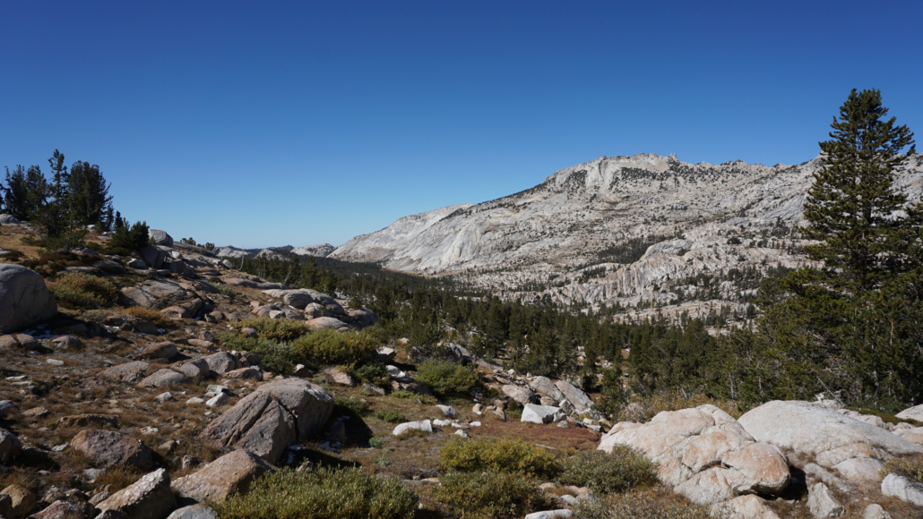
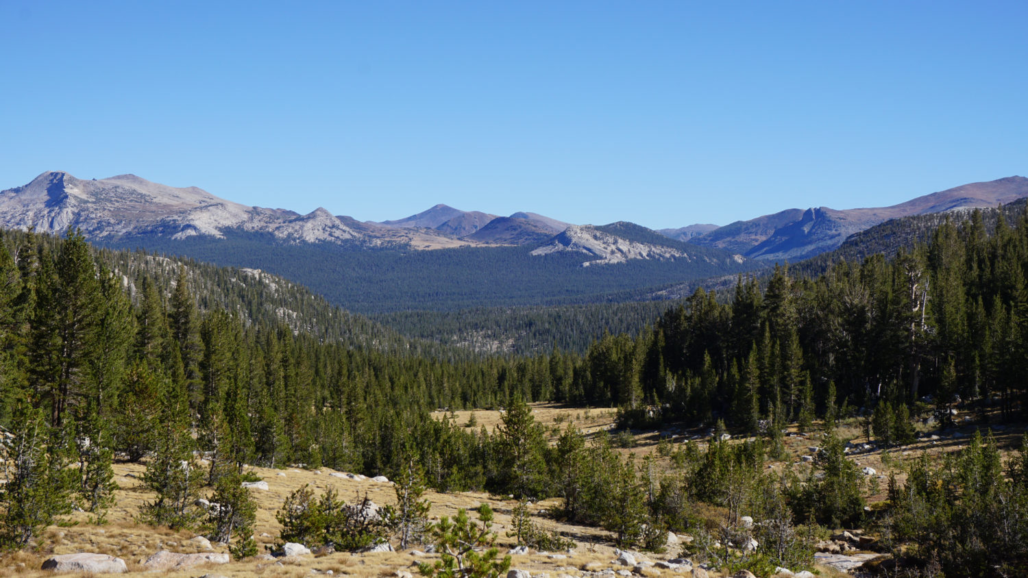
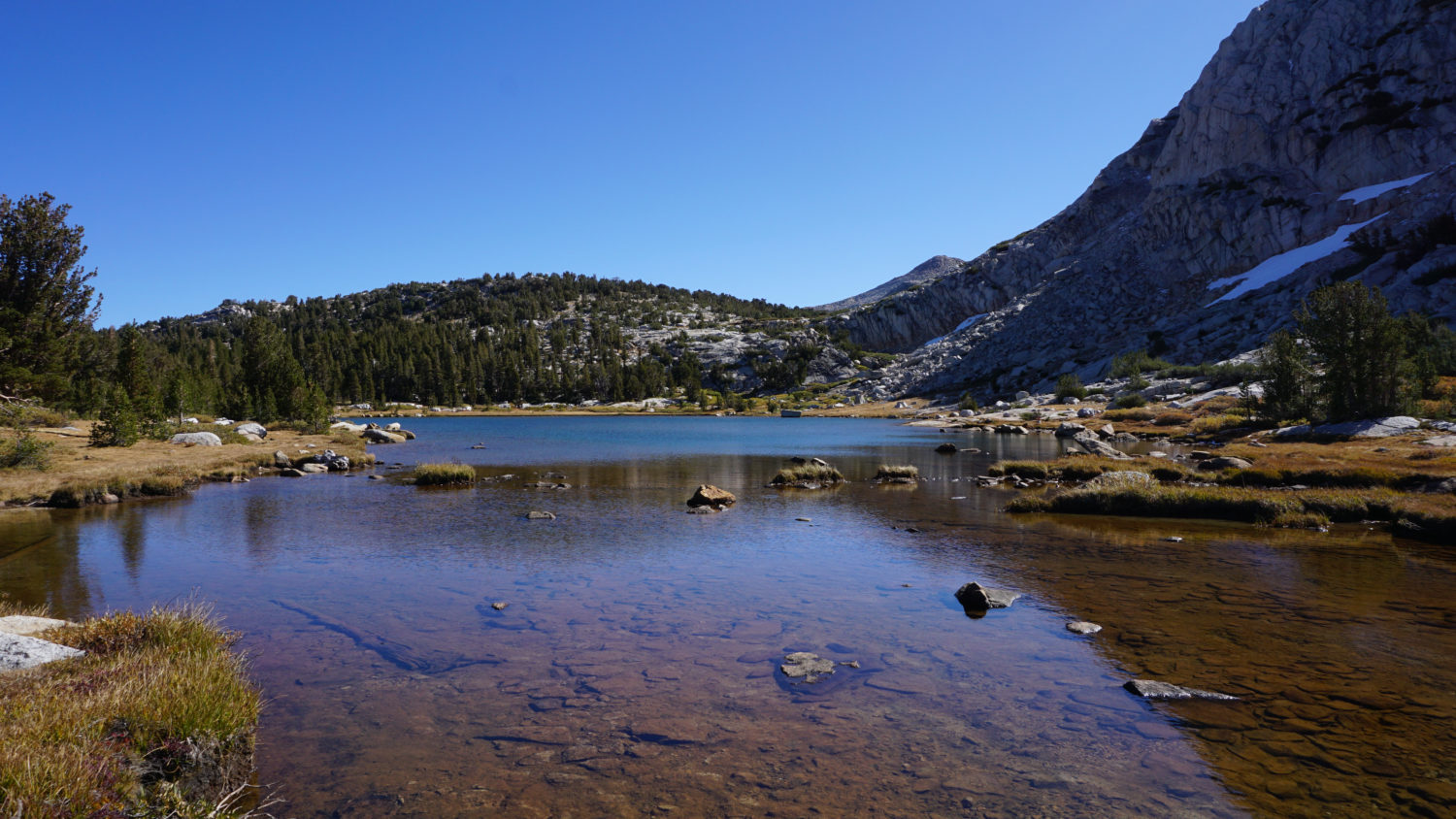
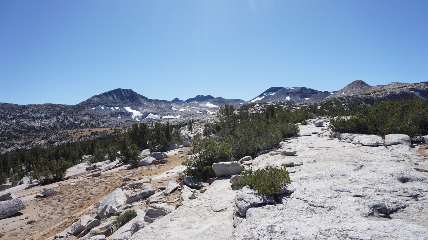
If you’re following the entire looping route, Vogelsang is a great option for your first night’s stay. The continuation of the route heads northeast over a gentle, wooded slope that crests at 8.5 miles. There are a handful of promontories from which you can enjoy a quick view overlooking Fletcher Creek’s drainage, which extends from Vogelsang down to Merced Lake. From the crest, the trail begins a descent into a vast, grassy basin containing picturesque Evelyn Lake. This beautiful section of hiking features wide-open skies and the sparkling waters of the lake set against a backdrop of alpine peaks dominating the Cathedral Range.
Evelyn Lake
The trail crosses this basin, passing Evelyn Lake’s outlet creek at 9 miles. Once across the creek, the trail resumes climbing eastbound over a ridge that hems in a much smaller, unnamed lake at 9.9 miles. After crossing this lake’s outlet creek, the climb resumes to a ridge at 10.4 miles that separates the Evelyn Lake basin from Lyell Canyon to the east. Begin a descent to the 11 mile mark, which is marked by a junction with a spur trail leading south to Ireland Lake.
Ireland Lake is back there somewhere
Full disclosure: when I scouted this route, I did not visit Ireland Lake, so I can’t say much about what the route is like. However, I included the GPS information, as Ireland Lake is a natural spot for camping on a second night. The spur trail to Ireland Lake travels 1.5 miles south, gaining a little over 400 miles.
Note that the distances referenced from this point include the spur trail to Ireland Lake.

The Kuna Crest above Lyell Canyon
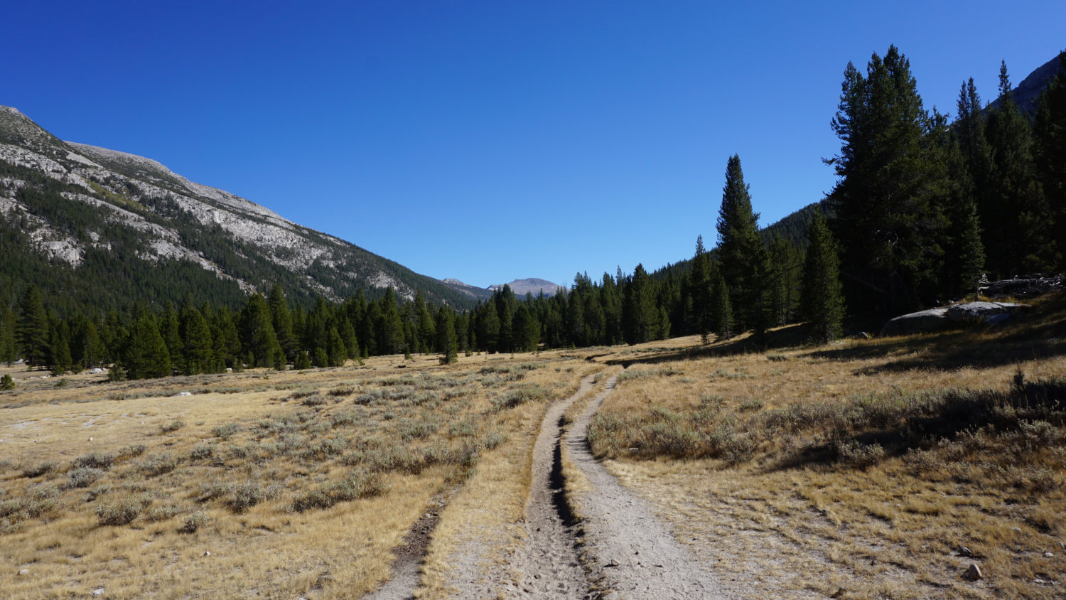
From the Ireland Lake junction, the trail begins a long, winding descent through dense forest into the depths of Lyell Canyon some 1500 feet below. On the initial stretch of the descent, you can enjoy fine views east to the Kuna Crest, but the forest quickly obscures those views. This descent bottoms out at 16.5 miles at a junction with the PCT/JMT. Turn left here to begin traveling north on an undulating track the follows the Lyell Fork back to the Rafferty Creek Trailhead. If you want to camp within Lyell Canyon, there are some suitable campsites north from the junction; be aware that the park prohibits camping south of this junction, and this will be your last chance to set up for the night.

Lyell Canyon and the PCT/JMT
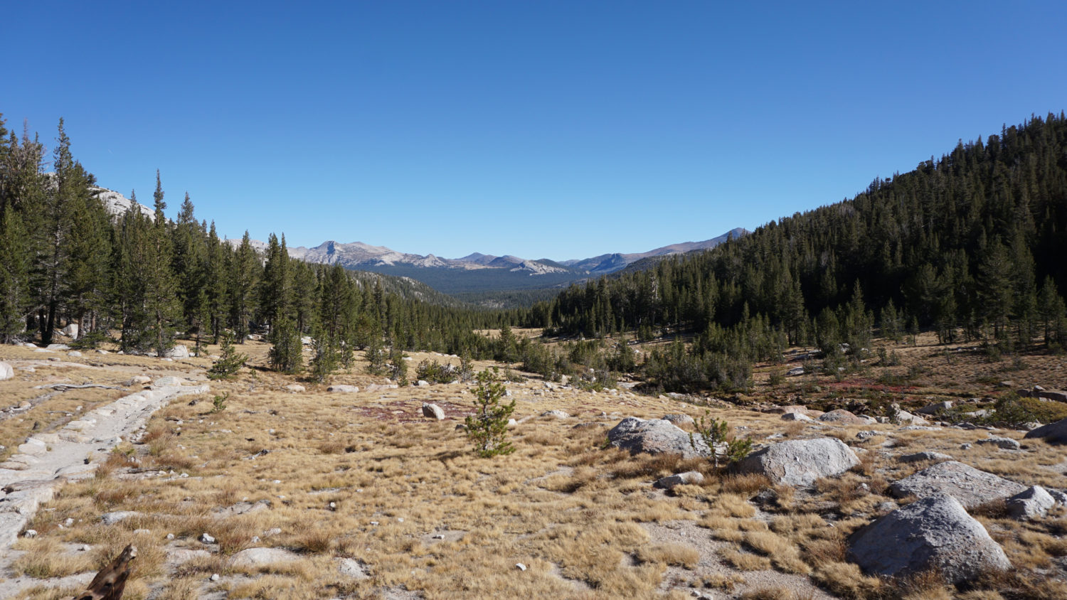
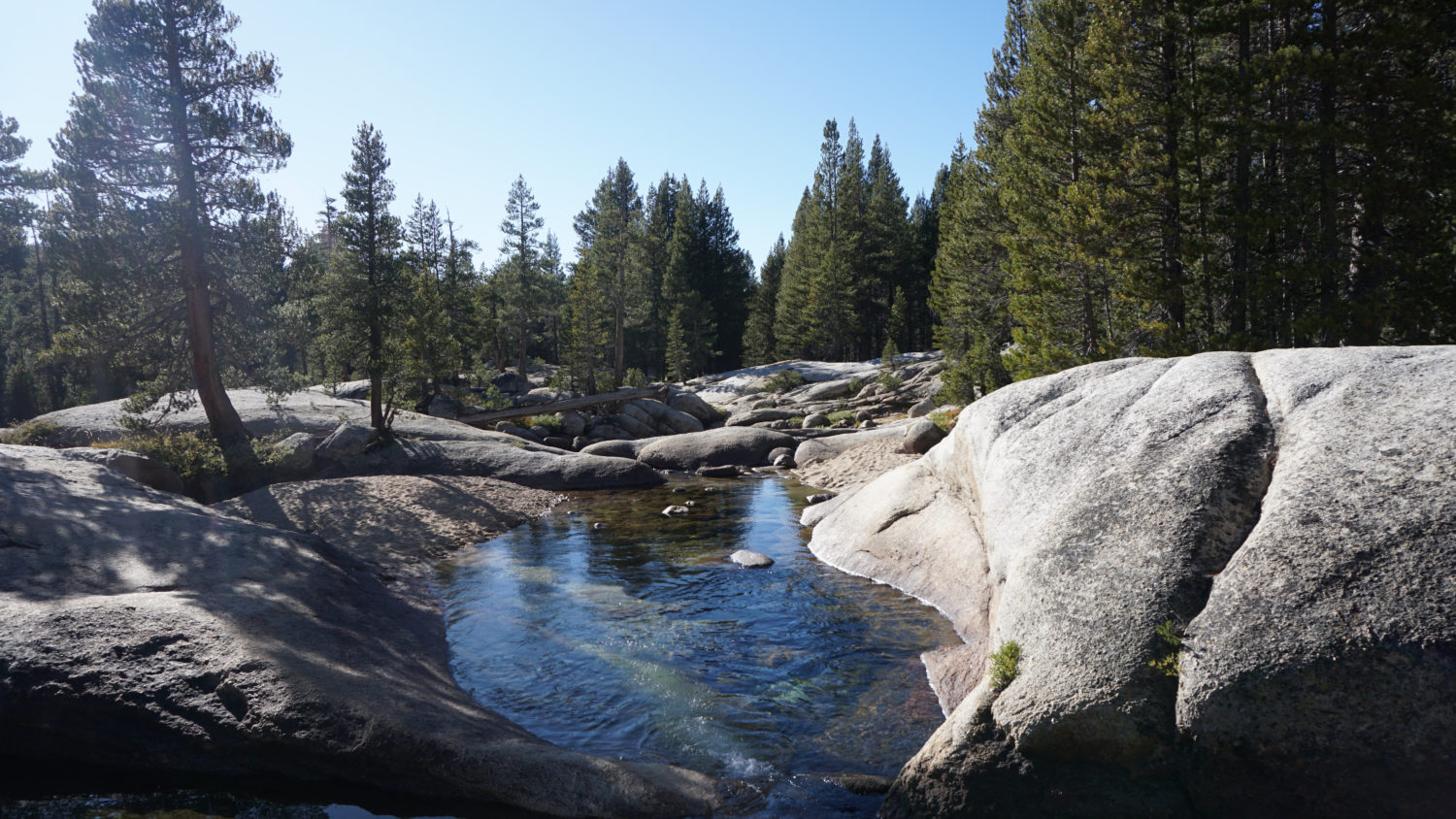
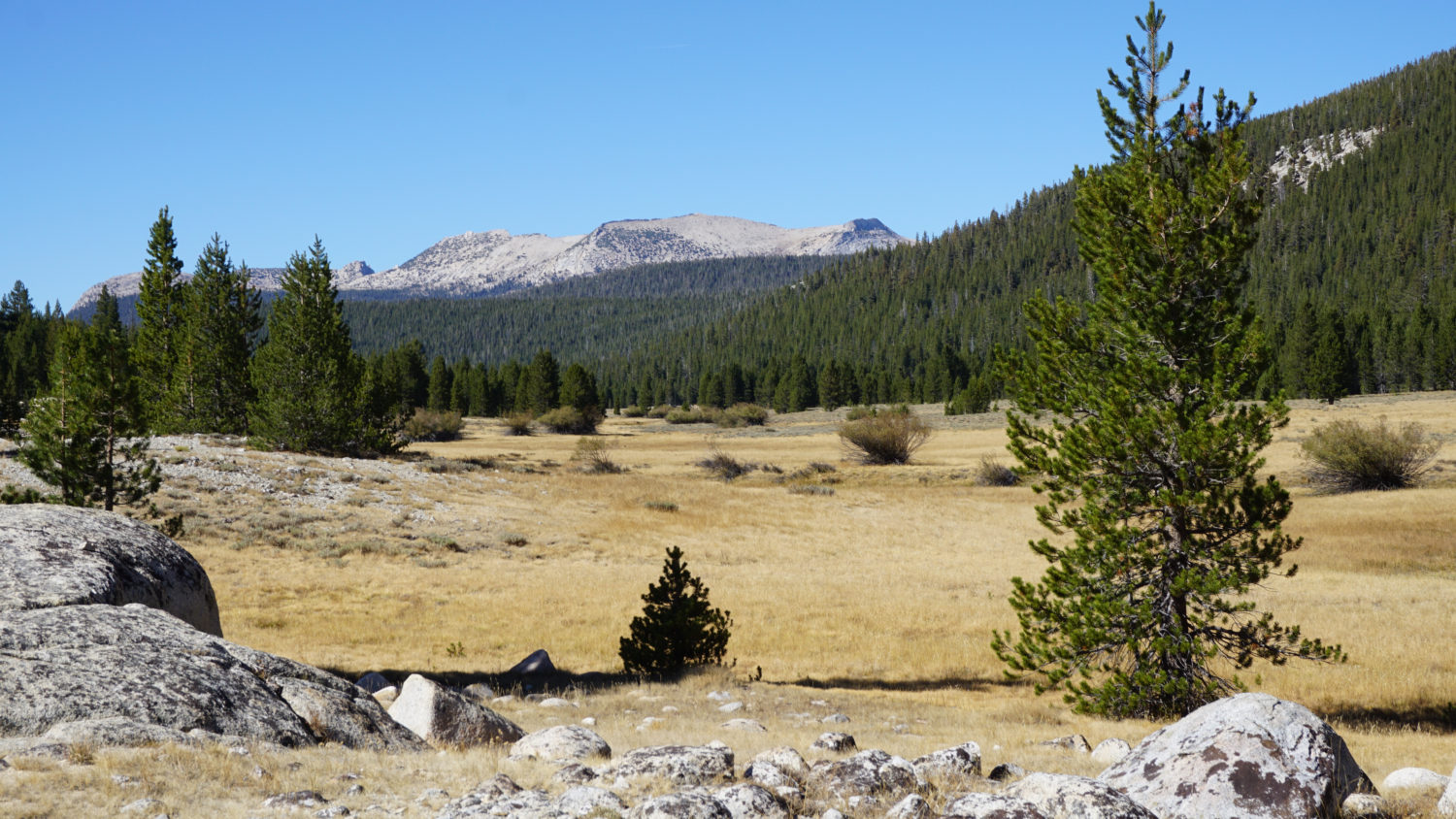
The traverse through Lyell Canyon is mostly flat, with a handful of gentle undulations – a definite relief after all the climbing. The scenery in Lyell Canyon alternates between open lodgepole forest and open meadows along the Lyell Fork Tuolumne River. The trail steers clear of the river, but there are a handful of spots where you can carefully rock hop to the banks. Note that the habitat around the river is sensitive meadows, and the park discourages people from trampling this habitat. Only approach the river if there are rocks you can follow to reach the banks.

The Lyell Fork Tuolumne River
After 3.2 miles of gentle walking along the banks of the river, the trail begins a gradual arc to the west. After plunging back into the forest, the trail reaches a lovely meadow at 20.2 miles. Shortly beyond the meadow, the trail reaches the junction with the Rafferty Creek Trail, closing the loop. Re-trace your steps west to the Lyell Fork bridge, turning right to remain on the PCT where it splits from the JMT. Cross the Dana Fork at 22 miles, then continue to either the Rafferty Creek Trailhead or beyond to the Wilderness Center to wrap up the hike.
Swimming hole on the Lyell Fork


Be the first to comment