Telescope Peak is the highest summit in Death Valley National Park, and the hike is a classic. The peak is snow-capped for much of the year and is visible from the well-watered canyons on its eastern side and all along the Death Valley floor. The route is one of the few established trails in Death Valley with the demanding 13-mile trek giving up spectacular views and nearly 3,000 feet of elevation gain.
In a land known for geologic drama, Telescope Peak brings it. From Telescope Peak down to Badwater Basin below (the lowest point in North America at 282 feet below sea level) the drop is a dizzying 11,331 feet. This is higher than the south rim of the Grand Canyon. Fortunately, you don’t have to start on the valley floor to hike Telescope Peak, although it’s possible. That extreme route has no established trail. Instead, hearty souls pick their way up from Shorty’s Well on the west side of Badwater Basin via Hanaupah Canyon in an approximately 30 mile round trip haul. On my trip I ran into one such day hiker. He had brought a single small bottle of water and was relying on year-round snow patches to keep him going. When we parted ways after the peak, he galloped off down the mountain toward his car which was barely visible as a tiny glint in the valley 15 miles and more than 11,000 feet below.

The lowest point in North America with snow-capped Telescope Peak in the distance.

Views of Telescope Peak from Hanaupah Canyon.
The trail begins at the high elevation Mahogany Flat Campground (8,200 feet). It winds through a forest of pinyon, juniper, and mahogany to swing around Rogers Peak on the east side with eastward views down to the valley floor the whole way. At 2.4 miles into the hike, you’ll reach the flinty expanse of the Arcane Meadows. This cold and wind-scoured mountain pass is where you’ll catch the first glimpses west toward the Panamint Valley and the Argus Range.

Wind-scoured Arcane Meadows.
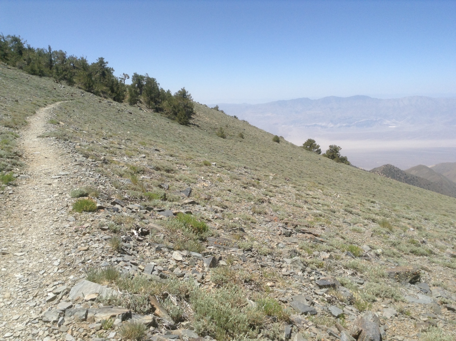
The next two miles remain fairly level, giving you a break from the elevation gain as you walk a gently rising ridge. The highly visible trail ribbons ahead, licking up to the point of Telescope Peak in the distance.

Telescope Peak straight ahead
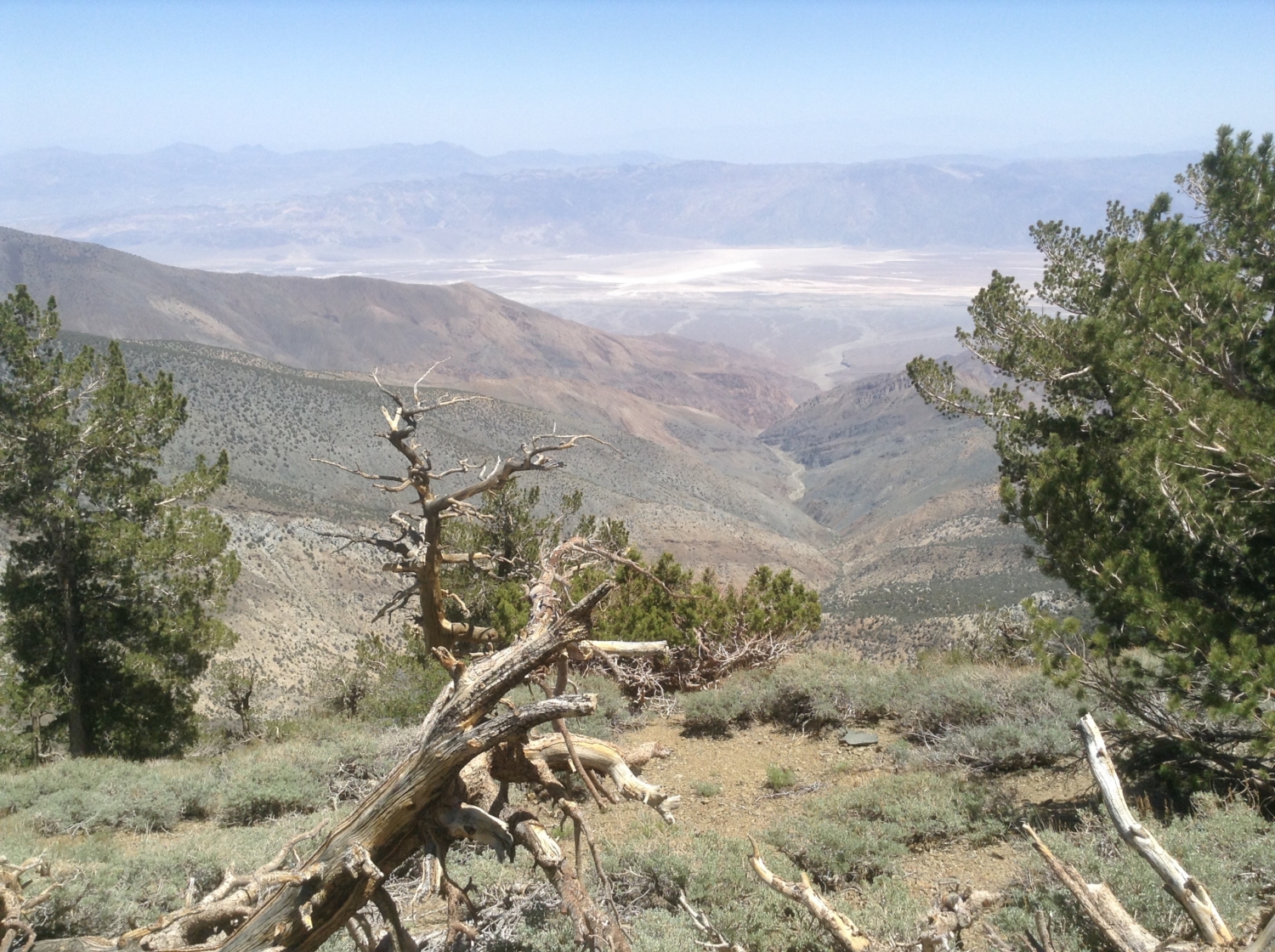
Enjoy the western views into Tuber and Jail Canyons—the rough canyons that nose in toward the Death Valley park boundary from the Panamint Valley below. To the east, Hanaupah Canyon’s three forks cut deeply into the contoured flanks of the Panamint Mountains. To the north, you can also make out the snaking road up to Aguereberry Point, where it looks like no read should ever exist. The road was hand-built by old-time miner Pete Aguereberry to show his friends his favorite view. At 6,433 feet, Aguereberry Point offers spectacular views of Death Valley. At this point you might be wishing you had chosen this drive-able option.

Views to the west and Death Valley.
Around the 4-mile mark, the trail begins to climb again in earnest, and you’ll begin passing through ancient Bristlecone pine forest. These gnarled trees are some of the oldest species of plant life on the planet, with some individuals dating to thousands of years old. They like to grow in harsh and arid environments, . The twisted trees dot the landscape, forming surreal shapes against the increasingly far-flung views—the Amargosa Range and Death Valley to the east, the Argus Range and Panamint Valley to the west.
The last mile to the peak climbs in a tight series of switchbacks. It’s not just the amazing views that will take your breath away. The thinner air and the tight coils of the rocky rise make for a strenuous final ascent, until finally, you poke your head above what appears to be the cloud line and Telescope Peak rolls in front of you in a swoop. Gulp in air and views as you enjoy the wildness and solitude of the peak—from the luminous salt flats of the valley floor to the distant Sierra Nevada Mountains.

Walk along the ridge line to the peak.
This is a great hike to cap off a trip to Death Valley. If you’ve been wandering down in the canyons and on the valley floor, you’ll get a chance for your own travel retrospective.
Tags: badwater basin, Bristlecone Pines, Furnace Creek, Panamint Springs, Stovepipe Wells, telescope peak