Of all the things you might find in Anza-Borrego Desert State Park, the least likely and most unexpected feature has to be water flowing over polished stone into cool, secluded, and heavily shaded grottos. Vast, sun-blasted aridness dominates so much of the park that you’d be excused for not knowing that the Sheep Canyon area, which includes similarly hydrologically blessed canyons like Cougar, Indian, and Salvador Canyons, would have some of the most beautiful waterfalls in the county. Yet, here they are in such abundance and of such sublime beauty that you almost start getting bored and blasé about them. No big deal; just another gorgeous Anza-Borrego waterfall.

Ferns and mosses at the first waterfall
Of course, if you want to see the waterfalls of Sheep Canyon, you’re going to have to work for it. Getting here is no picnic. You’ll have to follow the rough dirt track of Coyote Canyon Road from the north end of Borrego Springs. You’ll cross Coyote Creek at least twice – more if the creek is gushing.

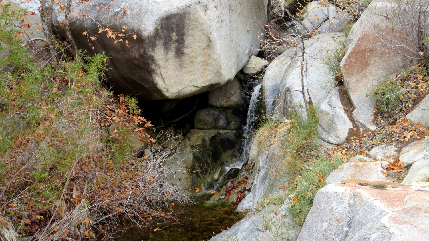
One of the numerous small falls in the canyon
Unless you drive a lifted 4WD vehicle, you’ll be extremely lucky to drive past Third Crossing. Beyond this point, the Lower Willows Bypass Road, dubbed affectionately as the “Granite Staircase” by off-road enthusiasts, is passable, and only barely so, by the most experienced of drivers.

Fall color and gleaming granite
And should you make it to the mouth of Sheep Canyon, you’ll have to deal with the usual desert obstacles, magnified by the presence of water: heat, exposure, steep slopes, anger bushes and danger poofs (that’s cholla and agave to you desert novices), scrambling, dense riparian vegetation, and route-finding. If you’re going to try to find the waterfalls in Sheep Canyon, be sure that you are prepared for what the desert will throw at you, otherwise you’ll go down swinging like a San Francisco Giant facing Clayton Kershaw.

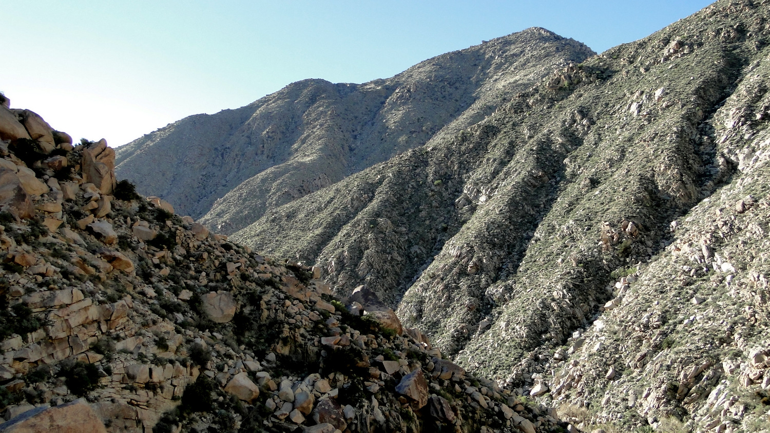
The rugged walls of Sheep Canyon
This is a difficult hike even for experienced desert travelers, and hikers coming into this route assuming they’re going to experience something like the easy walk down to Cedar Creek Falls are in for an extremely rude shock.

Detail of the third waterfall
If you’re walking from Third Crossing, cross over Coyote Creek and ascend the Lower Willows Bypass Road. Once at the top, follow Coyote Canyon west and southwest toward Sheep Canyon Campground. Once in Sheep Canyon Campground, turn due north and find the wide crease in the boulder-y hillside; this is Sheep Canyon. This entire walk from Third Crossing to Sheep Canyon tacks on an additional 8.2 miles and 500 feet of climbing.

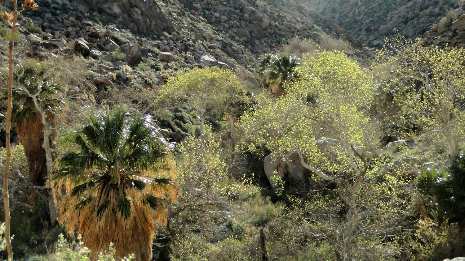
Typical vegetation: California fan palms and Fremont cottonwoods
If you’re walking this stretch, consider turning this hike into an overnight trip so that you can fully enjoy the wonders of the canyon and perhaps extend your trip over to nearby Cougar Canyon (also preposterously beautiful). Throughout the rest of the write-up, I will reckon all distances from the end of the road at the north end of Sheep Canyon Campground – your official starting point.

A garden of cacti and boulders
As you approach the mouth of Sheep Canyon, be sure to keep to the right. An even steeper crease in the earth to the left, South Fork Sheep Canyon, may look inviting, but passage through this steep ravine is both very challenging and way off course. As you enter Sheep Canyon, you’ll notice an informal path threading its way through vegetation and occasionally out of the canyon bottom where vegetation or boulders impede progress.

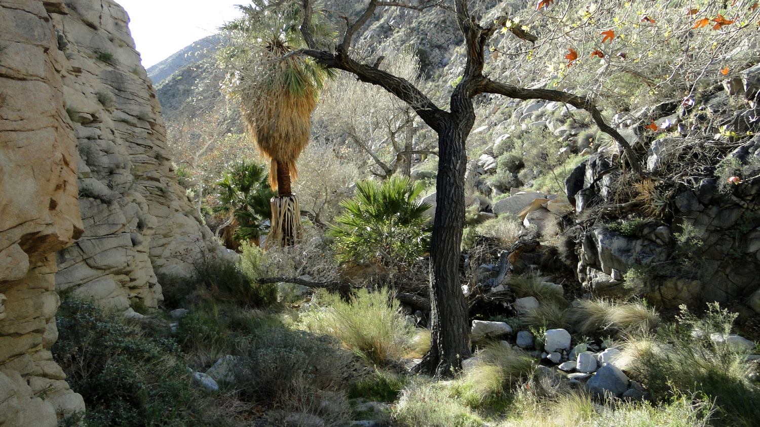
Sycamores in the canyon bottom
Your best bet in the canyon is to follow this path to the best of your ability, but you may want to resign yourself to the fact that, sooner or later, you’ll have to make your own way over several formidable obstacles without the aid of a trail. At times, the path crosses back and forth over the creek to avoid a sheer wall on either side of the canyon. At those times, it’s best to take the path of least resistance, even though it often means climbing out of the canyon and crossing over steep, cactus-infested slopes. The path of least resistance is an extremely relative term in the desert.

First waterfall
You reach the first waterfall at .6 mile by following an obscure, descending side path from the main path into a secluded grotto. The water cascades over a massive boulder perched twenty feet above. Sycamores and a few cottonwoods add shade, while water spilling into the grotto splashes and splatters merrily against polished rock. Patches of fern and moss, the most unexpected of desert denizens, add splashes of green to this tranquil setting.

Second waterfall
More waterfalls await the further you penetrate. The most beautiful of these waterfalls occurs at 1.1 miles. After an up-and-over bypass to avoid a jumble of boulders, the path drops you down into another vegetation choked section of the canyon. As you push through the mess of palm fronds, shrubs, and sycamore leaves, you enter an even larger grotto with a taller waterfall. Water tumbles down from above, smacking melodiously against the rock and reverberating off of the sheer walls to your right. Cottonwoods throw shade (not the antagonistic kind of shade, mind you) over the grotto, creating a comfortable, seductive resting spot. Of all of the waterfalls I’ve seen in the county, this one is my favorite. The combination of idyllic setting, the musical sound of the water, and the cool shade make it stand trunk and crown above the rest.

Third waterfall
If you’re able to pry yourself away from this waterfall, you’ll once again climb the hillside away from the grotto and begin a steep traverse up and over an even more formidable jumble of boulders with another waterfall at 1.2 miles. Once past this obstacle, if you drop down to the creek and backtrack a bit, you’ll find yourself above a series of pools atop another waterfall (this one is not accessible). The pools present an enticing spot for a quick dip if you’ve got the time.

Shallow pool
One final marvel awaits before it’s time to turn back. As you continue through the canyon, you’ll drop down a tricky slope into a wider, open basin. The creek cascades through a series of pools partially shaded by native California fan palms. A wide, shallow pool beckons overheated hikers. A large, flat boulder to the left and above the pool shows signs of Native American use. Several flat, comfortable areas present ideal spots for a long, leisurely lunch.

Flat Top Mountain further up Sheep Canyon
From here, it is possible to press on through the canyon into a spacious valley fed by numerous tributary ravines. The going gets really tough as you have to fight through dense growths of vegetation. The shallow pool at 1.5 miles is a great spot to stop and turnaround, although you will be able to find some sandy spots just beyond that will work as campsites.
Tags: Anza-Borrego Desert, Collins Valley, Coyote Canyon, Sheep Canyon, Sheep Canyon Primitive Camp, waterfalls


