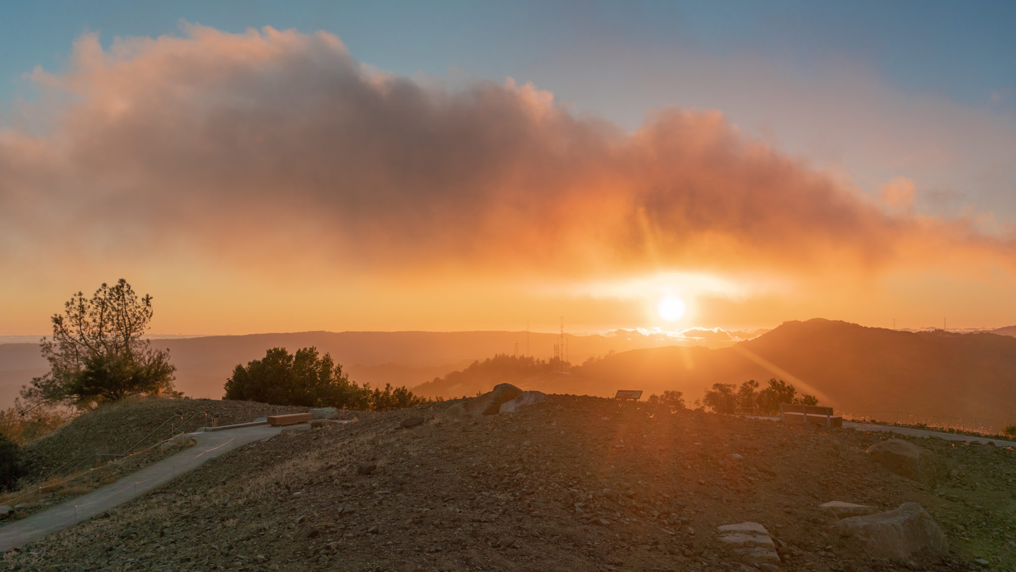
At 3,486 feet, Mount Umunhum is a prominent peak in the Santa Cruz Mountains just a 45-minute drive south of Silicon Valley. The concrete cube on its summit, visible throughout the Bay Area, pops in and out of view on the Mount Umunhum Trail, a surprisingly shady and gently graded 3.7-mile trail from the Bald Mountain Parking Area to Mount Umunhum’s summit. You can also drive to the Summit Parking Area and climb 159 stairs to the summit to watch the sunset. Either way, you are in for a treat: The 360-degree views of the Diablo Range, Santa Clara Valley, Santa Cruz Mountains, and Pacific Ocean, coupled with the mountain’s history, make it a stunning and enriching experience.
Start your hike from the Bald Mountain Parking Area, elevation 2,336 feet. To the west is Mount Umunhum’s summit and concrete radar tower, known as “the cube.” The white, golf ball-like tower south of it is a NEXRAD Doppler radar used by the National Weather Service to monitor weather and storms in the Bay Area.

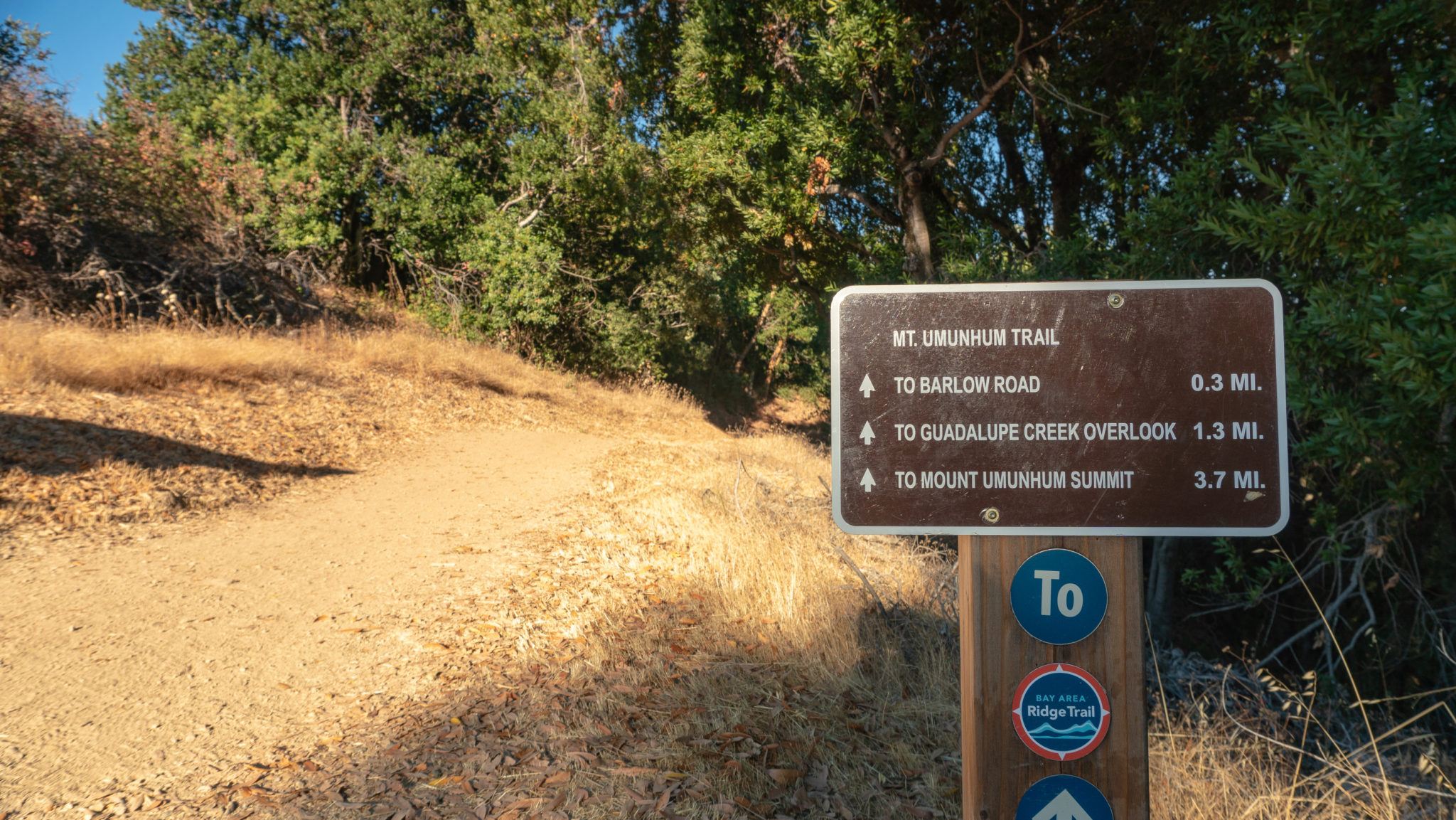
Head to the western edge of the parking lot, near the restrooms, and cross Mount Umunhum Road. Turn left onto a dirt trail that parallels the road for 200 feet to a display with free brochures and a trail sign. The brochures contain a topo map, historical information, and a detailed trail profile.


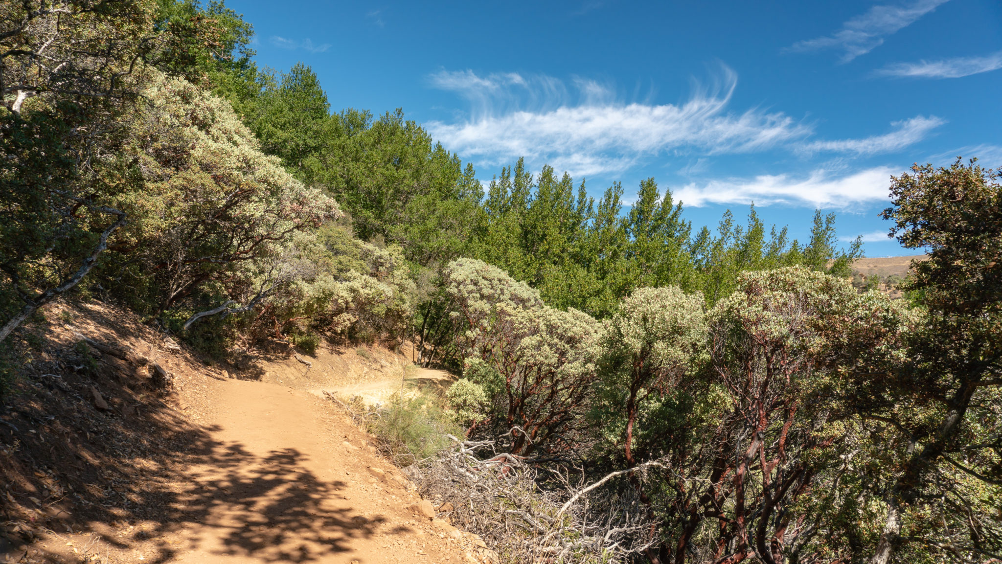
Continuing west, enter a cool forest of Pacific madrone and California bay laurel. A fun fact: the scientific name for California bay laurel, Umbellularia californica, is a nod to its leaf arrangement. Umbellularia means “little umbrella” in Latin and if you look carefully, you can see the leaves spiral around and dip inward in the shape of an umbrella.


In 0.3 miles, reach Barlow Road, a connector for mountain bikers, hikers, and equestrians coming up from the Woods Trail to the north. Mountain bikers who start from Lexington Reservoir or Los Gatos can easily connect to the Mount Umunhum Trail via Barlow Road to reach the summit. You can also take Barlow Road to Mount El Sombroso, a 2,999-foot peak in the Sierra Azul Open Space Preserve.

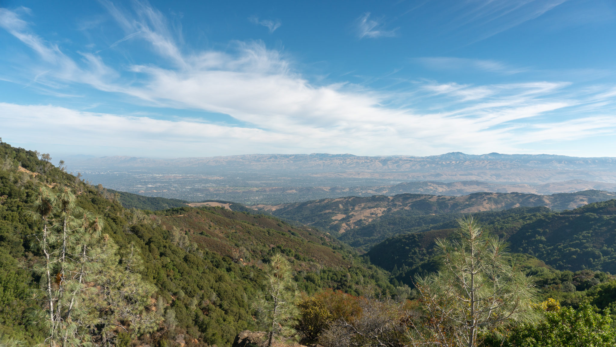
Cross Barlow Road to stay on the Mt Umunhum Trail towards Guadalupe Creek Overlook. The trail follows an east-west orientation along a ridgeline, so when the trees and shrubs occasionally clear, you can see views to the north and east of the Diablo Range with the white Lick Observatory buildings on top of Mount Hamilton, the tallest peak in the Bay Area at 4,209 feet.

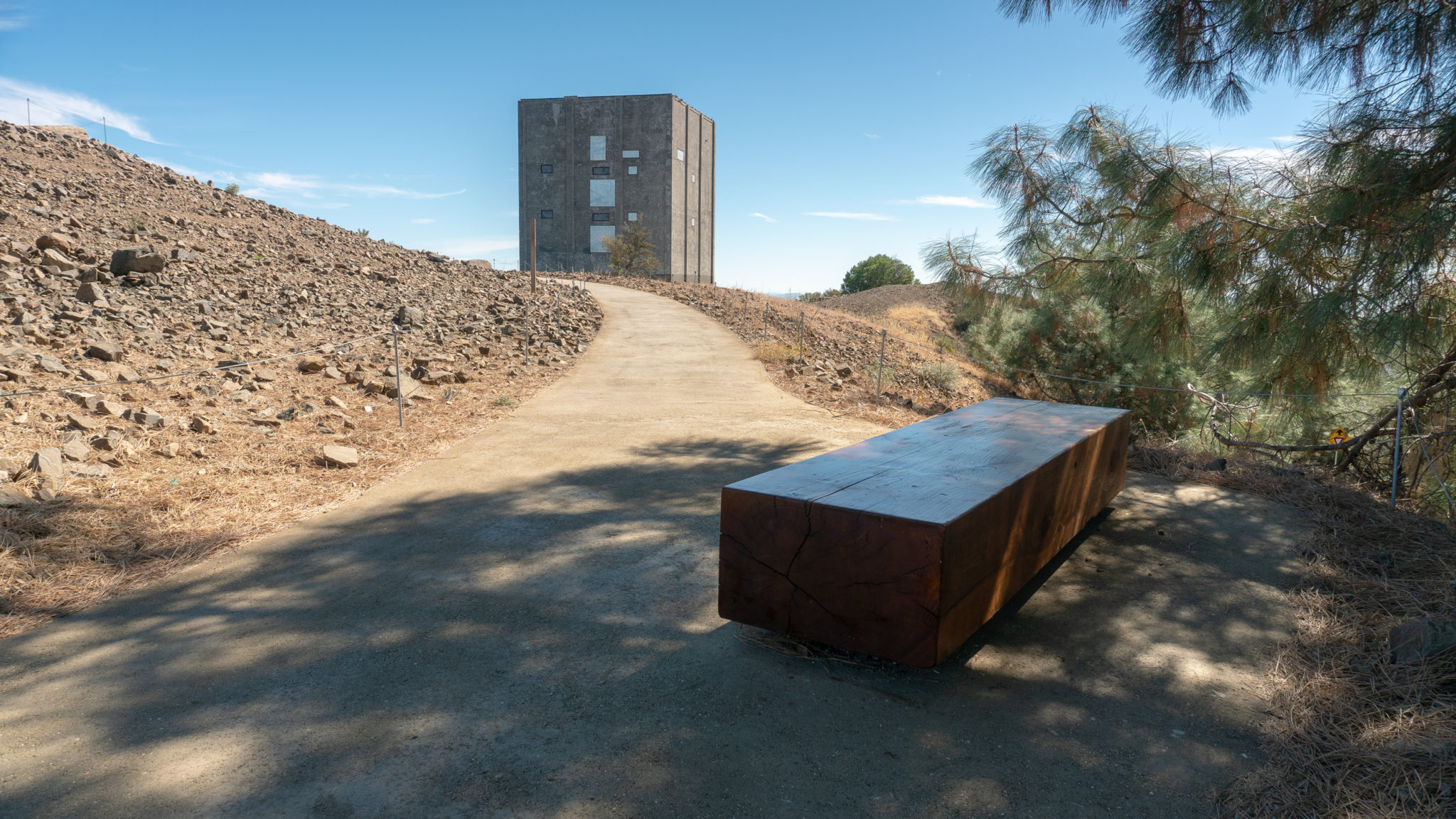
Overhead to the west is the 84.5-foot tall concrete cube, a foundation for a radar antenna or “sail” that once rested on top of it. The antenna was roughly 150 feet wide by 25 feet tall, and spun around every 12 seconds, 24 hours a day. The Air Force used it to monitor the skies from the Almaden Air Force Station on the summit of Mount Umunhum from 1957-1980. It could detect incoming aircrafts up to 250 miles out to sea. During the base’s lifetime, they never had to intercept enemy aircraft and eventually, satellite technology replaced the radar system.

Cross East Bridge at the 1.0-mile mark, the first of three bridges on the Mount Umunhum Trail.

In another 0.3 miles, arrive at a signed spur trail for Guadalupe Creek Overlook. To the northeast is Mount Hamilton, Santa Clara Valley, the city of San Jose, and Mount Diablo.

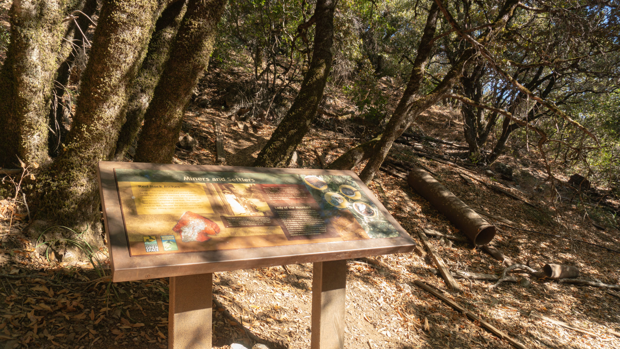
Back on the Mount Umunhum Trail, climb west through Central Bridge and West Bridge at the 2.0-mile mark. Between the two bridges are an educational display and the remains of a cabin. From the 1870s-1930s, Austrian and German refugees from the Franco-Prussian War lived in this area known as “Austrian Gulch” on the southwestern flanks of Mount Umunhum.


Ascend a gentle 480 feet over the next 1.5 miles, weaving through manzanita as you climb closer to the summit. How did Mount Umunhum get its name? “Umunhum” contains the root word for hummingbird in five Ohlone languages and when spoken, sounds like a hummingbird hovering. In the Mutsun language, the word for hummingbird is “humuunya.” Today you can see hummingbirds at Mount Umunhum’s summit during their migration in the spring and fall.

Approaching the 3.5-mile mark, reach an “area closed” sign. Normally you would stay straight here to continue on the trail to the summit, but in 2017, it closed because flecks of paint had sheared off from the radar tower and when tested, had small amounts of lead in them. Midpen closed the trail here and the area around the radar tower out of caution for the public.

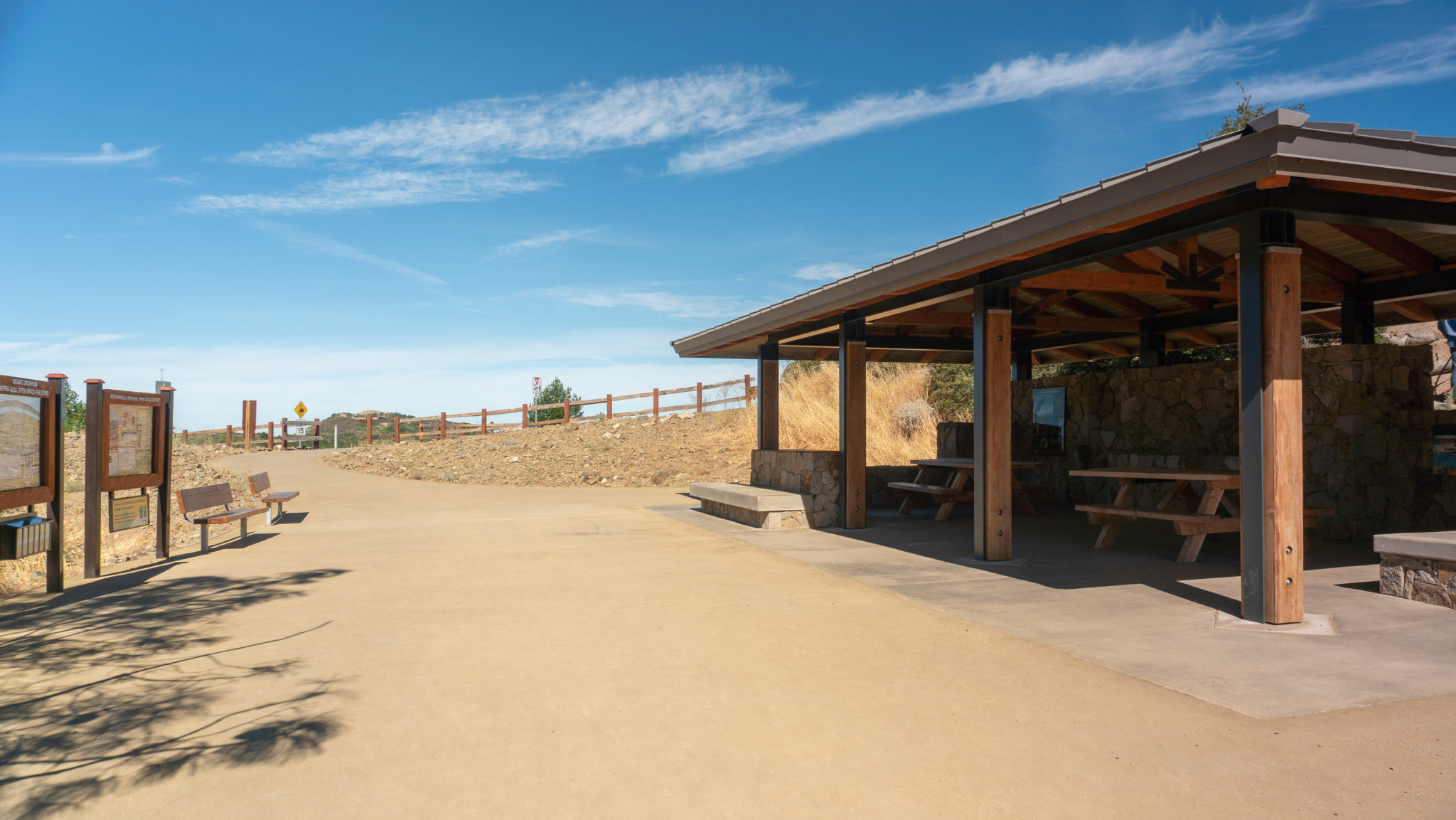
For now, bear left towards the Summit Parking Area, reaching a Trailhead Shelter with picnic tables, educational displays, and shade.

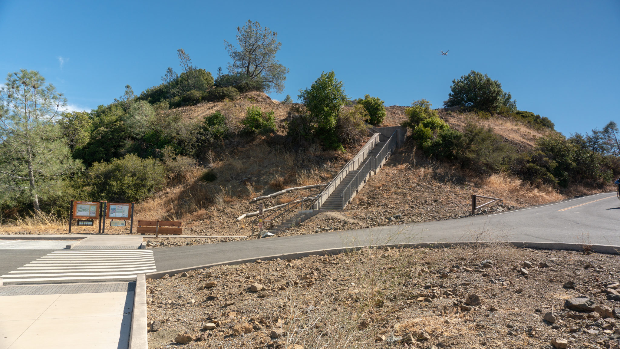
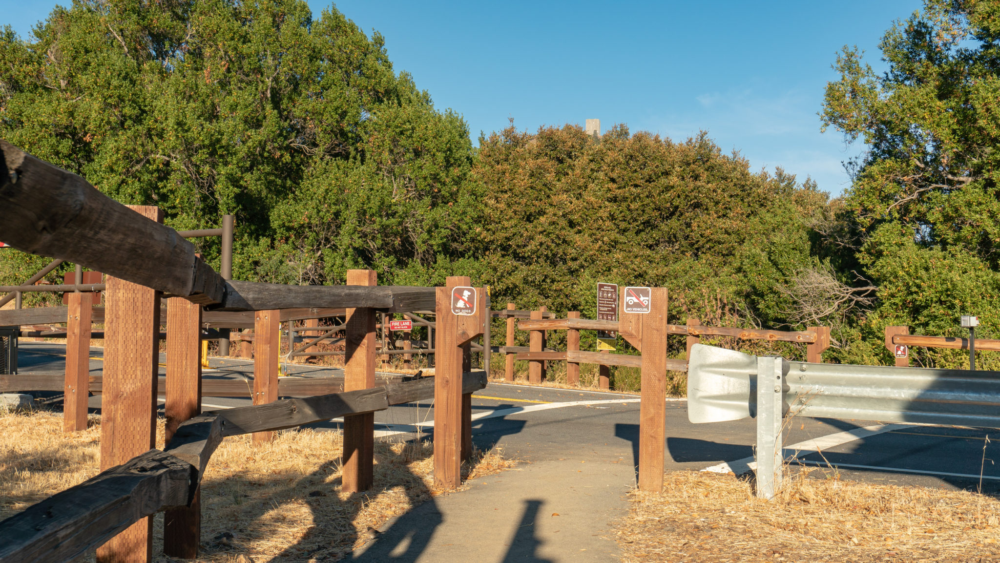
Cross Mount Umunhum Road and turn right towards the Summit Parking Area and staircase. The road on the right leads to ADA-accessible parking. In 1986, the MidPeninsula Regional Open Space District purchased 36 acres on the summit of Mount Umunhum. Over the course of 31 years, they supervised the clean-up of the summit, its reconstruction, and the 3.7-mile Mount Umunhum Trail that opened to the public in September 2017.

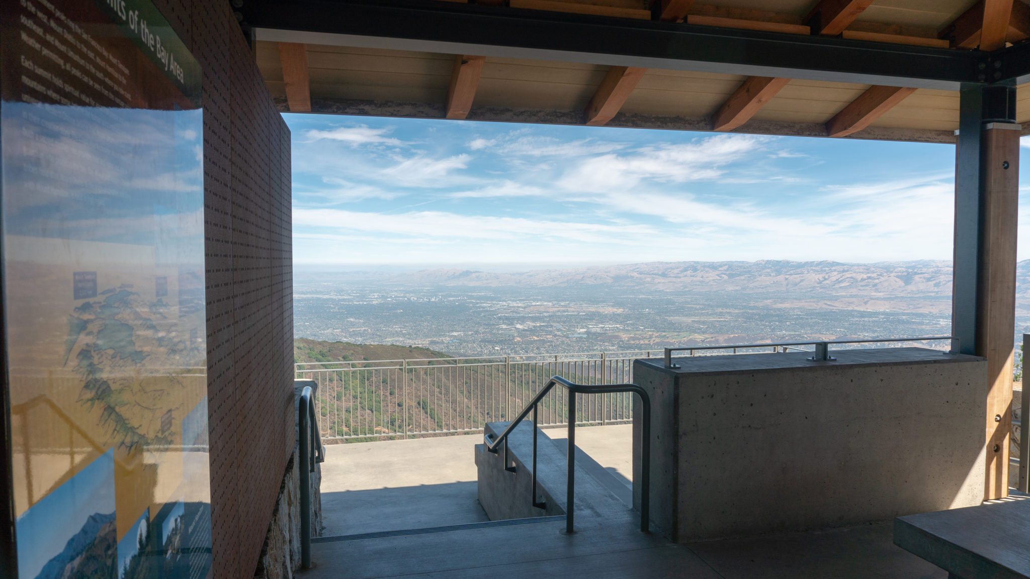
At the Summit Parking Area, climb 159 stairs northeast to reach the summit at 3.7 miles. An ADA-accessible and stroller-friendly path circles the summit, passing by the radar tower, a cantilever deck, and educational displays. Bear right towards the radar tower and summit shelter.

The views from the cantilever deck at the summit shelter are sprawling. From east to west, you have Mount Hamilton, Mount Diablo, San Jose, the San Jose Airport, Levi’s Stadium, Apple Park, Mount Tamalpais in the distance to the north, and Black Mountain. The peak directly to the north with antennas is Mount El Sombroso. If coming up from Lexington Reservoir or Los Gatos, mountain bikers will top out at Mount El Sombroso, elevation 2,999 feet, and then drop over 1,000 feet to connect with Barlow Road and the Mount Umunhum Trail to the summit.

Continuing on the circular path, enter a ceremonial circle built to honor the Native American history on Mount Umunhum. The opening to the circle is to the east because the east corresponds with the sunrise, and it is therefore symbolic of new beginnings and new opportunities. It is a special place for tribal bands to pray and dance. At the same time, everyone is welcome to use it. It is “a destination of prayer for all people,” says Valentin Lopez, Amah Mutsun Tribal Chair.

Circling around to the western side of the summit is a MidPeninsula Regional Open Space District display and map, where you can identify open space preserves to the north. To the west are views of Santa Cruz and the Pacific Ocean on a clear day. When ready, descend the stairs back to the summit parking area, retracing your steps on the Mount Umunhum Trail to the Bald Mountain Parking Area.

At its heart, Mount Umunhum is a mountaintop of stories—stories of a 31-year revitalization, stories of veterans and their children living on Mount Umunhum and protecting the Bay Area during the Cold War, stories of German and Austrian settlers making their home on the mountainside, and stories of Native Americans as active stewards and caretakers of Mount Umunhum. Their stories take place over generations, and are important to remember and memorialize in their own right. Mount Umunhum brings them together as one history in a memorable and poignant experience.
Notes:
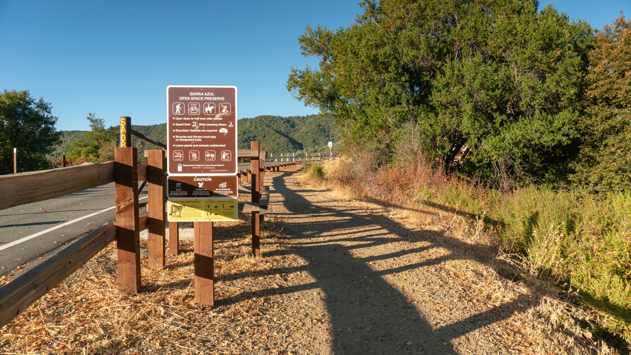
- The Mount Umunhum area is open from 7:00 a.m. to a half hour after sunset.
- A free brochure containing a detailed trail map is available in the parking areas as well as online.
- An audio tour of Mount Umunhum is available to download from the App Store and Google Play.
- Dogs are not allowed on the trails or in parking lots in the Mount Umunhum area.
- Restrooms are located in the Bald Mountain Parking Area and at the Summit Parking Area.
- Bring water: there are no water fountains or potable water sources on Mount Umunhum. There are no trash receptacles either.
Tags: bay area, california, Hiking, history, Mount Umunhum, Radar Tower, san francisco, Sierra Azul Open Space Preserve, South Bay, summit, sunset