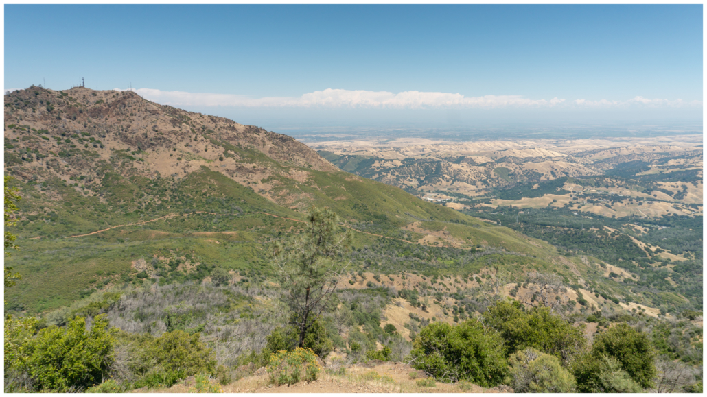
Mount Diablo Grand Loop circles Mount Diablo on an undulating route to phenomenal views of the Coast Range, East Bay Hills, and the Sierra Nevada on a clear day. Wildflowers and the northern waterways like the Sacramento-San Joaquin Delta, Suisun Bay, and Carquinez Strait punch up the scenic value. Although there are shady stretches, most of the hike is hot and exposed. The prolonged sun exposure combined with steep climbs through the last quarter of the hike make it a strenuous outing. It is best in winter and spring.
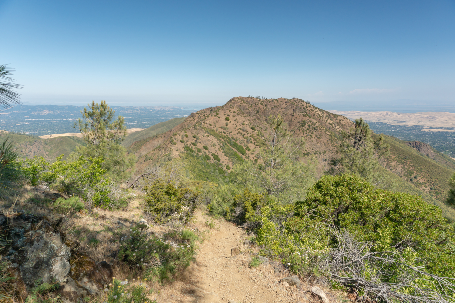
Looking north towards North Peak on the North Peak Trail.
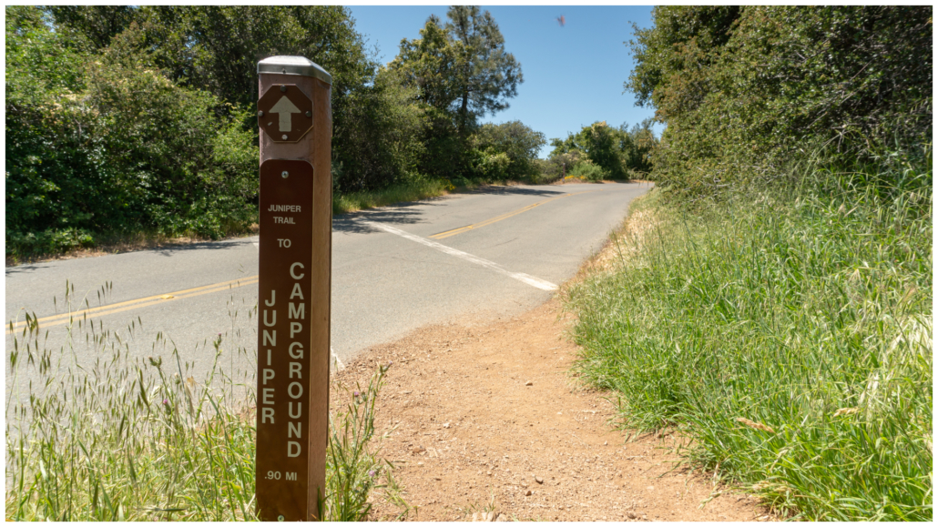
Start your hike from the wide pullout outside Juniper Campground. Walk down the road through the campground, where you will pass campers waking up in the morning. Head all the way back to the western edge of the campground.
Wide pullout outside Juniper Campground.
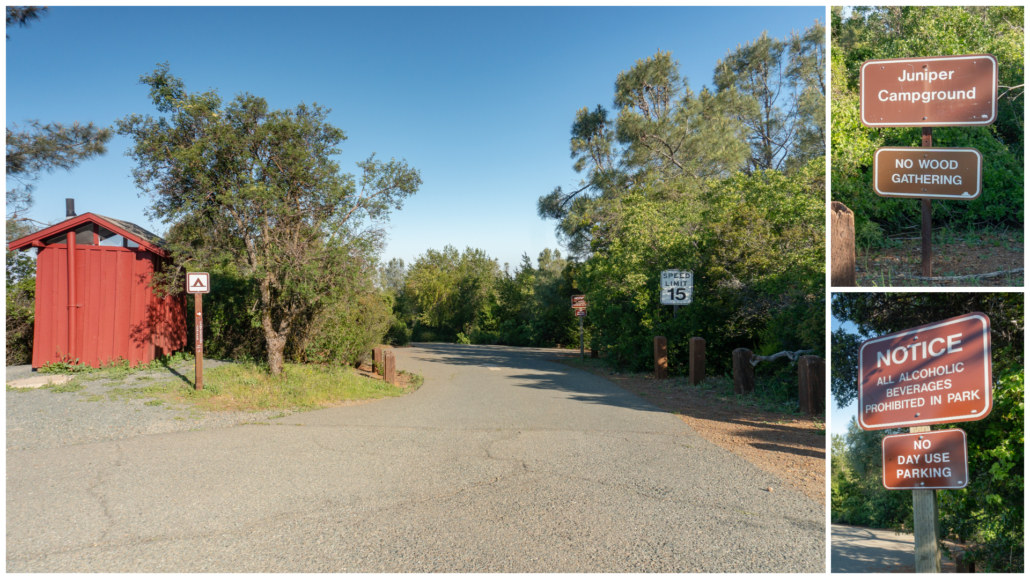
Road leading into Juniper Campground.
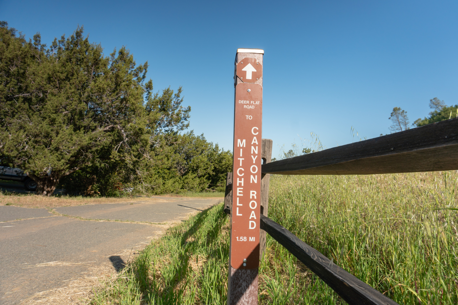
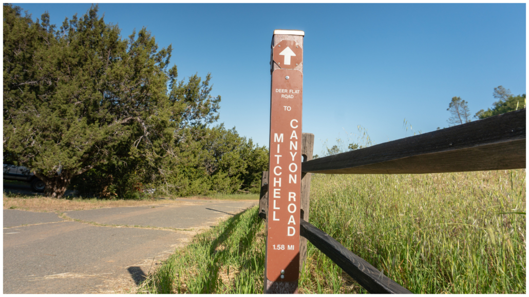
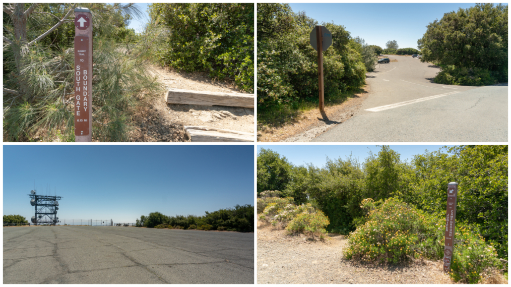
At a sharp bend in the road, across from the restrooms, spot the sign for Deer Flat Road towards Mitchell Canyon Road. If you are new to hiking in Mount Diablo State Park, it’s good to know how the trail signs work. The name of the trail you are on is in small print at the top. The trail you are heading towards is in larger letters at the bottom, and the number below is the distance between the two. So in this case, the trail you are on is Deer Flat Road, heading towards Mitchell Canyon Road, which you will reach in 1.58 miles. It is a bit counter-intuitive, but you get used to it after a while.
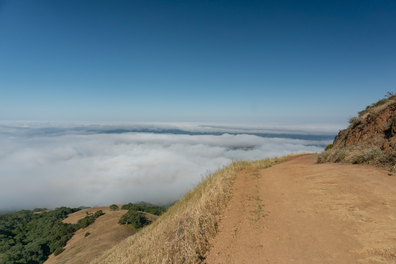
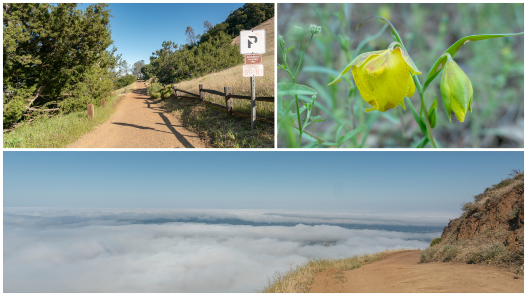
Take Deer Flat Road northwest towards Mitchell Canyon Road. The trailhead elevation is 2,940 feet, just 909 feet below Mount Diablo’s summit. As you hike out from the juniper trees, you get the benefit of that height. Looking southwest, you are eye-to-eye with the Santa Cruz Mountains, peering over sine waves of oak valleys. California bay trees provide a little bit of shade in the beginning, and in spring, Mount Diablo globe lilies dangle next to the road. If a layer of morning fog creeps in, you have the ethereal sensation of hiking above the clouds.
At 0.8 miles, veer right at a junction with Burma Road to stay on Deer Flat Road. So far, your hike is a breeze! All in all, you are descending 950 feet for the first 2.2 miles to Deer Flat Creek. Gray pine and blue oak intermingle with views of Eagle Peak. Chinese houses, wild hyacinth, narrowleaf goldenbush, and mule ears grow along the trail in spring.
View of Eagle Peak from Deer Flat Road.
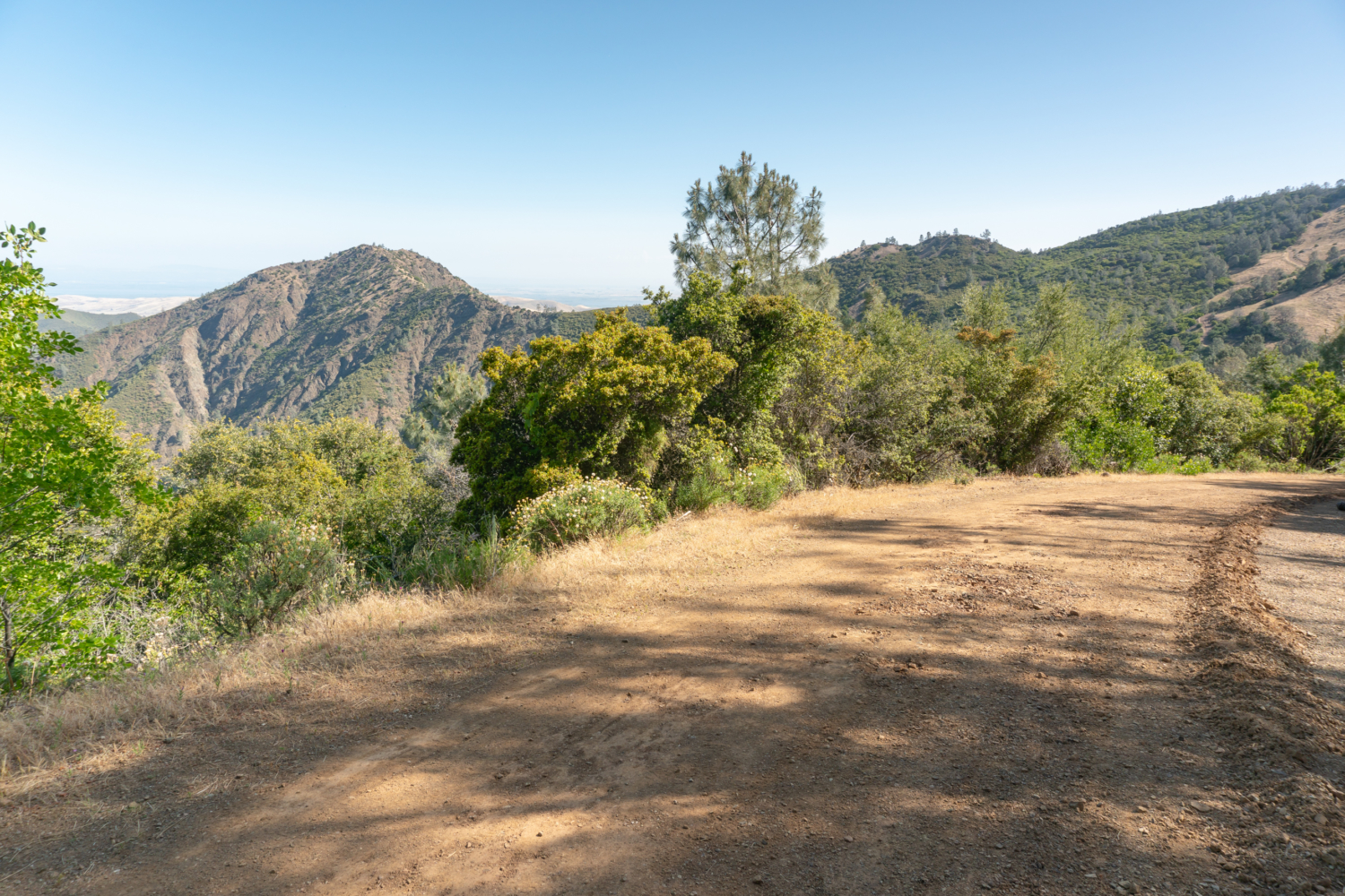
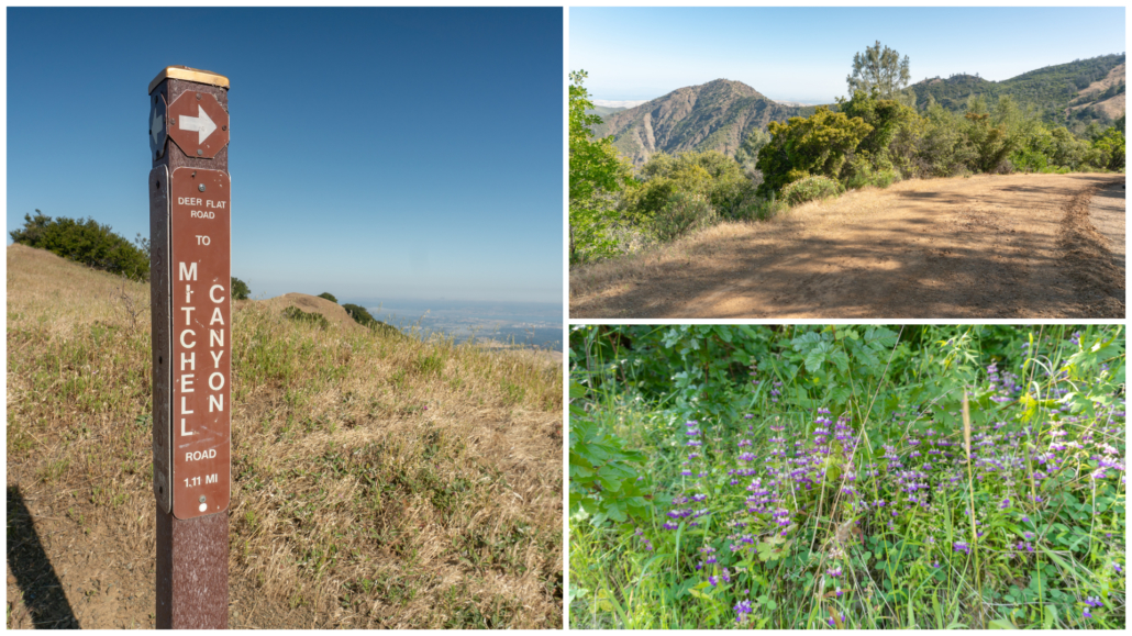
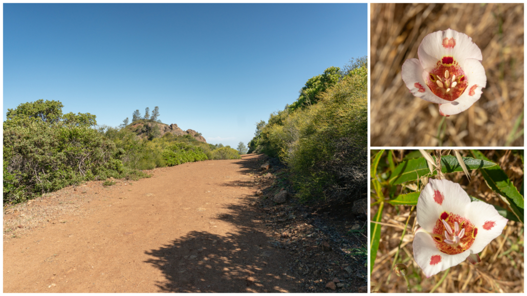
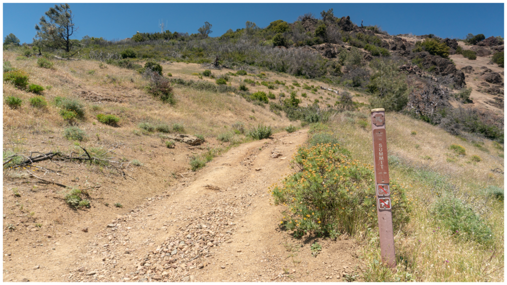
At the 2.0-mile mark, bear right at the Y-junction at Deer Flat, merging onto Meridian Ridge Road north towards Murchio Gap. The vista you see above you is Bald Ridge, which we will be hiking on after tagging Eagle Peak. More springtime wildflowers grow along the trail here: paintbrush, California larkspur, and orange wind poppies.
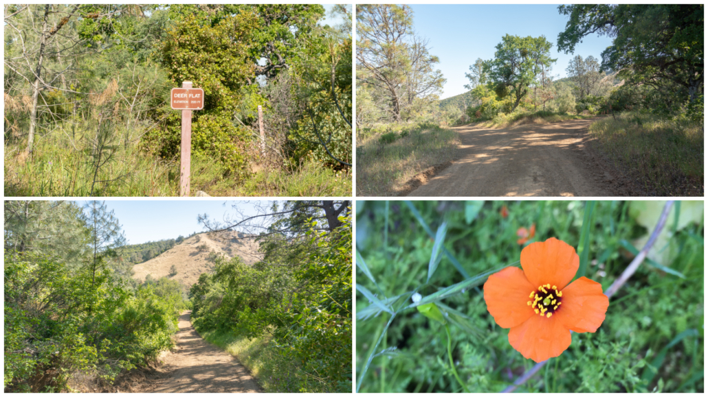
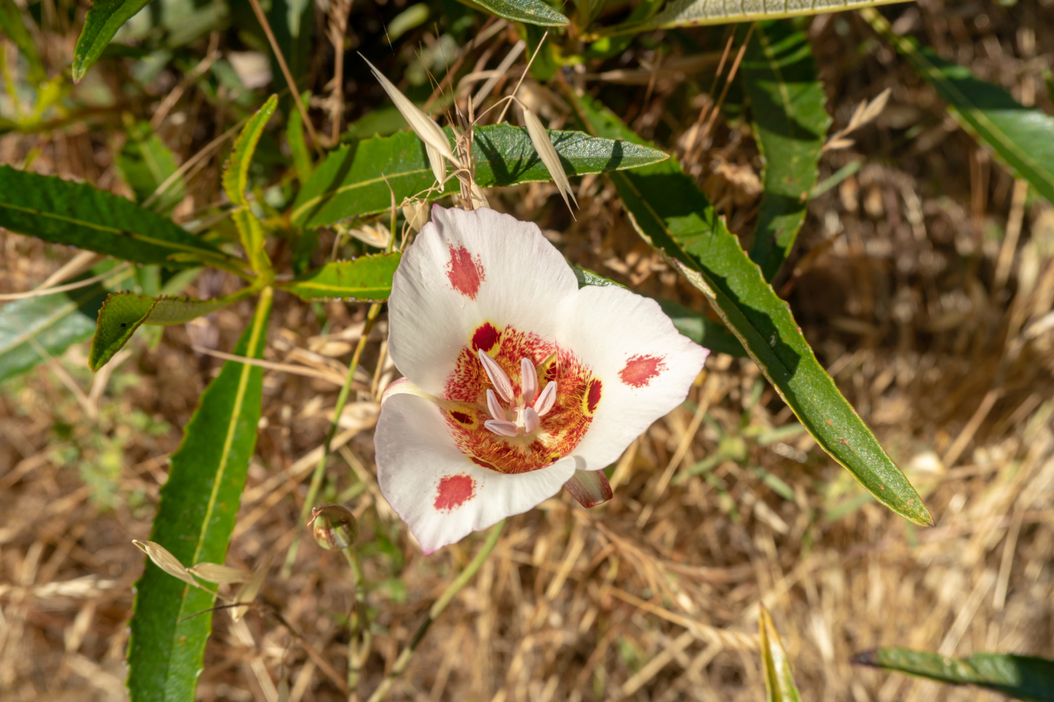
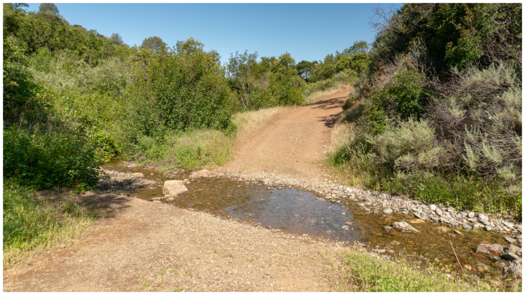
In 0.2 miles, hop across Deer Flat Creek and begin your ascent. Keep an eye out for butterfly mariposa lilies, recognizable by the two dots on each petal. The second dot is a paintbrush-like echo of the lower dot. Climb steadily among evergreen chaparral towards Murchio Gap.
Sunny chaparral and butterfly mariposa lilies
Arrive at Murchio Gap at 2.7 miles. Turn left and hop on the Eagle Peak Trail northwest for 0.8 miles to Eagle Peak. You are now on a rocky single track with chamise, buckbrush, and the occasional mariposa lily. The undulating trail descends to a saddle and then climbs to Eagle Peak, elevation 2,369 feet. The views are outstanding, particularly looking east to North Peak and Mount Diablo. Gulp—yep, we are heading to both. Let’s do this!
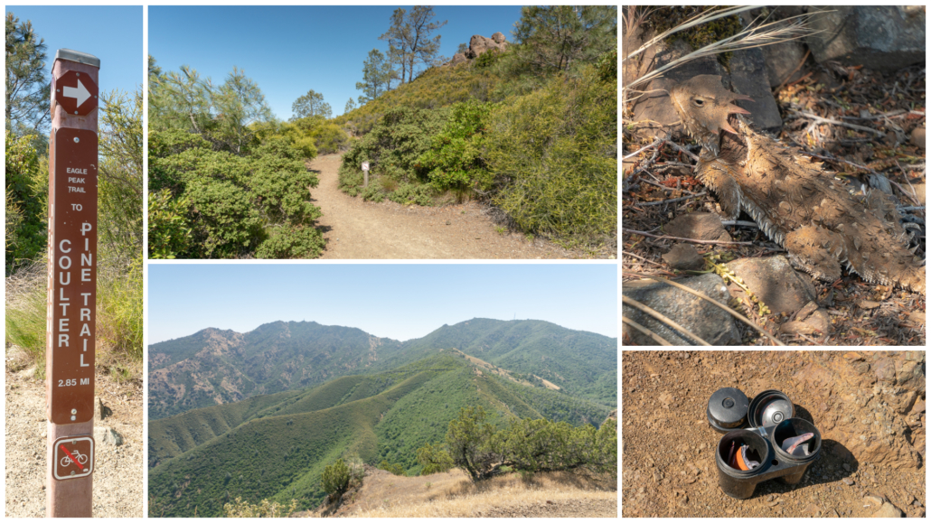
The Eagle Peak Trail leads to views of North Peak and Mount Diablo. Summit registers are located in black plastic bins. Blainville’s horned lizard on upper right.
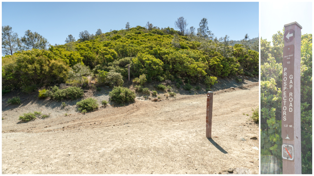
After your rest on Eagle Peak, retrace your steps back to Murchio Gap. At the 4.3 mile-mark, cross Meridian Ridge Road and pick up the Bald Ridge Trail, a partially shady “shortcut” to Prospectors Gap. The single-track trail climbs southeast through rough and steep terrain. It can have overgrown poison oak. A clearer, although slightly longer option is to turn left at Murchio Gap and take Meridian Ridge Road to Prospectors Gap Road instead, heading southeast. The trails parallel Bald Ridge and lead to the same place: Prospectors Gap.
Murchio Gap, looking across Meridian Ridge Road to the Bald Ridge Trail.
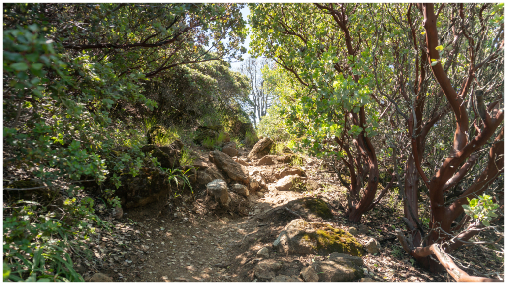
Slightly brushy and rocky Bald Ridge trail
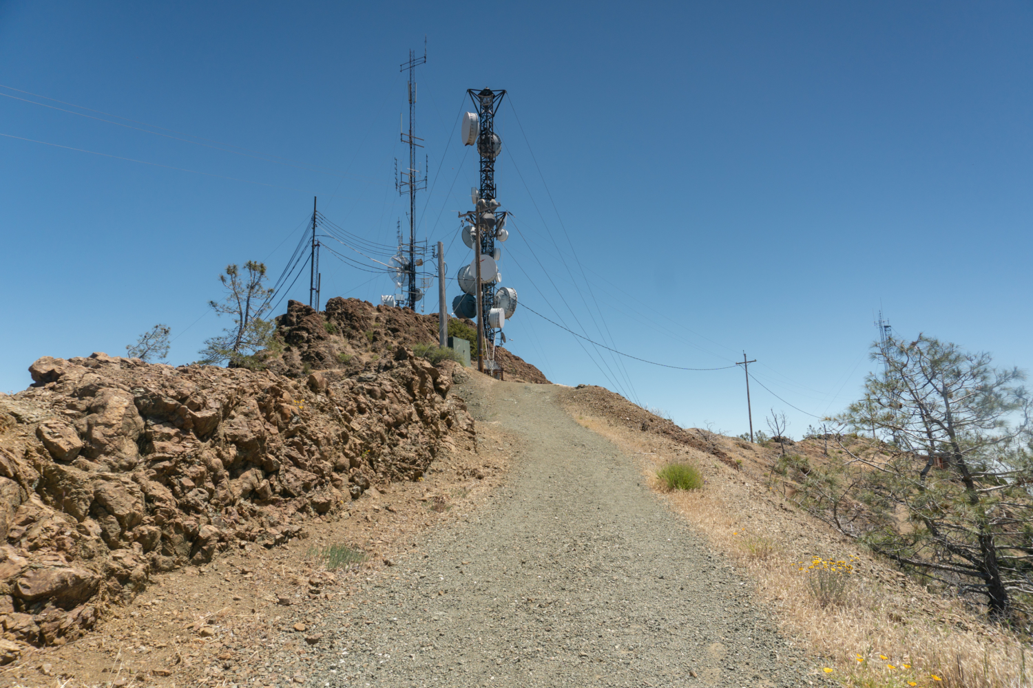
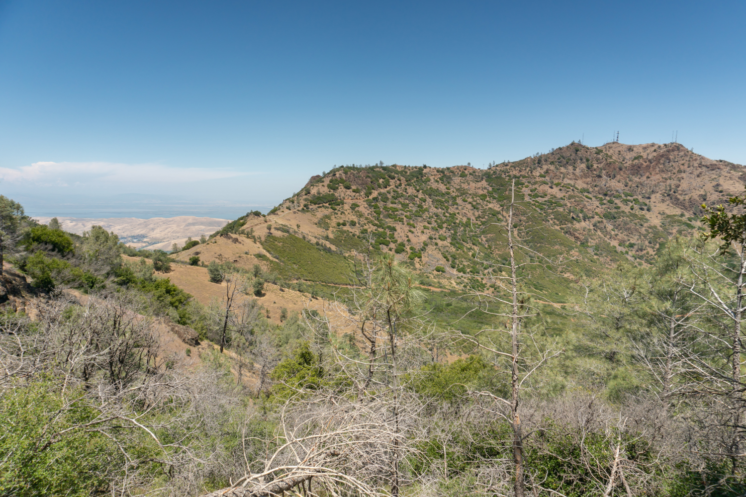
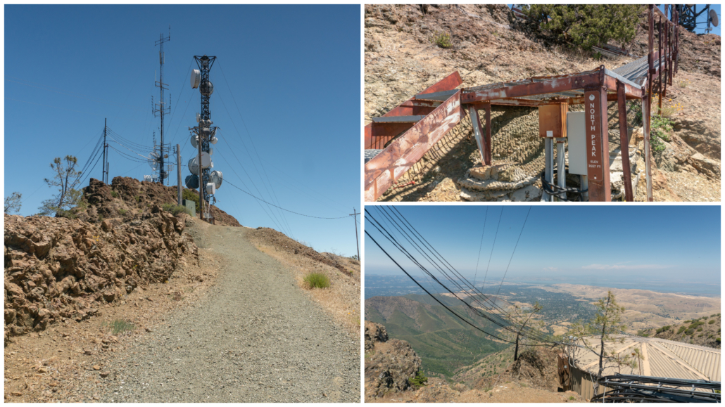
Reach the end of Bald Ridge Trail at 5.6 miles and turn right onto Prospectors Gap Road. In 75 feet, arrive at Prospectors Gap, a five-way junction. Turn left onto North Peak Road towards North Peak. The moderately steep, gravelly fire road climbs northeast towards radio towers. As you climb, it is rewarding to turn around and see the Mount Diablo observation deck and beacon.

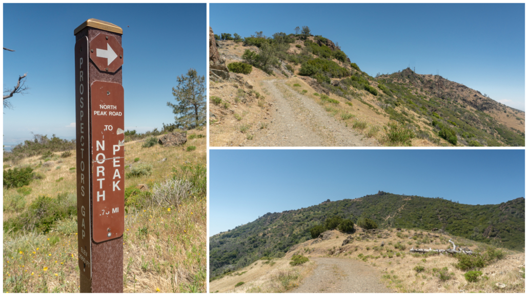
Ascending North Peak Road. On the upper right is the view as you climb towards North Peak. On the lower right is the Mount Diablo observation deck and beacon.
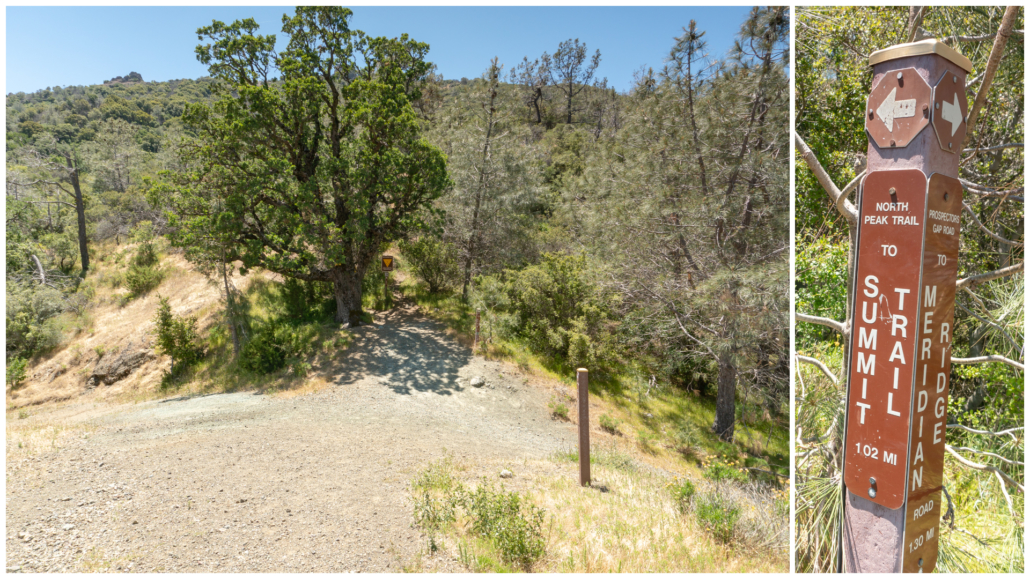
In a half mile, pass a junction on your left for the North Peak Trail, staying straight on North Peak Road. The North Peak Trail descends on a rubbly trail to Mount Olympia, elevation 2,946 feet. If you are looking to add more oomph to your grand loop hike, this is one way to do it. It is an extra 1.6 miles round-trip and 700 feet cumulative gain out-and-back to Mount Olympia.
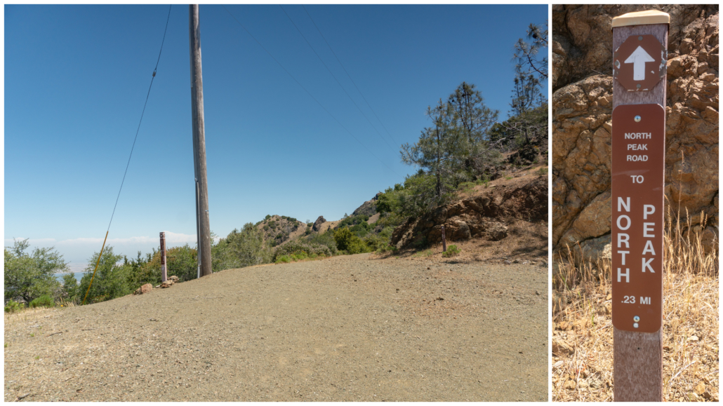
Staying straight on North Peak Road, hike up a steep, deeply rutted road surface. Take care here—the combination of slippery rocks, steepness, and unevenness of the road makes it easy to lose your feet out from under you.
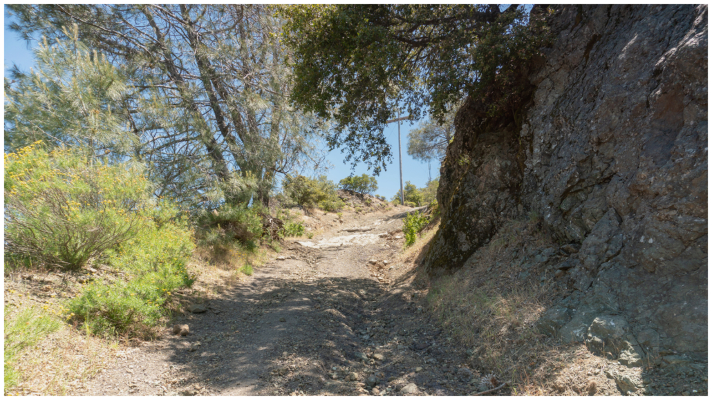
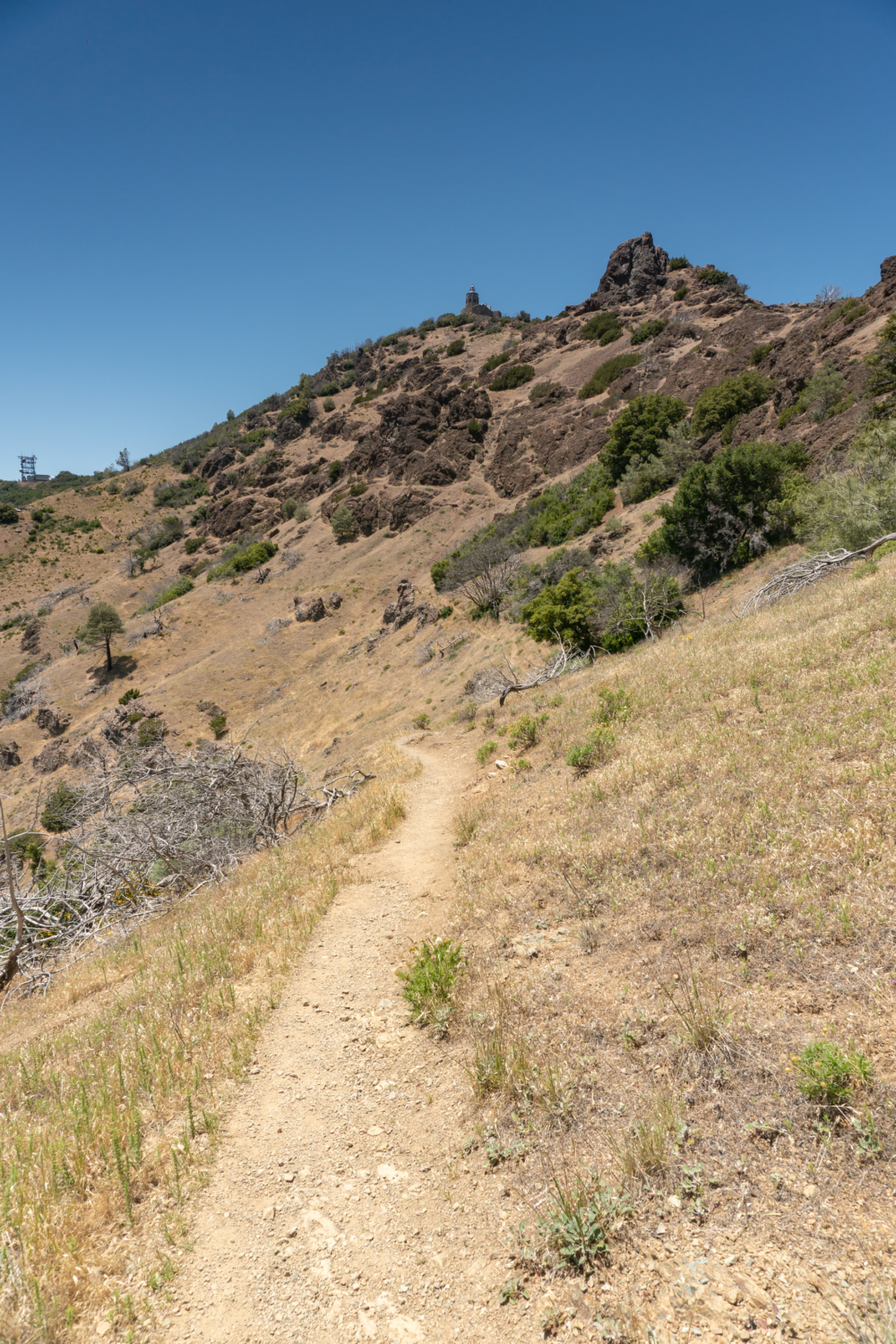
At 6.4 miles, reach the towers and a staircase marked North Peak, elevation 3,557 feet. A landing at the top features a partially obscured view of northern waterways, Mount Zion, and ridgelines in Mount Diablo State Park. Two peaks down, one to go!
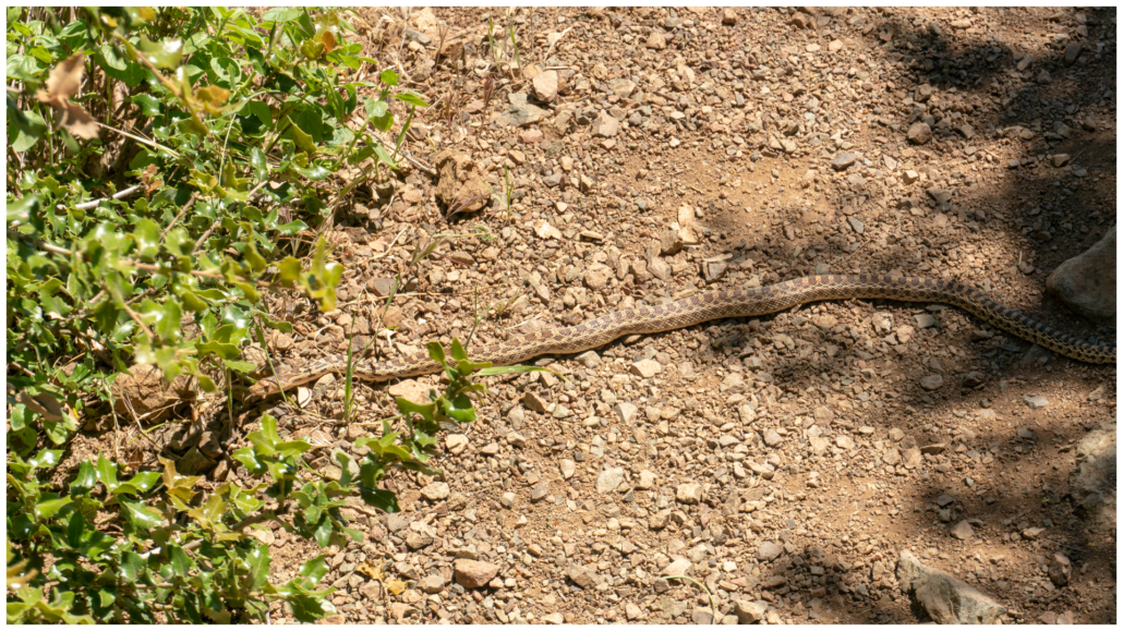
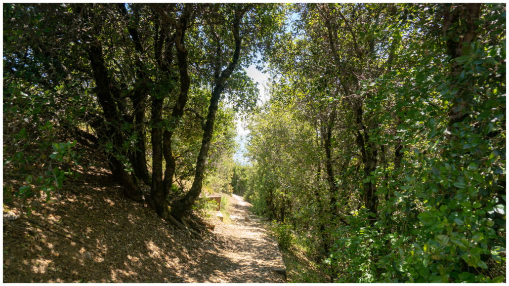
Retrace your steps to Prospectors Gap at the 7.2-mile mark. Cross Prospectors Gap Road and pick up the North Peak Trail, heading south towards the Summit Trail. The smooth dirt single track is partially shady with red larkspur, narrowleaf goldenbush, and lupine in spring. On this day, I saw two snakes—one laying across the sunny trail, and a rattlesnake on the Summit Trail. If you see a snake, leave them be and give them a wide berth. Here are a few protocols from the CA Department of Fish and Wildlife regarding rattlesnake bites.
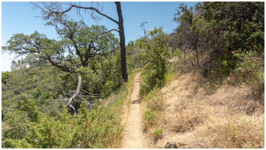
Reach the end of the North Peak Trail at 8.3 miles. Make a sharp right onto the Summit Trail towards the summit. In spring, you may see purple owl’s clover, penstemon, and butterflies resting on yerba santa shrubs. Yerba santa means “holy weed” or “holy herb” in Spanish, and was so named by missionaries because of its medicinal uses they had learned about from native Californians.
In 0.3 miles, the Summit Trail temporarily dead-ends at an overflow parking lot. Turn right, and then right again, carefully walking up the side of Summit Road. In 275 feet, turn left into the shady median, picking back up the Summit Trail.
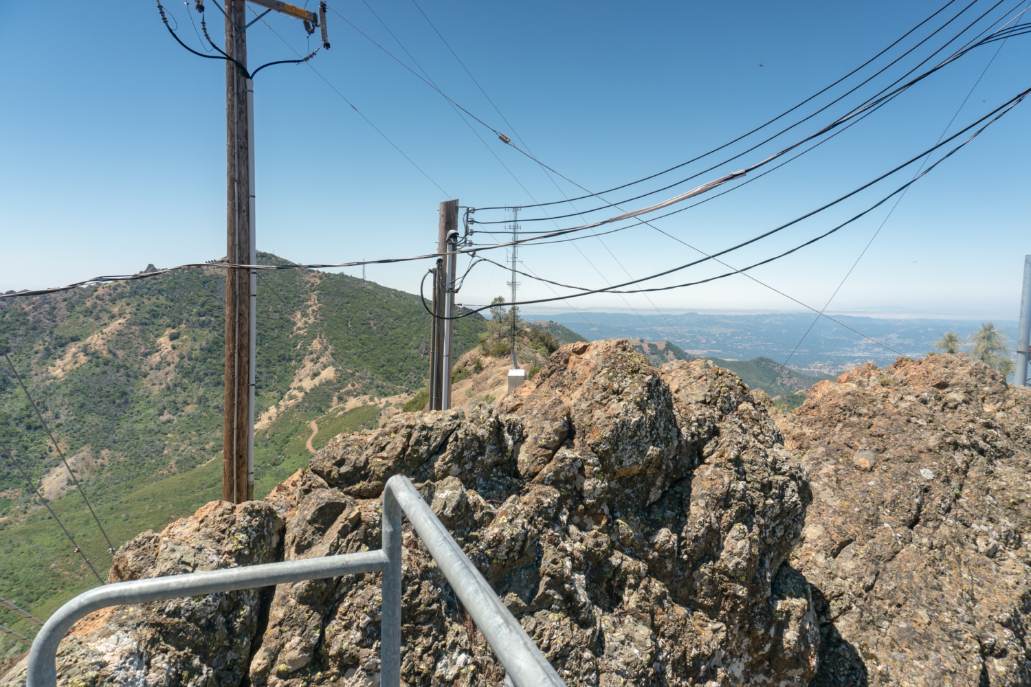
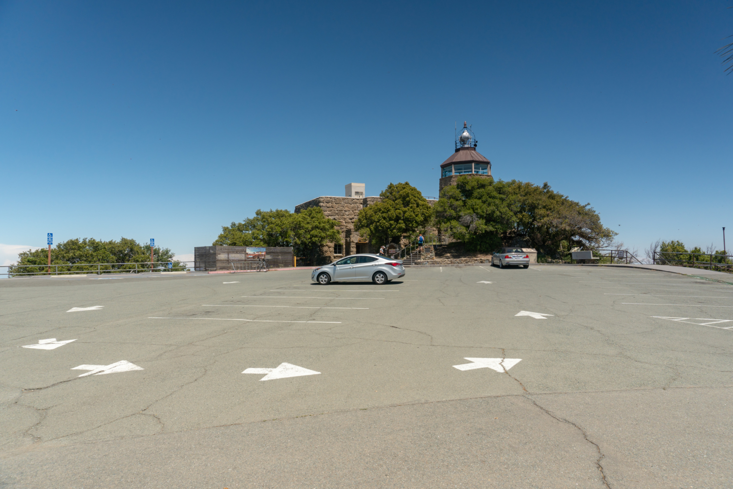
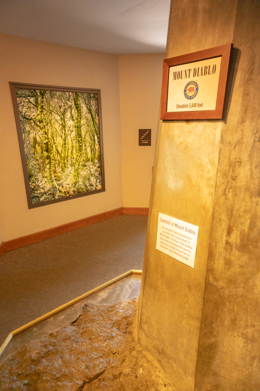
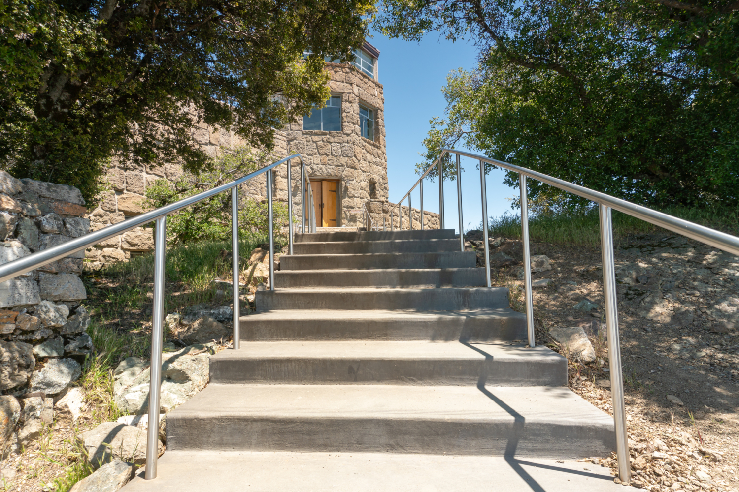
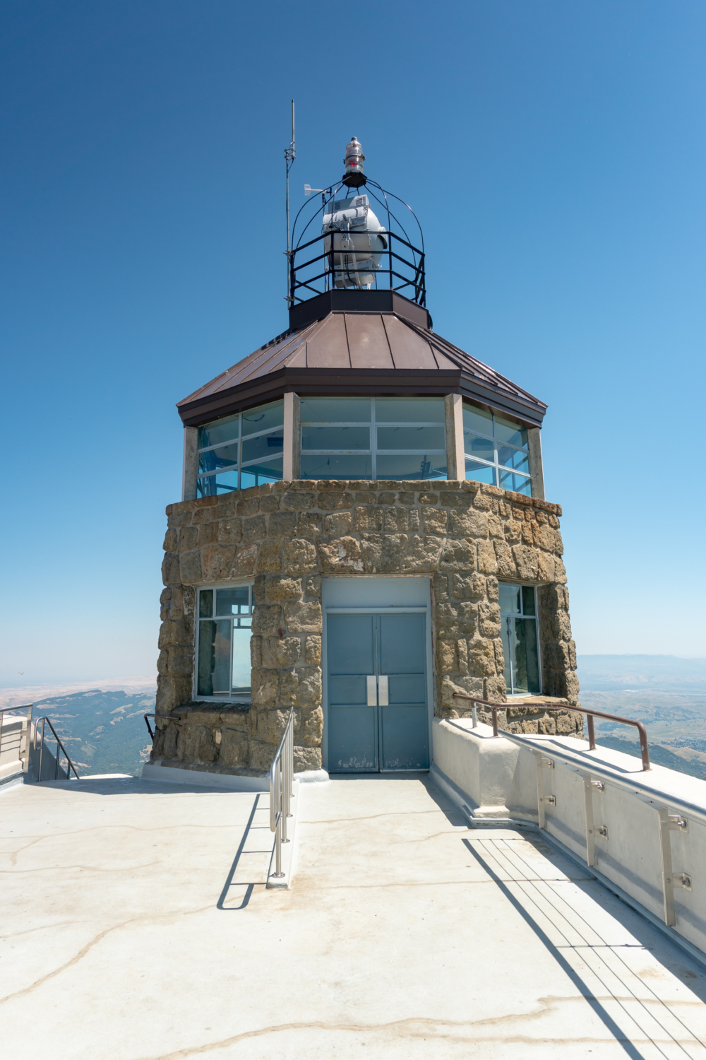
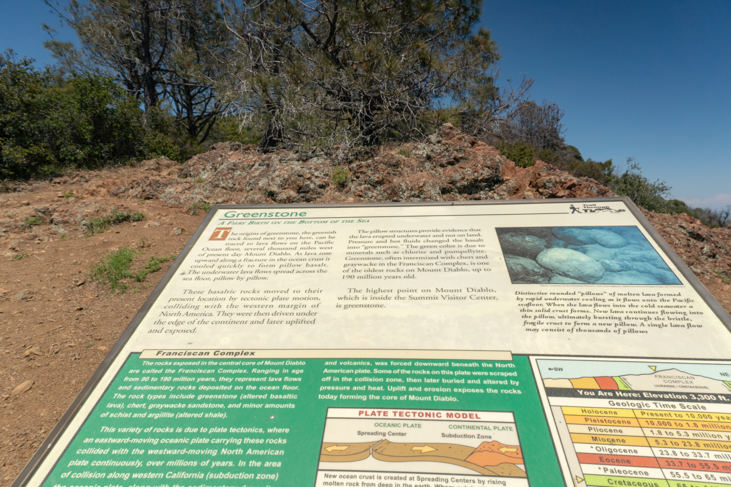
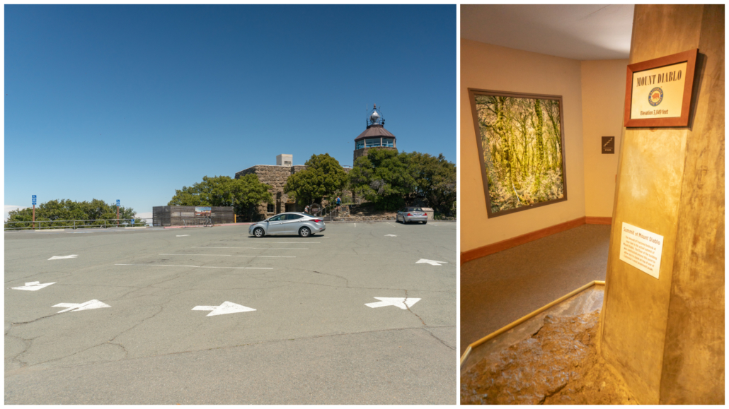
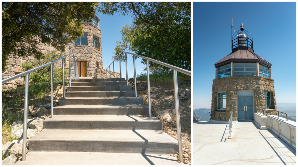
At 8.8 miles, pop out at the Mount Diablo summit parking lot. The Summit Visitor Center is straight ahead on the lower level, open 10:00 a.m. – 4:00 p.m. daily. A water fountain is outside next to the visitor center, and an outdoor staircase leads to the observation deck and beacon. Head inside the visitor center and treat yourself to a Gatorade or an ice cream. Be sure to take the stairs up the back to check out the wildflower paintings by WPA artists and the true summit of Mount Diablo in the exhibit area.
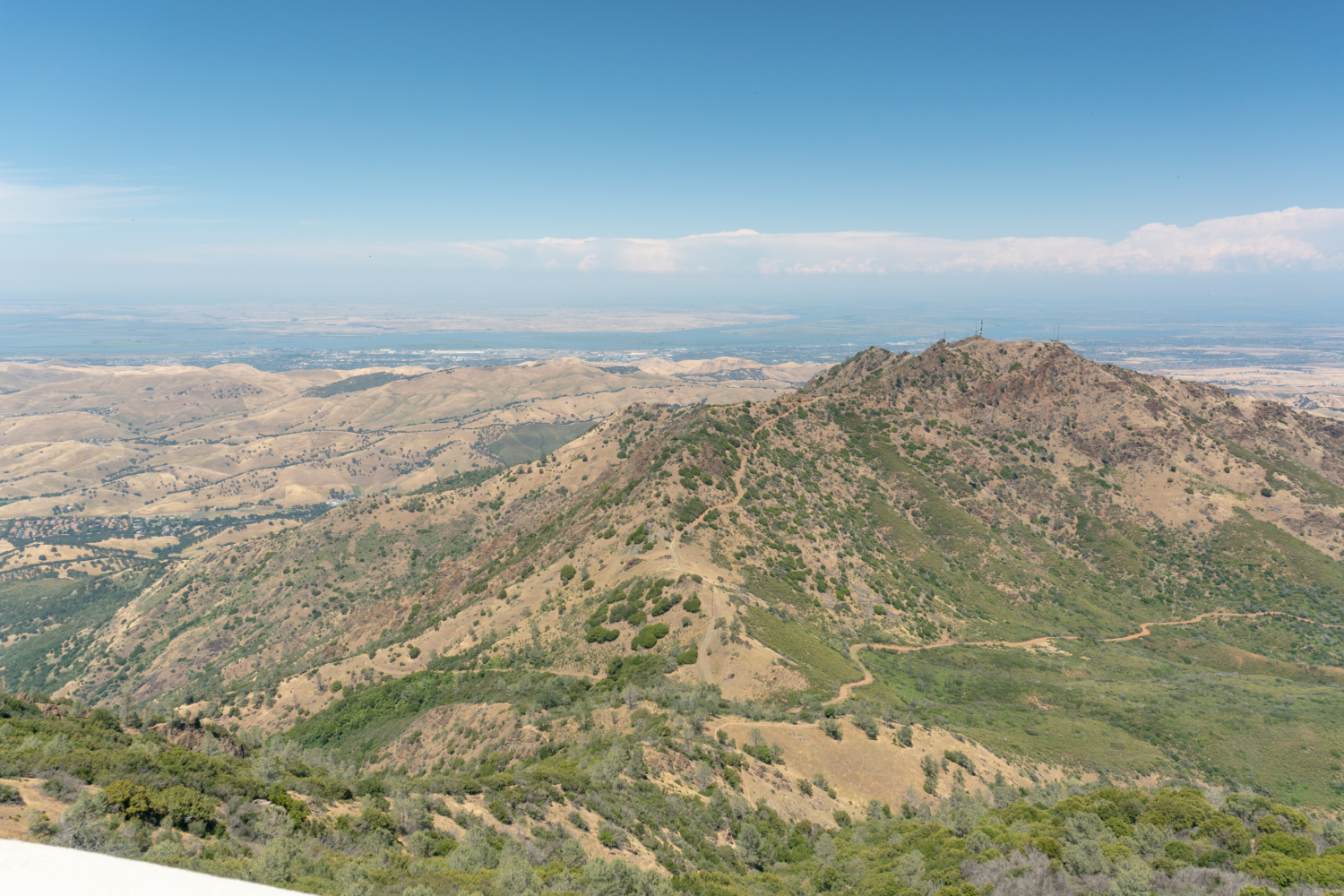
After you have checked out the inside, head outside and climb up to observation deck to see the beacon and view. My favorite part about standing on the deck is looking down at North Peak, Prospectors Gap, and Eagle Peak, seeing the northern waterways leading west to the San Francisco Bay, and finding the outline of Mount Tamalpais to the west. On a clear day, you can see Mount Saint Helena to the northwest and the Sierra Nevada to the east.
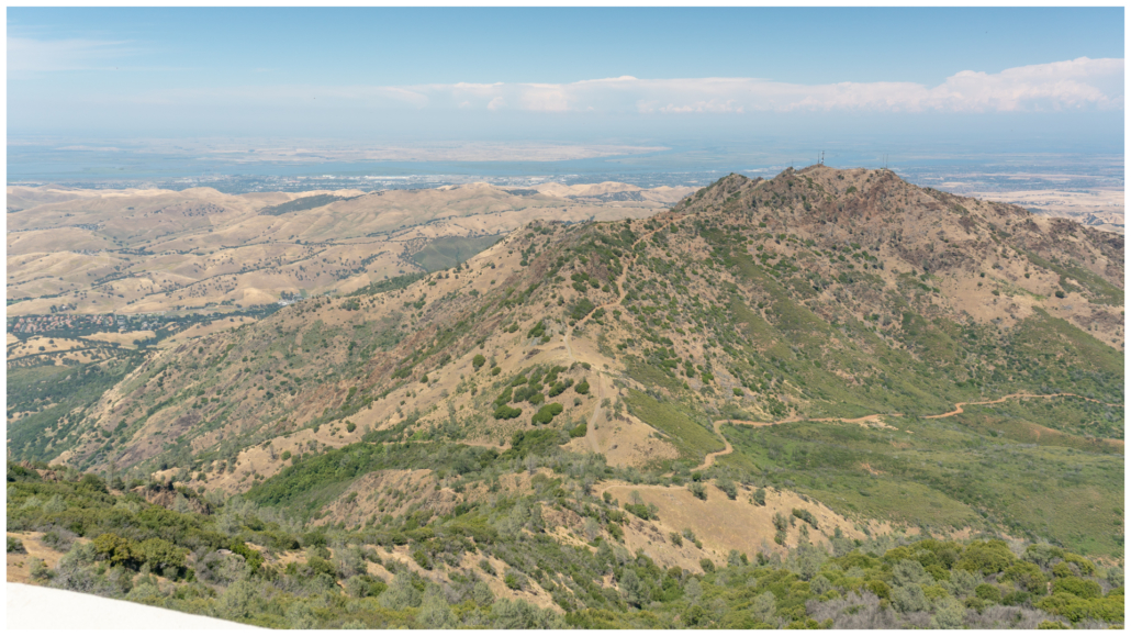
Looking northwest towards North Peak and the Sacramento-San Joaquin Delta.

View northwest towards Eagle Peak, Mitchell Canyon, and Mount Zion.
When ready, retrace your steps on the Summit Trail through the median. Pass the stop sign, and return to the overflow parking lot. Head all the way to the back of the parking lot. Pick up the Juniper Trail towards Juniper Campground at the 9.2 mile-mark.
Descend through tunnels of chamise, buckbrush, and pitcher sage. In 0.1 miles, carefully cross Summit Road, picking up the Juniper Trail on the other side.
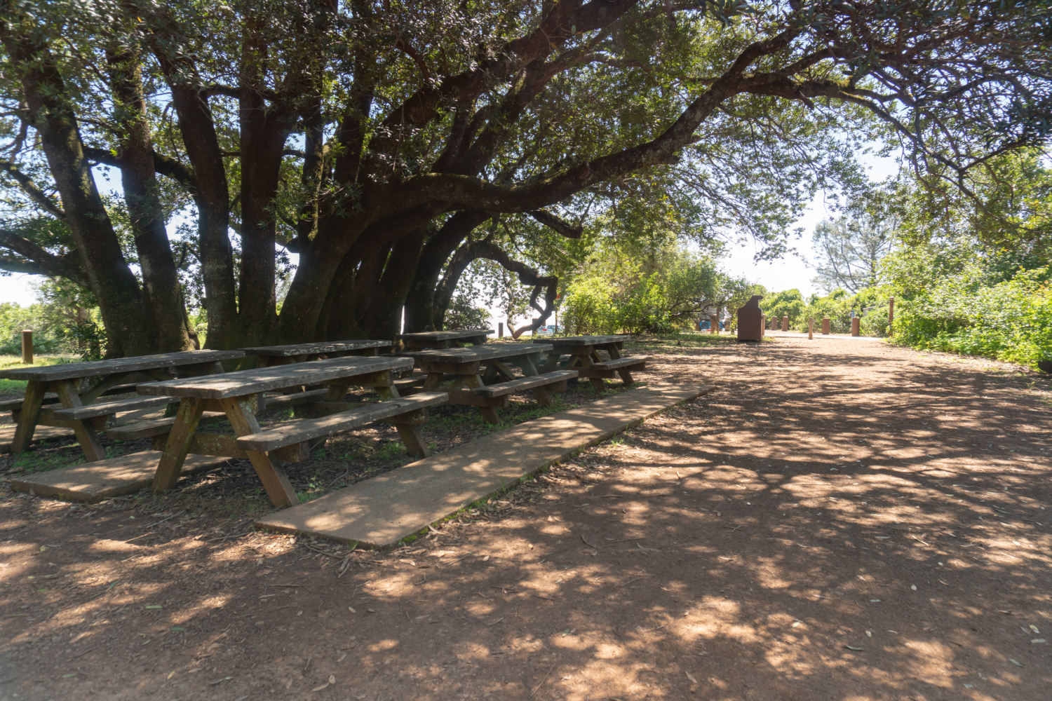
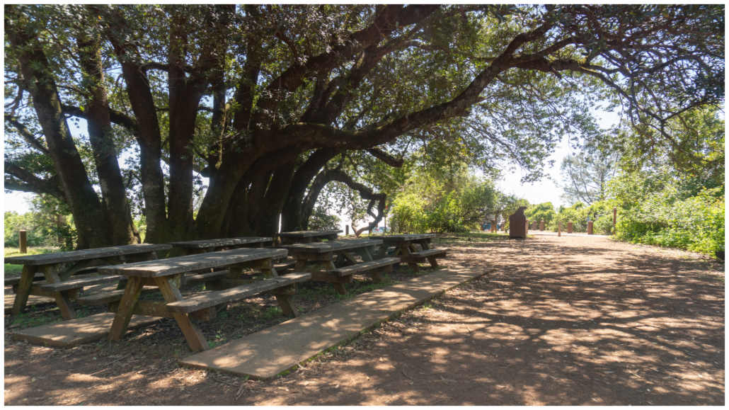
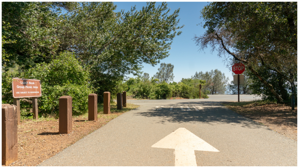
Finish your hike at the Laurel Nook Picnic Area in Juniper Campground. The wide turnout where you parked is just south in 100 feet.
Notes:
- Mount Diablo State Park is open daily from 8:00 a.m. to sunset.
- The sun exposure and steep climbs made this a strenuous hike. Avoid it in summer unless it is a cool, cloudy day.
- The vehicle entrance fee for the South Gate Road entrance is $10, payable by cash or check in self-registration envelopes. Credit and debit cards are accepted when kiosks are staffed.
- The Summit Visitor Center is open daily from 10:00 a.m. – 4:00 p.m. There is no entrance fee. A water fountain is location outside.
- Restrooms are available in Juniper Campground and on Mount Diablo’s summit.
- Dogs are not allowed on trails in Mount Diablo State Park. Leashed dogs are allowed in developed areas of the park.
- The Mount Diablo Interpretive Association (mdia.org) produces a detailed topo map called Trail Map of Mount Diablo State Park. It has all the trails, campgrounds, and entrances in the state park clearly marked. I highly recommend it. You can purchase it at sporting goods stores, Mount Diablo Visitor Centers, and on the MDIA’s website.
Tags: east bay, Mount Diablo State Park, San Francisco Bay Area, wildflowers