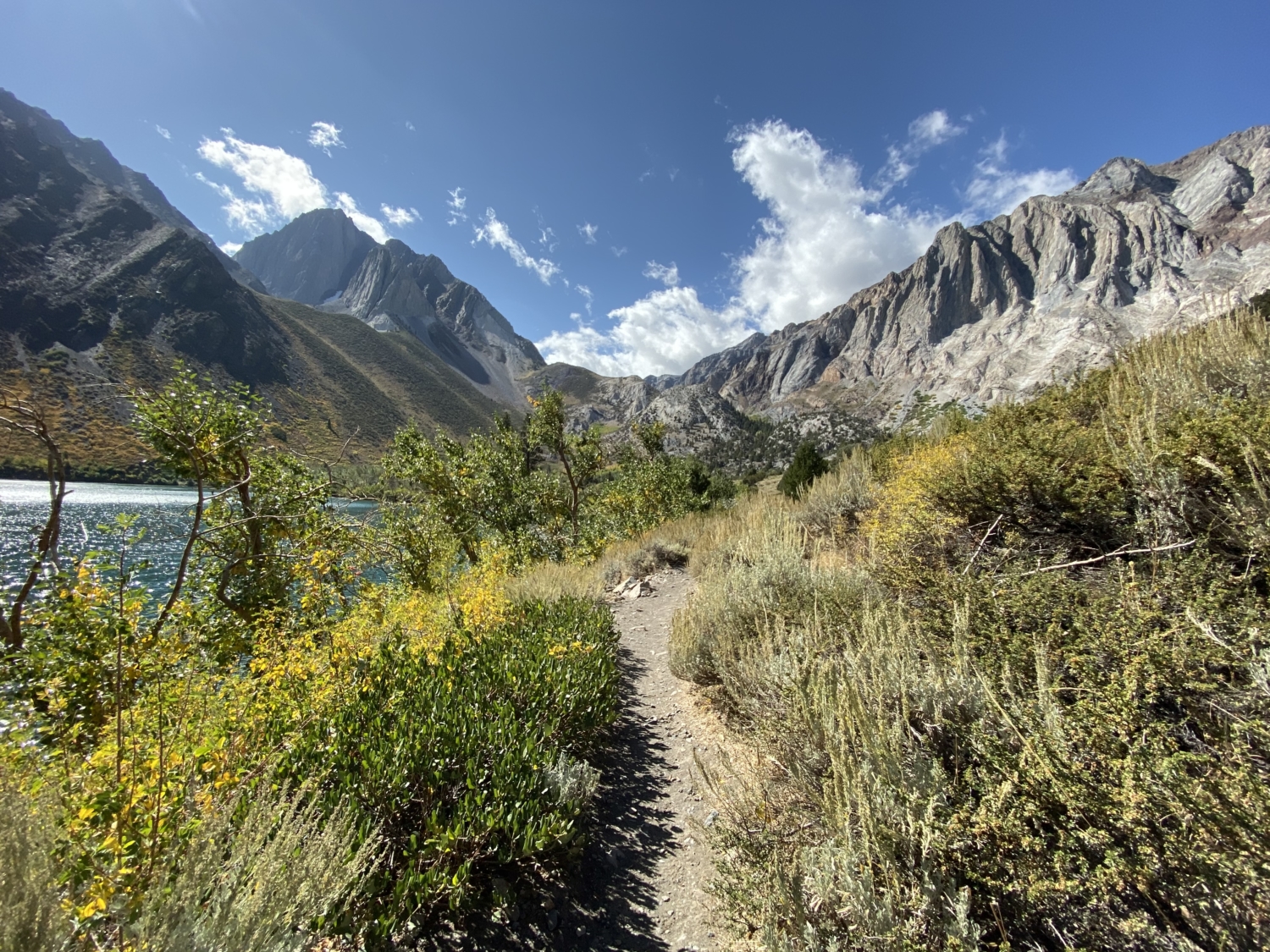
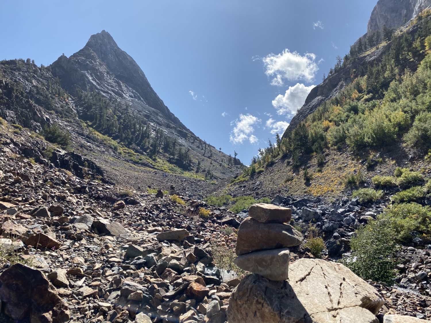
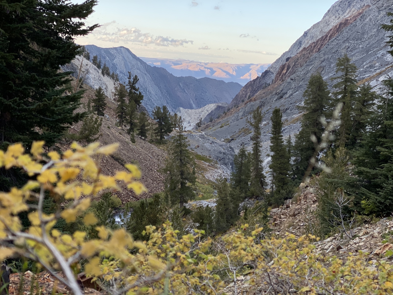
I would be remiss if I didn’t start by saying that trying to describe the immense beauty of Convict Canyon and Mildred Lake is a futile effort, at best. It’s like trying to describe the color blue to someone who’s never seen it before. But, dear readers, I will try my best to create a tantalizing reproduction of the trek up to these two gems, because they are not to be missed. This is easily one of the prettiest trails in the entire Sierra Nevada, tucked away behind the famous Convict Lake. Go in September or October, if you can, when the creek crossing is easy and the fall colors put on a spectacular show.

If you’re planning on doing this trail as an overnight backpacking trip, remember to reserve a wilderness permit and pick it up at one of the permit offices nearby. As with pretty much every hike in the Sierra Nevada, we highly recommend bringing bug spray in your pack during summer months and remembering that you’re hiking in bear country. Be sure to bring a bear-proof container for your food, toiletries, and all other smellables if you’re going to be spending the night.
Now, one of the best things about this trail is that it’s located just 2 miles off Highway 395, south of the town of Mammoth Lakes. Sick of winding, washboard roads that your Prius might not be able to safely handle? This is the hike for you. A paved and impeccably well-maintained road will take you past Convict Lake Resort and down to the parking area near the trailhead itself. In summer months, the lower parking area may fill up, so be on the lookout for a “hiker parking area” sign on your drive in. There’s another lot nearby for overflow.

Convict Lake, as seen from the parking area.
The trail around Convict Lake is a stunning and worthy endeavor on its own, but if you’re dying to get up and into that rocky canyon, turn right at the Convict Lake viewpoint in the center of the parking lot and start your hike on the north side of the lake. It’s a shorter and more direct route. The first mile is mostly flat and offers incredible views of Laurel Mountain’s jagged escarpments straight ahead, while Mt. Morrison’s imposing north face is on your left.
If the weather’s good, you’re bound to see a few anglers around the lake’s edge, trying their luck. Convict Lake is so popular for fishing that it’s stocked every week with brook trout by the California Department of Fish and Wildlife.

After a .9 mile warm up along the dusty, lakeside trail, you’ll come to a sign saying that it’s 5 miles to Mildred Lake and 6 miles to Lake Dorothy. Veer right at the junction and mentally prepare yourself for a long climb. From here, the trail will gain over 2,000 feet in just 5 miles, much of it on uneven talus and rocky terrain. Slap on some sunscreen and get ready to ascend.
One thing that immediately struck me about the next section of trail was how vast and sinister Laurel Mountain’s east face is up close. Most visitors only catch a glimpse of her while driving by on the freeway, but when you’re face-to-face with this behemoth, she is a beast. Towering white cliffs plunge sharply into the valley below, creating a traffic jam of talus that hikers must pick their way through, eyeballing the trail on the other side.

The canyon to the left is where you’ll be heading!
Keep following Convict Creek upstream as the trail bends to the left, and take a moment to enjoy the shade of the cottonwood trees while it lasts. This stretch of trail pops with color during autumn months, making this a great choice for a leaf-viewing excursion. From here on out, most of the climb will be sunny and exposed, so take breaks in the shade while you can!
Around the 4-mile mark, you’ll come to the remains of a washed out bridge. In early summer months, you may be faced with a sketchy creek crossing that forces you to turn around at this point. In late summer and fall, however, the crossing is wide and fast, but relatively shallow and shouldn’t cause too much trouble if you bring your trekking poles. Hop from rock to rock to log as you make your way across the two intersecting streams, aiming for the cairns on the opposite side of the water.

There’s a lot of contention on online messaging boards about the helpfulness of the cairns on this next section of trail. My group found them to be incredibly useful and playfully rock-hopped our way up the steep, rust-colored talus slope on both the up and the downhill with no issues.
Due to many recent rockslides (geological time includes the present!), there are a few small blowouts on the path as it climbs the final uphill to Mildred Lake. Take your time, look out for the cairns, and use trekking poles if you have them. If you have any experience scrambling off trail, you’ll find the blowouts to be a piece of cake.

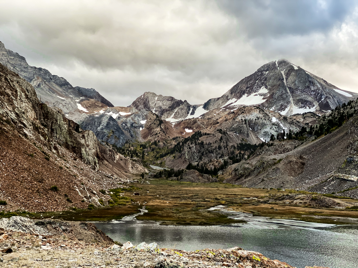
Just before Mildred Lake, the trail will pass a “no campfires beyond this point” sign and cross a sandy wash before spitting hikers out into a glorious alpine meadow fit for a king. From this vantage point, the view of Mt. Baldwin and Red Slate Mountain are phenomenal, and Mildred Lake is a perfect dollop of blue set right in the middle of it.
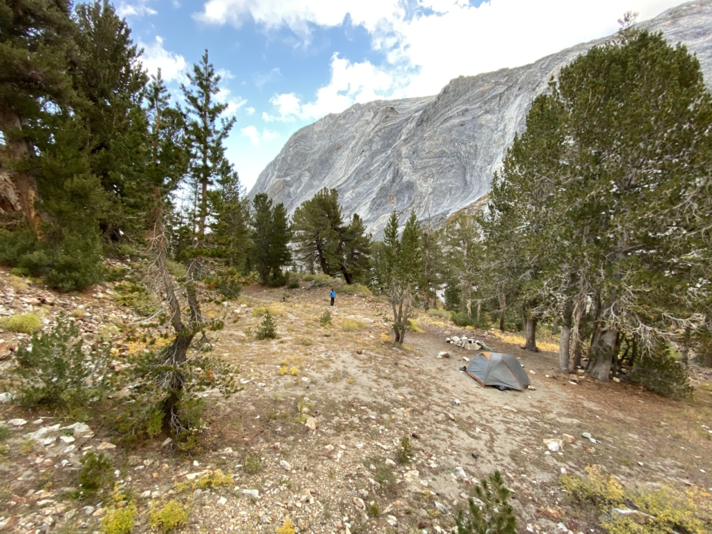
If you’re planning to set up camp, backtrack about .1 miles from the lake itself and hunt for a spot nestled in the trees behind the lake, near Convict Creek. Fires used to be allowed here, but are no longer, due to the environmental impact of too many visitors and so few trees. Ignore the fire ring, if your campsite has one. Grab a tent spot in a windbreak, if you can, to protect yourself from sudden gusts in the night.
If you’re looking to crush bigger miles, Lake Dorothy, Lake Genevieve, and Laurel Lakes to the west are all worthy objectives. But, if you’re feeling pooped after the climb up (like I was), it’s time to relax in the gorgeous splendor of Convict Canyon and its colorful, striated rock formations.

When it’s time to go home, simply turn around and head back the way you came, carefully boulder hopping through the scree fields and crossing the creek at the downed bridge. Turn right at the junction near Convict Lake if you’d like to complete the lake loop hike and check out a different view of Laurel Mountain.
This trek to Mildred Lake is a fantastic trail for anyone looking for a leg-busting day hike full of killer views or an overnight backpacking weekend in the always amazing Sierra.
Tags: alpine lakes, Backpacking, Camping, Eastern Sierra Nevada, eastern sierras, fall colors, lake, lakes, overnight trip, Waterfall


