Although many hikers who visit Palm Springs are drawn by the stronger pulls of places like Joshua Tree or Mount San Jacinto, I personally feel that Indian Canyons has some of the best hiking in the region — especially in winter and early spring. Wide-open desert basins, native palm oases, cascading waterfalls, Agua Caliente Band of Cahuilla sites and ruins, wildflower blooms … the list really goes on and on. There is a wide range of hiking here, but for those looking for the shortest, toughest trek that’s closest to town — you’re going to want to set your sights right here on the Maynard Mine Trail.
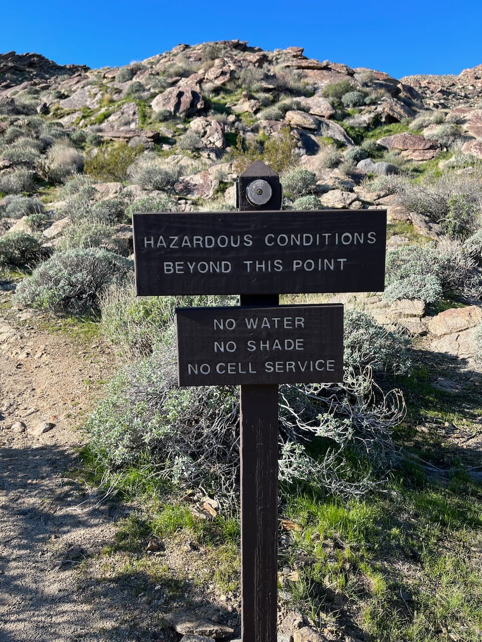
This 6-mile out and back starts at the same trailhead as the much easier Andreas Canyon and the still-easier-but-a-bit-of-a-step-up Murray Canyon. But where those trails lead you to water and shade, the Maynard Mine Trail is a classic desert climb, heading straight up the side of the San Jacinto Mountains. There are almost no breaks and no shade or water along the way, so you’re definitely going to want to get started early to avoid the hottest parts of the day.
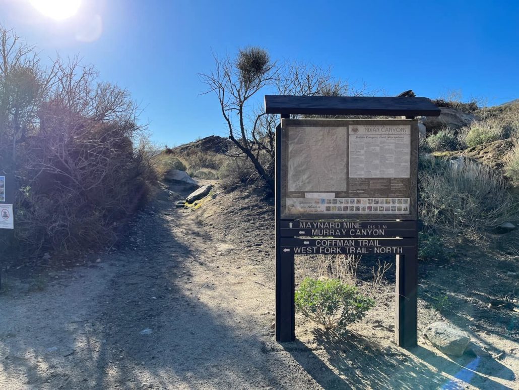
To find the trailhead to the Maynard Mine Trail, head toward the southeast corner of the parking area at Andreas Canyon. Look for a sign with a map and wayfinding signs pointing toward Murray Canyon and the Coffman Trail and head straight.
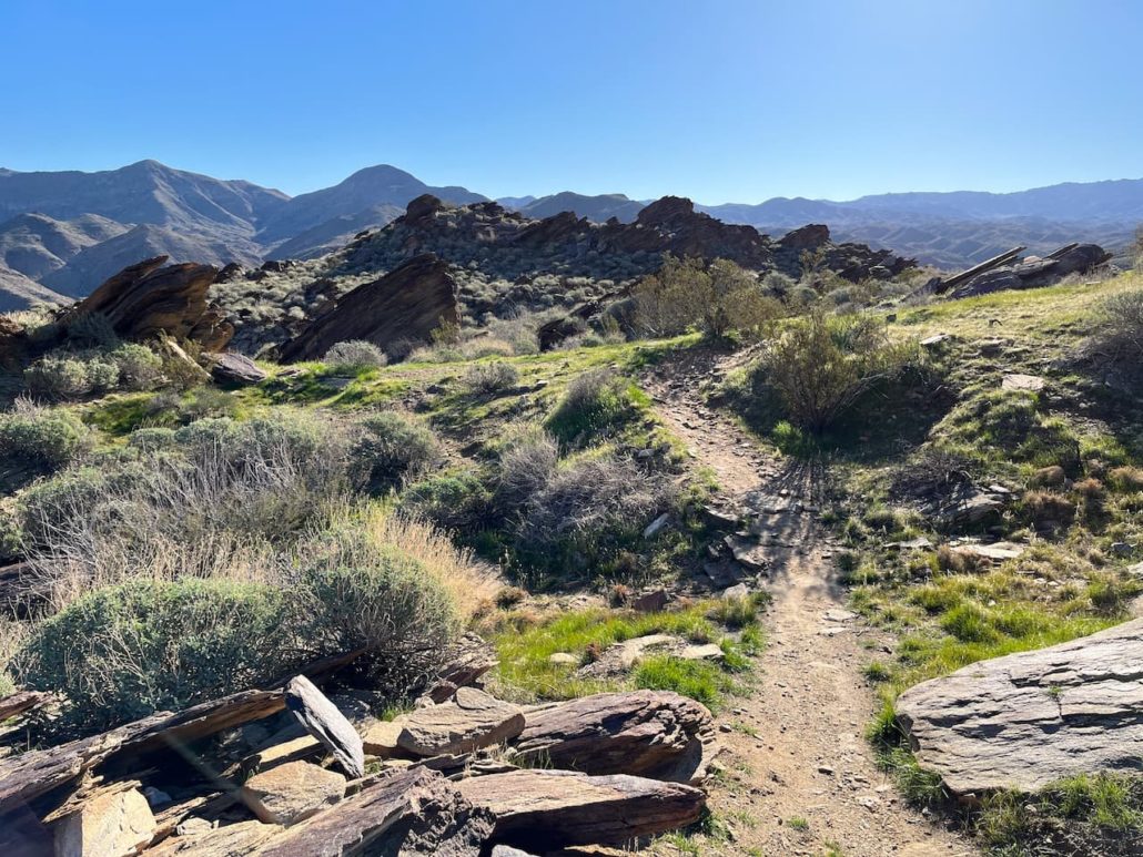
You’ll pass through a small equestrian area with some water tanks, then start hiking on an easy dirt trail through some smoke trees and creosote.
Don’t get used to how easy this is.
It’s only about 0.2 mile before you get to the start of the incline. And it’s up up up from there on out!
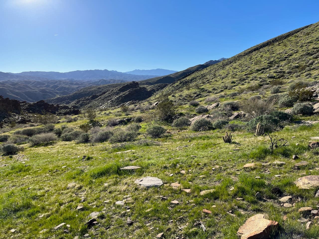
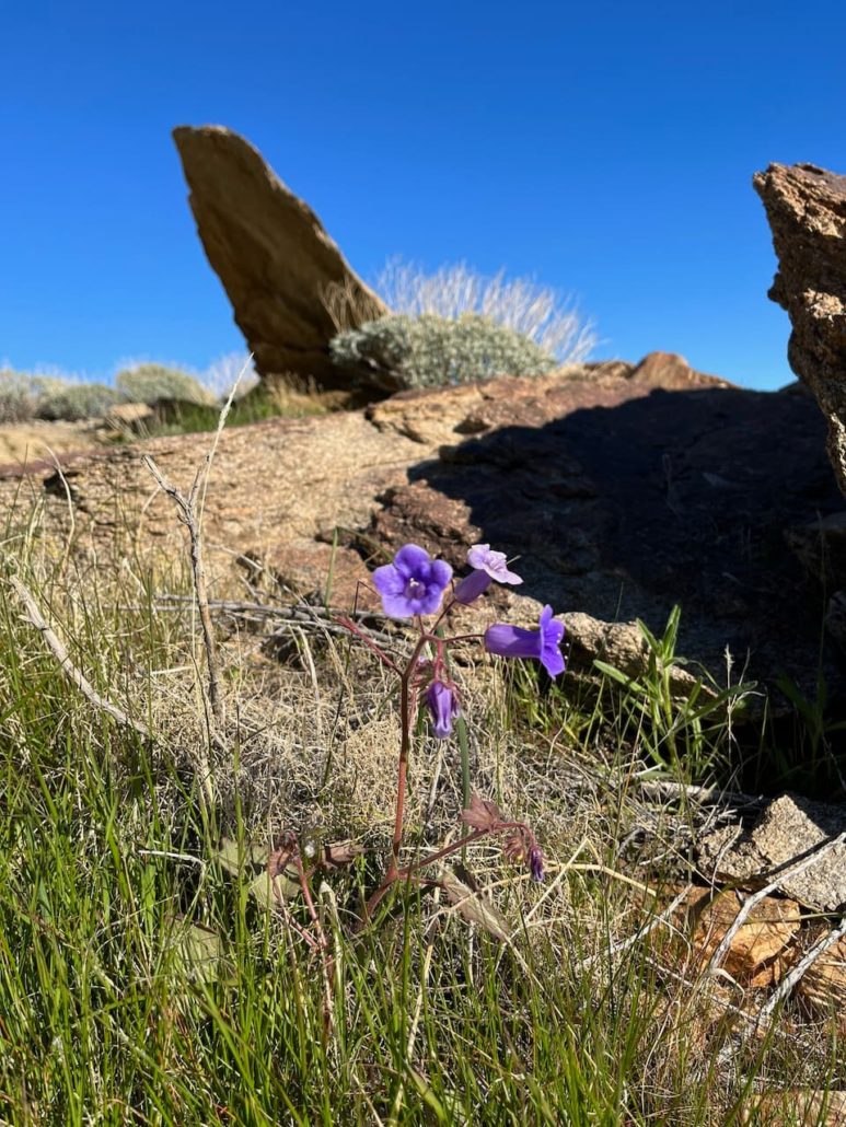
Very quickly, the creosote and catclaw gives way to huge hillside fields of brittlebush. If you’re hiking in the late winter or early spring after a good, rainy season, you’re likely to see lots of green here. When I hiked in late January I was a bit early for blooms, but lots of plants were getting ready — if you’re looking for wildflowers your best bet is to aim for February or March.
Green in the desert!
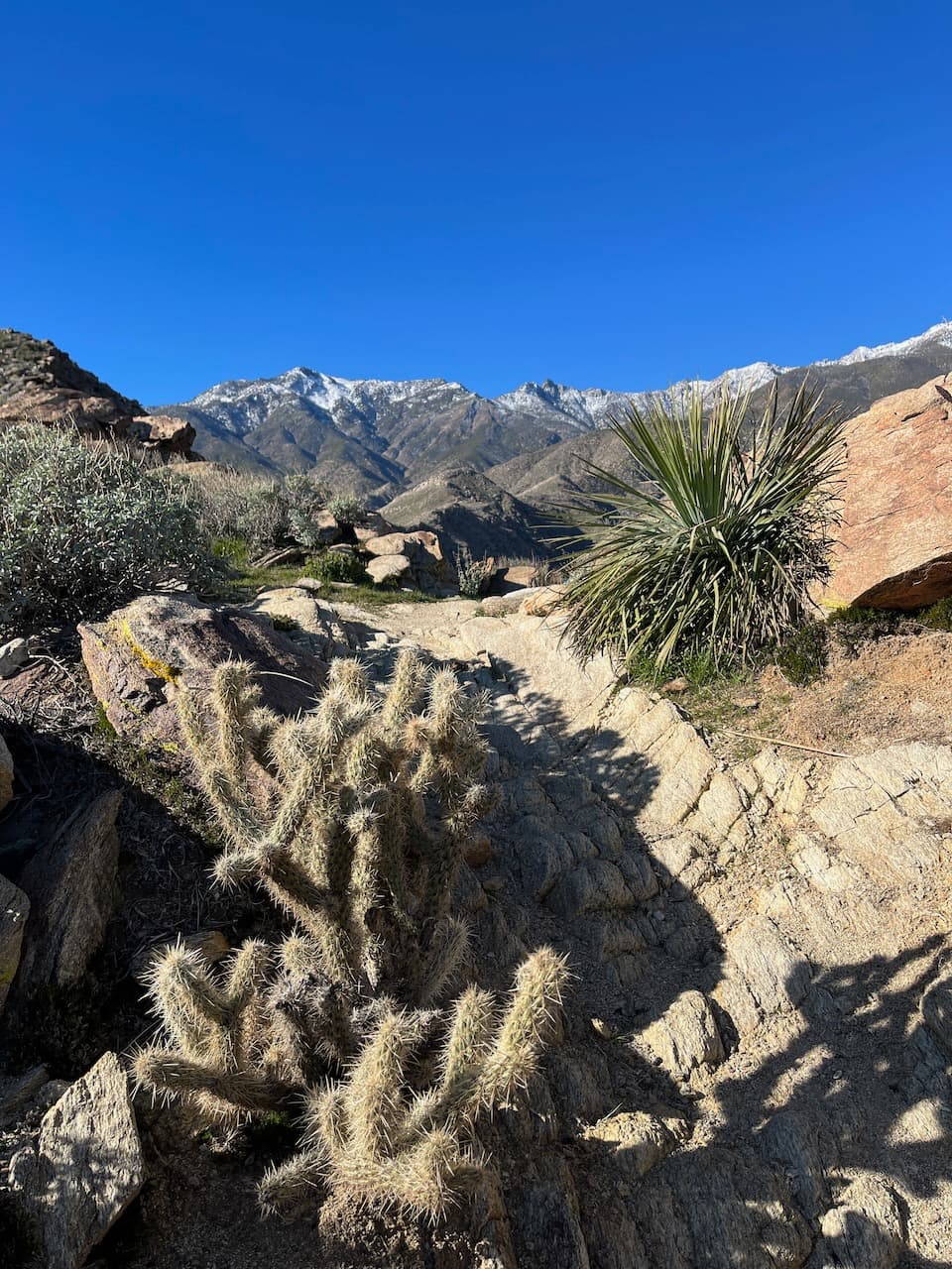
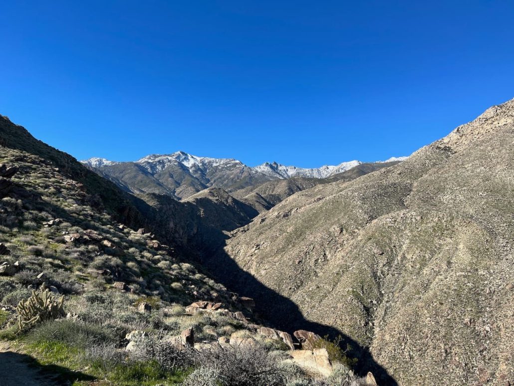
As the trail gains elevation, you’ll also have some truly incredible views of the landscape. And although you will definitely feel this trail in your legs, you’ll have lots of great visual distractions to keep you occupied. Another reason to tackle this route earlier in the day is the low light of the rising sun provides some terrific shadows on the rolling hillsides and steep mountains that surround you.
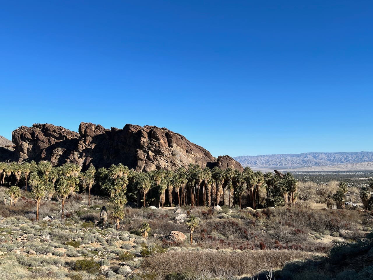
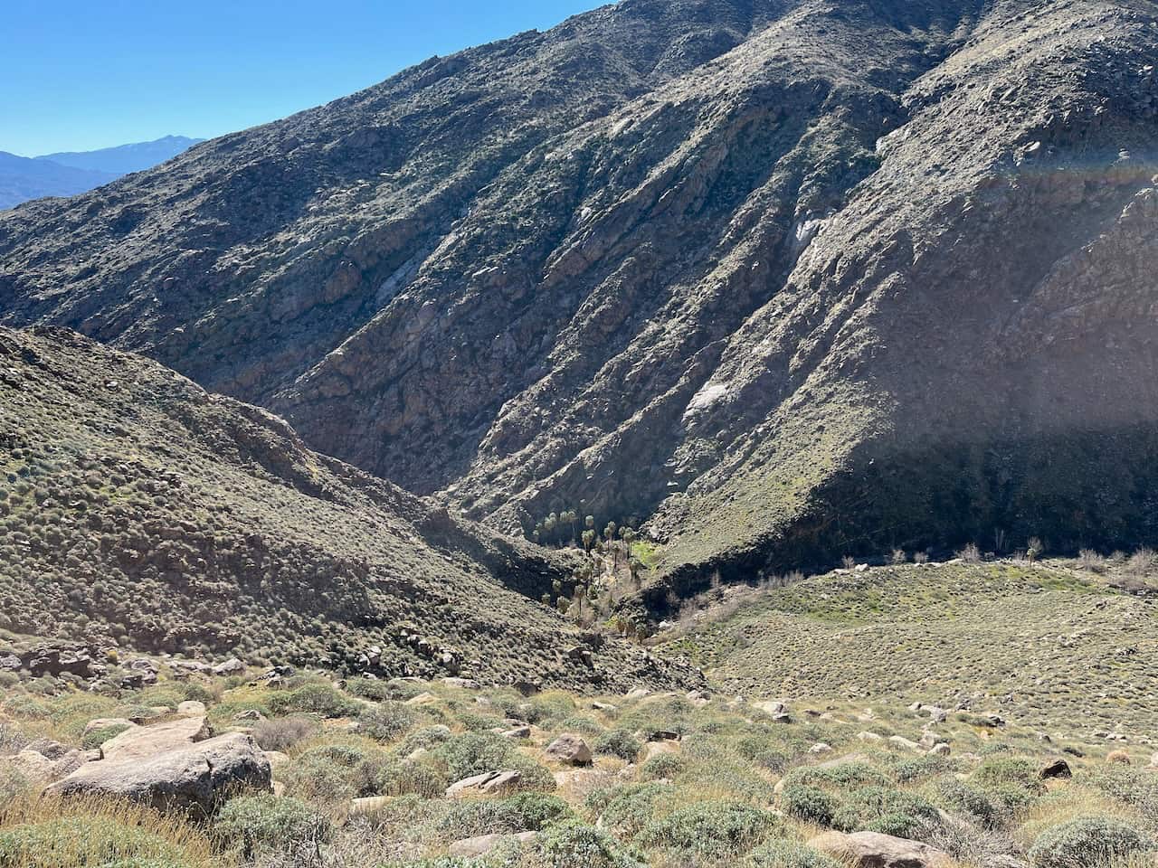
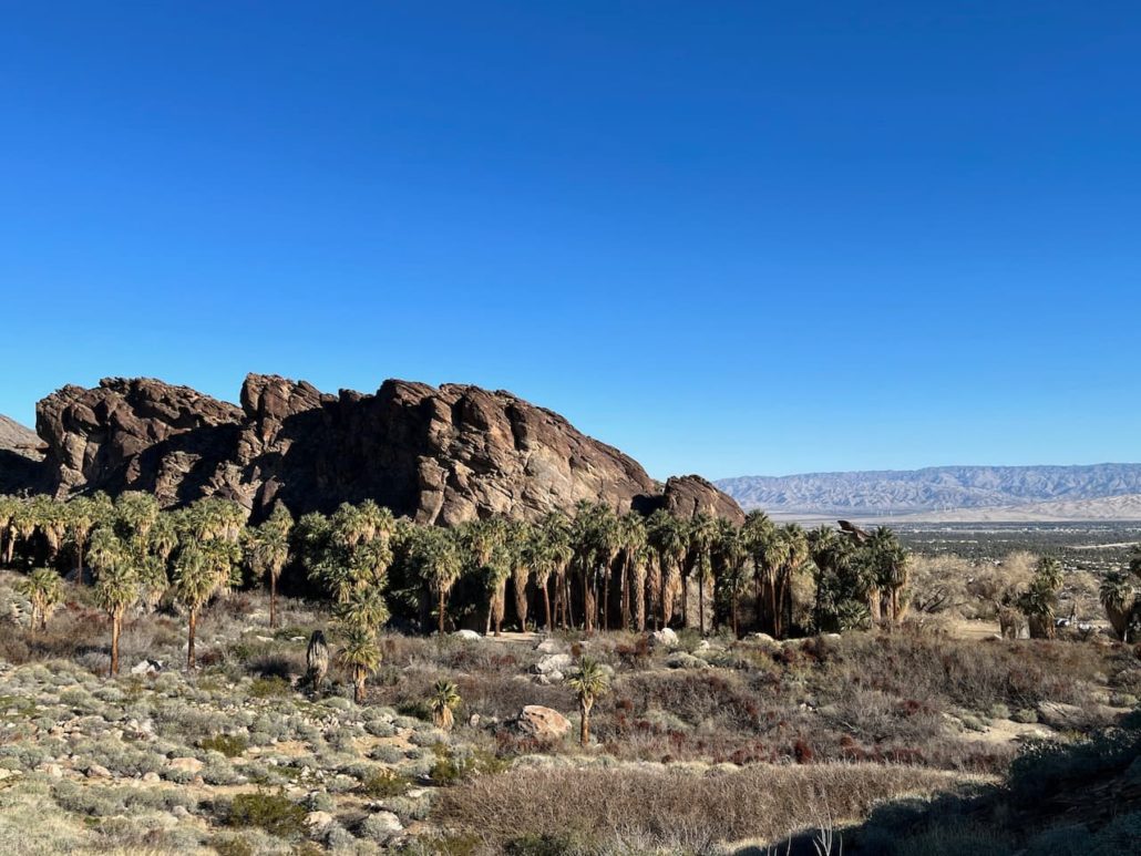
Oh, and you’ll have great views of those nearby palm oases, too.
A few things to keep in mind on this trail as you trek up. First, it’s mostly on stone. There isn’t a lot of give to the ground here, so in addition to the steep incline you’ll also be doing a bit of a number on your legs with the impact. It’s especially important to keep this in mind on the decline — don’t forget to stop and stretch every once in a while to give your legs a break!
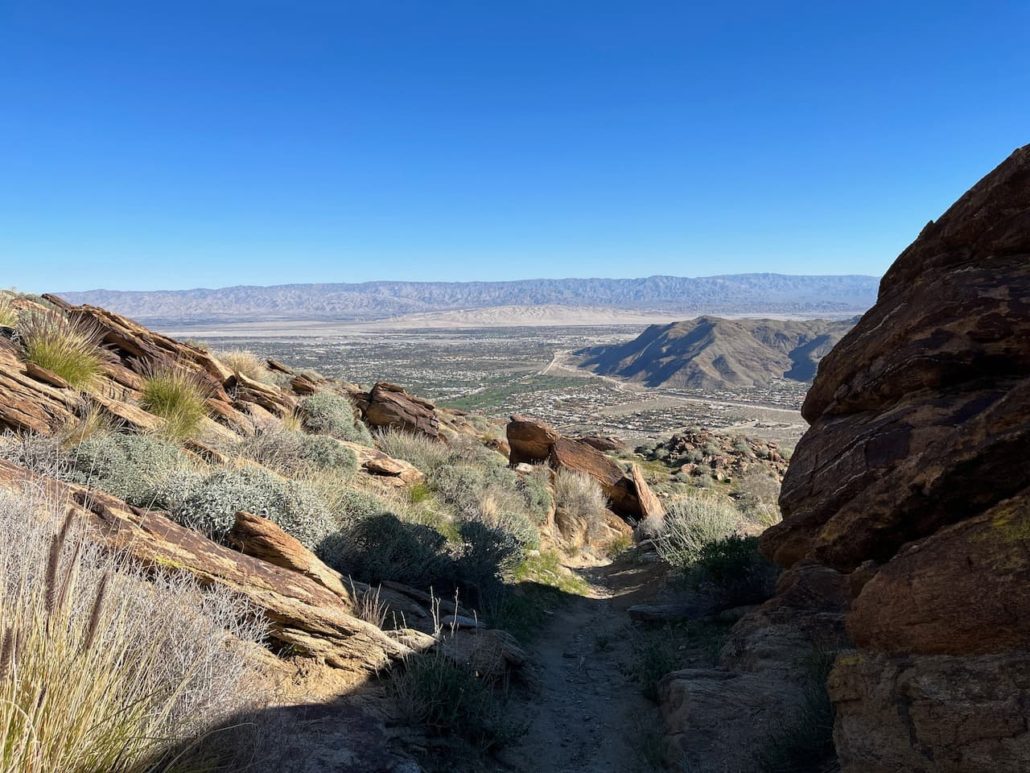
Looking across the Coachella Valley to the Little San Bernardino Mountains in Joshua Tree National Park
Second, it’s the desert, so be on the lookout for little spiny and spiky plants lining the route. For the most part, this trail is well-maintained and clear, but there are a few areas where you may have to step sideways to avoid being pricked. If you’re hiking this with a buddy, be sure to not be TOO deep in conversation!

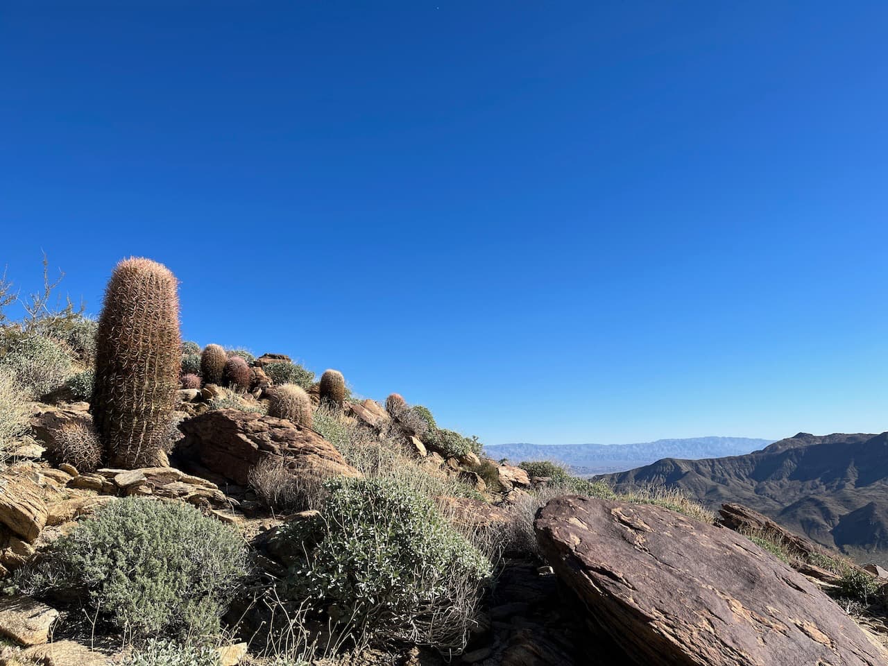
Barrel cactus on the climb up
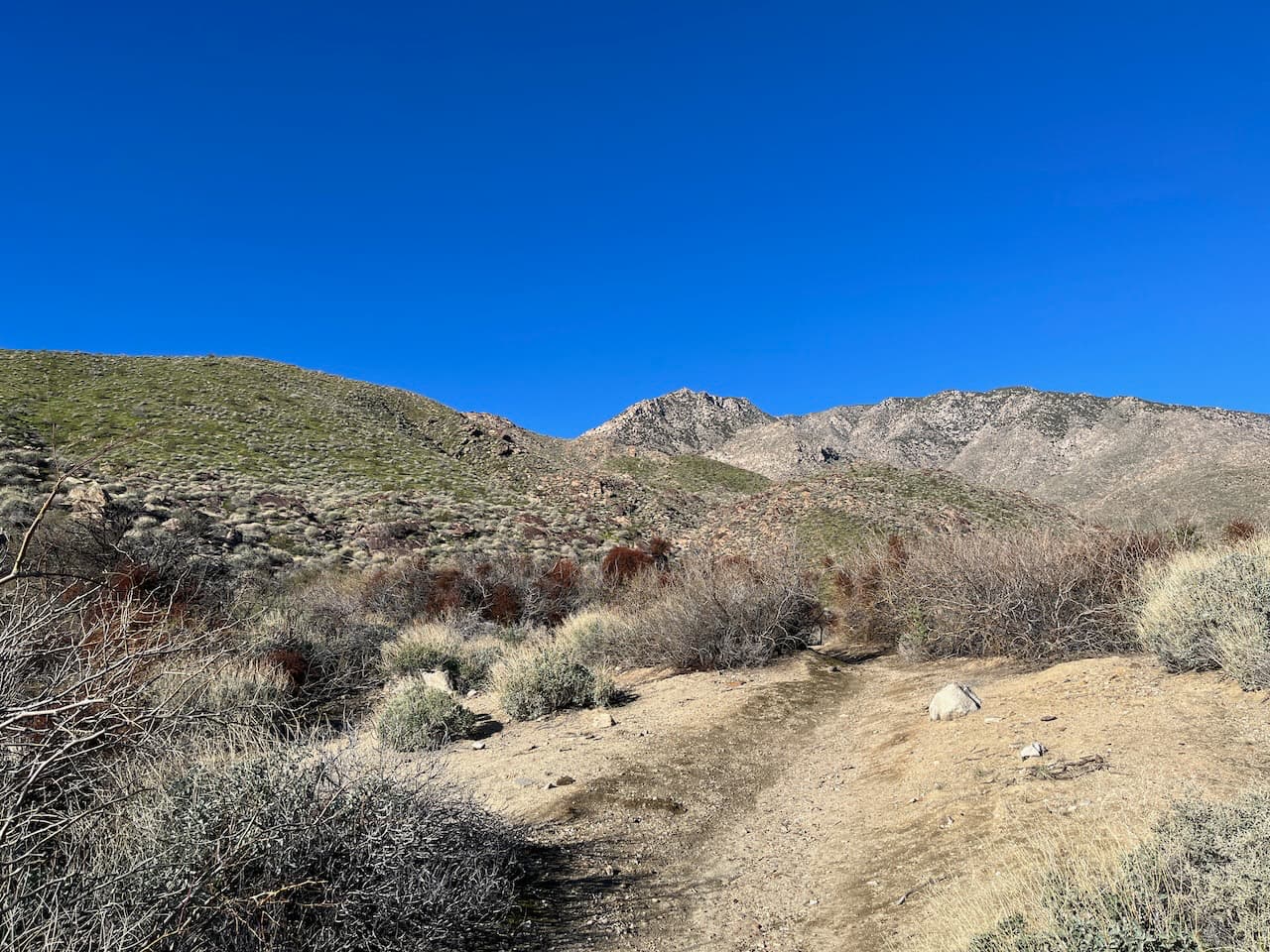
Just before the 1.5 mile mark, the trail makes its way to a ridgeline. You’ve still got a good amount of distance and incline to go, but the views really pick up here in a substantial way. To your north, you are far above water-and-palm rich Andreas Canyon. You may be able to hear the cascading water in the distance. And to the west, the looming towering peaks in the San Jacinto Wilderness. This area is not part of the Sand to Snow National Monument, but it’s close-by and if you’re lucky you’ll be able to see how that area got its name.
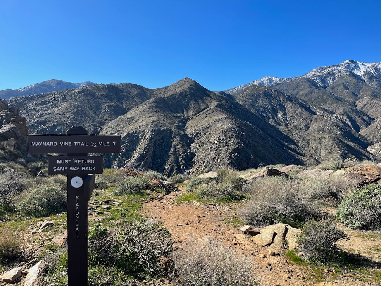
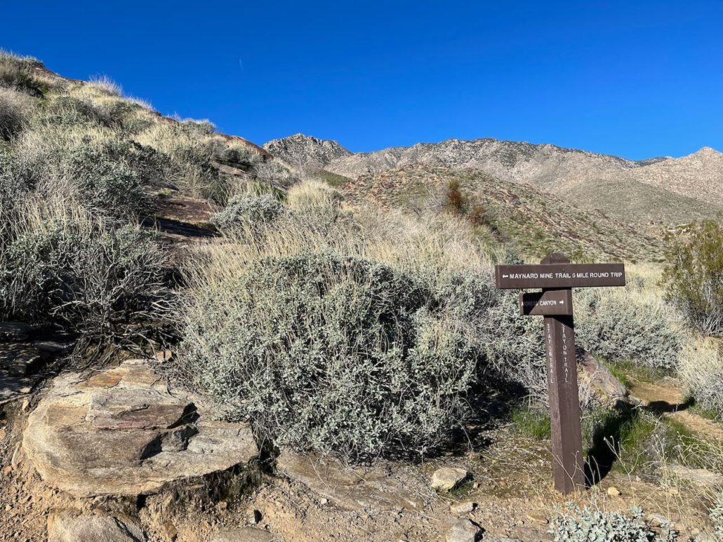
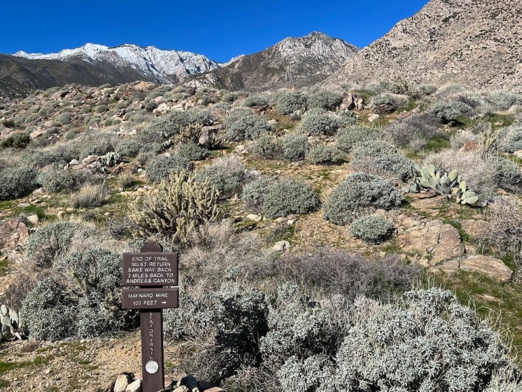
If you’re in the mood for a quick break, this is a great spot for one. Otherwise, keep on climbing up and at 2.5 miles the trail levels off a bit near the high-point of this route. You should be able to see a sign noting the Maynard Mine Trail continues for another half mile. Catch your breath, enjoy a snack, and then keep moving.
As the trail crests, the route gets a bit more crumbly and steep. You’ve been doing an all-uphill day so far, so be sure to adjust your mindset and hiking accordingly here. Right near the summit you’ve just passed, the trail is eroded and a little slippery, but it gets better as it continues on the downhill. Just be sure to keep your wits about you here — even as the footing gets more secure, there are a lot more spiny plants near / on the trail!

The trail makes some tight switchbacks before hitting an east-west ridgeline. Follow this to a sign noting the Maynard Mine site just around the corner.
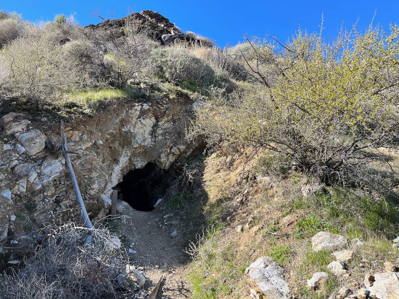
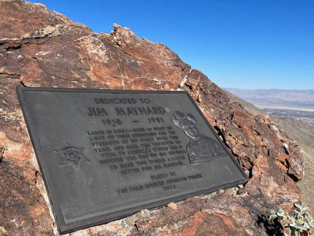
The trail direction on CalTopo and other mapping sites hooks south from here for a short distance before ending, but the trail sign points you north instead. Follow the sign and you’ll spot a plaque dedicated to Jim Maynard, and just beyond that there is a narrow, steep use trail that descends a short distance to an open mine remnant.
Jim Maynard seems to have two prominent nicknames — “Big” Jim Maynard and “Tiny.” Standing 6 foot 6 inches and “some 300 pounds of solid muscle,” Maynard moved to Palm Springs from Oregon in 1923 at the age of 6. Like many at the time, his family came for health reasons — the dry desert air was supposed to be a balm for the tuberculosis his younger sister suffered from.
By all accounts, Maynard had a personality as big as his physical frame. By the age of 12 he was a trail guide for visiting hotel guests and he spent most of his time in the mountains, skipping school to explore the canyons and peaks with the Agua Caliente Cahuilla. He learned their language and at the age of 18 founded the region’s first search-and-rescue group, which would later go on to become the Palm Springs Mounted Police Search and Rescue Team.
Maynard joined the police and later the Navy, and local newspapers featured his good deeds on a regular basis. In the 1940s, the Agua Caliente Cahuilla allowed him to file for some claims on a tungsten deposit in this area, and Maynard hauled all the mining equipment up here by hand — suffering a heart attack in the process. The tungsten he mined here (returning to town via wheelbarrow!) helped with the American war effort in World War II, and after the mines closed he resumed his police work in town until his death in 1981 at the age of 63. Tracy Conrad wrote an excellent feature on Jim for the Palm Springs Desert Sun back in 2020 and it’s worth the quick read.

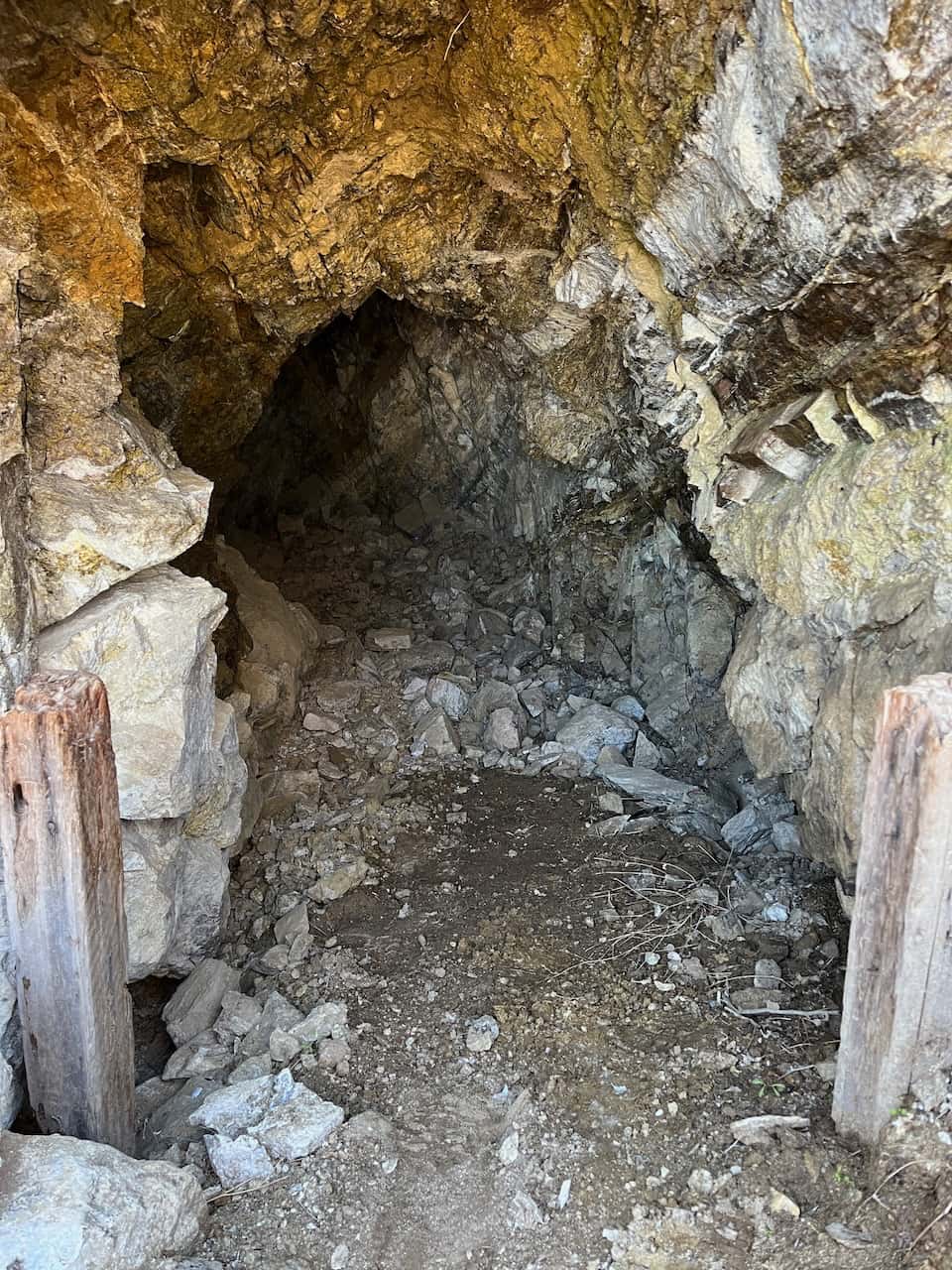
The collapsed mine shaft near the plaque
This is where the park’s official trail ends, so that’s where this route ends as well. The collapsed mine shaft is small and short, and should be entered only at your own risk (honestly — I never go in these things but they’re neat to see).
If you decide to follow the online trail mappers’ routes southward, there apparently are some more mine shafts and some leftover mining equipment. Again, this should be traveled at your own risk, and be sure to leave ALL artifacts in place where you found them. Not only is this a protected historical site, but you should also leave these experiences in place for future hikers to enjoy. Also, even though he was by all accounts a very friendly guy, you probably don’t want the ghost of Big Jim Maynard following you around, do ya?
Tags: agua caliente cahuilla, history, maynard mine, mine, palm springs, ruins