A just over 6 mile out-and-back trail to two prominent peaks to the west of Mount Baden-Powell. With a stretch of spectacularly-designed trail, lots of shade, and phenomenal scenery with not a whole lot of elevation gain, this is a great way to introduce yourself to this area of the San Gabriels and plot out future trips. If you want to spend more time here, there are plenty of connecting trails to other nearby peaks and canyons.
Throop Peak (pronounced “Troop”) lies along a ridge just south of a large bend in the Angeles Crest Highway, to the west of Mount Baden-Powell. I wanted to explore more of this newly-opened area of the Angeles National Forest, but didn’t want to drive all the way out there for a single short trail, so decided to add nearby Mount Hawkins to the trip.
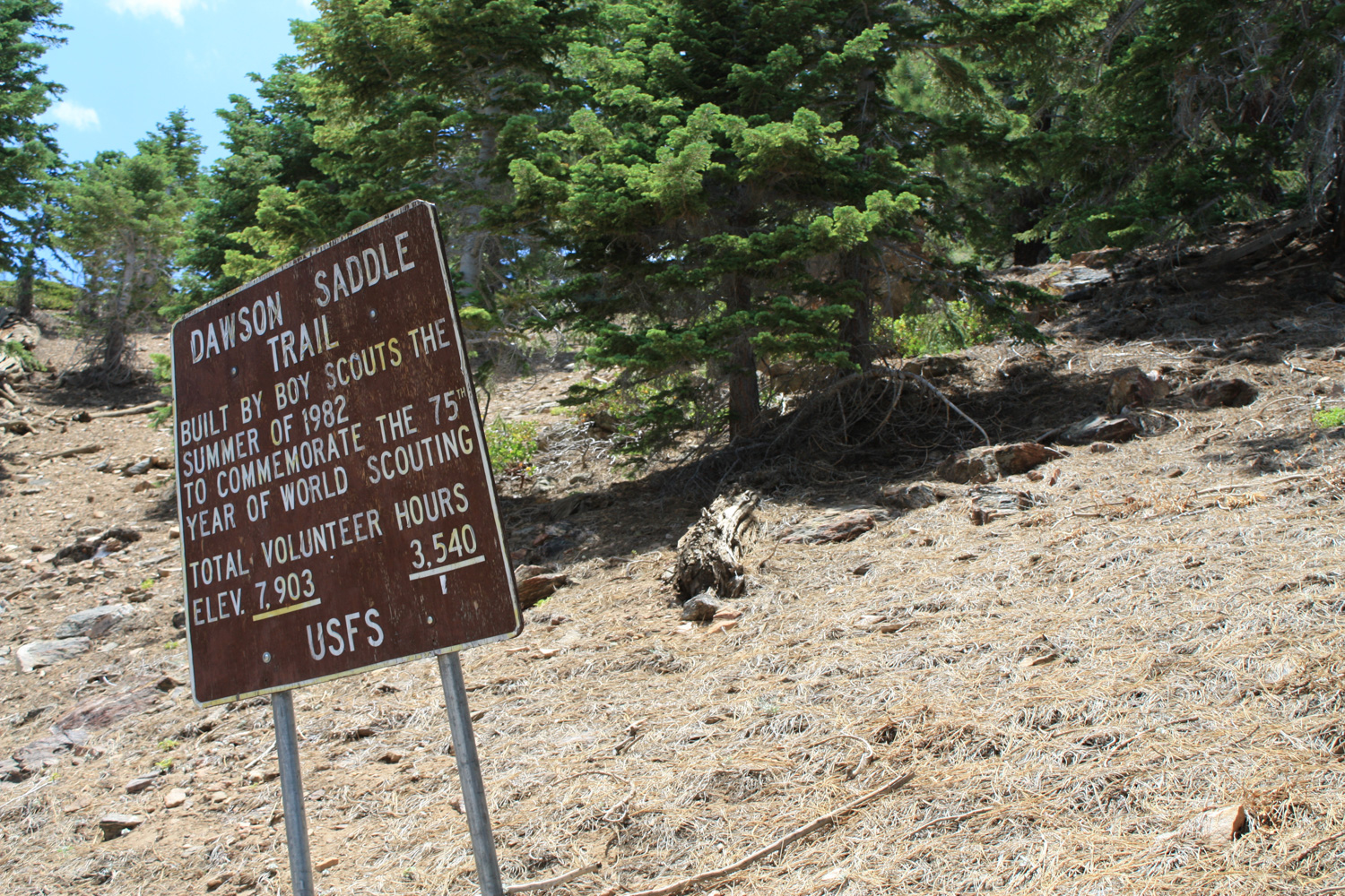
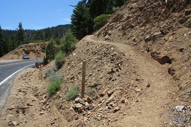
The parking area is very easy to find. Dawson’s Saddle is clearly marked with a large, visible sign on the road. If you happen to miss that, you’ll most likely see the cars parked on the north side. This is your cue to join them. Park, suit up, hang your Adventure Pass, then cross the street to the south side and walk a few hundred feet to the east, where you’ll see this:
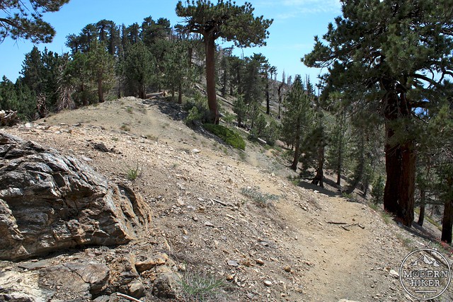
Start climbing up these switchbacks, and you’re on your way. And don’t get scared! Unlike nearby Mount Baden-Powell, this trail makes very minimal use of the switchback. You’ll really only encounter them in this first 0.3 miles of trail – and only the very first one is exposed like this.
There has been a bit of confusion as to where, exactly, the trailhead is – there is a shed just as the Angeles Crest Highway makes an eastward turn that has a small parking area. There is a series of very steep switchbacks directly across the street from that parking area, but the easier and more official trailhead is just a few hundred feet to the east, near where the road turns south again and a much larger parking area on the north side of the road.
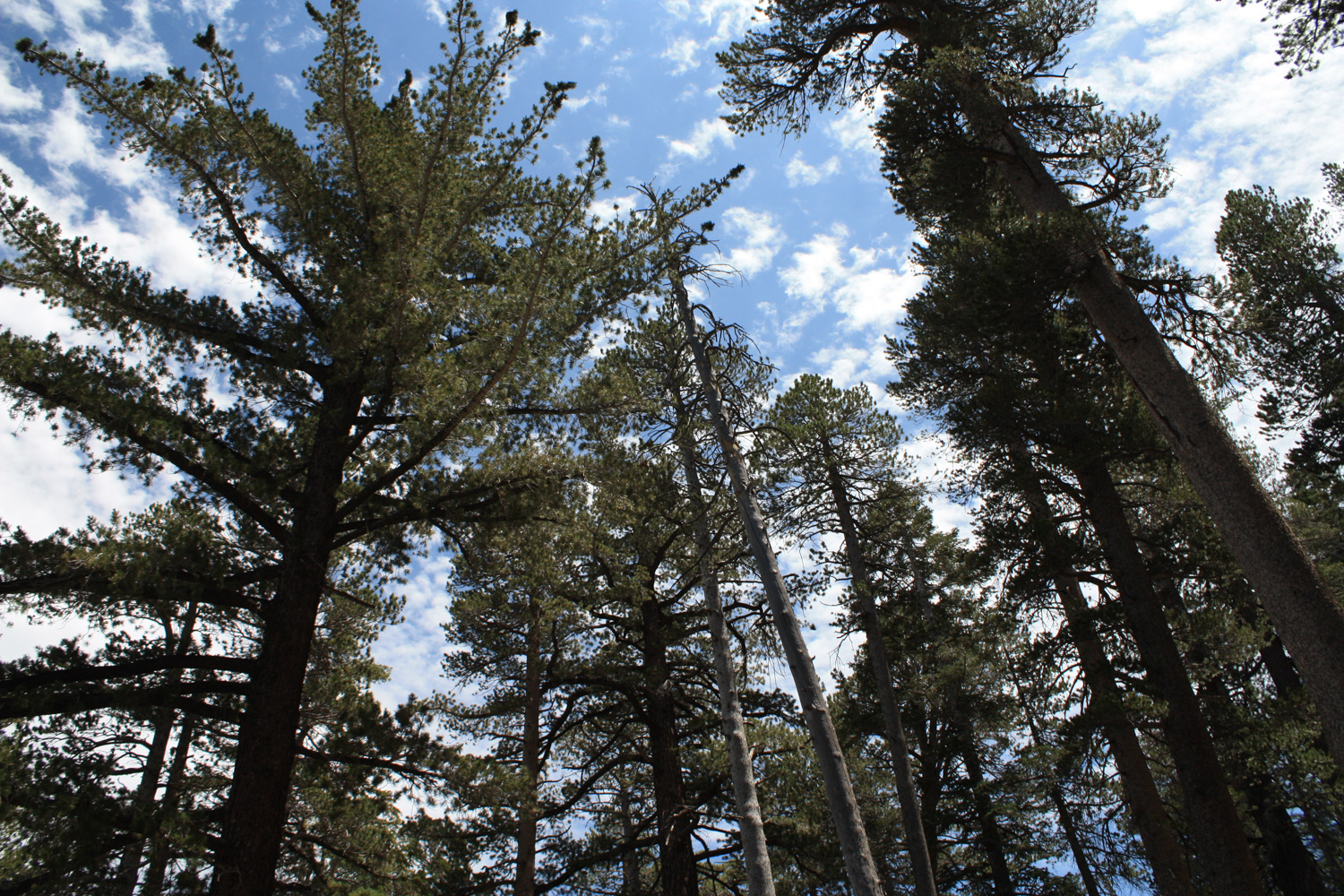
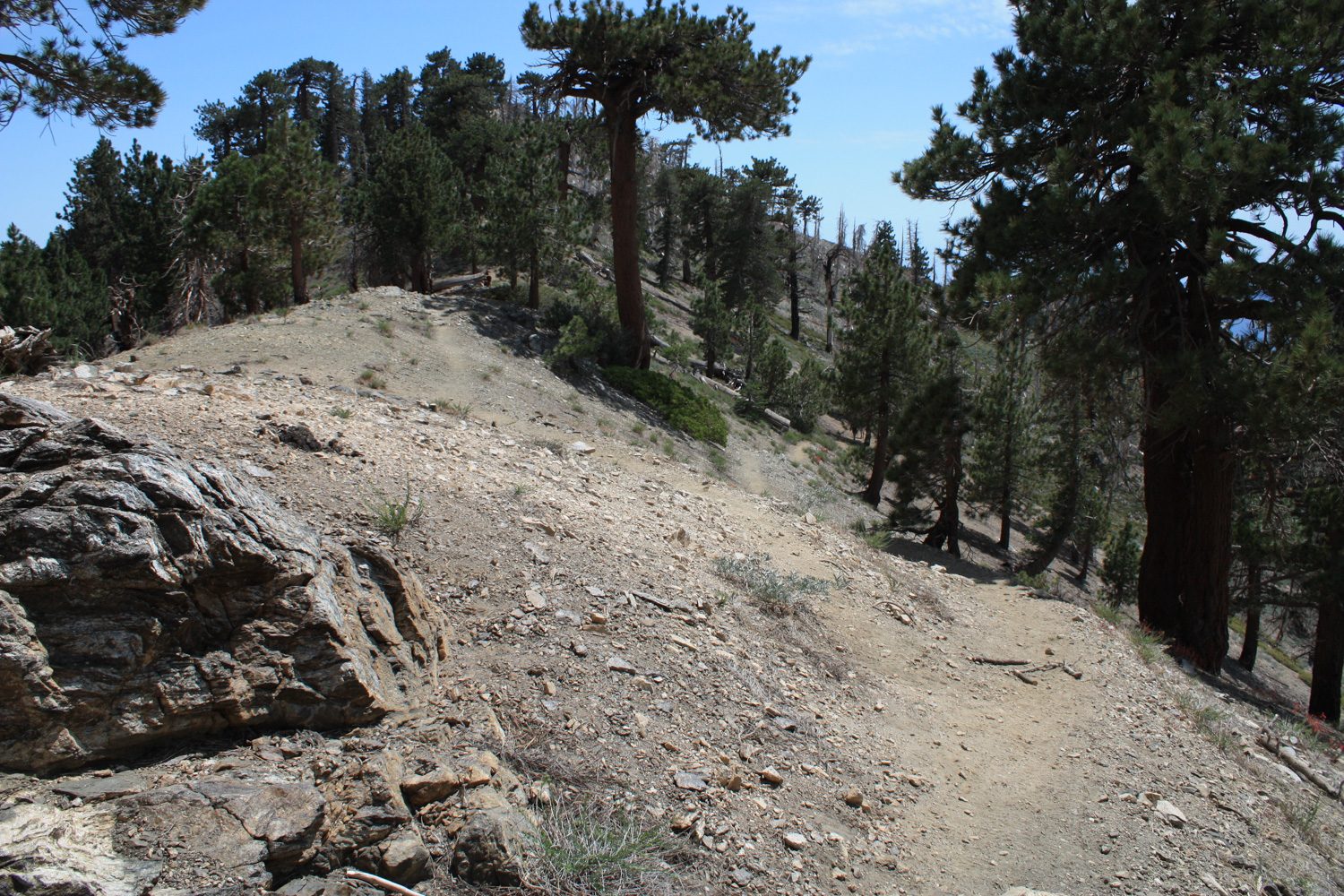
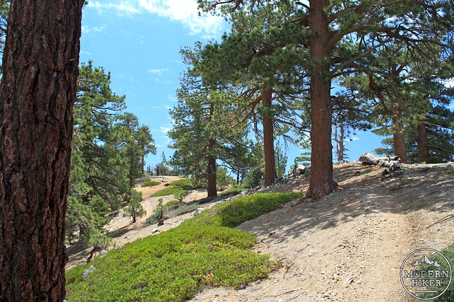
This is the Dawson Saddle Trail, built by Boy Scout volunteers in 1982, and I’ve really got to hand it to them – they built a fine stretch of trail. The elevation gain is almost unnoticeable, and after you get that first small barren switchback out of the way, the trail meanders through some beautiful stretches of pine forest. It’s one of the nicest trails I’ve hiked in a long time.
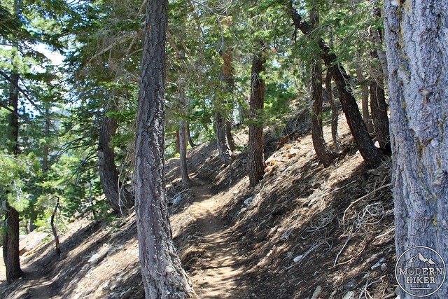
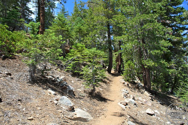
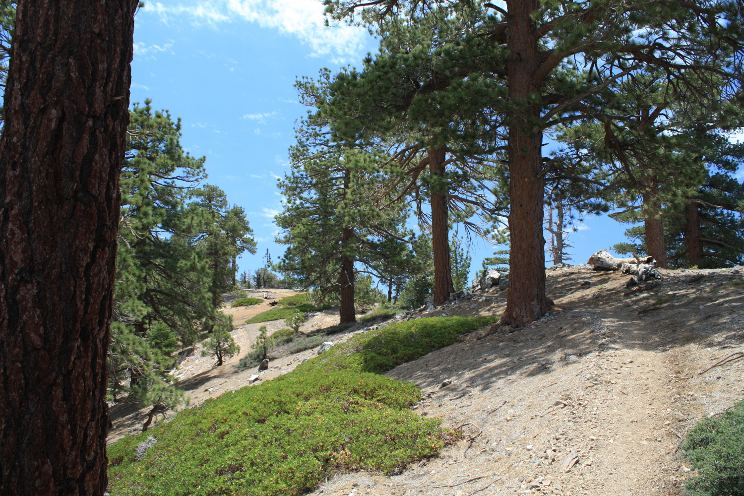
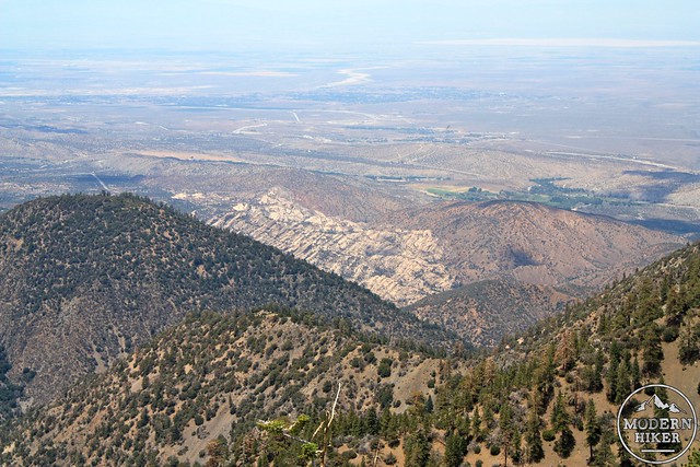
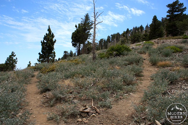
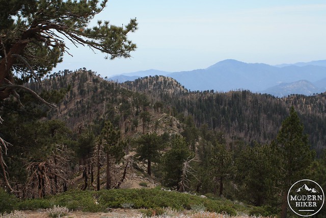
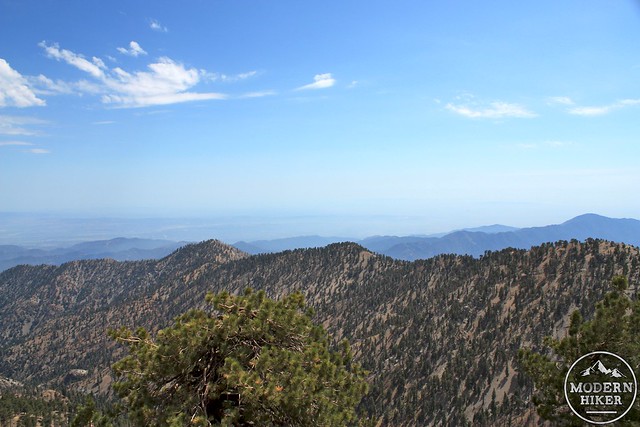
The first 1.1 miles of the trail walk through this heavily shaded area, but then reaches a long, very gentle incline along Throop Peak’s north ridge. There are a few use-trails here that leave the established trail and meet up again later, but they seemed to add elevation and not save a whole lot of distance. Hopefully, you’ll be digging the Boy Scouts’ work as much as I did that you’ll just want to stick on the main trail anyway, using the clearings along the ridge to take in your first expansive views of the Devil’s Punchbowl and Antelope Valley to the northwest.
The trail continues in a generally southern direction until about the 1.7 mile mark, where it makes a sharp turn toward the east. You’ll probably think you missed a turn somewhere, as it will seem like you’re now hiking away from the peak, but don’t worry – you’re still on the right track. The trail here hooks around to the ridge on the northeast side of Throop Peak, where it meets with the Pacific Crest Trail at about the 2 mile mark. Enjoy the views of the west side of Mount Baden-Powell, and the still fairly-thick pine groves.

At the 2 mile mark, turn right to head south on the Pacific Crest Trail, moving away from Mount Baden-Powell. The trail to the summit of Throop Peak splits off less than a hundred feet on the PCT. It’s a small fork in the trail, which may be marked by a cairn. Veer to the right to head on the Throop Peak Use Trail.
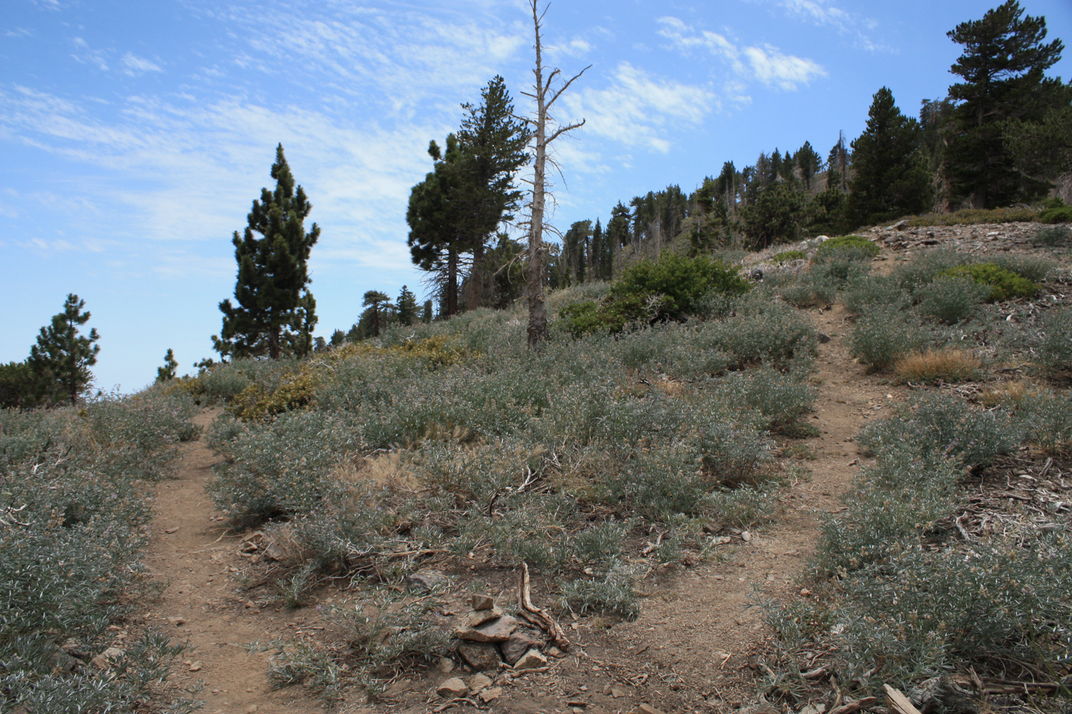
This trail is not nearly as well-kept as the Dawson Saddle Trail, and you’ll notice the path overgrown in several places. While this route may become faint in places, you’re usually able to see the trail amid the plants. Follow the ridge and make a few more switchbacks, and you’ll be approaching the summit in 0.3 miles. You’ll spot the tree-less summit in no time.

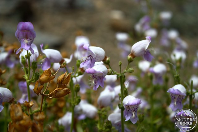
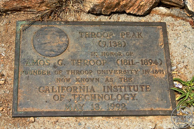
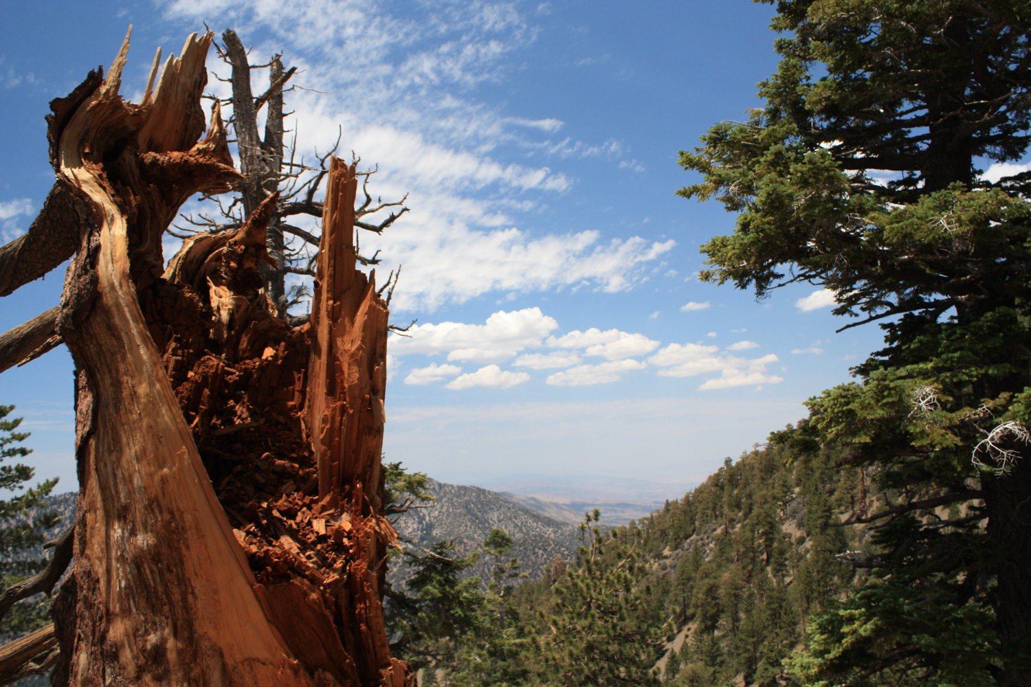
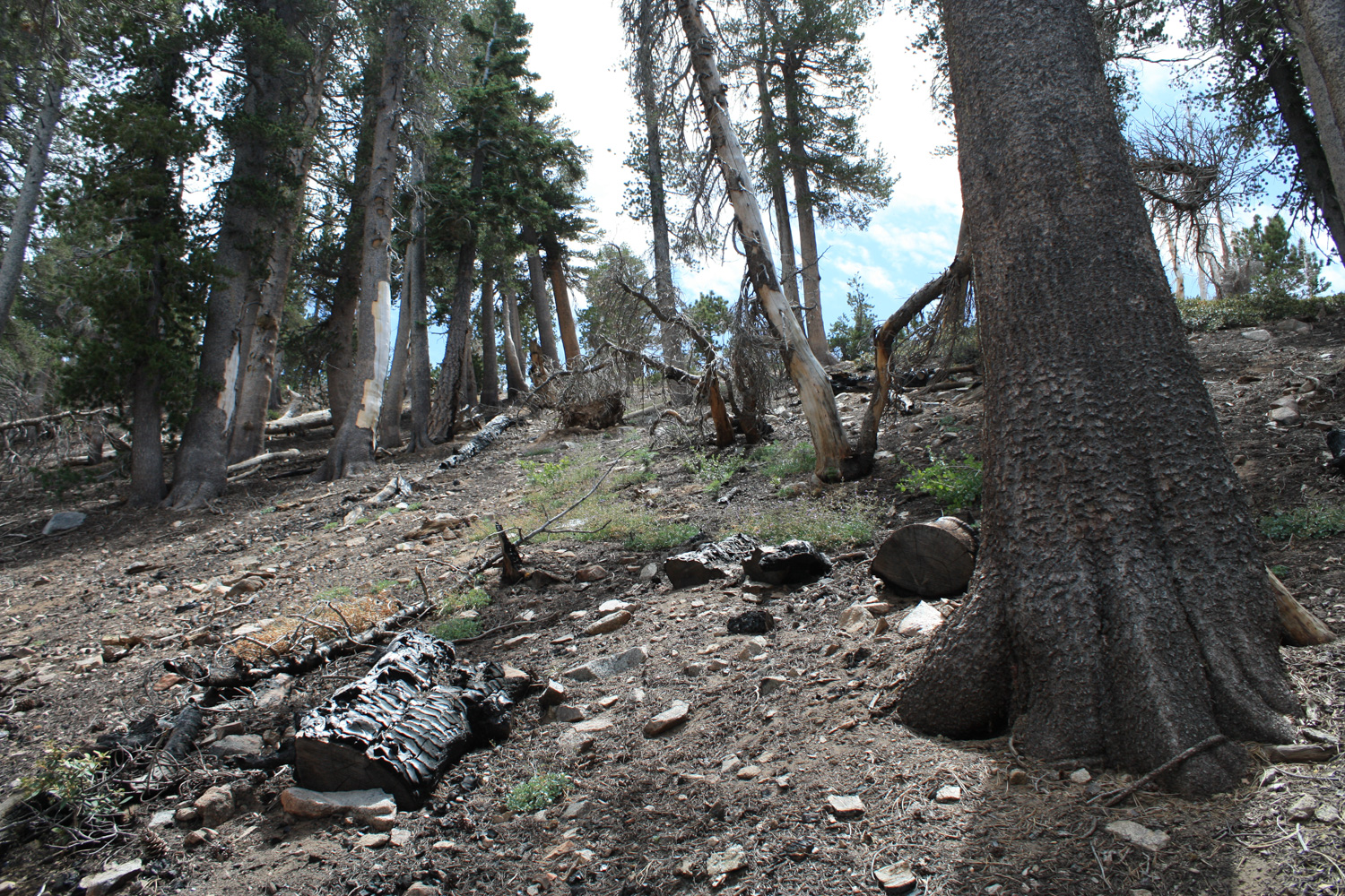
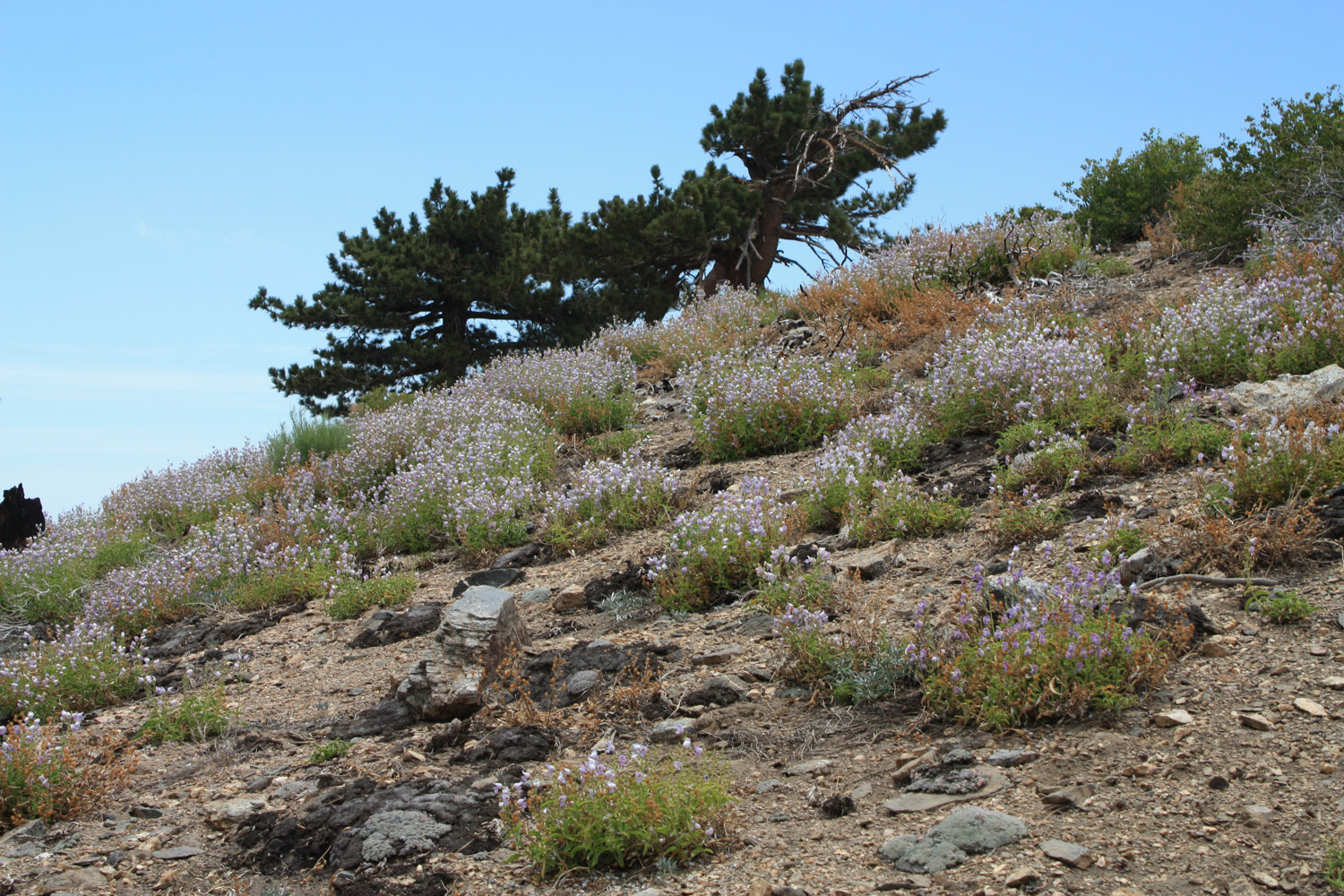
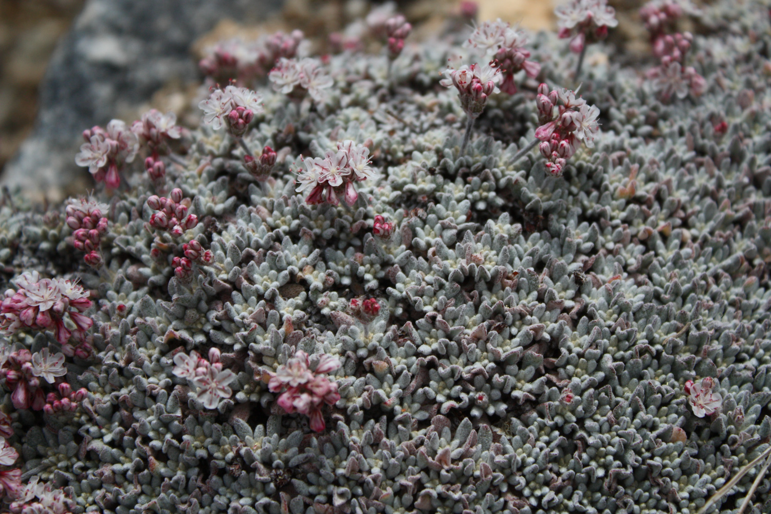
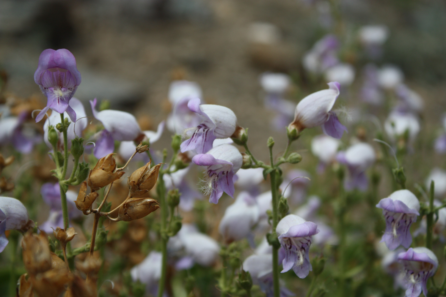
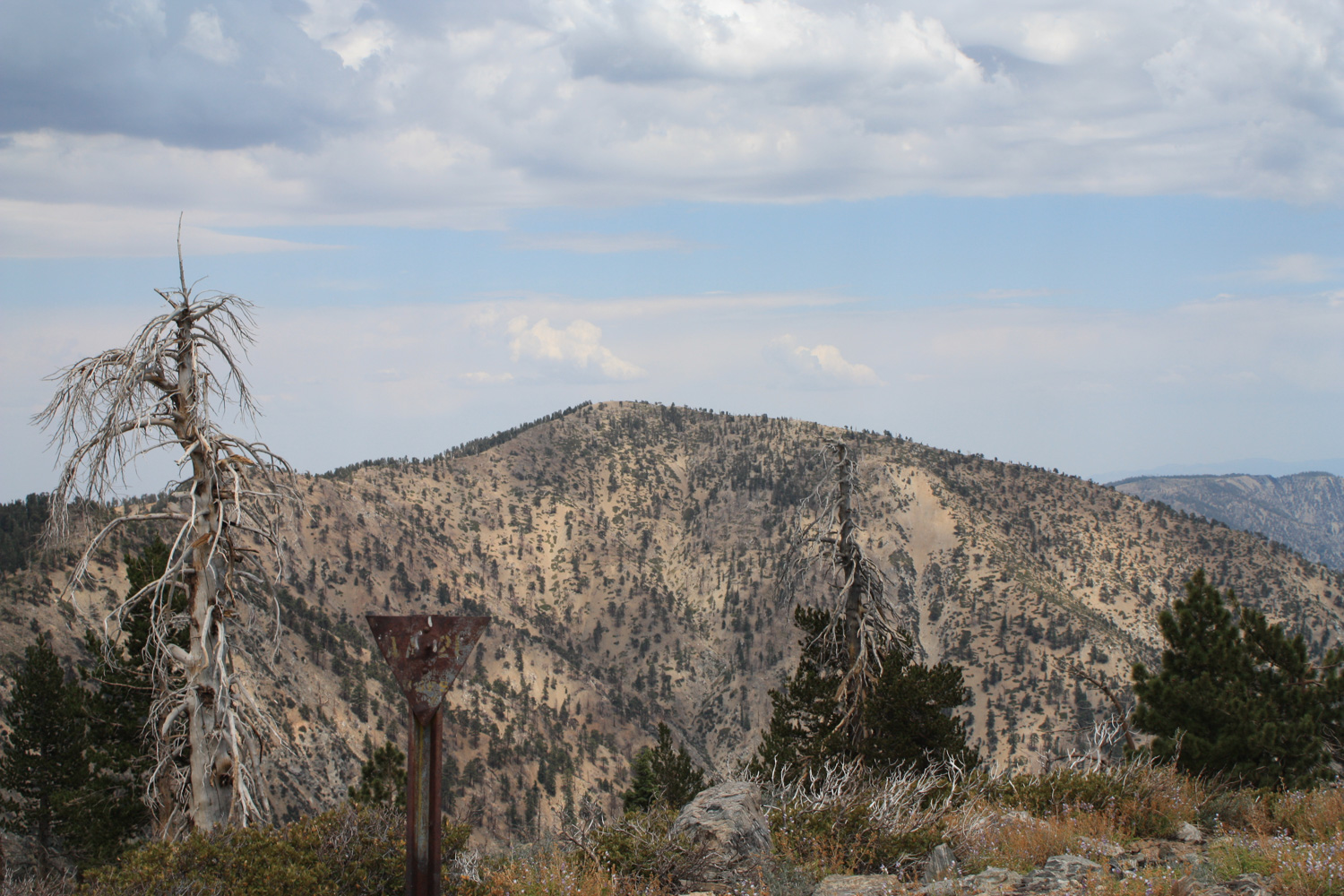
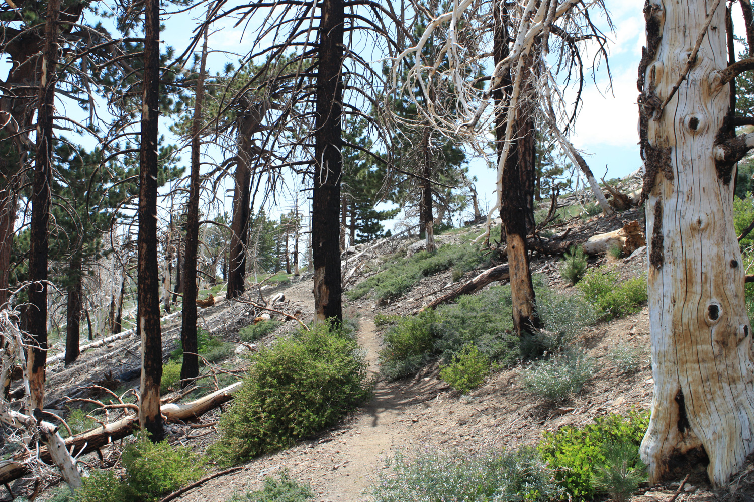
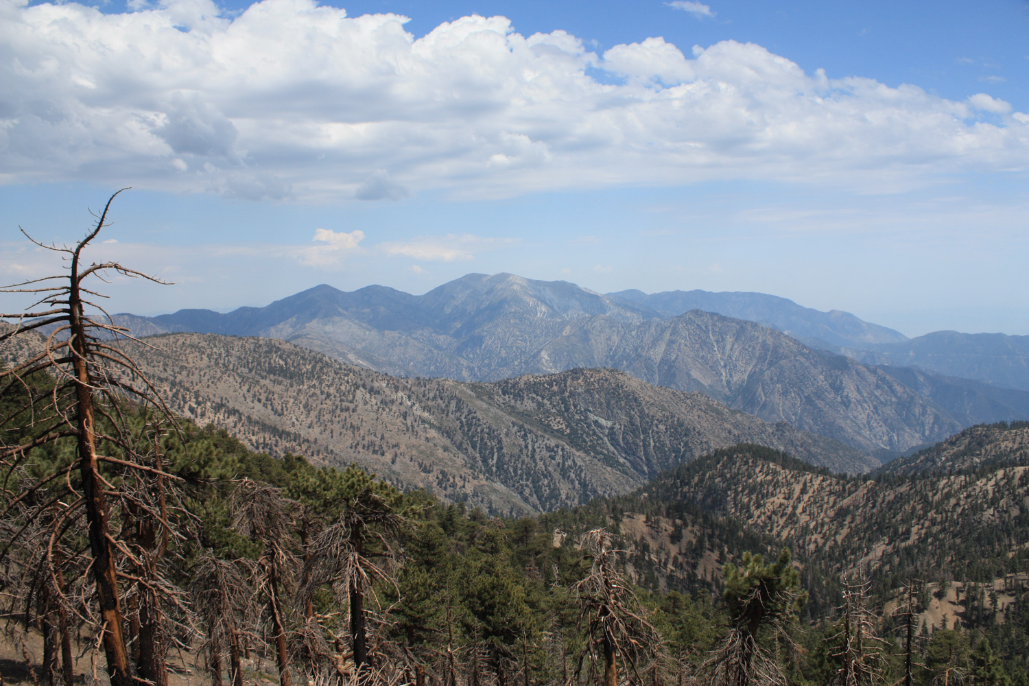
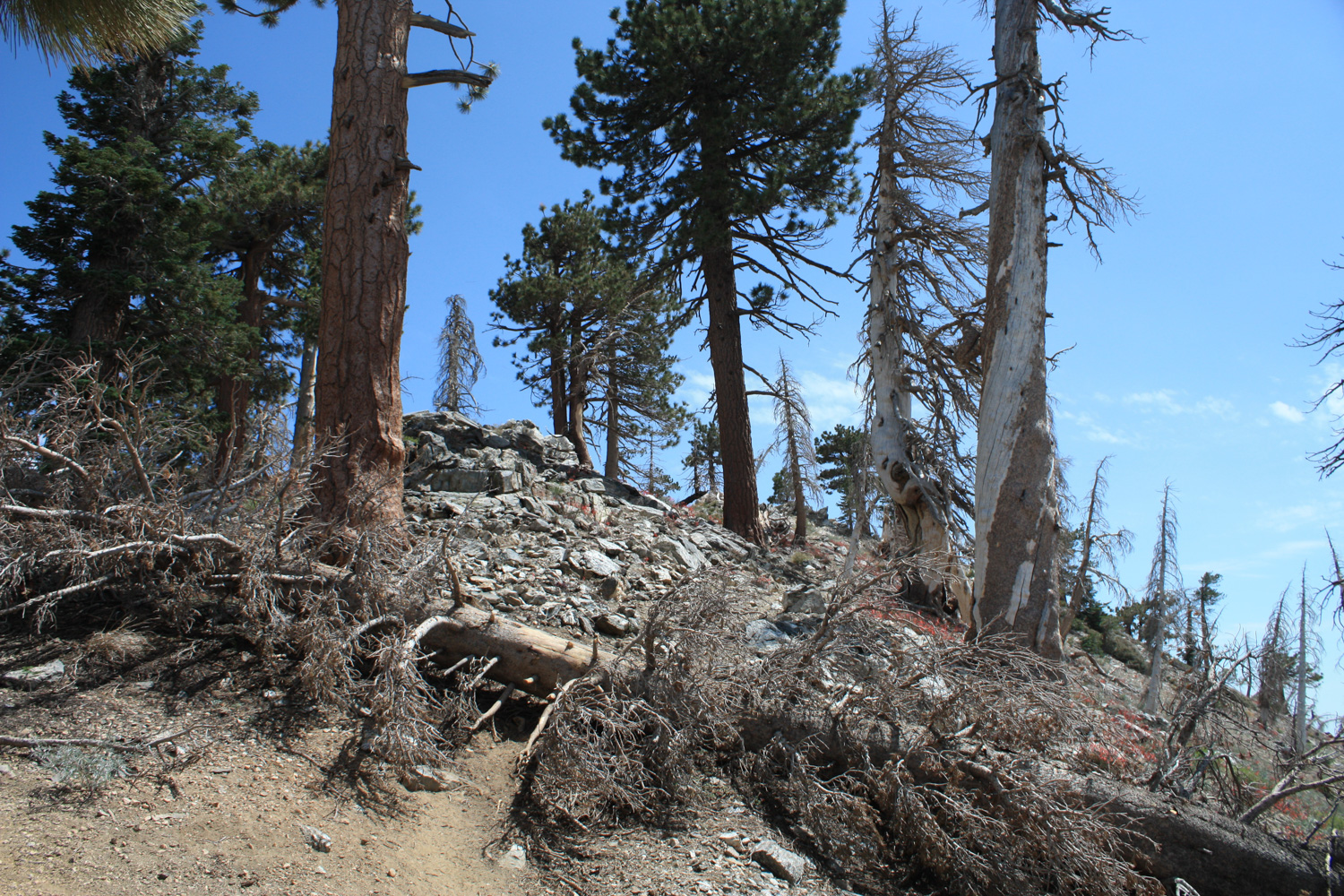
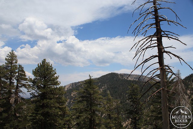
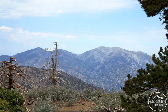
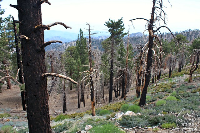
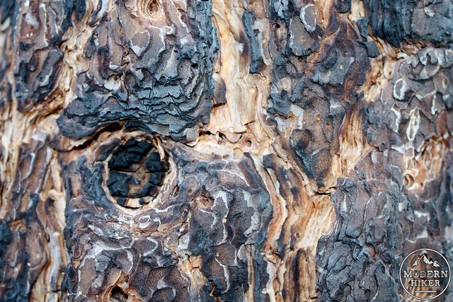
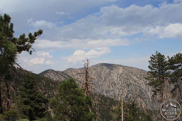
When I hiked in, all of the plants near the summit were blooming, and the air was thick with buzzing bees and insects. But I guess they were too busy with their pollen-gathering to notice me, since nothing bothered me at all. I was able to sit down near the plaque honoring Amos Throop and soak in the views of neighboring Baden-Powell and Baldy, as well as see some of the lingering evidence of the devastating 2002 Curve Fire, which badly damaged the area. You’ll get a closer-view of the effects of wildfires in a bit.
When you’re done at the summit, head in a southwestern direction, down a steep but navigable ridge. You’ll see the longer ridge-line of the Hawkins Mountains right in front of you.
Just keep heading to the southwest. The trail will go missing in a few hundred feet, but if you generally follow the ridge you’ll be ok. Keep looking south, and you’ll be able to make out the Pacific Crest Trail going east-to-west just below you. Keep on the ridge until it gets too steep or you get close enough to the PCT, then hop on.
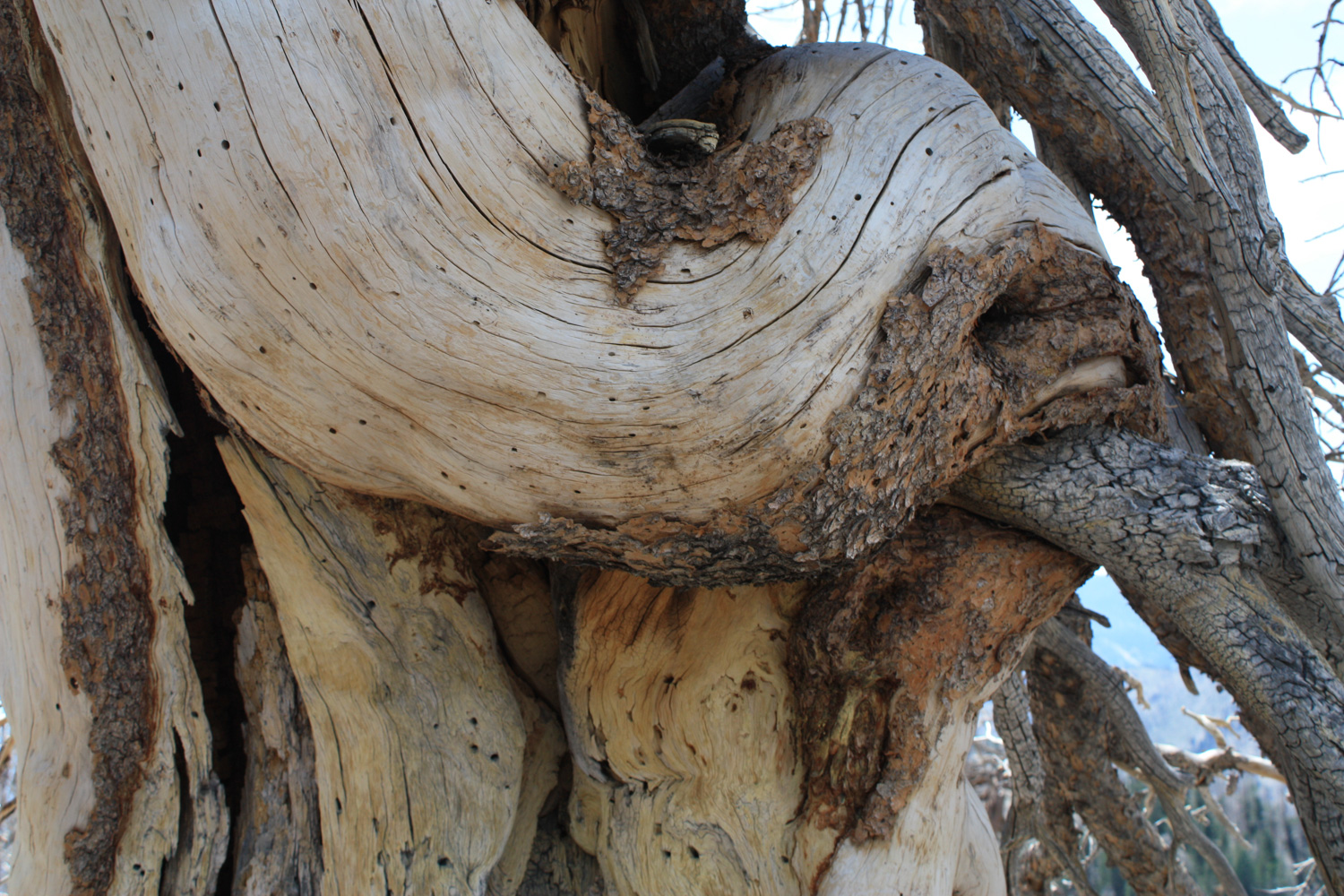
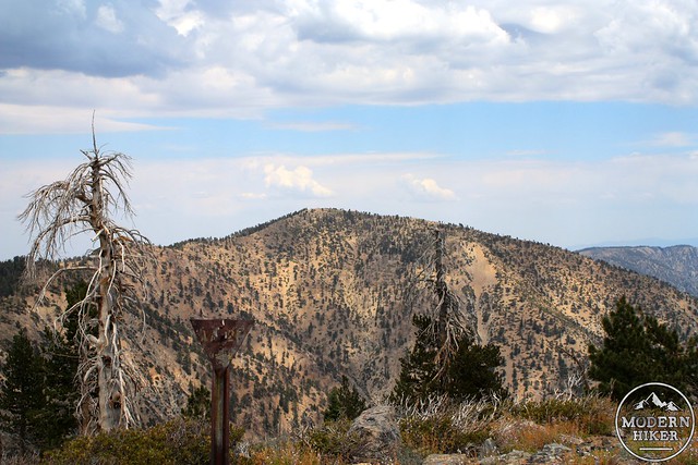
Here, you’ll see some effects of the Curve Fire more up-close-and-personal. Countless trees are still charred and dead, but most of the grasses and small brush has bounced back.
At about the 2.9 mile mark, the Pacific Crest Trail descends on the west side of the Hawkins Ridge, while the unmarked Hawkins Trail continues on the ridge top, heading south. Keep right to stay on the Hawkins Trail, which hops over a few more small bumps on the last 0.1 miles to the summit.
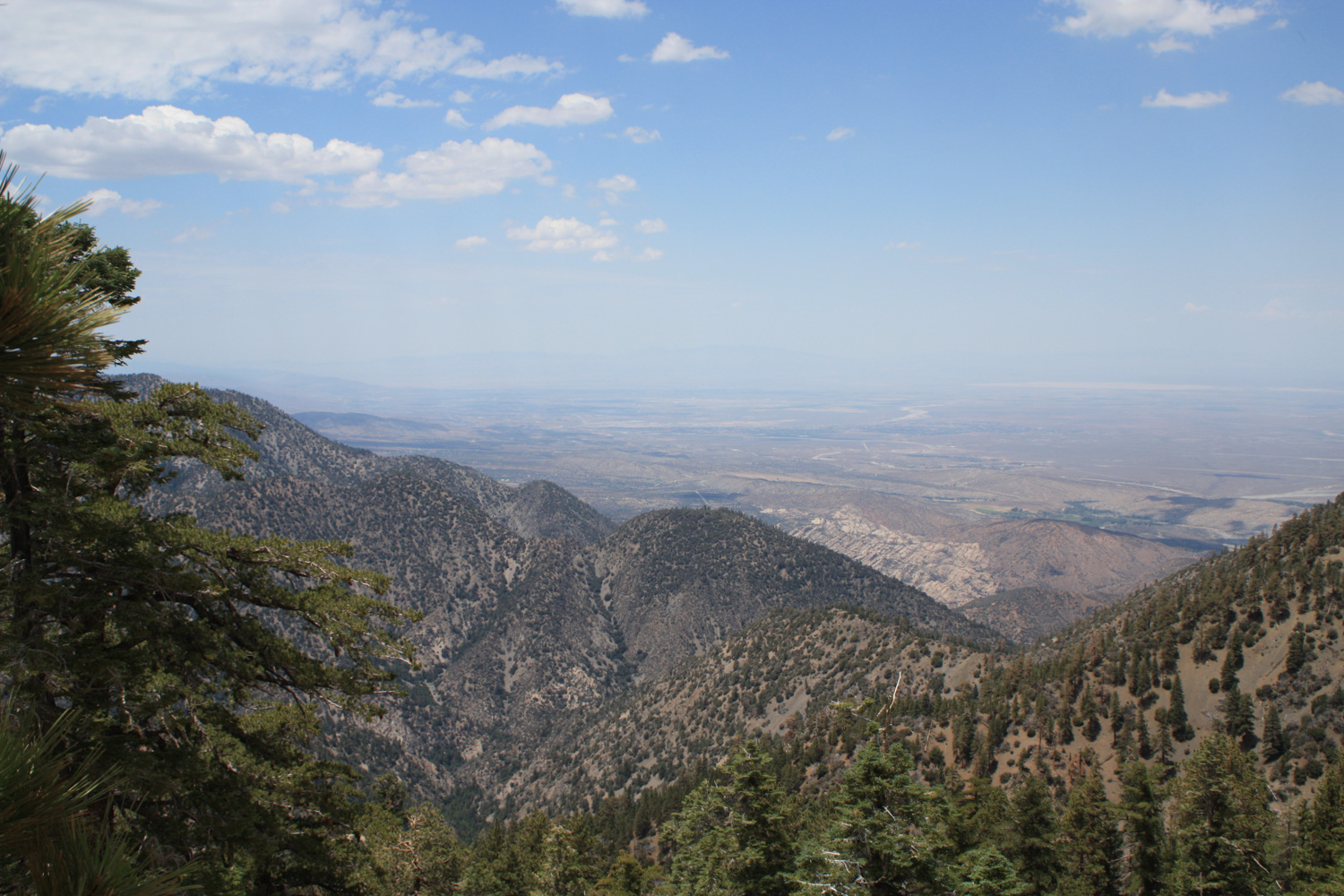
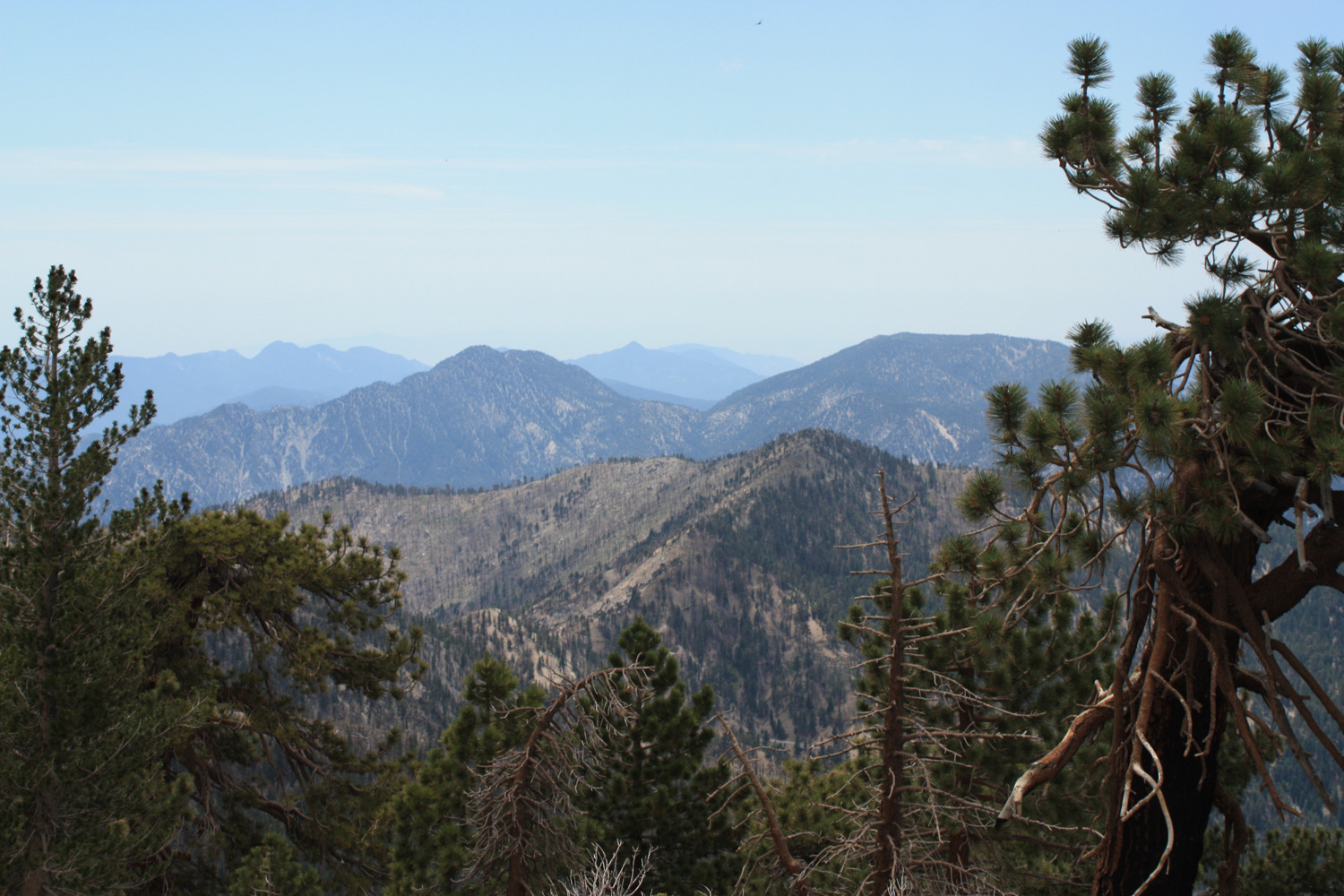
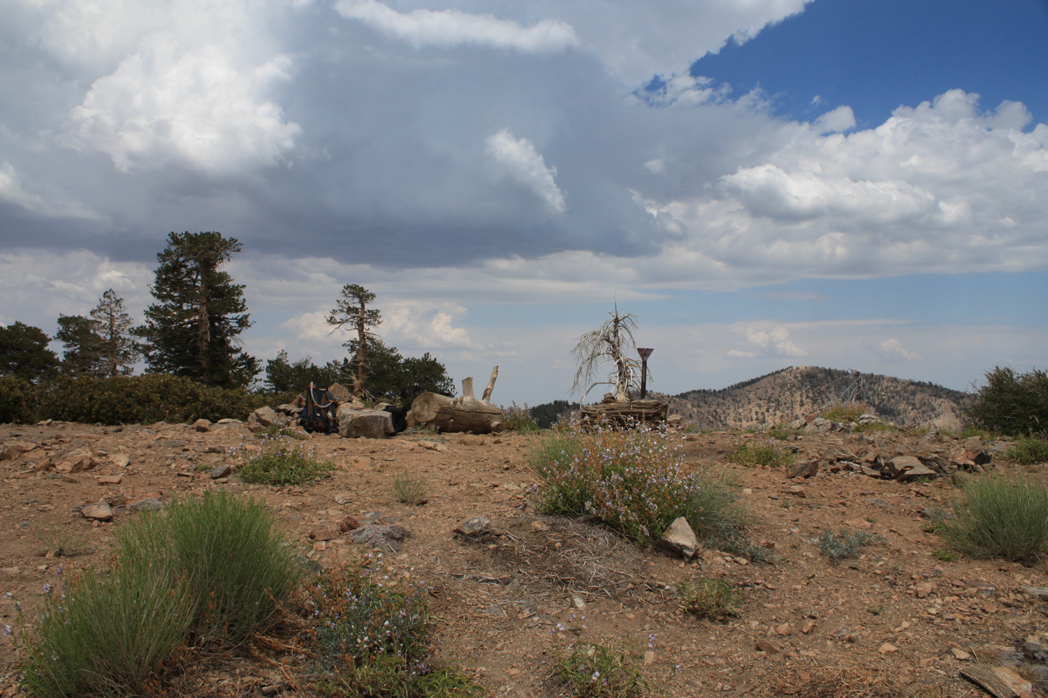
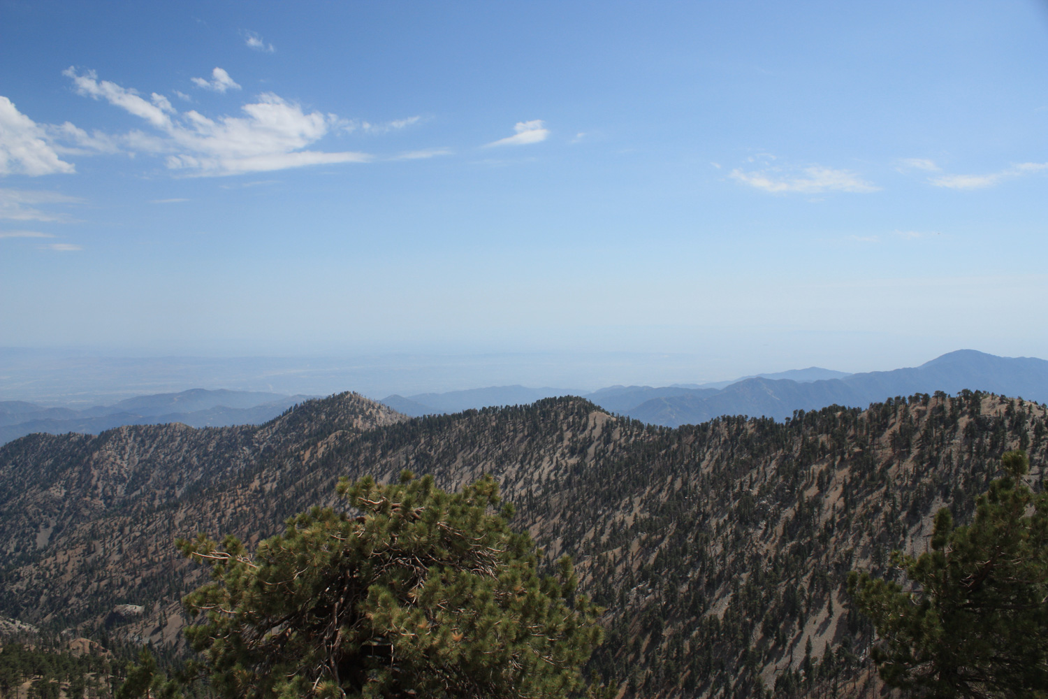
From the small, rocky summit of Mount Hawkins, you’ll have outstanding views of the surrounding areas – including the canyons of the South and Iron Forks of the San Gabriel River, as well as Mount Baldy to the east and the Hawkins Ridge to the south, where Middle Hawkins, Sadie Hawkins and South Mount Hawkins – former site of an historic fire tower – can be seen.
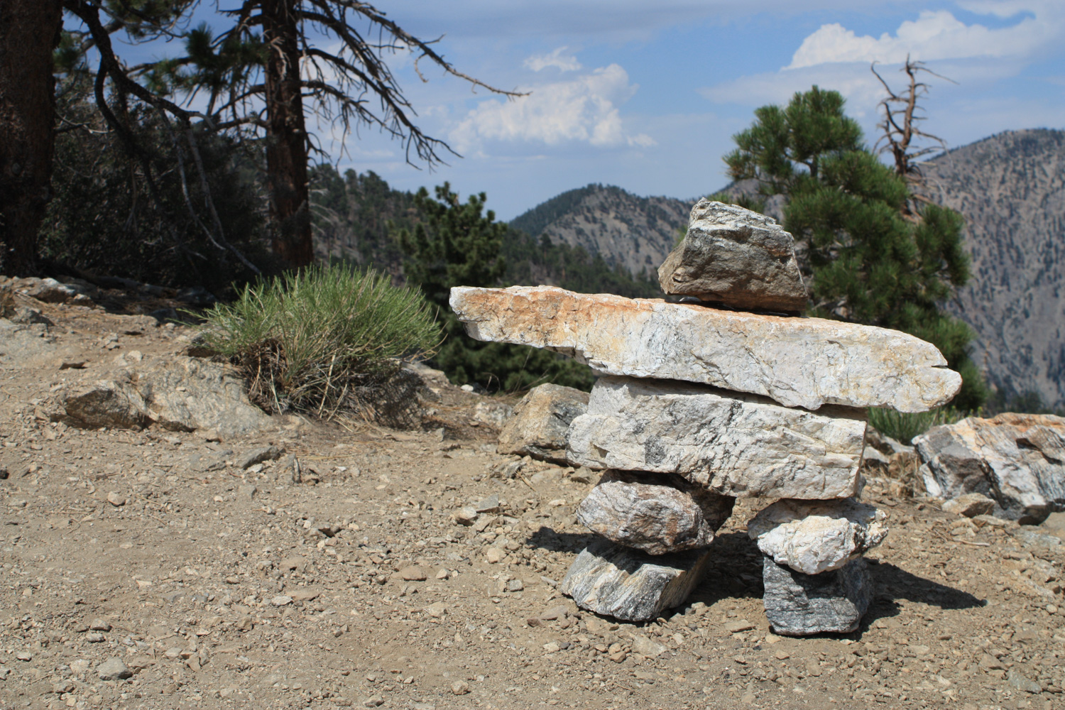
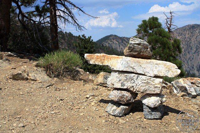
… and if you’re extremely lucky, this little cairn-man will be pointing you directly at the summit of Mount Hawkins:
When you’re ready to head back, rejoin the Pacific Crest Trail and take it back around Throop Peak to the Dawson Saddle Trail, or, if you’re feeling like more off-trail climbing, head back to the top of Throop Peak and follow the northern ridge back to the Dawson Saddle Trail.
Tags: Angeles National Forest, curve fire, dawson saddle trail, Hiking, mount hawkins, Pacific Crest Trail, PCT, throop peak