Distance (round-trip)
10.8 mi
Time
7 hrs
Elevation Gain
2731 ft
Season
Spring
Summer
Fall
Winter
Weather
–
10.8 mi
7 hrs
2731 ft
Spring
Summer
Fall
Winter
–
The most challenging peak in the front range of the San Gabriels. This trail loops through a shaded canyon, brush, and exposed rock-face Class Three bouldering before descending to idyllic meadows in the shadow of Strawberry Peak’s dramatic north face. Hands down, one of the best hikes in Los Angeles.
NOTE: THIS TRAIL WAS HEAVILY DAMAGED IN THE STATION FIRE. As of November, 2015, hikers have reported both the Colby Canyon Trail and Mountaineer’s Route are in passable shape. Although conditions are improving, be aware of poodle-dog bush and poison oak on the Colby Canyon Trail and note that some of the scrambling directions on the Mountaineer’s Route are tough to spot.
An easier way to reach Strawberry Peak is by hiking from the saddles of neighboring Mount Lawlor or a longer trek from Josephine Peak.
Strawberry Peak was one of the first hikes I did in the San Gabriels that reminded me that hiking is more than just strolling in the woods. It starts out with a swiftly ascending canyon trail, moves to an unmaintained, thorn-lined use-trail, and tops off with some straight-up class 3 rock climbing. It is, as they say, a doozy. But it’s also a lot of fun, and one of the few peaks close to the city that feels like a real-life mountain climb.
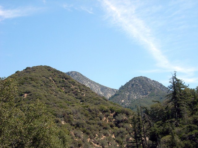
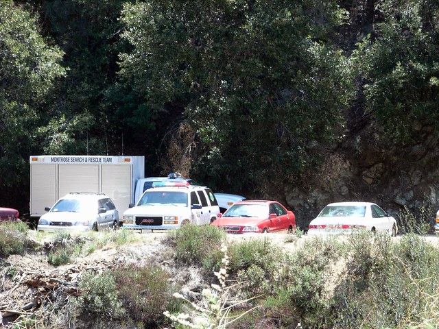
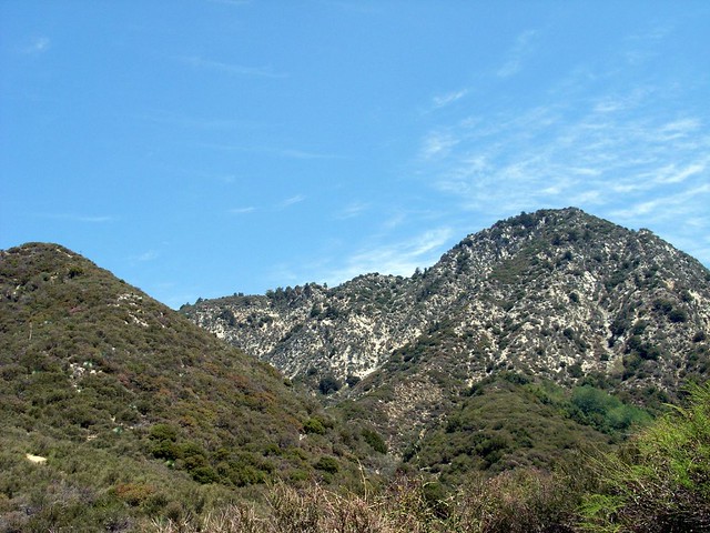
As I parked at the busy trailhead, I could see the deceptively rounded summit peeking out from behind two shorter hills. I laced up, stretched out, and headed up. When I did this hike, there was also apparently a Search and Rescue mission going on. This is one of those trails that doesn’t seem like it can be dangerous … until it is. If you’re planning on taking the mountaineers route / scramble to the top, you should know what you’re getting into before you do it.
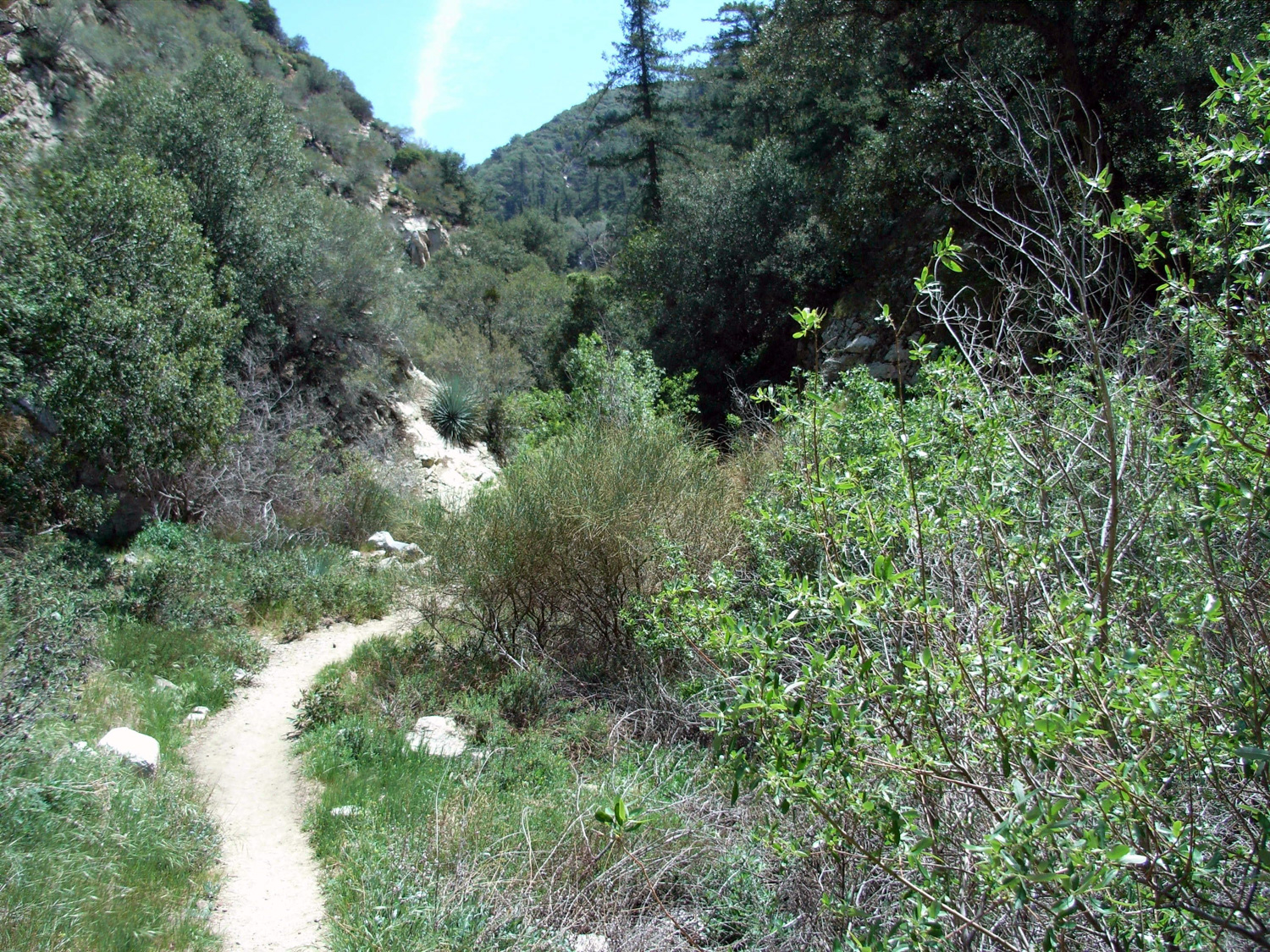
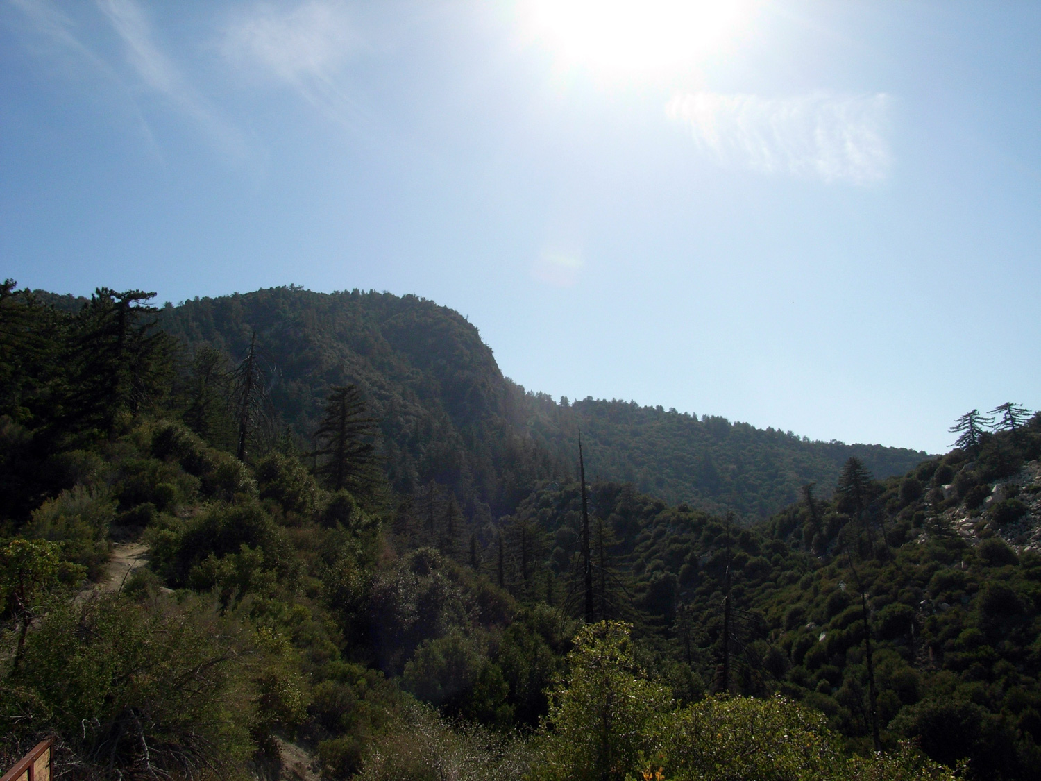
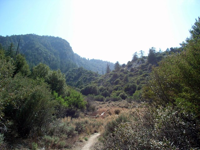
The trail at Colby Canyon starts out by dropping a bit from the road to the canyon floor. It’s heavily forested and you should enjoy it … because this is pretty much it for the shade on this trail.
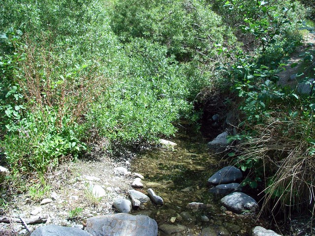
This early section also had a small seasonal creek. When I hiked this in October there was nothing but dust in the riverbed. Today, it was full of croaking frogs and the occasional bathing bird.
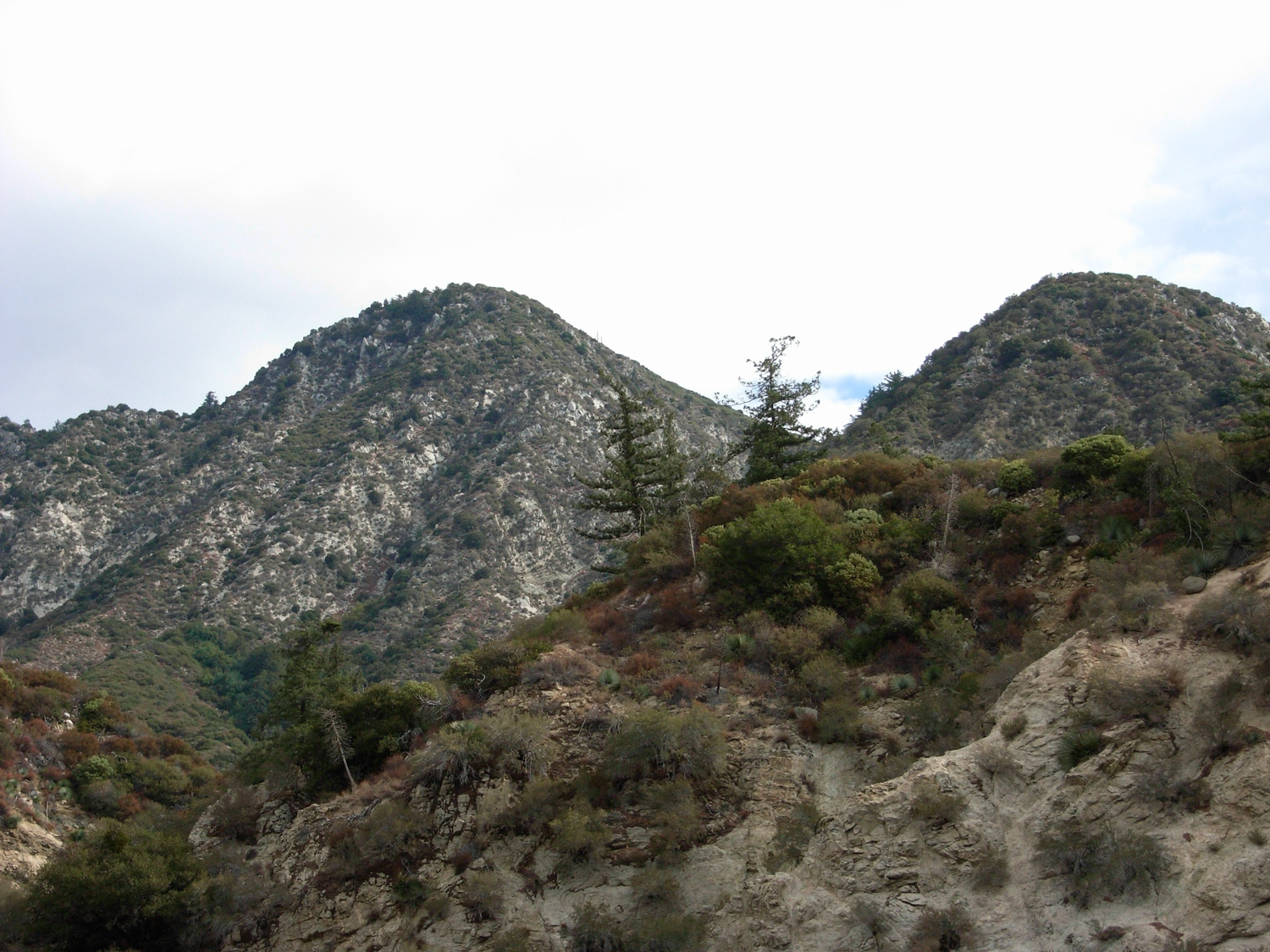
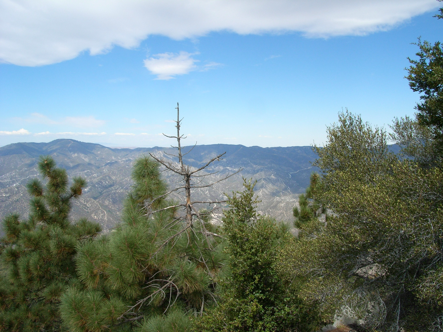
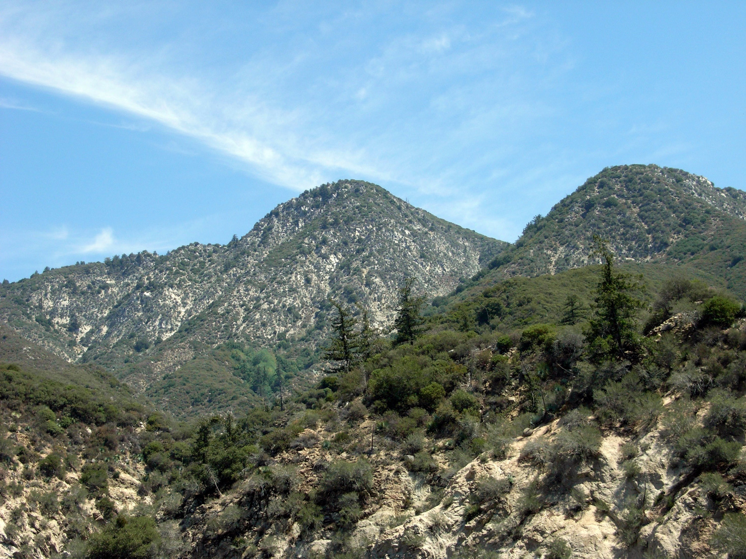
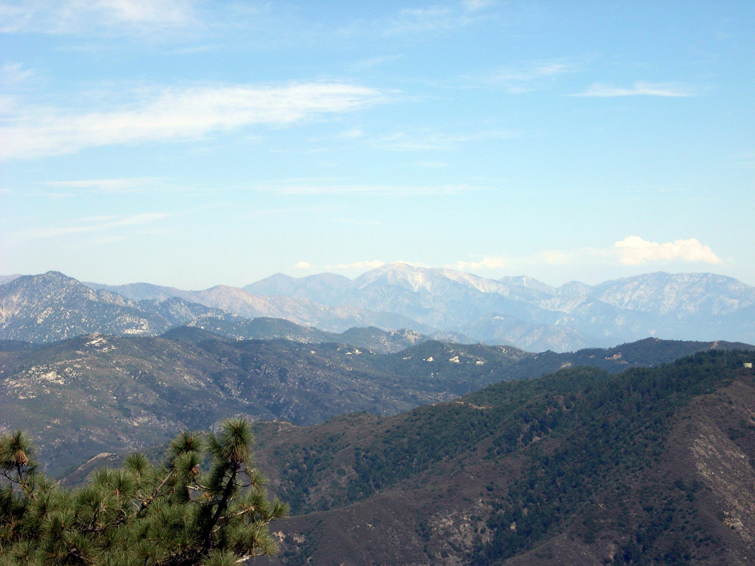
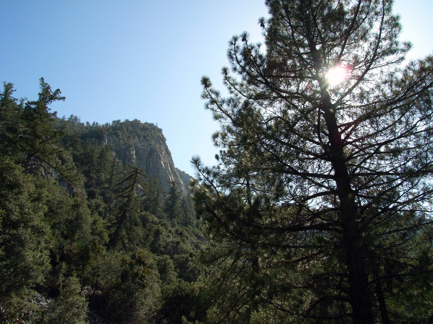
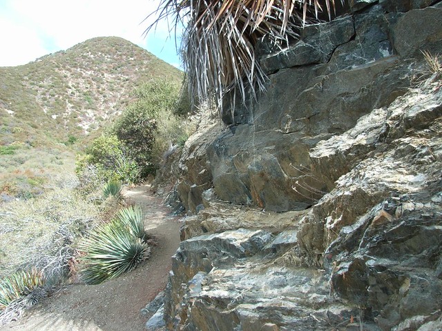
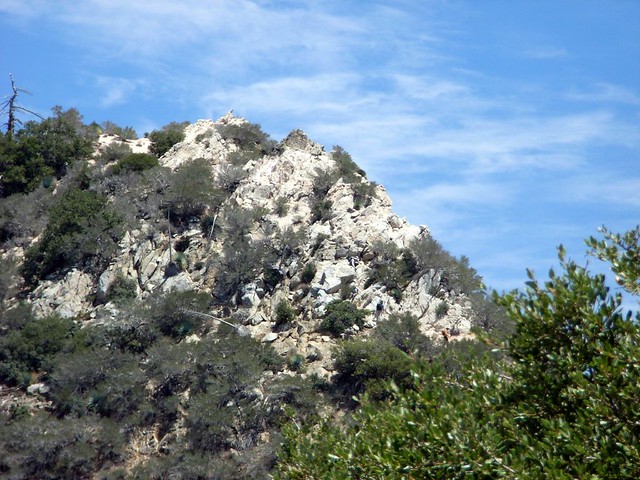
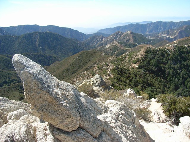
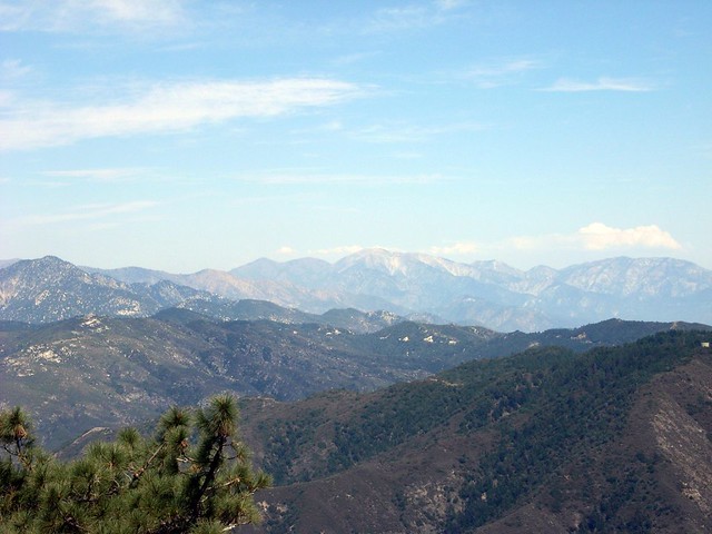
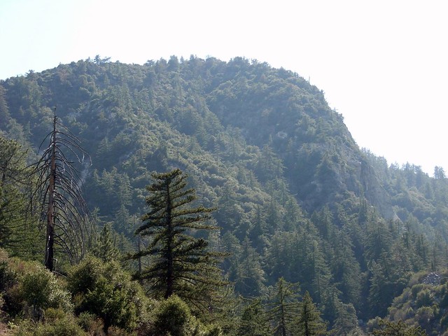
In this lower section of Colby Canyon there is a lot of poison oak – especially near the seasonal stream. Just watch where your arms and legs are going and you should be fine. This area was badly burned in the 2009 Station Fire but appears to be making a strong recovery. After a short distance, the trail climbs the east wall of the canyon and leaves most of the vegetation behind it. From here, you’ll get your first views of the south face of Strawberry Peak.
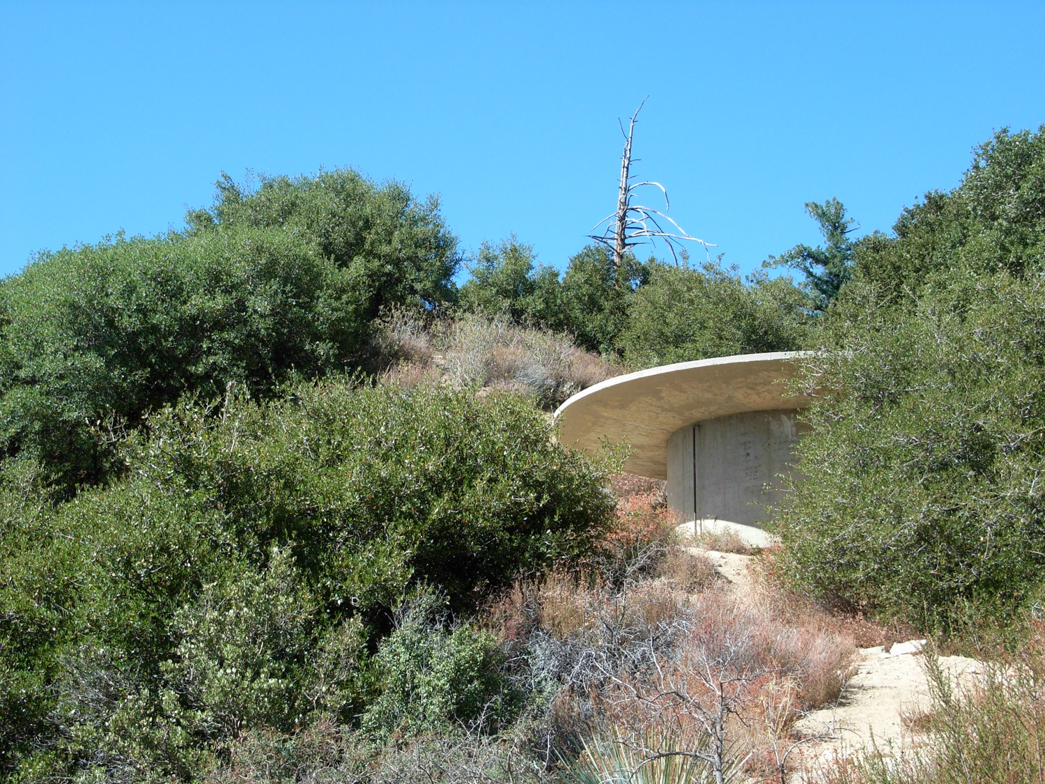
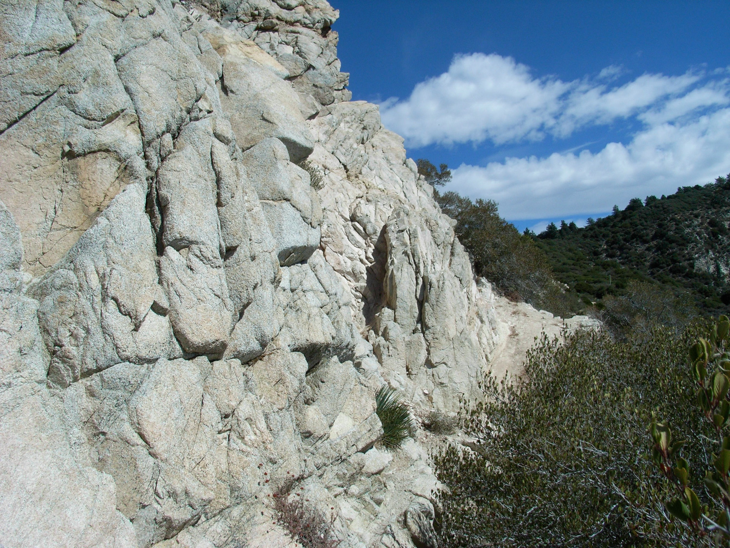
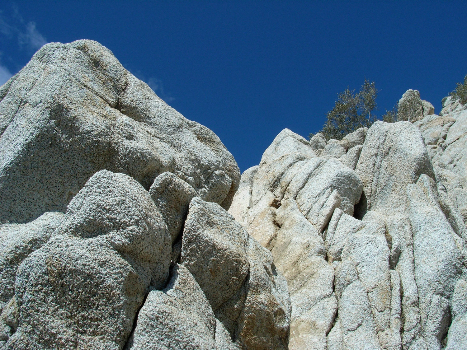
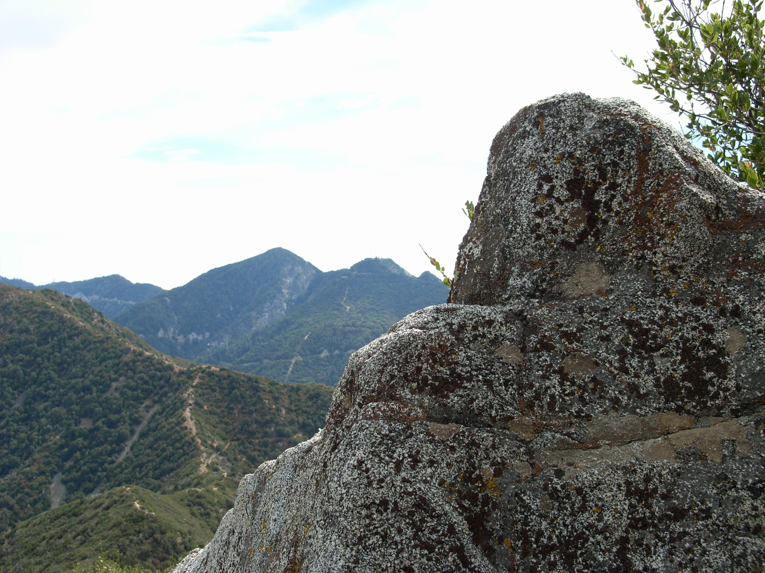
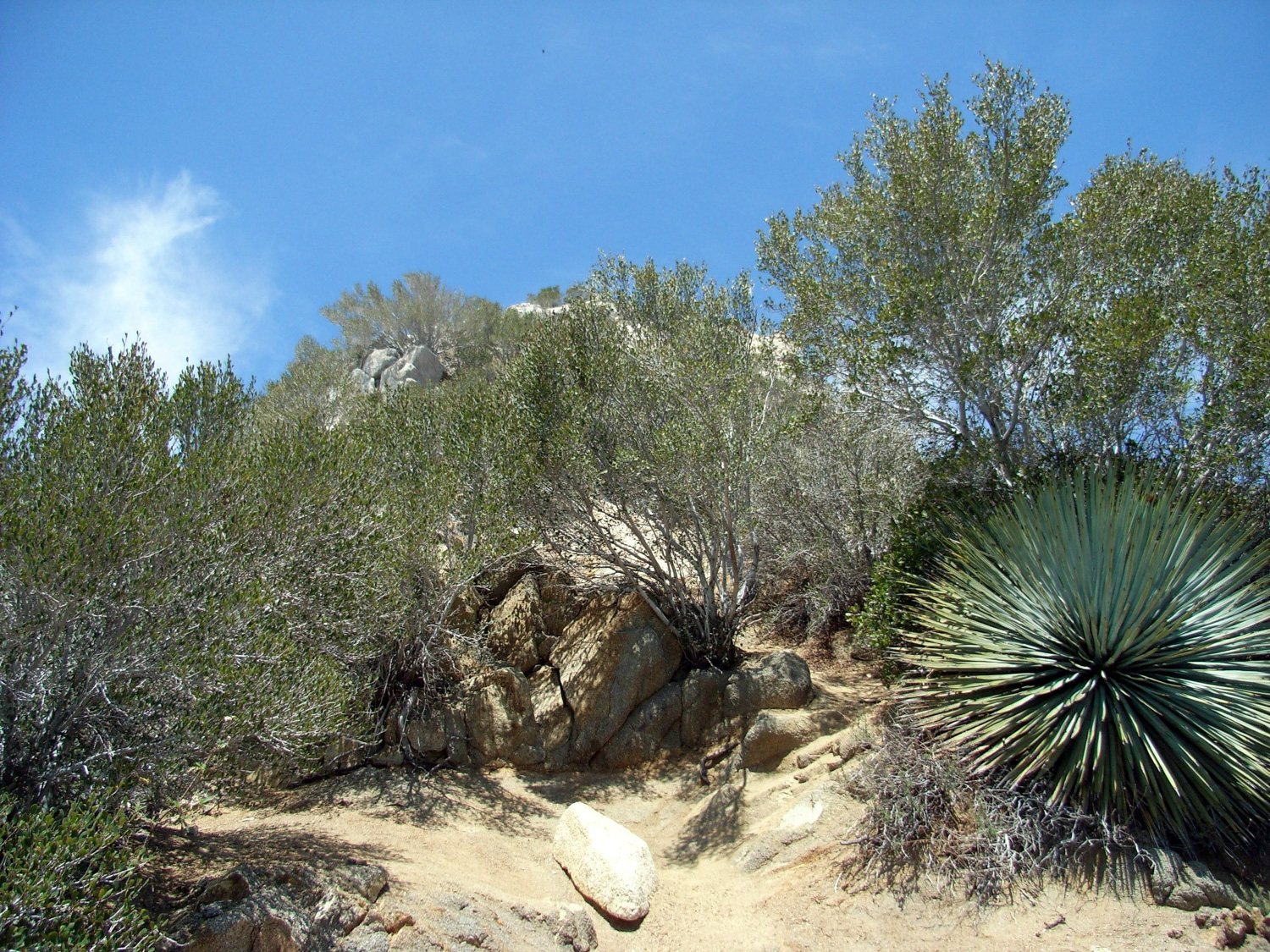
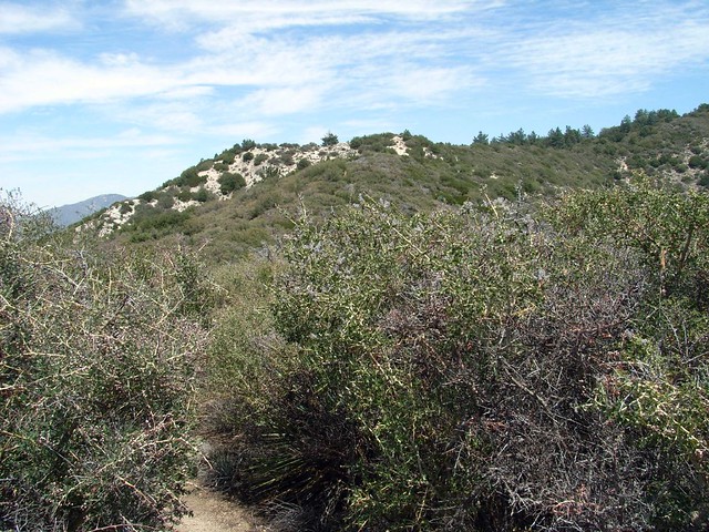
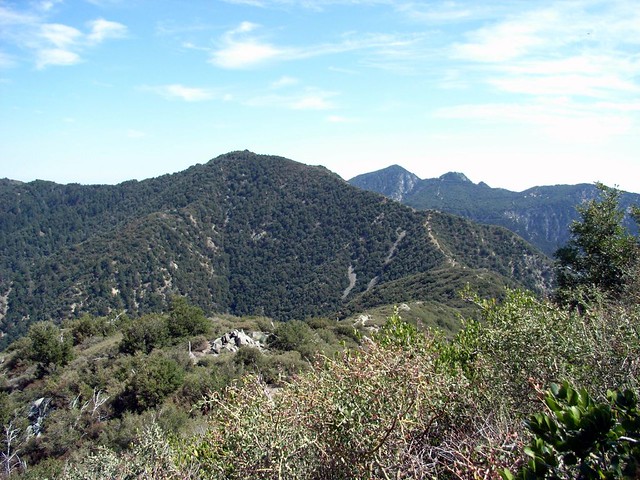
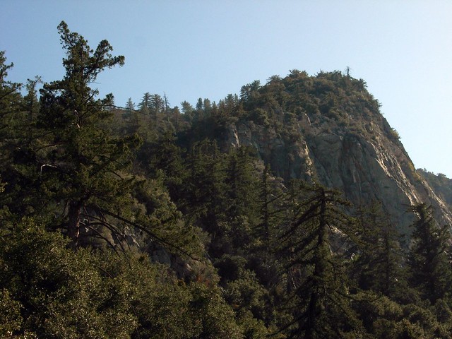
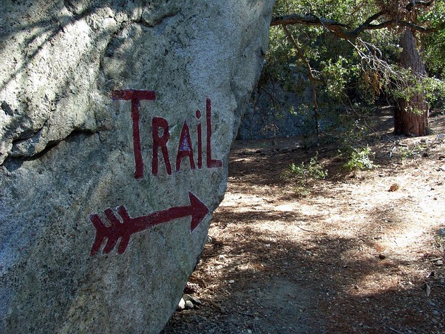
At about the 2 mile mark you’ll come upon Josephine Saddle, where the trail splits toward Josephine Peak to the west and Strawberry Peak to the north at a water tank that may have some interesting graffiti. If you’re looking for the more fun mountaineer’s route to Strawberry Peak, walk north toward the Strawberry Peak Trail but keep your eye peeled for a short use-trail on the east side of the path very close to the Saddle. Make a quick scramble up to the ridge and walk about 0.2 miles to what looks like the end of the trail at a rugged rock face.
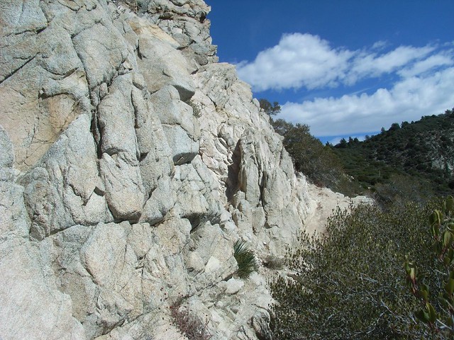
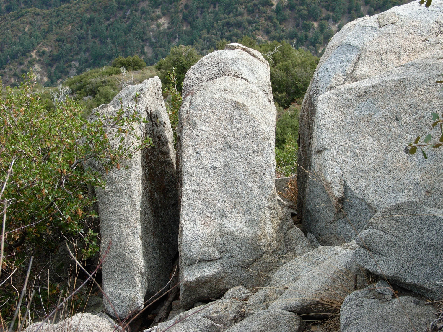
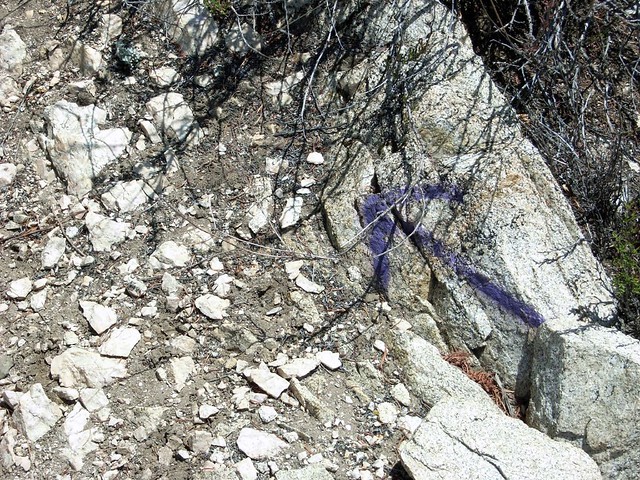
I remember the first time I got to this part of the trail and thought about going back and taking the long way around. If you’re not used to rock scrambling – or in a feisty mood – this can get intimidating very quickly. But it’s really not as tough as it looks. A kind vandal was nice enough to mark a suggested path up the rocks which – while technically graffiti – is actually pretty helpful when you don’t know where you’re supposed to be going.
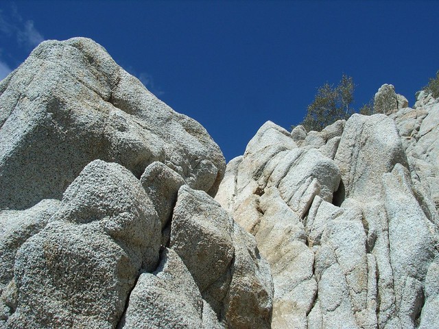
… and the knowledge that you’ve got a tougher climb ahead of you.
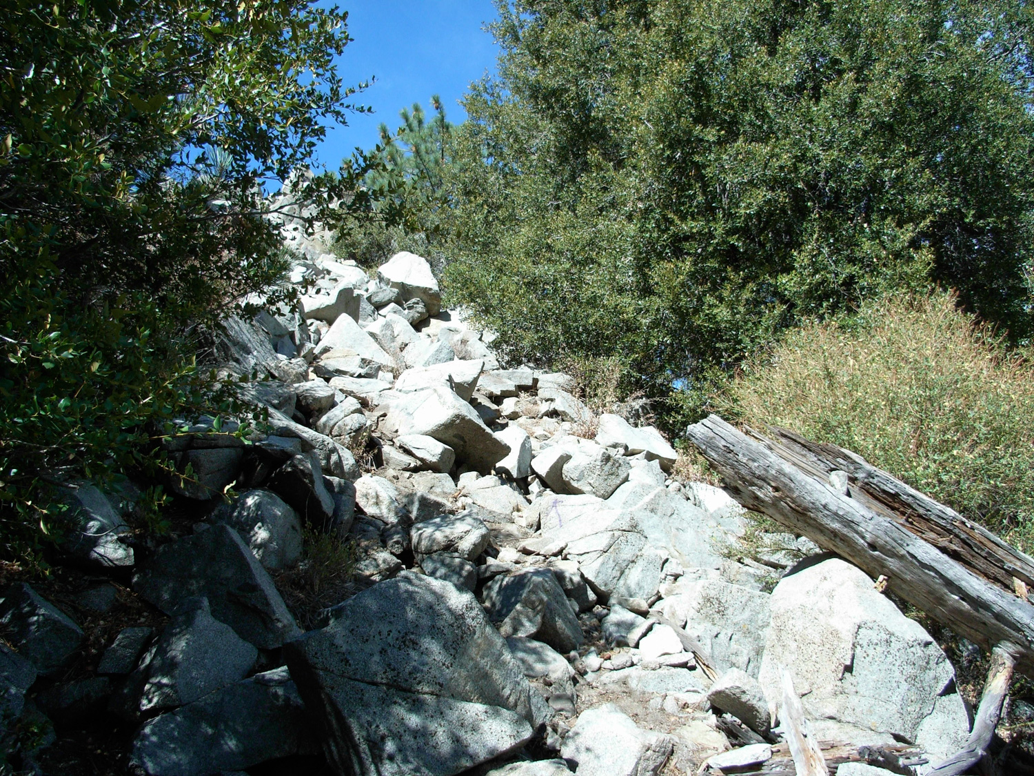
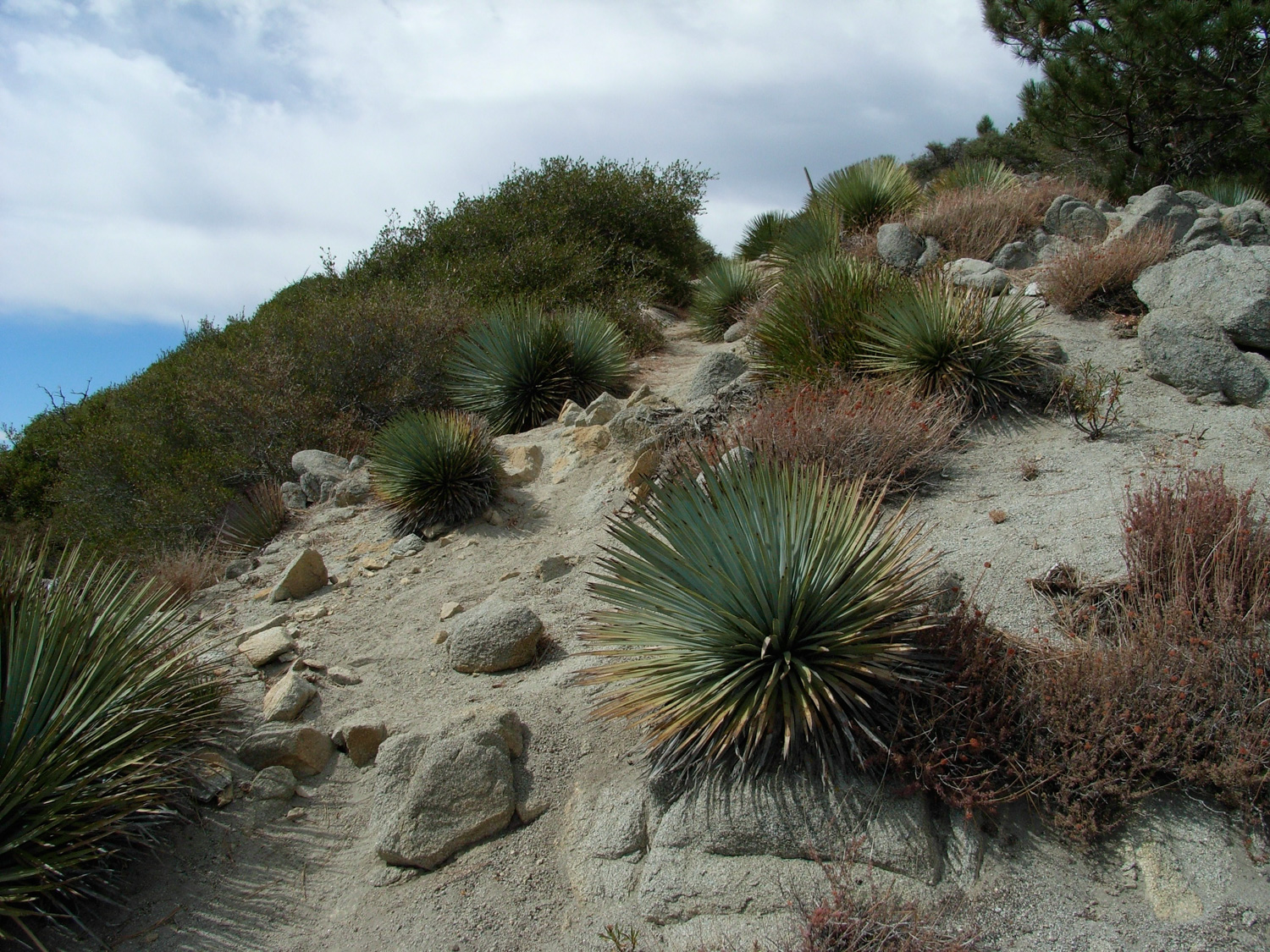
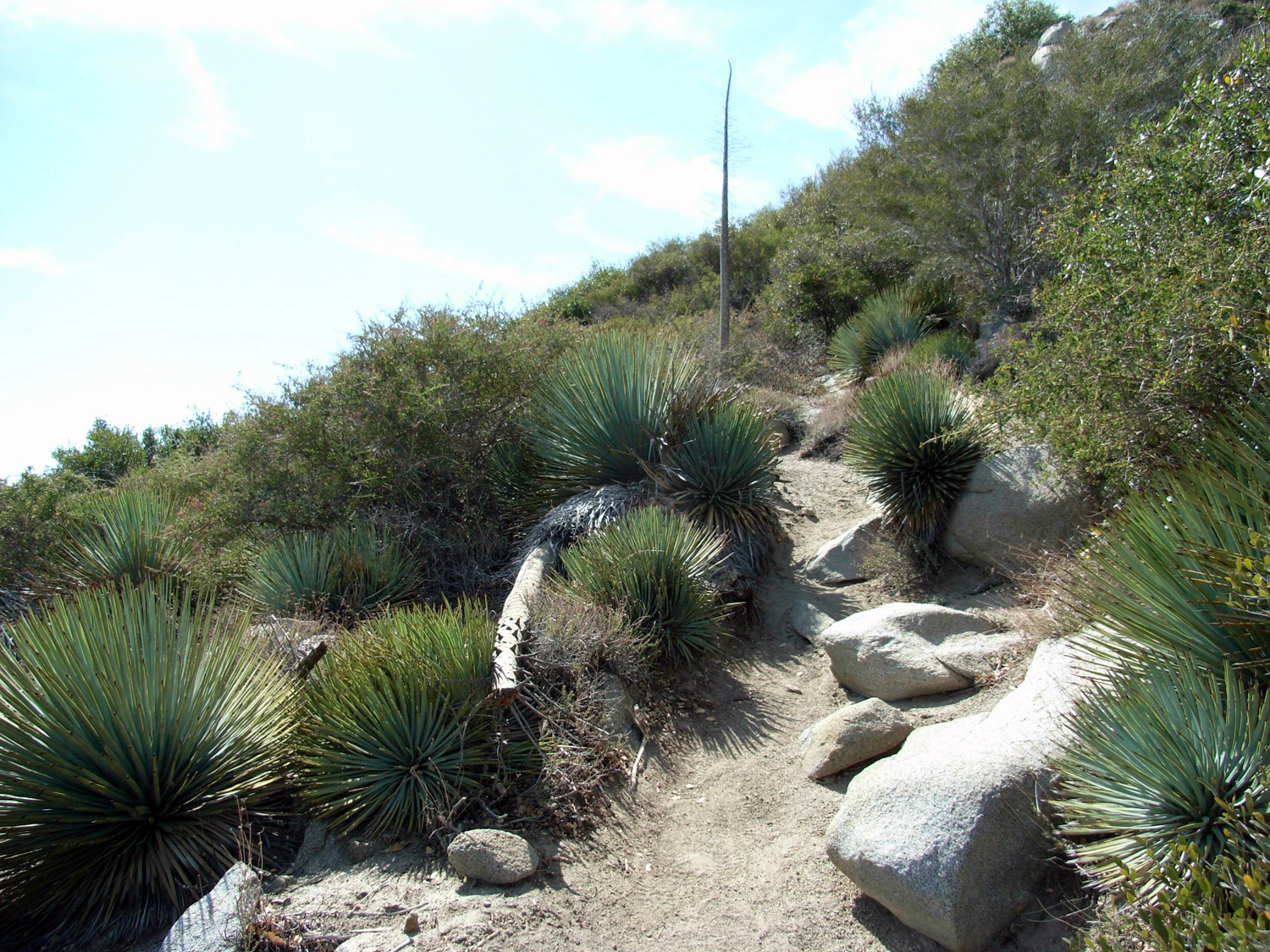
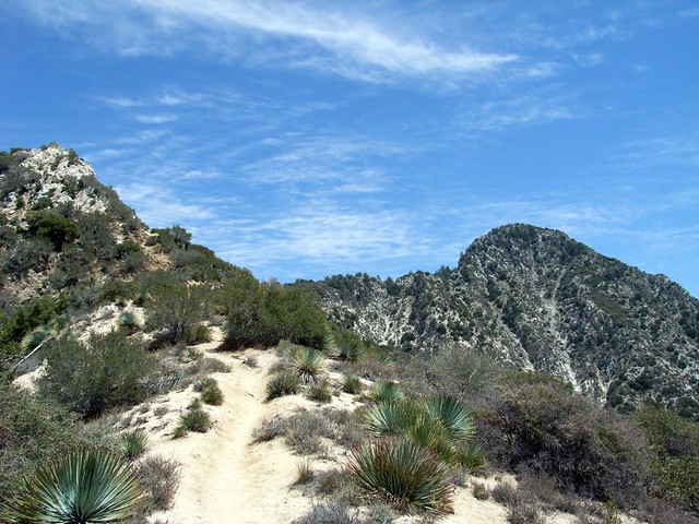
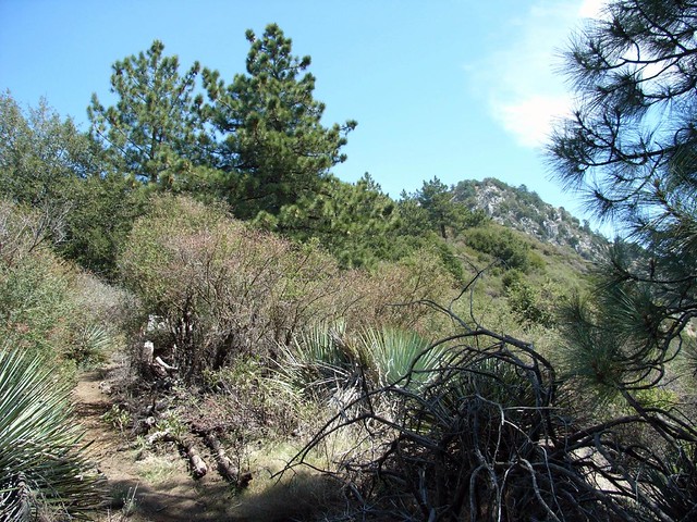
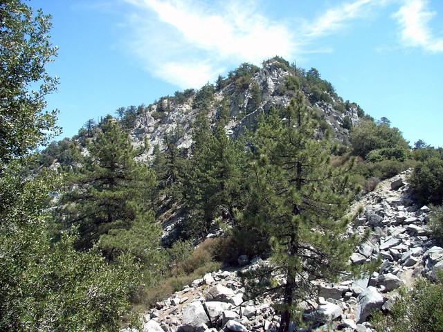
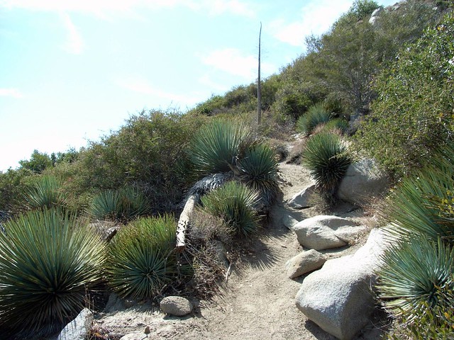
The trail makes a steep but steady climb until you reach the 2.9 mile mark. You’ll meander through giant boulders, dive under chaparral, and avoid Spanish bayonets along the way.
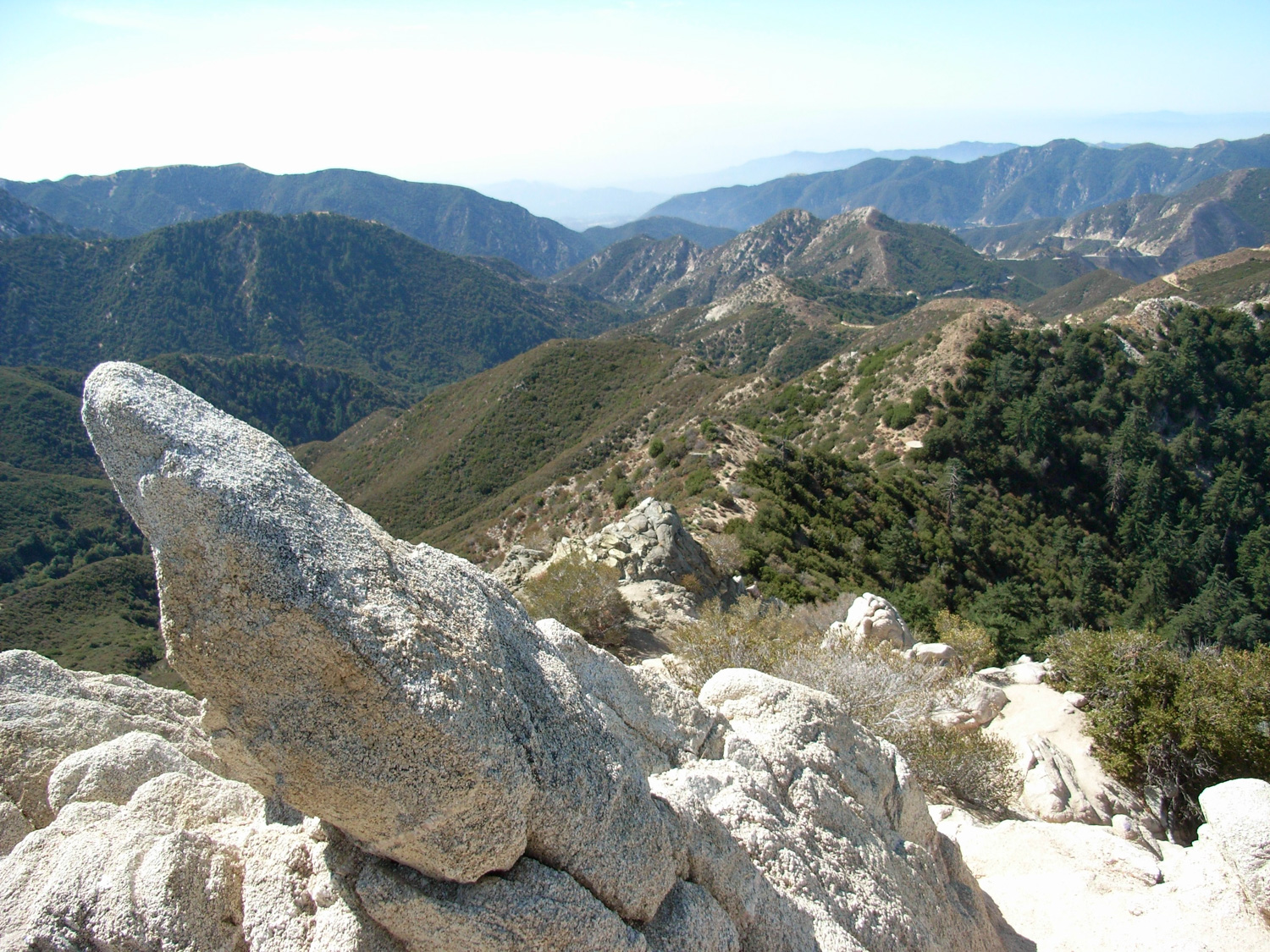
And eventually, you’ll hop over a large pile of broken rocks and come face to face with this:
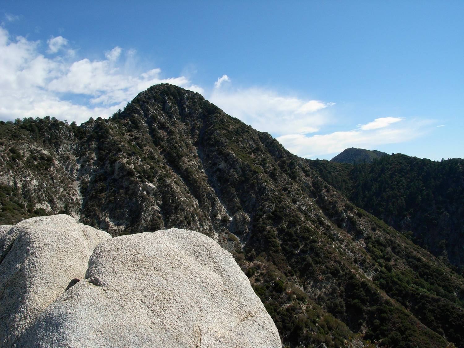
When you’re finished hanging out at the summit, either return back the way you came or continue down a steep, rugged trail that runs along one of the eastern ridges of Strawberry Peak. It’s not nearly as adventurous as the western ascent nor are there any fun climbing spots … but the trail is fairly easy to follow and only runs into Bayonet gauntlets a few times along the way.
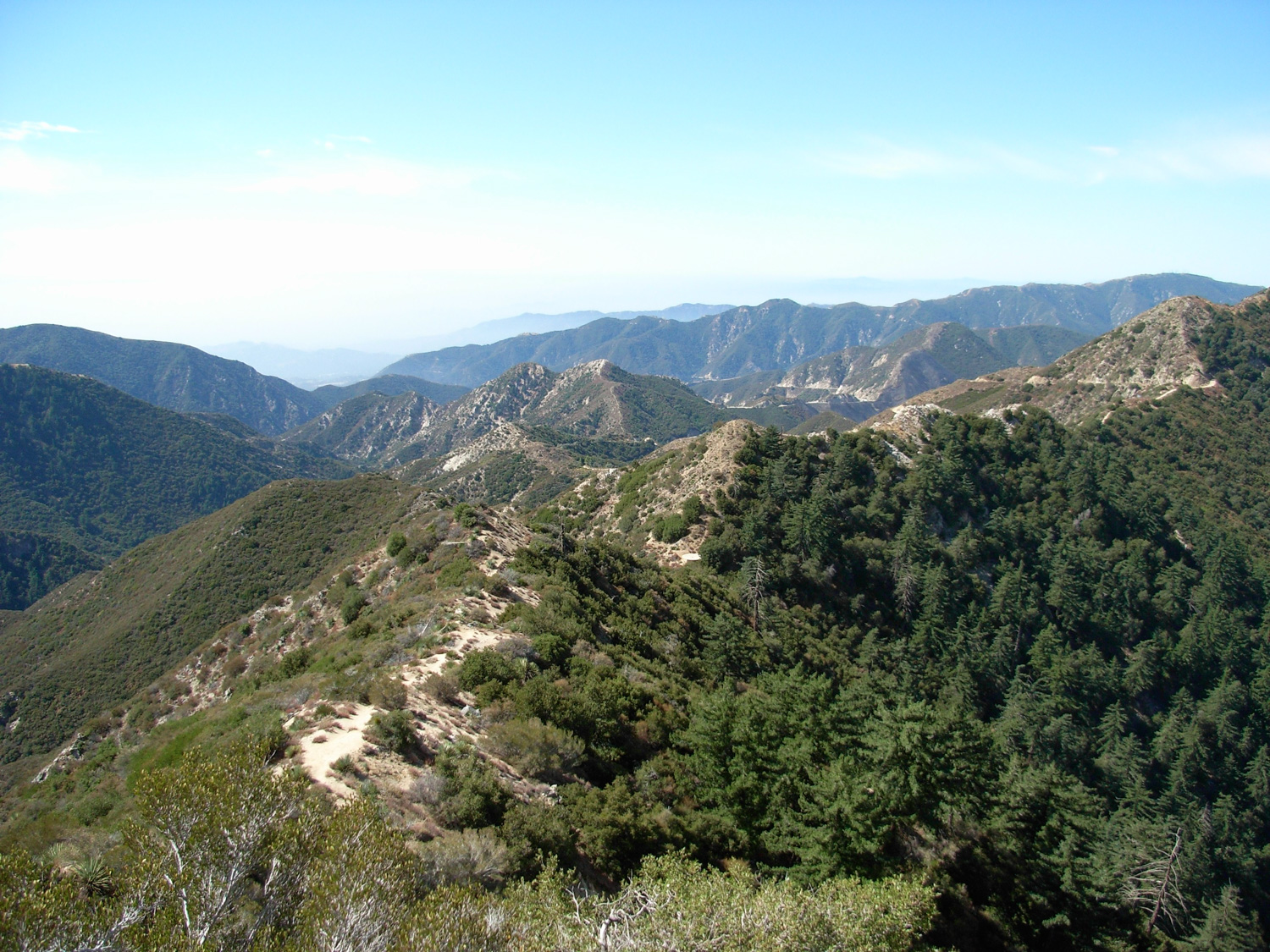
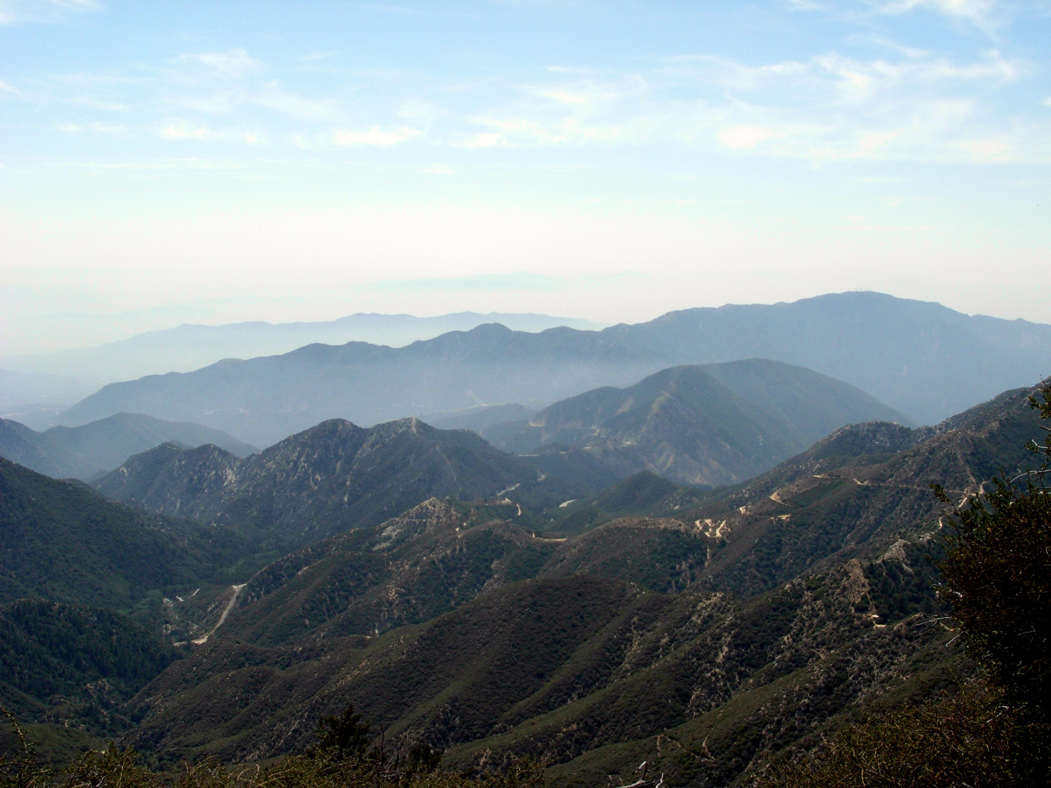
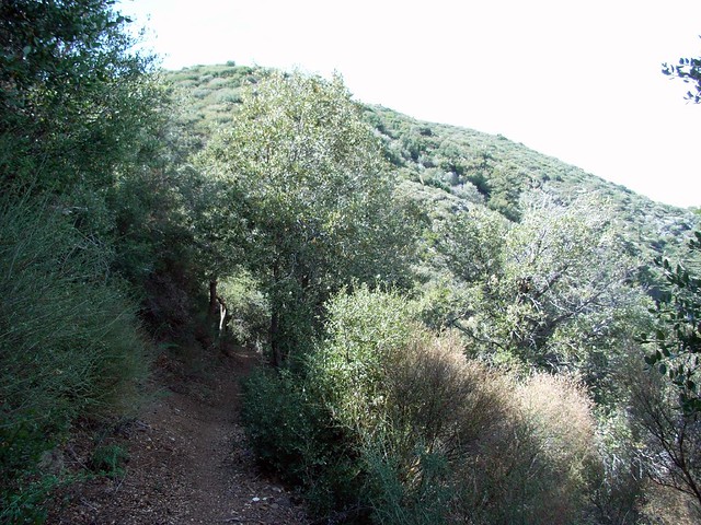
In a mile you’ll reach the bottom of the eastern trail, where you can tack on a scramble up Lawlor or head back to Red Box for a car shuttle. Instead, turn north on the Strawberry Trail to start the long loop around the north side of the peak you just bagged. Enjoy the shaded, slightly declining trail as it loops north and west, passing a seasonal spring at the 5.2 mile mark.
From the Meadows, it’s about a mile and a half back to Josephine Saddle. Head back to the trailhead the way you came in.
From Colby Canyon to Josephine Saddle, the trail clearly marked and easy to travel. The "mountaineer's route" is a semi-maintained, unofficial trail that traverses through noticeably tougher terrain. You'll have to fight your way through thick brush, steep slopes, and class 3 bouldering with steep drop-offs. While the route is marked, caution should be taken - especially on the bouldering sections. The trail that winds through Strawberry Meadow to the north of the mountain is another official trail. While seldom-used, it is easy to follow and not too steep.
From the 210 in La Canada Flintridge, take the Angeles Crest Highway 10.1 miles toward the Angeles National Forest. There are two small dirt lots on the north side of the road at Colby Canyon, marked with trailhead signs and distances. It's just past the turn-off for the Switzer's Picnic Area and trail.
52 Comments
Guys. Seriously...do NOT make the mistake of doing this trail clockwise like I did this weekend. You'll have to go DOWN the steep rock scrambling parts, often questioning whether you're completely off the correct route, end up on a precipice overhang, give up, and never make it down. Picture #10 in this post is the the steep trail that you should look for on your right soon after you pass the tank wheel thingie. Also, bring at least 3L. I did it on a semi hazy day and ran out of water. But on the plus side, do it now and you will see millions of beautiful colorful wildflowers all over the trail!!
Just completed this loop out of Red Box – rather than Colby. Trail is in fair condition and there was minimal poodle-dog bush. All springs have run dry and I did not see any water at Strawberry Meadow to purify. Bring lots of water.
Awesome hike! The mountaineer's route was great fun, and with recent rain there are some beautiful water falls and creeks. The rain brought down some trees but the trails look good for the most part. The day following this hike I found that a tick had bit my back and needed to be removed, so check yourself out before bed if you decide to scramble through the brush on the mountaineer's route! I'll be up there again soon, truly a fantastic hike.
Thank you to have shared this !
This hike is amazing, it never get boring despite its length.
I made the error of starting too fast and was really proud of reaching the summit so quickly.
But I payed it later and was wasted on the way back to the reservoir and so happy to finish the hike in refreshing clouds with some drops of rain.
I tried to rest in at the shadow of the trees in the meadow but was attacked by flies, how do deal with those ?
Lovely back in there. Like a little bit of Yosemite. And hardly a soul around. Other thing I really like about this hike is its variety. Start out creekside, then up though open chaparral, bouldering to the peak, down that shaded backstretch, the quiet of the meadow, back up through forest cover to Josephine Saddle, then out. It's a 10. Great work on the site, b/t/w. Wouldn't have found it without it. Thanks.
Sounds like a great experience! Strawberry Meadow is really a nice, calming counterpoint to the adrenaline rush of the scrambling, isn't it?
Started hiking San Gabriels this past November and this trail has been the best of the lot. Did it twice this spring, once late March, then went back for more a few weeks ago. Trail is in excellent shape. My GPS had 3,559 total elevation gain. First time it became a struggle as I ran out of water about half way through (only brought 1.5 liters), second was much better as I packed in 3 plus+. There is a creek at the trailhead but you lose it after a mile or so in. Was flowing pretty well late March but by late April was struggling and will dry up.
Excellent reptile viewing. Between the two hikes saw 2 striped racers, a rattlesnake, 2 horned lizards, an alligator lizard, plus all the usual fence lizards.
The bouldering was a bit freaky the first time. Second time much better. Be sure to test your footholds and handholds before putting full weight on them. The rock can be crumbly. Great feeling when you get to the top though.
The toy in the cereal box surprise to all this was Strawberry Meadow. Serenity underneath the looming Strawberry Peak. Held out high hopes for this spot as a possible overnighting spot but no water close by, at least none that I saw.
And learned a new dish from some hikers I ran into: funeral potatoes.
I think I have those "what am I doing with my life" moments EVERY time I do this trail. That is the perfect way of putting it :)
Hiked today 8/22/15, trail is in decent shape. However, it's true that the arrows are very faded, I didn't even notice them till about 1/2 way up the second climb. Luckily I followed a group that included a hiker who had done this trail before. So much fun! Highly recommended ONLY if you're comfortable with scrambling. There will be a few "what am I doing with my life" moments.
Saw two snakes on the way up, none on the climbs though. Keep your eyes open.
Forgot to say thanks for providing these great guides.
There's so much Spanish Bayonet on this trail that I googled it when I got home. The variety seems to be Lord's Candle (Hesperoyucca whipplei). I took a machete up there and ended up hardly using it: only the hardest swings cuts through the stalks.
Learn about new trail guides, outdoor news, and events in the free Modern Hiker Newsletter. All original content and guaranteed not to flood your inbox -- new issues usually come every 2-3 weeks.