Distance (round-trip)
7 mi
Time
3 hrs
Elevation Gain
491 ft
Season
Spring
Fall
Winter
Weather
–
7 mi
3 hrs
491 ft
Spring
Fall
Winter
–
Lost Palms Oasis is a moderately difficult 7 mile hike to an overlook featuring the highest concentration of native California Fan Palms in Joshua Tree National Park. There are great views of the oasis, nearby peaks, and the Salton Sea to the south, as well as opportunities to extend the route to include Mastodon Peak and a strenuous scramble down into the oasis itself. Backcountry camping is permitted here, and the oasis is a perfect place to try to spot some bighorn sheep and other wildlife in the morning. This is an especially incredible trip in the spring, when wildflower blooms can fill these lower elevations inside the park.
Here’s a dirty little secret about Southern California. You know all those iconic palm trees lining the Boulevards and beaches? The tree that most often springs to mind first when you picture L.A.? None of them are from here.
Almost all of those palm trees were planted as part of a massive effort in the 30s to curb unemployment and only one type of palm tree is actually native to the region – the California fan palm.
The fan palm grows tucked away in canyons in the low Colorado Desert, where mountain springs create small oases. Anza-Borrego’s Palm Canyon is a great example, but Joshua Tree’s Lost Palms Oasis is much more impressive one (nearby Munsen Canyon actually has more palms, but the palms in Lost Palms Oasis are at a higher concentration).
The trailhead is just past the road to the popular Cottonwood Campground, right near the park’s southern entrance. Park at the small cul-de-sac and walk down the small concrete staircase into the Cottonwood Spring Oasis (if you plan on backcountry camping here, be sure to register at the trailhead first!).
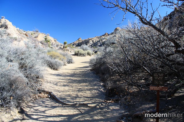
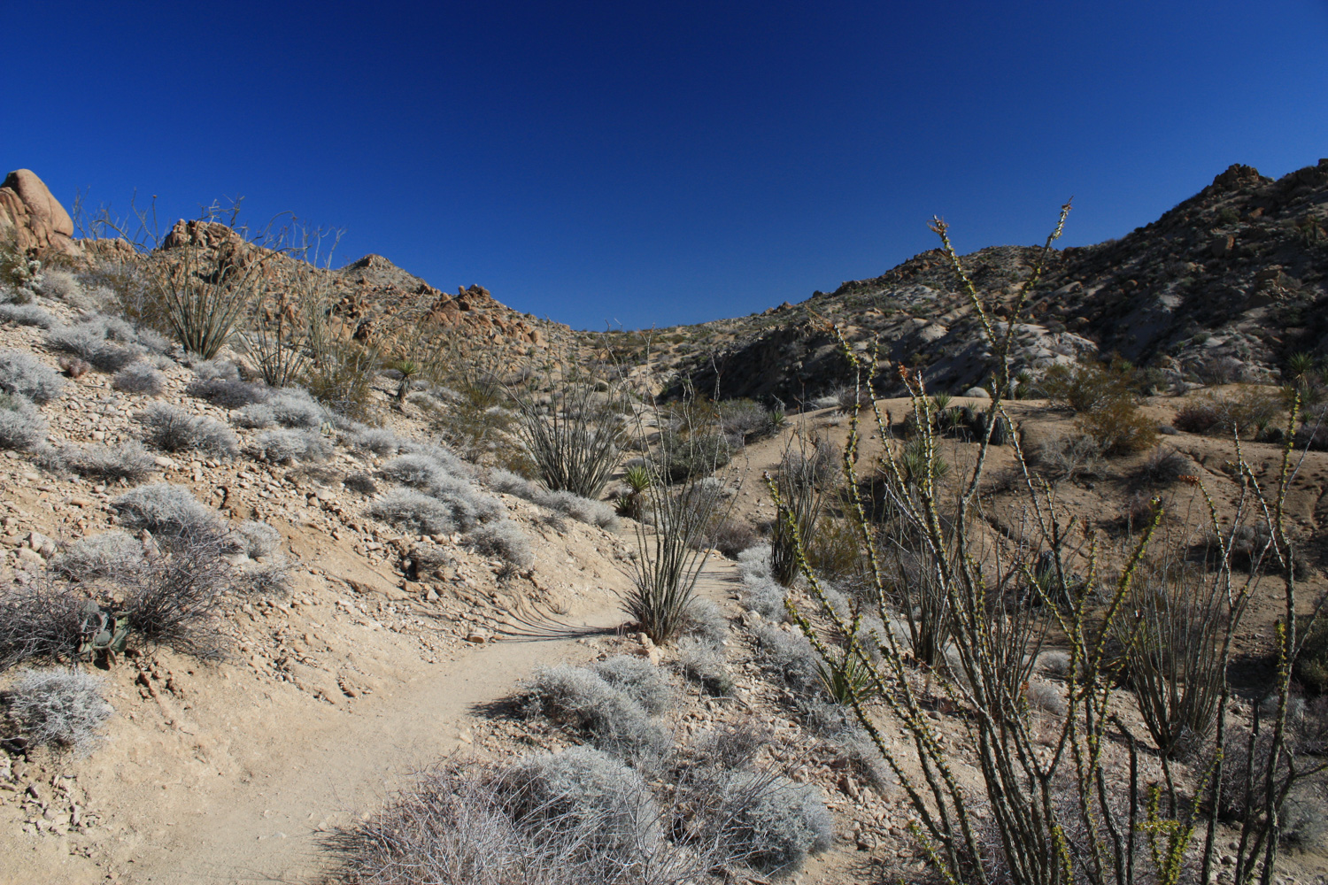
The trail does have its share of ups and downs and there are a few moderately strenuous areas but if you’re hiking during the cooler months and have plenty of water you shouldn’t have any trouble. Enjoy the scenery and environment of the low desert – the plants and animals you see here will most likely be entirely different than the ones you’ll see on the western / northern parts of the park. Like ocotillo cacti!
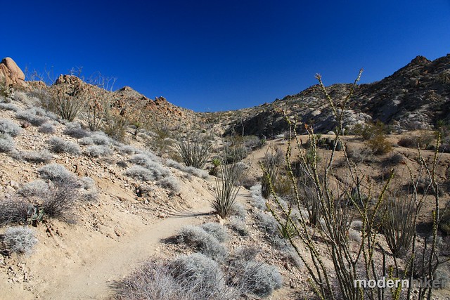
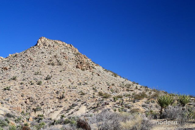
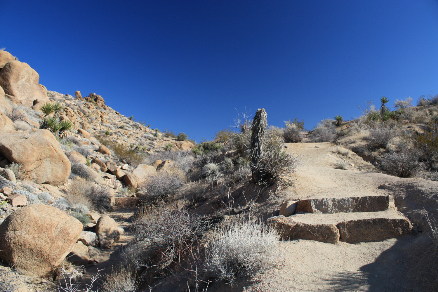
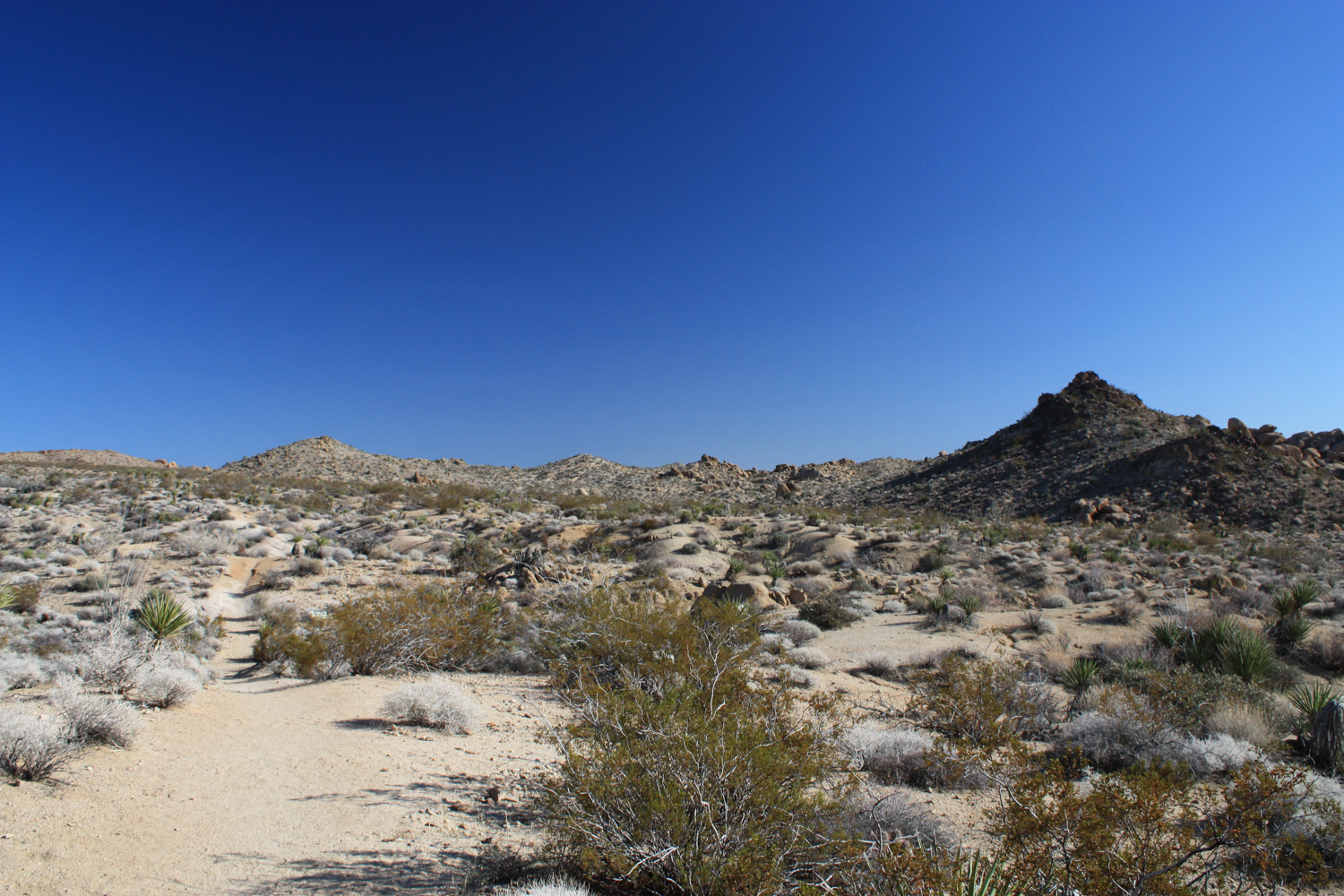
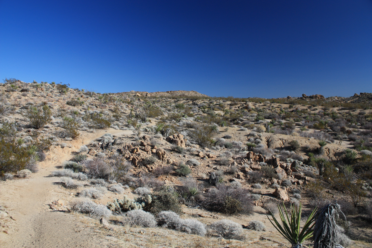
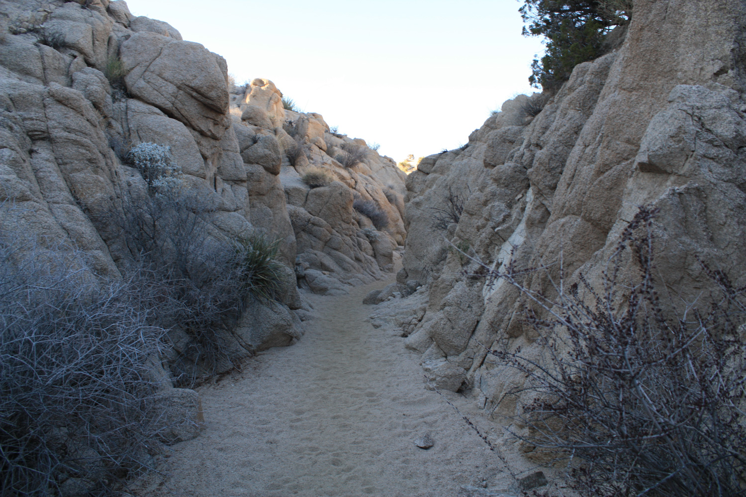
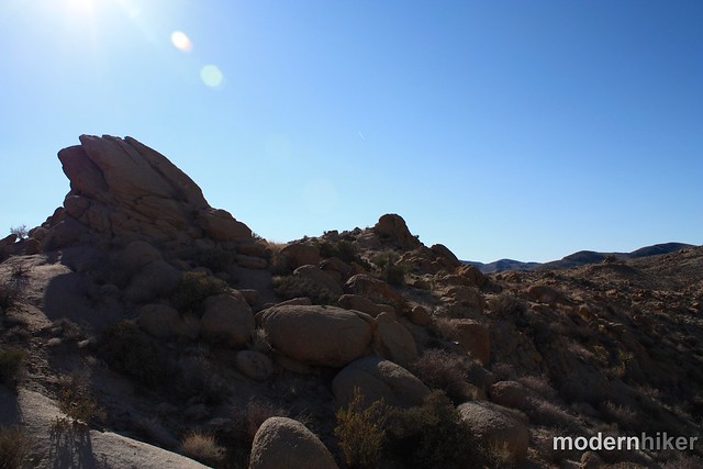
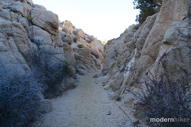
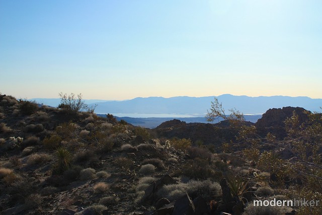
The trail here is extremely straightforward. You’re basically making a bee-line to the southeast, climbing over boulder piles and dipping into desert washes. If you’re not a big fan of the desert, you may think this route a little tedious and boring – but pay attention and you’ll spot different types of cacti, note subtle differences in the surrounding mountains, and maybe even catch a glimpse of the nearby Salton Sea.
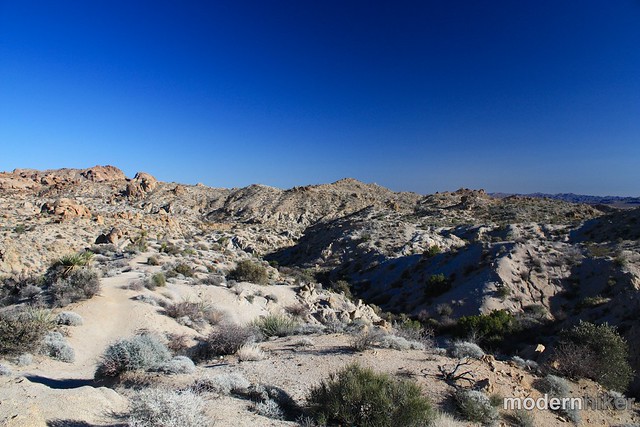
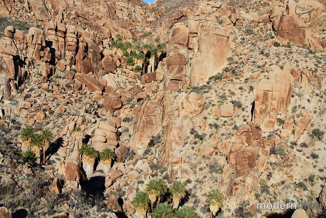
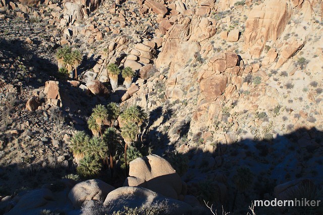
The extremely well-signed trail continues climbing, then makes a sharp drop onto a flat plateau just above the Lost Palms Oasis.
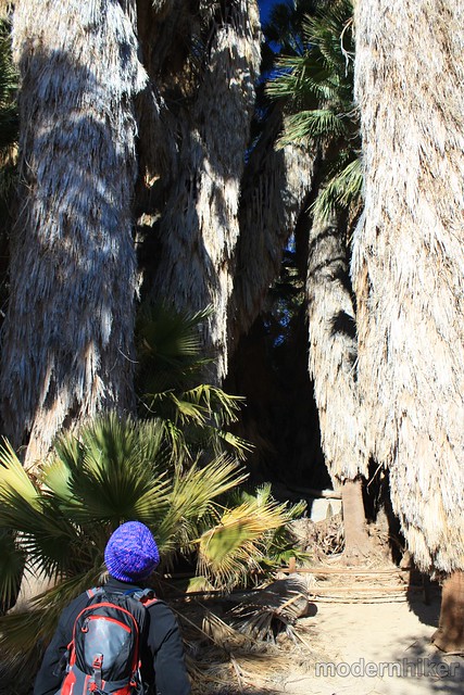
From here, you’ll be able to see further southeast into the canyon, Lost Palms Oasis directly below you, and the oasis at Dike Springs just to the north. The palms are pretty huge, even from your distant viewpoint, and definitely impressive.
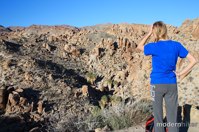
From the overlook, there is a small, strenuous use-trail you can use to scramble and boulder-hop down into the Lost Palms Oasis itself. From there, you can continue scrambling and climbing north into the Dike Springs oasis, or continue south in the canyon on a faint use-trail toward Victory Palms, an isolated duo of palm trees about a mile away.
If you’re not comfortable with the scrambling or are just pressed for time, soak in the views of the oases from the overlook, then return back to the trailhead the way you came in.
Excellent. This is probably the most well-signed isolated trail I've ever seen. There are arrows marking the correct direction at almost every conceivable place you could get lost. The use-trail at the overlook to the bottom of the oasis is unmarked and unmaintained, however.
Cottonwood Campground, located between this trailhead and the Visitors Center, is the closest campsite.
From the 10, take the exit for Cottonwood Springs Road north into the National Park. After 6.9 miles, turn right on the road leading toward Cottonwood Campground (right before the Cottonwood Visitor Center). Pass the campgrounds on your left and continue 1.2 miles until the road dead-ends at a cul-de-sac just above Cottonwood Oasis.
10 Comments
Nice trail description- this was helpful. Thank you. One thing worth noting is that the oasis itself is restricted to day use only, to protect bighorn sheep.
You'll have to register at a backcountry board first. Here's a link to some of J-Tree's backcountry rules and regulations, but in terms of spaces to set up a tent it's tough. You'll probably have more solitude toward the end of the trail, but if you head down toward the oasis itself you'll be in lots of shade in the morning so bring some extra layers. The ground is probably more flat toward the middle part of the trail. I haven't camped there myself, but my gut says to lean toward the adventure and head further along on the trail :)
This looks awesome. Any suggestions on where to setup camp for backcountry camping? At the end of trail or somewhere in the middle?
There is, but it's seasonal and you'll have to scramble down into the canyon to get near it.
Also, you should probably just pack in your own H2O and leave that oasis stuff for the wildlife that can't trek to a faucet ;)
TW,
Thanks! It's always nice to hear when people use the site to explore their city in a new way.
It's been a little tough for me to get down there for trips (and a lot of the roads in the Cleveland are high-clearance), but I've got a few ideas on ways to get more OC content soon.
Hello there! Love your site, have used it for a couple of years now. I just wanted to propose that you explore more hikes around the O.C. (e.g. Laguna Coast Wilderness) area. Most of your hikes are north of the LA area. Just a suggesstion, and would really appreciate your consideration! :) Cheers!
Visited a couple of years ago, in April. LOTS of chuckwalla. Desert mallow were in bloom, too.
I've decided my favorite oasis in Joshua Tree is 49 Palms, on the other side of the park.
This is my favorite hike in the entire park. The sense of isolation is really special, and I like the variety the trail offers. Even though it's an out-and-back, there are lots of amazing views of the surrounding mountains and I also like that the trail goes through the sandy, tunnel-like washes of the desert. I did get down into the oasis itself by following the cairns, but after I did I regretted it. I was alone, and all I could think of was Aaron Ralston and getting a big boulder falling on me. I'm much more comfortable just hanging out at the top of the oasis trail now.
Amazing pictures, thanks for the report! We'll check it out next time we're down there. How old do you think those palm trees are?
With recent wildfire damage and ongoing waves of COVID-19 infections and restrictions, National Forest, National Park, and other public land closures, restrictions, or social distancing guidelines may be in-effect.
If infection rates are on the rise, please do your best to remain local for your hikes. If you do travel, please be mindful of small gateway communities and avoid as much interaction as you can. Also remember to be extra prepared with supplies so you don't have to stop somewhere outside your local community for gas, food, or anything else.
Please be sure to contact the local land management agency BEFORE you head out, as these conditions are likely to change without enough notice for us to fully stay on top of them. Thanks, and stay safe!
Click here to read the current CDC guidelines for traveling during the COVID-19 pandemic.