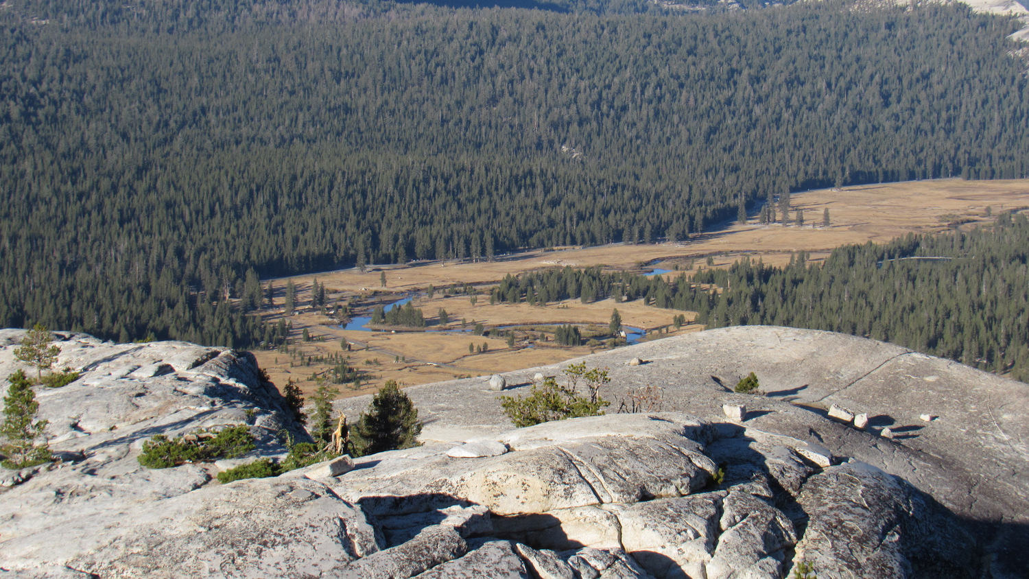
Visitors to Yosemite National Park attempting to escape the valley to the higher, cooler, and slightly less crowded confines of Tuolumne Meadows encounter a wide variety of hiking options. Several different routes depart from the meadow and approach alpine lakes. Other trails, skirt the edge of the meadows and the banks of the Tuolumne River. Other routes, some informal, lead you to the summits of rounded granite domes offering a perch from which to survey the spacious meadows. If you are on a time crunch, or if you’re simply baffled as to where to start, why not take a route that kills all of these birds with one moderate, memorable stone?

This looping route with two short spur trails ties together a scenic lake, the most famous granite dome in the area, and a ramble along the Tuolumne River and its various meadows. You will earn a mixture of impressive views, including vistas across the serene waters of Dog Lake, a sweeping panorama of the Yosemite High Country from Lembert Dome, and Cathedral Peak rising up over a vast lodgepole pine forest.

From the parking area at the southwest edge of Lembert Dome, skirt the northern edge of the lot to find the Dog Lake/Lembert Dome Trailhead. Step onto the wide, sandy trail and travel north, first through lodgepole pine forest, and then across a granite slab. Cairns mark the way across the slab to the continuation of trail, but the practice of building extra cairns creates a fair amount of confusion on which way to go. I kicked over all of the misdirecting rock piles on my visit, but expect people to come along afterward and re-build them. Once on the other side of the slab, the trail continues across a narrow meadow with nice views west toward Cathedral Peak before reaching the base of a moderately steep slope.

From the base of the slope, you’ll commence a vigorous 400′ climb over .5 mile along the right bank of the stream draining Dog Lake. At .7 miles, the terrain evens out for a brief stretch before resuming a gentler climb at the junction leading right toward Lembert Dome. Commit this spot to memory, as you will return to this junction and take the trail east toward the dome after you visit Dog Lake.

Dog Lake in the morning

Dog Lake panorama
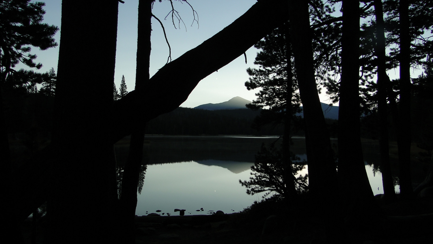
You meet a second junction for a trail leading to the distant Young Lakes at 1.2 miles. Keep right here and continue about 100 yards toward the banks of Dog Lake. Your first view of the lake comes from the western shore, and you can spot Mt. Dana and Mt. Gibbs on the eastern horizon. Early morning vistas during quiescent weather with the forest silhouetted by the rising sun present a memorable mirror image of shadowy pines contrasted against a pale blue reflected sky. An informal trail circle Dog Lake, but it’s just as nice to relax at the western shore.

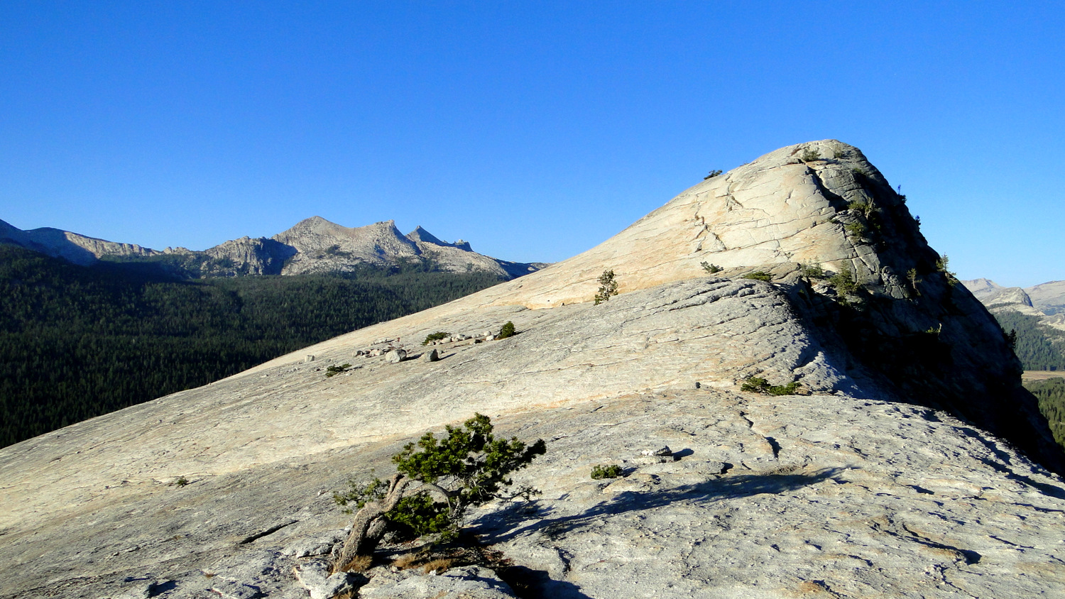
Retrace your steps south back to the Lembert Dome junction and turn left. You will skirt the northern base of the dome, heading generally southeast toward a barely perceptible ridge. Just south of this gentle ridge, a side trail leading off on the right appears just before the trail begins a steep descent. If you start going downhill, turn back and try again. This side trail follows Lembert Dome’s eastern ridge first through forest and then along the granitic spine. A natural staircase formed from exfoliation layers invites your first cross-country steps toward the dome’s summit.

Travel across the granite dome is easy right up to the base of the high point. At the base, you have two options. The first, and more difficult, is to work your way up on a sometimes Class 3 scramble utilizing nooks and crannies with your hands at a few spots. For a less challenging ascent, take a short detour to the left so you can approach the summit along a gentler south slope.

Looking west
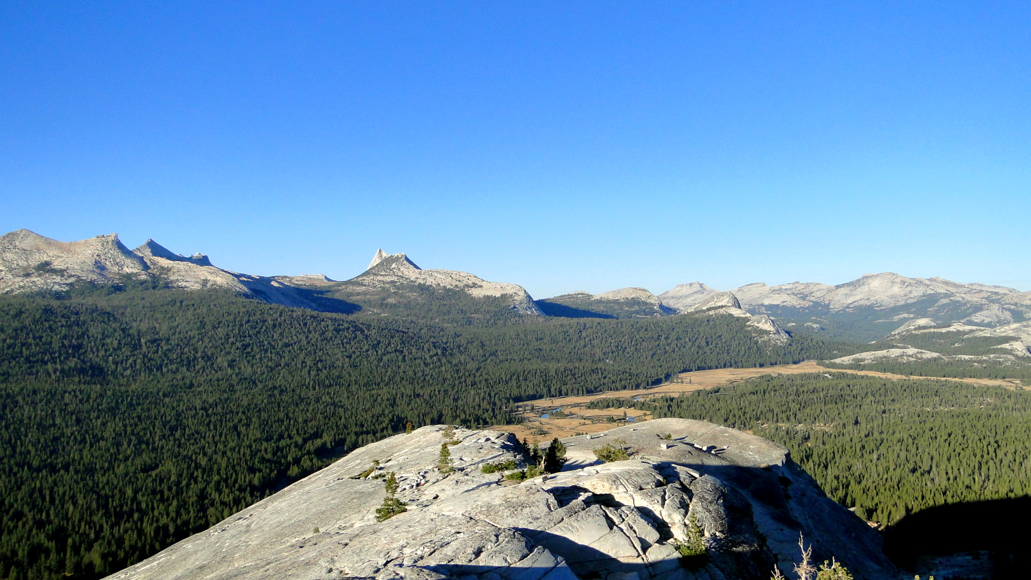
Once on the top, you earn a nearly complete panorama of the Yosemite High Country. Look west, and you can easily spot the distinctive forms of Tuolumne Peak, Mendicott Dome, and Cathedral Peak. Continue scanning counter-clockwise to spot Unicorn Peak and the Cathedral Range to the south. Looking southeast and east, you will spot a parade of notable peaks and passes, including Donahue Pass and Peak, Mono Pass, Kuna Crest, Mammoth Peak, Mt. Gibbs, Mt. Dana, and Tioga Pass.

Looking north
Northeast to north, you can pick out Mt. Conness and a hint of the dramatic fold of Matterhorn Canyon. Continuing northwest to west, see if you can follow the sinuous folds of the Grand Canyon of the Tuolumne before completing the circular panorama back at Tuolumne Peak. A good map and a pair of binoculars will aid you in your reconnaissance.

Dana Fork, Tuolumne River
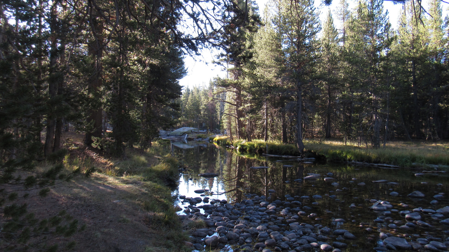
When you’ve concluded your survey, you can either return the way you came, or you can follow the dome’s ridgeline toward its western edge to get a fuller picture of Tuolumne Meadow, which is the one thing you can’t see in its entirety from the summit. Once back at the main trail, turn right to begin a steep descent heading south. You will cross Tioga Road before reaching another parking area. Continue south through the parking area across the access road leading to Tuolumne Meadows Lodge. Just across this road, continue south to the banks of the Dana Fork of the Tuolumne River. Turn right to begin the return to the parking area; turning left will connect you to the John Muir Trail.

Cathedral Peak
As you head west across gentle terrain, you will pass through meadows rimmed with lodgepole pines as well as an informal access route for rock climbing at Puppy Dome. You will skirt a second, larger meadow with more nice views of Cathedral Peak before reaching Tioga Road for a second time. Cross the road to return to the Lembert Dome Parking Area where your vehicle awaits.
Tags: Dog Lake, Lembert Dome, Tioga Road, Tuolumne Meadows, Tuolumne River, Yosemite National Park


