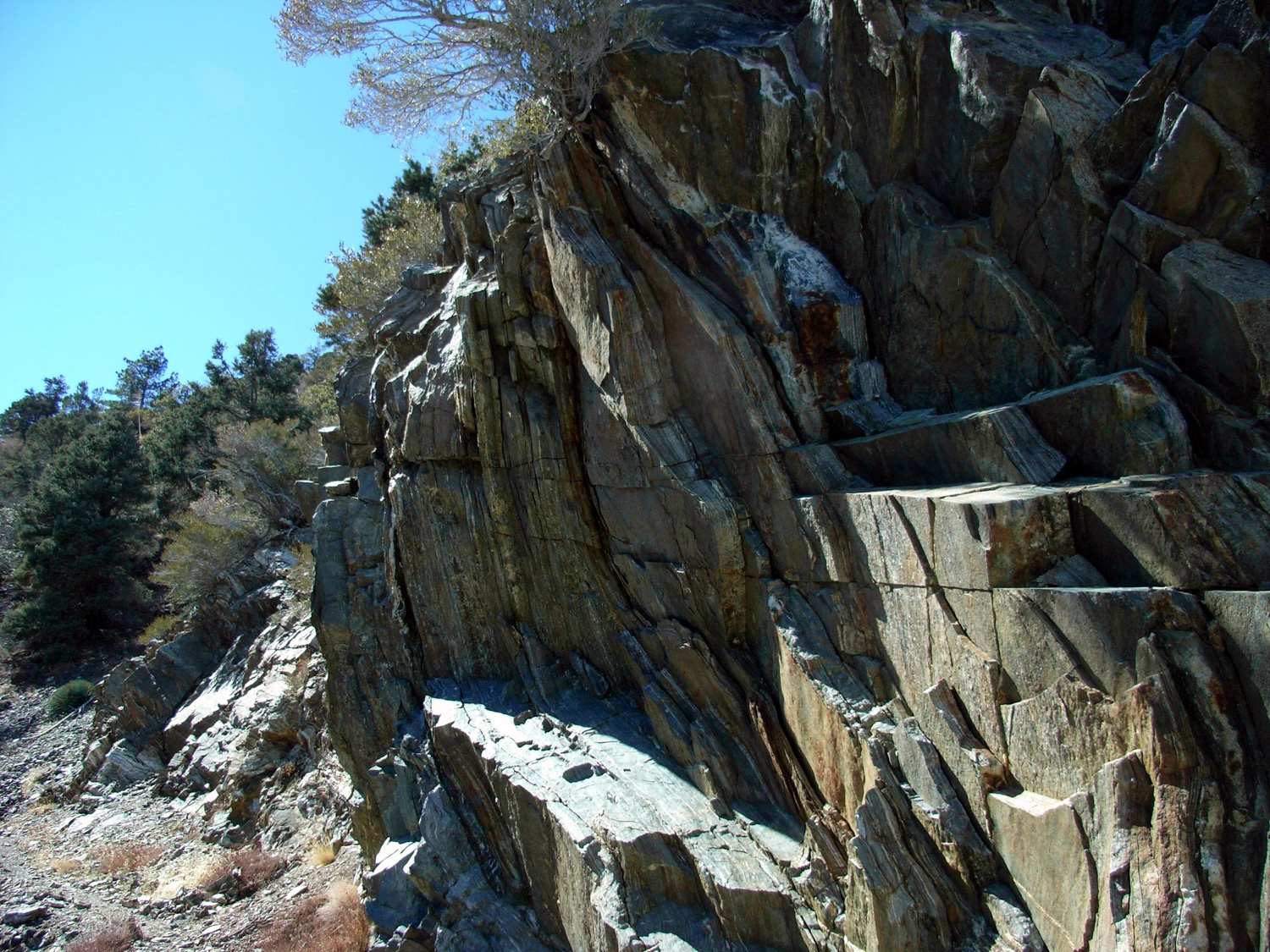
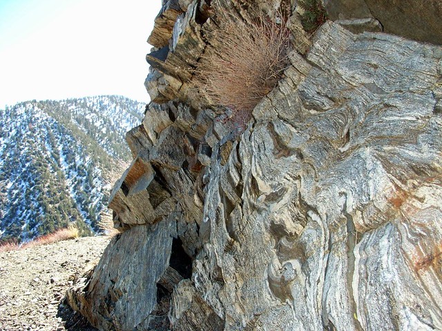
A lengthy trip from the high desert to Burkhart Saddle, amidst the high peaks of the San Gabriels. This trail will take you through several California Climate zones – from Joshua Trees to Jeffrey Pines – and show off some weird and wonderful geologic features along the way. A great, rarely-used path, nice for a long day hike or backpacking trip deeper into the mountains.
The Burkhart Trail is a no-nonsense route from the north side of the San Gabriels all the way to the center of the high range. It’s a gorgeous trail that can take you from the desert floor to snow-capped peaks, and even if you don’t reach (or even have) a destination peak it’s a fantastic journey worth experiencing.
Devil’s Punchbowl Recreation Area Post Bobcat Fire Update
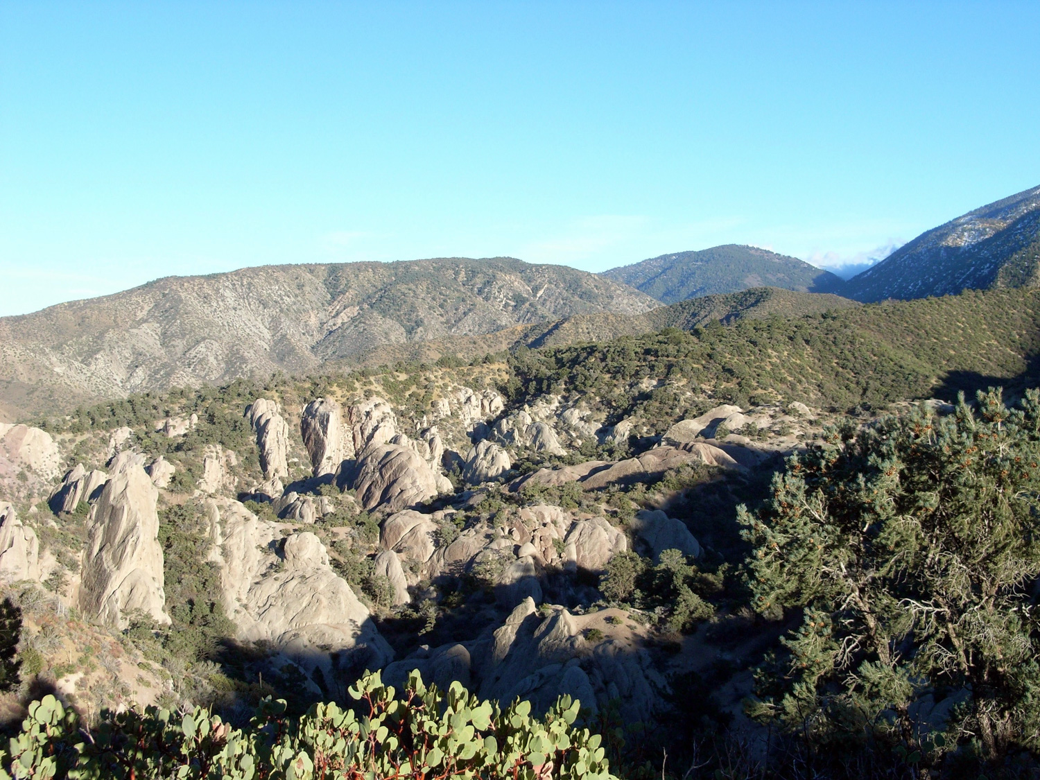
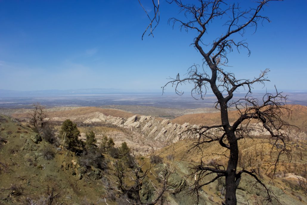
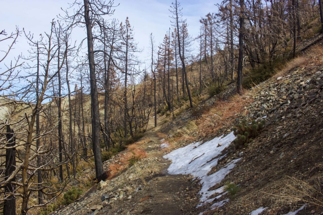
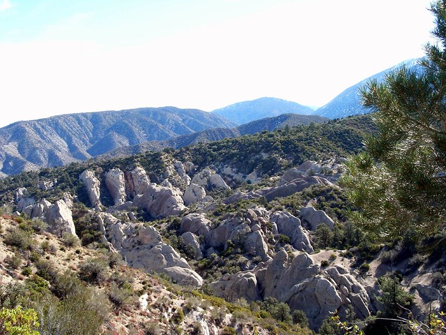
Since reopening on April 1st, 2022, the Devil’s Punchbowl Recreation Area bears many scars from the Bobcat Fire that torched much of the San Gabriel Mountains in September 2020. As of March 2023, many of the large trees and bushes are still lifeless and charred. Mercifully, there are several, less pine-heavy sections of the Devil’s Chair trail that evaded the worst of the flames. Even looking at the mountain peaks south of you, it is prominent which sections were affected the most by the fire. Overall, a solid 80 percent of these hiking trails are still clearly burned.

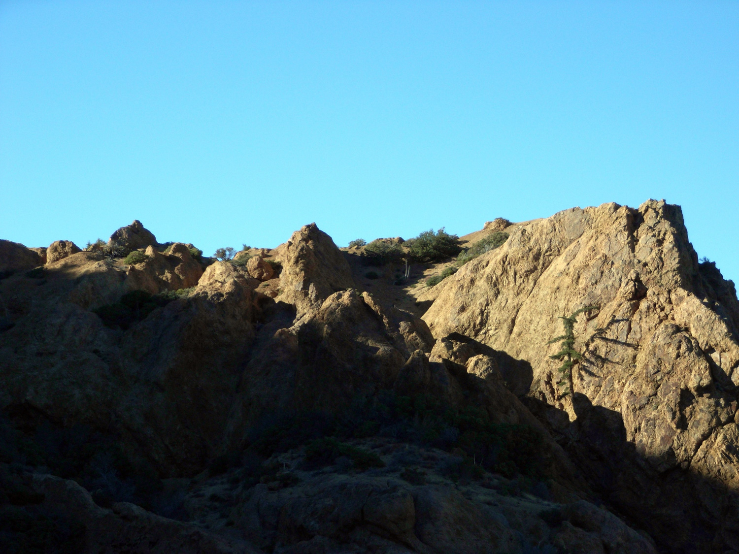
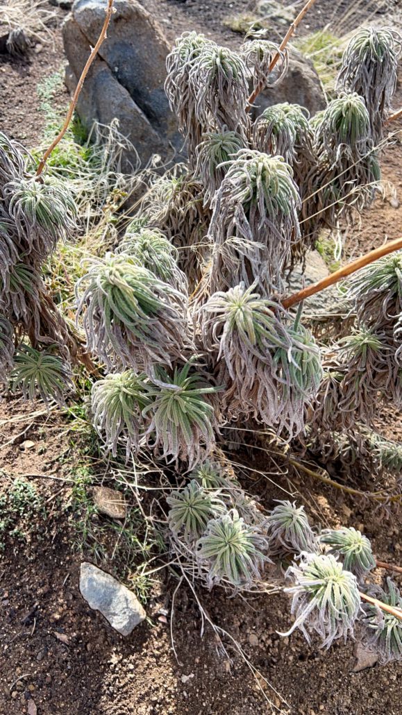
In the aftermath of the Bobcat fire, several native Southern California plant species are beginning to poke their heads through the soil. Aside from the seasonal grasses, Hairy Yerba Santa, Poodle-dog Bush, and Chaparral Yucca were growing in the burned sections. And although many perished, there were also several Pinyon trees that survived the flames. If there is any consolation from the fire, it’s that the rainbow of color that highlight the hillside is now in clear view, reminding me of Death Valley’s painted canyons.
Trail conditions were surprisingly great. Both trails were well-maintained and easy to follow, with markers throughout. A new map board, four pit toilets, and picnic tables are available for hikers to use at the trailhead. Sadly, the nature center was destroyed and is not yet rebuilt.
Despite the many burn scars, the Devil’s Punchbowl Recreation Area is still a fascinating and otherworldly place to explore. However, as listed on the Los Angeles County Parks and Recreation website, this is still an active recovery zone, so please stay on the trails to help the new growth thrive.
When I hiked this, we’d just had a healthy amount of rainfall here in Southern California, which usually translates into snow in the higher elevations. I was feeling a bit nostalgic for winter and wanted to try to get up and into the white stuff before too much of it melted away.
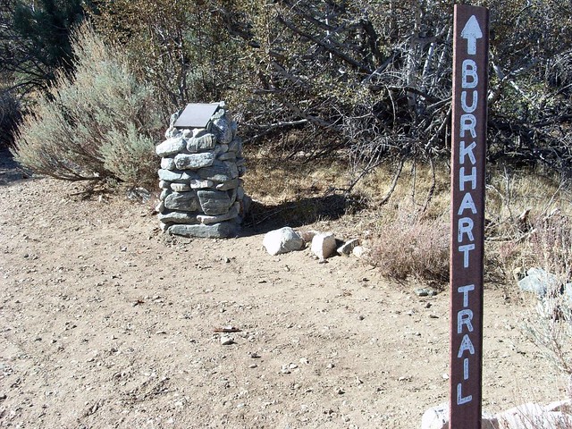
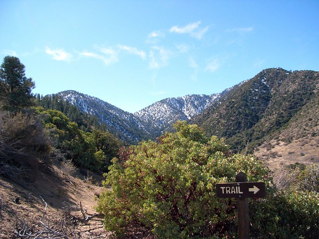
The trailhead is right at the parking lot to Devil’s Punchbowl State Park, and is clearly marked.
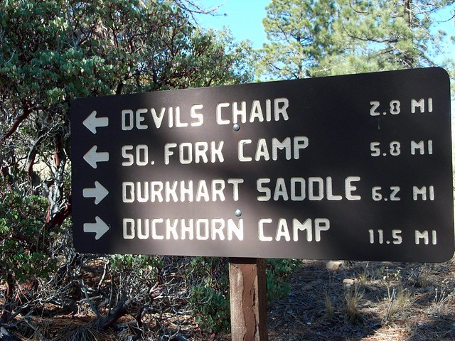
Stay on the road and in just under a mile, you’ll reach a junction with the Devil’s Chair Trail, a fun trek in and of itself that will give you some outstanding views of the Punchbowl. But for now, just stay on the Burkhart – you’ve still got a long way to go!
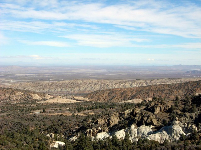
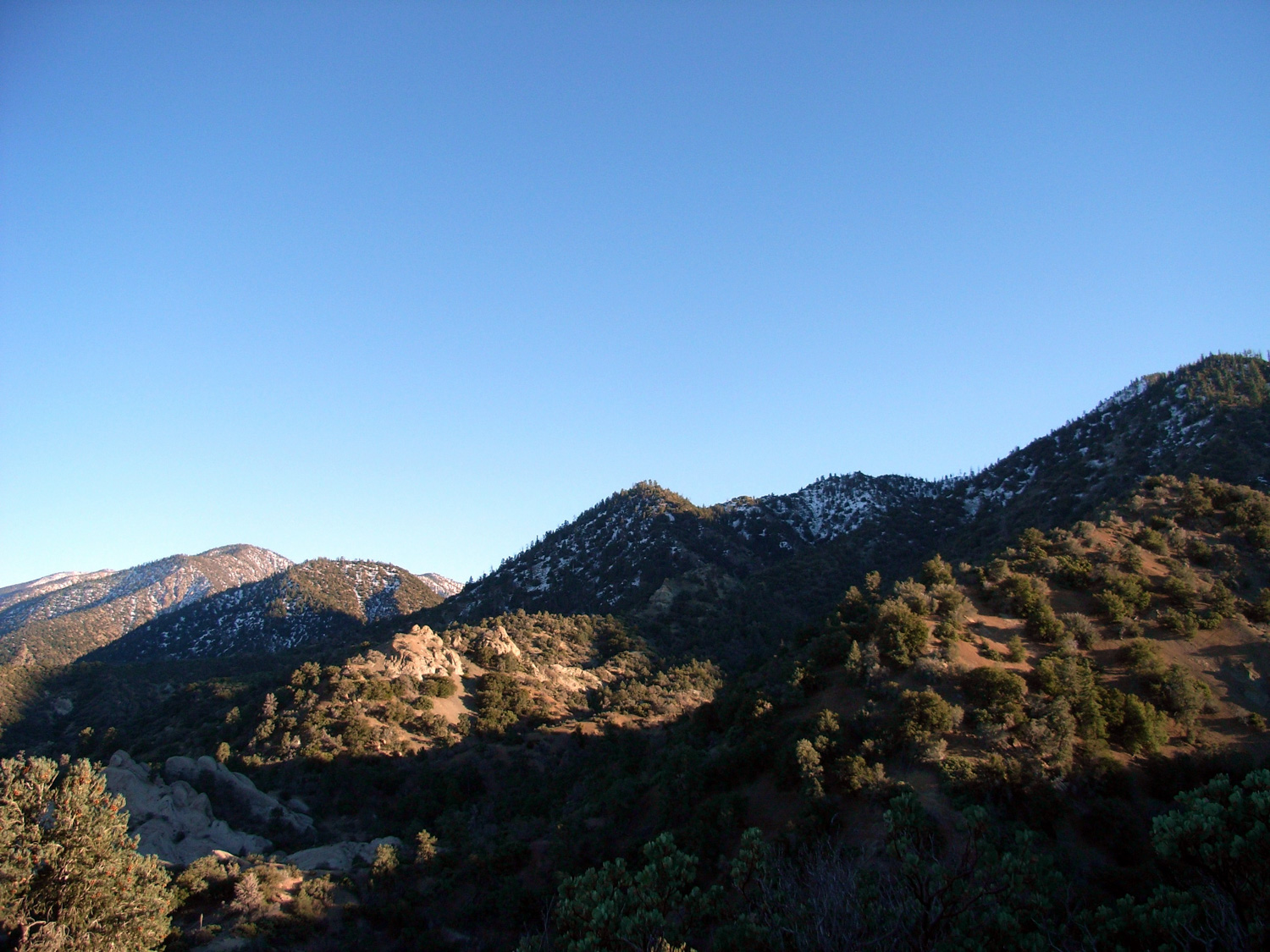
The trail plateaus and stays relatively level until you get to the 2.3 mile mark. Here you’ll be able to see the trail across the banks of Cruthers Creek – and you’ll also note that the trail drops quite a bit in elevation before it starts crawling up into the San Gabriels.
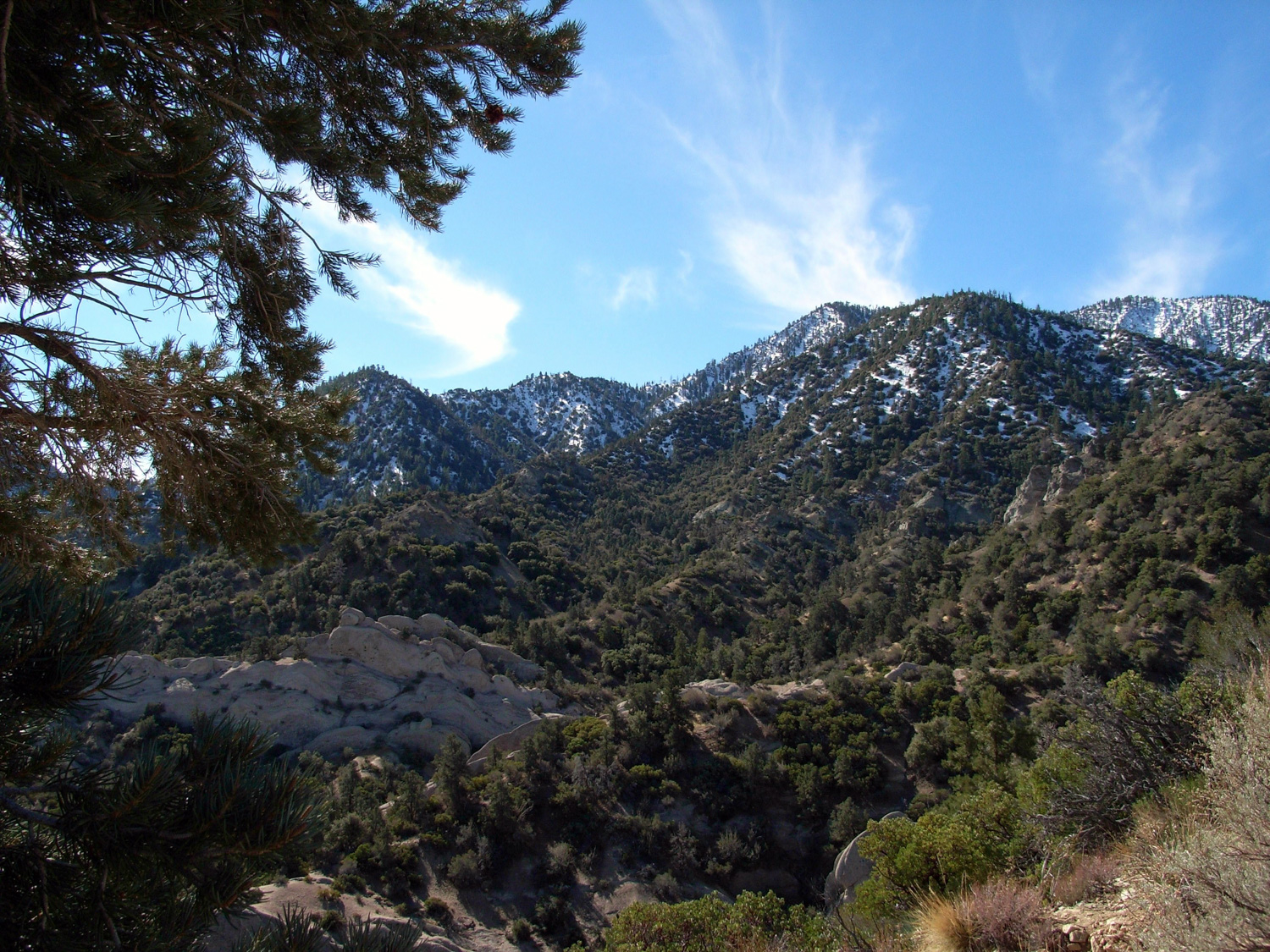
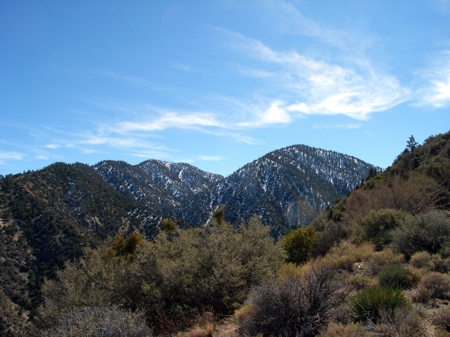
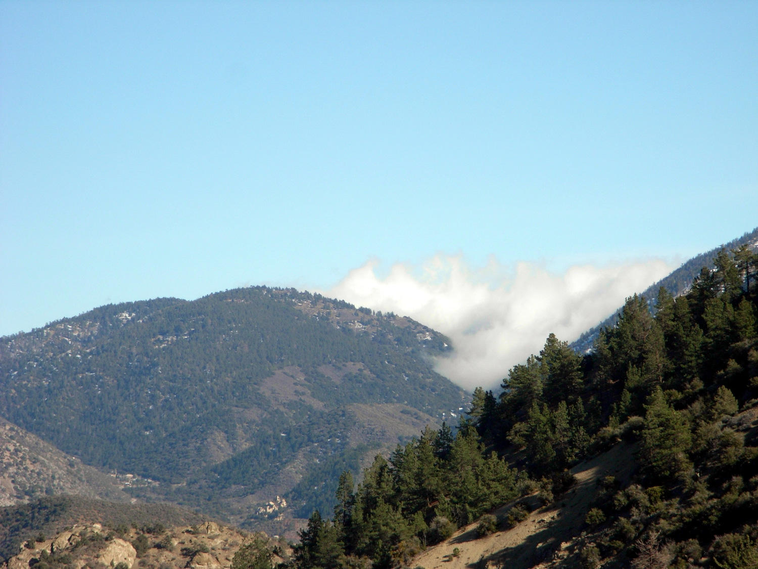
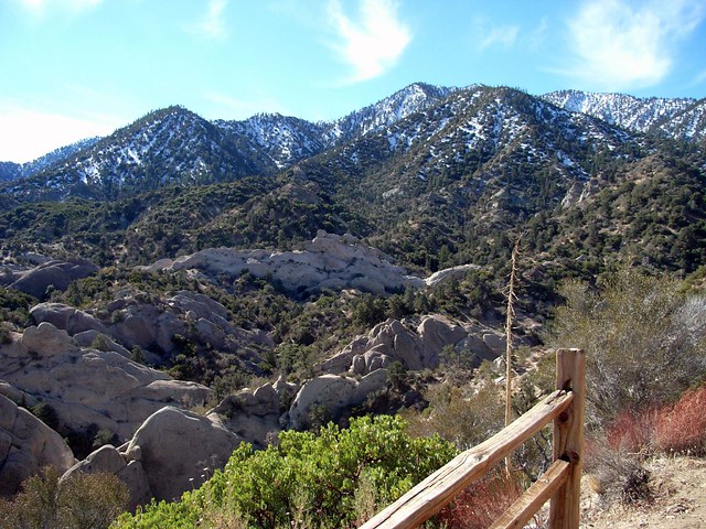
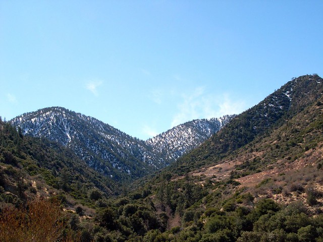
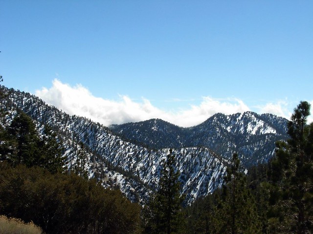
It’s a little disheartening to have to drop below the elevation of the trailhead before you start that long hard slog up to the Saddle, but just remember – you’re out here to have fun! Any residual grumpiness you might have about this extra work will melt away once you start hiking through the meadows to see the peaks ahead of you – Pallett to the left and Will Thrall to the right with Burkhart Saddle in the bullseye center.
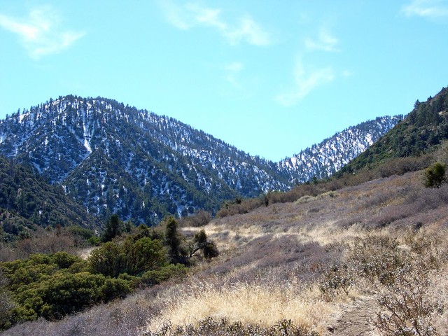
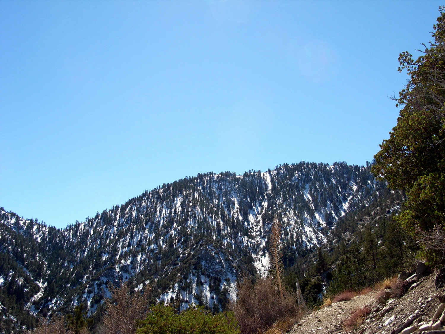
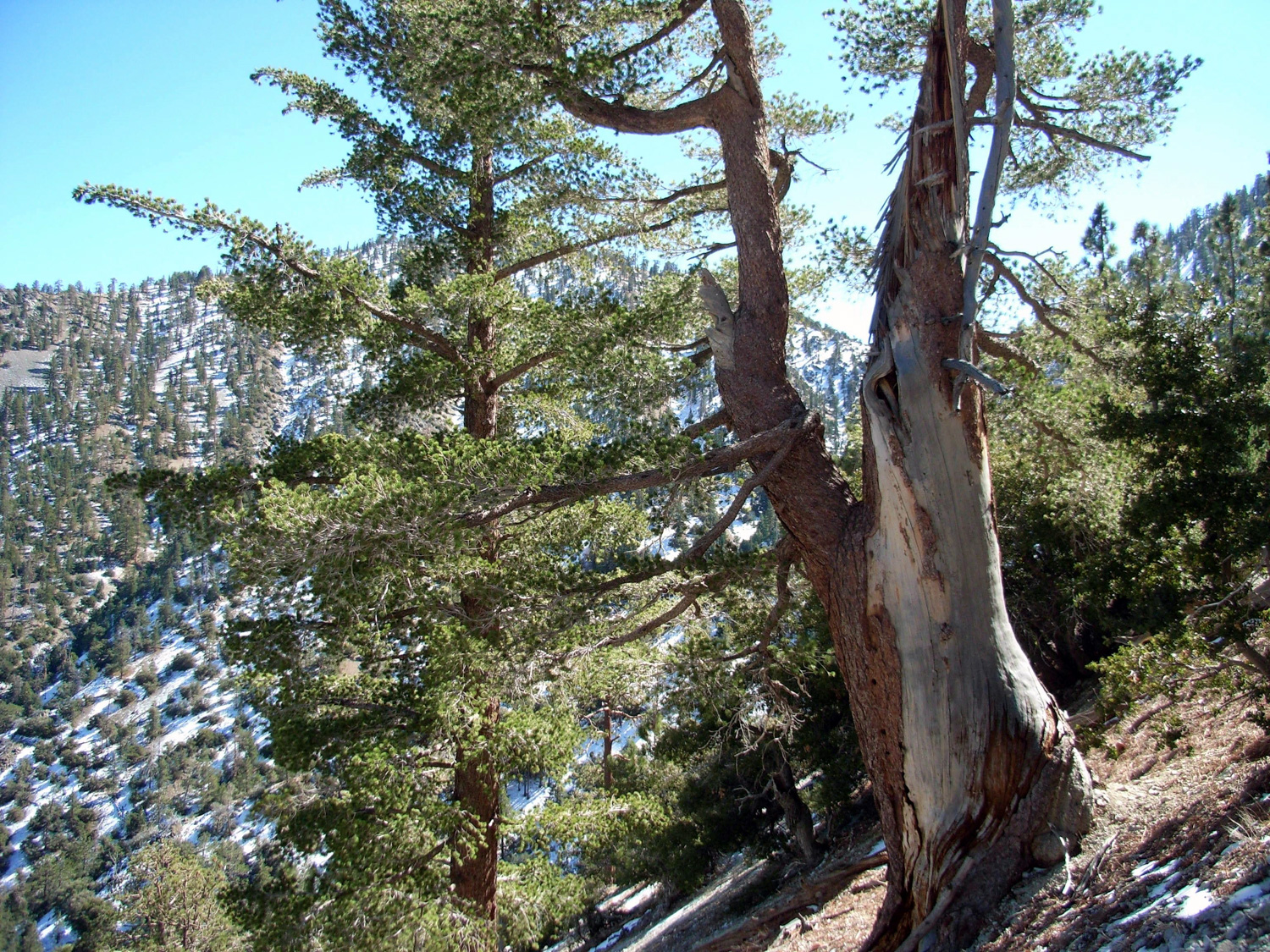
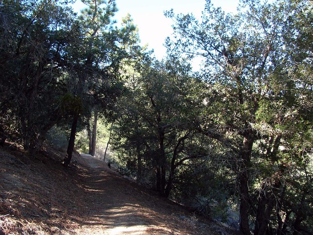
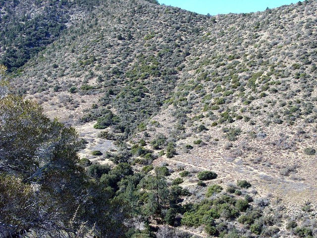
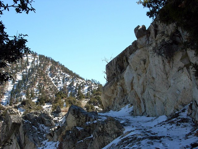
From here, it’s pretty much a straight-shot on the Burkhart Trail. The trail makes a few switchbacks and climbs up the western side of Cruthers Creek Canyon. Slowly, the scrub of the desert floor gives way to a few pine trees carving out homes for themselves.
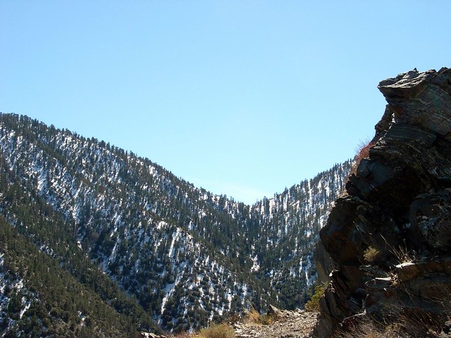
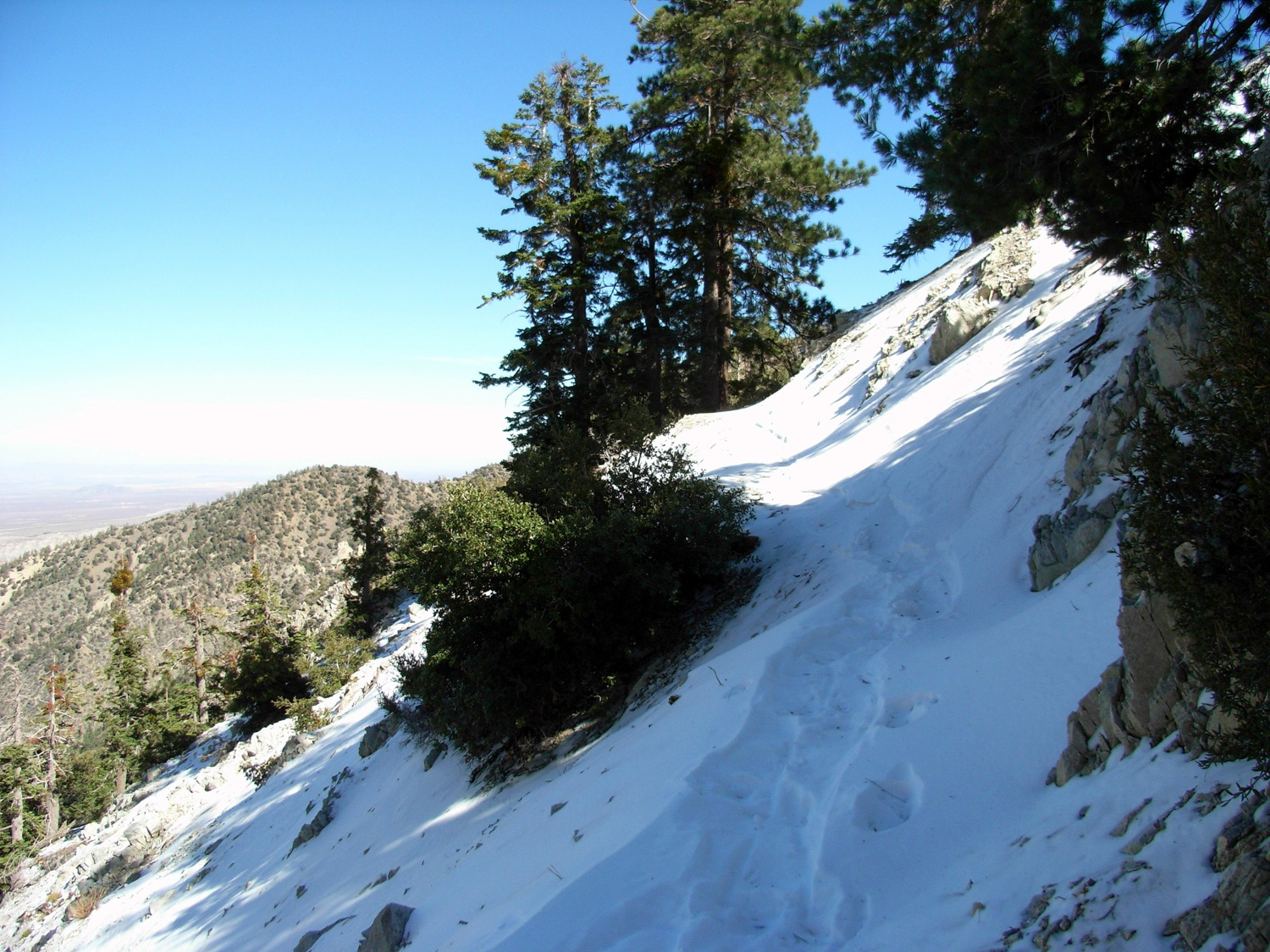
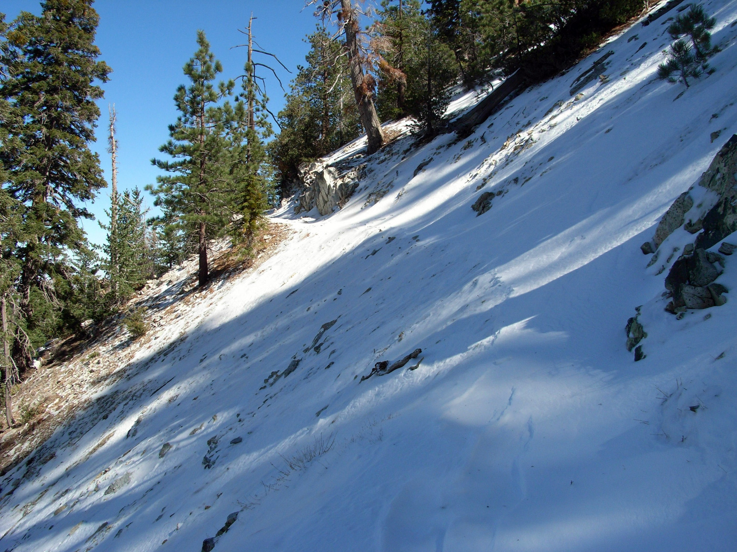
As the ascent continued up the north face of the mountains, the temperature cooled and I started seeing snow on the trail. Nothing too bad yet.
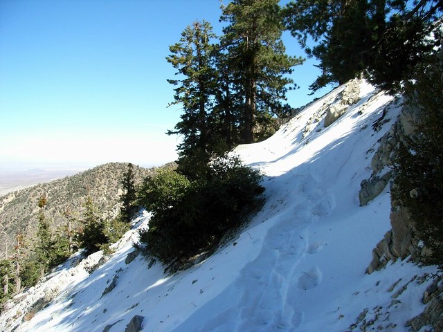
I will admit that my heart started pumping a bit faster than it necessarily needed to around this point in the trail. But I still thought I had my situation under control.
Then I saw this:
I took a deep breath and told myself I didn’t come all this way to not even reach the saddle and – against better judgment – pressed on.
I fell a few times on the steep incline, but managed to steady myself by burying my ungloved hands in the snowpack. Thankfully, this was the worst of the snowed sections, and when the trail rounded a bend into a more well-lit west-facing slope, the snow disappeared again … but I did have to stop for a few minutes afterward to calm myself down.
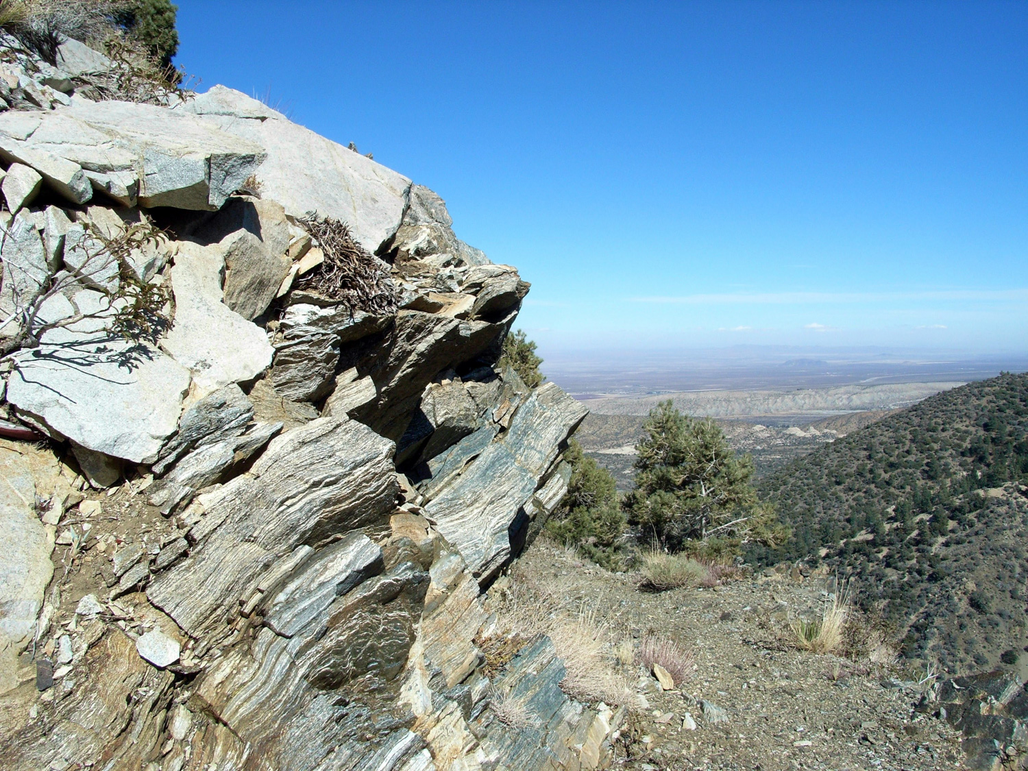
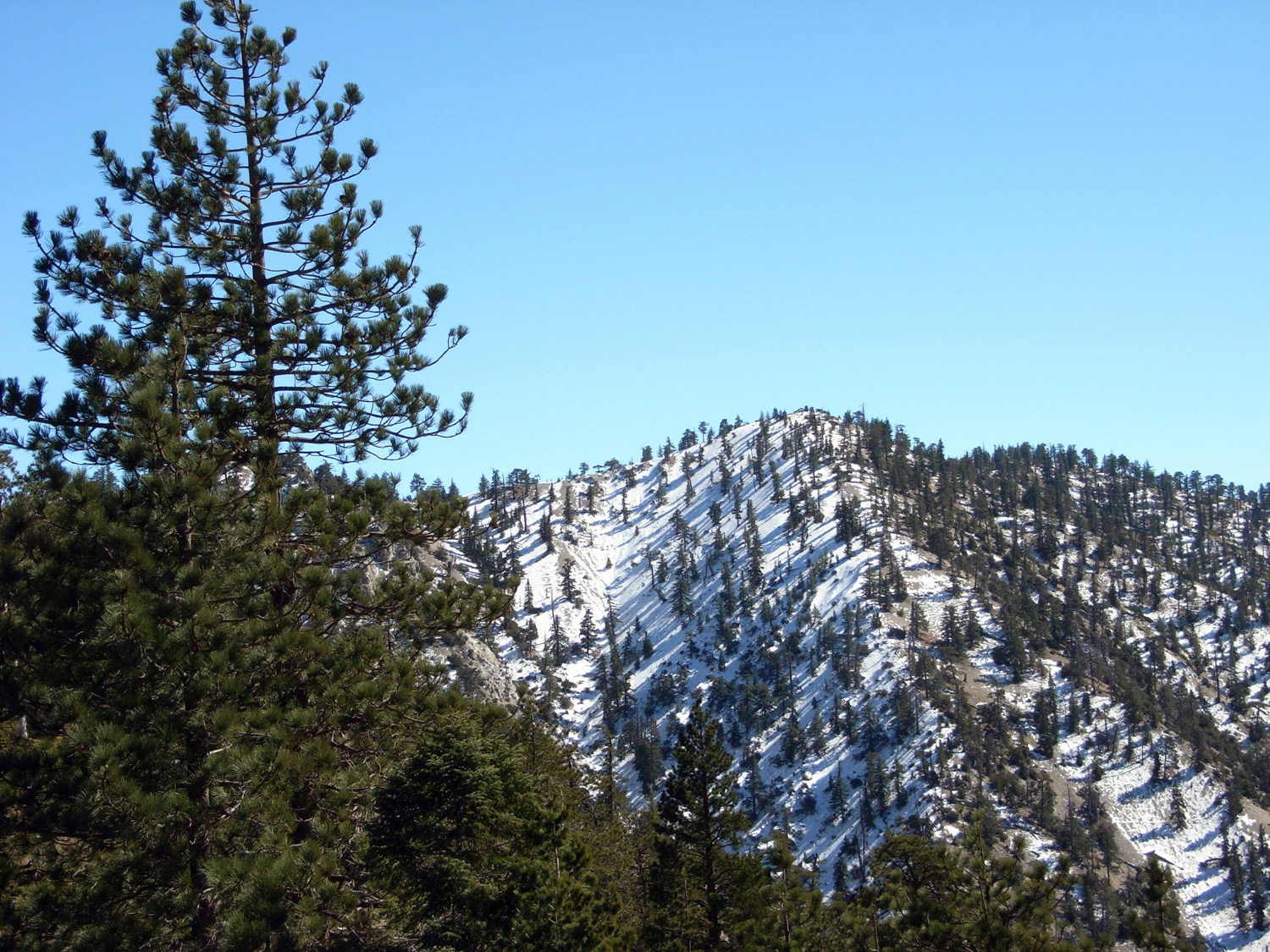
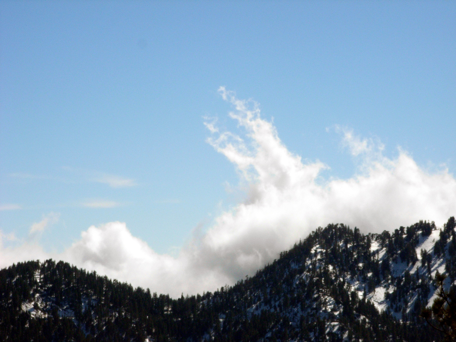
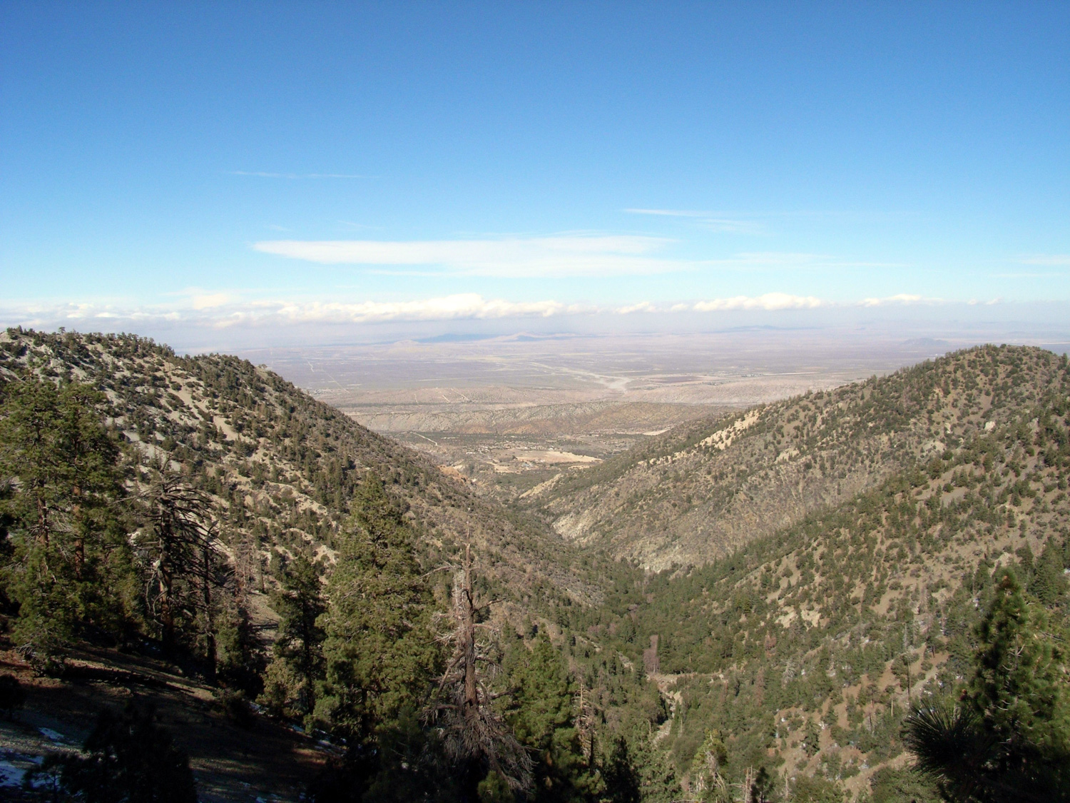
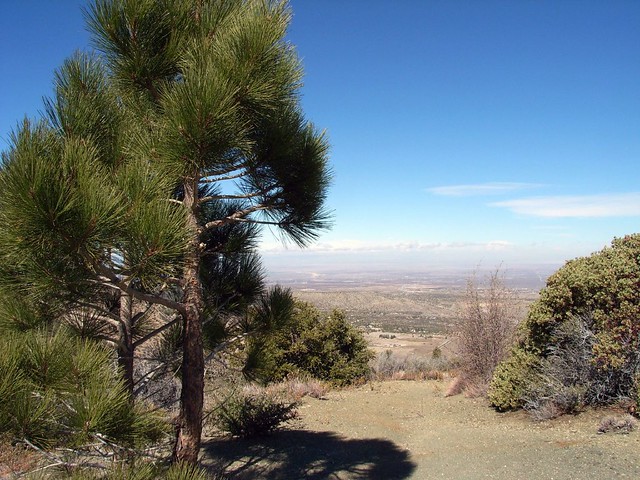
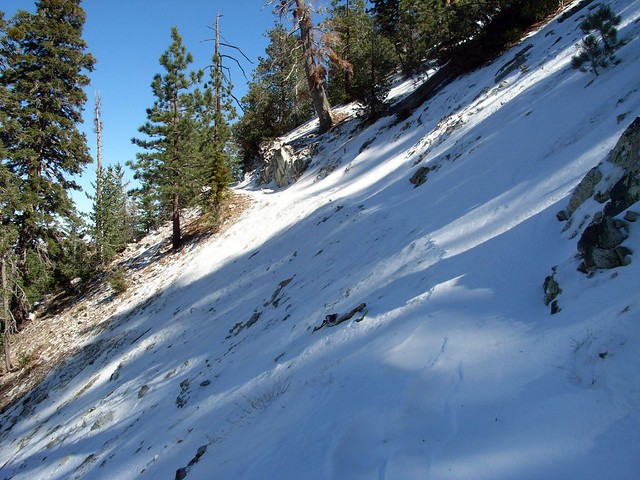
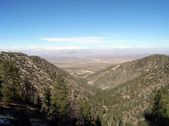
After that harrowing cliffside adventure, the trail wound up through some more lightly snowed switchbacks to Burkhart Saddle. As the wind whipped around me from all directions, the sweeping views were 100% worth the trouble of getting up there in the first place. Looking north, the entire flat Mojave spread out before me, vanishing in a distant cloud of haze. And to the south, the snow-capped alpine summits of the San Gabriels, with windswept clouds brushing up against their southern faces. It still blows my mind that I’m able to see these two incongruous landscapes standing in the same spot.
It’s for scenes like this that I go hiking in the first place. The fact that I had to fight my way up the mountain to see it only made it more rewarding.
I sat down on a fallen log once I reached the Saddle at around 7.2 miles and tried to shield myself from the wind as I downed some granola. After a few moments’ rest, I looked at the steep slope directly to my west. A faint use trail led up the side, partially obscured by snow and ice. I was about a half mile away from the summit of Will Thrall Peak, and I wanted it badly.
It took a lot of effort to stand up, and even more to signal my blistered feet to shuffle forward, but I began up the summit slowly but surely. I sure as hell wasn’t going quickly, with the trail gaining several hundred feet of elevation in very little distance. The snow and ice started to thicken, and I started slipping again.
As the trail rose, so did the angle of the slope. Each potential slip got more and more dangerous, and with the ice on the ground getting increasingly sheer and solid, more likely, too.
And so, after crawling up a few hundred more feet, huffing and puffing the entire way, I stopped. It may have been my tired legs, painful blisters, or some residual common sense that was catching up with me from the snowbanks, but I didn’t think it was safe for me to keep climbing up the icy peak. I let out a deep sigh, turned around, and started back down.
The mountain beat me.
Or, if I want to look at it in a less defeatist attitude (and I do), Will Thrall Peak was giving me some clear signals that I wasn’t supposed to climb it yet.
Say what you will about the perseverance of man, and I’ll counter with my healthy respect for the cold indifference of nature. Also, I’ll bemoan my crampon-purchase-procrastination.
On the way back down, though, I did get to pass several marks I’d made in the snow while slipping and falling. That was more than enough evidence to let me know I’d made the right decision.

The seven mile shuffle back down to the trailhead went a bit slower than usual, due to the blisters, the soreness, and the extra incline on the way. But I will say that getting back to my car and taking off my boots ranks as one of my favorite parts of this hike … even though I had trouble walking later on that night.
The drive home into the low desert sunset wasn’t bad, either.
UPDATE: A few years later, I did make it up to the summit of Will Thrall Peak, but from the Buckhorn Campground to the south. For that route (or for a description of the final stretch from Burkhart Saddle to Will Thrall Peak), read here!
Tags: Angeles National Forest, Burkhart Saddle, Burkhart Trail, Devil's Punchbowl State Park, geology, High Desert National Recreation Trail, Hiking, Los Angeles, Trail Write-Ups