
If you’re a waterfall aficionado, this hike to Glen Aulin in Yosemite National Park is the trail for you. With no fewer than five major falls and dozens of cascades, this odyssey into the heart of the Grand Canyon of the Tuolumne provides all of the gravity-assisted whitewater churns a waterfall lover could ask for. Granite wonderlands, dense forests, and the omnipresent rumble of the Tuolumne River all add to the grandeur of this challenging full-day hike. And for those who enjoy backcountry camping, the Glen Aulin High Sierra Camp caters both to the primitive camping fans and the more luxury-minded.

Glen Aulin
Red Tape
For dayhikers, the only red tape on this route is the park entrance fee ($35 at the time of writing) required to access Yosemite National Park.
If you’re backpacking, you will need to obtain a permit in advance. To do so, first check the Full Trailhead Report to find out what days have permit availability. As this is a very popular route, it will behoove you to check the Wilderness Permits Reservation Window website to determine when you will be able to select your permit; early birds get the worm. After that, go to the Yosemite Conservancy website to request your permit. If your permit request is rewarded, the Conservancy will send an email allowing you to confirm your permit. After confirming your permit request, the last step is to pick up your actual paper permit from Yosemite Rangers at the nearest ranger station, which in this case is the Tuolumne Meadows Wilderness Center.
If you’re looking to camp at the fabled Glen Aulin High Sierra Camp, there’s a separate reservation process. Go to the Travel Yosemite Website and enter the lottery. Unfortunately, at the time of writing this article, we were still deep into COVID-19 closures, and the camps had been closed for 2 years. I can’t provide detailed info on the lottery system since the lottery is not active. However, the above link will take you to the process when everything open backs up.
Safety
Like all hikes in the Sierra, the common dangers on this route are altitude sickness issues, bears, and water safety.
Fortunately, this altitude at the trailhead (8600 feet) is not terribly high by Sierra standards, so most people will not have too many issues with altitude sickness. For sensitive individuals, it may help to spend a night or two at a nearby campground to get used to the elevation.
Bears are present throughout Yosemite, and they pose a significant threat to your food. There’s little to fear from a bear encounter as far as personal safety is concerned, but it is imperative to keep food stored in approved storage container. The park requires appropriate food storage in order to protect bears from access to human food. When bears do get into food, they look for more food, which could lead to a negative encounter with humans and potential euthanasia for the bear.
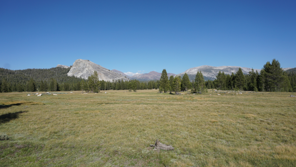
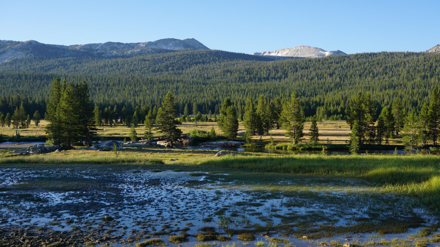
Tuolumne Meadows
The waterfalls on this route exert an inexorable pull, and you will undoubtedly want to get close. The Tuolumne River drains a wide swath of High Sierra terrain, and the river can become a raging torrent during spring and occasionally in early summer. During those times, straying too close to the river can become extremely dangerous. Use caution at all times of year near the waterfalls, as a slip and fall could be catastrophic.
One special consideration on this hike: the hike to Glen Aulin and Waterwheel Falls is a downhill affair, which means the return trip is uphill. The accumulated elevation gain is not particularly significant – 2000 feet. However, the long return route in the heat of mid-day can be both exhausting and a recipe for heat exhaustion during the peak of summer. Move slowly on the return route and do what you can to keep cool. Thankfully, there are a lot of spots along the river where you can douse yourself with refreshing cold water.
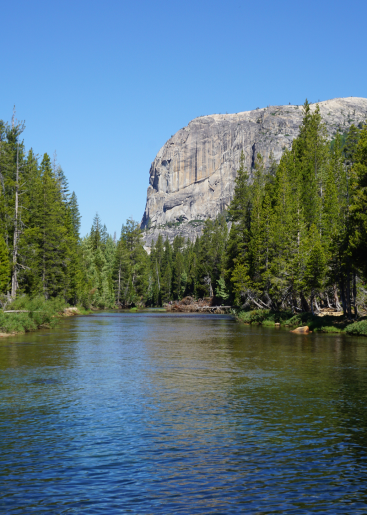
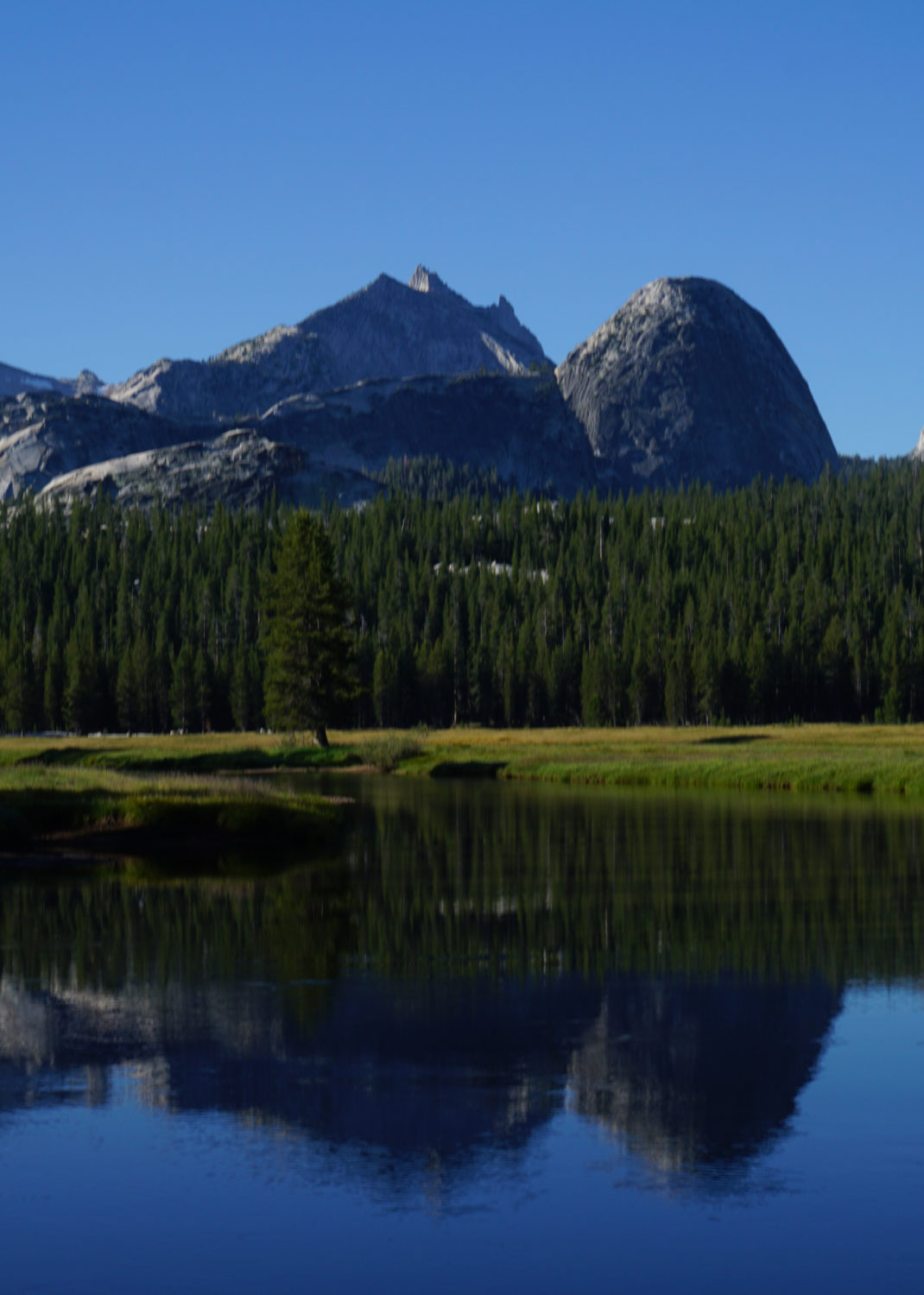
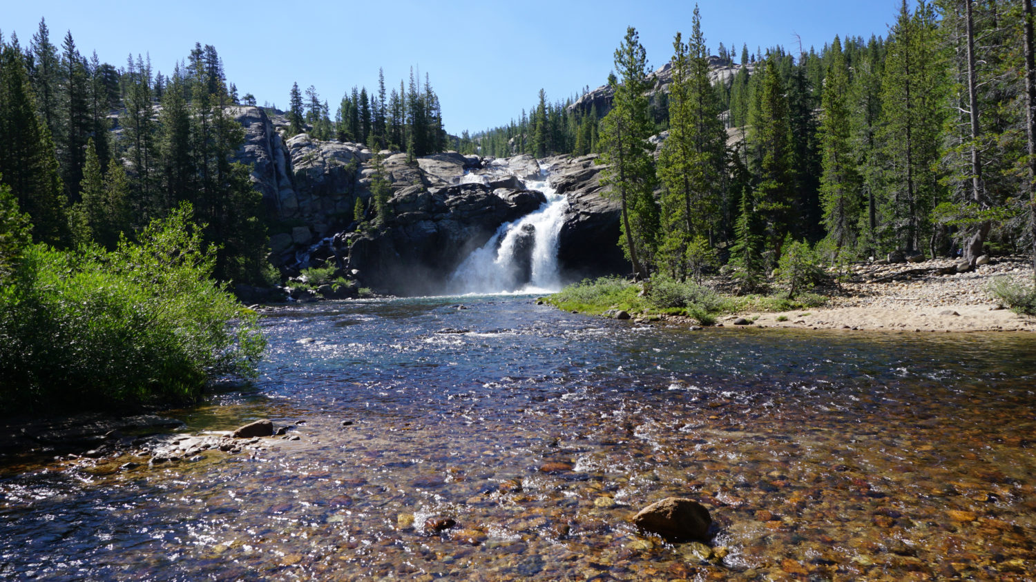
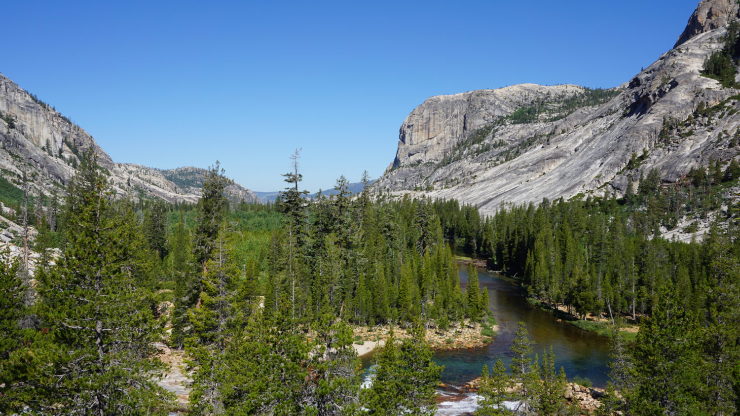
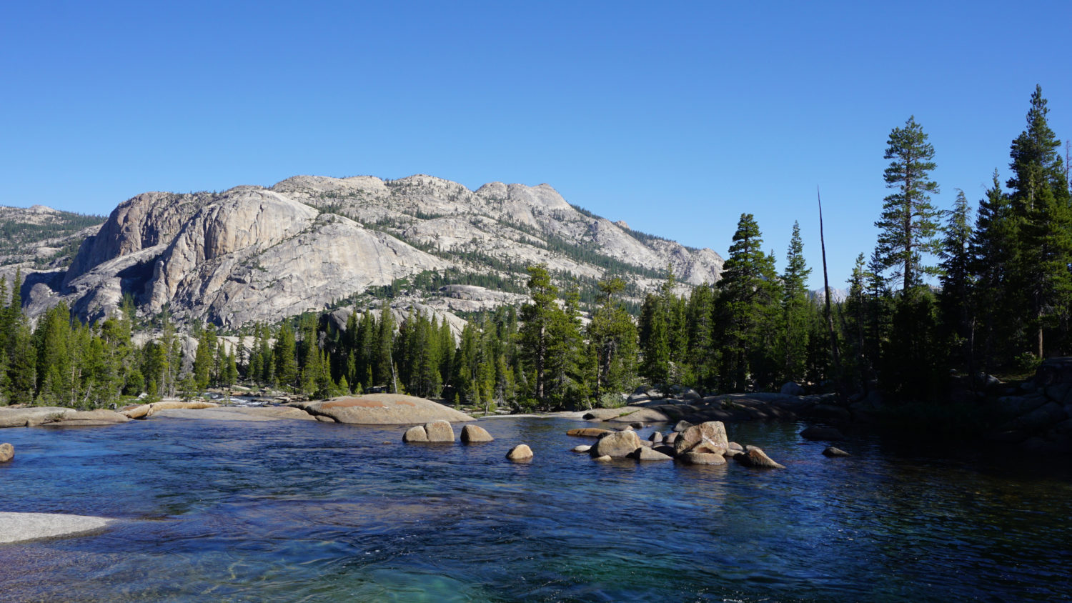
A placid stretch of the Tuolumne in Glen Aulin
Hike Description
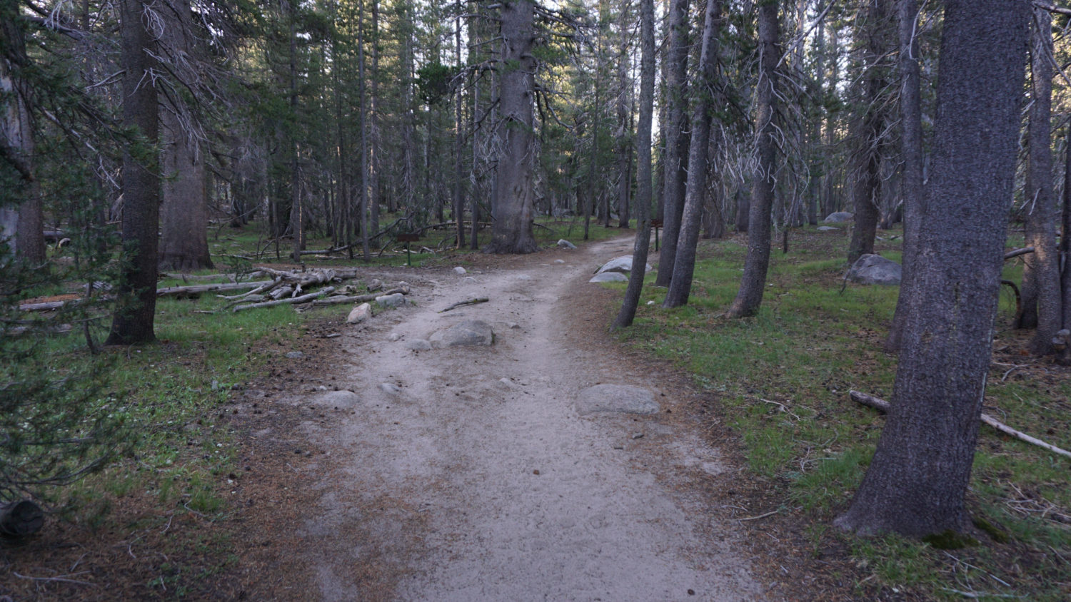
Whether you’re starting from the gate closing the road west to Parsons Lodge (which also doubles as the Pacific Crest Trail), or whether you’re starting from a point along the road between the gate and the Dog Lake parking area, walk west along the north edge of Tuolumne Meadows on a wide dirt road – note that all distances are reckoned from the gate. An appealing mixture of open grasslands and marshy meadows punctuated by copses of lodgepole pines set the foreground to the backdrop of the Cathedral Range to the south. Interpretive signs along the path describe the meadows’ history and natural features at intervals.

Soda Springs
After a half-mile, the road reaches a flurry of junctions. The first junction leads left (south) across the meadow to the Tuolumne Meadows Visitor Center; stay straight through this junction. Shortly after, a trail leads right around the north edge of Soda Springs, while a second trail leads left to Parsons Lodge; both of these spots are worthwhile side trips, as they are only a few dozen yards from the main trail. One final junction lies straight ahead at the Glen Aulin Trailhead. This marks the formal start of the route, and from here, the Pacific Crest Trail will continue west on a wide tread that enters a wilderness of lodgepole pine forest, meadows, and soon enough, the Tuolumne River.

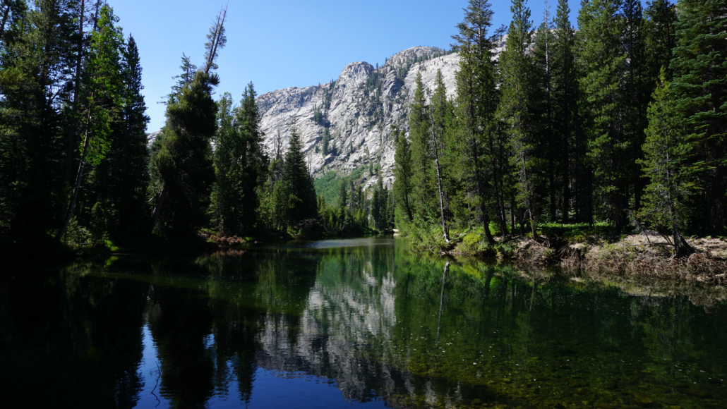
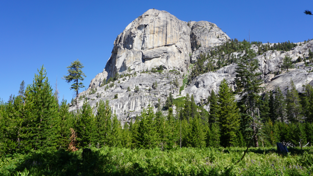
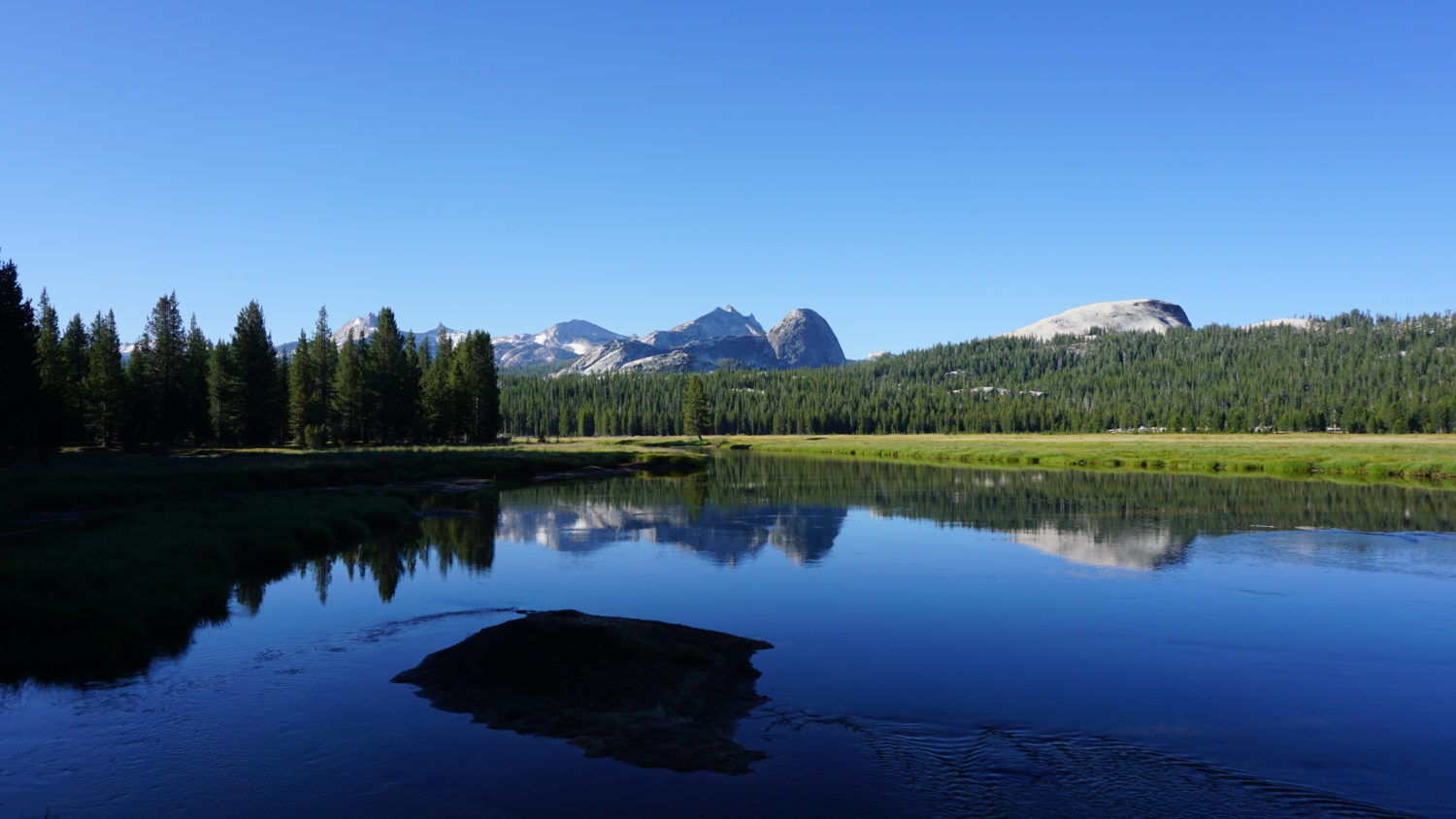
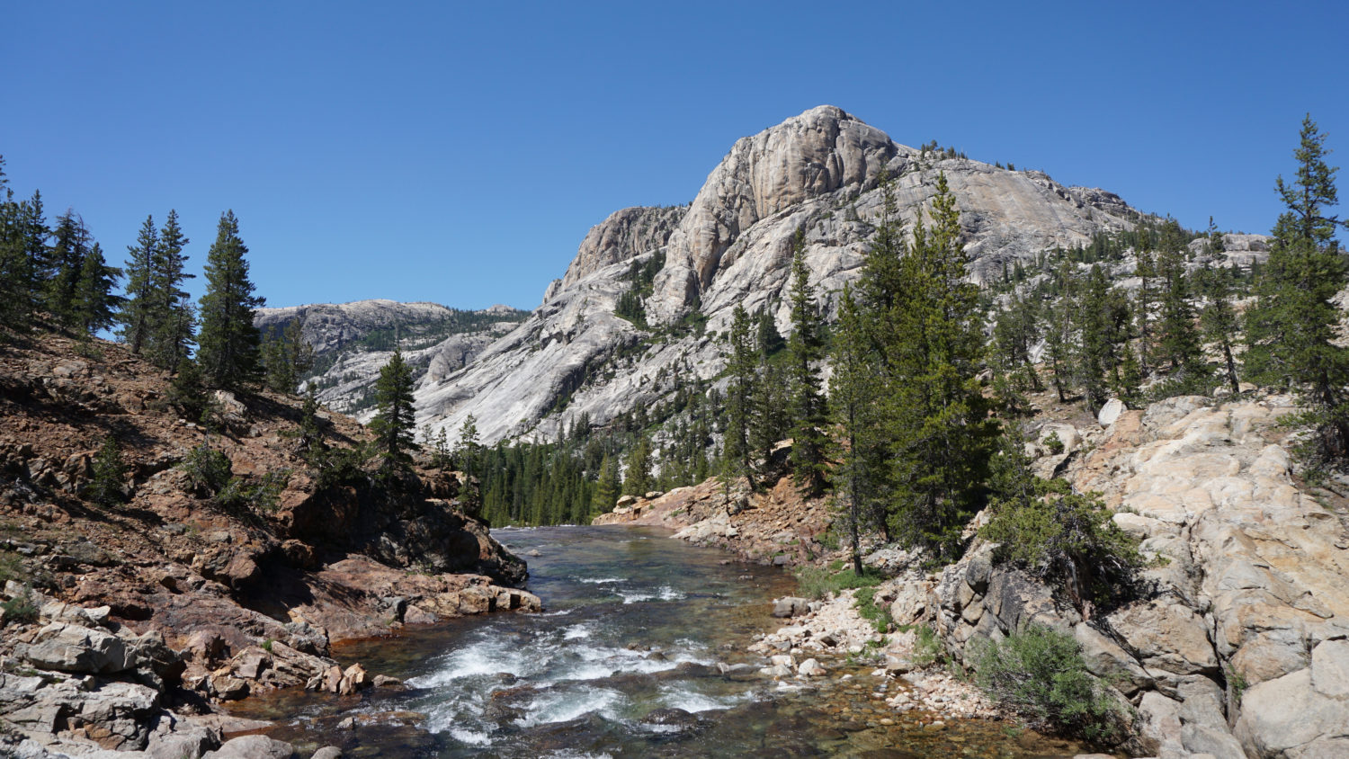
Tuolumne River and the Cathedral Range
After 0.8 mile of mellow walking through lodgepole pine forest, the PCT crosses Dingley Creek, which can be a tricky rock-hop early in the season. At 1.6 miles, keep left at a junction where the Young Lakes Trail leads away on the right. The lodgepole pine forest scenery remains static over the next mile until a crossing over several forks of Delaney Creek at 2.6 miles, which also coincides with the PCT reaching the northwestern edge of Tuolumne Meadows. Beyond the forks of Delaney Creek, the PCT reaches a bend in the Tuolumne River where the forest clears enough to grant views south across a wide, placid stretch of the river with the Cathedral Range looming picturesquely in the distance. Take a few moments to enjoy this first scenic reward before continuing west on the PCT.

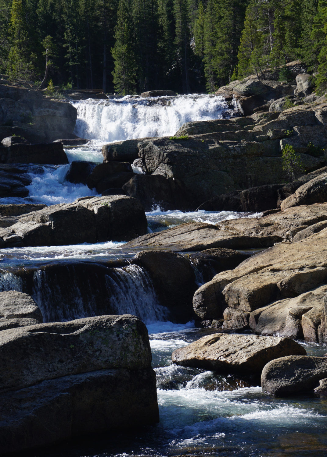
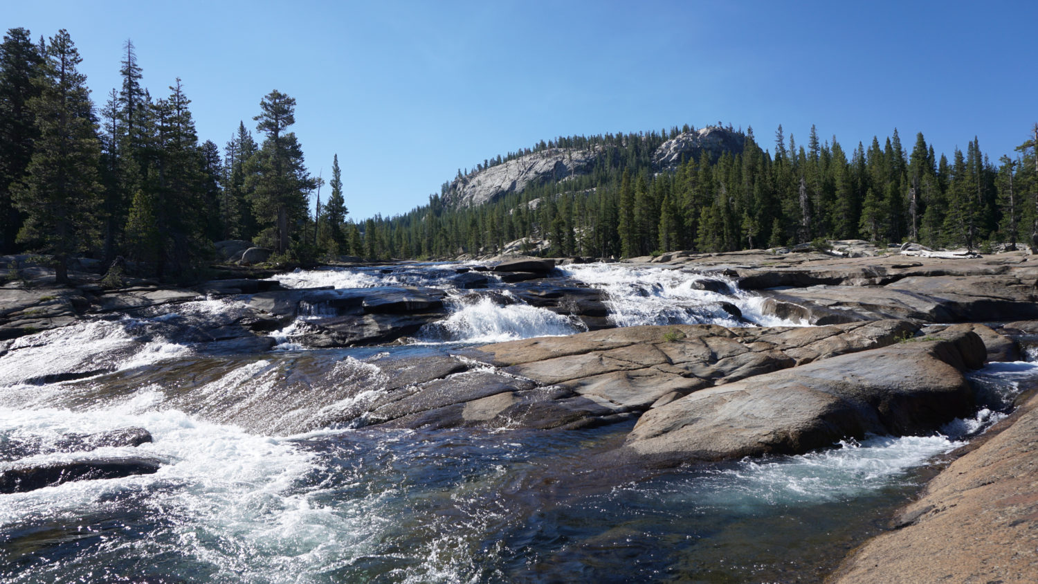
Cascades on the Tuolumne
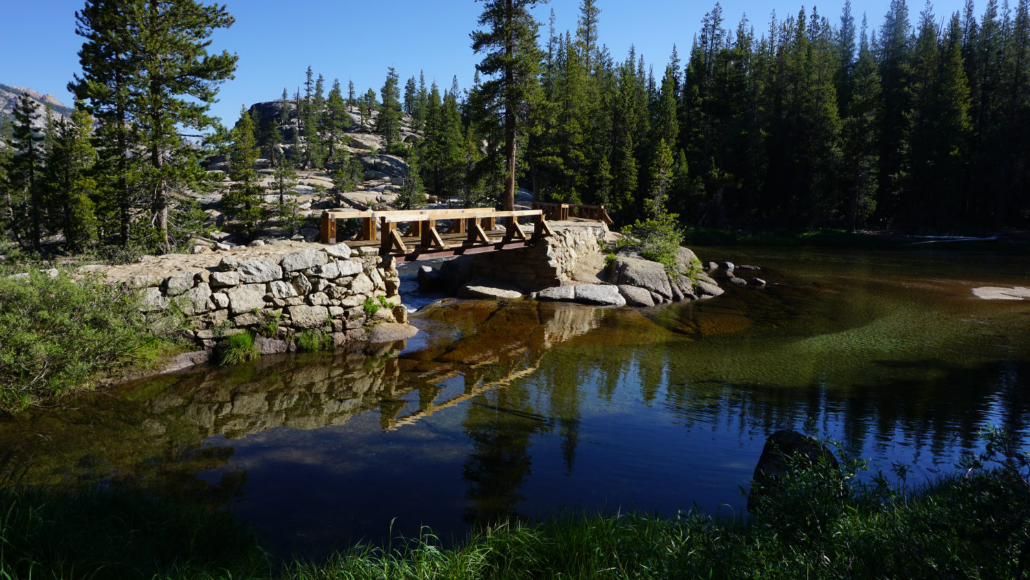
After the Delaney Creek crossings, the PCT passes through alternating patches of forest and granite outcrops with the river rumbling along on the left. At 3.8 miles, the trail, which up to this point has been relatively flat, begins a more noticeable descent into dense forest. This descent marks the appearance of the first waterfalls on the route. Unlike the classic showstoppers in Yosemite Valley, the first few waterfalls are unnamed cascades that crash and careen over granite for dozens of yards. Views toward some of the formations above the Grand Canyon of the Tuolumne add scenic grandeur, particularly at a foot bridge crossing the Tuolumne at 4.1 miles.

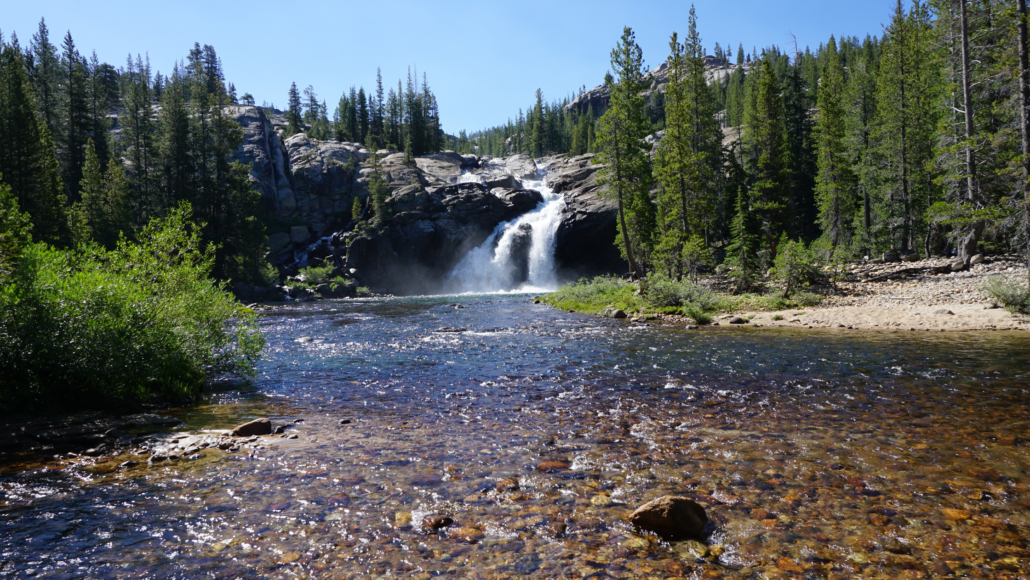
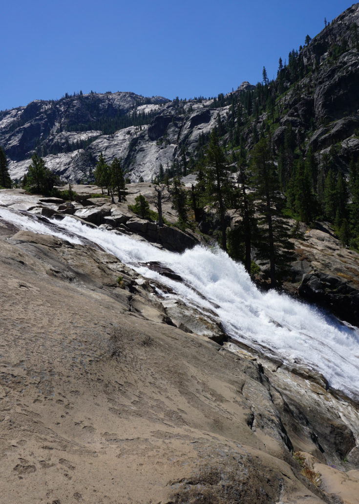
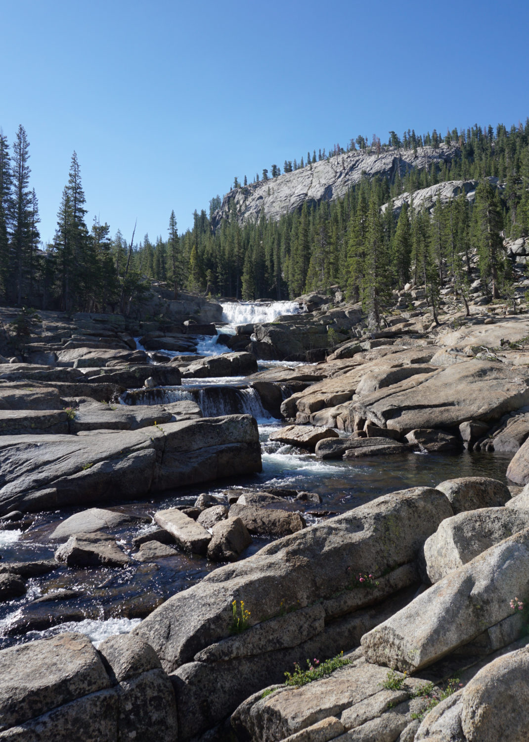
Tuolumne Falls
Beyond the footbridge, the descent continues on the south side of the river. At 4.8 miles, the PCT reaches the first of the named waterfalls – Tuolumne Falls. Tuolumne Falls spills in several cascades over a sheer ledge draining into a rocky bowl. The view of the falls from the trail is good, but it’s even better if you can scramble along the rocks below the falls. Recall my warning that the river becomes dangerous during spring and early summer; if the water is high, content yourself with viewing Tuolumne Falls from a distance to remain safe and sound.
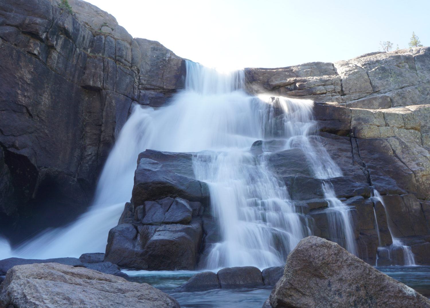
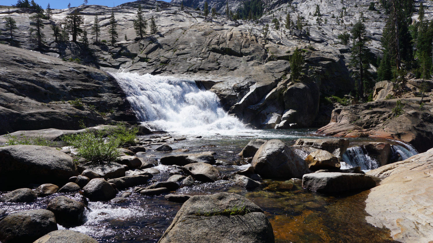
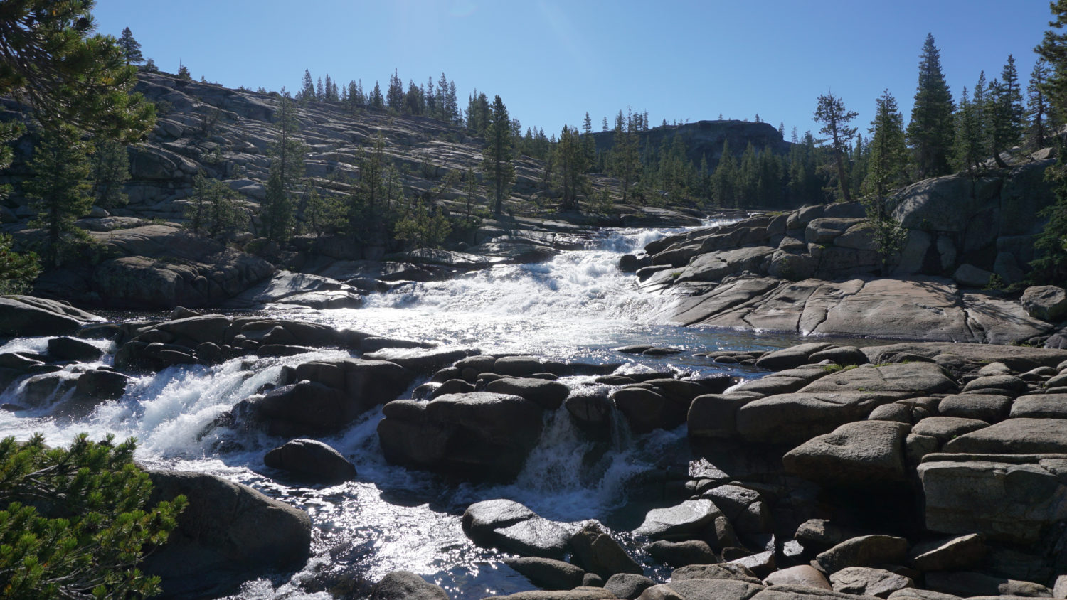
White Cascade
The descent continues beyond Tuolumne Falls until the trail reaches a junction with the Murphy Creek Trail leading south to Tenaya Lake. Keep right at this junction and begin a final descent down to the Glen Aulin High Sierra Camp through a dense, lovely forest with an active population of mule deer. Just before a second footbridge across the Tuolumne River at 5.2 miles, look to the right for White Cascade, a thundering, churning waterfall spilling into a broad pool just to the south of Glen Aulin High Sierra Camp, which lies directly across the river from this point. A second view of White Cascade lies ahead from the bridge spanning the Tuolumne, allowing a lot of looks at this beautiful spot.
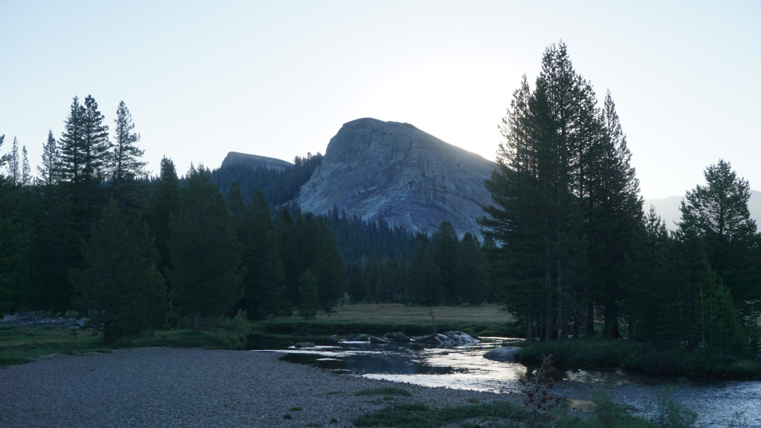
Glen Aulin
On the other side of the bridge, look for a 4-way junction. The right turn leads to Glen Aulin High Sierra Camp. Folks lucky enough to have a reservation will be able to stay within the camp; backpackers will be able to sleep at a nearby designated area for tent camping. The PCT continues straight ahead on its meandering, undulating tread to Mexico. The trail to Waterwheel Falls continues west on the left junction. If you’re camping, this will be a good opportunity to stop and pitch a tent, as there aren’t many camping opportunities between here and Waterwheel Falls.
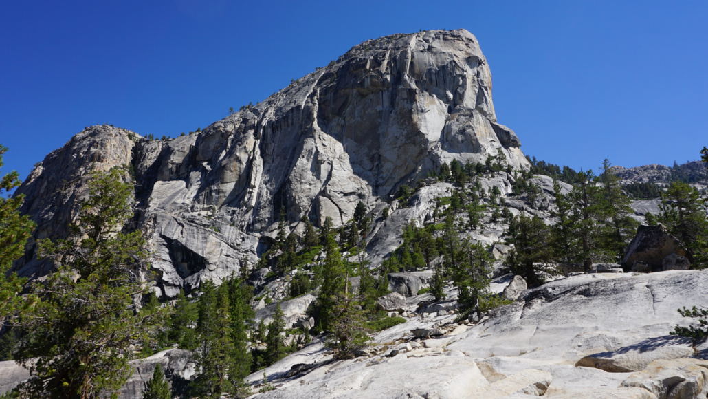
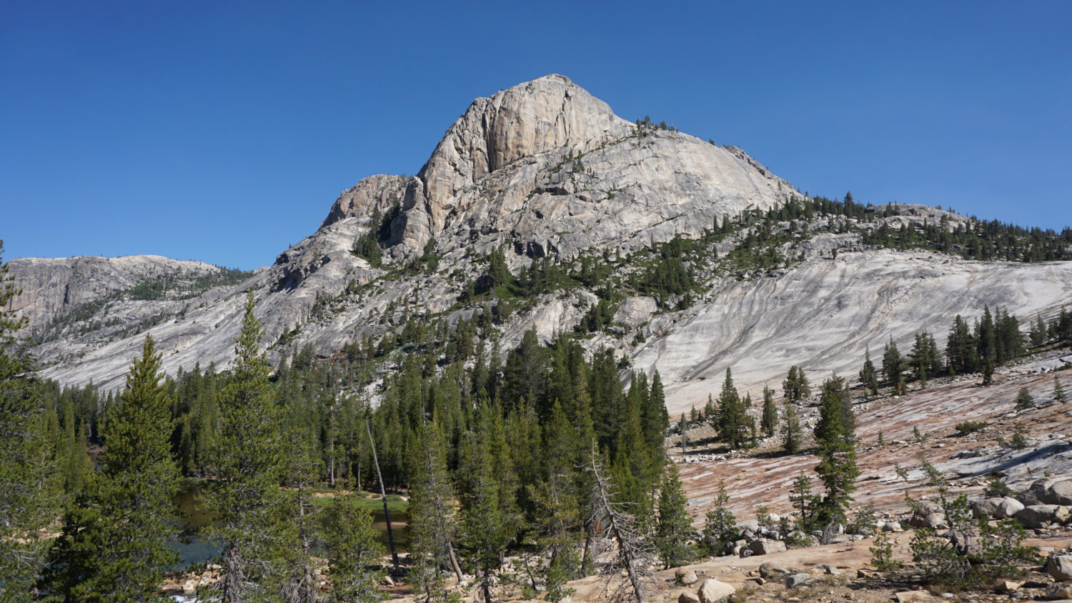
Wildcat Point
Even if you don’t have plans to go all the way to Waterwheel Falls, consider continuing west on the trail as it drops a short distance to the eastern edge of Glen Aulin. The name Glen Aulin derives from the Gaelic words for “Beautiful Valley,” which is exactly what you will find over the next 1.3 miles. There is a beach at the east end of the valley that will serve the less determined day-hikers quite well. It’s worth walking all the way through Glen Aulin to the valley’s western end at 6.7 miles, provided you have the energy.
The flat terrain within Glen Aulin causes the Tuolumne River to slow down and meander through a beautiful forest of lodgepole pines, sugar pines, white firs, and Jeffrey pines.Groves of quaking aspen trees ring pocket meadows, providing a promise of fall color in early and mid-October. Towering granite formations reminiscent of those within Yosemite Valley rise high above the forest canopy, dominating the scene wherever the trail hugs the river. For those with their sights set on Waterwheel Falls, continue west to traverse Glen Aulin’s beautiful environs.
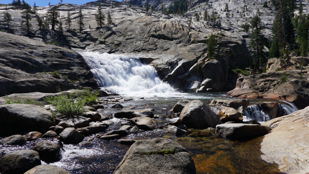
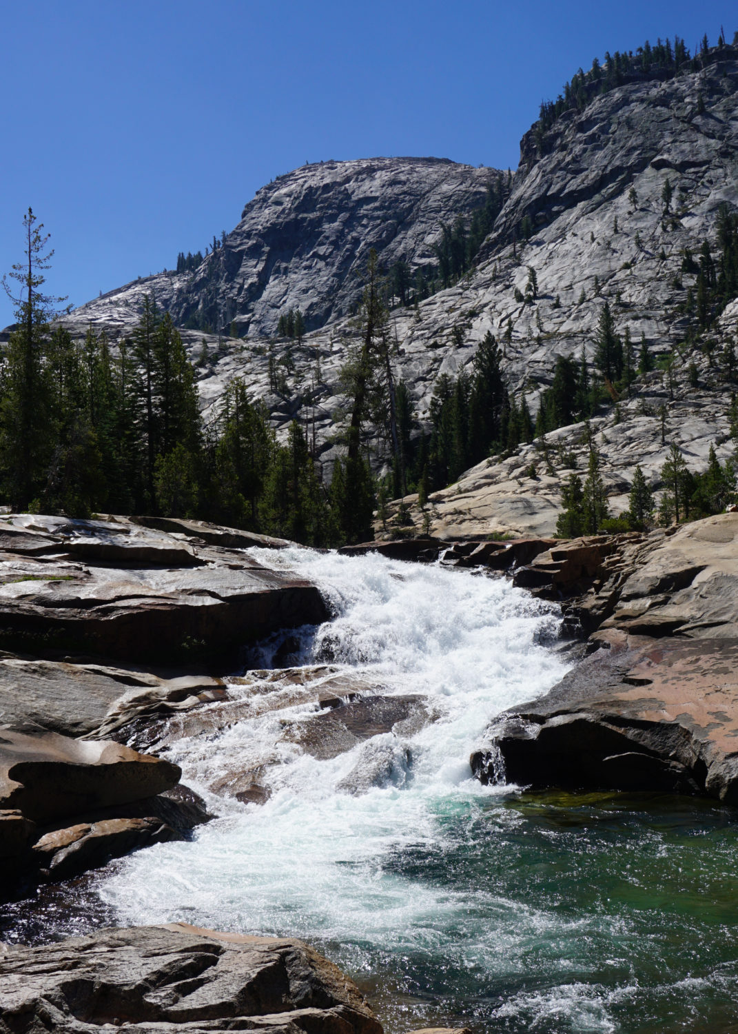
California Falls
At 6.7 miles and at the end of the pleasant, flat traverse of Glen Aulin, the trail begins descending again from the top to the bottom of California Falls. This multi-tiered fall rushes from the edge of Glen Aulin reaching a final culmination with the most picturesque of its cascades spilling into a granite bowl. Look for a side trail at 6.9 miles that leads downhill to the base of this bowl for some of the best views of lower California Falls. This tranquil spot is a great place for a rest.

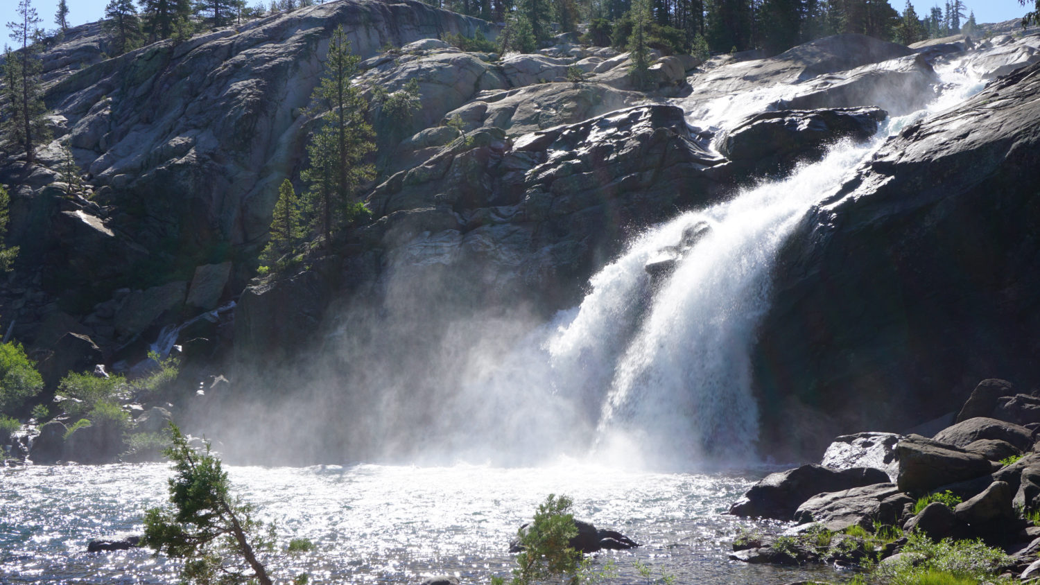
The steepest portion of the descent (and re-ascent on the return trip) lies beyond California Falls. The trail loses 800 feet of elevation over the span of 1.5 miles, and as the elevation here dips below 7000 feet for the first time, the temperatures in the middle of the day – i.e., the time when you’ll be hiking back – can get a bit uncomfortable. However, the scenery is sublime, especially when the trail reaches LeConte Falls at 7.9 miles.
LeConte Falls
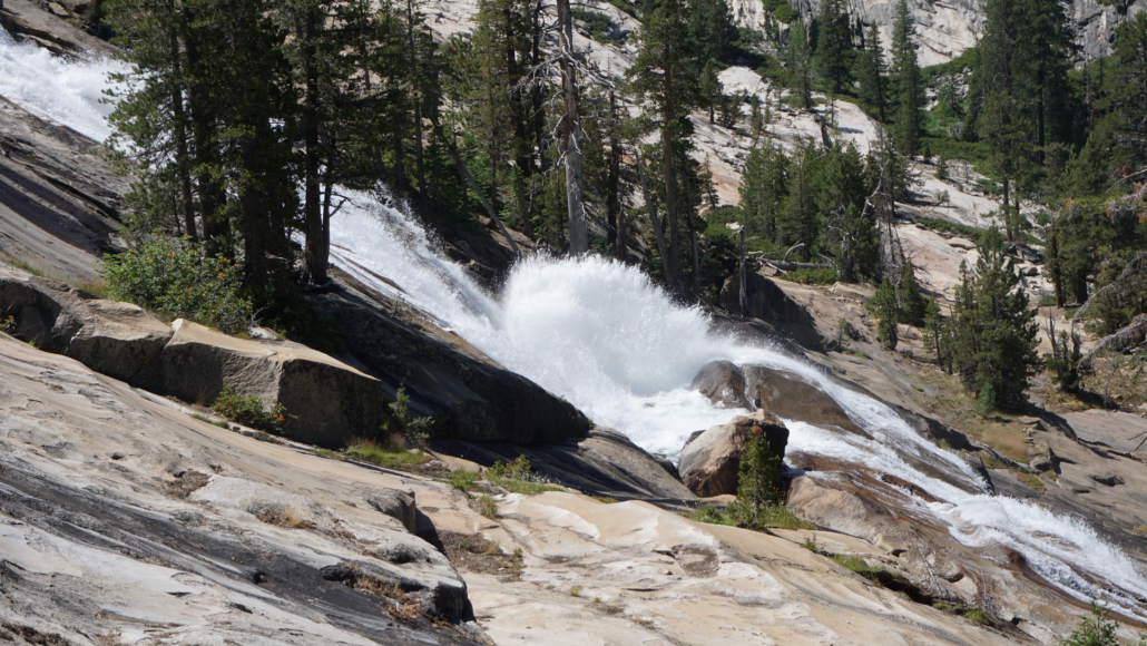
There’s no obvious spur trail to reach LeConte Falls, and it’s the only major waterfall on the route that you’ll need to admire from a distance. LeConte Falls has a similar feature to Waterwheel Falls that’s apparent even from a distance: a submerged granite ledge the sends cascading water into the air much like an old-fashioned waterwheel.
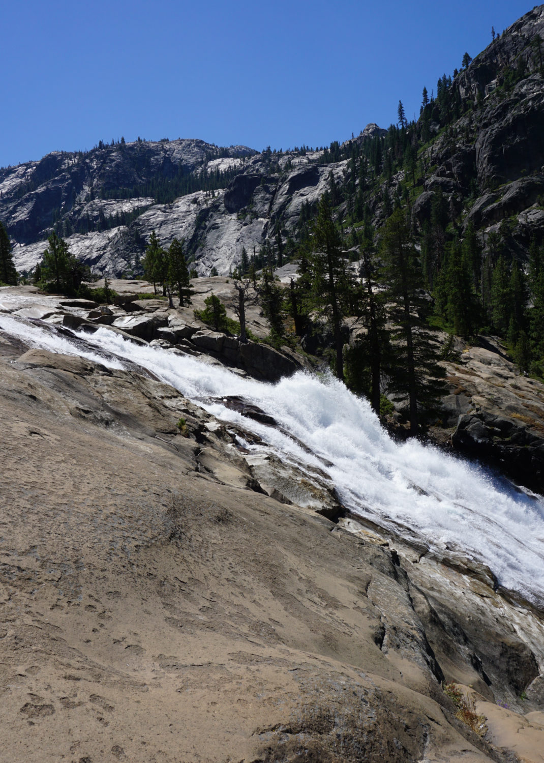
Waterwheel Falls
The final 0.5 mile of the hike continues downhill to a rocky ledge overlooking the U-shaped Grand Canyon of the Tuolumne. The Tuolumne River spills over this ledge, hitting a submerged ledge that sends water into the air. This is Waterwheel Falls, so-named because it reminded early explorers of a waterwheel. The falls are at their most dramatic early in the season, and if you’re hiking this route specifically for this waterfall, aim to hike here shortly after Tioga Road opens for the spring to get the maximum water flow. The views into the canyon and the grandeur of the waterfall are enough of a reward even if the water levels are low, and this spot is a fitting turnaround point for the hike.
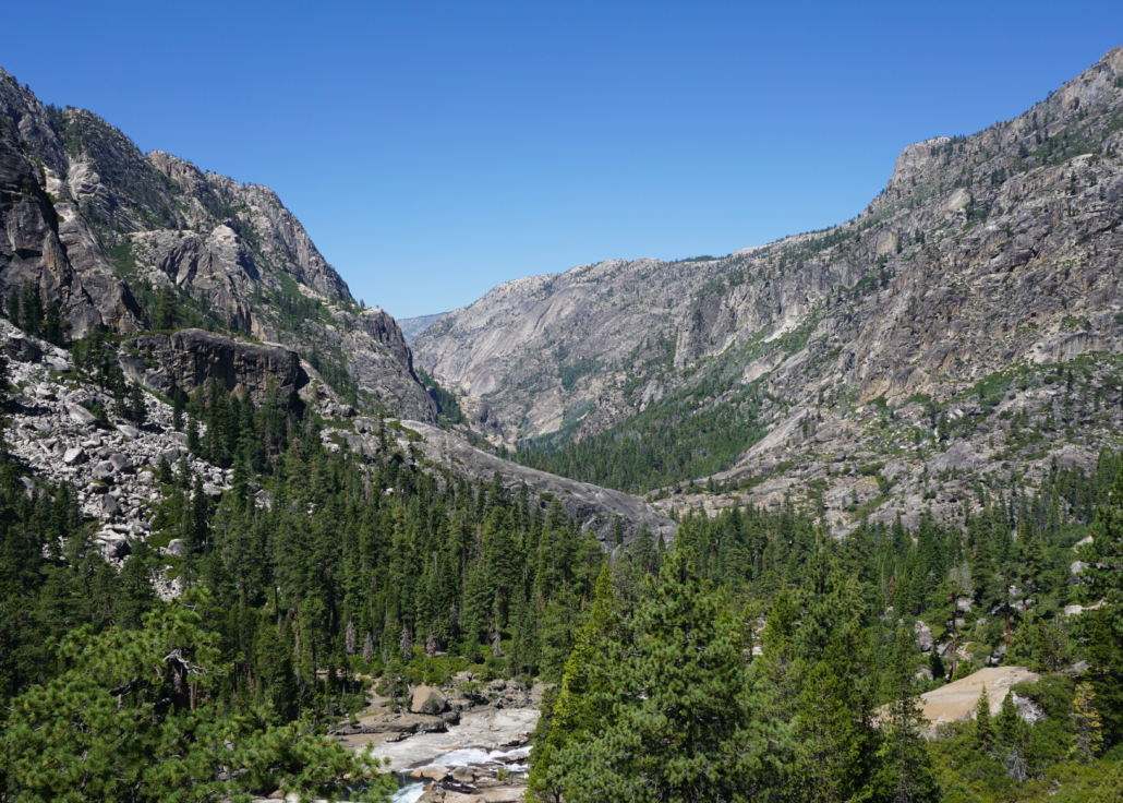
Grand Canyon of the Tuolumne
The canyon runs due west for another 15 miles before reaching Hetch Hetchy Reservoir occupying Hetch Hetchy Valley. Many backpackers enjoying continuing on this route over the next 13 miles just past Pate Valley. At 21 miles, a trail departs on the left to climb uphill to Harden Lake and beyond to White Wolf. If you have the means to leave one car at White Wolf and one car at Tuolumne Meadows, you can fashion a one-way excursion from Tuolumne Meadows to White Wolf – one of the classic backpacking routes in Yosemite National Park. This full route runs 29 miles, one-way, with over 5000 feet of elevation gain and loss. Keep in mind that the climb from Pate Valley to White Wolf gains nearly 4000 feet over over 8 miles, making that section a fairly brutal ending.


Be the first to comment