From its perch high above the Bridalveil Creek drainage, Dewey Point surveys a sweeping panorama taking in Yosemite Valley and much of Yosemite National Park‘s high country. Two principal routes lead to Dewey Point – a winter route and a summer route – making Dewey Point a great year-round hiking option. Both routes differ considerably, and this write-up discusses each in turn.
Red Tape
For day-hikers, the only red tape for the route is paying the park entrance fee ($35 at time of writing).
The winter route departs from Badger Pass Ski Area, which generally opens between December and March, depending on the state of the snowpack. During this time, Glacier Point Road closes beyond Badger Pass Ski Area, and the only way to access trailheads along the road is to snowshoe or cross-country ski. Both of the trailheads for the Dewey Point winter Route (Ridge Trail/#14 and Meadow Trail/#18) can be found along Glacier Point Road, and those trails are only open during winter when the terrain is snowbound.
If you’re backpacking the McGurk Meadow route, you will need to obtain a permit in advance. To do so, first check availability for the McGurk Meadow Trailhead on the Full Trailhead Report to find out what days have permit availability. As most trailhead quotas in Yosemite often fill up in advance, it will behoove you to check the Wilderness Permits Reservation Window website to determine when you will be able to select your permit; early birds get the worm. After that, go to the Yosemite Conservancy website to request your permit. If your permit request is rewarded, the Conservancy will send an email allowing you to confirm your permit. After confirming your permit request, the last step is to pick up your actual paper permit from Yosemite Rangers at the nearest ranger station, which in this case is either the Valley Wilderness Center or the Wawona Ranger Station.
Safety
For the winter route, inclement weather, extreme cold, ice, and deep snow drifts are the primary safety concerns.
Your best strategy for coping with inclement weather is always to avoid hiking in inclement weather. If the forecast calls for heavy snow on the day of your hike, cancel the hike – you won’t see anything from Dewey Point if it’s snowing, anyway. It may also be worth calling the Badger Pass Ski Area in advance to get a sense of what the conditions will be like, as snow levels vary considerably throughout the season and from year-to-year.
For cold weather, it’s best to stack several layers of clothing rather than wearing one large bulky jacket. You may start out cold only to heat up as you begin hiking. If you have layers, you can add or subtract them as needed along the way. Snow gaiters around your waterproof boots are also a good idea, as it will prevent snow from melting inside your boots and making your feet cold.
For ice and snow, be advised that snowshoes are a necessity for the winter route. There are some conditions where you can complete the hike with microspikes, but that’s only if the snow is compacted. If the snow is fresh or melting, you will spend your entire hike post-holing, which could make you rather wet and uncomfortable. You can also ski on this route.

For the McGurk Meadow route, the primary issues are elevation and bear safety.
The altitude at the trailhead (7000 feet) is not terribly high by Sierra standards, but the trail does reach elevations over 7500 feet. Some people may therefore have issues with altitude sickness. For sensitive individuals, it may help to spend a night or two at a nearby campground to get used to the elevation before starting the hike.
Bears are present and active in this area. There are storage lockers at the McGurk Meadow Trailhead. If you’re backpacking, be sure to carry an approved cannister to store your food when you’re camped. If bears get your food, they may become aggressive, which may lead the park to have to euthanize the bear.

Dewey Point Winter Route
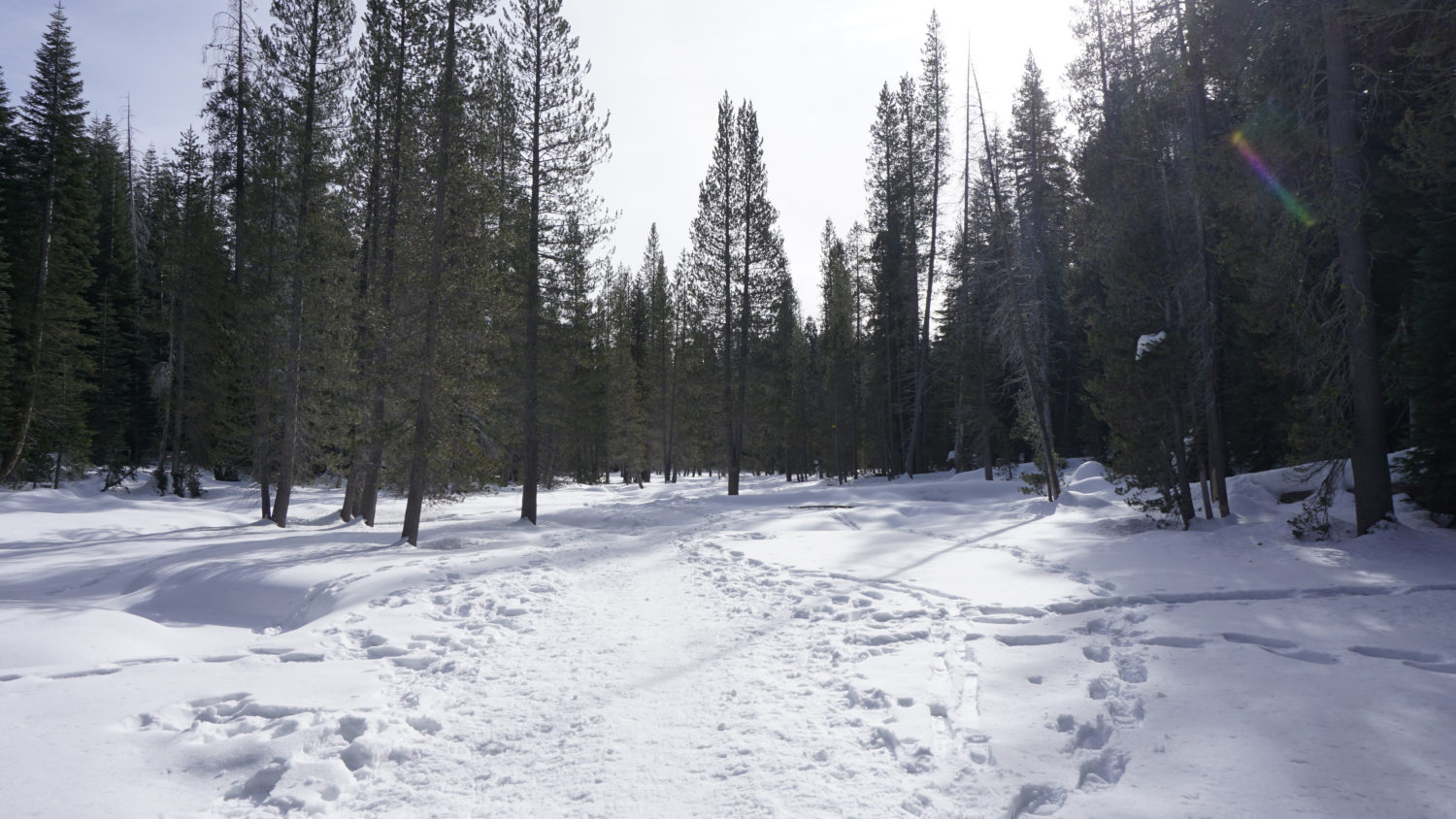
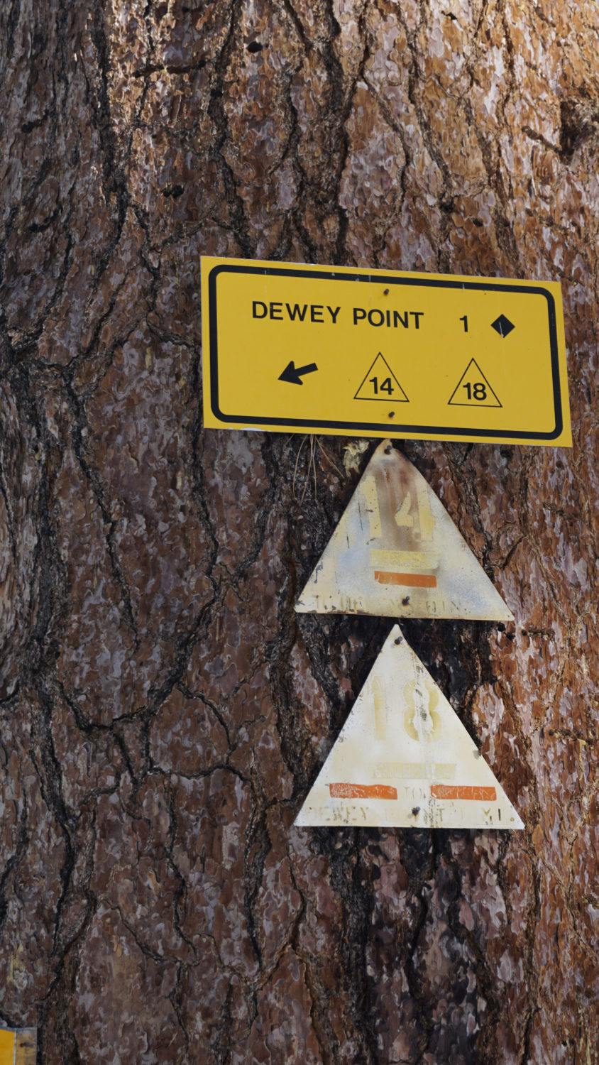
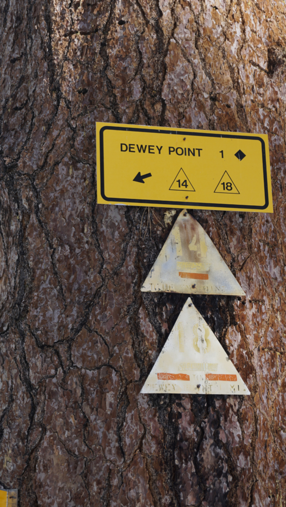
From the Badger Pass Ski Area parking lot, find the winter trailhead leading to Glacier Point Road on the north end of the parking area. Follow a short segment of snow colored access road down to Glacier Point Road, and turn right. The park grooms the snow on the road throughout the winter season, and there are priority lanes for each type of user – hiker, skiier, and snowshoer. Be sure to familiarize yourself with which user is supposed to use which lane so as not to deteriorate the grooming faster than necessary. Hike east along Glacier Point Road for 0.7 mile to the Ridge Route/#14 Trailhead on the left side of the road.

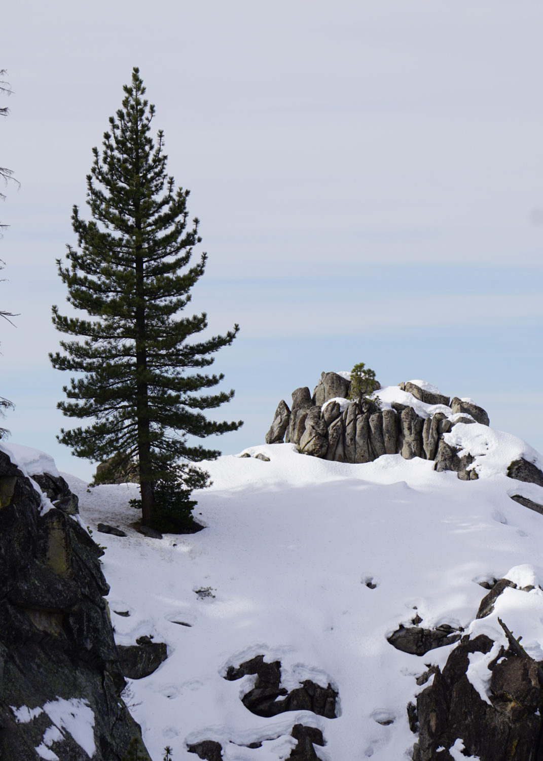
Join the Ridge Route and begin hiking north on a moderate incline. Yellow blazes high up on the trees will mark the route for you as you progress. After wrapping around the east shoulder of Peak 7631 (the route’s high point), the Ridge Route travels northbound, undulating over a ridge dividing Meadow Brook to the west from the Bridalveil Creek watershed. The route travels mostly through open forest, and there are occasional views west atop some of the high points on the ridge.
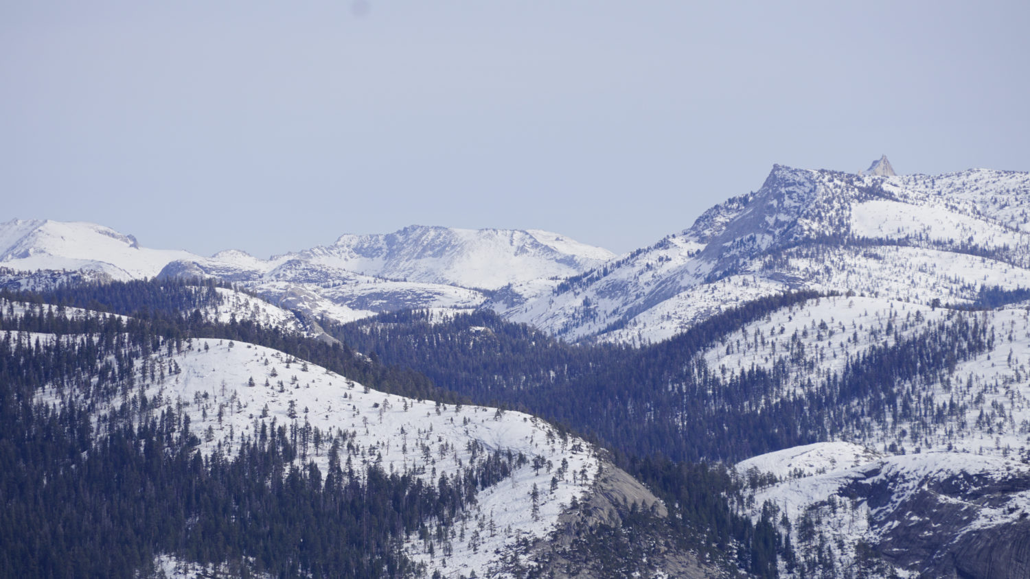
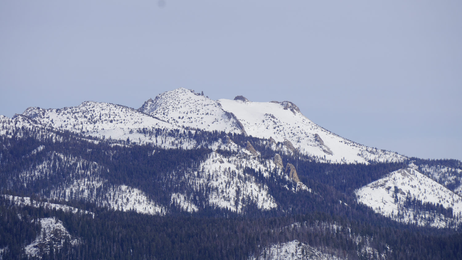
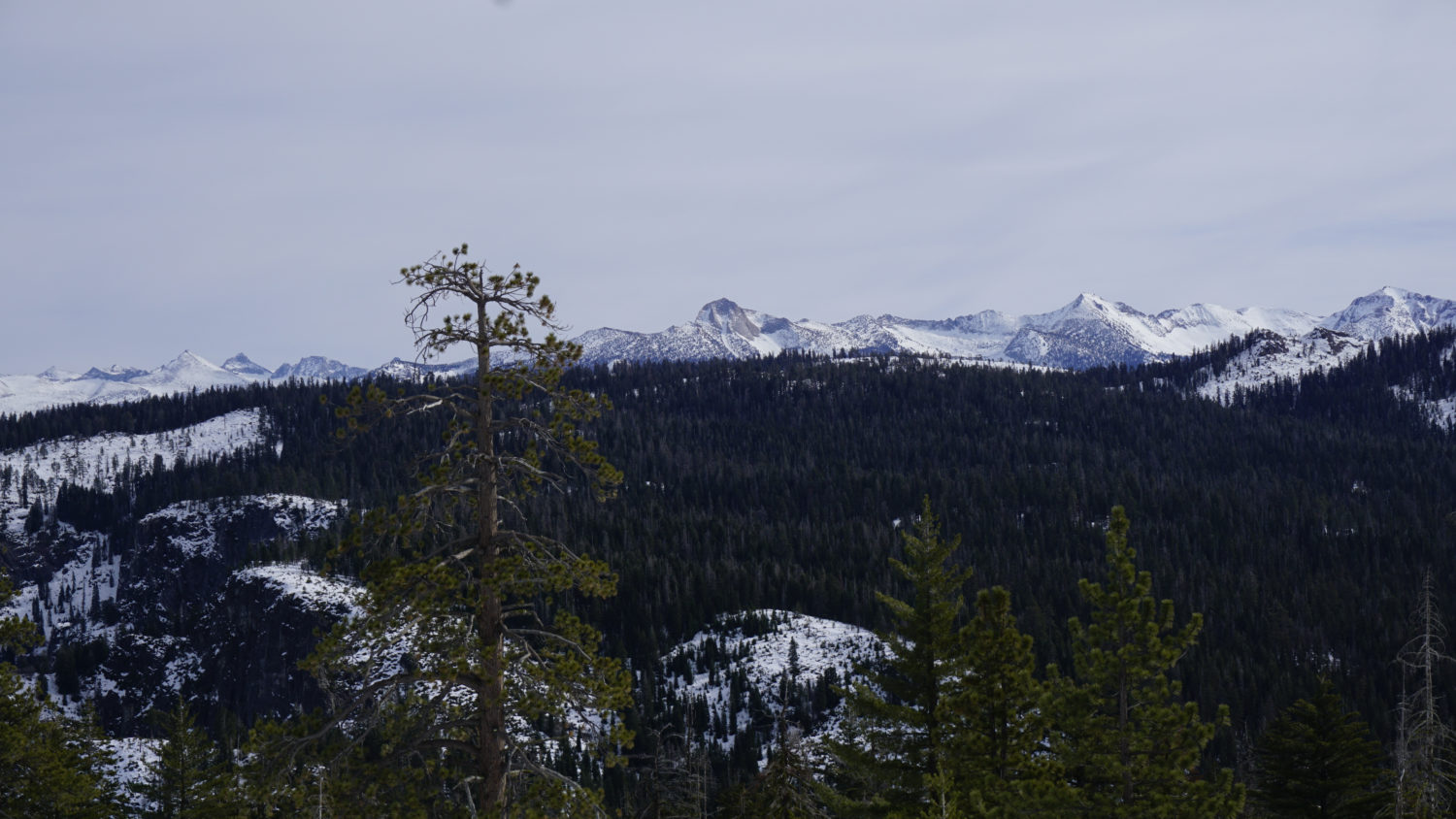
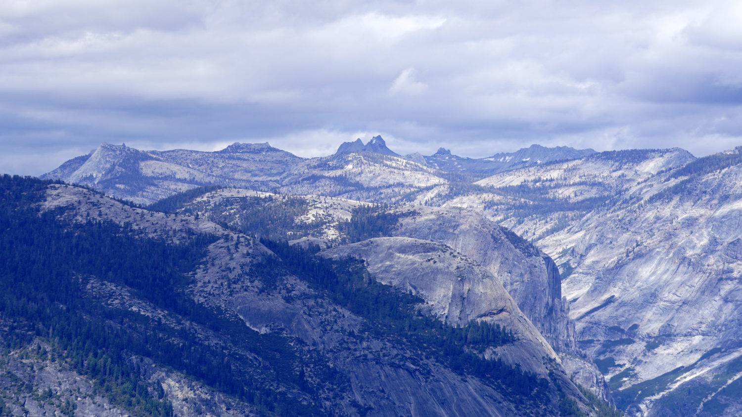
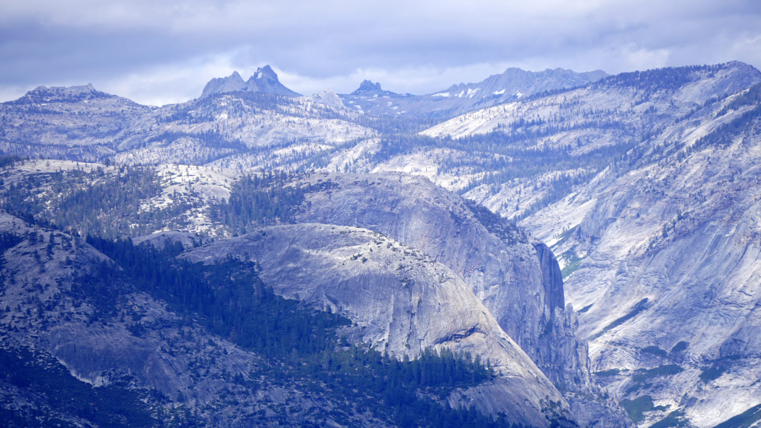
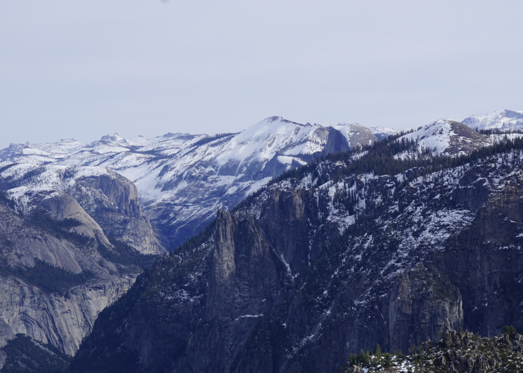
After 2 miles of undulating travel from Glacier Point Road, the Ridge Route merges with the Meadow Route/#18. From here, continue north, undulating over a few more hills to a junction with the Pohono Trail at 3.5 miles. Note that the Pohono Trail will likely be buried in snow, and the only indicator of the trail is the trail sign. From the trail sign, walk north about 50 yards to Dewey Point, from which spot you can enjoy the stellar views. Unlike the summer views, in which bare granite is the star, the winter views may feature Yosemite Valley and its higher points along the rim and beyond in the Cathedral Range caked in snow.
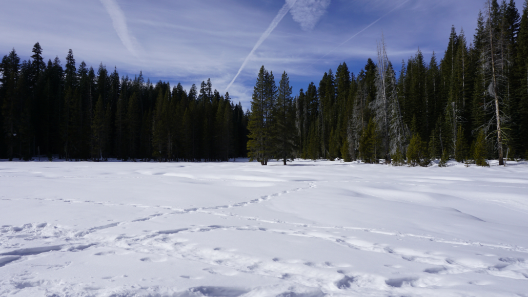
To return, follow the combined Ridge Route/Meadow Route south to the merge. Upon reaching the merge, keep left to follow the Meadow Route/#18. The meadow route gains and loses considerably less elevation as it travels on a gentle incline through a long, linear meadow on the eastern base of the ridge you hiked in on. This route is arguably more scenic thanks to the wide open spaces blanketed in winter snow. This route reaches Glacier Point Road at 6 miles at a point just north of Summit Meadow. Turn right onto Glacier Point Road and follow it west all the way back to the ski area, ending the hike at approximately 7 miles.
Dewey Point via McGurk Meadow
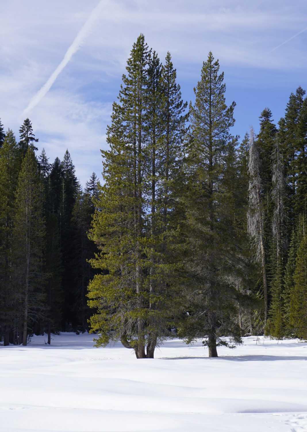
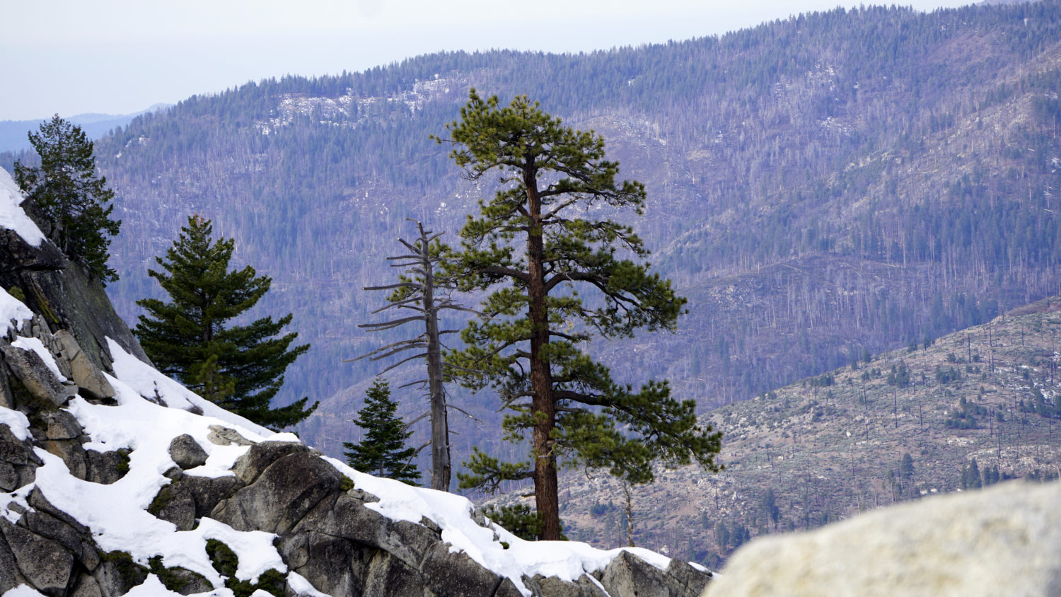
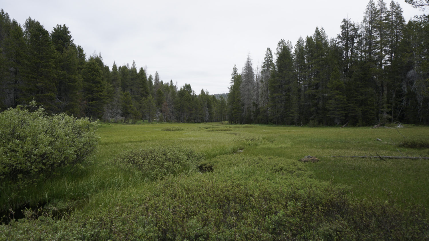
During summer time, the McGurk Meadow Trail becomes the optimal route to Dewey Point. This 7.5 mile hike is great as a day-hike, and it also makes a pleasant overnight hike. The trail begins from the McGurk Meadow Trailhead, which lies about 50 yards north of the McGurk Meadow Parking area. Locate the trailhead, and plunge into a cool, lush forest dominated by lodgepole pines. This section of the forest is denser and more verdant than other areas of the Yosemite Wilderness, especially around McGurk Meadow itself. The cool, lush forest makes for some very pleasant hiking en route to Dewey Point, where spectacular views await.
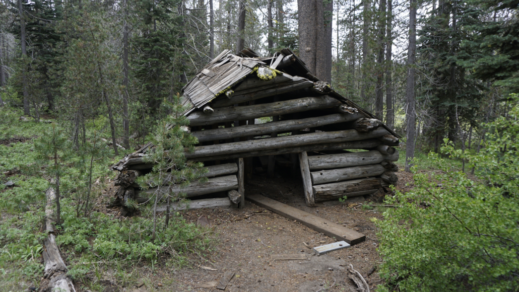
Dewey Cabin
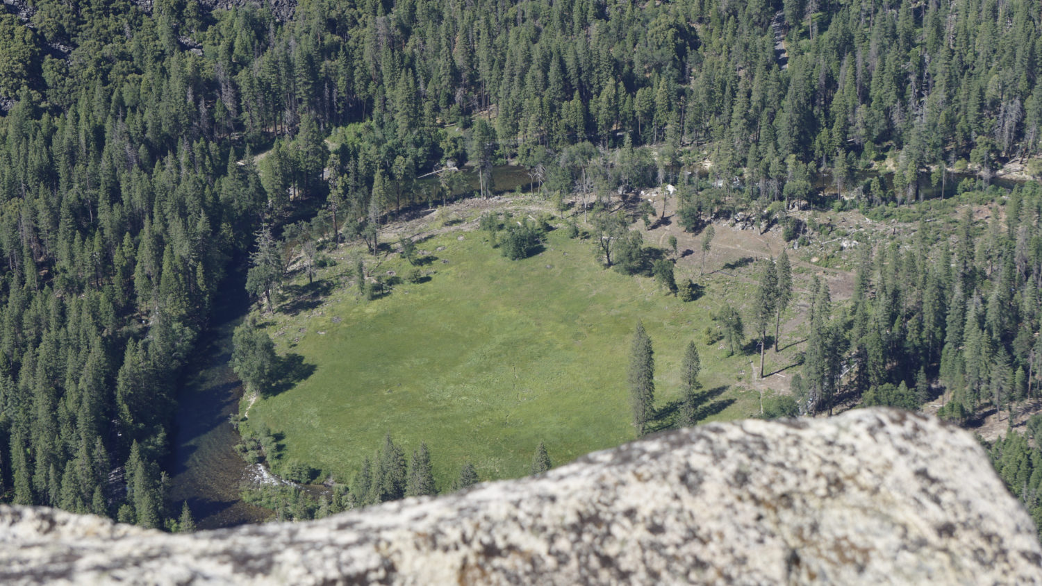
Begin by locating the McGurk Meadow Trail and follow the trail north and downhill through a dense forest of lodgepole pines. The first 0.6 mile follow a mellow descent through the forest until reaching the edge of McGurk Meadow. Just before reaching the meadow, keep an eye out for the ramshackle, dilapidated remains of McGurk Cabin, abode of the homesteader who herded sheep in the area prior to this area’s inclusion into Yosemite National Park. A footbridge spans McGurk Meadow shortly after; cross a creek and the meadow before continuing north along the meadow’s west edge.
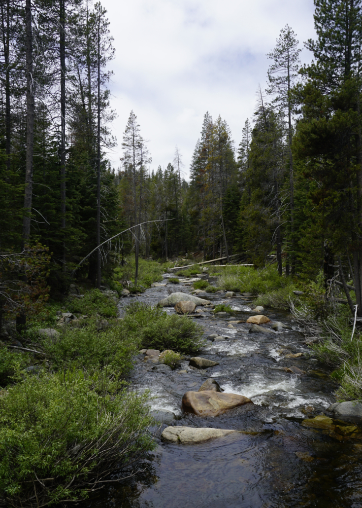
Bridalveil Creek
The McGurk Meadow Trail reaches a junction with the Pohono Trail at 1.8 miles. Day-hikers will turn left here to continue west toward Dewey Point. However, if you’re backpacking, there are some nice campsites about 0.25 mile to the east near the banks of Bridalveil Creek. The creek is the most reliable watercourse in the area, and late season backpackers will find reliable water here. Note that there’s no camping east of Bridalveil Creek.
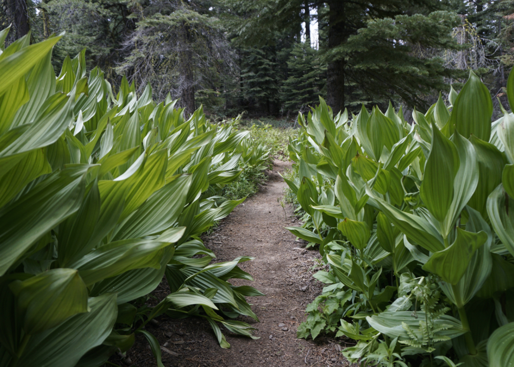
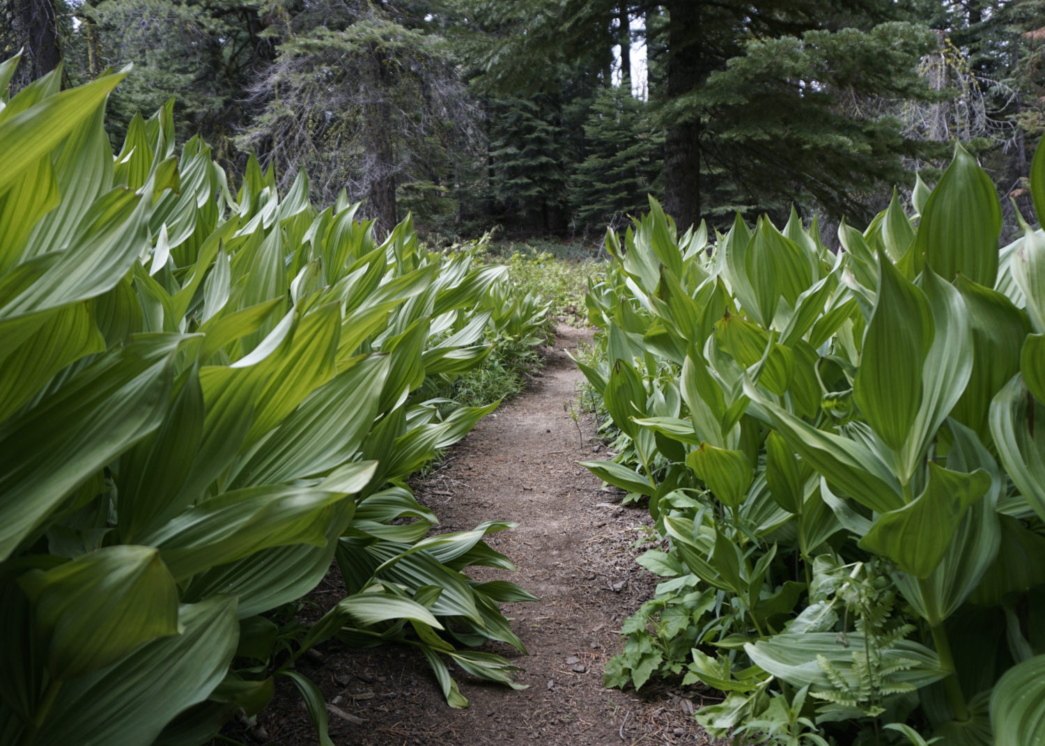
A corridor of corn lilies
After turning left on the Pohono Trail, continue a pleasant westward journey through more dense lodgepole interspersed with red firs, sugar pines, and occasional Jeffrey pines. The trail crosses over two seasonal creeks that nourish narrow ribbon meadows rife with vegetation and insect life (that includes mosquitoes). At 2.8 miles, the Pohono Trail sidles up alongside one of these creeks for a pleasant stretch along another ribbon meadow. This cues the final stretch of climbing where you’ll gain about 500 feet over the next mile as the Pohono Trail ascends to Dewey Point.
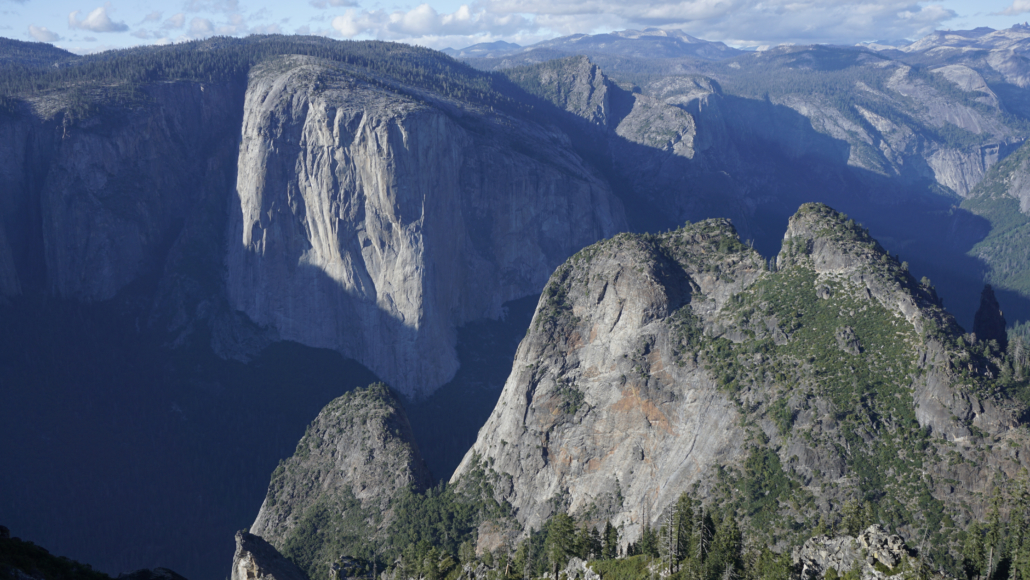
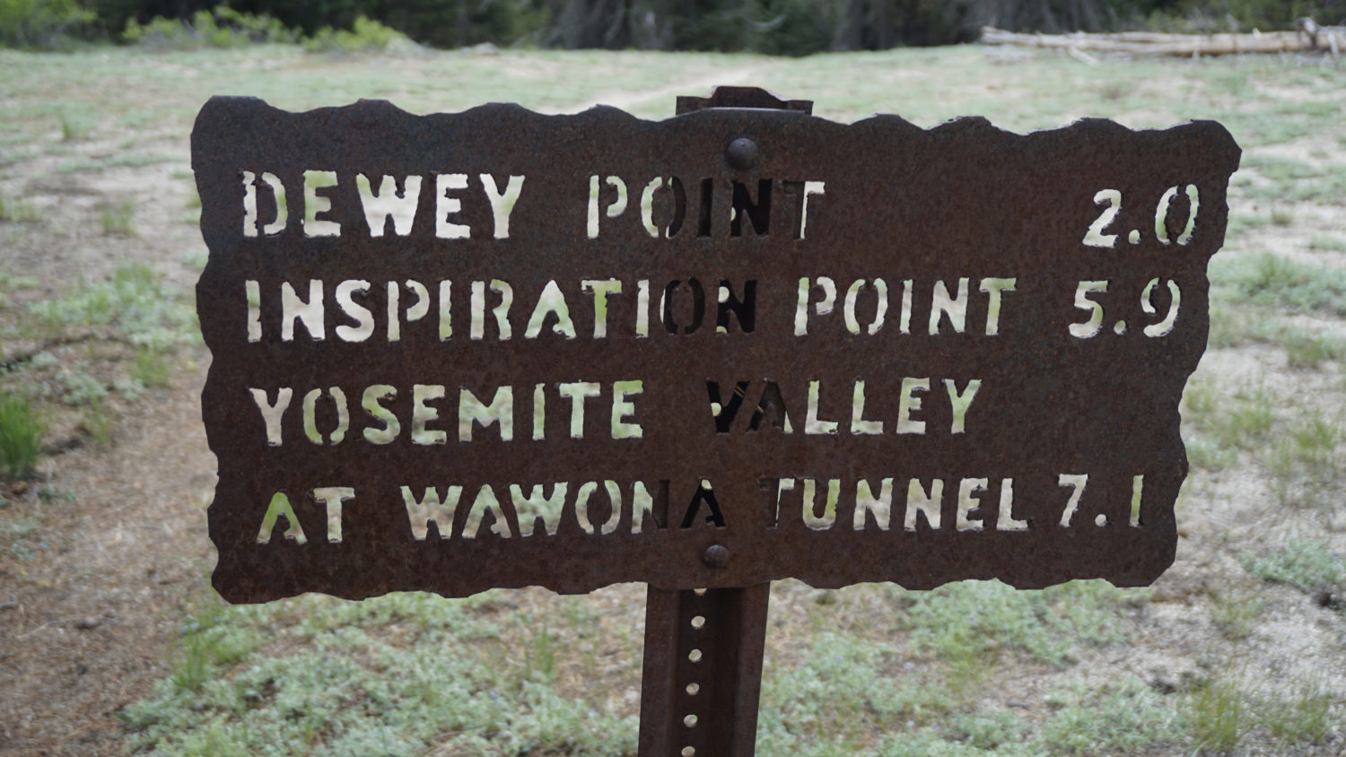
The moderate climb to the point concludes at a spot just north of Dewey Point itself at the 3.7 mile mark. There’s no sign signifying Dewey Point aside from the Pohono Trail junction sign indicating distances west toward Tunnel View. Turn right at this sign toward an obvious promontory with the void of Yosemite Valley lying beyond. Walk up to the edge of Dewey Point to find a number of comfortable sitting spots.

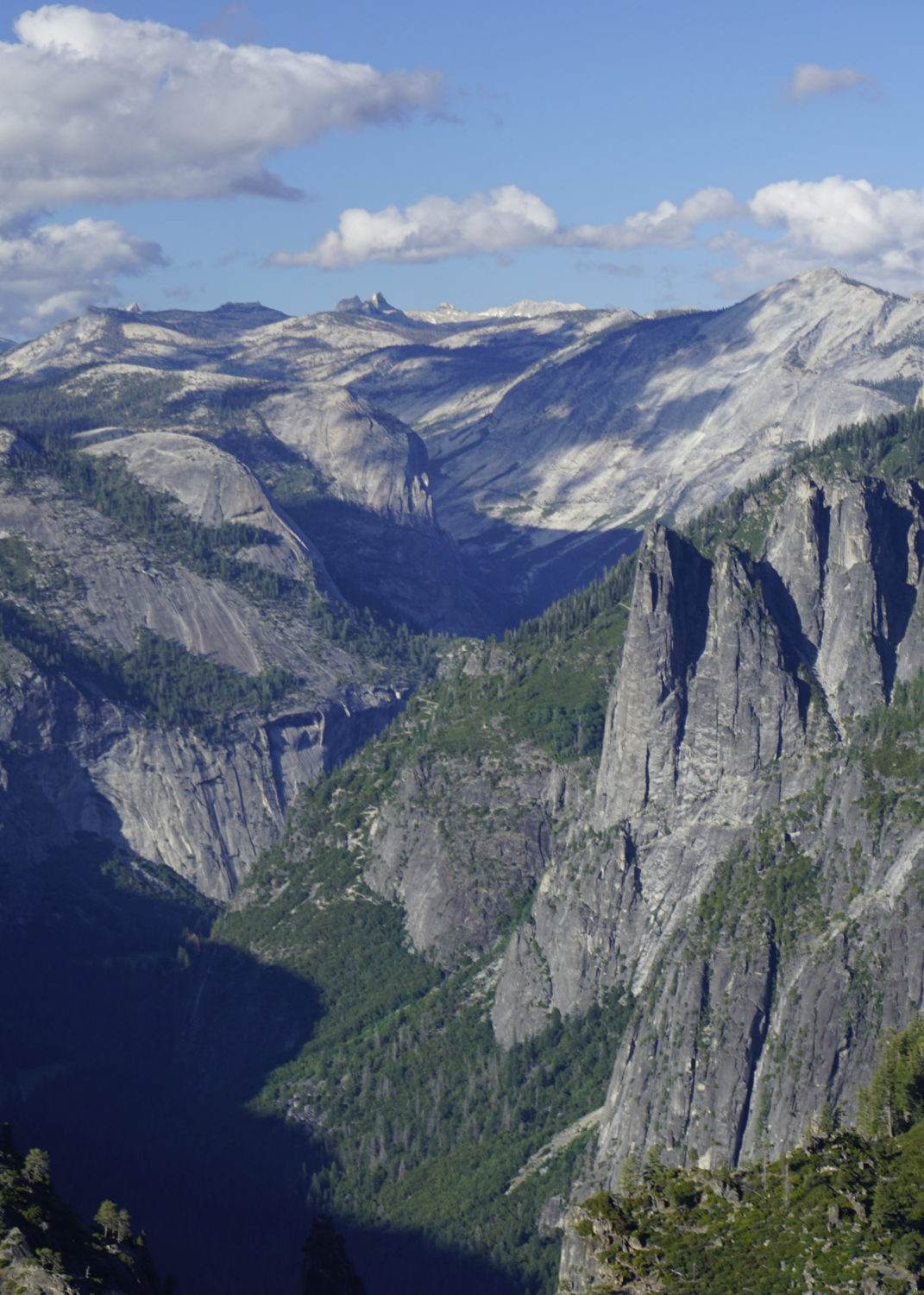
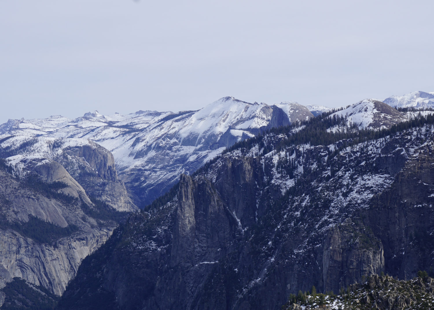
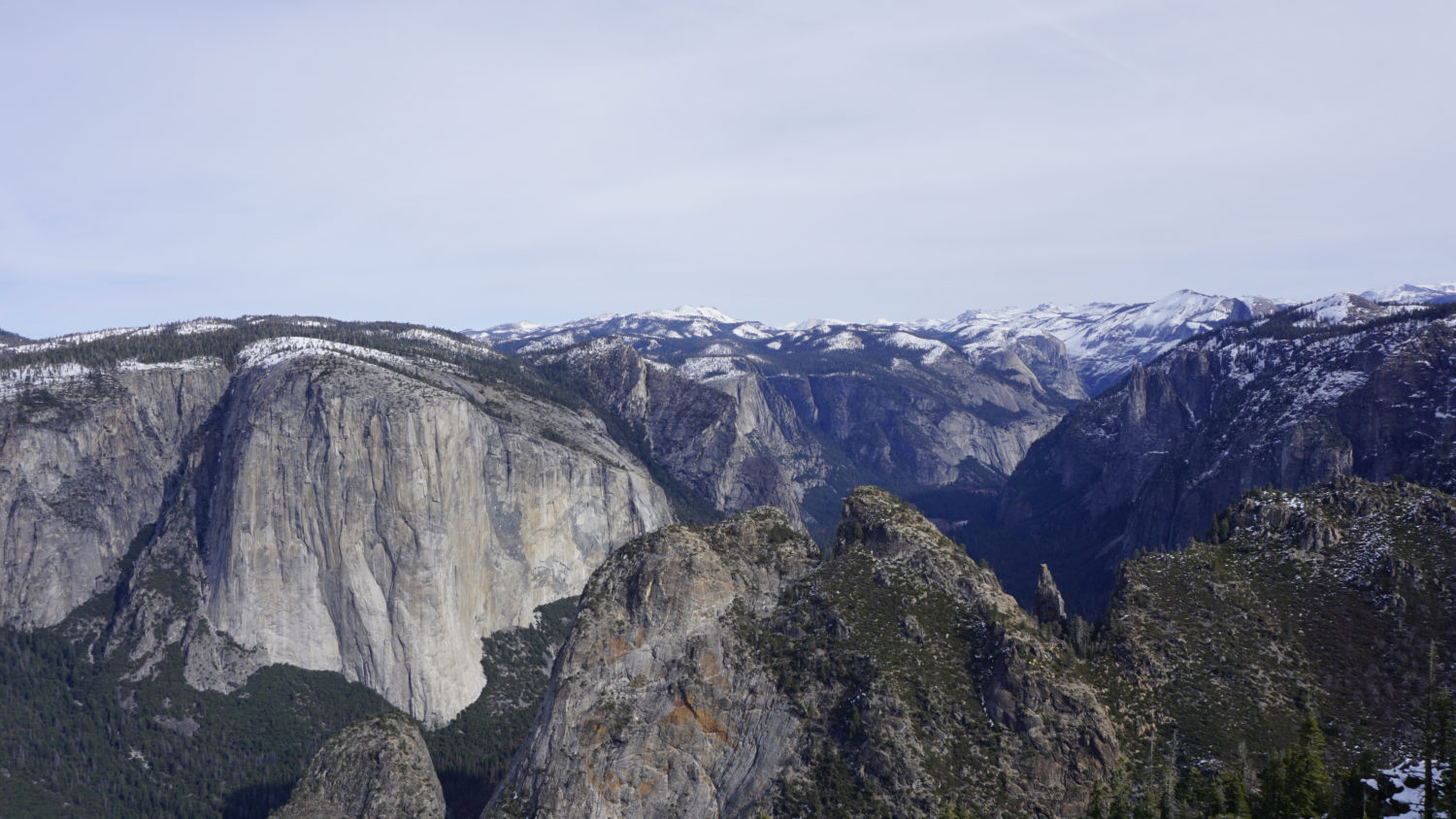
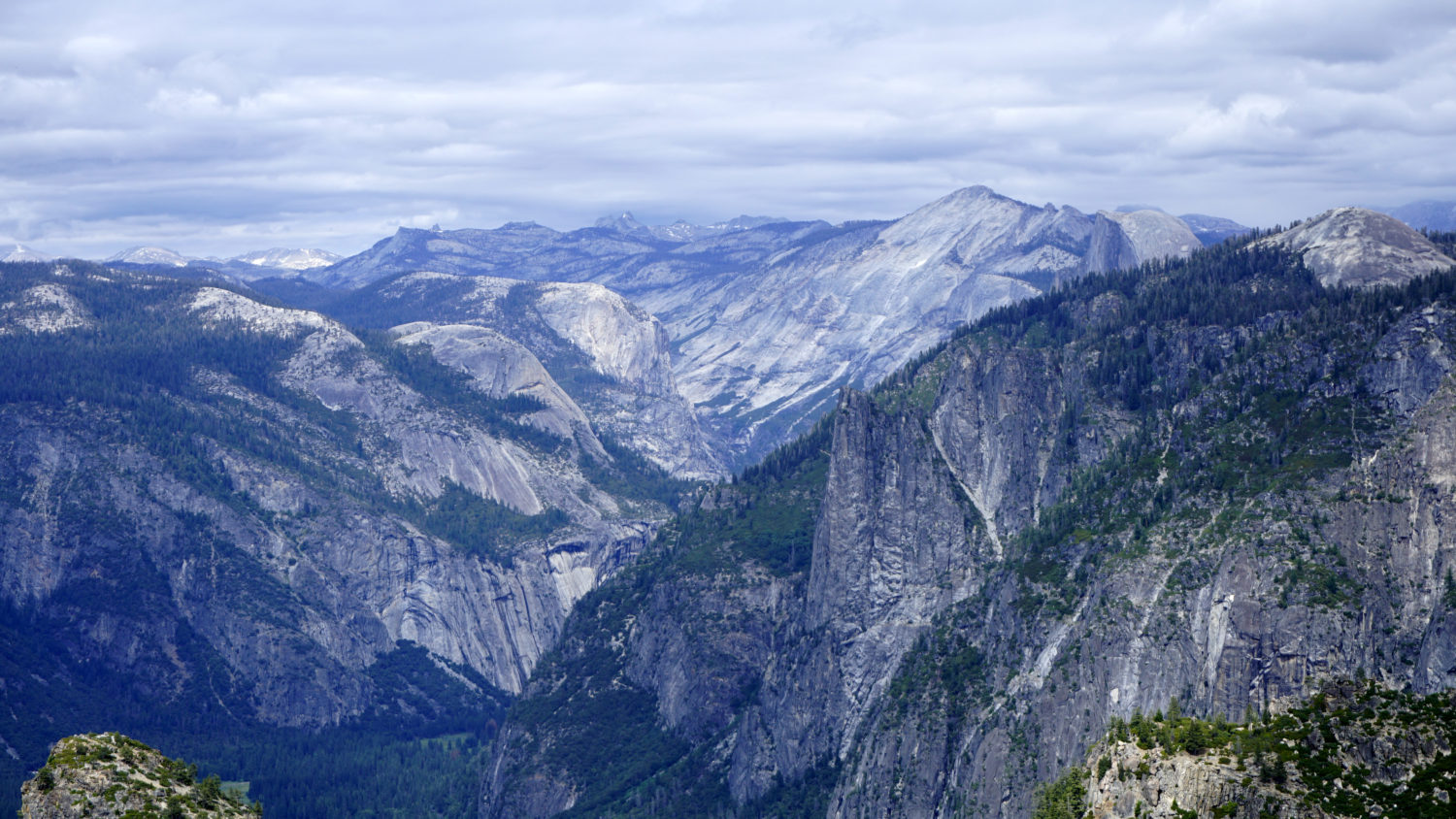
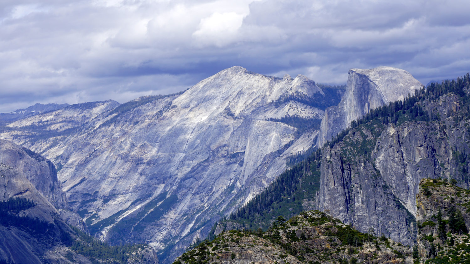
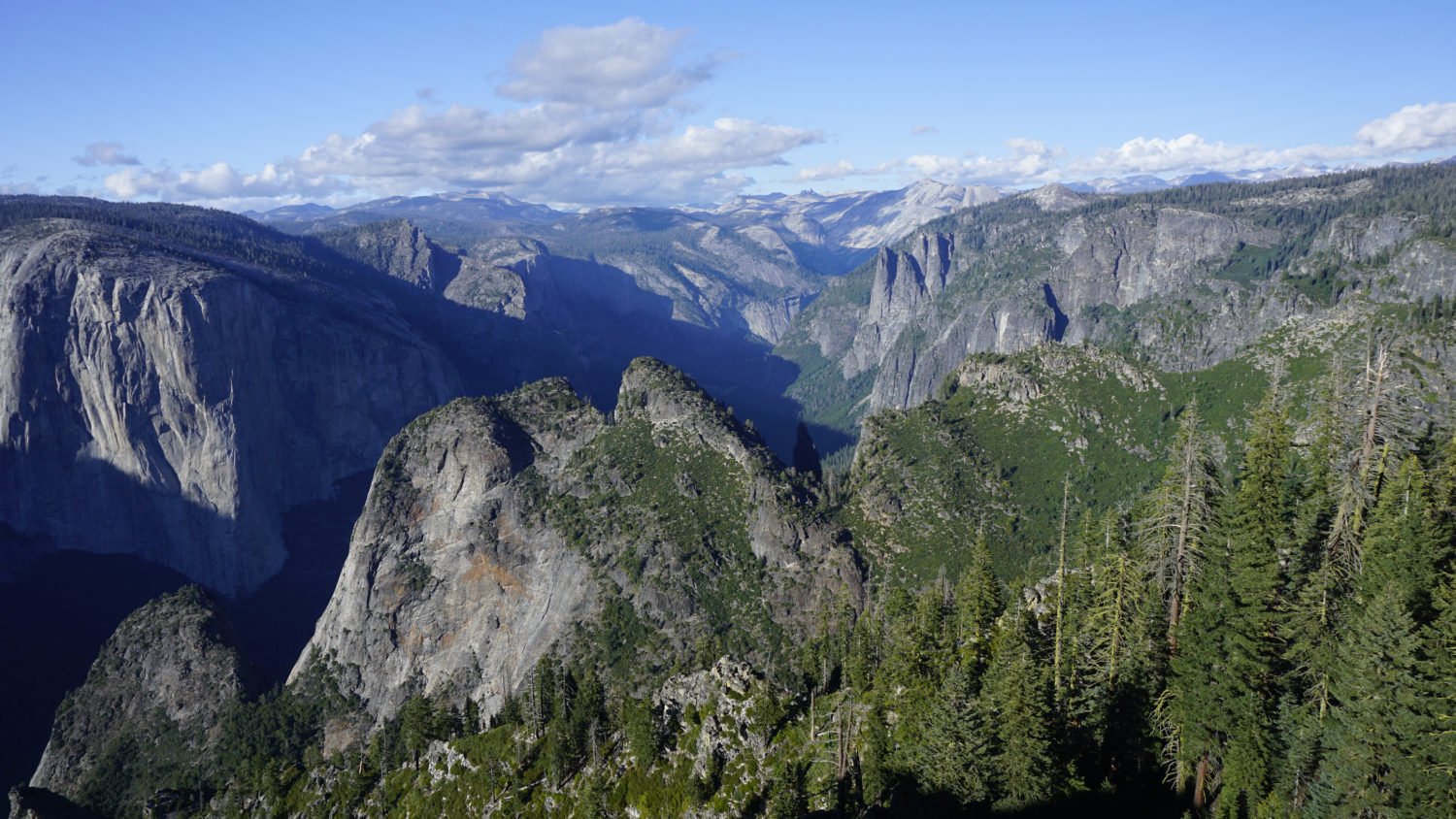
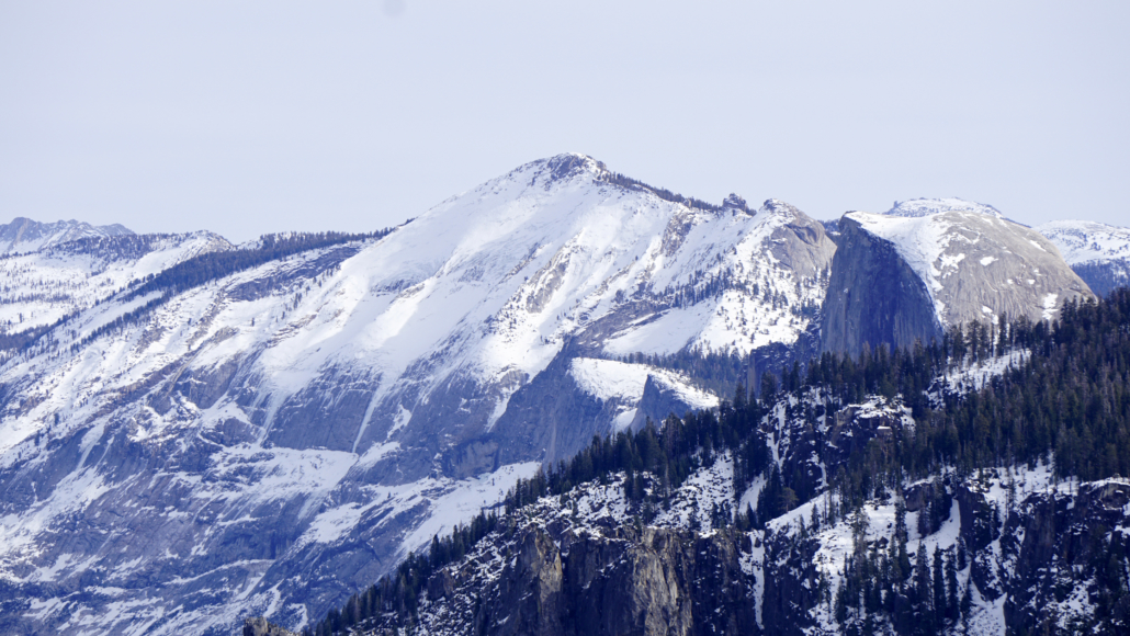
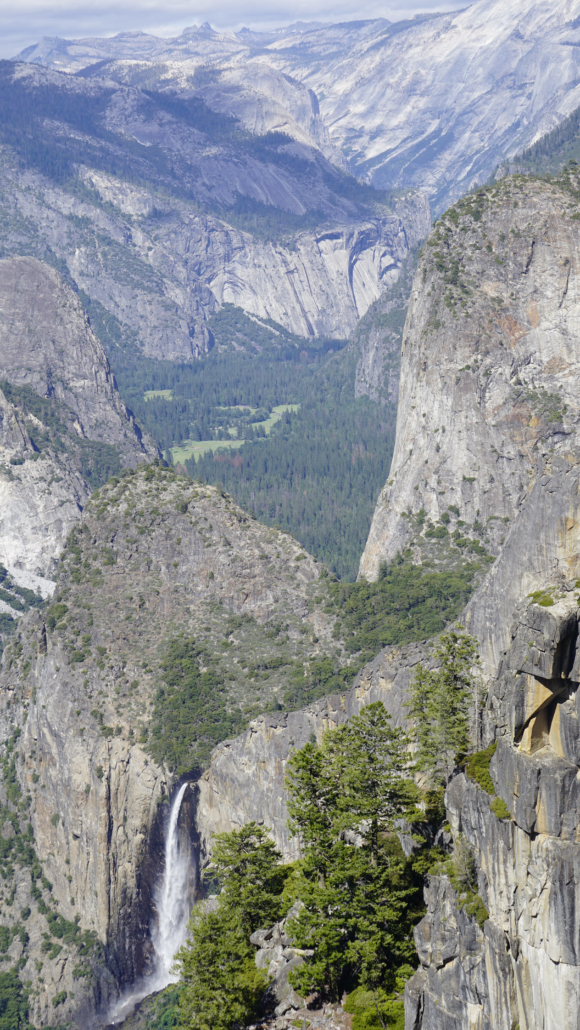
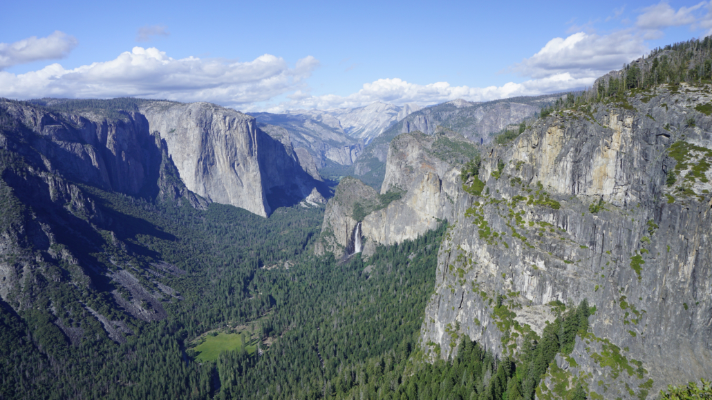
The view here is spectacular, encompassing much of the upper reaches of Yosemite Valley. Unlike many other Yosemite viewpoints, Dewey Point doesn’t jut out directly over the valley. Instead, it juts out over Bridalveil Creek’s hanging canyon, from which Bridalveil Fall spills 620 feet into the valley below. This unique vantage point also takes in most of the famous landmarks, with El Capitan taking prominence in the scene directly across the canyon. The one landmark that isn’t as obvious is Half Dome, which lies partially obscured by Glacier Point to the east.
Going Further
For most people, the trip to Dewey Point will be plenty of hiking and a satisfying experience. More ambitious hikers can continue west on the Pohono Trail to another trip of viewpoints, including Crocker Point, Stanford Point, and Old Inspiration Point.
Stanford Point
Crocker Point lies 0.6 mile west of Dewey Point, and Stanford Point is another 0.6 mile beyond. Both points aren’t marked aside from another trail distance sign at each spur trail leading to each point. These two points feature fine variations on the Dewey Point view, with the primary difference being that Bridalveil Fall is also visible from both points.
Old Inspiration Point
Old Inspiration Point is the hardest spot to reach primarily since the spur trail to the point is not marked. To find the point, continue across Meadow Brook Creek, continuing south. At a prominent switchback shortly after the trail starts descending, look for the trail on the right. If you reach Artist Creek, you’ve gone too far. The spur trail will drop down to the point, which juts out over the valley about 2,000 feet above Tunnel View almost directly below. You can also get an up-close view of Silver Strand Falls, which usually peak around April and May.