While it’s true that Pleasanton Ridge Regional Park has its fair share of sunny trails, there’s a secret in its northern reaches: shade. Following seasonal streams into cool Kilkare Canyon, you’re partially covered by oak and California bay on this 7.4-mile balloon loop. Vistas of Mount Diablo, the Tri-Valley, and East Bay parks make it an exceptional hike in the San Francisco Bay Area, especially in spring when wildflowers bloom and hills turn green.

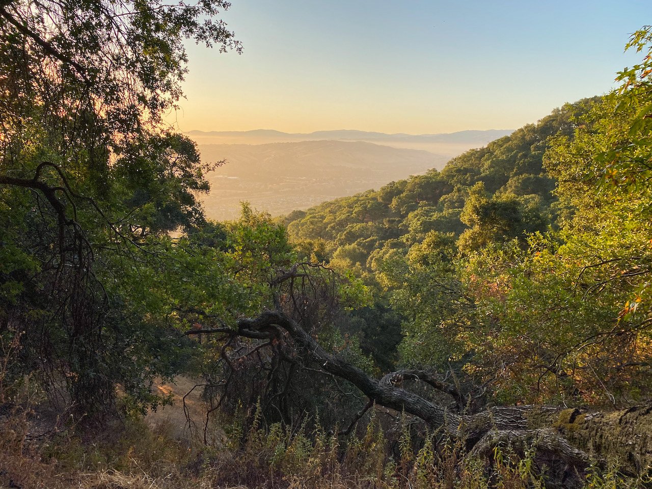
Sunrises are spectacular along the Courdet Trail.
Pleasanton Ridge is a northwest-southeast trending ridge west of Pleasanton. It’s 6.5-miles long as the crow flies, with grasslands, oak woodlands, and ephemeral streams. Augustin Bernal Park lies in the middle, separating the park into northern and southern sides. On its northeastern side is the Castleridge trailhead, built in 2018 to provide direct access to the northern parklands. The Courdet Trail rises from this trailhead, a challenging-but-not-brutal approach gaining 1,000 feet over two miles. There is enough shade to hike this route in summer. At the same time, it’s good to have sun protection and plenty of water. Starting early, when the sun is still low in the sky, will help maximize your shade time. As a bonus, the trail is cricket-quiet then, too.
Castleridge Trailhead at Pleasanton Ridge
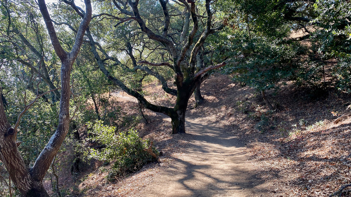
Begin your hike at the Castleridge trailhead, heading west on the Courdet Trail. The moderately wide dirt trail gets down to business, gaining 1,000 feet over the next two miles: the majority of your elevation gain on this hike. After 0.7 miles, the trail transitions to partial shade. Black oak and California bay stretch beside the trail, with sagebrush, sticky monkeyflower, and ferns in the underbrush. Steller’s jays and dark-eyed juncos flit through the canopy. If you’re out quite early, you may see wild turkeys tip-toeing and bunnies foraging. Eastern vistas of Mount Diablo, Altamont Pass, and Pleasanton appear through windows in the trees.


Reach the top of the ridge at 2.0 miles and turn left onto the Ridgeline Trail. In 300 feet, make a quick right to stay on the Ridgeline Trail. Descending west, the trail dips under coast live oak and California bays. That’s Sunol Ridge across the canyon to the west, several hundred feet higher than Pleasanton Ridge. In between them, where you’re headed, is Kilkare Canyon.


In a short 300 feet, you’ll turn right to stay on the Ridgeline Trail.

Sunol Ridge rises to the west of Pleasanton Ridge, with Kilkare Canyon in the middle.
Seasonal Creeks and Shade
Turn left onto the Shady Creek Trail at 2.6 miles. The smell of bay trees wafts beside a seasonal stream as you continue descending. The streams have water in the winter and spring, but tend to dry out by mid-summer.


At 3.1 miles, turn left onto the Sinbad Creek Trail, heading south. This is the shadiest part of the hike, cool and refrigerator-like in Kilkare Canyon. The trail is wide, mostly flat, and still gently descending. Beside it is Sinbad Creek, a seasonal creek that is a tributary to Alameda Creek. Lace lichen dangles from tall oaks above airy thickets of poison oak.


From left to right: valley oak, black oak, and California bay on the Shady Creek-Sinbad-Bay Leaf Trail loop
Turn left onto the Bay Leaf Trail at 3.8 miles, beginning your 400-foot climb east to the ridgeline. The trail is mostly shady, hugging the edge of the ravine beside California bay. It gradually becomes more exposed and sunny as you get closer to the Ridgeline Trail.


Ridgeline and Vistas
At 4.8 miles, turn left onto the Ridgeline Trail. After 0.2 miles, just before a junction with the Schuhart Trail, make a sharp right onto an unsigned bike path. Hike 300 feet to a 180 degree panorama of Mount Diablo, Morgan Hill Territory Regional Preserve, the Tri-Valley area, Altamont Pass and windmills, and the Ohlone Regional Wilderness.


An unsigned bike path on the right leads to a panoramic vista. The Schuhart Trail junction is visible ahead.

From left to right: Mount Diablo, Altamont Pass, and Rose Peak in the Ohlone Regional Wilderness
Retrace your steps to the Ridgeline Trail, continuing north. A view of Mount Diablo is icing on the cake as you close your loop.


Mount Diablo from the Ridgeline Trail
At 5.4 miles, turn right into the Courdet Trail, retracing your steps back to the Castleridge trailhead. Enjoy the partial shade and oak-framed views of Mount Diablo on the way down.


Tags: Castleridge trailhead, dog-friendly, East Bay Regional Parks, Mount Diablo, Pleasanton, Pleasanton Ridge, Pleasanton Ridge Regional Park, Sunol Ridge, wildflowers, wildlife