Here’s an absolute treat for fans of alpine lakes and glacial basin: A long loop that gains a reasonable amount of elevation while stopping at over a dozen different lakes. This route, informally known as the “20 Lakes Basin” samples lakes on both sides of Lundy Pass, which divides the Lundy Creek and Lee Vining Creek watersheds. Along the way, you will sample lakes of all shapes, sizes, and characters set against the backdrop of the Sierra Crest on the Yosemite National Park border.

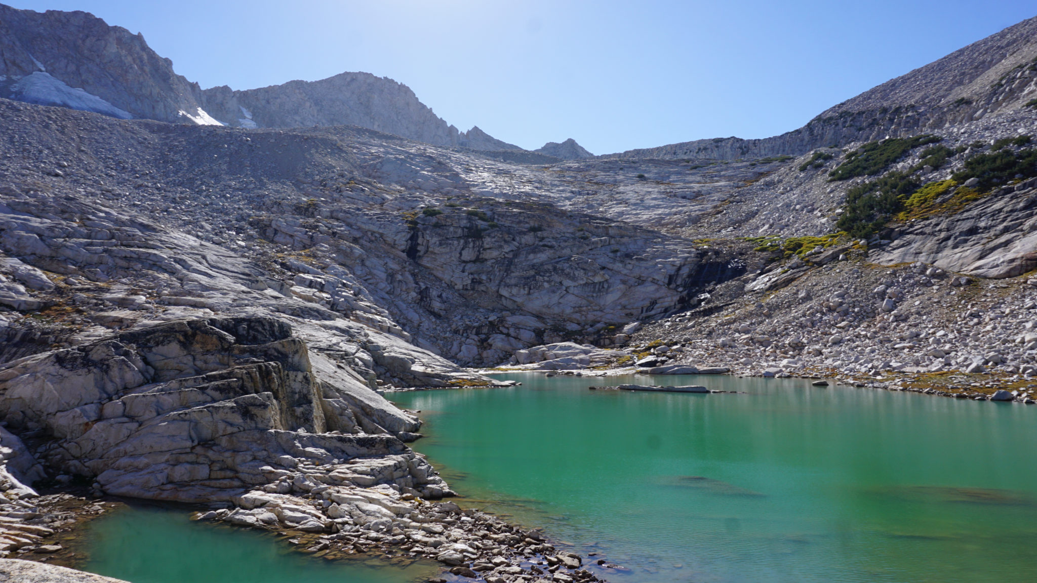
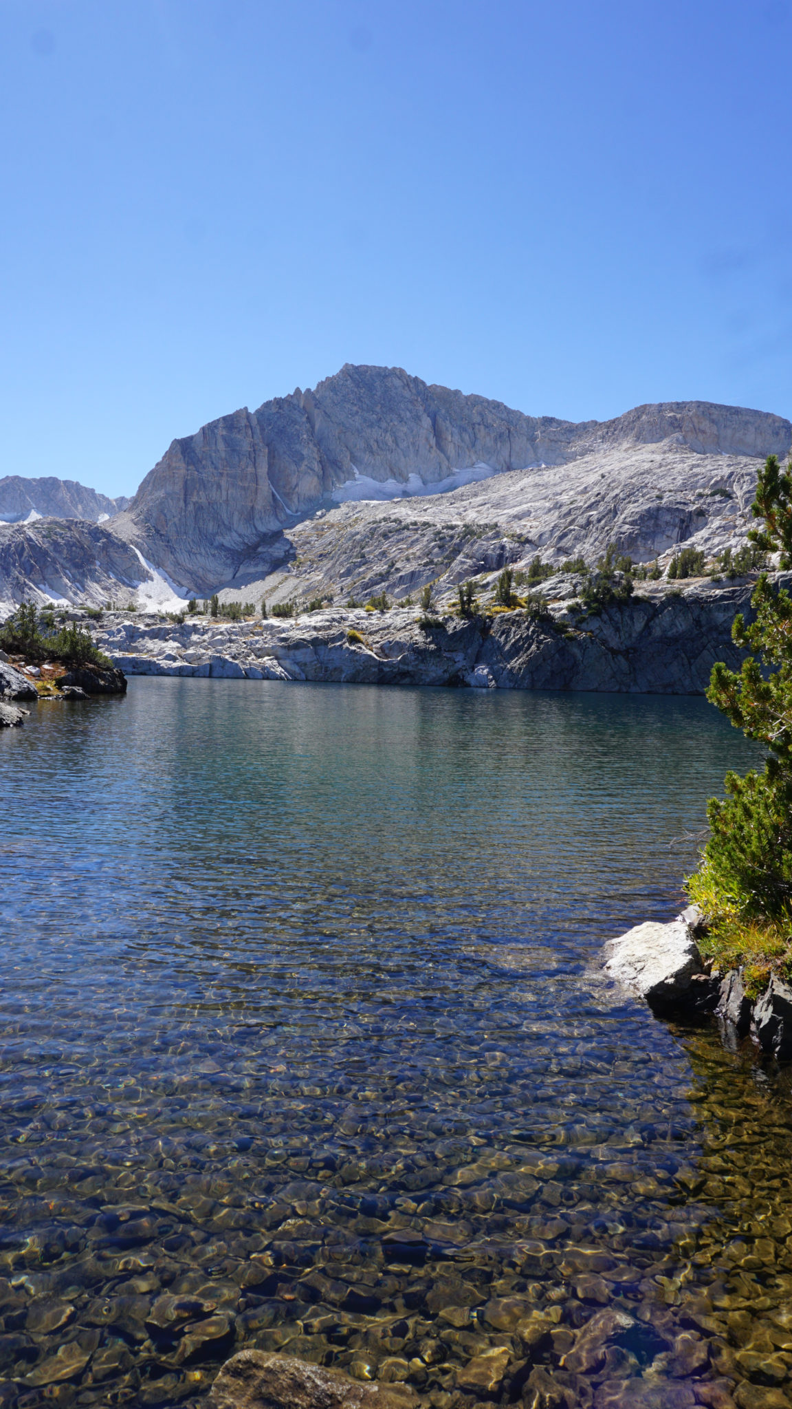
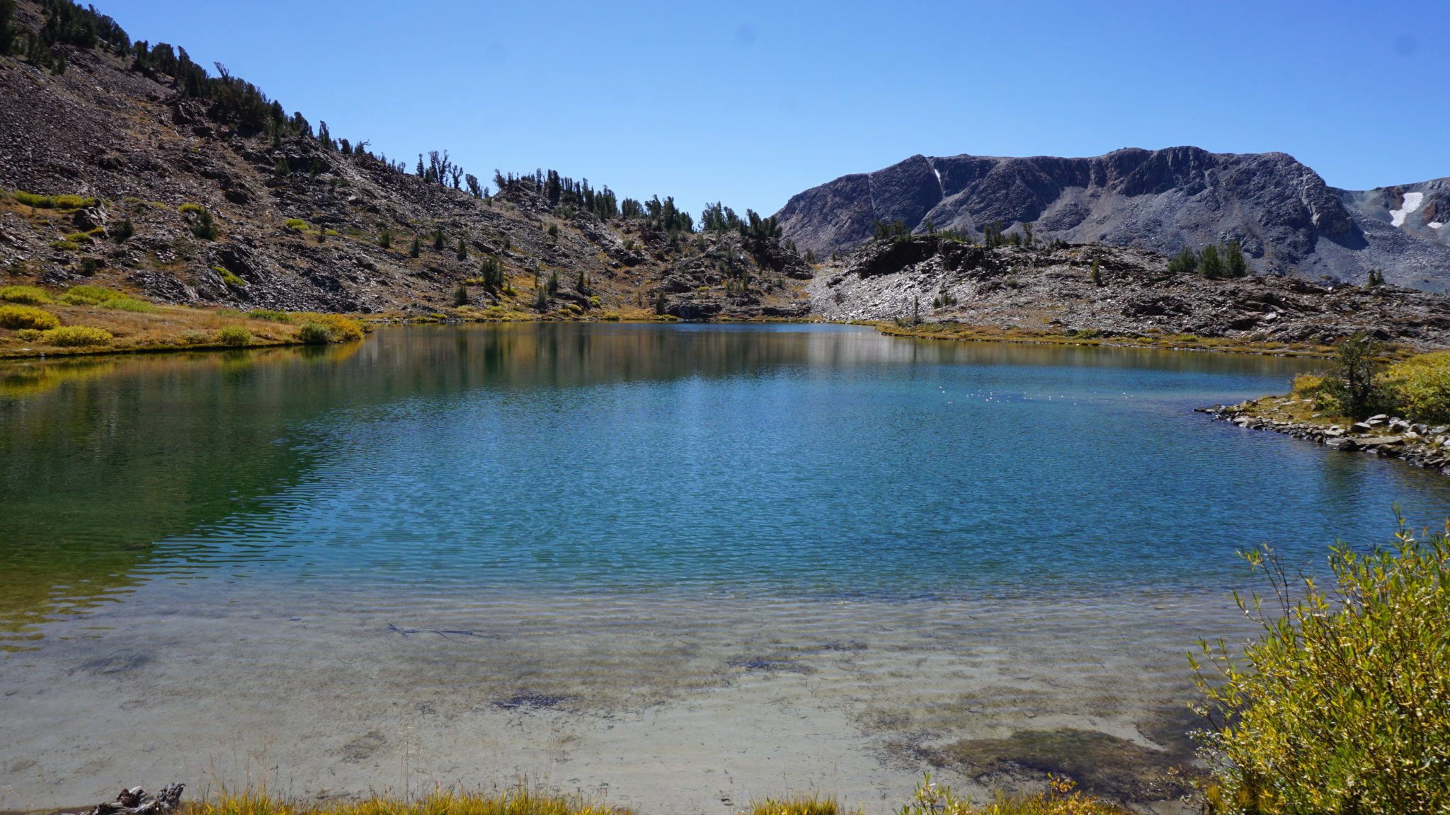
The third Conness Lake
In this write-up, I’ve combined the traditional 20 Lakes Basin route with the semi-cross-country route to the Conness Lakes. You can take the entire route as a full-day odyssey, or you can approach 20 Lakes and Conness Lakes as separate hikes. Either method of exploring this area will yield satisfying results as there aren’t a lot of lake basins that are this easy to access and this relatively easy to explore.
Red Tape for the 20 Lakes Basin
If you are interested in backpacking, you will need to obtain a permit from Inyo National Forest in advance of your hike. Permits for the Inyo are available through this website on Recreation.gov, which allows you to select your start point, your dates, and the length of your trip while paying for the permit online. The only other step after that is to pick up your permit on the day of your trip from the nearest Inyo N.F. visitor center, which for reference is the Mono Basin National Forest Scenic Area Visitor Center in Lee Vining. There’s currently no quota for the 20 Lakes Basin, but it’s still a sensible strategy to plan ahead.
All of your backpacking will need to occur within the Hoover Wilderness. The Hoover Wilderness abuts the Harvey Monroe Hall Natural Area, which operates as a sort of living research lab studying that contains the Conness Glacier and the Conness Lakes. Hall Natural Area is open for day-use only, which means you won’t be able to camp at any of the Conness Lakes.
Trail Description: Saddlebag Lake and 20 Lakes Basin

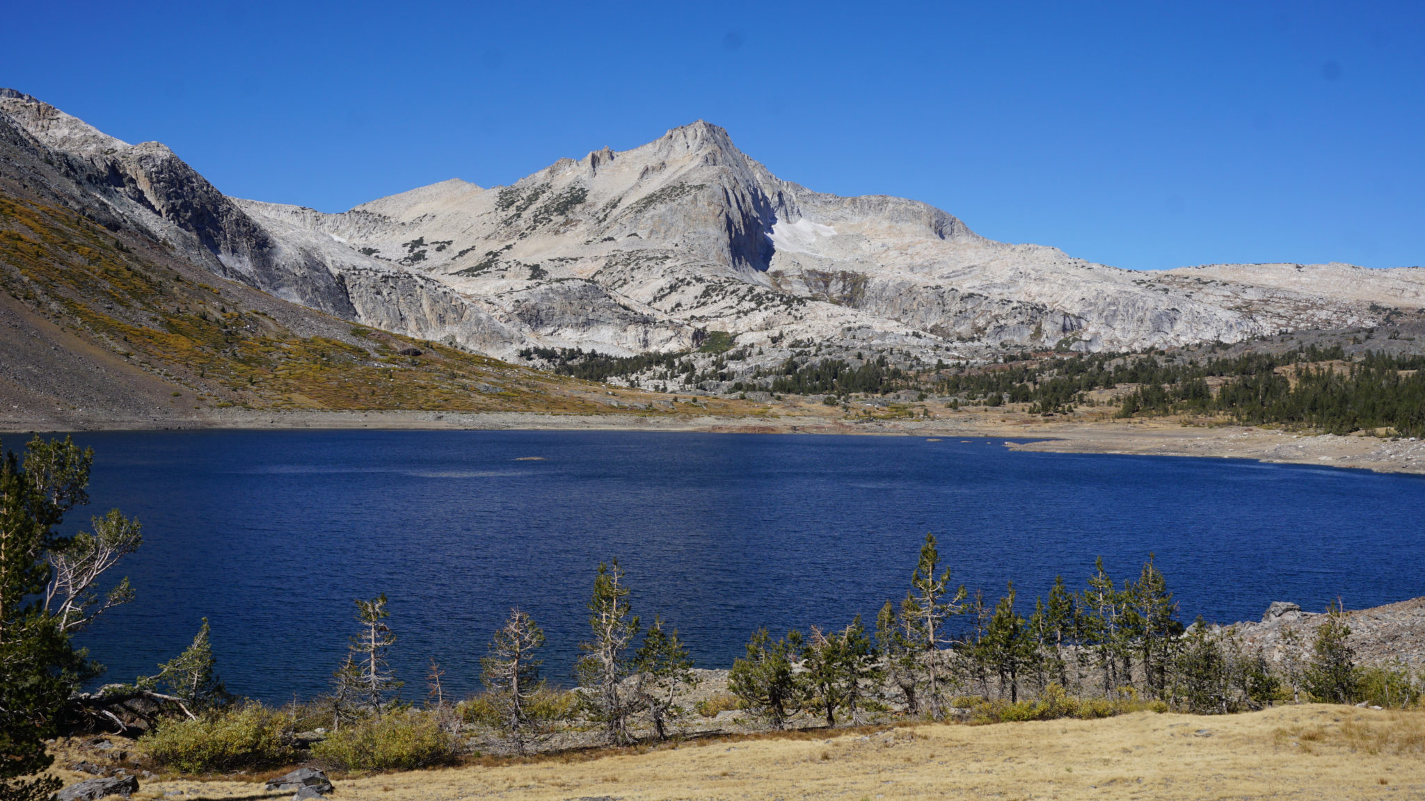
Saddlebag Lake and North Peak
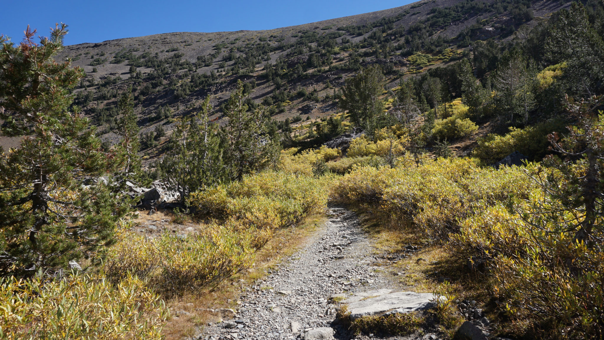
After parking in the Saddlebag Trailhead parking lot, walk down toward the dam, and keep right to find the beginning of the Saddlebag Lake loop. You can loop Saddlebag Lake either clockwise or counter-clockwise, but the counter-clockwise approach gets the longer segment of the loop around the trail out of the way. This enables a shorter return from Greenstone Lake on the back end of the hike. The trailhead lies just to the east of the Saddlebag Lake Resort and boat ramp. Follow the trail on a mostly level, rocky arc through numerous thickets of spring-fed willows that turn gold during fall. After the trail completes its arc, continue heading north, paralleling the lake shore about 50-150′ above the water. You’ll enjoy views toward the Sierra Crest, crowned by North Peak until the 1.4 mile mark when the trail enters a forest of whitebark and lodgepole pines.

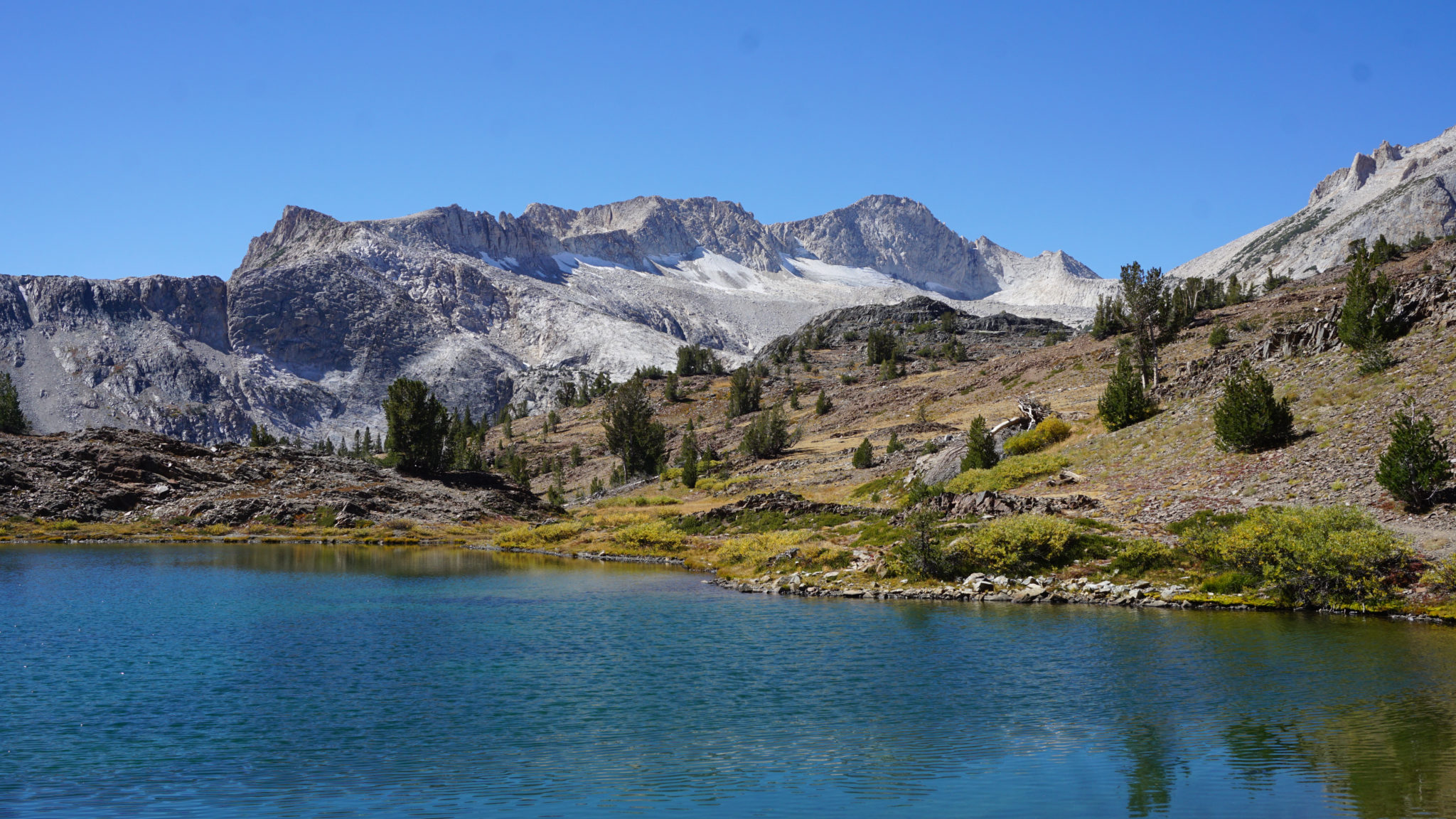
Hummingbird Lake and Mt. Conness (highest point, center-right)
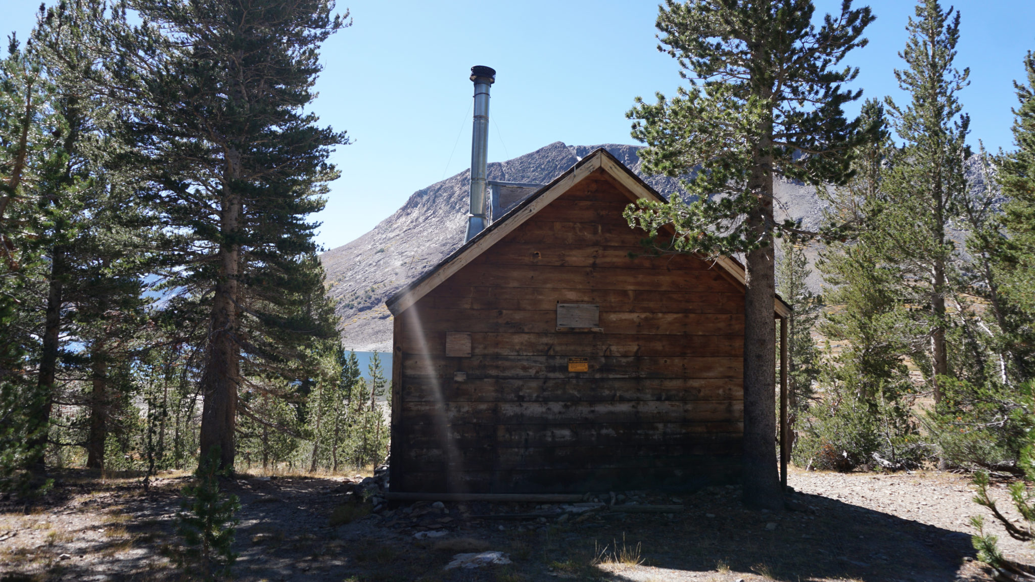
At 2.1 miles, keep your eye out for the old ranger station as well as an informal path that wanders down the banks of the lake. Directly opposite this informal trail, look for a somewhat obscure, beat-up (as of 2018) sign that indicates Lundy Pass. Turn right at this signed junction, and begin a moderate climb out of the forest toward Lundy Pass. After 0.5 mile of moderate climbing, the trail reaches an informal path leading left to grassy Hummingbird Lake, your second lake on the loop. You can follow the informal path around the banks of the lake to take in a nice view of Mt. Conness rising up above the water.

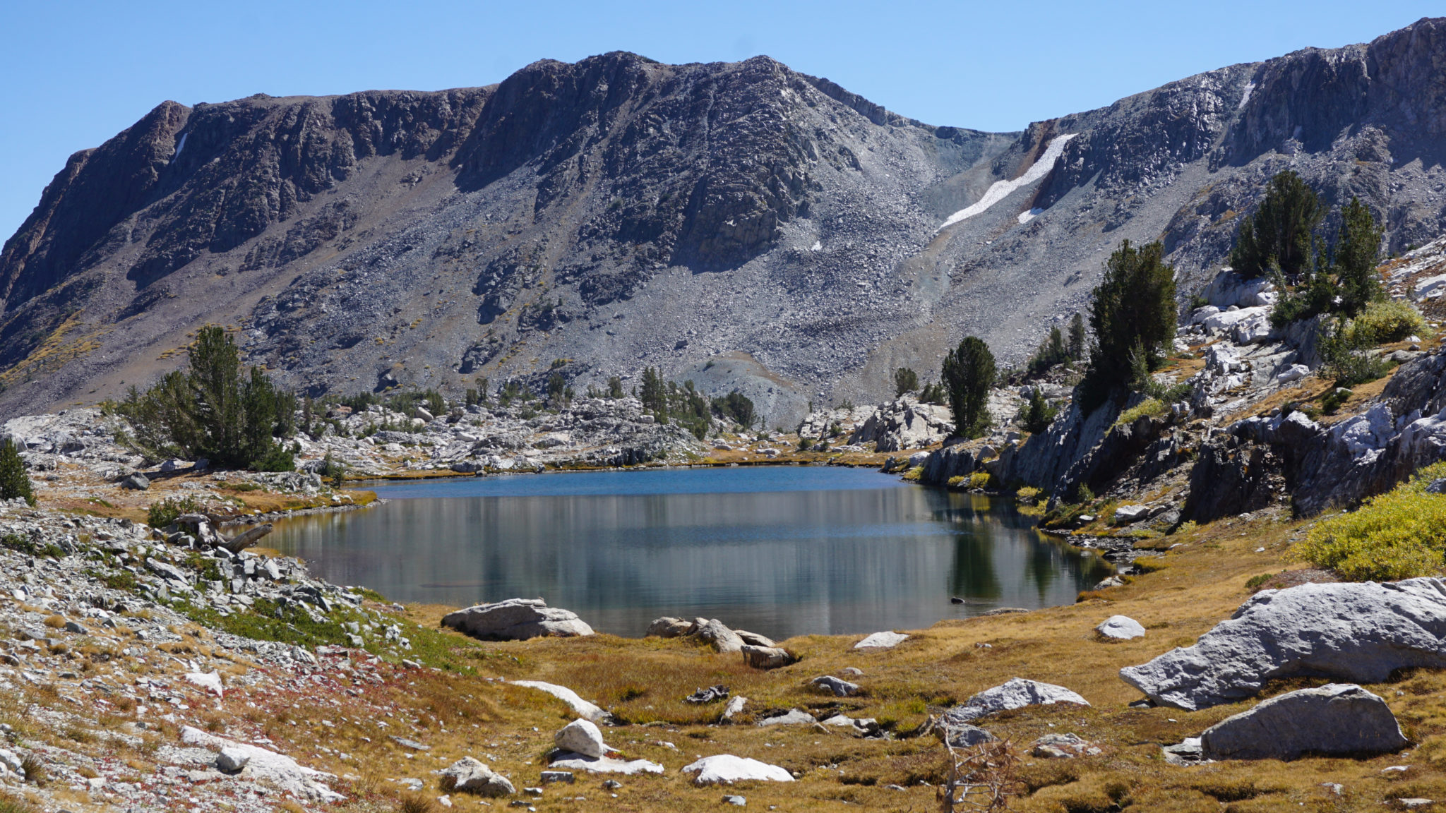
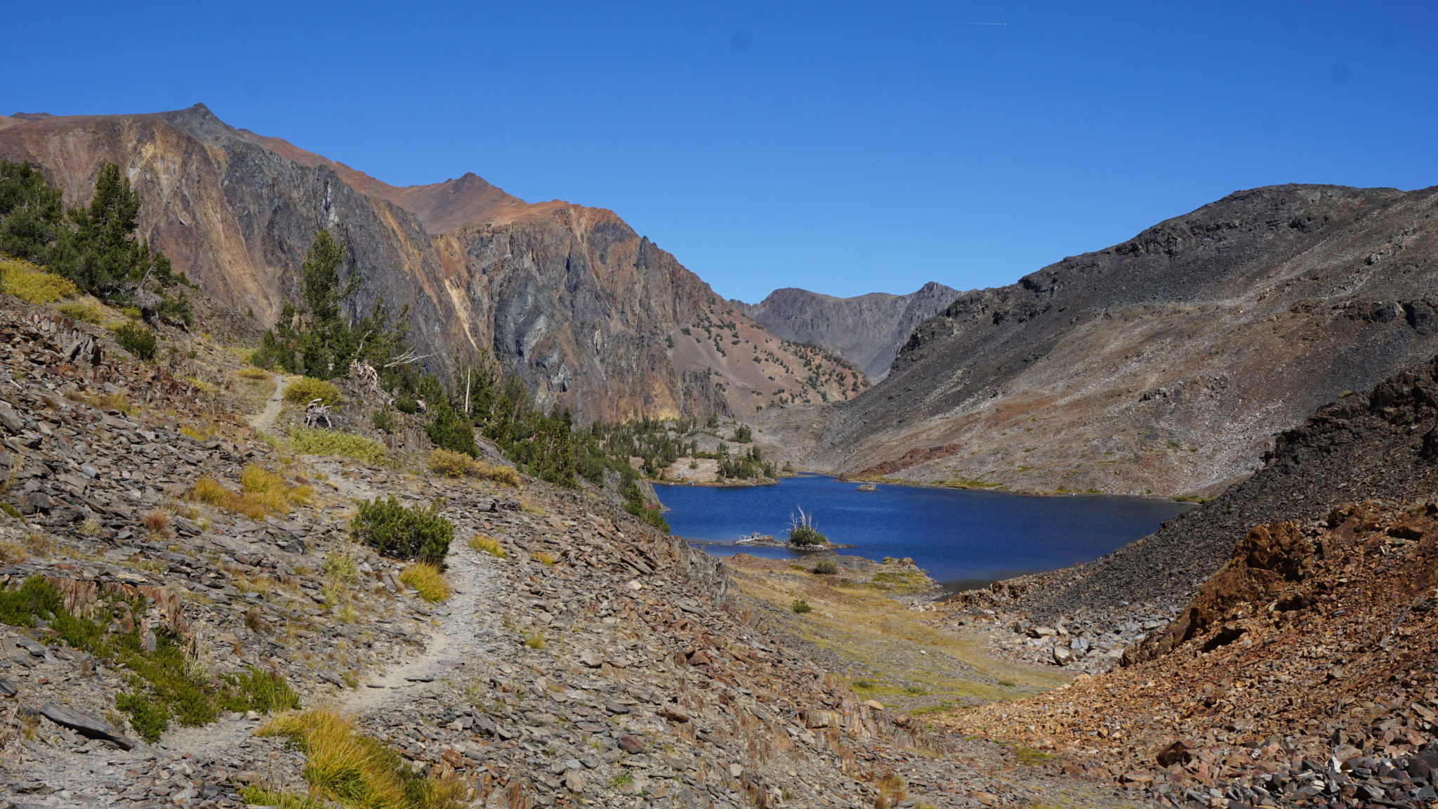
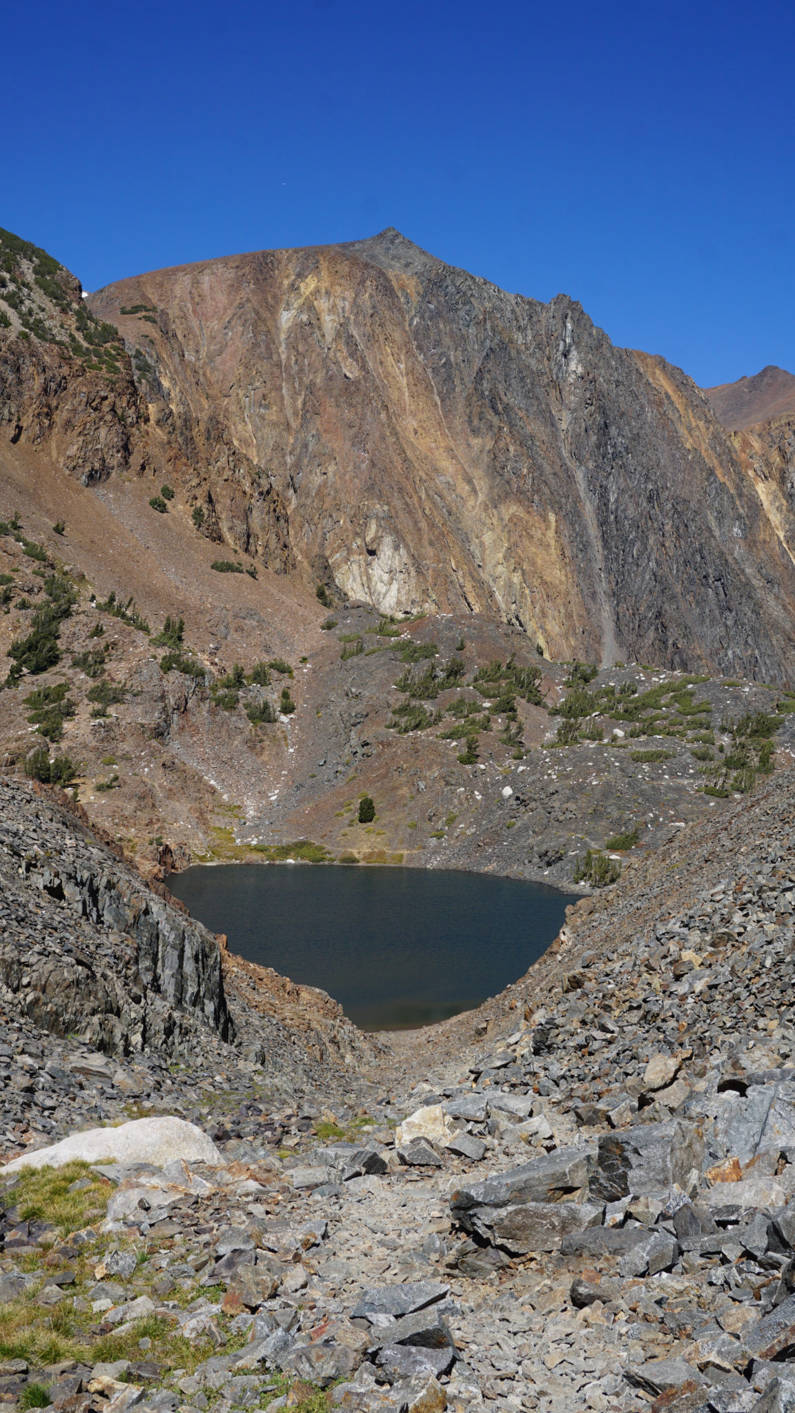
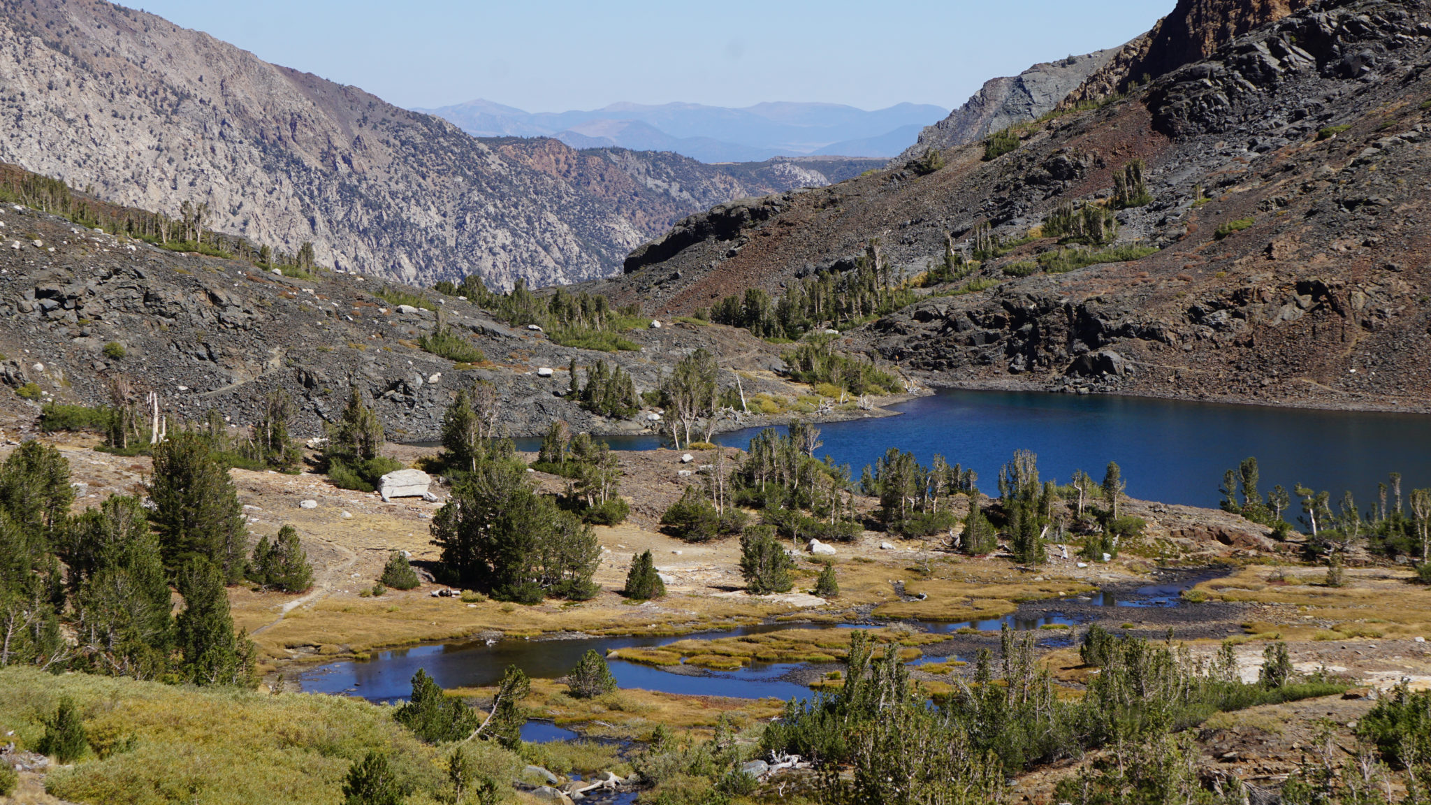
Odell Lake and beyond toward Lundy Canyon
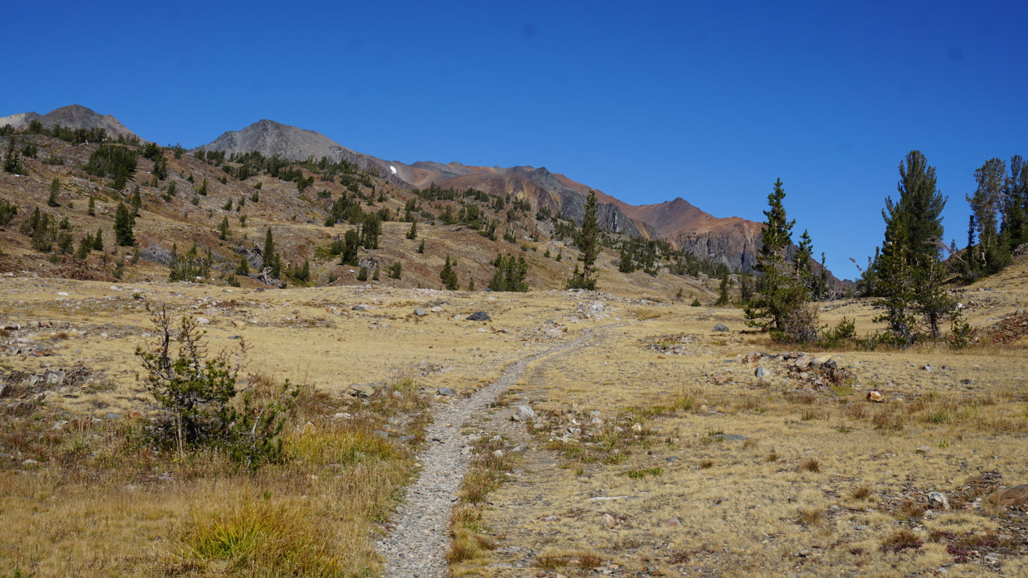
Climbing continues until 2.8 miles, at which point you crest Lundy Pass and begins a rocky descent toward Odell Lake. Sierra aficionados may notice that the landscape looks a bit more colorful than the usual Sierra high country. A huge region of rust red metamorphic rock dominates the landscape from Lundy Canyon south toward Bloody Canyon near the June Lakes Loop. This “painted” Sierra landscape is a refreshing change from the typical light gray Sierra granite, although the rock, especially the scree, can become quite jagged.
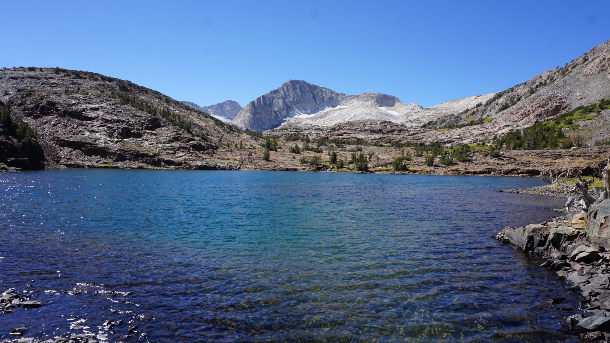
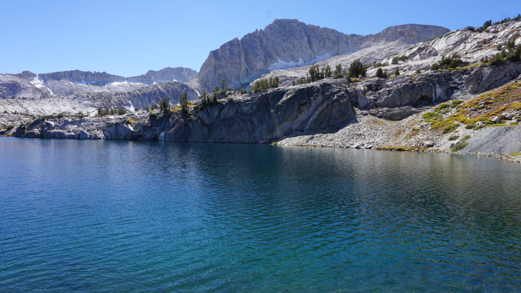
Lake Helen and North Peak
You’ll discover just how fun the scree is as you skirt by Odell Lake at 3 miles and begin a rough descent along a vague trail through a steep ravine toward Lake Helen. Loose rock dominates under foot all the way to Lake Helen at 3.6 miles and beyond. Lake Helen, the northernmost point on the route, is a great place to stop and take a break as it marks the end of your descent from Lundy Pass and the beginning of a second ascent up to Steelhead Lake. It’s also one of the prettier lakes on a loop full of pretty lakes.
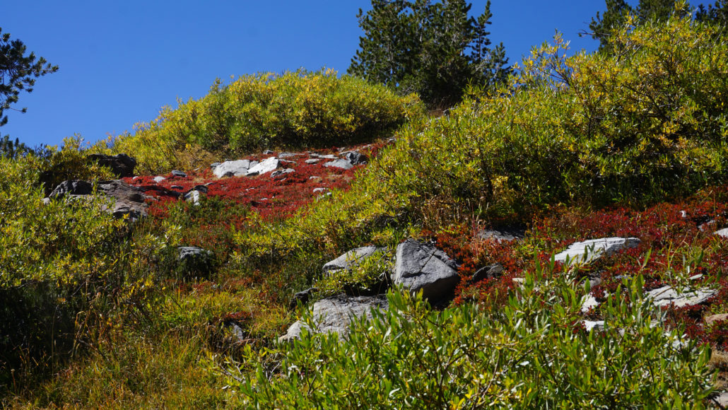
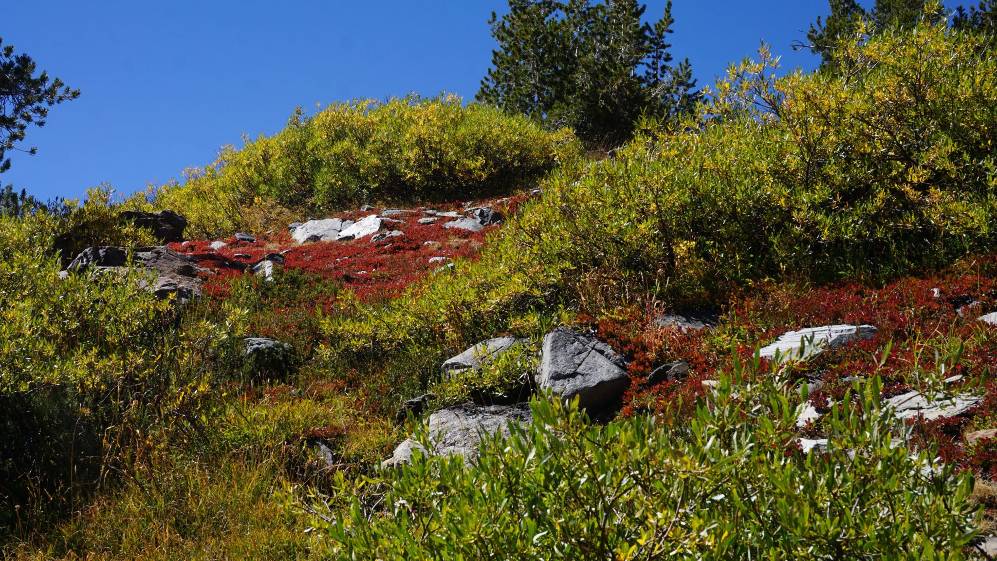
Fall color
If you want to poke around a bit near Lake Helen, you can follow the trail to Lundy Canyon a short distance toward a rocky outcrop that will let you gain a partial view into Lundy Canyon. You may be tempted to consider following the windy, scree-lined trail down to the canyon, but having attempted the trail up from the canyon, I can assure you it’s a brutal hurt-fest set aside specifically for the determined. Not worth the effort in my humble opinion.
Shamrock Lake with North Peak to the right
To continue, cross Lundy Creek at Lake Helen’s outlet, and begin a moderate climb over a marshy moraine laced with waterfalls and meandering creeks as you climb up toward your next lake, Shamrock Lake. Shamrock Lake’s multiple bays, islands, and inlets set beneath the gaze of North Peak.
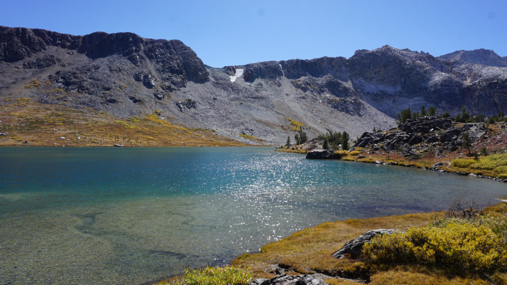
Steelhead Lake and our old friend, North Peak
Continue along the bank of Shamrock Lake as you climb to a three-way junction perched between Steelhead Lake and a small, unnamed lake at 4.5 miles. At this junction, you can turn right to follow the end of an old mining road toward the Hess Mine. Even if you don’t make it to Hess Mine, a short stroll along this road reveals some of the best views across Steelhead Lake and the now familiar, nearly ubiquitous presence of North Peak.

Wasco Lake
After checking out the view on the mining road, backtrack to the junction and continue on what is now an abandoned mining road that will loop around a knoll before hugging the bank of Steelhead Lake, heading southeast toward Wasco and Greenstone Lakes. The signage here is pretty poor, so you may have to think your way through a couple of vague informal trails. Just keep in mind that the path you want is the former mining road, which is very obviously an old road and not a single-track trail.
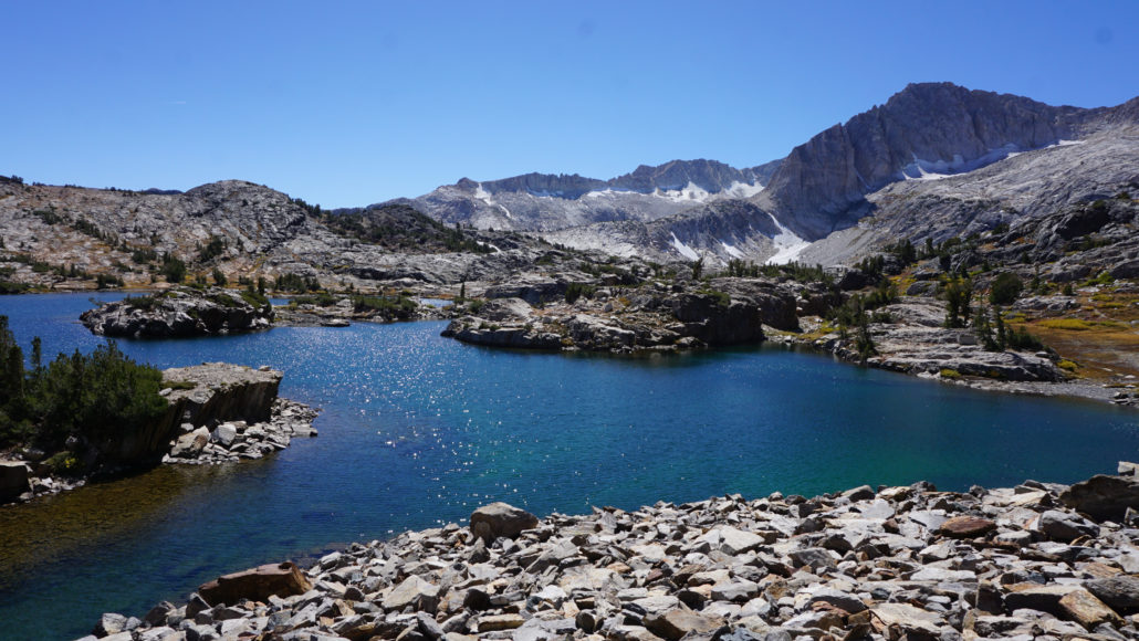
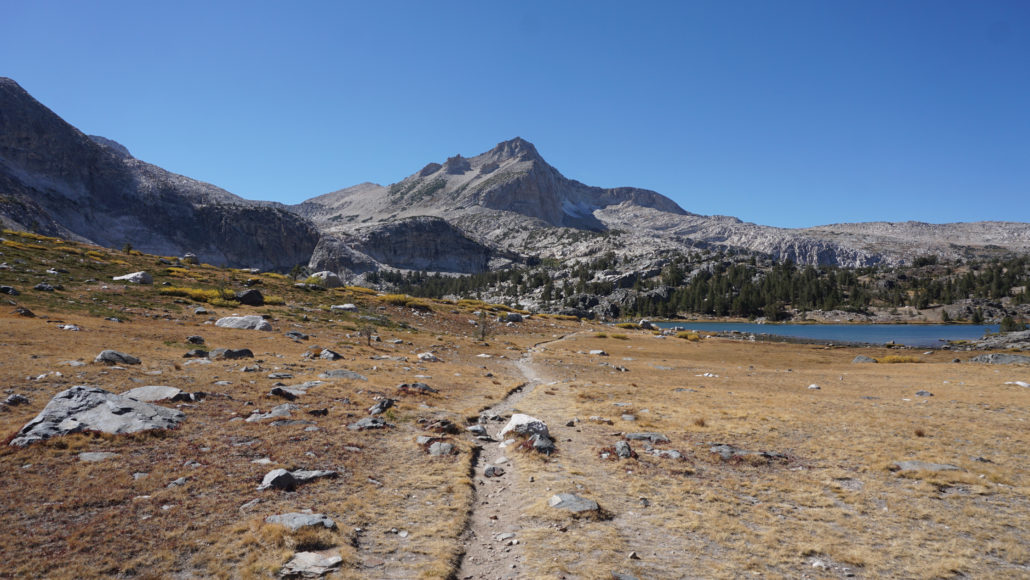
The north shore of Greenstone Lake
After reaching the outlet for Steelhead Lake at 5.0 miles, continue past a junction that connects to a loop that separates from the mining road to reach a few campsites on higher ground between Steelhead Lake and Wasco Lake. This loop trail rejoins the mining road just before reaching Wasco Lake at 5.25 miles. Just past Wasco Lake, the mining road crests a second divide (5.4 miles) that separates the Lundy Creek and Lee Vining Creek watersheds.
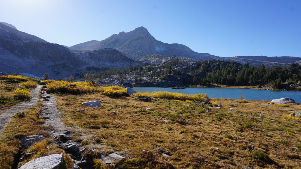
South shore of Greenstone Lake and North Peak
From this divide, the road begins a descent toward the second-largest lake on the route, Greenstone Lake. After a 0.6 mile descent, the mining road reaches the northern end of Greenstone Lake. You’ll find an unmapped informal trail that leads around the northern shores of the lake toward the informal trail accessing the Conness Lakes. A second informal trail leading to the eastern banks of Greenstone Lake lies ahead at 6.2 miles. These junctions are all unsigned, and it’s possible to confuse this trail with the main trail back to the Saddlebag Trailhead with another informal trail that descends to the lake shore. You may have to commit a bit of trial and error exploration here (I certainly did). You’ll know you’re on the right track when you find yourself heading south and toward an unmarked, unmaintained trail that leads north to the Conness Lakes at 6.5 miles.
If you’re skipping the Conness Lakes, continue through this junction and follow the increasingly rocky and uncomfortable trail south along the western shores of Saddlebag Lake. At 7.7 miles, turn left to cross over the dam, and follow the service road back to the parking area for the Saddlebag Trailhead.
Trail Description – Conness Lakes
You can take the trip to the Conness Lakes as a side-trip to the 20 Lakes Basin route or as its own hike. There’s a pretty steep bit of cross-country climbing involved, so if you feel pretty cooked after the 20 Lakes, you may want to skip it and come back after a break or a good night’s sleep. Taken on its own, the Conness Lakes will run you 6.2 miles with about 1,200 feet of elevation gain. Note that I write these directions as if you are tacking this route onto the 20 Lakes Basin, which allows you to avoid hiking the 2.8 mile stretch of trail along the western shore of Saddlebag Lake twice (this section of trail sucks thanks to the rocky footing, so you’re welcome).
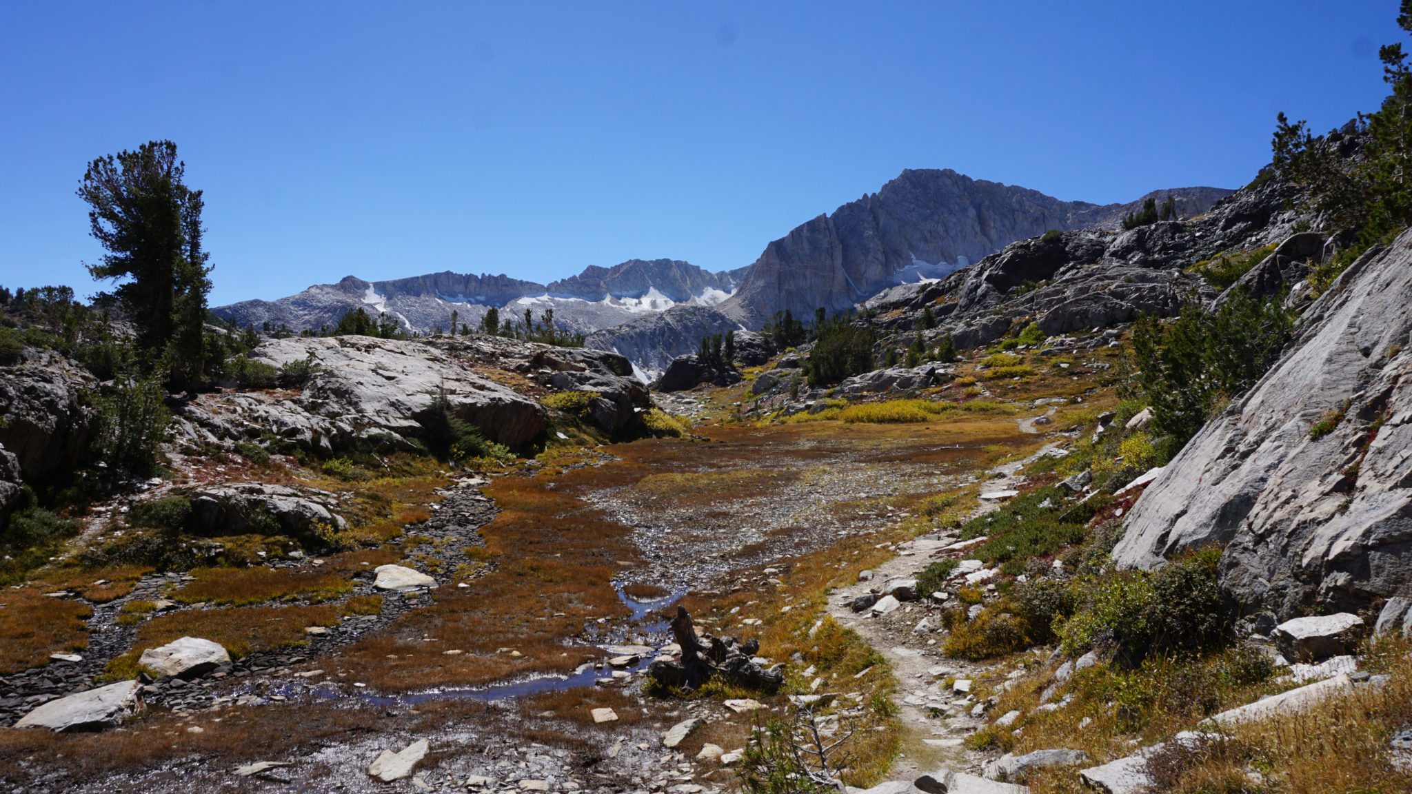
The trail to the Conness Lakes
From the unmarked junction southeast of Greenstone Lake, turn right and head west along the southern shore of Greenstone Lake. Mt. Conness looms invitingly above the lake shore as you progress. Once you reach the end of the lake, cross the lakes inlet creek, and continue along the informal path as it wanders into the forest. The trail begins to climb on a rocky, unmaintained, and occasionally vague path that crosses into the Hall Natural Area as it climbs a steep slope to narrow meadow threaded by the meandering creek at 7.3 miles.
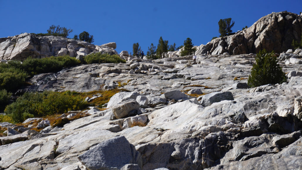
The cross-country climb
The second, and more difficult chunk of climbing follows a very tough to identify trail as it works up granite slabs. You may have more luck just working across country up these slabs since the trail is harder to follow on the ascent (and easier to identify on the descent). Look for a waterfall spilling the contents of the creek draining the Conness Lakes over a 50-foot cliff. You’ll want to aim for a spot just to the right of this waterfall. Once you crest that spot, you will be able to locate the continuation of the path as it continues southeast into the glacial basin containing the quintet of Conness Lakes.
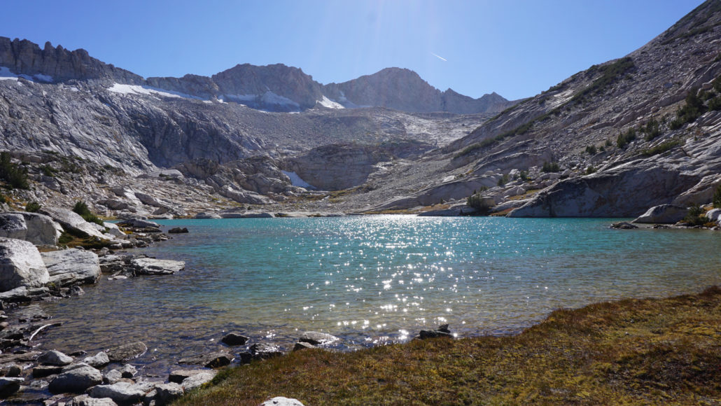
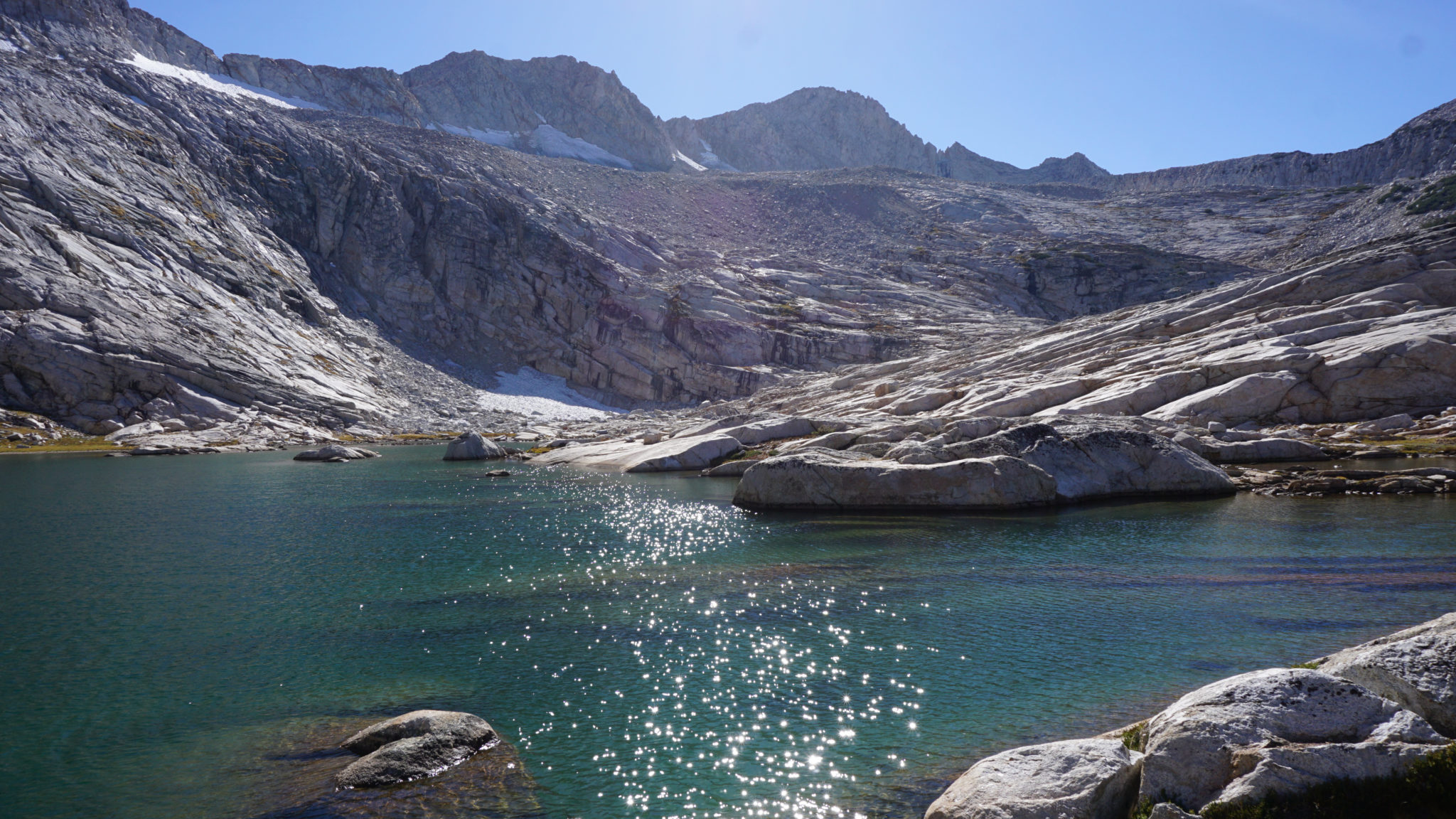
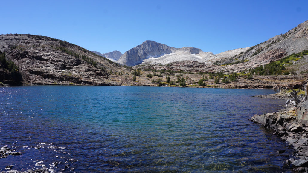
Second Conness Lake
There are actually a few different informal paths, which makes the going challenging if you’re expecting to follow a footpath. If you land on the trail that runs north of the creek, you will follow it to an isthmus that divides the first small lake and the larger second lake. Pass between the two lakes and continue nearly south along the southern lake. At this point, you can continue south and up a rocky slope to the 3rd and 4th lakes to the south. The Conness Glacier directly feeds the 4th lake, which gives it a milky, green-blue appearance. Reaching the fifth and highest lake requires that you turn west from the 3rd lake and commit to a cross-country climb over granite slabs.
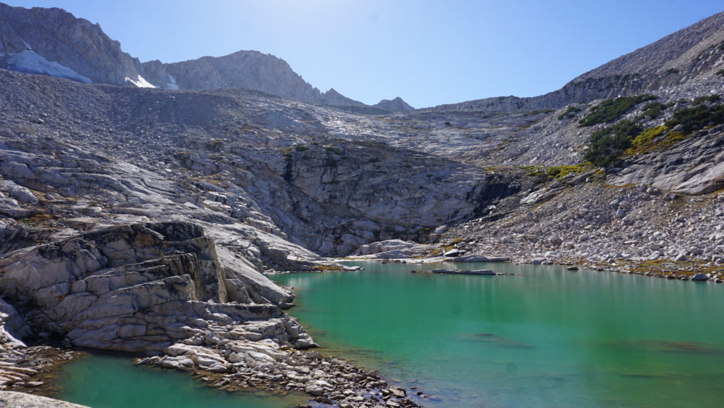
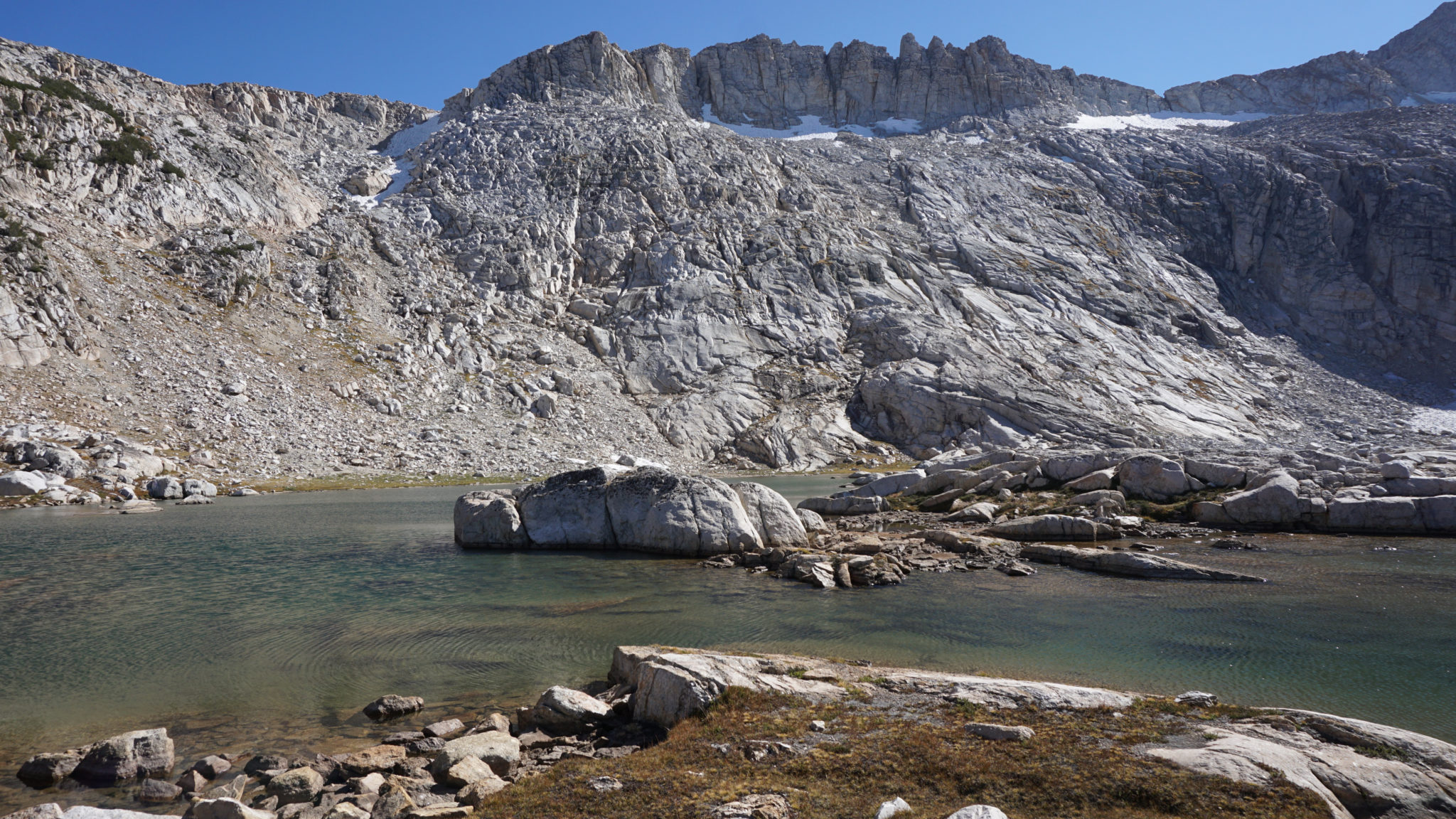
Fourth Conness Lake
Turn around wherever you like here. Each of the lakes are beautiful, and I actually liked the second one the best. You can spend a lot of time scrambling and poking around in this basin, although you probably will be rather exhausted from this if you’re combing the route. Either way, conclude your hike by retracing your steps to Greenstone Lake, and follow the trail back to the Saddlebag Trailhead to conclude your hike.
Tags: 20 lakes basin, Conness Lakes. Hummingbird Lake, Greenstone Lake, Hall-Monroe Natural Area, Hoover Wilderness, Inyo National Forest, Lake Helen, Lee Vining Canyon, Lee Vining Creek, Lundy Canyon, Lundy Creek, Lundy Pass, Mt. Conness, Odell Lake, Saddlebag Lake, Saddlebag Lake Road, Shamrock Lake, Steelhead Lake, Tioga Pass, Twenty Lakes Basin, Yosemite National Park