Over the long weekend, I had a chance to head back to Point Mugu State Park to see how the area had fared after the Springs Fire. Starting on May 2nd, the fire burned over 24,000 acres – and from the burn area maps released, it looked like virtually ALL of Point Mugu State Park was on fire.
Before the long weekend, officials in the Santa Monica Mountains and Point Mugu made the surprise announcement that ALL of the trails in the park were re-opened and I’ll say that my first impression was that it’s going to take some time – but I think the area will recover nicely.
When I first entered the park, one of the things I noticed as much as what was burned was what wasn’t burned – firefighters did an excellent job of keeping the fire away from the Satwiwa Nature Center and looked like they used the trails between the center and the trailhead as their border. On one side, everything is burned – on the other, lots of green.
The other thing I noticed immediately is that the park is REALLY doing its best to make sure you know what’s going on there – right at the entrance at Via Goleta, there’s a large sign informing visitors that the park is, indeed open – but that access may be restricted to certain routes.
Similar signs are posted near the parking areas and entrances to the park. It’d be really, really hard for someone to wander into the area and not know what the rules are.
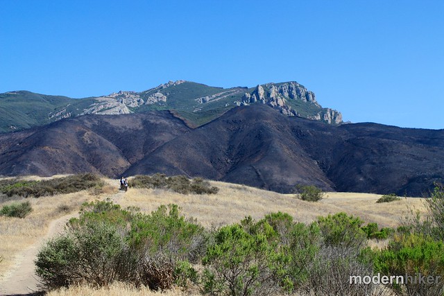
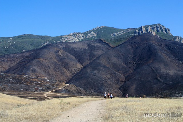
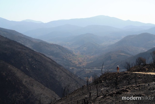
Looking toward Boney Mountain, I was struck at the different view – some of the grassland in Rancho Sierra Vista is still there, while other sections have been charred completely black. Looking up at the mountain, you can see the thick burn area that, thankfully, didn’t make it to the mountain itself.
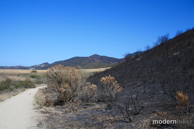
Sycamore Canyon – known for the lush, green canopy over the intermittent babbling brook – has been drastically altered. While pockets of leaves remain, most of the landscape is charred beyond recognition – especially in the Upper Canyon. Looking further downstream, it appears that areas closer to the water escaped with the least damage – although many trees were still singed and may not recover.
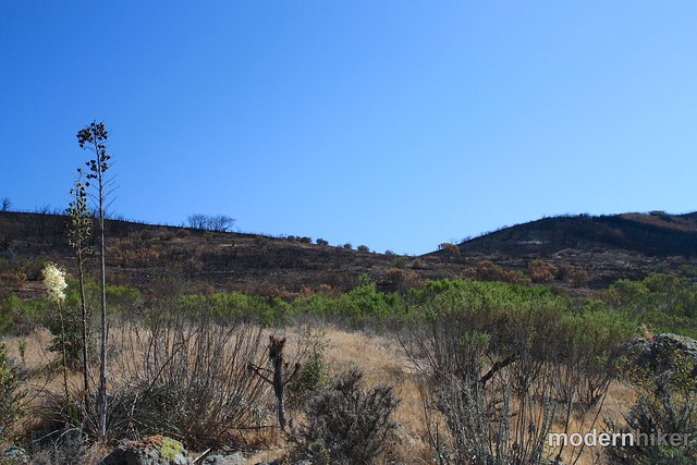
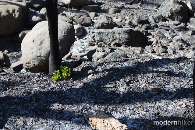
There is good news, though – only a few weeks after the fire, many yuccas had already started to re-sprout from their crowns and some grasses and small plants had begun pushing up from the devastation, too.
I was also heartened to see just how many people were out enjoying the park even in its burned state. There were lots of hikers and bikers out – some just to take pictures, some intent on enjoying their favorite trails anyway, others there with kids using the opportunity to show them how SoCal landscapes are affected by burns.
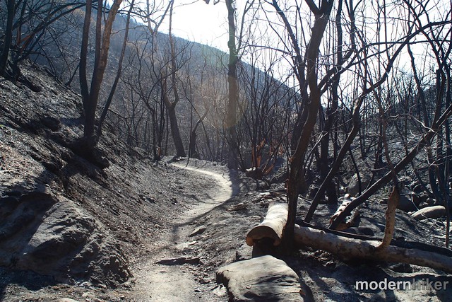
If you were thinking about heading out to Point Mugu for a hike, know that the trails are still in remarkably good shape. Other than a few areas of loose soil, crews have already done an excellent job of removing most of the large trail obstacles and keeping footpaths passable. From what I saw, anything that’s off-limits is very clearly marked as such.
Know that a lot of what you may have loved about this park is gone – for now – but what remains is an invaluable opportunity to see, up close and personally, how a landscape recovers after a wildfire.
For more photos of the Springs Fire Burn Area, here’s a Flickr slideshow of my images.
Tags: burn area, Hiking, Los Angeles, photos, Point Mugu State Park, springs fire, Sycamore Canyon, ventura, Video