Many High Sierra hikes, especially those on the eastern side of the range, come along with some pretty brutal climbing. After all, the eastern side of the range is an escarpment that can drop 10,000′ from the higher summits to the Owens Valley within a short horizontal distance. The severity of the eastern side of the range means that hikers are often dragging their quads and calves well into the danger zone on grueling ascents through imposing glacial canyons.
This tends to leave the High Sierra out of the question for the casual hiker who may be neither prepared nor interested in multi-day treks or 4,000′ elevation gain day hikes. Fortunately, Little Lakes Valley at the end of Rock Creek Canyon is a relatively flat alpine valley studded with lakes set against a breathtaking backdrop of glacially scoured peaks that sits above the magical 10,000′ elevation line. In other words, at Little Lakes Valley you can get all of the beauty of the High Sierra without all of the work.
Of course, Little Lakes Valley is not a well-kept secret due to the comfortable hiking conditions and its sublime beauty. Even on an icy October morning, I encountered numerous groups of people before the clock even struck 7 AM. If you wish to backpack here at one of the many alpine lakes, I recommend reserving your permits early. You can get them up to six months in advance through Recreation.gov, which operates in conjunction with Inyo National Forest to streamline the permit process. This system allows you to peruse the dates with available permits in much the same way that you would if you were looking for campsites at your favorite campground. Of course, you’ll still need to pick the permit up at Inyo NF’s backcountry permit office, but it looks like the days of trying to fax or mail your requests are behind us – at least with Inyo National Forest (I’m looking at you, NPS).
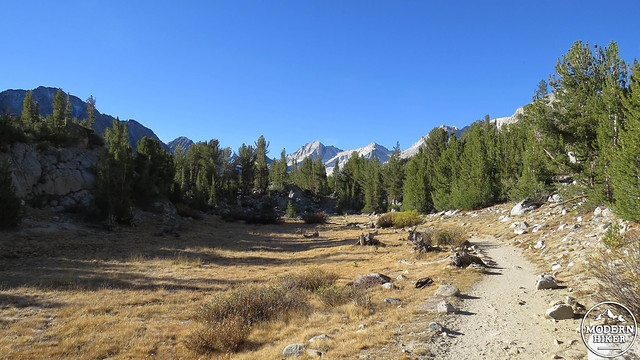
Anyhow, the trailhead for this hike starts around 10,200′, which means there is little time for acclimation if you are dayhiking. Fortunately, the elevation gain is minimal until you near Chickenfoot Lake, and even there the climbing is quite reasonable. Still, for those looking to dayhike but are also camping nearby, it may be wise to save Little Lakes Valley until the second day of your trip just to avoid any unnecessary tussles with altitude sickness.
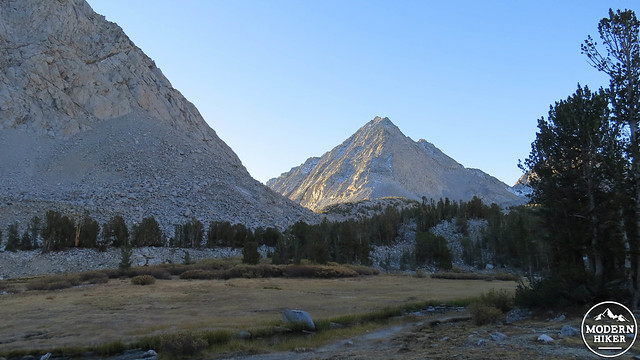
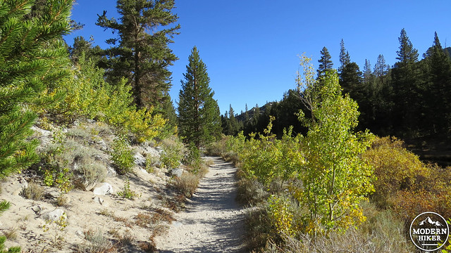
Starting from the expansive parking area for the ominously-named Mosquito Flat Trail, find the short paved access road leading past a bathroom on the right, a bridge over Rock Creek on the left, and a trailhead sign just slightly to the left of the actual trail. You will immediately commence one of the two brief stretches of climbing along the right bank of Rock Creek, gaining a manageable 250′ over .5 miles. The trail starts at the extreme upper limit of aspen forest, meaning there is a chance for some colorful foliage at the beginning of the trail during late September.
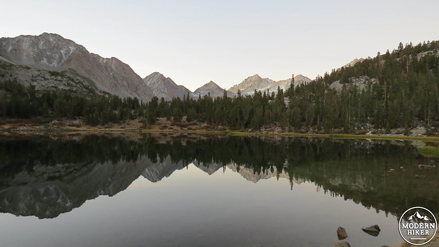
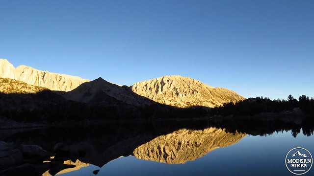
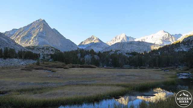
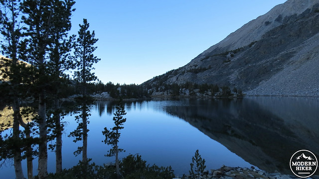
At the end of this initial climb, you will pass the signed junction for the Mono Pass Trail going right and the Morgan Pass Trail going left. Keep left to reach the lakes. Not long after, you will notice the first of the several lakes you encounter off to your left. The first, Mack Lake, is indeed little, and it does not appear that either the camping or the fishing are very good here. After another .7 miles, you will come to the second lake, Heart Lake, which is also little. You may have noticed a small body of water off to the left between the two lakes. This is Marsh Lake, and it is a bit more marsh than lake. If you follow the short access trail to the shore of Heart Lake, you will be greeted by the site of towering peaks reflecting off of the tranquil surface of the water. This is an inspiring sight whether it is seen in dawn’s inky shadows or during the height of the day.
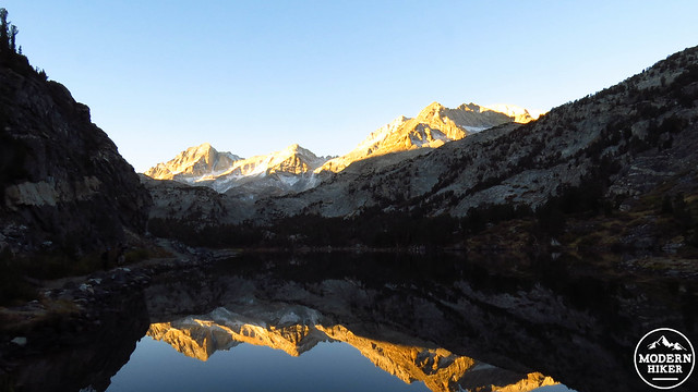
The trail wraps around the western shore of Marsh Lake before climbing another 90′ along a shelf overlooking the third lake, which is called Box Lake. You’ll enjoy a bird’s eye vantage point of this lake on your left, while the alpine scenery around you remains effortlessly gorgeous. From the southern end of Box Lake, you’ll enjoy a paltry .3 miles before the next and largest lake of the hike, Long Lake. From here, you will enjoy nearly .4 of a mile of strolling along the lake shore, where the trail hugs a small cliff to the left of the lake. Expect lovely views of peaks mirrored off of the smooth surface of the water.
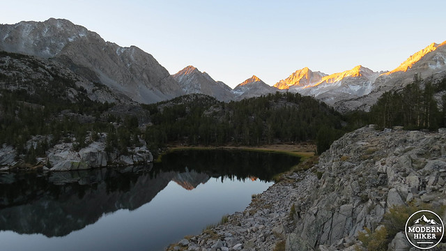
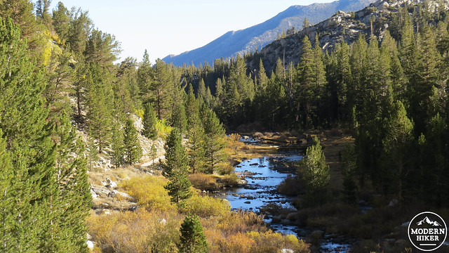
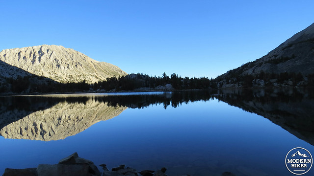
Immediately after Long Lake, the trail will begin the second portion of climbing as it gains another 250′ over the next .7 mile to reach multi-armed Chickenfoot Lake. The main trail passes but does not directly access Chickenfoot Lake. Instead, you will branch off on an access trail leading off on your left at 2.7 miles. The access trail will take you up a short rise before dropping you along the edge of a meadow through which flows a branch of Rock Creek. The trail will bend to the left and will shoot off in multiple directions toward different points along the shore of the lake. This track climbs a small rise on the south end of the lake, which comes complete with easy access to the water and a few nice camping spots.
This is the end of the line for this particular trip. You do have the option of backtracking to the main trail and turning left to continue on toward the Gem Lakes and even further up canyon toward the Morgan Lakes. Be aware that climbing will commence more earnestly after this point, so if you’re looking for an easy going hike, Chickenfoot Lake is your turnaround point. There are plenty of places to sit at Chickenfoot where you can enjoy the chilly blue waters or the reflection of peaks towering above. You will likely see a number of fisherman testing their luck and skill. It’s a very peaceful place to spend a chunk of your morning or afternoon.
After enjoying this last lake, turn around and retrace your way back to Mosquito Flats Trailhead, perhaps stopping frequently at each lake to enjoy the changes in the light or to revisit things that caught your eye on the inbound. Eventually, you will arrive back at your car, from which point you can return to where you started or perhaps even stop off to take a brief stroll around Rock Creek Lake for foliage viewing in the fall.
Tags: Chickenfoot Lake, Eastern Sierra Nevada, Heart Lake, Inyo National Forest, John Muir Wilderness, Little Lakes Valley, Mosquito Flat Trail, Mosquito Flats Trailhead, Rock Creek, Rock Creek Lake