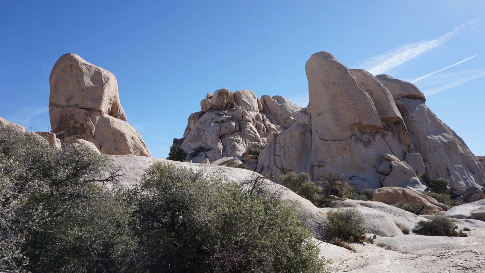
Despite its allure to the casual hiker, in-depth exploration of the Wonderland of Rocks presents a formidable challenge owing to its labyrinthine nature. Most explorations of this confusing maze of monzogranite require competent navigation skills, including solid map and compass competency in order to navigate the maze-like region. However, there are a handful of sections of the Wonderland, particularly around Willow Hole and around the Wall Street Mill, where hikers can penetrate the area a short distance to wander through a pantheon of giant rock formations, including a large rock arch tucked away in a hidden valley.
Red Tape
Aside from the entry fee to Joshua Tree National Park, there’s no permit required for entering the Wonderland of Rocks. However, because the wonderland supports a small herd of bighorn sheep, a species who survives on the margins, overnight use is prohibited to ensure the sheep can rove at night without human interruptions.
Safety

Before you even consider hiking this route, bone up on some of your traditional navigation skills. Yes, we provide a GPS track, and no doubt that can come in handy as a fallback option as you explore. However, GPS devices (app or standalone) have been known to fail, and if that happens to you in the Wonderland of Rocks, you may become lost without any clear sense of how to get out again if you don’t know how to navigate. At the very least, you should have a topographic map and compass. This link will take you to Caltopo, where you can create a customized topographic map based on this region/route. You can then download the .pdf of the map, or better yet, print it, for reference.
Although few formidable obstacles exist on this route, any cross country desert hike brings you into close contact with rough terrain, cacti, class-2 and class-3 scrambling, and even dangerous animals like rattlesnakes. On hikes like this, you’ll need to exercise a lot more awareness of your surroundings than usual. If this sounds daunting, remember the flipside: more awareness on your hike will deepen your experience.
You should also note that for about a third of the year (June to October), temperatures at the Wonderland of rocks can be extremely hot. It’s dangerous enough to hike in these temperatures on a well-marked trail, but unless you’re some freak of nature who is well-acclimated to hiking in 100+ degree temperatures, stay away from this route unless it’s 85 degrees or lower.
The Route
Before I get into the description, dust off your topo (or pull up Caltopo) so that you can follow along. I base all of the descriptions off of features on the topo map, which I’ve marked with waypoints/markers for reference. Those features are the primary “sign posts” that will help you along the way.
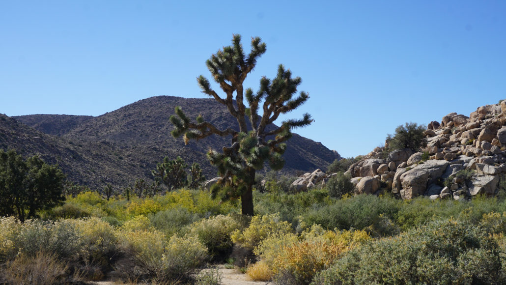
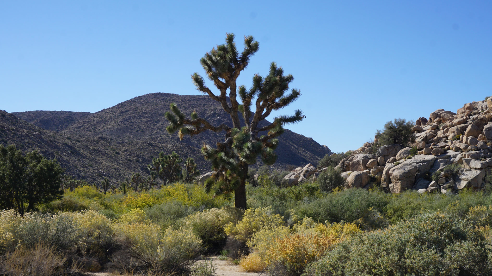
Kick off the route by following the wide, well-traveled former dirt road leading toward the Wall Street Mill. Continue through dense Joshua Tree forest occupying the west end of Queen Valley hemmed in by the Wonderland of Rocks on your left and a series of unnamed peaks on your right. After a mere 50 yards or so, turn right toward the Wonderland Ranch ruins. The decaying crumbling structure memorializes a long-gone homesteading family with a penchant for pink architecture, and it’s worth poking around for a few minutes before you leave the security of marked trails for cross-country wandering.

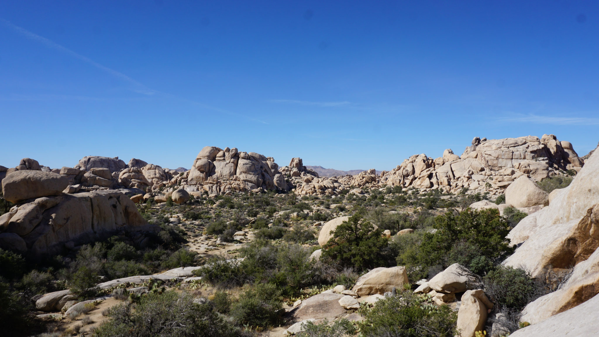
Head west on a use path that dips into a dense thicket of live oaks and follow it 30 yards until it connects with the wash, which is sometimes informally referred to as Wonderland Wash. Turn right/north into this wash, and begin following the sandy wash surface into a narrow canyon hemmed in on both sides by Joshua Tree’s characteristic monzogranite formations. You can follow the wash faithfully, or you can follow the occasional informal path branching off of the wash for short distances. The sandy surface of the wash can be a bit tedious at times, and the surface of the informal paths makes more comfortable watching.
The Astrodome
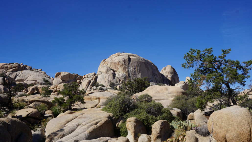
As you continue through the wash, occasionally in the wash and occasionally on formal trails, progress through numerous memorable rock formations adorned by a vegetation scheme dominated by pinyon pine, juniper, live oak, manzanita, and several varieties of cacti. The wash fades into flat terrain around 0.7 mile, and around this point look to the right for a granite formation resembling a pair of snake fangs (marked “snake fangs” on the linked Caltopo map). Although the wash is now mostly gone, you can continue heading north-northwest, sometimes on easy to follow informal paths as you progress deeper into the Wonderland. Look to the west to spot a tall, rounded granite massif colloquially known as the “Astrodome,” formally as Peak 4624. This conspicuous landmark will help you remain oriented as you continue.
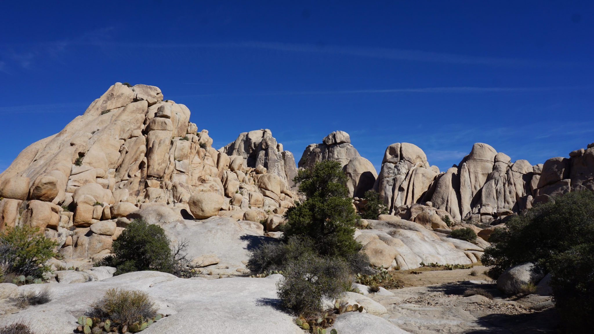
The landmark rock pile with massive blocks of granite on top
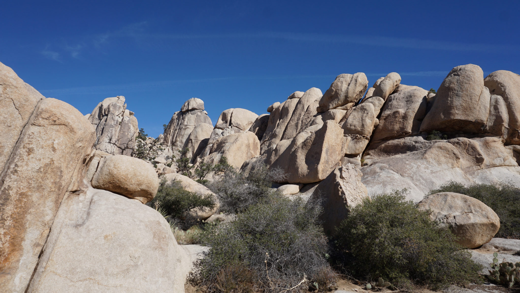
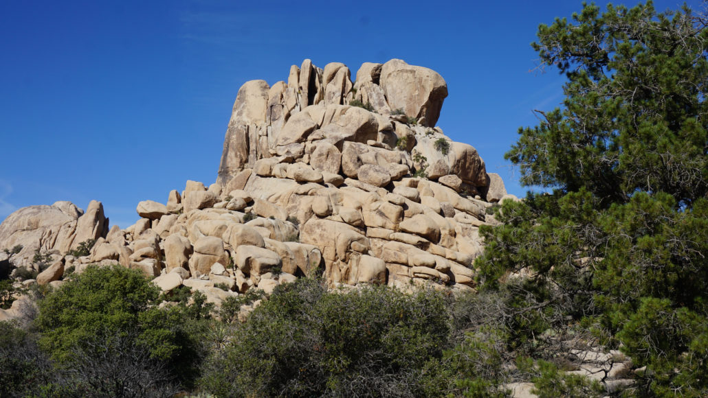
Cross an obvious wash exactly 1 mile from the start, and continue on the same north-northwest bearing you’ve followed from Wonderland Ranch. Look to the northwest to spot another conspicuous rock formation crowned by several massive granite blocks. This unnamed, unnumbered peak is another good landmark to note; just as you arrive at the northeast base of that peak (1.3 miles), look to your right to find an amphitheater-like valley ringed by impressive granite formations. You’ll turn right on a feeder wash to travel into this valley. Keep to the south side of the valley, and aim for a gap due east.
The Red Obelisk
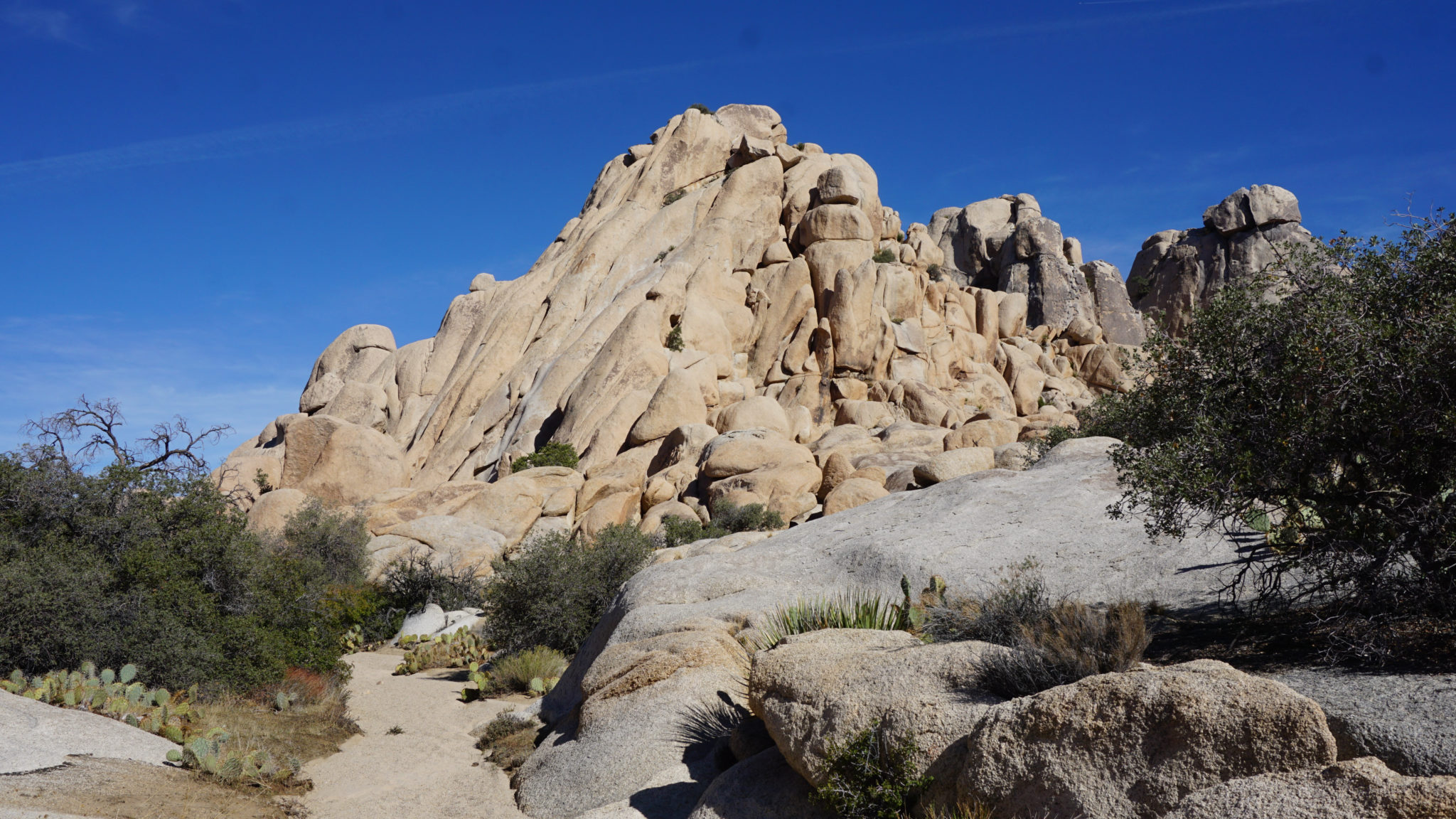
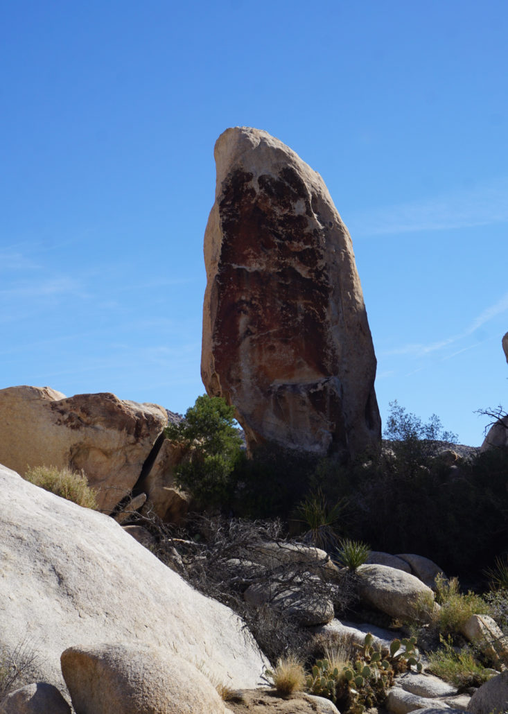
At 1.5 miles, you’ll pass just south of a monolithic boulder with a red tint of desert varnish sometimes referred to as the “Red Obelisk.” Just beyond this landmark, the wash you’re following narrows through a gap to emerge on a second, broader valley. An informal trail within this valley leads east for 0.2 mile before turning to the northeast toward a rugged cluster of rockpiles on the northeast quadrant of the valley. This informal path is a little tough to follow at times, so orient yourself to the high point on the east side of the valley, marked Peak 4547 on the topo.
The arch, your final destination, lies almost due north about 250 yards from this spot. If you can keep to the informal path, it will lead you right up to the base of the rockpiles, at which point you should be able to spot the arch if you ended up in the right place. Make a short Class-2 scramble up the slope to get a closer look at the arch. The terrain makes it difficult to actually enter the arch, so you’ll have to admire it from a distance. However, you can also enjoy the panorama of rugged granite encircling you from this quiet, lonely spot.

The return journey requires you to re-trace your steps. The aforementioned landmarks ought to help you maintain your bearings until you reach the Wonderland Wash. From there, it’s a straight shot back to Wonderland Ranch and beyond to your car.
Tags: Astrodome, Barker Dam, wall street mill, Wonderland of Rocks, wonderland ranch, Wonderland Wash