For a fairly solitary, nature-filled hike with a beautiful lake, dense brush, and numerous scenic spots to sit and take in panoramic views of Los Angeles, Wild Mustard Loop may be the perfect hike.
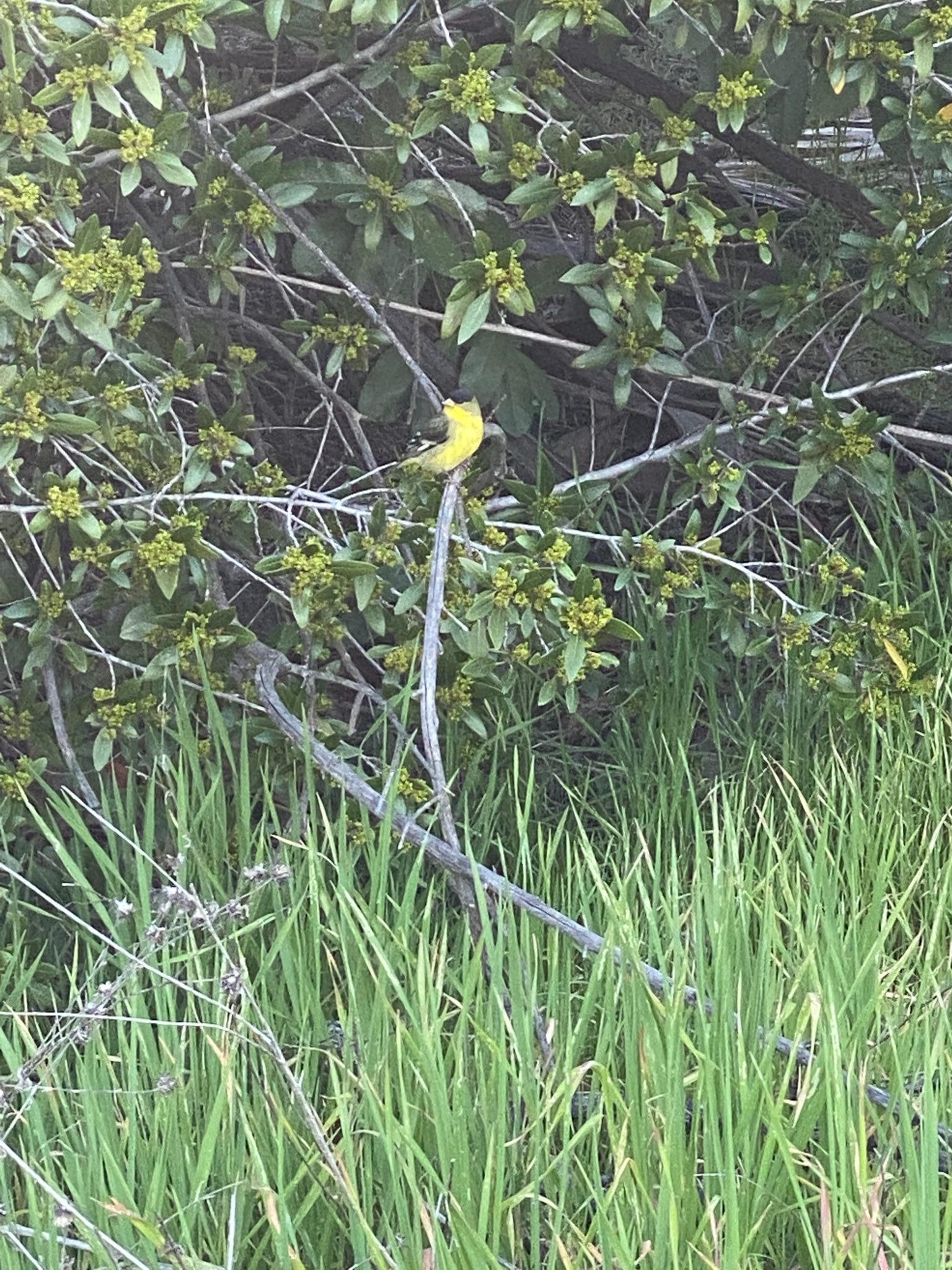
I’ve done this hike twice; once in the summer and once in the spring, and highly recommend waiting until the spring to do this. There was a stark contrast between the un-shaded hike I took last August, full of bugs and dry, brown brush, and the enchanted, lush hike I experienced in March. This second hike was full of butterflies and birdsong, plenty of shade, and I found myself immersed in abundant greenery. It truly felt like I had left Los Angeles (despite being minutes from Dodger Stadium) until I was met with the remarkable views toward the midpoint of the hike. I do recommend wearing long pants, as the greenery is quite overgrown in some places and will definitely brush up against your legs (and higher, if you’re short like me!). Even though this is a fairly popular urban park, you may still want to do some periodic tick checks!
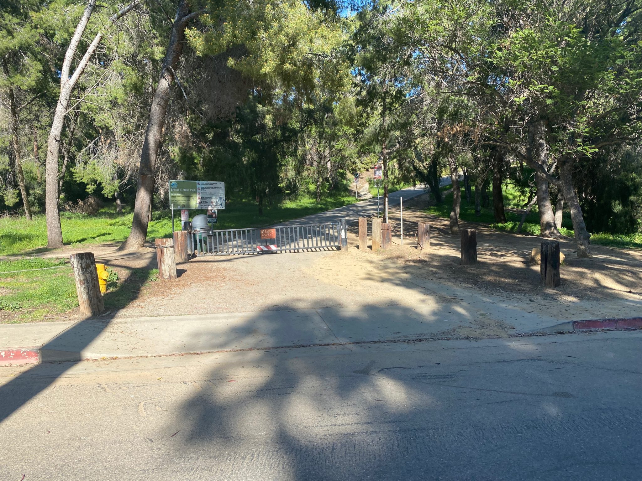
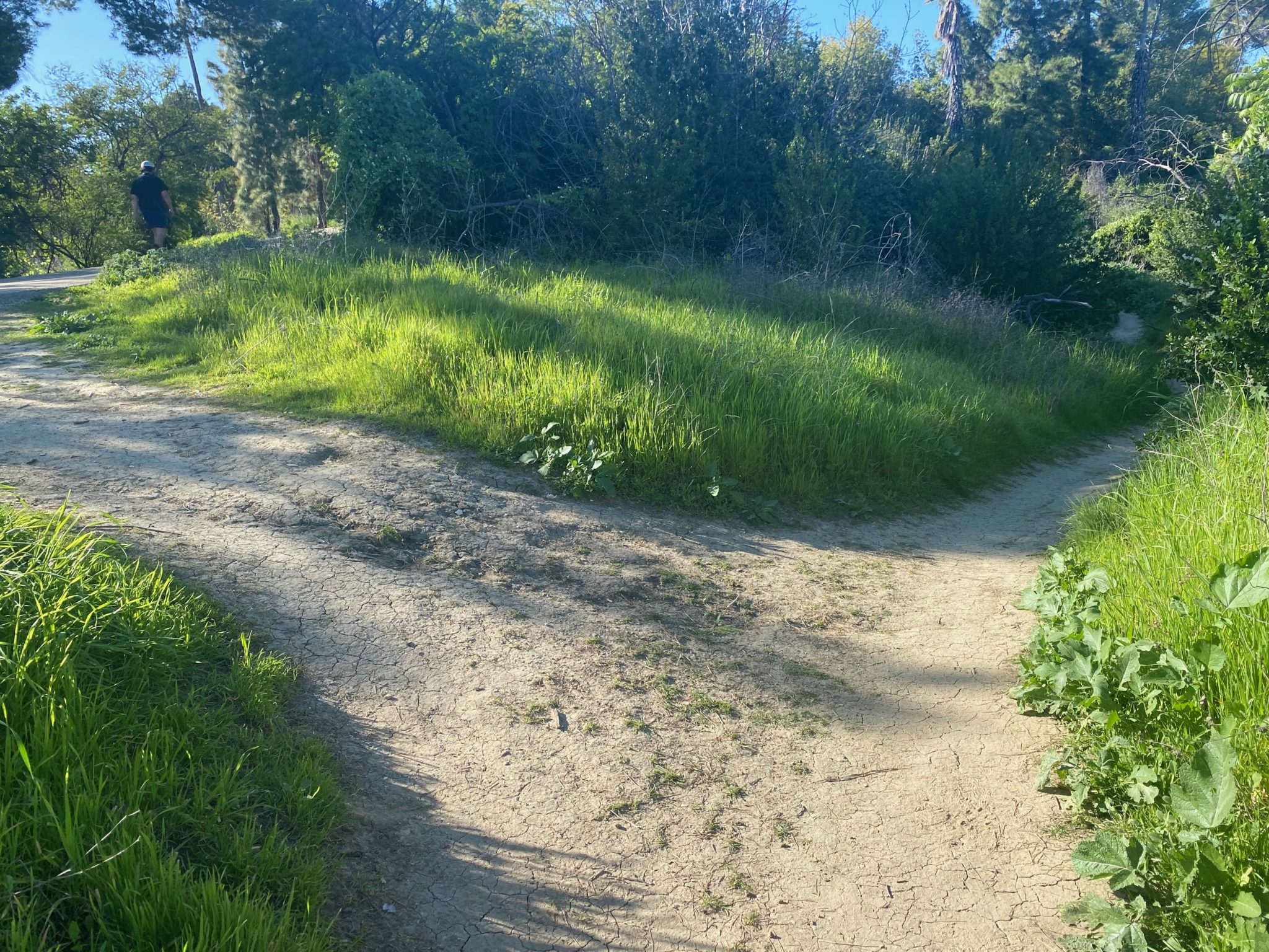
To find the trailhead for the Wild Mustard Loop, park anywhere in the large parking lot by the Debs Park picnic area (this is a great place to hang out before or after your hike, if you want to prolong your trip outdoors). This is also where you’ll find water and restrooms. You’ll see a brown gate opposite the park; head toward that brown gate and take the paved road straight until you happen upon a fork in the road with a dirt road to your right.
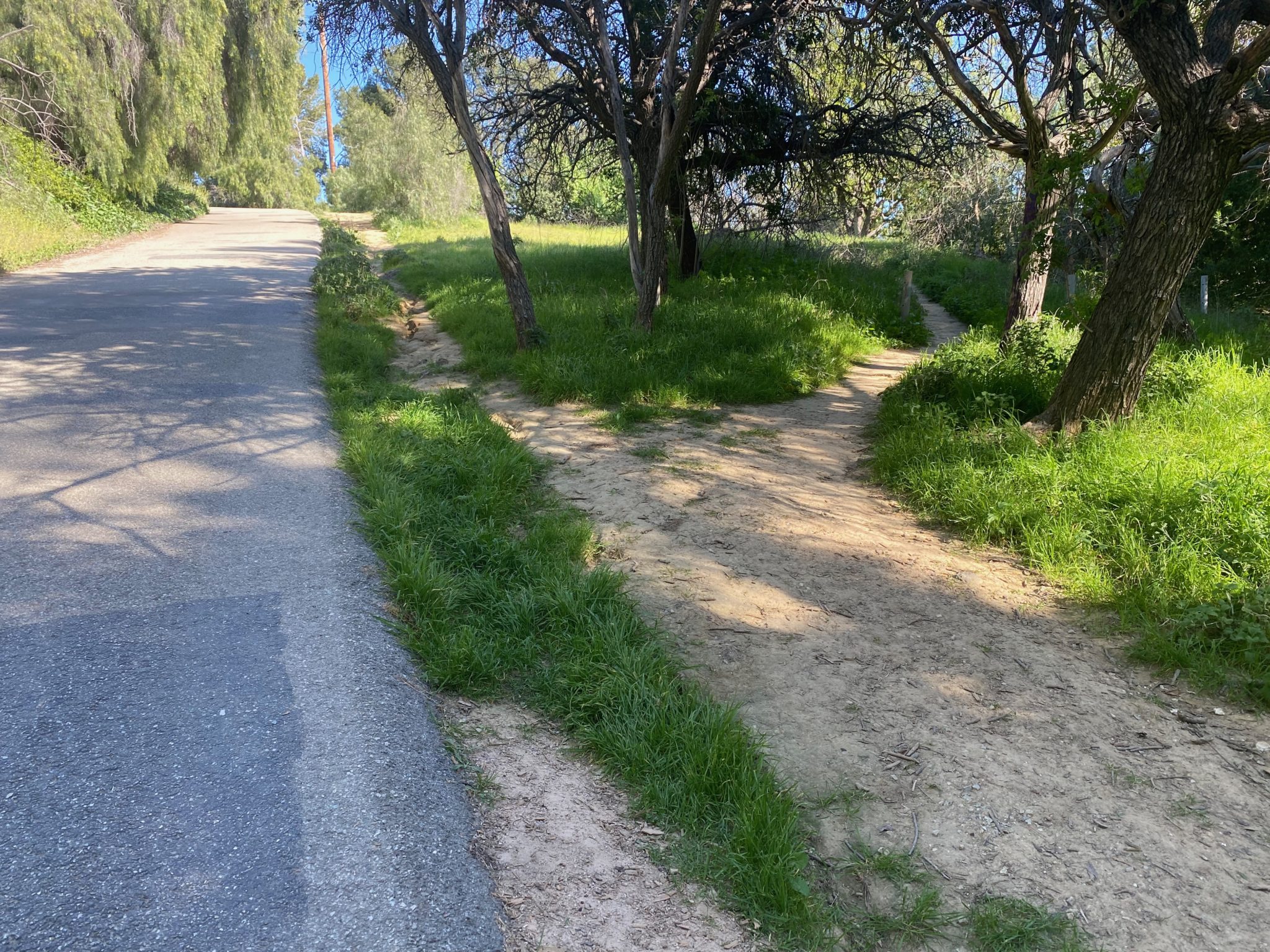
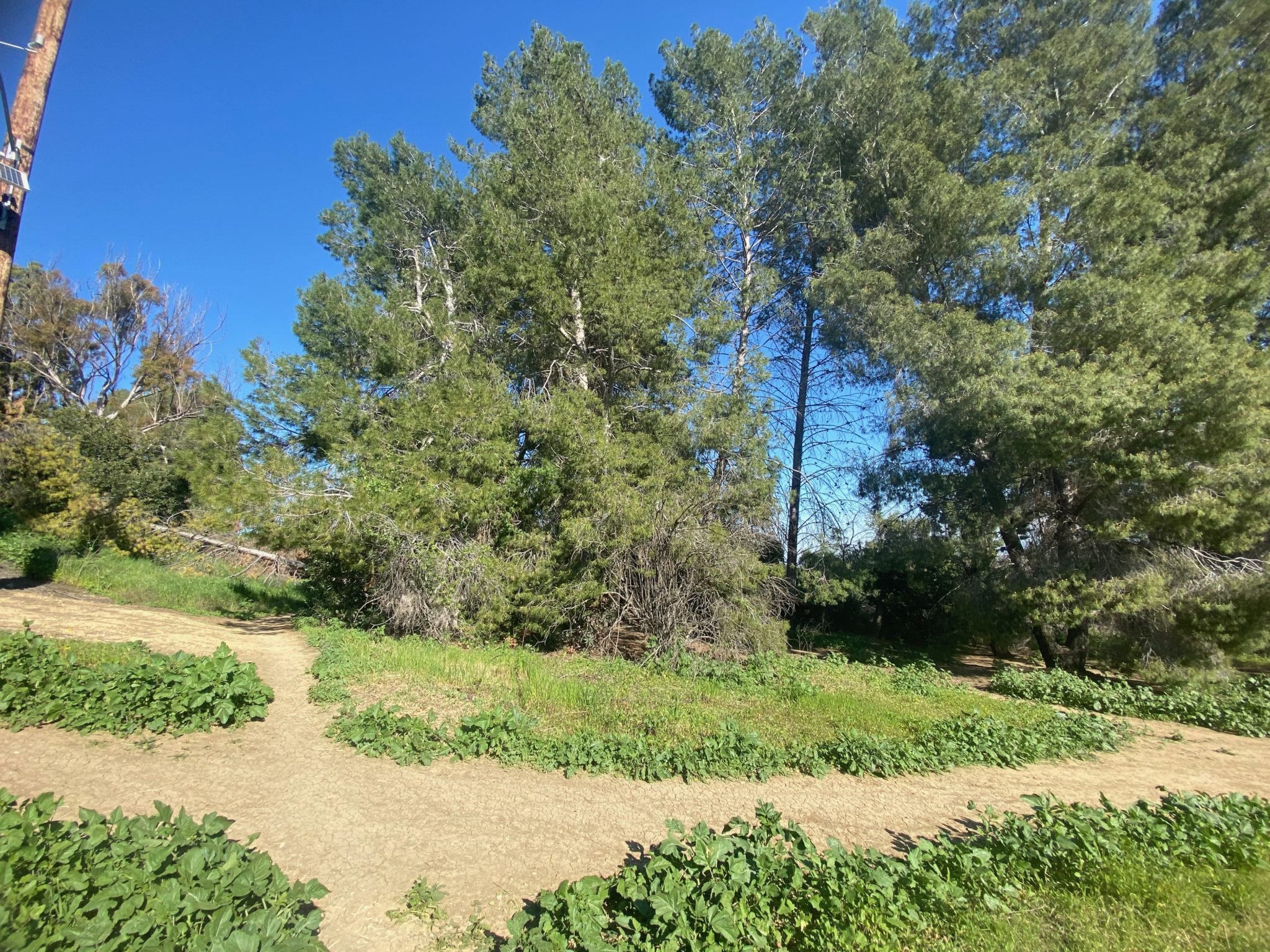
Take that dirt path for Valley View Road. and then veer left for the narrower dirt road. This path will take you along the Wild Mustard Loop, which is the part of the hike full of plants and greenery.
It gets a little twisty around this part, but there’s no real “right” way to take the path. Nonetheless, here’s the most straightforward way to continue.
You’ll come to a fallen tree; veer right at that fork.
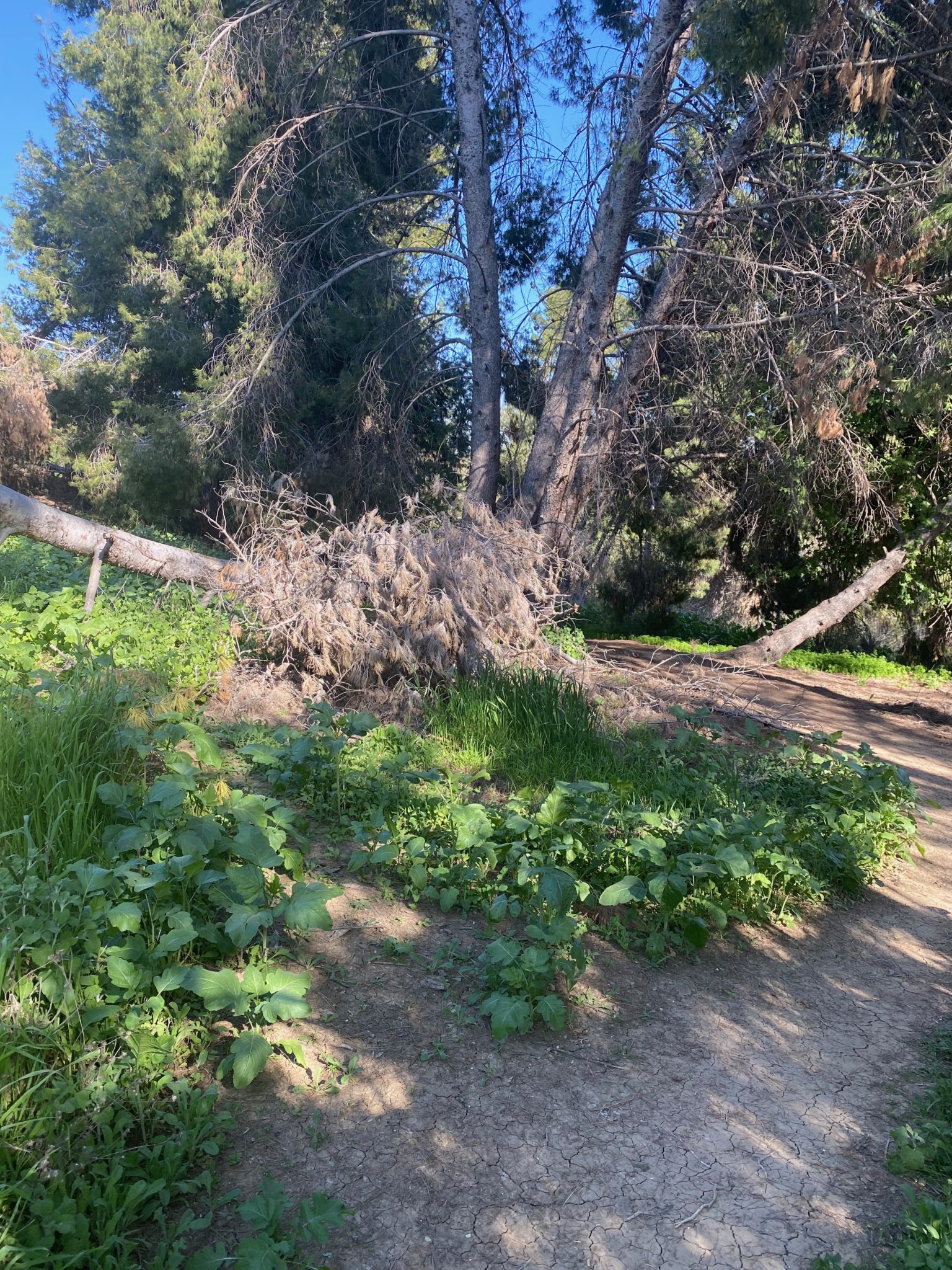
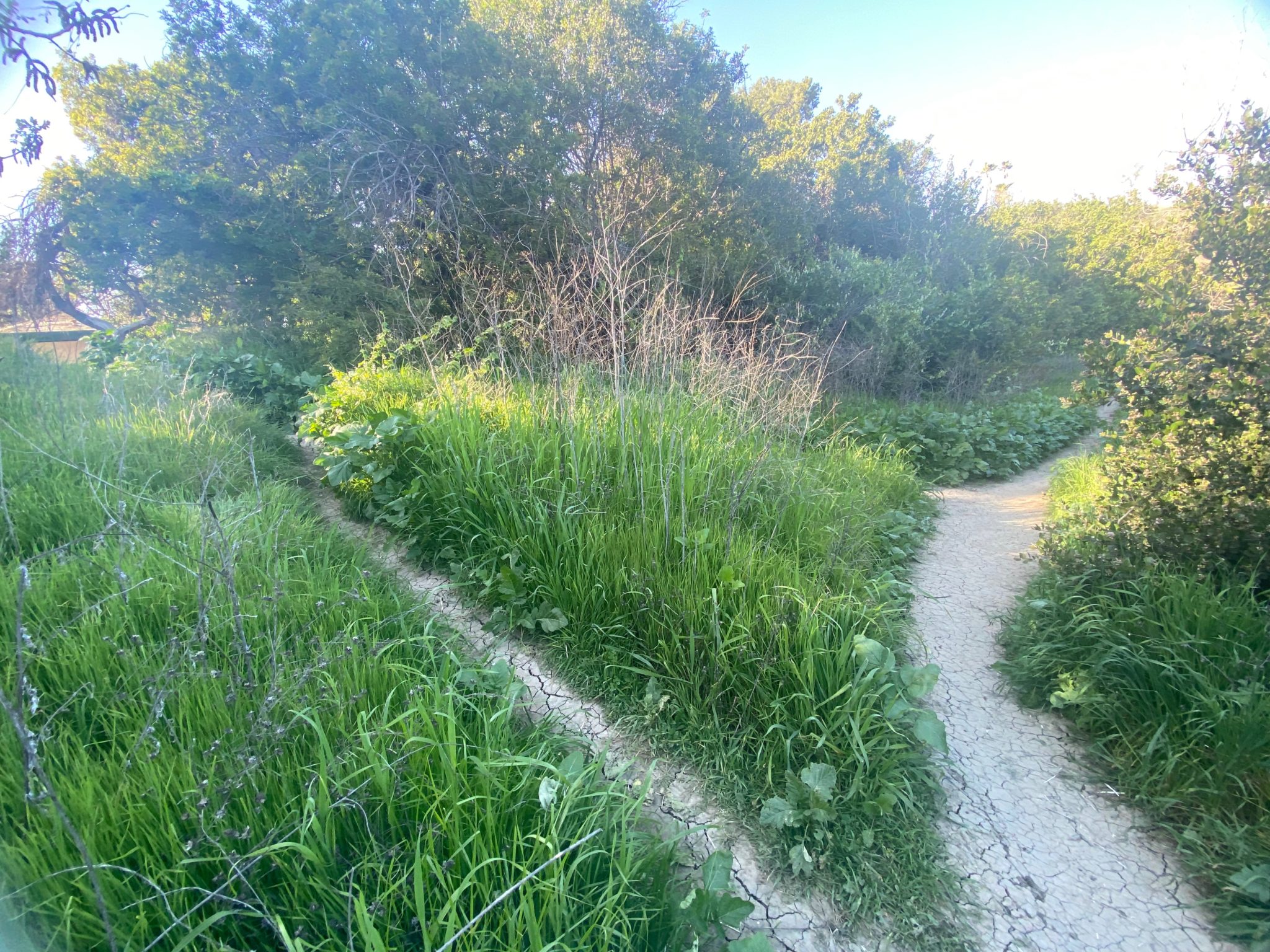
Take a left at the next fork, on the other side of the tree. You’ll find yourself on a winding narrow dirt path.
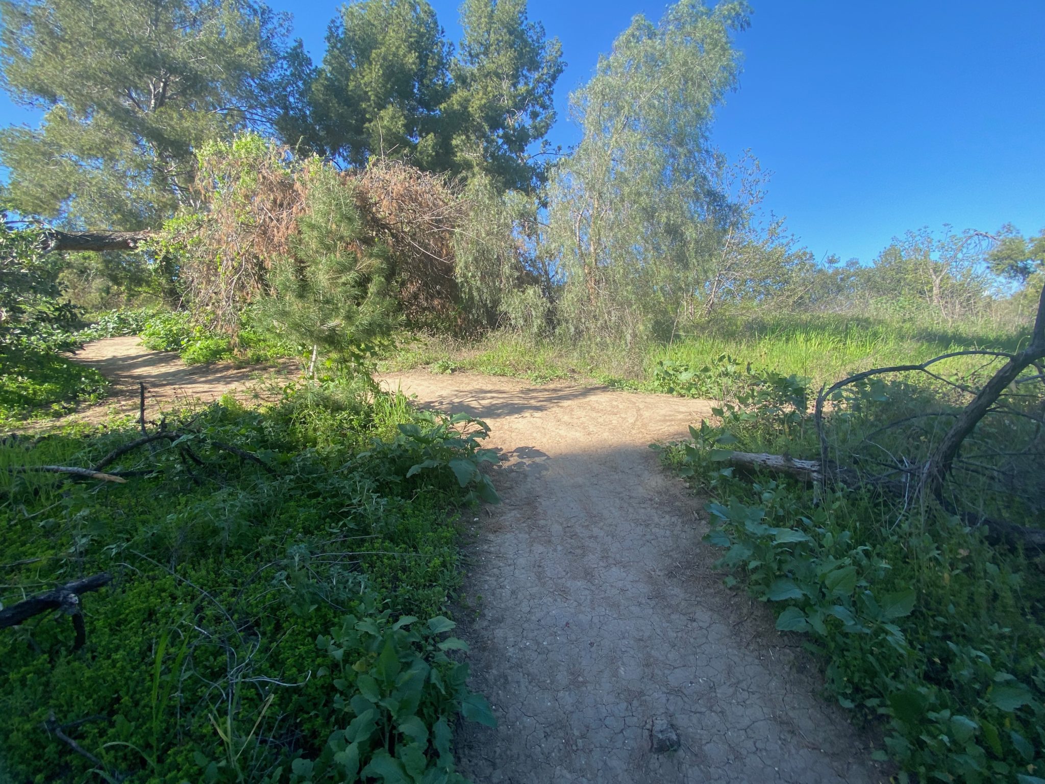
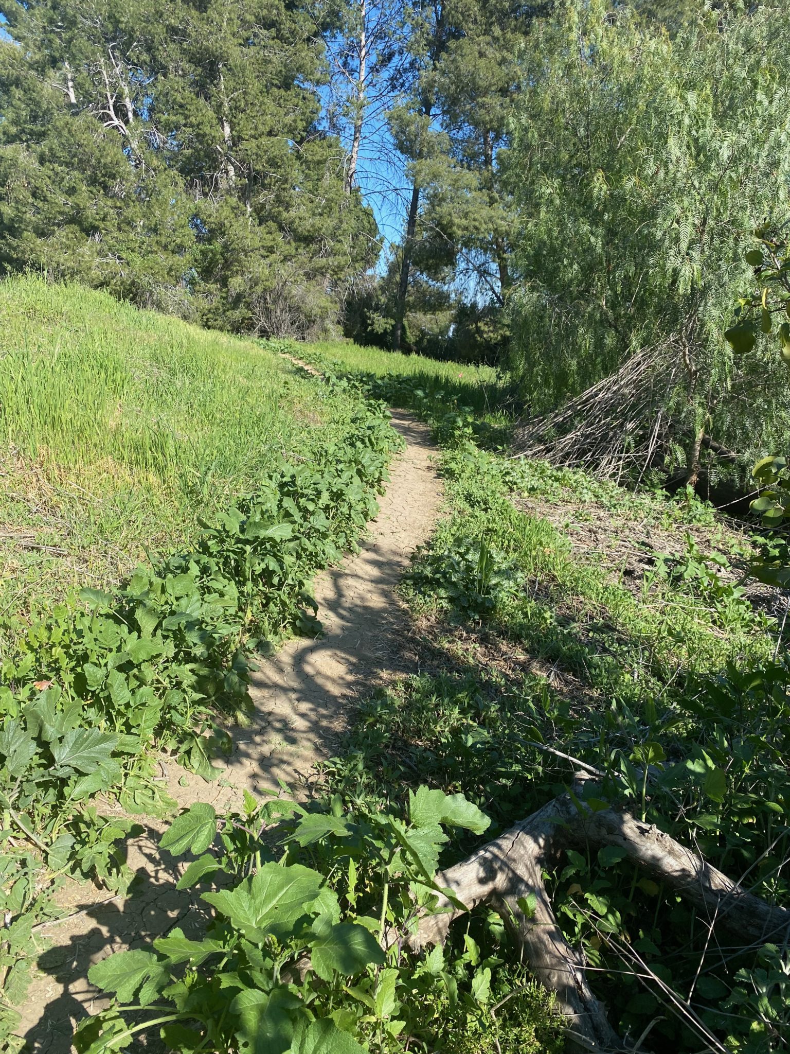
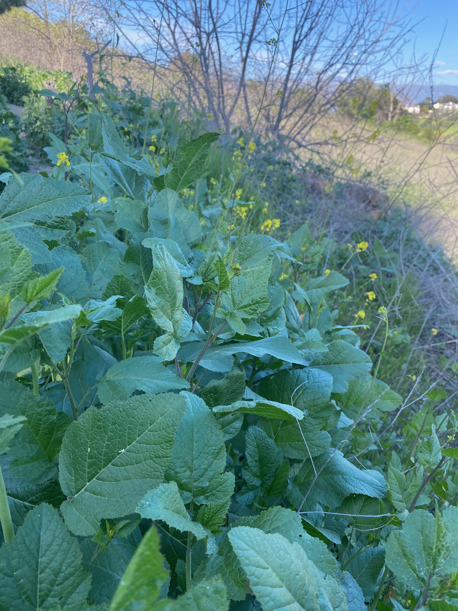
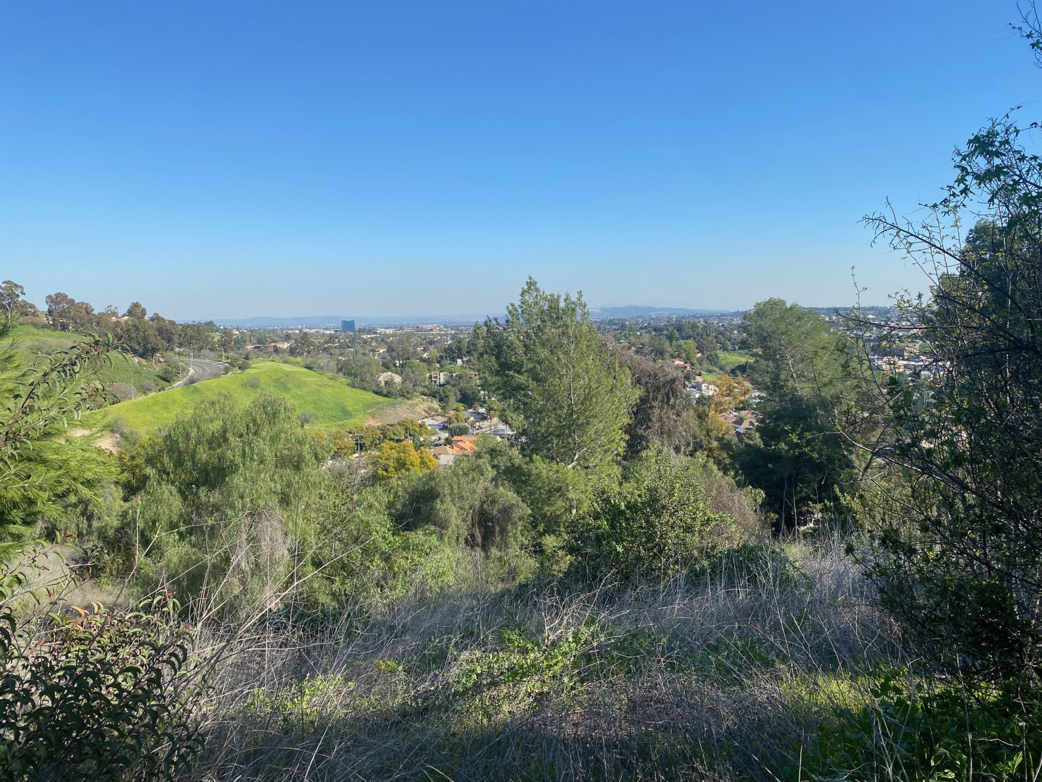
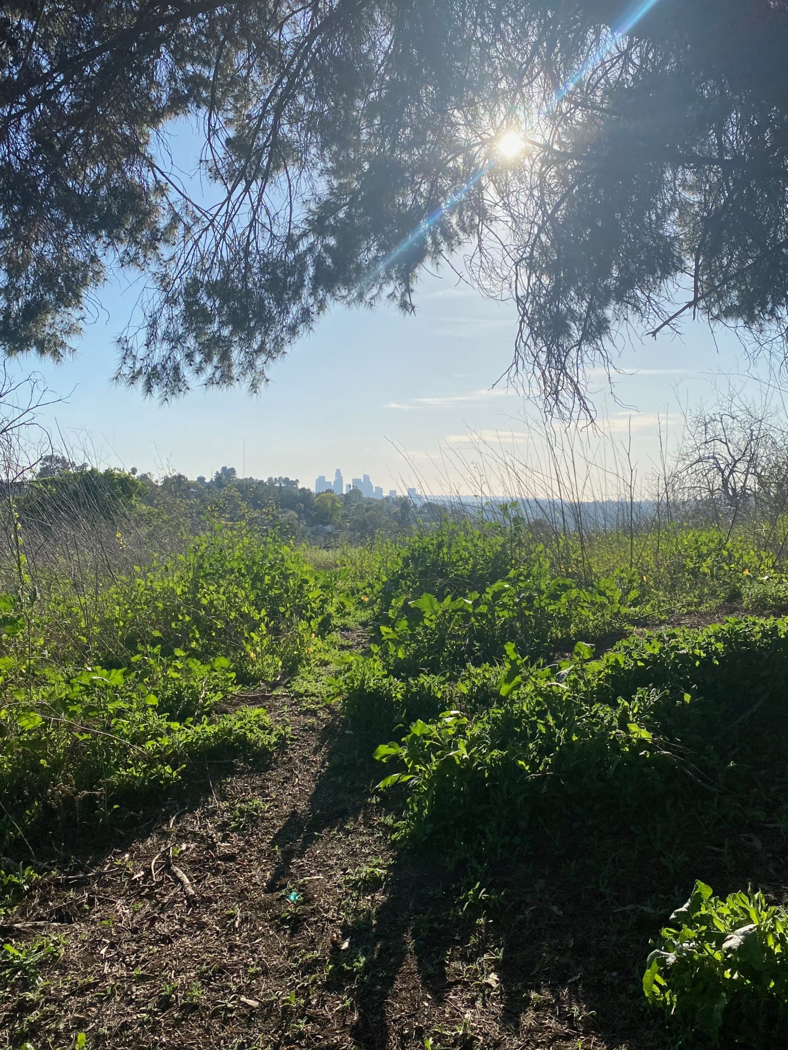
Here’s where the grass is full and green, especially after all the recent rain, which makes the path lush but narrower. There’s also great views of the city (Downtown views will come later).
At the next fork, keep right to stay on dirt path.
At this point, all the sounds of the city disappear. You don’t hear any traffic, despite being close to a freeway, and there are barely any people. It also smelled incredibly green and fresh, like a garden in bloom.
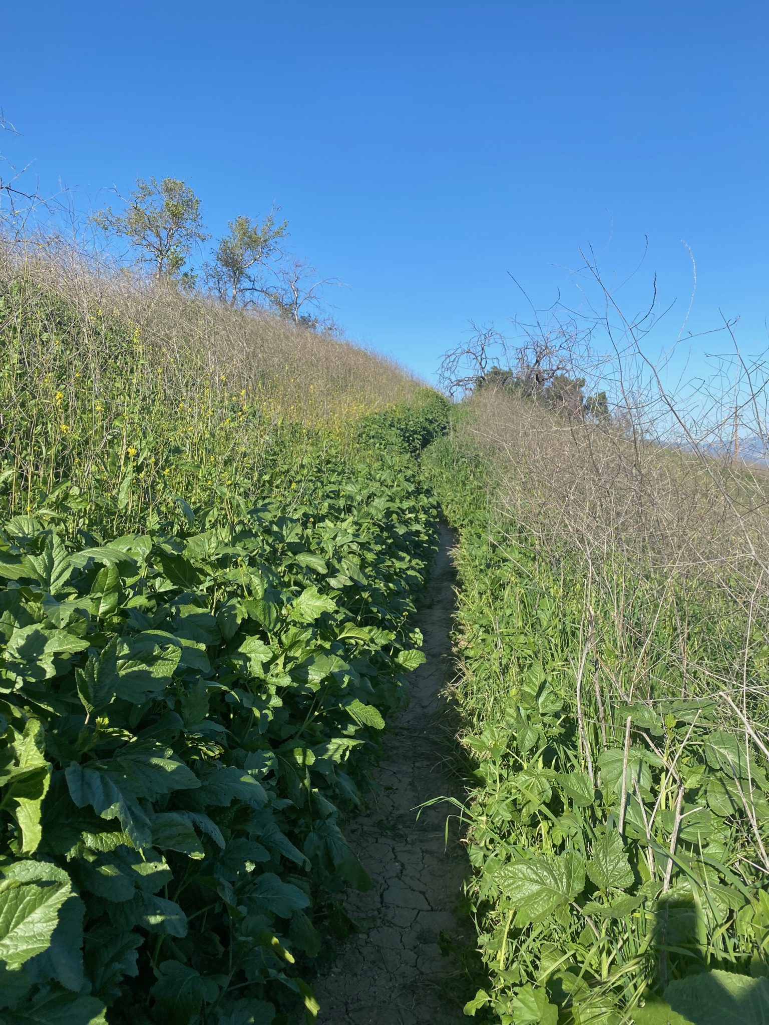
This is a good spot to loop around if you want a shorter hike. To loop here, turn left on the paved path and head back. There’s bench to rest on and take in some views. To stay on the dirt path and continue hiking, keep right. The plants get even taller and fuller here, and it’s the most narrow the path gets. Of course, this is also where I encountered some bikers, and did have to move over into the shrubbery to make room for them, but it was only a slight and short inconvenience.
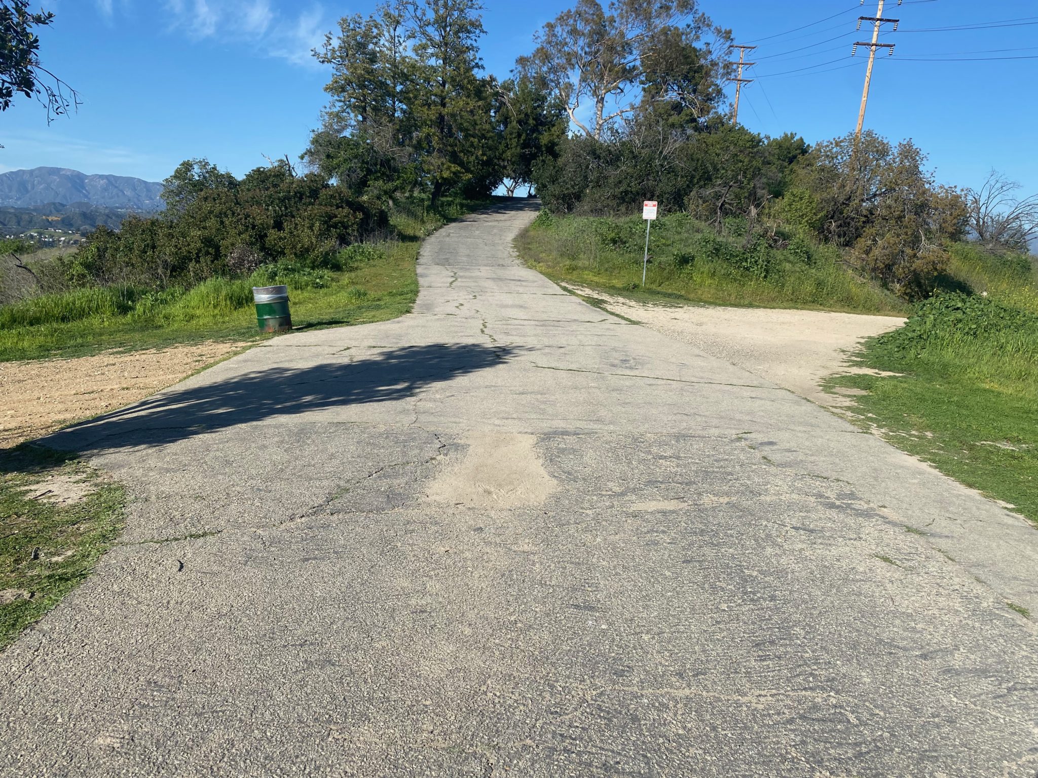
Before too long, the path starts widening out, and you’ll catch a peek of a green-roofed gazebo on your left. Keep following the dirt path until it naturally converges with the paved road. Keep right on the paved road; you’ll see it’ll start going uphill. This is also where you might start seeing lots of dogs!
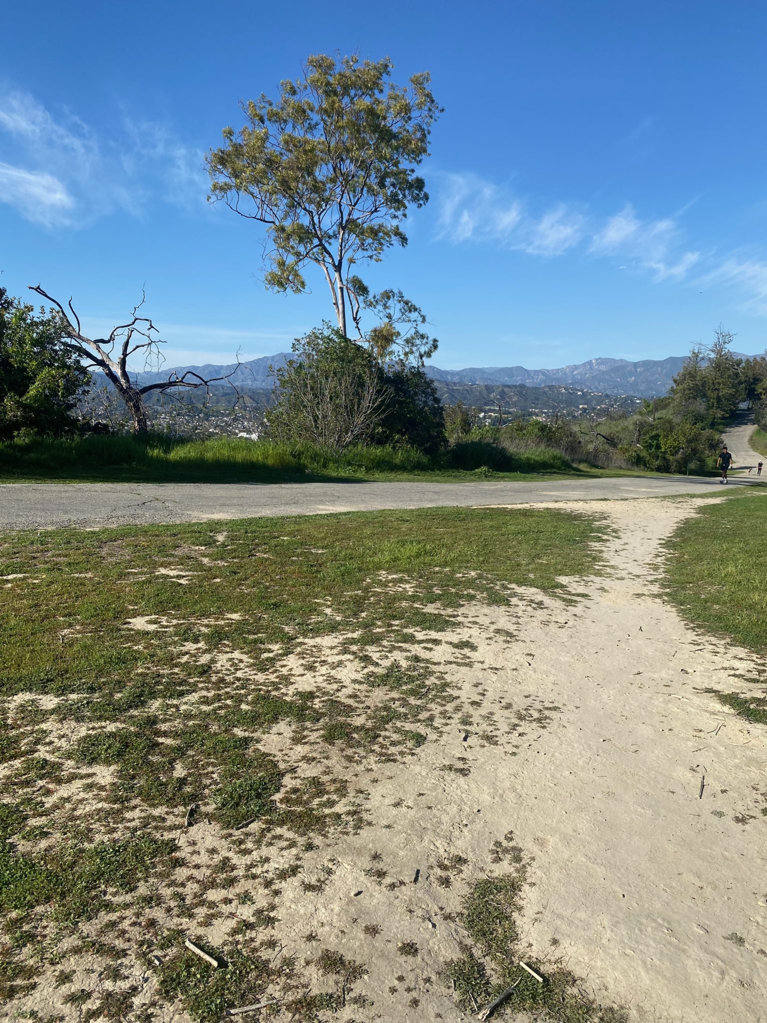
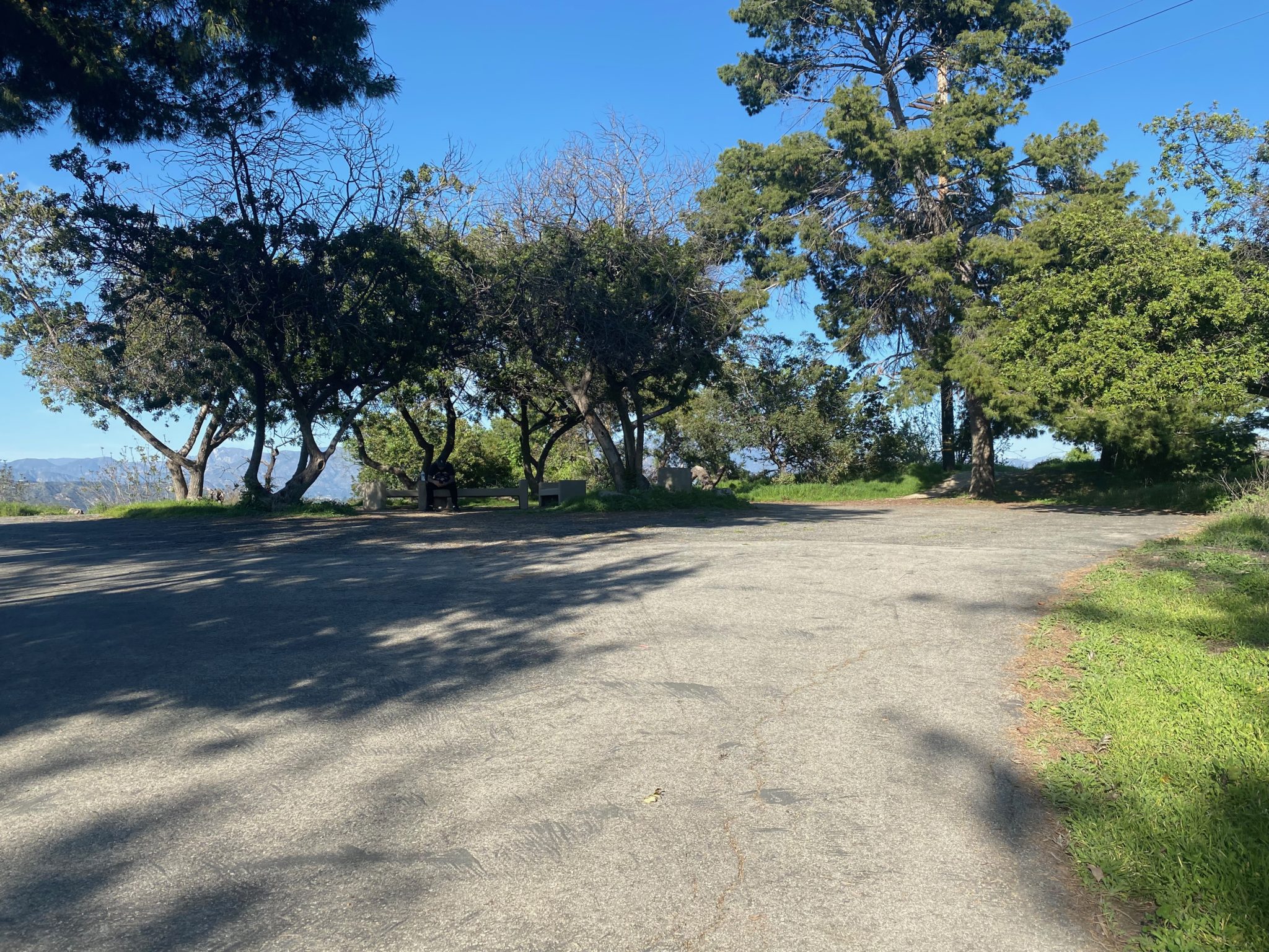
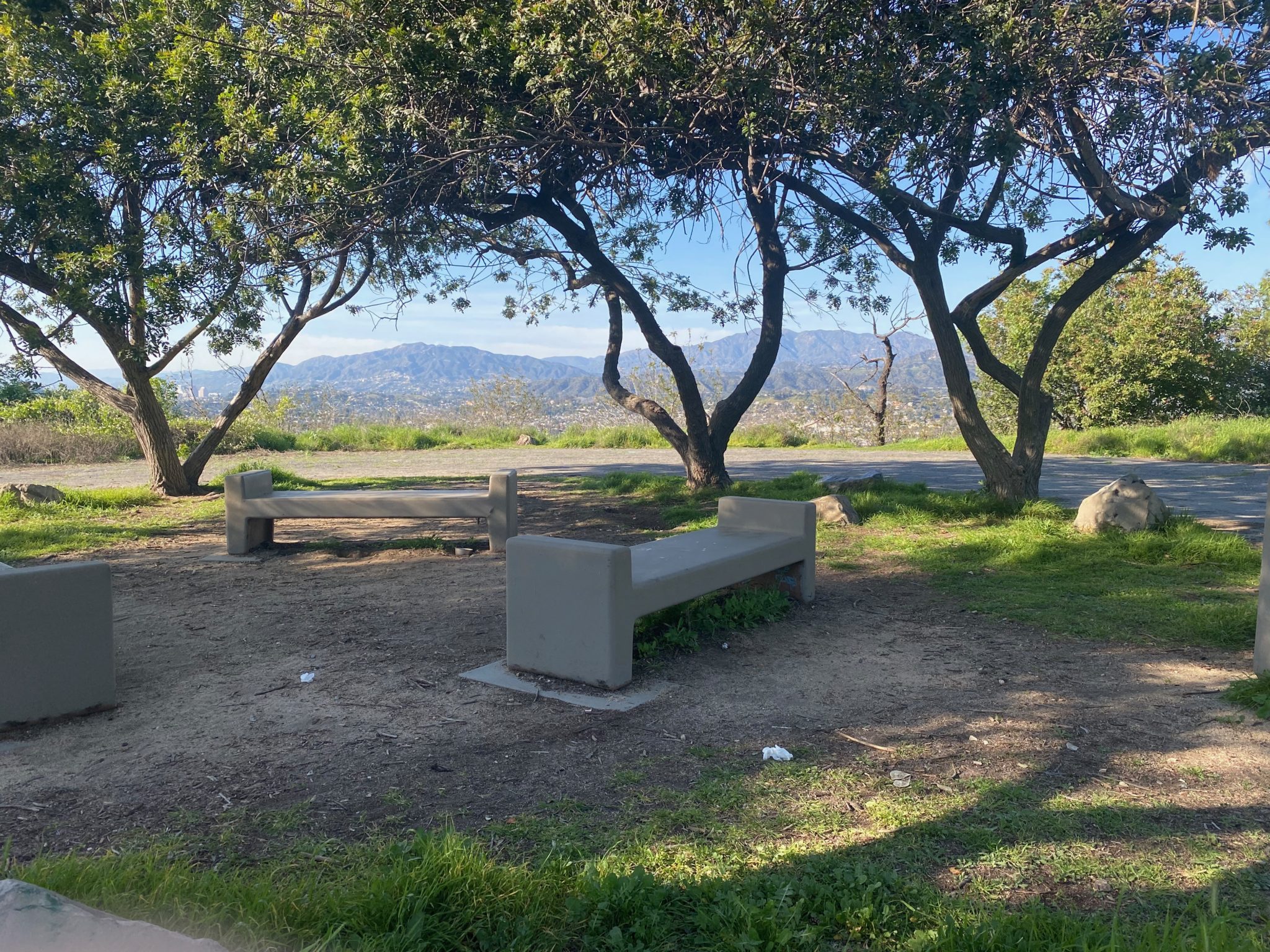
You’ll see two wide dirt roads, but keep straight on the paved road. At the top of the road is a few benches to rest on, and take in city views. This is a great place to rest in the shade. When you’re ready, head back down the paved road. This time, you’ll be taking it all the way back down so you can pass by the lake.
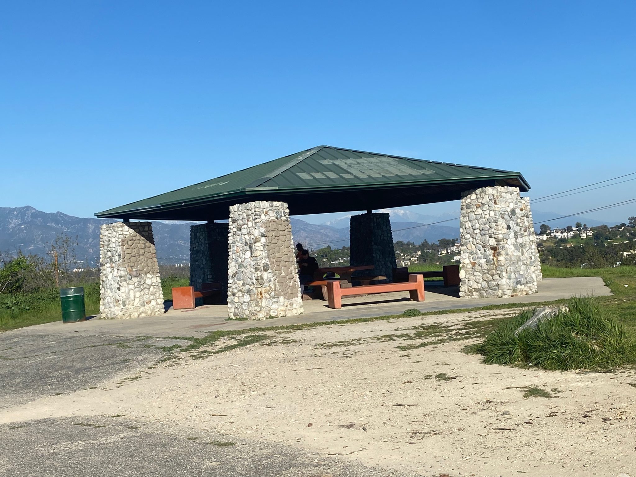
You’ll pass the gazebo on your left, which is another great option for resting with picnic benches and trash cans as well. It’s close to the peak of the loop, so you can rest in either spot, but probably won’t need to rest at both. As you continue, you’ll have fantastic views of Downtown L.A. on your right.
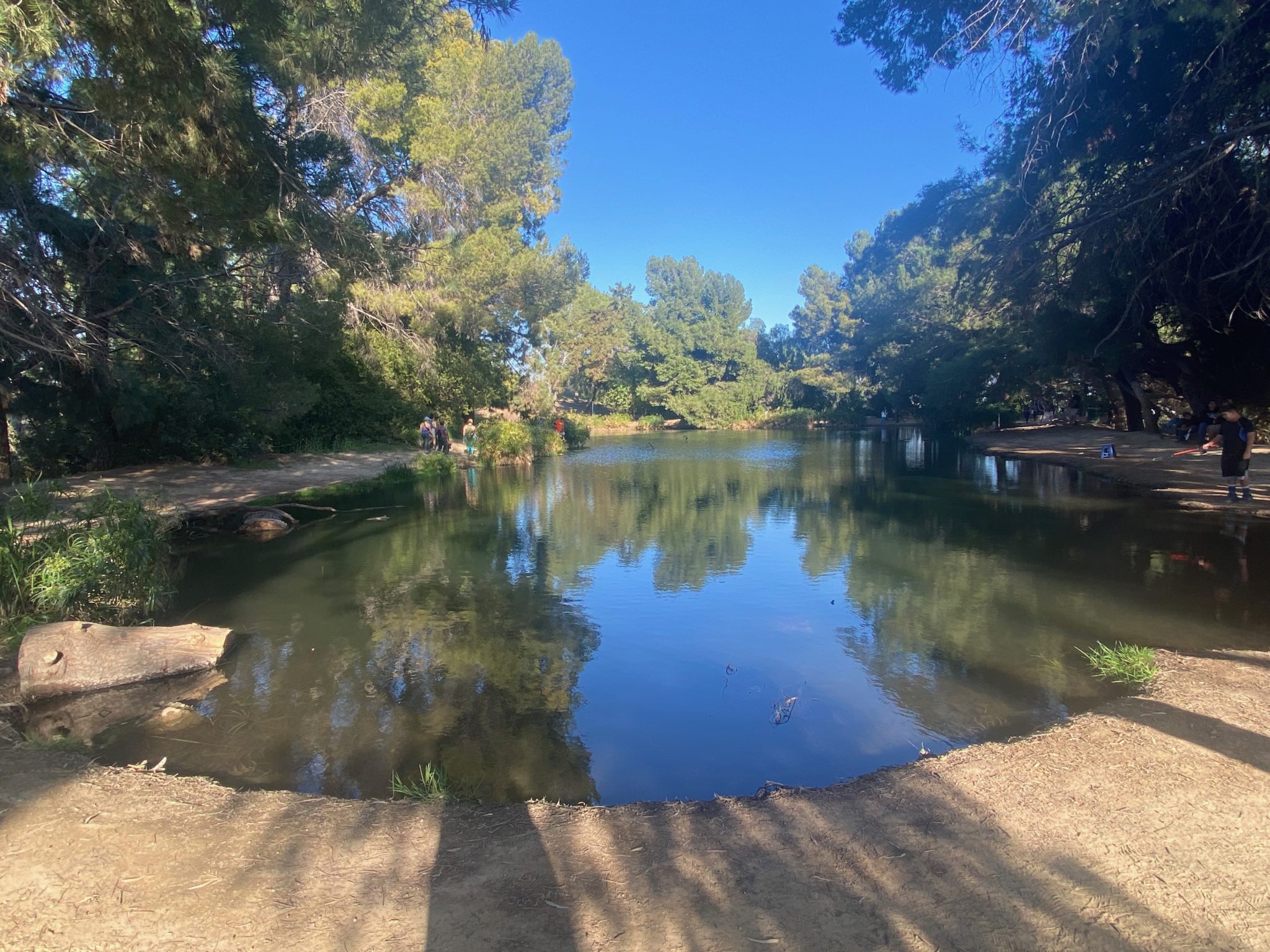
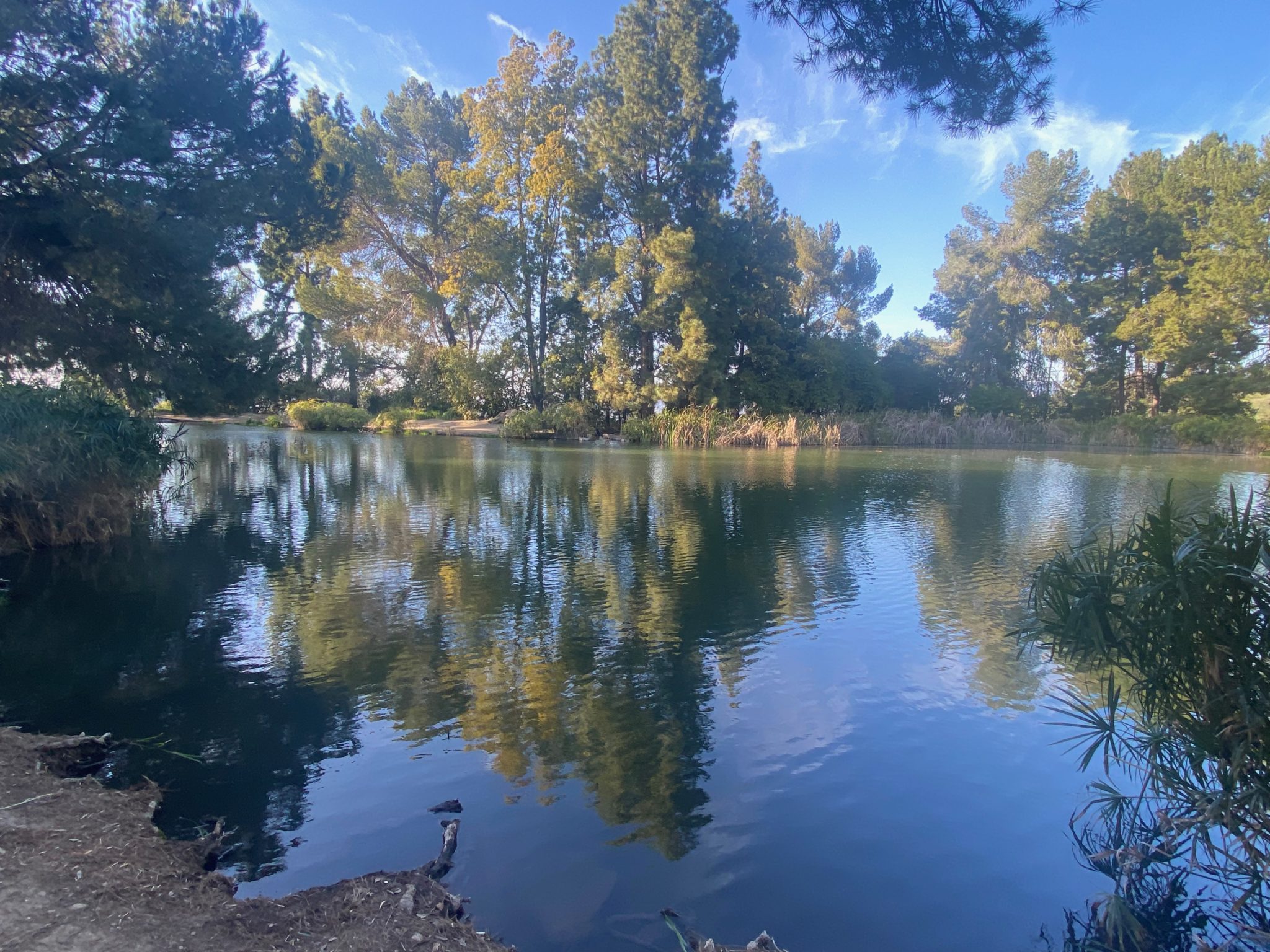
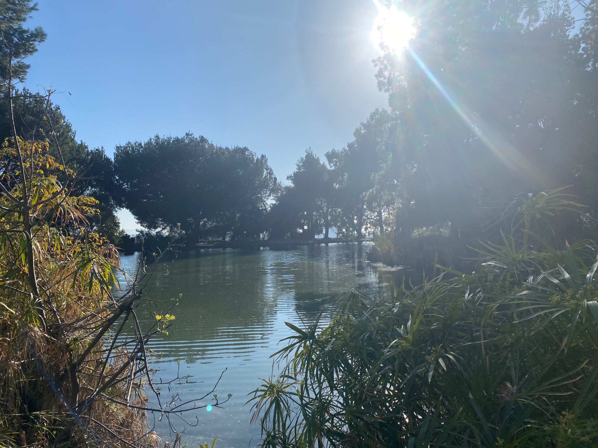
Keep right at the next “intersection”. Continue walking and you’ll come to a small lake on your right. You can loop the lake (which I did), sit and rest (which I also did!), or continue your loop on Summit Ridge Trail, which will see you taking the leftmost path. A few people were fishing when I was there. There’s lots of benches and flat rocks to sit on, and it seems like the most popular place to chill for a spell on the hike.
When you’re ready to head back, take the dirt road until it converges with the paved road. Keep right at the fork (there will be a yellow fire hydrant on your right). You can now either take the paved road all the way back, or the dirt path that you came up on. I took the paved path for the opportunity to see more dogs, of course. If you want to take the dirt path back, simply keep left and then right. You’ll know you’re going the right way if you’re going downhill. Simply take this back to where you started.
This was a short and sweet hike full of my favorite things: dogs, water features, and full, fresh greenery and wildflowers. Next time, I plan on bringing a book and spending the afternoon by the lake to really get the most out of the trip.