
Cove Palisades State Park in central Oregon is likely best known as a summer boating and fishing destination due to 4000 acre Lake Billy Chinook. Created in 1964 with the installation of the Round Butte Dam, today it’s one of the largest hydro-electric projects in the United States. Fortunately, Cove Palisades also has much to offer those looking to explore by foot, including one of the most picturesque hikes in all of central Oregon. The park exists at a unique point where three rivers come together: the Deschutes, the Metolius, and the Crooked Rivers. With the creation of the dam, the reservoir reached far up each of the three rivers, creating a sizable body of water that fills a impressive gorge of sheer basalt rock walls.
As we might be able to guess, humans have moved through this landscape long before settlers arrived in the 1800s to ranch and farm in this area. Today, the descendants of many of these groups live on the Warm Springs Reservation to the north, who also co-own the Round Butte Dam. The lake was named “Billy Chinook” by the Confederated Tribes after a local Wasco who guided the pioneer John C. Fremont into the area in 1843.
The Tam-a-láu trail (meaning “a place of big rocks on the ground”) is a spectacular 7 mile loop encompassing a high plateau. It includes big views down the Deschutes and Crooked Rivers, intriguing geology, as well as the chance to explore the plateau top. Best of all, the trail takes you to the tip of the plateau where you can view “The Island,” a 200 acre plateau that was designated a Research Natural Area (RNA) in 1986 due to it’s unique significance of being one of the few remaining examples of pre-settlement ecology in the west. It’s only connection to the mainland is a small isthmus, making it a uniquely isolated community. It was thus closed to recreational visitors in 1997, and the Tam-a-láu trail was built as a way to both view the Island and also allow visitors to experience a similar high plateau.
Covering a difference of 700 feet in elevation, the Tam-a-láu trail can begin in a day use parking lot .5 miles from the Deschutes campground or in the campground itself. The half mile connecting trail begins at the northeast end of the parking lot, which is marked by a large sign.


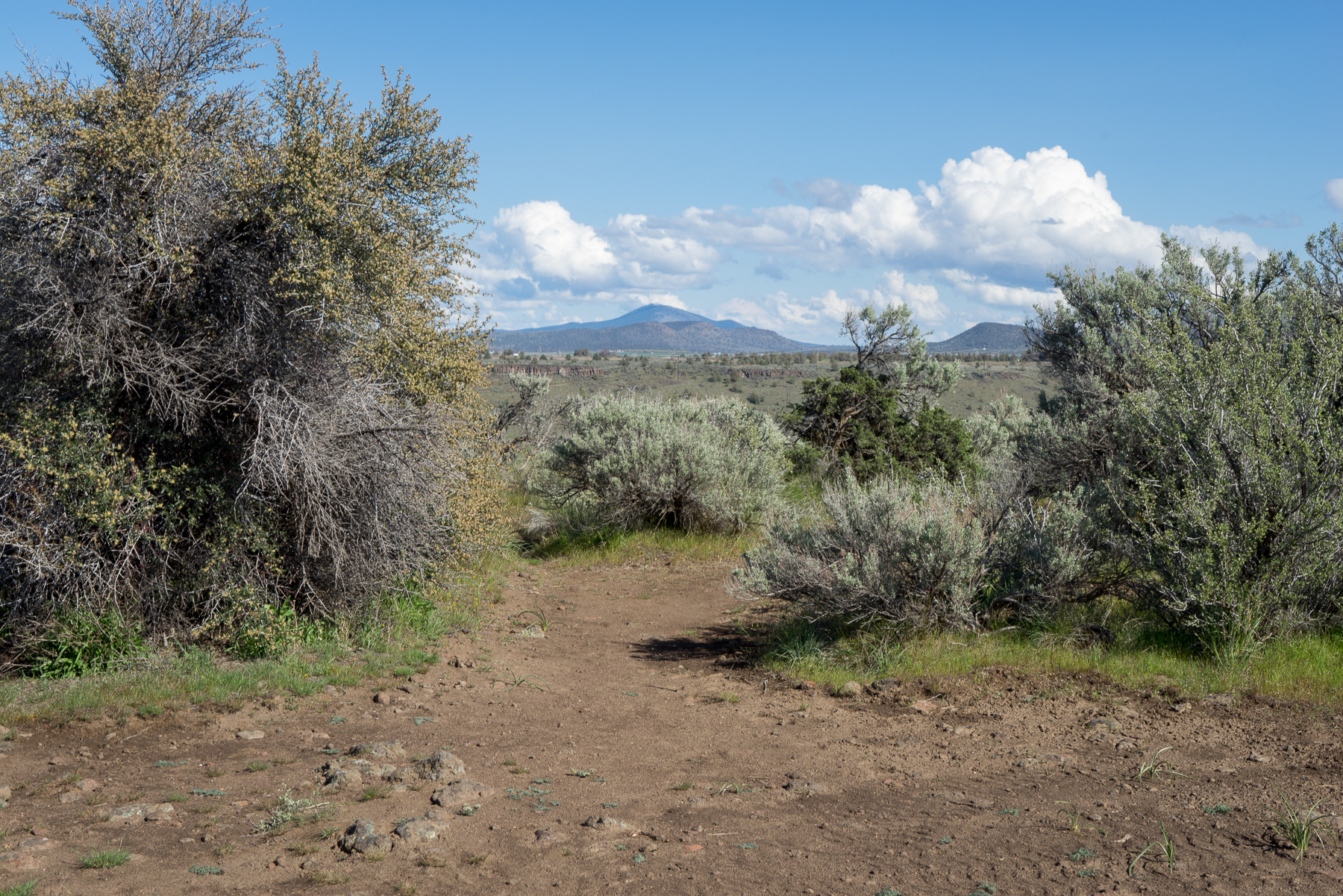
Traveling between the parking lot and the campground, this section of trail travels through rolling hills of sagebrush and western juniper. It passes several impressively large boulders, before crossing a paved path and then over SW Jordan road to continue towards the base of the plateau. Head towards your right on the smaller paved path, which will take you over the road.


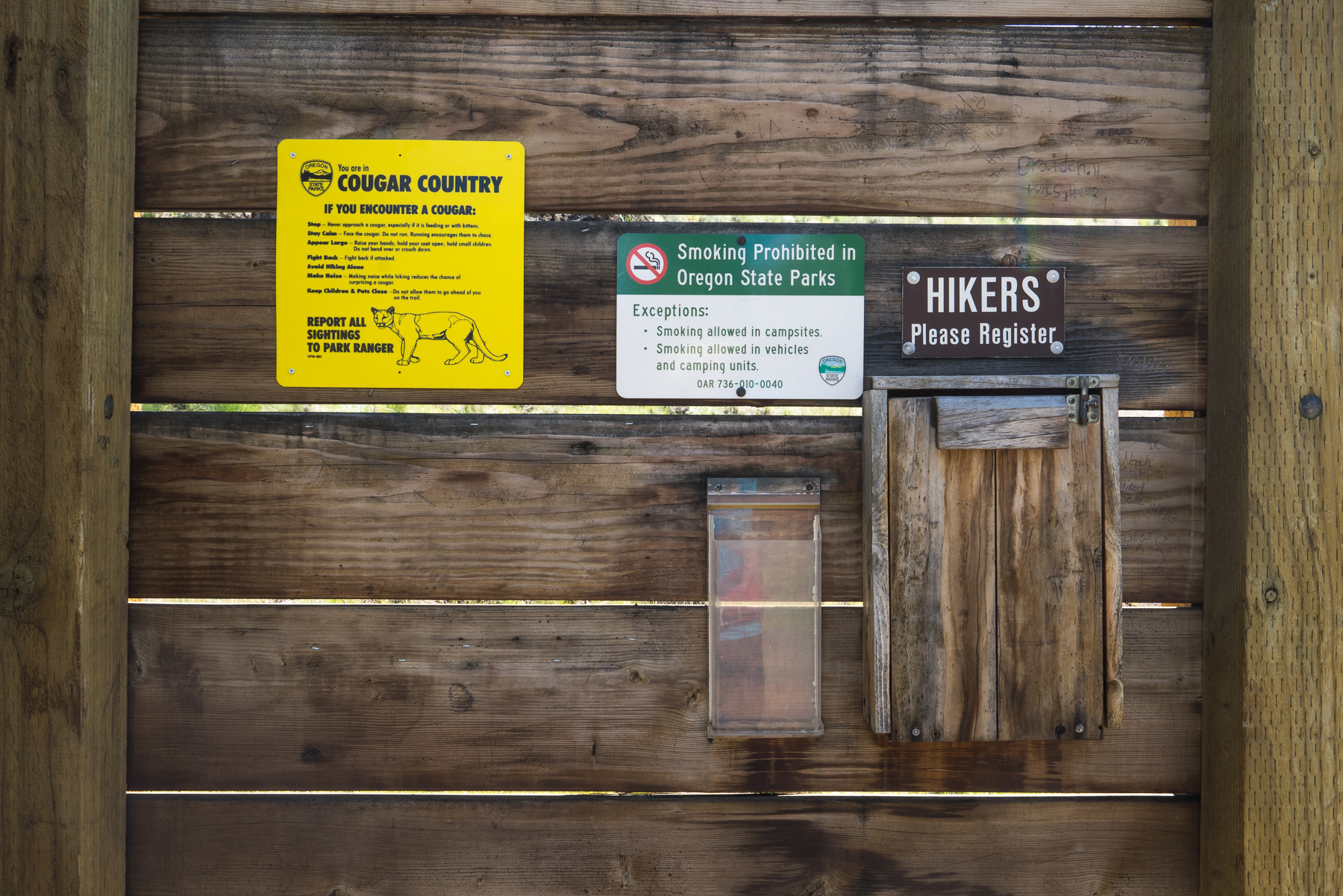
You’ll shortly pass through a gate, and see the campground on your left before encountering another signed start to the trail. At the wooden board, fill out the hiker log found in the folding wooden box, and be sure to read through the information posted for any seasonal warnings.
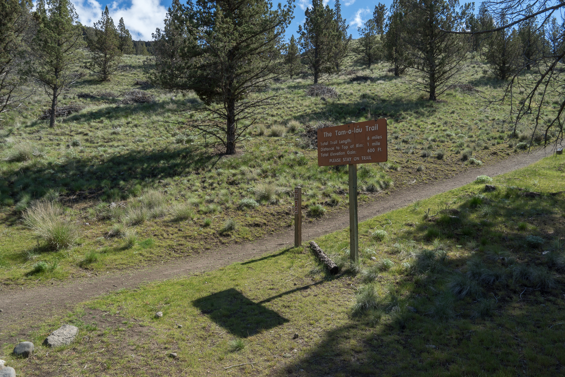
From here the well-marked trail begins its mile long 600 foot ascent of the plateau (it can seem a little daunting from the bottom, but there are numerous views and places to take a break, so don’t worry too much).


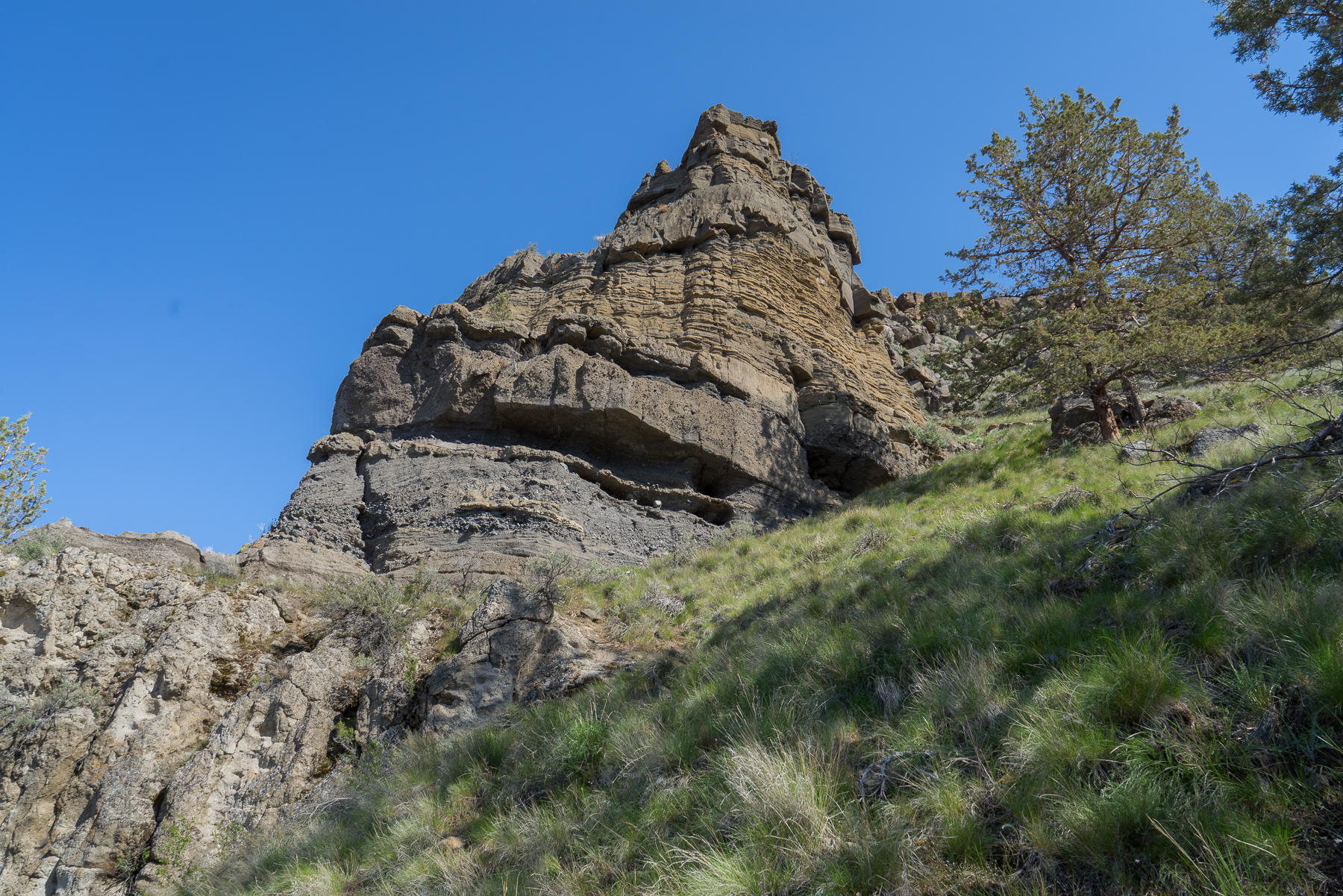
At one mile into the trip, the trail sharply turns towards the west and cuts a more level ascent for the next quarter mile. Amazing geology is on display here, with softer sedimentary stone visible under the newer layers of basalt. Here you’re able to see some of the geological features forming the river basin, the result of lava, floods and volcanic ash over millions of years (check out this page for a nice overview of geology in the park).

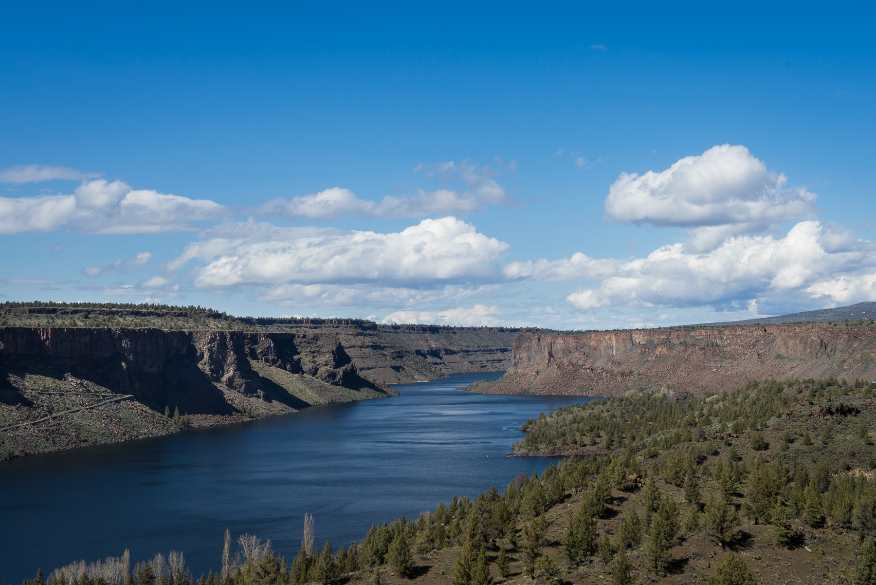
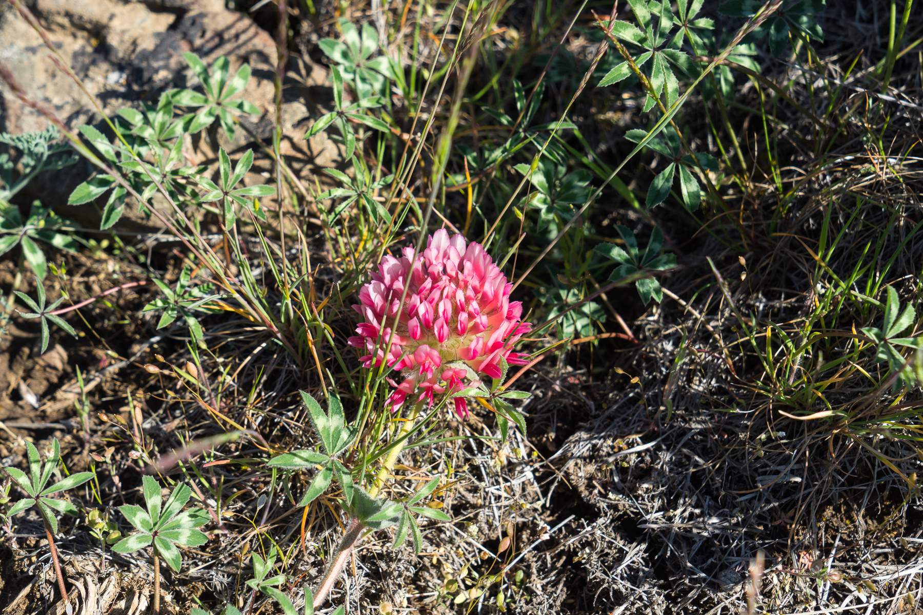
The view down the Deschutes River is spectacular in this section, and it becomes even more stunning as you gain elevation. During mid-spring you’ll see a variety of wildflowers appear as you gain elevation towards the top of the plateau.

Phlox diffusa
Toward the west, Mount Jefferson and several other Cascade volcanoes are visible on a clear day (unfortunately, it was mostly covered in clouds during my visit, but you might be lucky with better visibility).

Mt. Jefferson under clouds
At 1.5 miles you’ve reached the top of our climb and have arrived on the plateau. Shortly, you’ll encounter a sign indicating the start of the loop. From here you’ll enjoy a level walk along relatively flat terrain before eventually returning back down the plateau the way you came. While you can start the loop in either direction, I suggest heading straight to follow the plateau edge.

In front of you, the Deschutes River winds down the canyon, where it will eventually meet up with the Crooked River (as we’ll shortly see) and later the Metolius River. While this area is also dominated by fragrant sagebrush, rabbitbrush and western juniper trees, there are also new flowers.
For the next mile, the trail will follow the edge of the plateau as it heads towards the point closest to the Island.

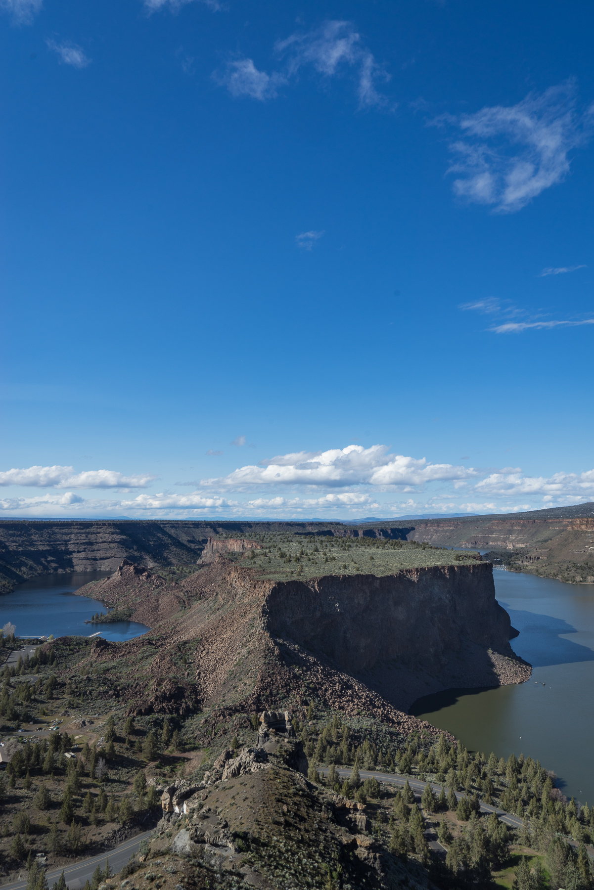
Reaching the scenic viewpoint overlooking the Island, you also get your first glimpse of the Crooked River, coming in from the right. Just beyond the Island the two rivers come together before shortly joining the Metolius, which is just out of view ahead. As an aside, just below this viewpoint and to your left there are petroglyphs just off the main road you see crossing over the isthmus. See the park trail map, which marks their location (unfortunately, I didn’t know about this until after my visit).
-

- Don’t take this!

-
- Take this!
When you’ve finished taking in the view, the trail continues around the plateau, this time following cliff-side above the Crooked River. Don’t take the double track jeep road just opposite the viewpoint (you’ll meet up with the trail you already took, and where’s the fun in that?). Rather, take a smaller (but relatively obvious) trail that follows the plateau edge towards the south.
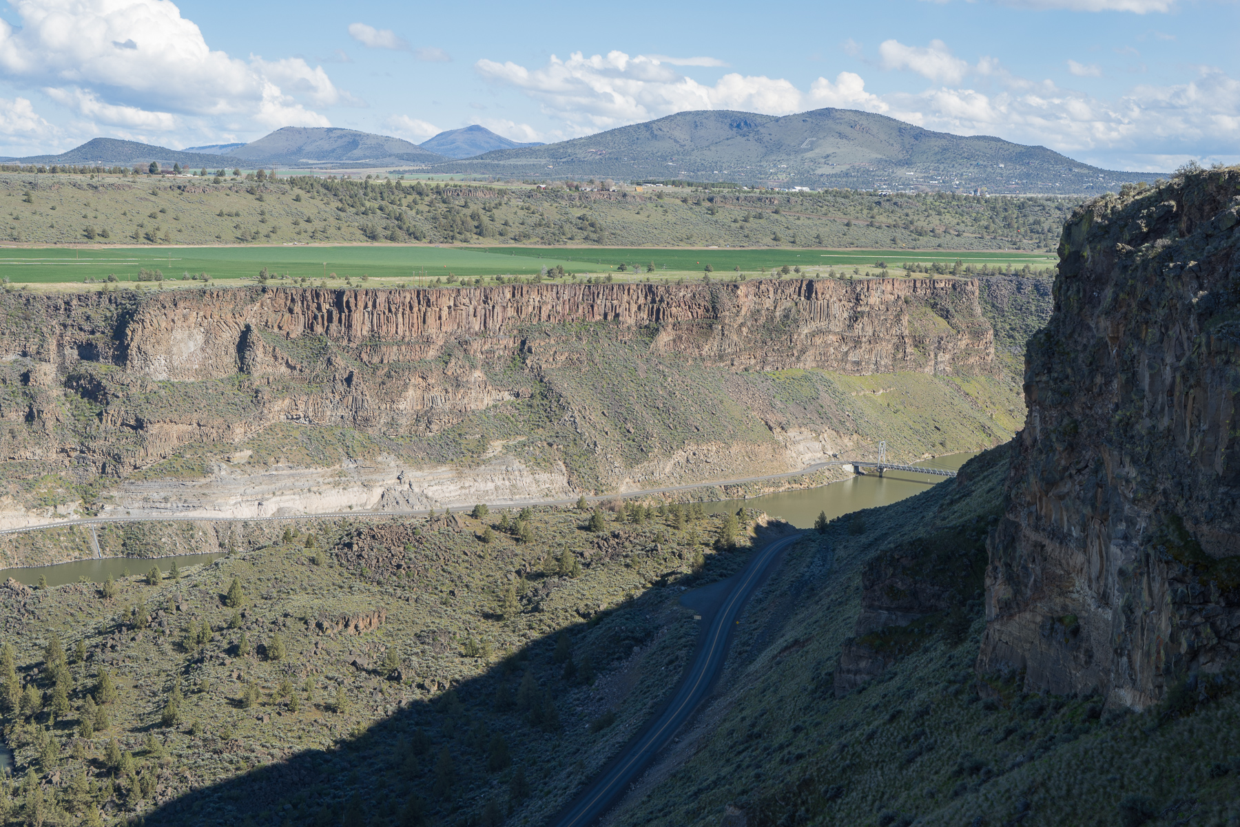
Walking along, you’ll see the road that earlier brought you into the park as well as the bridge you crossed on the Crooked River. On top of the riverside cliffs, farms add a splash of greenery to the high desert landscape. There are also mysterious, crumbling rock walls along this portion of the trail (as a good archaeologist I did some research, and they were likely stacked by ranch workers). Also scattered around the site are numerous historical artifacts (in this case, old metal cans).
Please enjoy this history on the trail without moving, disturbing, altering, or taking any items — all of these materials are protected features of the park and should be left for the enjoyment of those who visit after you.


At 3.75 miles into the hike, the trail turns towards the inside of the plateau. While not overlooking the river during this section, it’s a lovely walk through the heart of the landscape. Again, plant-life here is dominated by sagebrush and western juniper with the occasional desert bloom during mid-spring. Many of the juniper are impressively large and twisted, making one wonder how long they’re been growing atop this plateau. You’ll cross several jeep tracks, most of which are signed indicating the trail proceeds straight.

Eventually the trail will gently drop down again to meet up with the signed Tam-a-láu loop junction. At this point, return the way you came, making your way back down the plateau towards the Deschutes River. Going this direction, you’ll be facing down the gorge for much of this section, making for a lovely end to a great hike. Upon reaching the campground at the bottom of the decent, you’ll again cross the road and return back to the day-parking area.
Things to know:
–Map: The park provides this map, however, it’s lacking in detail and wouldn’t be very helpful in actual navigation. Unfortunately, I’ve yet to find a better one (but I’ll keep looking!)
–Weather: This area gets brutally hot during the summer, and visitors should be sure to bring extra water and sun protection year round. During the winter, the trail may be periodically closed due to occasional ice and snow.
Tags: central oregon, crooked river, deschutes river, desert, high desert, Hiking, metolius river, nature, oregon, outdoors, pacific northwest, Trail Write-Ups, wildflowers


