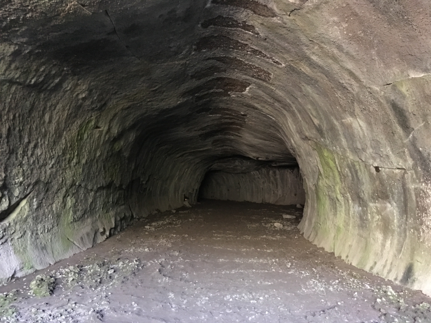
Tucked away just outside the northern border of Lassen Volcanic National Park is a smooth-walled cave formed from a lava flow 20,000 years ago. Lava surged through fissures near Old Station and flowed 16 miles to the north through Hat Creek Valley. The lava near the surface cooled and slowed while the still hot lava below continued to flow, forming caves.
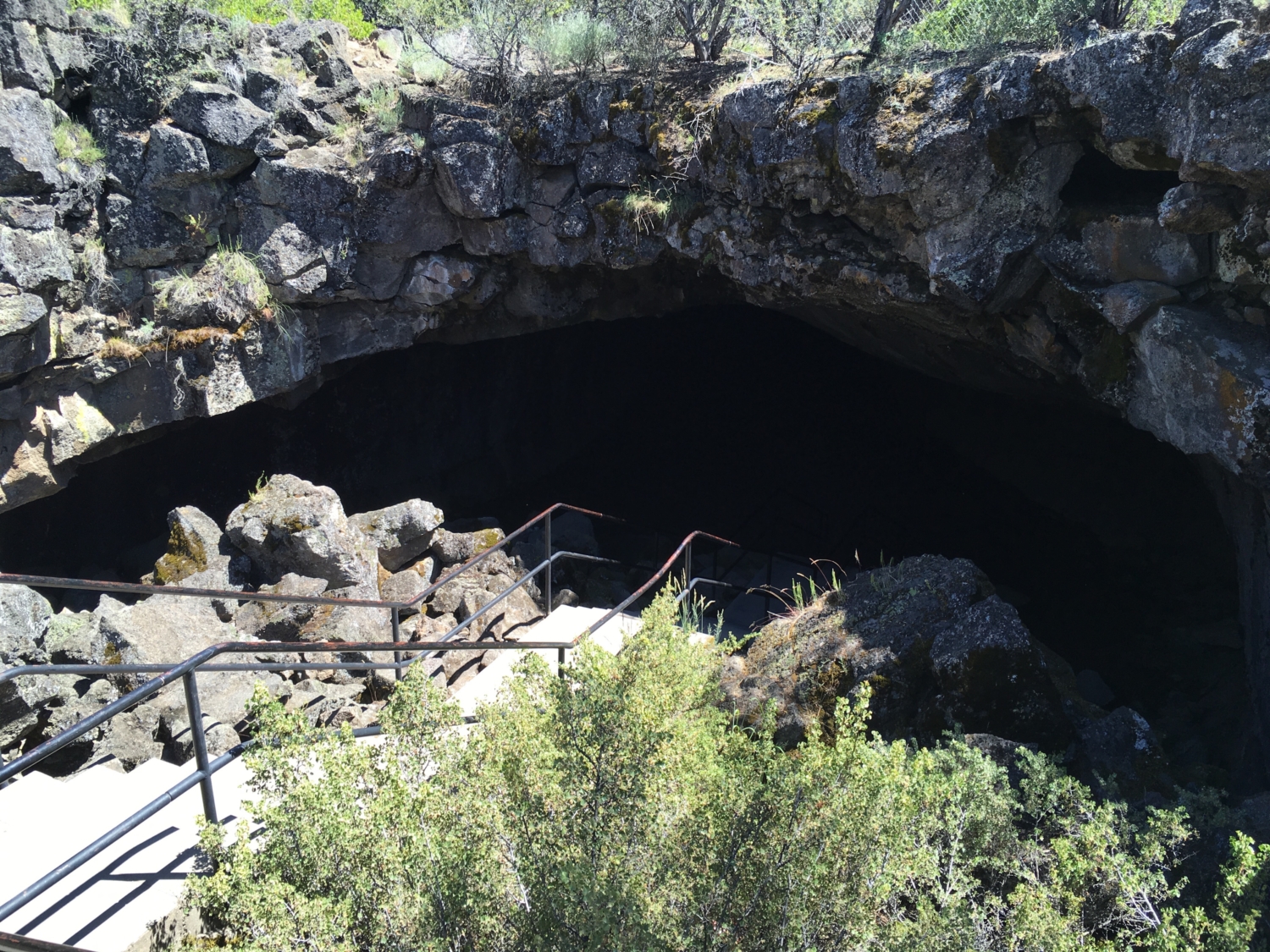
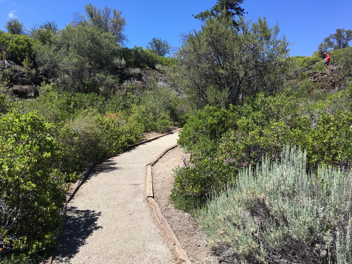
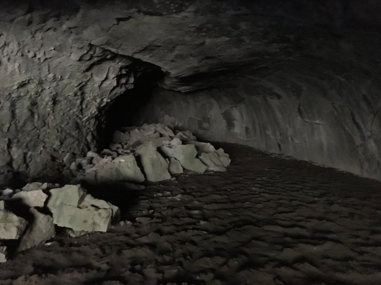
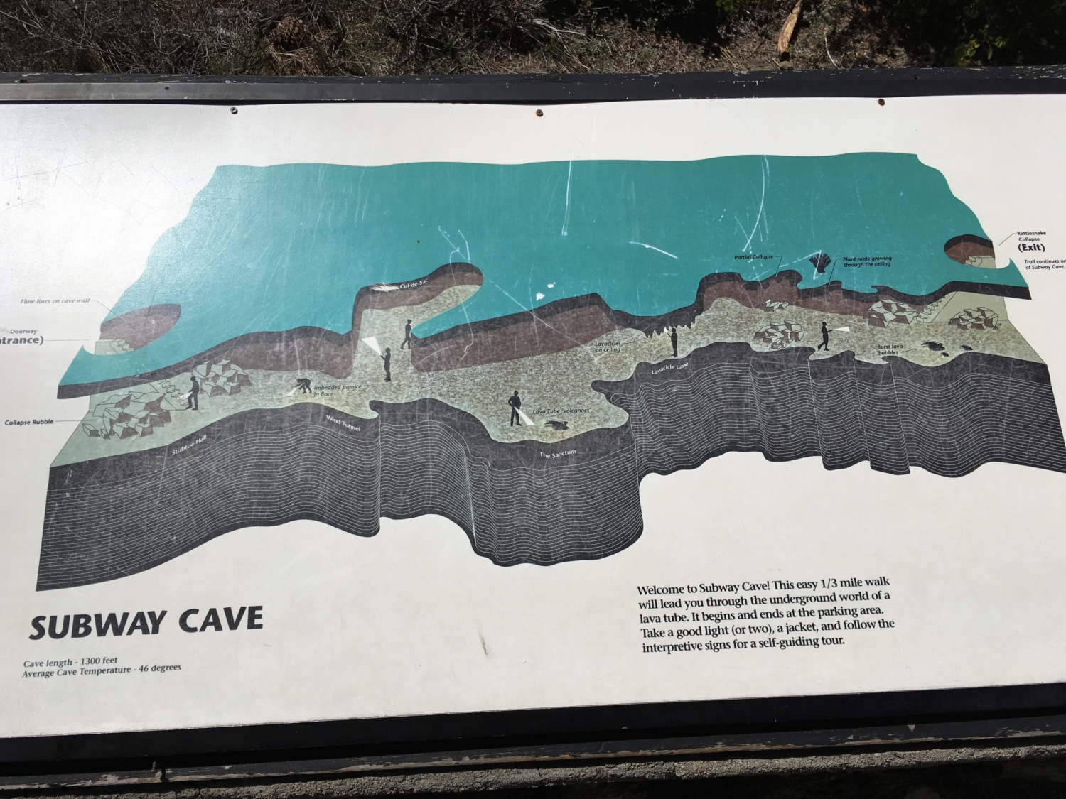
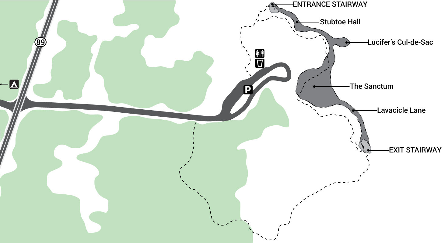
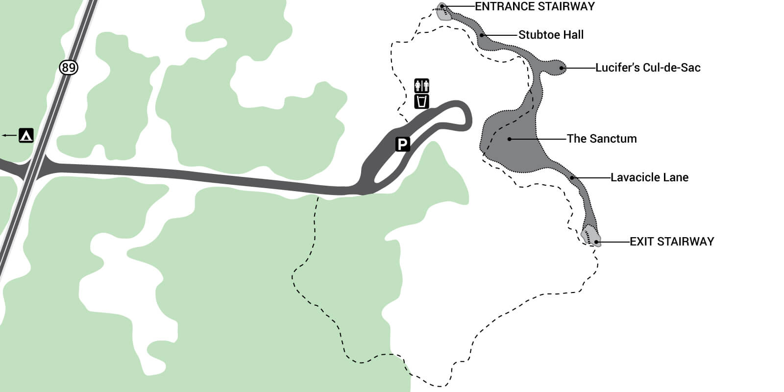
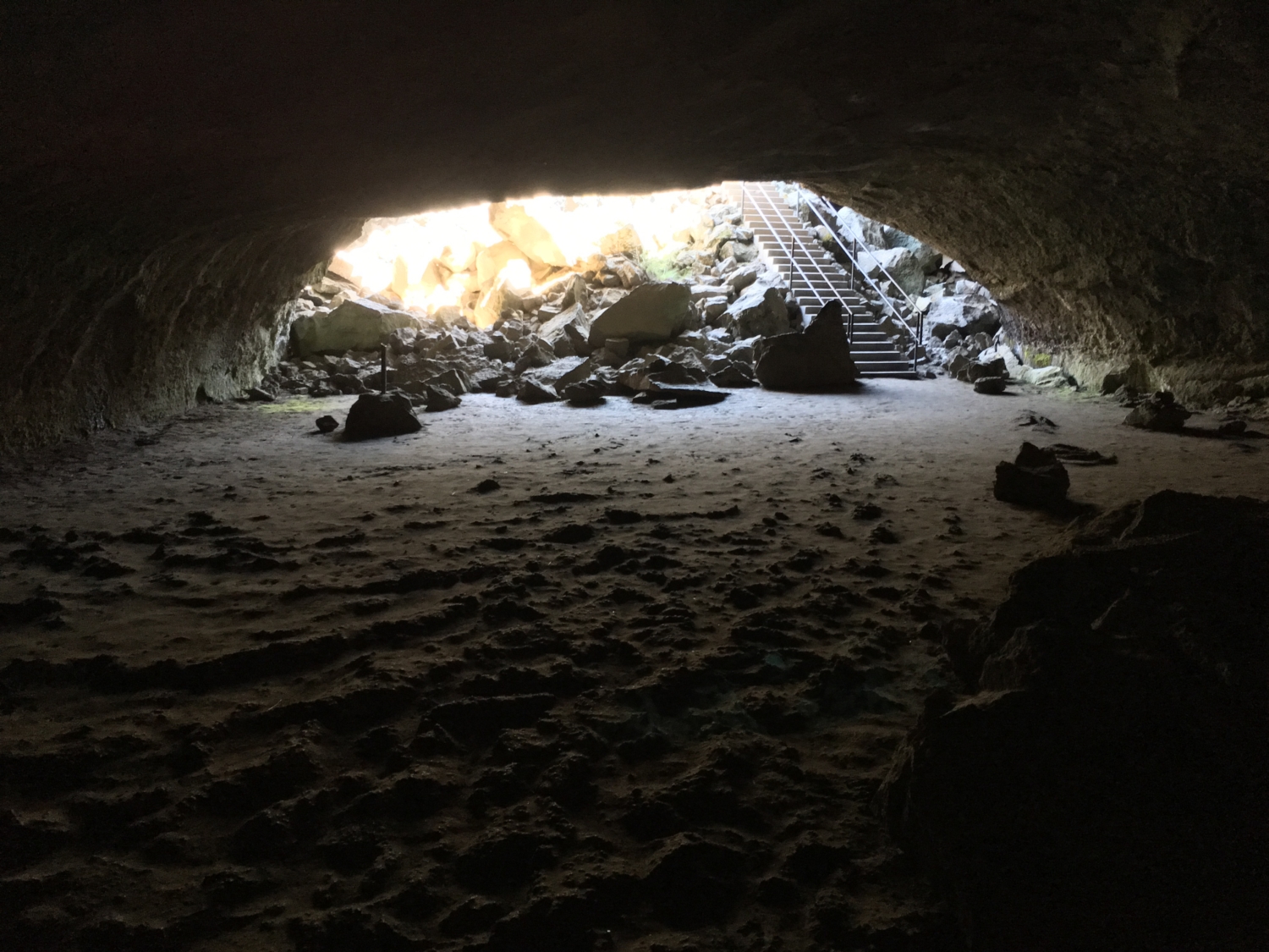
The entrance to the cave is located a hundred yards beyond the pit toilet. A series of stairs lead you down into the lava tube. Interpretive signs dot the path, explaining unique geologic features found only in these types of caves. This is a very family-friendly activity, but make sure to watch your footing as the ground is irregular throughout the entire cave portion. I’d strongly recommend wearing tennis shoes or hiking shoes, and make sure to carry a headlamp and light jacket since the cave is a consistent 46 degrees year-round. Subway cave is 6 – 17 feet tall so there is no need for crawling and only taller folks will need to stoop over slightly in spots.
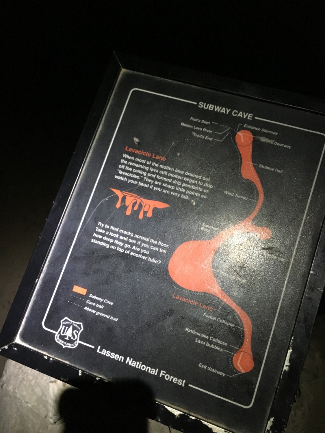
There are two side caverns you’ll encounter while exploring the cave – Lucifer’s Cul-de-Sac and the Sanctum. Both of these off-shoots are completely sealed, which means you won’t have to worry about getting lost. 1300 feet of cave exploration leads you to the exit staircase.
There are three possible return routes:
- Return back through the cave (which is the reason you’re there anyway).
- From the top of the exit stairs, you can head north and follow an above-ground trail past the entrance stairs and back to the parking lot.
- From the top of the exit stairs, you can head west and follow an above-ground trail that loops back to the parking lot.
The total distance is about 1/3 a mile round-trip, no matter which route you take.
Back at the parking lot, there is drinking water, a picnic table, and a pit toilet. Subway Cave is open from April through October and is free to use (donations accepted). I’d suggest driving up to Hat Creek Scenic Viewpoint, located on Highway 44 just to the east, for some views of Lassen Peak and Mount Shasta on your way out.
Tags: cave, Lassen National Forest, Lava Cave, Lava Tub