Tag a close-to-Seattle summit, wander through several forest ecosystems, and get your nature fix at Squak Mountain, a four-season hike that knits hiker-only, horse-and-hiker, and old roads to make a fun loop.
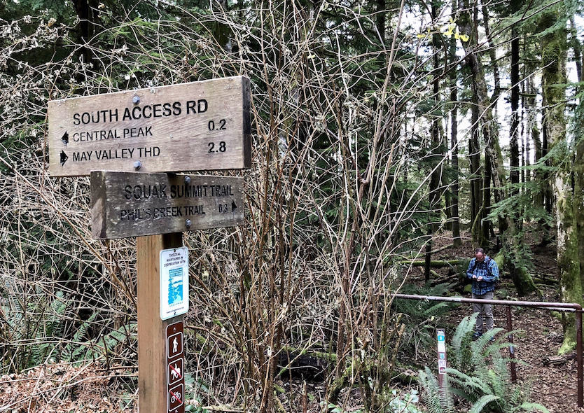
Start at the state park trailhead signed “Squak Mountain Trail” and follow the arrow for Central Peak. In 300 feet come to the South Access service road. Cross and follow the trail toward Central Peak. Note the service road will also get you to the summit — and provides a shorter return route — but it’s not nearly as pretty. Stay on the trail.

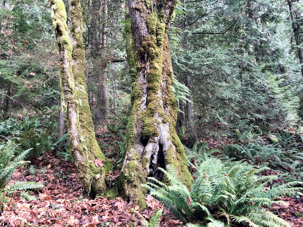
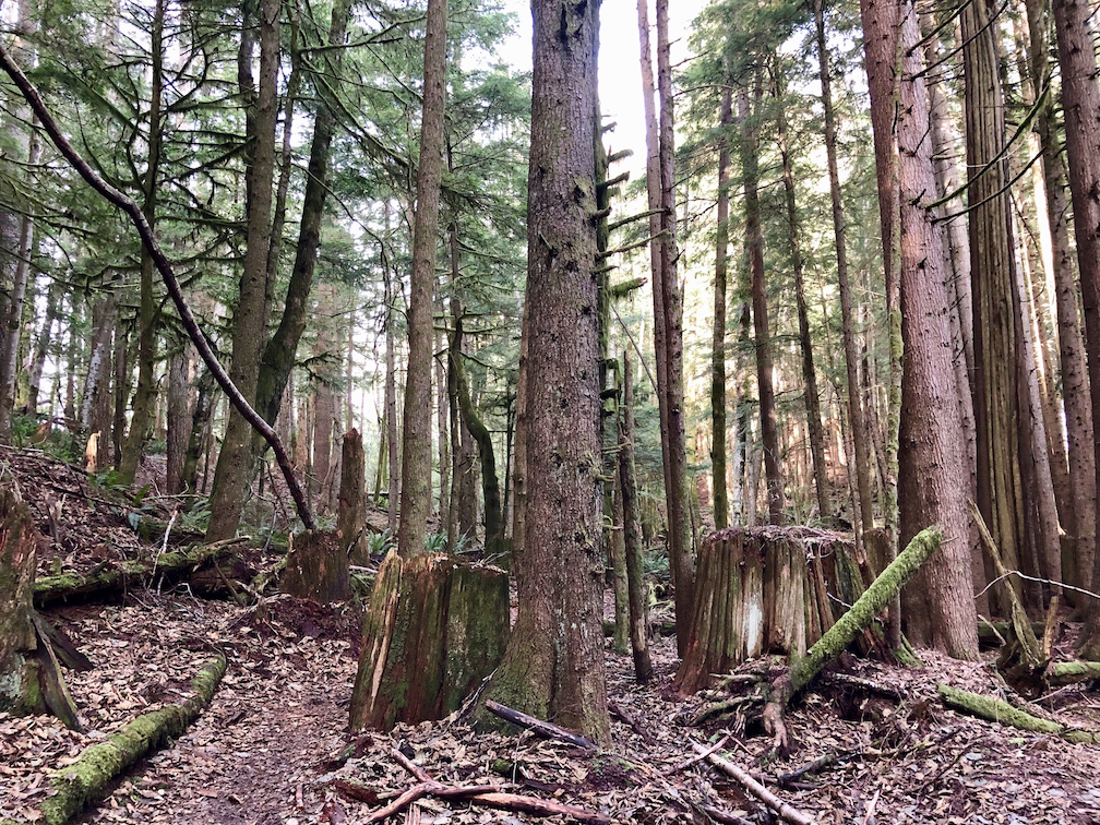
Continue 0.4 miles on a wide trail that steadily climbs through a mature forest of second-growth trees to the first of what will be numerous intersections. Stay on the trail marked “May Valley Loop,” following the arrows toward Central Peak, and you’ll be fine. Keep an eye out for large stumps, testament to the mountain’s logging history. Slowly decomposing, these “nurse stumps” provide nutrients to seedlings, which often grow over and around the old stump.


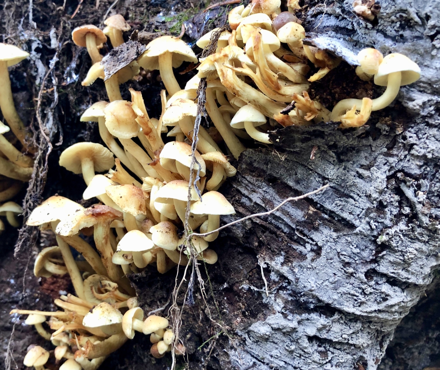
In another 0.75 mile, cross a bridge over a small creek; its source is a flat wetland area you’ll soon be hiking through. Continue on, looking for sculptural mushroom colonies growing in the understory, especially in fall and winter.


As you climb, the trail steepens and the forest changes. About a mile from the creek crossing, arrive at an intersection with the Bullitt Gorge Trail. Horses aren’t permitted on the trail past this point, and you’ll walk through a horse stile fence into the Squak Mountain State Park Natural Area. The 600-acre section covers the top of Squak Mountain and was donated in 1972 by the Bullitts, a prominent local family known for championing environmental causes, to create the state park.
One of Seattle’s most influential families, several generations of Bullitts transformed a lumber empire into an even larger fortune based in media and real estate. Matriarch Dorothy Stimson Bullitt founded KING Broadcasting Company. Her son Charles Stimson “Stim” Bullitt served as its president and was a successful civil rights and environmental attorney as well as real estate developer. An avid mountaineer, he built a cabin atop Squak in 1952 but seldom used it, instructing his children to determine whether to keep, sell, or donate the property. Thankfully for parkgoers, they chose to donate. Washington State Parks eventually acquired another 900-plus acres, and today Squak Mountain is one of the 20 largest state parks in the state system.


After a quarter-mile of climbing the trail’s steepest section, arrive in a flat wetland area dominated by a noticeably younger forest. The creek you crossed earlier starts here. Cedar stumps are everywhere, more evidence of past logging.
In about 0.25 mile, reach a junction with the Bullitt Fireplace Trail and continue up the old road toward Central Peak. The road is actually the former driveway to the Bullittss’ now-gone cabin. All that remains is its impressively large stone fireplace and some concrete column bases. A picnic table there makes a good stopping point.


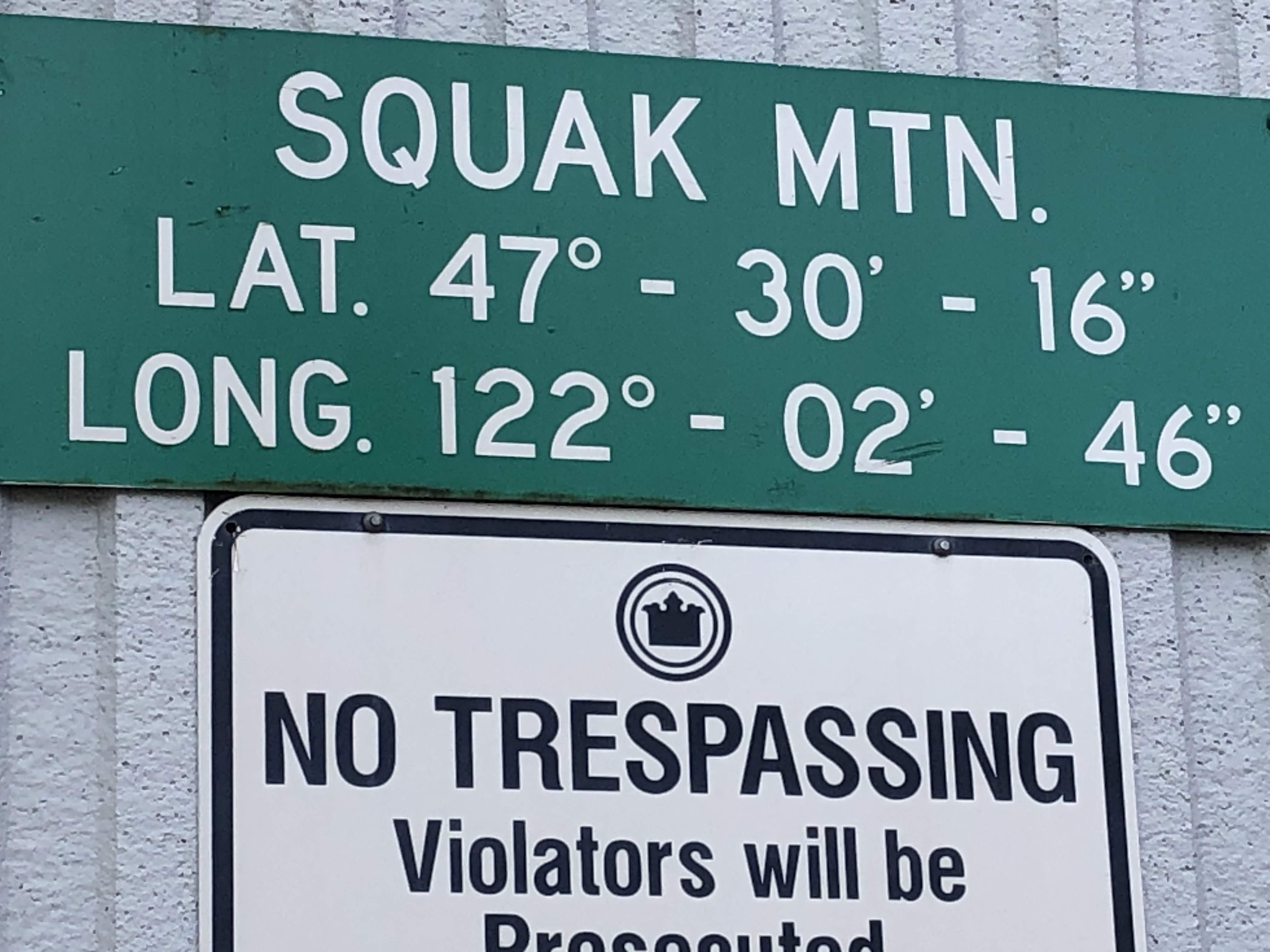
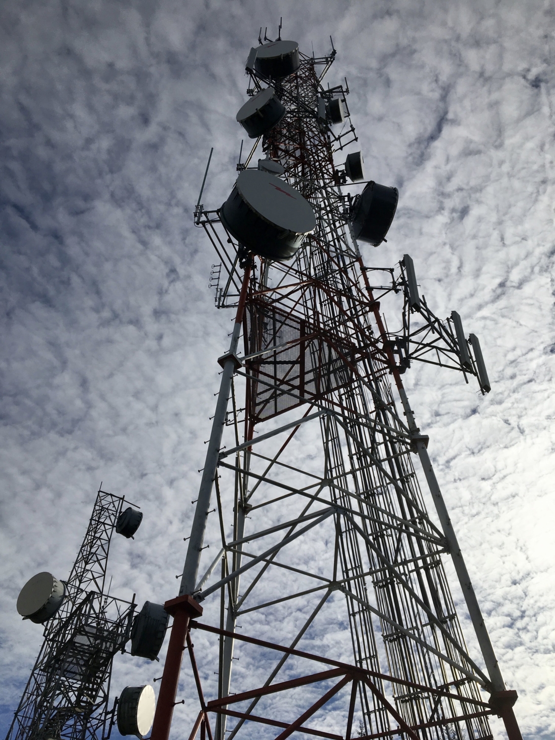
From the fireplace, continue along the trail and start heading sharply downhill. Although you might feel like you’re descending, you haven’t yet reached the summit of Central Peak, so keep going. Soon the trail levels out, then starts climbing again. Pass a few more junctions, staying on the Central Peak Trail. In less than a half-mile, walk through an overbuilt stile and up to the true central summit of Squak Mountain. The forest of trees is replaced by a forest of antennas, secured behind barbed wire-topped fencing. The series of microwave antennas is operated by the Bonneville Power Administration through an agreement with King County, and its only charm is a green sign on the side of one of the buildings indicating latitude and longitude, just in case you weren’t sure where you are. Peekaboo views of Bellevue are visible to the northwest.


At. this point, you’re back on the service road, the same one you crossed at the beginning of the hike. If you’re tired, head straight downhill to the trailhead. But for a more interesting experience, follow the road a couple hundred yards to a signed junction with the Squak Summit Trail. Turn off the road and follow the arrow to Phil’s Creek Trail, 0.3 mile downhill.
At the signed junction with Phil’s Creek Trail, turn right toward the May Valley Trailhead. Enjoy yet another forest ecosystem, this one a brushy riparian zone with plenty of salmonberry bushes lining the trail, which follows the eponymous creek for about 0.7 mile. Walk through another stile and arrive at the only unsigned junction of the hike. Continuing straight will take you back to the service road. Instead, turn left and immediately cross a bridge over Phil’s Creek, then continue on the other side around Squak Mountain’s east summit.

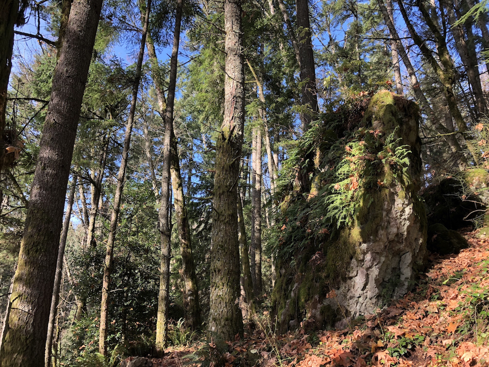
Notice the numerous glacial erratics along this section. These giant rocks were left by retreating glaciers at the end of the last Ice Age more than 10,000 years ago.
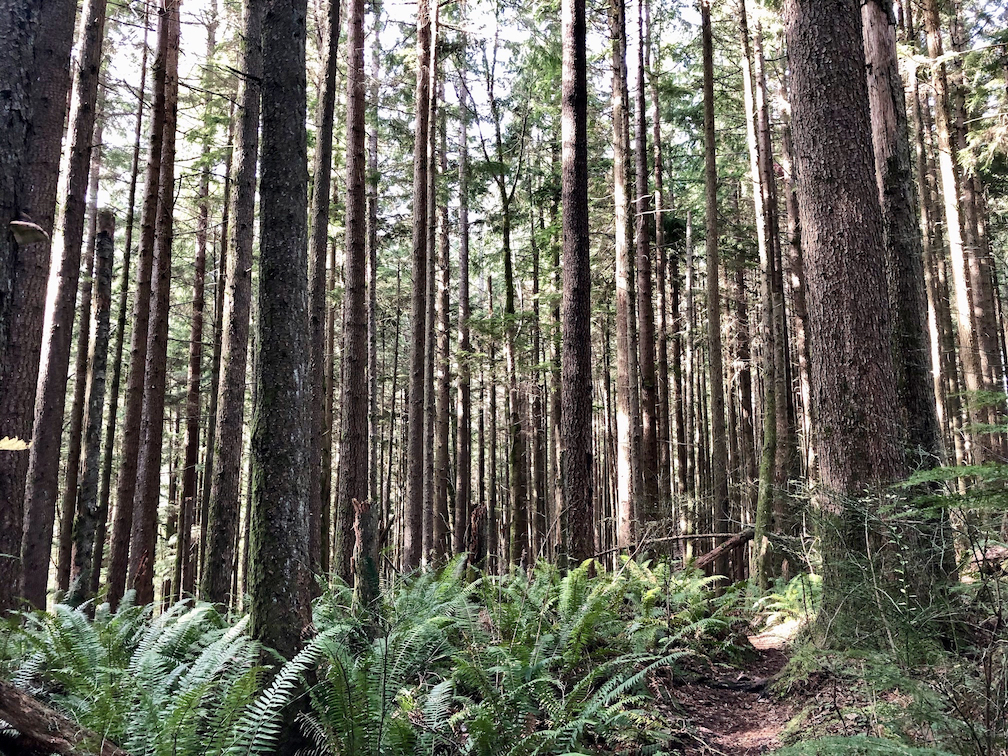
About 0.3 mile after crossing the creek, reach the top of a short switchback series that begins the last stretch of the hike. A bench offers a sweet stopping place overlooking the upland forest below. This is a predominantly maple upland forest with fern understory, lovely in the fall with its carpet of leaves swishing underfoot. Head downhill for 0.9 mile to a signed junction with the May Valley Loop. Either direction will lead to the trailhead, but turning right will shorten the hike a bit. In 0.4 mile, descend a ravine and cross another bridge, then climb out and follow the trail back to the service road another 0.3 mile further.


Cross the road and continue on the signed May Valley Loop trail toward the trailhead a half-mile away. The sign notes that Central Peak, from whence you just descended, is 2.8 miles in the same direction, and you’ll see that turnoff in a few hundred feet. Unless you want to climb the peak again, ignore it and continue straight to the parking lot.
If you have a little energy left, it’s worth a 0.3-mile side trip to walk the flat Pretzel Tree Interpretive Trail. Charmingly illustrated signs tell the story of Field Mouse as he learns about the forest and visits the Pretzel Tree, a twisted specimen sure to enchant little ones. Of-age hikers may prefer a stop at Sunset Ale House, about 3.5 miles away in Issaquah, to enjoy a post-hike brew and raise a glass to those whose foresight preserved Squak Mountain.
Tags: dog-friendly, forest, Hiking, history, kid-friendly, logging, Squak Mountain, summit