The Siphon Draw Trail to Flatiron near Phoenix, Arizona is known as one of the state’s top ten hikes to experience. This route is an unbelievable 6.05 mile round trip adventure that places hikers directly on top of the powerful and towering cliffs in the Superstition Mountains.

This trail is located in the Lost Dutchman’s State Park. The first section of this trail is actually named Siphon Draw Trail and the final one mile section, which takes you up to the very top is known as Flatiron Trail, named for the cliff’s unique curvature.
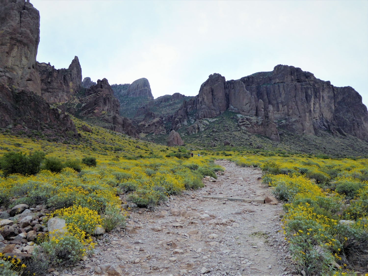
The trail begins on the base of the mountain and gradually takes you up in elevation. You are walking amongst the stillness of the desert, surrounded by the cactuses and soft green colors of the low dwelling plant life — and if you’re lucky enough to be hiking here in the springtime, you might also catch yourself a colorful desert wildflower bloom, too.
You will see Flatiron high above in the far distance and you will continue to see it throughout the entirety of this hike. For now, this dirt path at the base of the mountain is wide and clear, making it easy to follow along and keep track of as you climb up some well-constructed stone stairs.
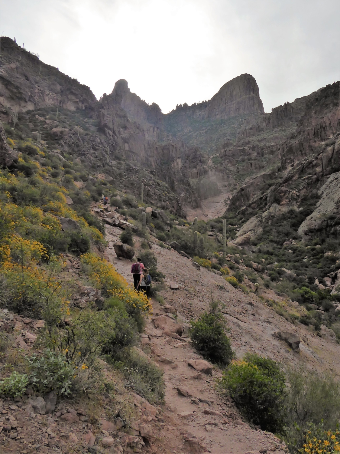
As you approach the cliff, the trail begins curving inward, taking you directly into the heart of this mountain. Here the landscape becomes rockier and you will notice that you are now walking amongst those jagged cliffs that only a few minutes ago seemed so far away. At this point the trail is still clear but that wide dirt path has now merged into more of a gravely, rockier and steeper route.
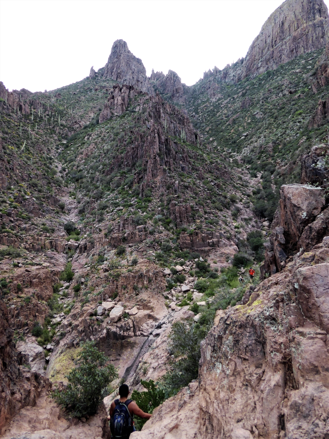
Just as you begin to wonder what’s so epic about this trail, all of a sudden you’ll turn a corner and a huge basin will be staring you right in the face.

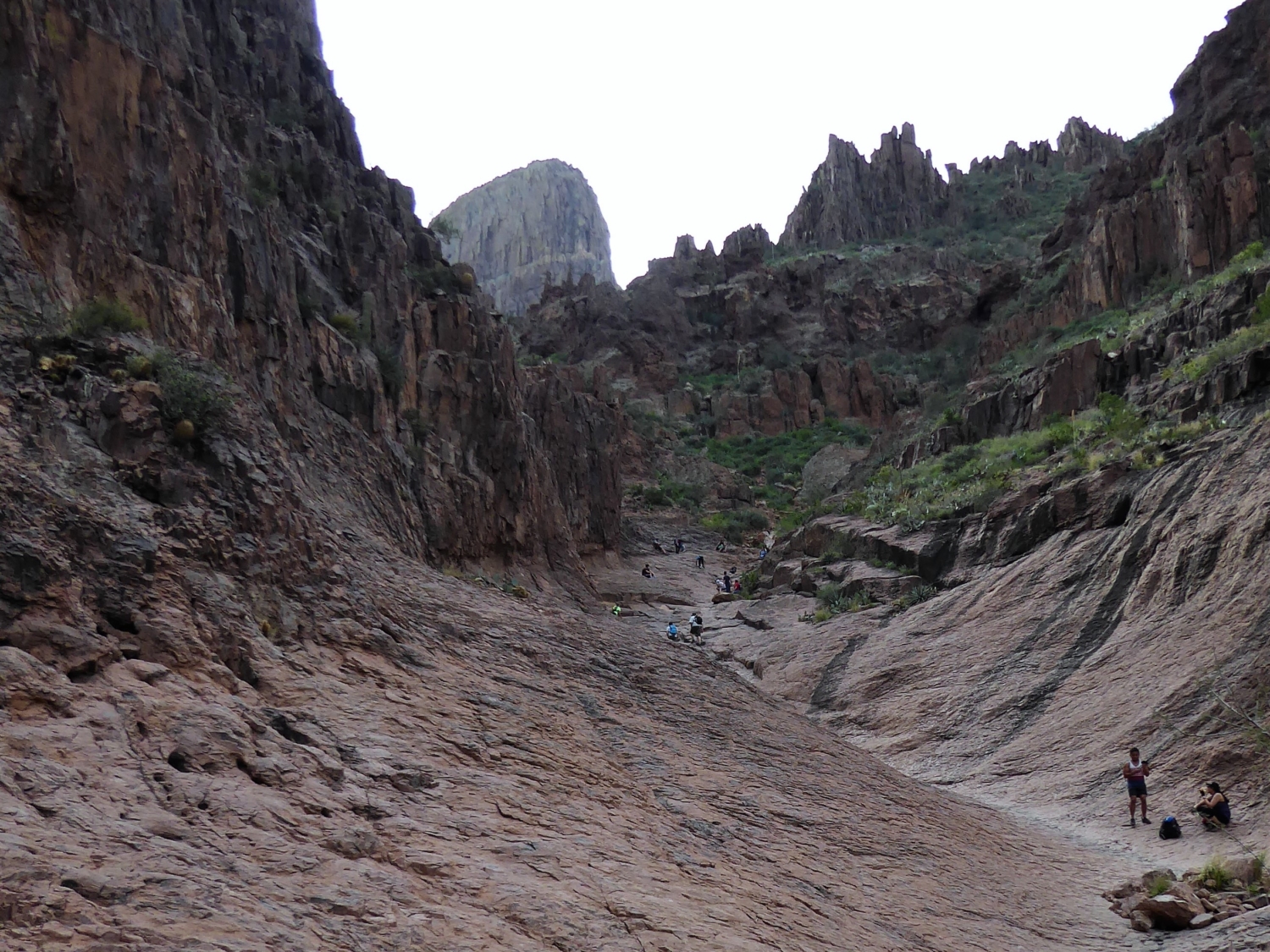
Basin area looking up (notice Flatiron in background)
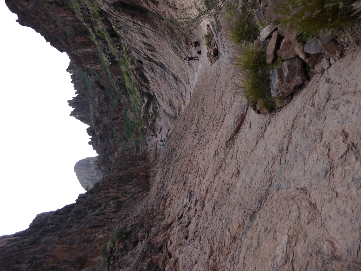
This basin area looks as if it belongs on another planet and doesn’t look like it fits in with the rest of the Superstition Mountains. While standing there at the bottom of this basin it’s easy to imagine a heavy rainstorm, the water rushing down and flowing with the sharp curves. Walking up and down this section is a little challenging because it is not only steep, but the ground here is also at an odd, slanted angle that makes this part of the hike a lot of fun — although you may definitely need to keep your wits about you here!

Basin looking down
Upon reaching the top of this steep basin area, you will have completed the Siphon Draw Trail. This is typically the spot most hikers decide to turn around, but if you’re up for an even greater challenge (and I know you are), Flat Iron is waiting for you above! At the top of the basin area, you will be able to see the final mile to the Flat Iron summit. The view may appear intimidating from here, because you can grasp just how vertical of a scramble this last mile will be.

View of last mile (Flatiron cliff on right)
This section of the trail is not well marked and can be a little confusing. There are some areas where a white or blue dot/arrow will be spray painted on a rock directing you to the trail, but other than that there are no other markers directing your path.

Example of painted white dot as a trail marker
The secret hint to this trail is to stay to the left. As one hiker put it, “the mountain will want you to go to the right, but you have to stay left.” This trail will usually look like it’s leading you toward the right, so most people have a tendency of following that (which also wears more use trails that direction, which leads more hikers there, etc. etc.). But now, since you know the secret, the key to Flatiron is to keep your eyes peeled for certain areas where the trail actually veers to the left. If you miss it and keep staying on the right side, no worries – you can still reach Flatiron. It’s just that the left side is easier to maneuver, especially toward the end of the climb.

The very last area of this scramble is when you will come to a rock that you will have to climb up vertically. The height of this rock is only about 8 feet so you don’t necessarily need rock climbing skills in order to do this, but you should have some basic scrambling know-how. If you stay on the left side of this rock wall you will see a little tree growing out of the mountain. This small but strong tree makes a great handle to help you lift yourself over this rock wall. Notice the smoothness of the branches of this trusted tree, due to it aiding all the hikers before you. Once over that rock wall, the rest of the trail is a piece of cake! You’ve made it to the top of the mountain and now you just need to walk over to the Flatiron area on your right.

Climbing the rock wall (notice the tree to the right)
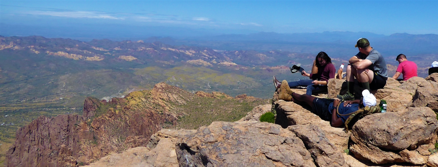
Your heart will be beating with excitement as you walk towards the edge of Flatiron. You have worked so hard to get to this spot and it doesn’t disappoint. The air feels crisp as you breathe it in and the winds become cooler and stronger. As you step towards the edge you get an all-encompassing view of the rolling mountain tops and the surrounding mountains and city below you. The blue of the sky and the green and brown color below you makes you feel as if you are standing on top of the globe. It’s such a stunning view that it’s hard to take your eyes away. Eventually though, you will need to come back down to that land below you. In order to do this, you simply just return the way you came.

View from the top of Flatiron

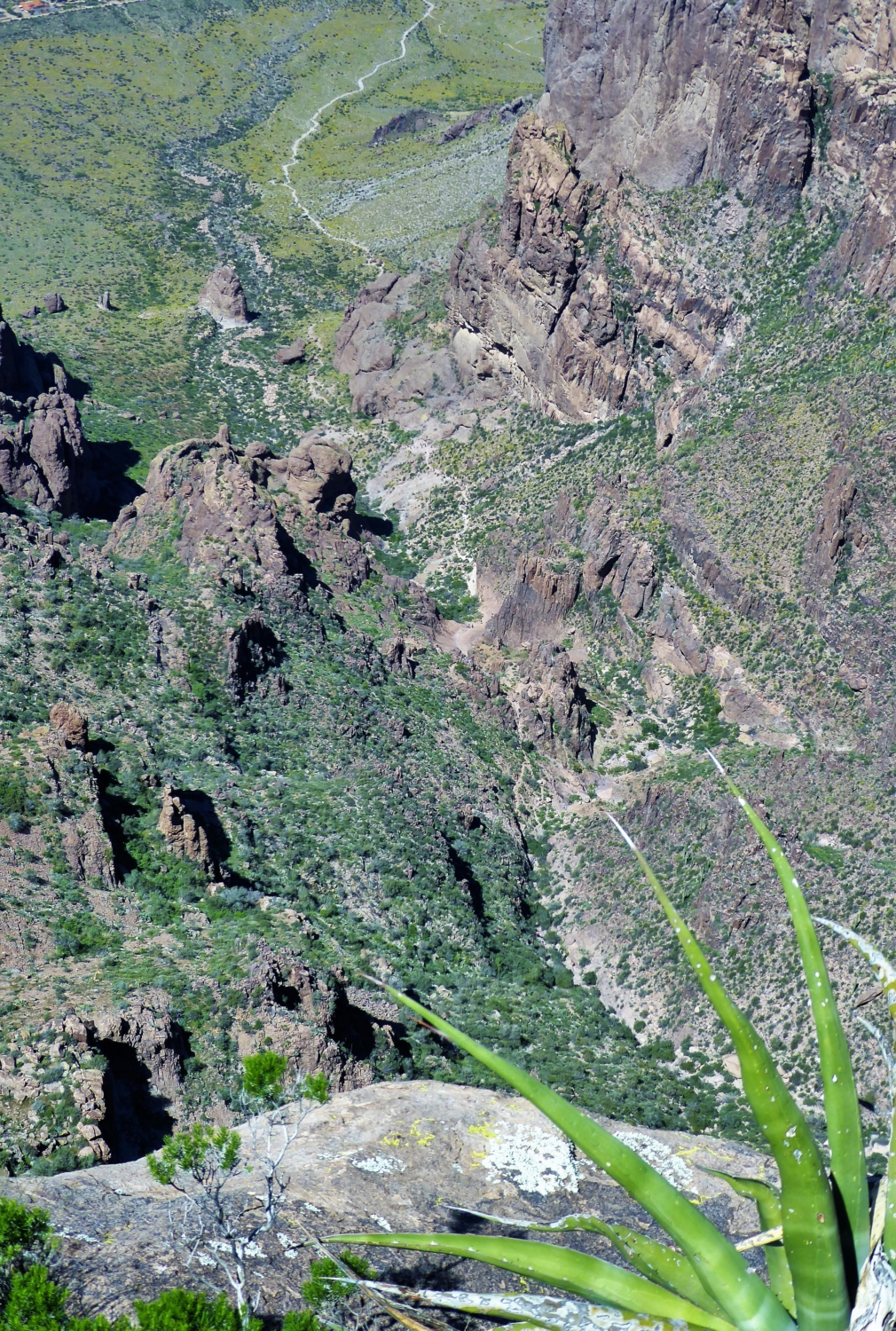
Looking down on the trail from a top Flatiron

View from the top
Be careful going down that 8-foot wall because now it’s harder to see where to place your feet. If you are struggling with this section I suggest asking someone below you to help direct your feet or else just take your time to feel the notches. Also like the ascent, expect the descent to be steep! I did a lot of controlled butt sliding and crab walking going down this trail (which made gloves very handy)!
Once you’ve reached the basin again, the trail is not as steep and is more manageable to walk down. As you walk towards the parking lot you can look back and see Flatiron shrinking away behind you. You may walk away exhausted but also exhilarated knowing that you just conquered Flatiron!
I don’t know about you, but I can always go for a good burger and a beer after a great hike! Luckily, I know a place nearby!
After leaving the Dutchman State Park, turn left out of the park and you will see Goldfield Ghost Town on your right. Turn in here and go to the Mammoth Saloon. They have great burgers, cold beers and a patio that looks out right onto Flatiron. It’s the perfect ending to the perfect day hike!
Notes:
- $7 car admission fee into the park
- Lots of parking spaces, with restrooms and water sources near the trail head.
- Dogs allowed (but I would not recommend).
- No bicycles.
- May want to bring gloves (you will be grabbing onto rocks).
- Don’t wear loose fitting clothing, that you could easily trip on.
- Watch out for falling rocks!
(as I was hiking this trail, I witnessed another hiker being rescued and airlifted off the mountain, due to head injuries from falling rocks)

Hiker being air lifted to hospital after sustaining head injuries from fallen rocks
Tags: Arizona, Flat Iron, Hiking, Lost Dutchman State Park, Phoenix, Siphon Draw, Superstition Mountain, Trail Write-Ups, wildflowers


