
This moderate loop trail on the slopes of Mount Hood visits picturesque Umbrella and Sahale Falls on its meander through ski runs, forest, and alpine meadows with wildflowers in late summer. Other than a few small sections of trail, the route is fairly moderate and should be approachable for most hikers — though it is important to keep in mind that most of the elevation gain will be done on the way back out. For anyone looking to get all their elevation over with at the beginning of the hike, an alternate trailhead is at the lower elevation near the Hood River Meadow (HRM) parking area of the Mount Hood Meadows Ski Resort.
To hike this trail as described here, park your car just outside the main parking area for the Mount Hood Meadows Ski Resort. Although Meadows is primarily known as a ski area, in recent years the resort has expanded its warm season offerings as well. In 2020, the resort greatly expanded summer hiking trails and recreational offerings on certain days in the summer months. Be sure to check their Summer Operations page for more info (or to see when the parking might be more crowded!).
When I hiked this route, the main lot was closed — but the trail itself starts on the southeastern side of the main lodge parking area and I assume is usually signed with something a bit more permanent than what I saw:

look at those late summer wildflowers, though!
The good news is if you were really just looking to get to a waterfall quickly, you’ve chosen the right trail. Look for a partially paved but still rough route that will make a slight descent around a few short switchbacks. And in no time (and about 0.2 miles of light hiking), you’ll be right at Umbrella Falls!


This is really a great way to start off the hike, and there is a nice area just across a footbridge to sit and watch / listen to the falls for as long as you’d like. But remember — you just started! And there’s a lot more beautiful hiking to enjoy!
When you’re ready, walk across the wooden footbridge and follow the wide dirt path into the forest. Keep an eye out for a sign at a junction at about the half mile mark and keep right to head toward Sahale Falls on the Sahalie Falls Trail #667C (note that the falls is spelled both “Sahale” and “Sahalie.”)

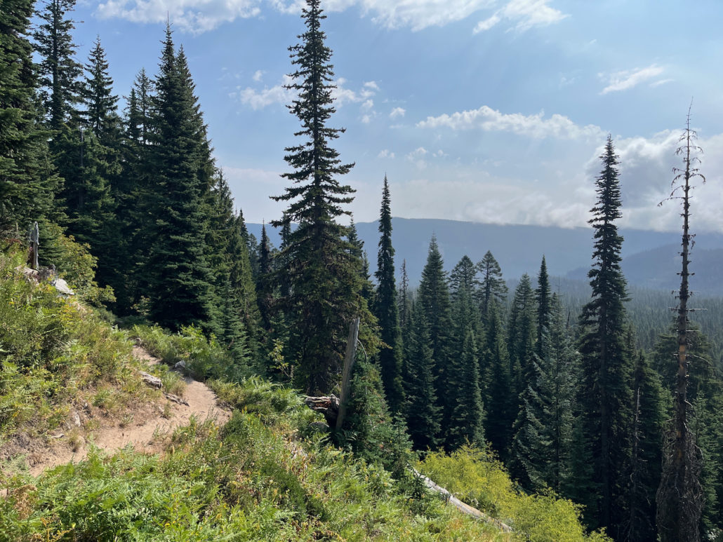
From here, the trail begins a gradual but noticeable descent as it heads into a more dense stretch of forest. If you’re hiking in the late summer / early fall, some of the blooms of leafy aster and goldenrod will start to give way in the shadier sections of trail. Don’t worry — you’ll get some more meadow views later!

This wooded trail hops over Meadows Creek a few times before reaching a steep ridge on the north side of the East Fork of Hood River (that’s a lot of directions, I know). If you’re looking off to your right, you may be able to see or hear the East Fork down in a ravine below you.
At 1.6 miles, you’ll see an established spur trail with a sign leading toward Sahalie Falls. Unfortunately, this trail does not really take you to a place where you can easily see the cascade. You can hear it, but it’s tough to spot through the trees.

This is basically where the trail stops.
If you’re in the mood for scrambling and going off-trail a bit, there are a few worn use trails that will take you down a steep, slippery slope closer to the falls. Your other, more safe option is to look for a use trail that heads downstream along the ridge, which will put you onto the paved road that runs between the Elk Meadows Trailhead / Hood River Meadows parking area and Mount Hood Meadows Drive.
From here, you’ll be able to stand on a bridge with a perfect, direct view of the falls. Here, you’ll be at about the 1.8 mile mark.

From here, you can walk along the road to the next section of the trail, but if you can make the short scramble back up to the Sahalie Falls Trail you’ll definitely have better scenery, and usually scrambles are easier going up than they are coming down. So you’ve already done the hard work!
It’s more gentle forest descent and just before the 2.4 mile mark, you’ll cross that access road again and walk through one of the cross country skiing routes along Meadows Creek. It’s a little odd seeing this strange linear meadow in the forest, but it’s kind of neat to see the difference in what types of plants are growing in these sunnier ski run areas.

At the 2.5 mile mark, you’ll cross the Elk Meadows Trailhead Road and pass a trailhead with a picnic table and toilet. Interpretive signs will help you understand the relatively recent volcanic and geologic history of Mount Hood. It’s also a nice place to rest since it’s gonna be uphill for the rest of the way, so refuel, stretch out, and continue on the Sahalie Falls Trail #667C as it passes through a few more cross country ski runs.
At 2.9 miles, take a left to hop onto the Umbrella Falls Trail #667 and start to make the long climb back up to the trailhead. If you hit the wilderness boundary, you missed this turn! Head back!

If you’re a skier on Mount Hood, you’re about to head into the area around the HRM (Hood River Meadow) lot and the Hood River Express lift. You’ll be hiking across the Skiway trail, as well as Skilit, Willow, and Kinnickinick — which, as a modest skier here, is kind of neat to experience when you can see the terrain not covered in snow. This is also when the views start to open up more generally as well.


There is a section of the hike here that gets a little tricky to follow. At about 5.2 miles, just after you’ve passed beneath the Hood River Express ski lift, the trail turns west and heads across a narrow gully — but it’s not clearly marked and there is a path that continues to head up the mountain generally parallel to the ski lift. You’ll want to head west / southwest here as the trail crosses a small creek and ducks briefly into a forested area between ski runs.

these hikers are heading the right way, but we all got a little spun around here
A bit past this location, you’ll pass a few more ski runs and see what is — oddly — the only view of the summit of Mount Hood you’ll get on this entire hike. It’s a short-lived but very lovely view, though.

From here, keep to the left at the junction at 4.5 miles, then keep right at 4.7 miles to head back to the trailhead the way you came in.
Tags: mount hood, mount hood meadows, sahale falls, umbrella falls


