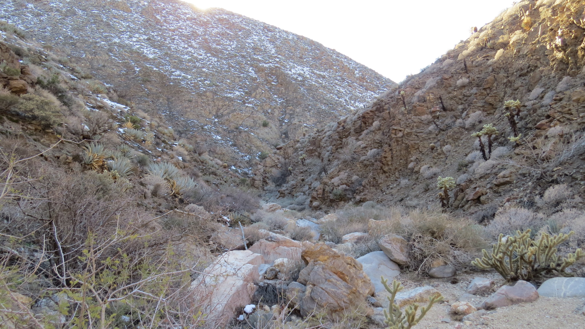
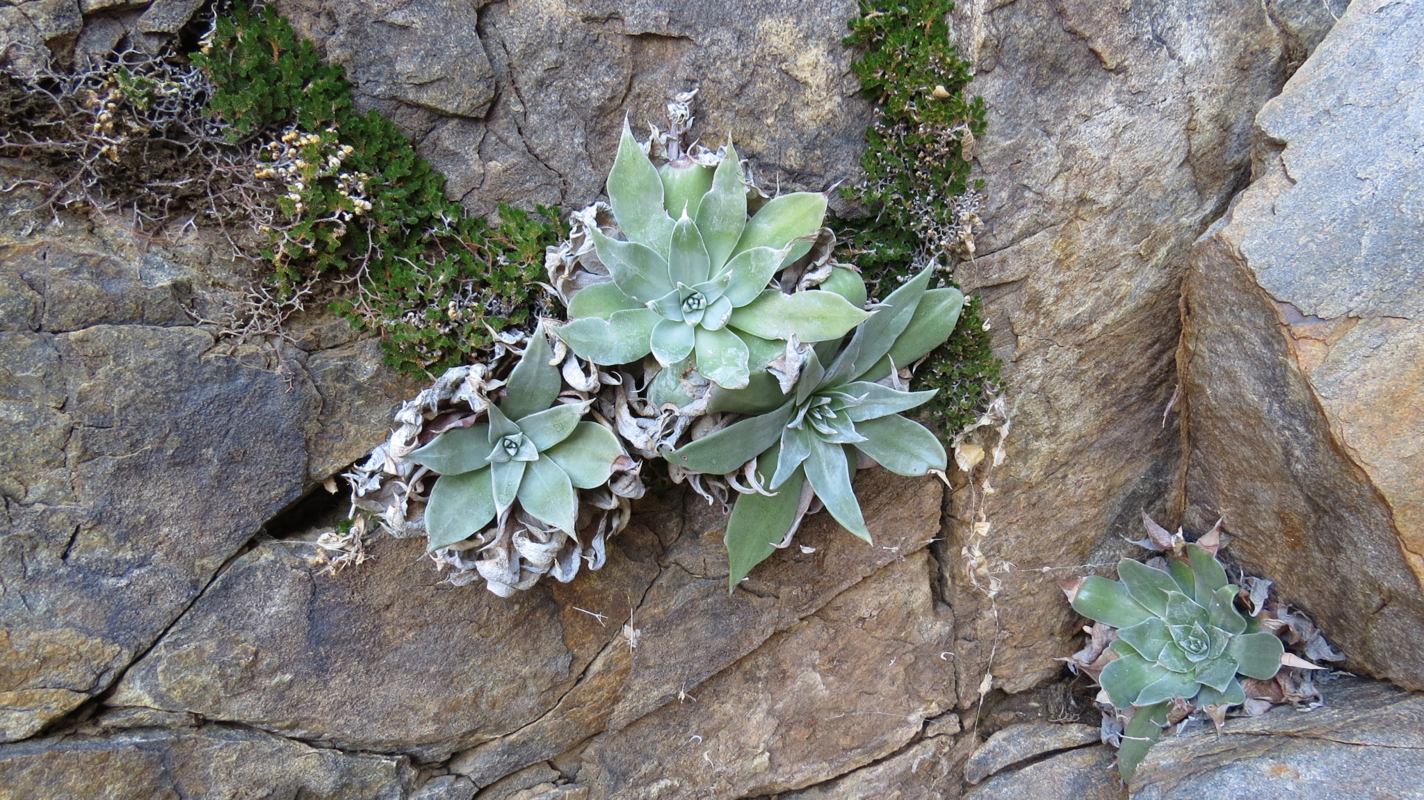
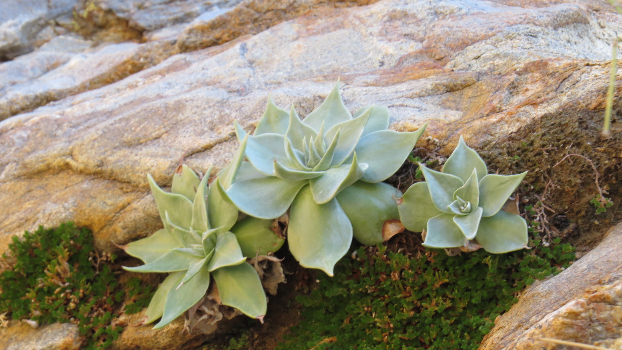
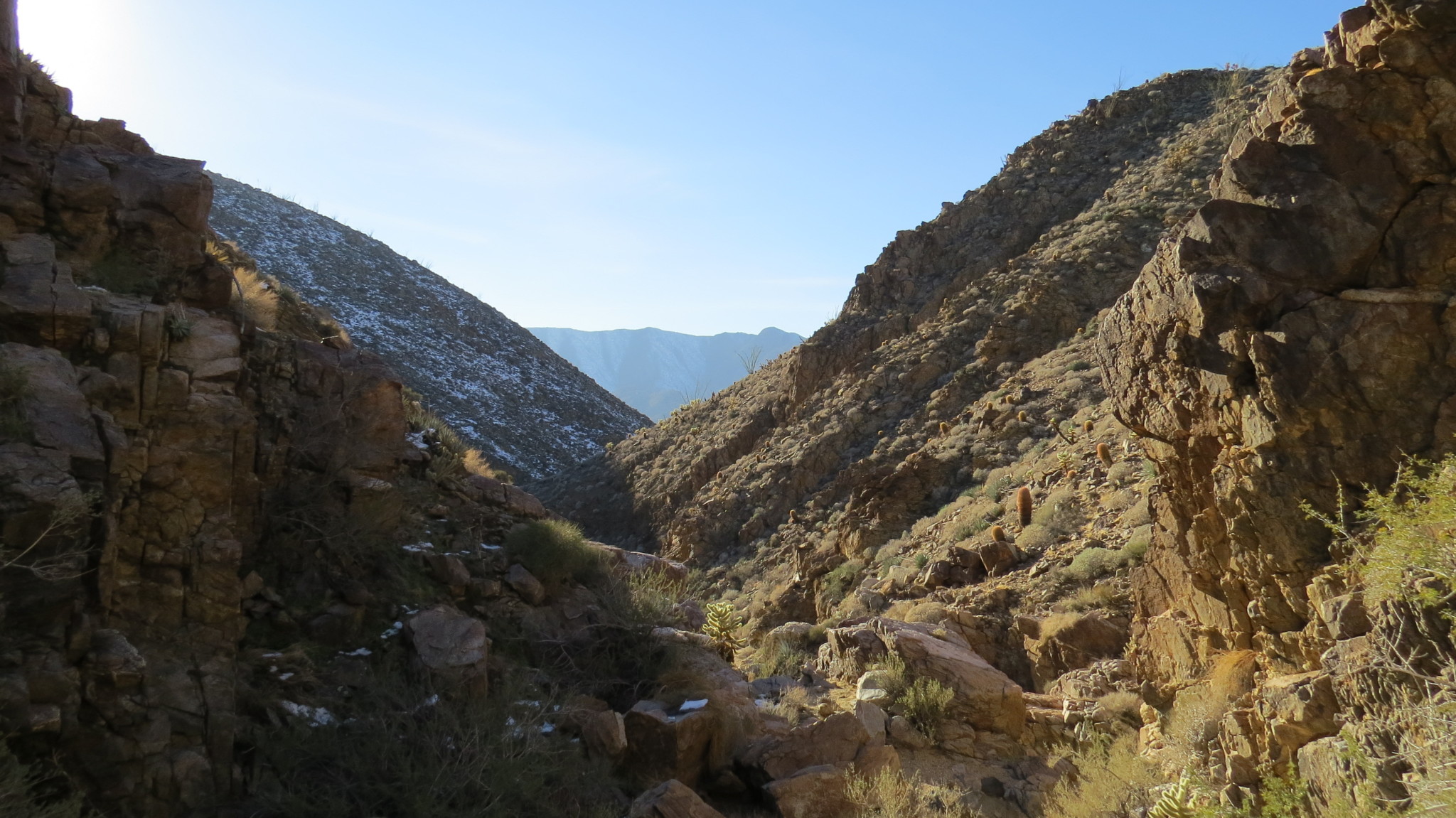
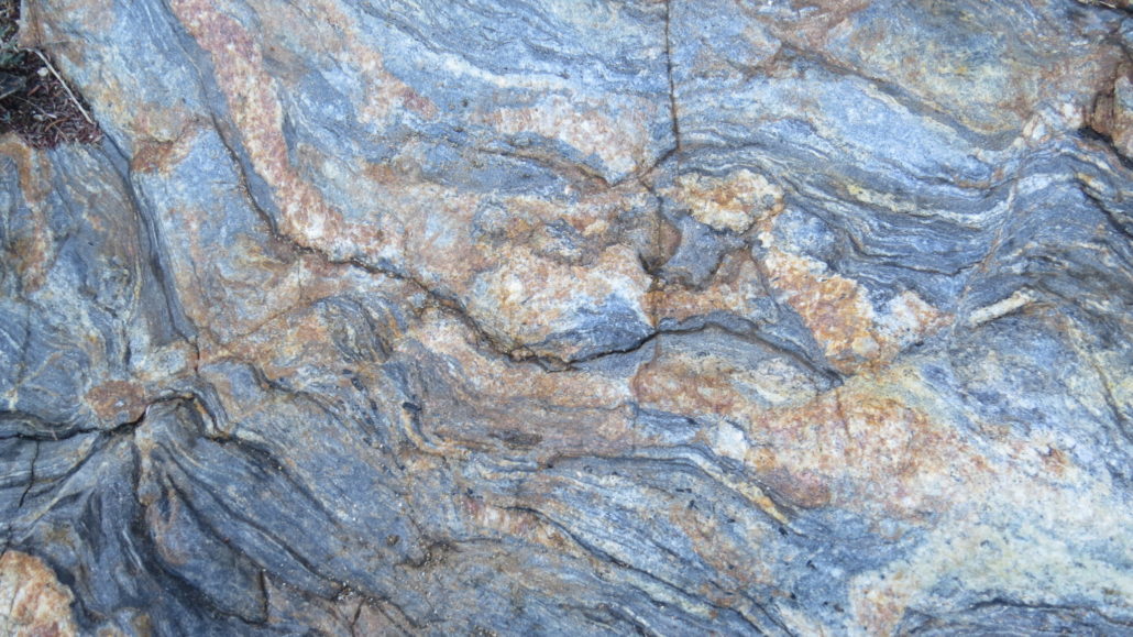
For a delightful introduction to desert canyon hiking, head to Anza-Borrego Desert State Park’s informally named Rainbow Canyon. This sinuous canyon composed of colorful metamorphic rock contains a number of interesting features within its intimate folds. Aside from the colorful rock which lends the canyon’s name, the canyon features an array of succulent vegetation growing out of seemingly every crack, a series of enjoyable dry falls that will help you build your scrambling skills (or enjoy the skills you’ve already developed), and a lovely sense of isolation in a quiet corner of the park.

This route would also make a fine introduction to desert hiking for children. Although children are often as adept as monkeys when it comes to scrambling and climbing, some of the younger ones may need a lot of support making it up and over the falls. The “moderate” rating for this hike – perhaps an overreaction on my part – stems from these obstacles. For safety’s sake, maintain an awareness of your ability (or your child’s) to navigate such obstacles. If that’s not your cup of Mormon tea, this hike may not be for you. Also, if you are bringing kids, be sure to educate them about the terrors and torments of cactus spines lest they decide to dabble in autodidactism.
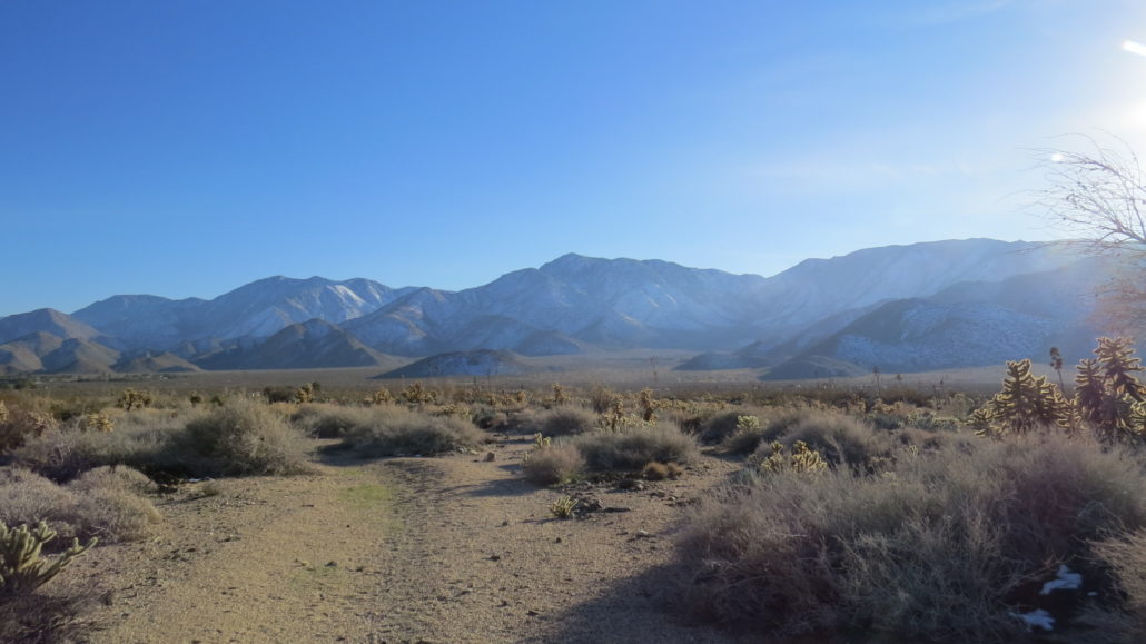
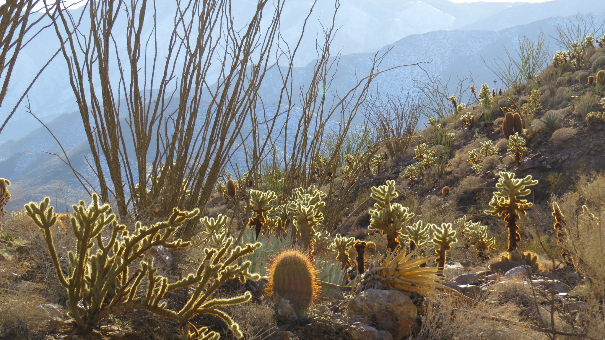
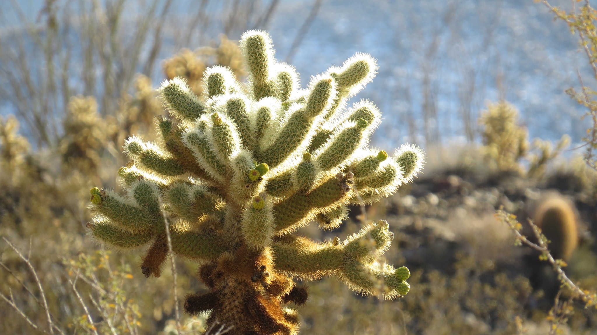
From the turnout on S-2, follow an informal path northeast until it blends into Rainbow Canyon’s wash. Stick to the wash as it progresses toward the mouth of Rainbow Canyon. Be sure to look back to take in the panorama of the Laguna Escarpment where the high Laguna Plateau drops suddenly and spectacularly to the desert floor below. Closer afoot, enjoy the wide array of cacti, agave, and ocotillos that characterize this transition zone between the low and high deserts.

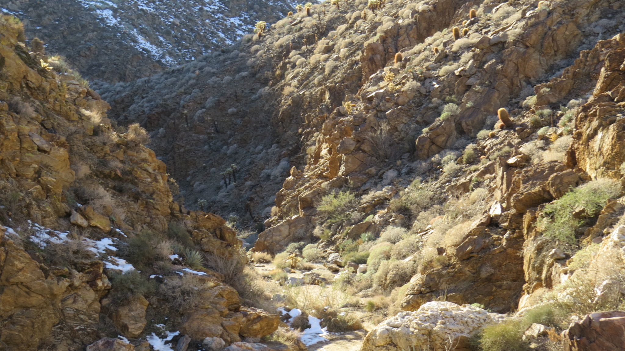
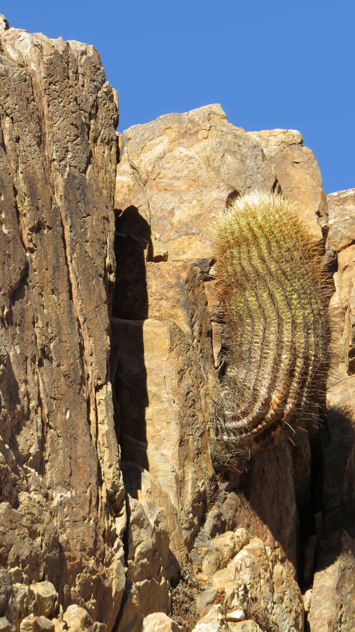
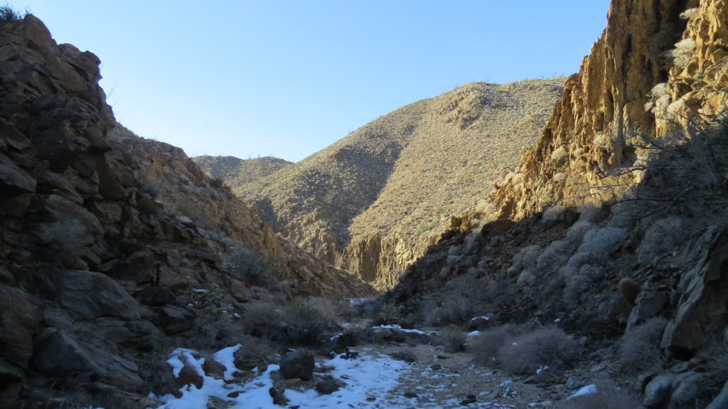
Upon reaching the mouth of the canyon, the walls will close in, enveloping you within their intimate folds. Quartz pegmatite dikes punctuate the colorful bands of metamorphic rock, occasionally creating the dry falls that you will have to scale and occasionally circumvent. Cacti and dudleya (aka “liveforever”) sprout from cracks in the walls seeming to take hold wherever even the barest bit of soil allows them to root. Springtime brings a riot of flowers, suffusing the canyon with a rich, honey-like smell.
The canyon wends on in this way for just over 1.1 miles. You could continue beyond the 1.1 mile mark where the canyon widens, but the going gets less interesting from here. If you were so inclined, and you came armed with a map and compass showing the Blair Valley area (USGS Monument Peak and USGS Earthquake Valley), you could reach the southeast end of Blair Valley and make your way to Ghost Mountain and the Marshal South House. If you don’t have the time or inclination for that sort of adventuring, simply turn back when you’re ready to return to your car.
Tags: Anza-Borrego Desert State Park, Blair Valley, Great Overland Stage Route, Laguna Escarpment, Mason Valley, Rainbow Canyon