Don’t skip tiny hikes. Getting lost in a national park or the backcountry has overwhelming charm and mystery—but sometimes, to jar us loose from the day-to-day, little gems work best.
The 1.5-mile trail at Point Dume is full of them, made all the more special by the initial frustration of navigating the area itself. The trailhead abuts Cliffside Drive, facing residential homes and flanked by ten two-hour parking spaces, the only available options within walking distance. Timing is key, as there are often a few other would-be hikers waiting for a spot to open up, but there’s turnover every ten minutes or so.


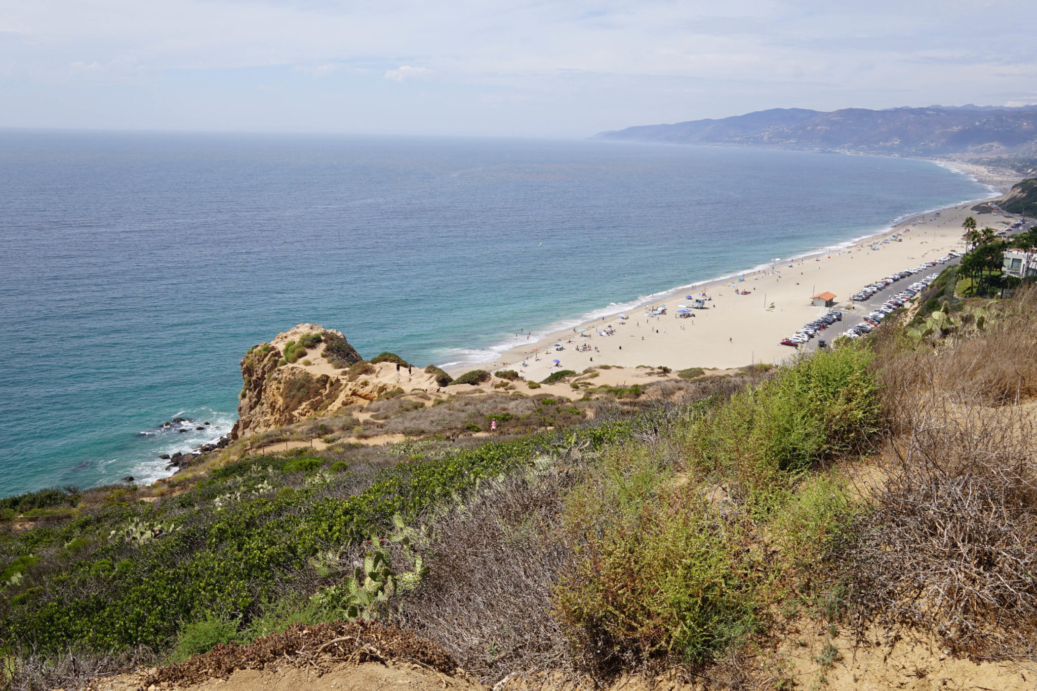
Walking in past the sign that marks the entrance, California coastal scrub gives way to a spectacular view of the Malibu coastline. The path splits in two not far along: left toward rusty fences and a staircase down toward the base of the cliffs, and right toward the highest point of the hike. Bearing right, the path splits again: right, upwards to an overlook, or left, along a walkway of wooden planks out along the point itself.


This area is well known for its whale watching in spring, but managed some magnificent wildlife even in early September. Dozens of sea lions sunned themselves on ledges at the cliff’s base, while a few rogue individuals played in the waves crashing around the rocks. Further out into the bay, a pair of dorsal fins lazily chased each other, occasionally breaching enough to showcase the dolphin underneath. The couple on the promontory sat and watched until the dolphins swam out of sight, and stayed a little longer to listen to the sea lions.


From there the path curves back around towards the street, passing an offshoot on the left that leads down to Point Dume State Beach. There is paid parking abutting the beach, a potential option if the line on Cliffside Drive is too long.


Walking along the street, another path opens into the reserve halfway back to the initial trailhead. This will take you up to the overlook that was bypassed earlier, featuring a better view of the coast and a short history lesson.


You’ll read that you now stand on a point that was named by an English explorer for a Spanish friar only two decades after America achieved independence. This would be slightly more impressive if that friar’s name, Padre Francisco Dumetz, had been taken down correctly by the explorer, George Vancouver. Instead, the misspelling he logged on his map stuck, and “Dume” has held fast. Vancouver was a renowned explorer—so much so that he has a major city in Canada named after him, one of many places to bear his name (including New Zealand’s sixth highest mountain). He hopefully paid slightly more attention to detail on future expeditions.
Heading back down the overlook, the path you came up connects to the one off of an earlier fork, the one where, had you not opted for the wooden planks, you would have found the overlook. Follow that down to reach that fork once more, and head back towards the reserve entrance, this time angling towards the rusty fences. You’ll see the beach below, potentially with a few (very) intrepid beachgoers—the rocks between the cliffs and the waterline are catch the eye, but don’t look particularly comfortable.


The staircase down to the beach is itself a small adventure, so tread carefully—small rends in the metal stand out plainly, and potentially larger holes (or even entire missing steps) are covered by wooden boards. Once navigated, enjoy the spray patterns the waves make against the rocks and your feet in the water. The little stretch of coast here is unique for Malibu: un-manicured, rough and uncomfortable. Beautiful in a raw sort of way.

When you’re ready, it’s a straight shot up the staircase and back out to Cliffside Drive. It’s worth a look back over the tiny hike you just finished, as you can see most of it from your parking spot. It was never out of sight of civilization, and probably didn’t take more than two hours (if you really ambled). But there was something at almost every turn—a little gem, glittering. The people waiting in line will thank you for the parking spot.
Tags: Cliffs, Hiking, Los Angeles, Malibu, ocean, Sea Life, Whale Watching


