Simply put, Piestewa Peak Summit Trail is a merciless hike — but it’s a fun challenge with a rewarding view.
Once at the trailhead, you will gain an elevation of 1200 feet in the 1.2 miles it takes to reach the 2,608 ft summit … so, let’s just say you’re going to want to stretch out before and after this hike, and that you’re probably not going to want to get going on this on a hot, sunny afternoon.
This trail will lead you to the 2nd highest peak in Phoenix and since it’s located right within the city it’s a convenient hike for locals and tourist alike, making this is a very popular trail for all different types of hikers.
Created in the 1930s this trail was originally named Squaw Peak. The name has recently changed to Piestewa Peak, in honor of Lori Piestewa who was the first female Native American to give her life in combat. (Although it isn’t uncommon to hear locals still referring to it as Squaw Peak.)
This trail is located in the Phoenix Mountains Preserve and the trailhead is located in the first parking lot to your left as you enter the gate to the park (there are no distinct signs within the park directing you to this trailhead). Due to the popularity of this trail, it’s not uncommon for the parking lot to be full. Therefore, you may have to park further away from the trailhead at one of the other parking areas located within this park or wait patiently for another hiker to leave.

Beginning of Trail
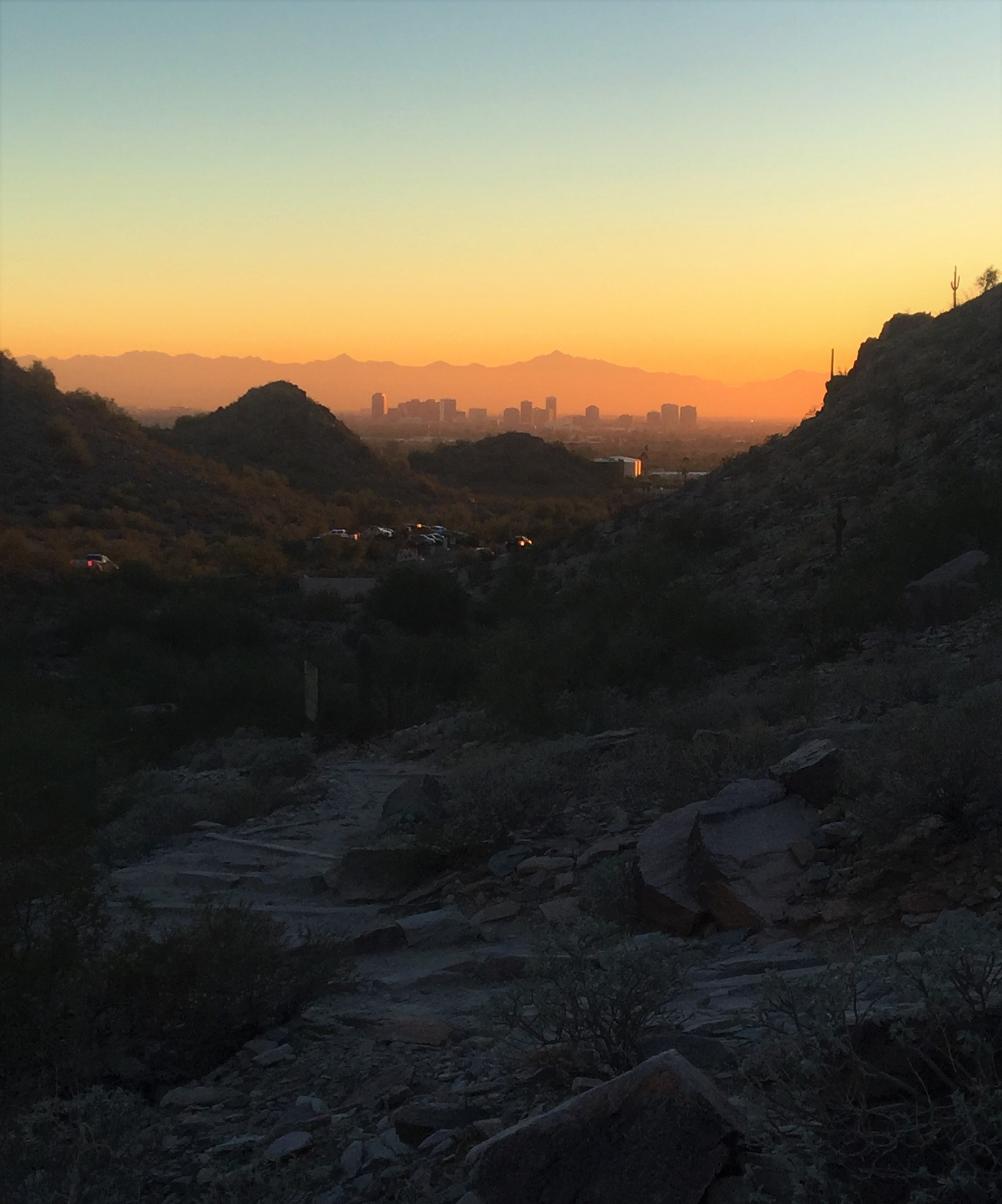
The beginning part of this trail is made up of an old concrete path that has evolved over the years into a mixture of broken concrete, gravel and dirt. This section is surprisingly steep and therefore advances up the mountain rather quickly! Heavy breathing from all hikers can be heard within the first few minutes of this hike and will likely continue for the duration of this challenging hike. As you take in the view, you will notice the cars in the parking lot shrinking away and the horizon growing wider, revealing a panorama of the exhilarating silhouettes of the mountains surrounding the city.
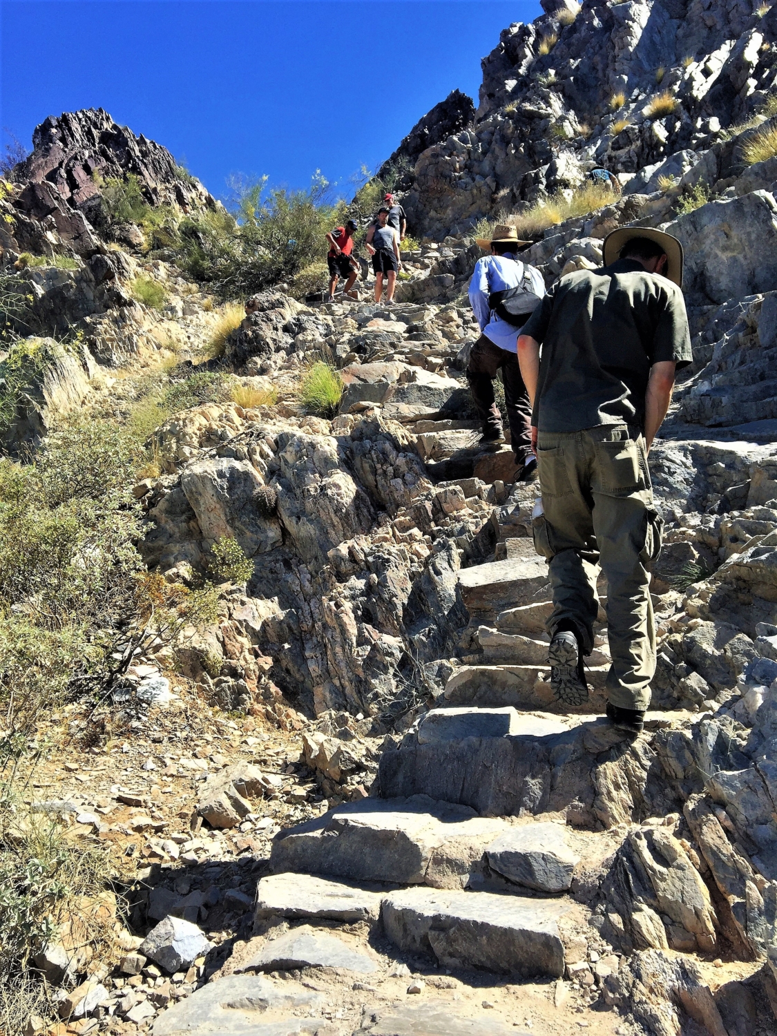
As the broken concrete path dissipates under your feet (and your breathing becomes even heavier) you will now walk upon the well-worn mountain trail laid out before you. The trail includes a series of steps carved out of the mountain and steps naturally made from rocks on the trail, making this one intense workout. Those electric stair climbers at the gym have nothing on Piestewa Peak!

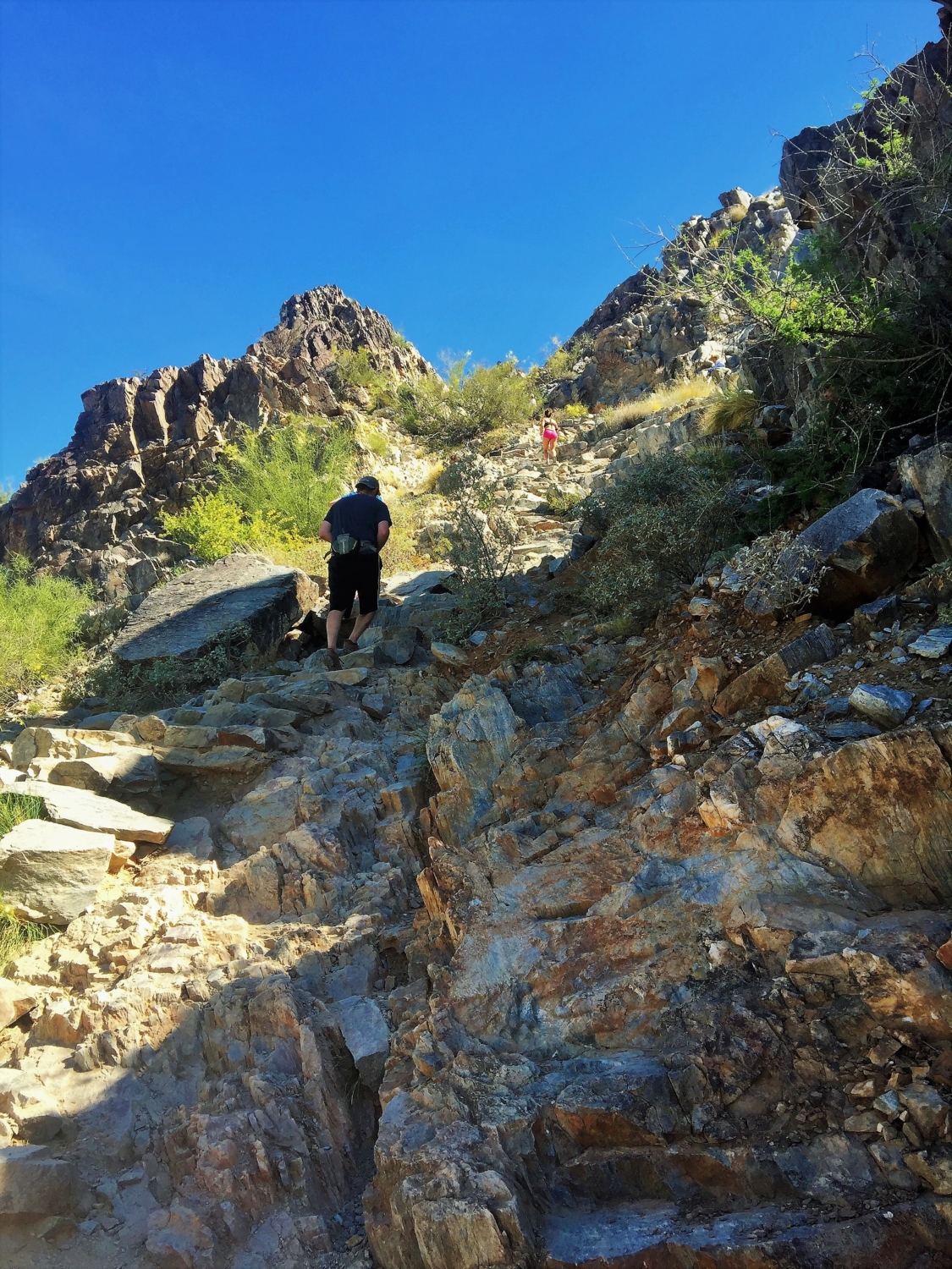
The view of the parking lot completely disappears as you climb deeper into the mountain range exposing the inner rolling mountain tops The summit trail will continue to sweep its way up with some small and flat areas to offer a little bit of a relief … but not for long! Before you know it, you will turn another corner and see another incline there to greet you.
The deceitful aspect of this summit trail is that you never actually see the summit until you are nearing the end. This trail will have you advancing up the mountain and gaining elevation quickly, but you won’t really have a view up at the summit while you’re doing it. Instead, this trail bends and curves within the mountain, hiding the end-point from your view.

2nd set of metal poles, landmark for knowing you’re almost there!
You will know you’re near the end of this trail once you have gone past the second set of metal poles. This part can be a little tricky for first-timers, because it’s a little unclear as to where the trail continues. Once you are toward the end of the second set of metal poles you will need to turn to the left and face the mountain side. The trail continues with a short scramble up this rock.

Across from 2nd metal pole, climb up this to continue onto summit trail
Trust me, it looks a lot harder than it actually is. There are little groove sections built into this rock that act as very easy hand and foot holds. Once you’ve climbed over this rock, you will be able to see the summit. You will also be able to see a long, narrow and steep staircase leading you to the final ascent.

The final ascent up the narrow staircase, summit pictured on left

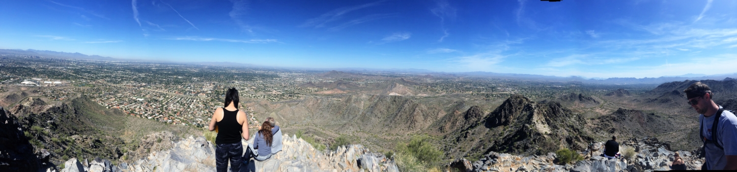
Once on top, the reward of completing this challenging hike is the overwhelmingly tranquil view. You will feel like a conqueror breathing in the victory of that 360 degree panorama of the stillness of the mountains and the city below.

View from the top

With this said, I’m typically not a fan of popular trails and usually prefer trails that offer more solitude — but there is something about this popular city hike that keeps me coming back for more.
Due to the popularity of Piestewa Peak, there are times when you might feel more like you’re waiting in a line than hiking — especially on the weekends. From what I’ve discovered, some of the best times to hike this route are weeknight evenings just before sunset (with a headlamp!). Hang out at the top to watch the sun sink and enjoy the solitude on the return trip — or try this as a great full moon nighttime hike, too!
Note:
Dogs and Bicycles are not allowed on this trail
Tags: Arizona, Hiking, nature, outdoors, Phoenix, Phoenix Mountains Preserve, Photography, Piestewa Peak, Squaw Peak