Down, up, down, up… Follow this rolling trail through wildflower meadows fringed with subalpine forest and, higher, the dramatic palisades of the Sourdough Mountains, a ridge of Mount Rainier. You’ll probably see more pikas than people, and it’s one of the more reliable places in the park to spot elk, or at least their hoofprints and droppings.
When locals refer to The Mountain, they’re talking about Mount Rainier. The Queen of the Cascades dominates the horizon for miles in every direction — when she’s visible, which is fewer than 100 days per year, at least west of the Cascades. When you’re longing for some mountain time but the weather looks blah, head to the mountain’s northeast side hike to Palisades Lakes (note: the Sunrise Road is seasonal, typically open late June to mid-October). This is one of the few trails without a view of Rainier, but its other charms more than compensate. For one thing, 99.8 percent of the cars here are heading to the Sunrise visitor area a mile further up the road, so expect some welcome solitude on this trail. Park your car, glance back to see if The Mountain is peeking out, turn your back on it and the throngs, and head down the trail.


Lose about 500′ in the first 0.75 mile, first hiking out Sunrise Ridge, then dropping down its north side along a couple of switchbacks. Before leaving the top of the ridge, look for Highway 410 in the distance and the White River roaring far below.

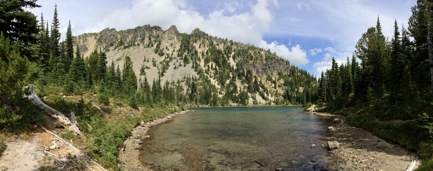
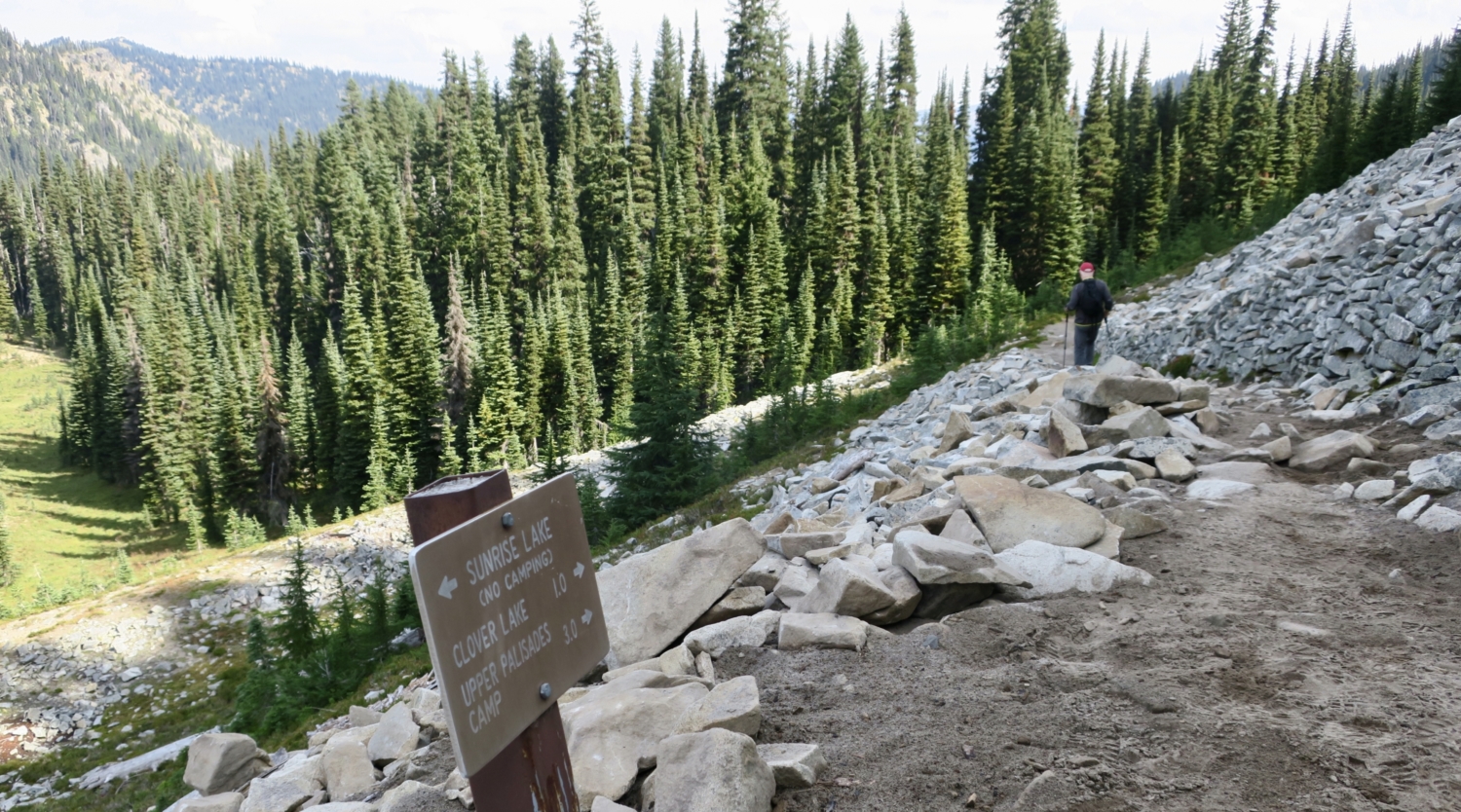
At the half-mile point, just where a switchback changes direction, turn off the main trail and follow a short trail to a view of Sunrise Lake, the first on this multi-lake hike.


Return to the main trail and cross a talus field heading toward a copse of subalpine firs and Clover Lake, one mile distant. Stop, look, and listen for pikas, which whistle warnings and scurry among the rocks here. These cute critters look like rodents but are actually related to rabbits, as their large ears suggest. Because their preferred habitat is alpine, pikas are feeling the pressure of climate change. As temperatures warm, pikas are forced further upslope and may eventually run out of places they can live. Thankfully, they are still abundant here.

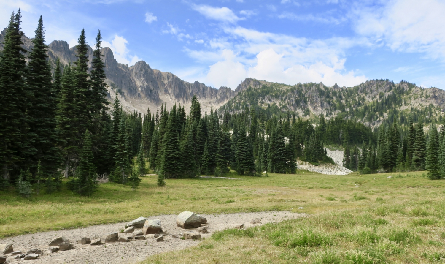
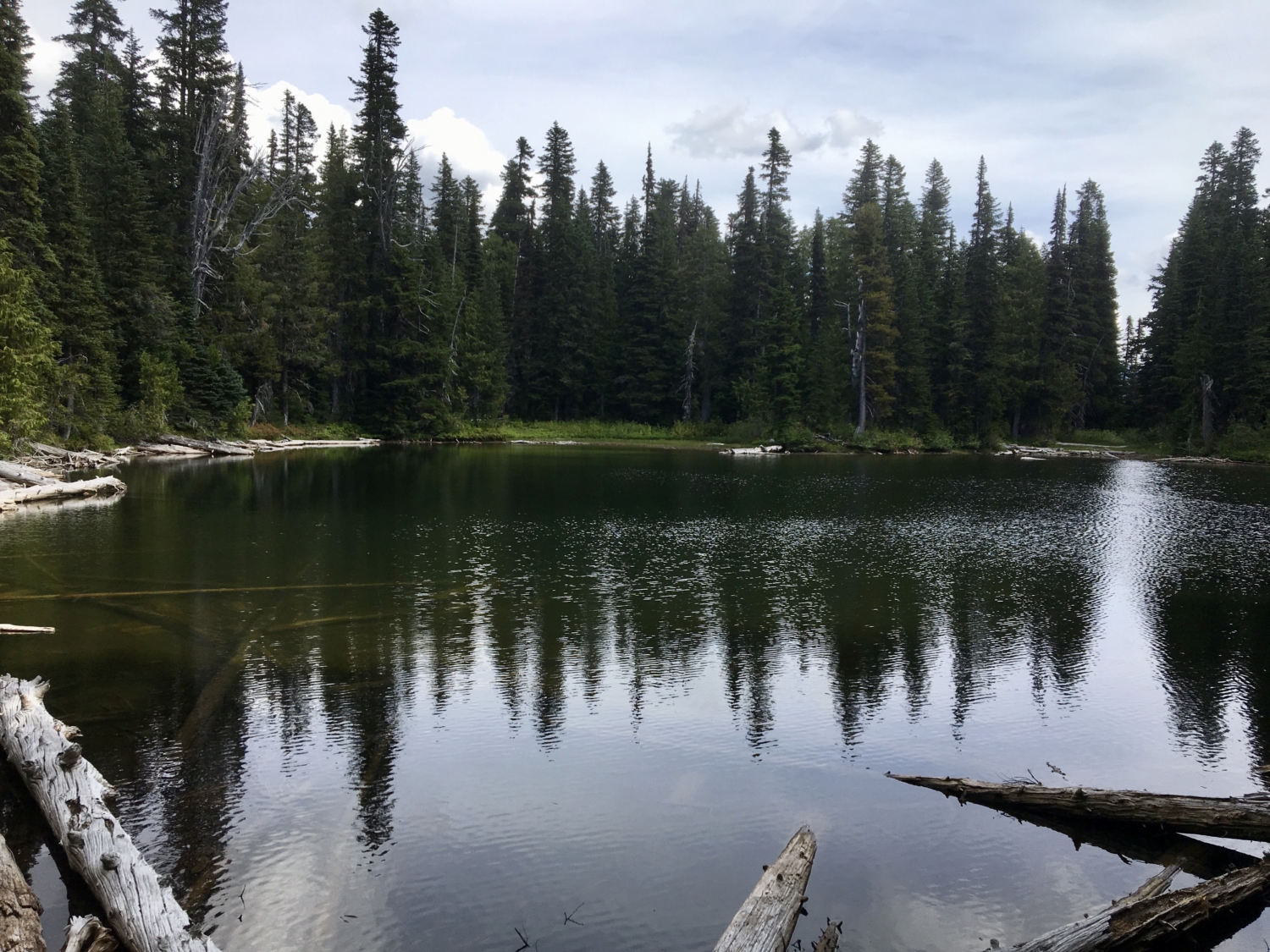
Head down into the trees and cross lovely subalpine meadows. Depending on the time of year, these could be bursting with Mount Rainier’s famous wildflowers. In late summer, huckleberries, yarrow, pearly everlasting, and grasses take center stage and the foliage begins to change color. At one mile, reach Clover Lake, the second tarn of your trip. Social trails lead to the lakeshore and invite splashing on warm days.


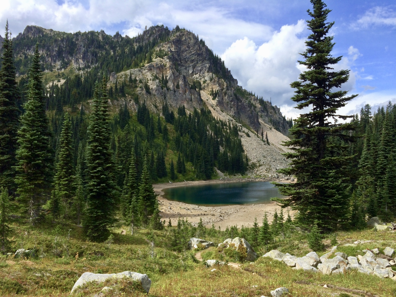
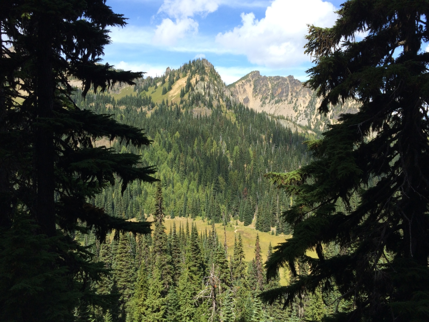
Enjoy the scene, then return to the trail and start heading uphill. And uphill some more. In less than 0.2 mile reach a saddle with views of the Palisades, rocky cliffs on the eastern face of the Sourdough Mountains. You’ll follow the bottom of these cliffs all the way to the turnaround point at Upper Palisades Lake.

Now it’s down, down, downhill for about a half-mile, when another small lake peeks through the trees to your left. A few steps farther along, reach a sign for Dick’s Lake Camp on your right. Yet another small lake nestles into the trees just beyond, and these three together are known as Tom, Dick, and Harry Lakes. Only Dick’s Lake has a backcountry campsite and trail access. If camping here is not on the agenda, keep going, as these three lakes simply aren’t as interesting as others on the hike.

Throughout the hike, notice what look like mini mountain ranges alongside the trail. These are tunnels dug by Mount Rainier’s rodents, which include several varieties of voles. Many voles make their homes in the subalpine forest and meadow habitat that comprises most of this hike, and their mounds and tunnels are distinctive and ubiquitous.

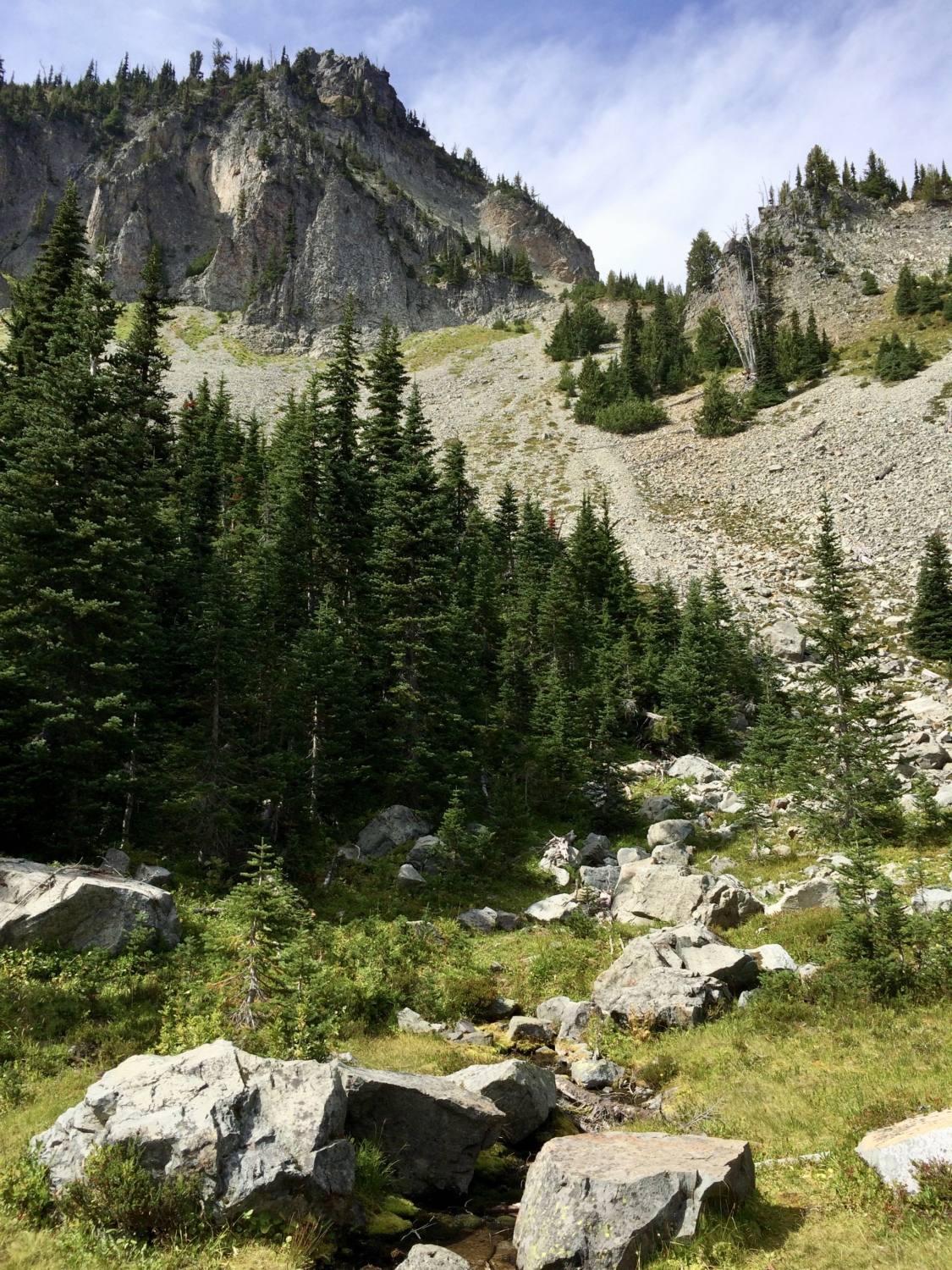
One-third of a mile past Dick’s Lake, cross a small stream and look up for an excellent view of the cliffs and rock fields below them. Lucky hikers might catch a glimpse of elk clattering across the talus high above. Grizzled hoary marmots clamber among the boulders, too.

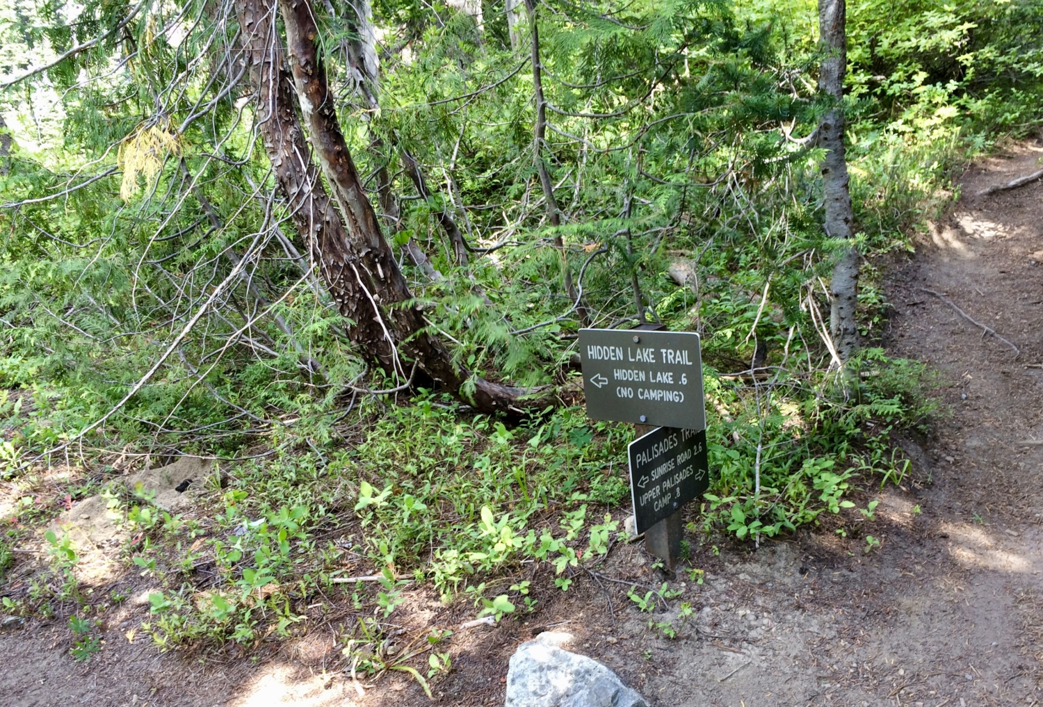
A few steps down the trail, reach a sign for a 0.6-mile side trip to Hidden Lake. Turn left and follow this short, steep trail to a stunning, appropriately named lake at the base of the Palisades. Note the columnar basalt forming the cliffs, a sign of their volcanic origin. This is the largest lake on the hike and well worth the detour. Gulp some water (from your bottle, not the lake) and head back downhill to the trail and the last 0.8 mile to Upper Palisades Lake.


Back on the main trail, continue through broad, grassy meadows. This is another good place to look for elk. On a recent trip, we found elk prints over our boot prints coming and going, along with plenty of scat, although we never saw an elk. They were probably watching from safe vantage points deep in the trees.

Clear a low saddle and find yourself at the edge of a basin, the amber-rimmed teal jewel of Upper Palisades Lake glittering below sheer cliffs. Resist its siren song for just a bit longer and continue on the trail for another 0.15 mile to a sign marking the end of the maintained trail. Step carefully onto a rocky viewpoint and look down. This is as close as you’ll get to Lower Palisades Lake nearly 400 vertical feet below.


Now retrace your steps back to the trail junction for Upper Palisades Lake, and follow any of several well-worn social trails to the shore. The Palisades loom above, plenty of rocks invite lounging, and the clear water may tempt you in for a cooling dip. You can explore all around the lake and even camp in one of three backcountry sites nearby (obtain a wilderness permit at the ranger station on the way in). Consider this: you’ve hiked past eight alpine lakes in about four miles. Which is your favorite?

To return to the trailhead, simply follow the main trail back, ignoring the side trails to Hidden and Sunrise Lakes. Two longish uphills await, one to the saddle above Clover Lake and one to the trailhead. Maybe you should relax at Upper Palisades Lake a big longer.
Tags: alpine lakes, berries, Enumclaw, forest, Greenwater, Hiking, lakes, Meadows, Mount Rainier National Park, national park, Sunrise, wildflowers, wildlife