In the summertime, when Mount Diablo’s steep fire roads bake in the sweltering sun, it is hard to imagine multiple waterfalls cascading from springs on the north face of the 3,849-foot peak. But cascade they do during California’s short rainy season, making it a surprising hike through grasslands, oak savannah, chaparral, and even winter wildflowers. The traditional approach to the waterfalls is an out-and-back on Donner Canyon Road. This route detours to Clayton Oaks Road at the beginning for an extra punch of mountain and valley views on the way to the falls.
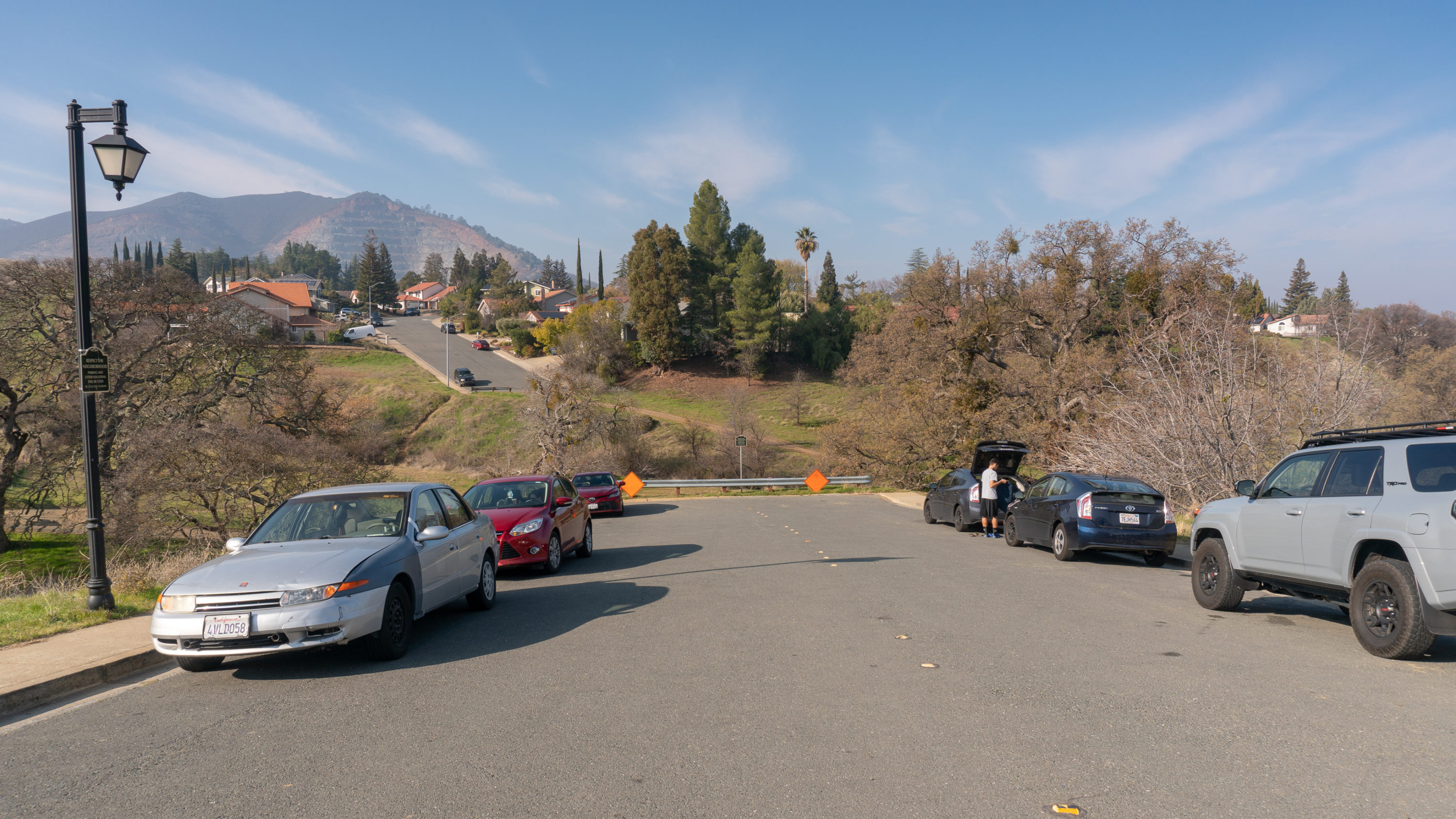
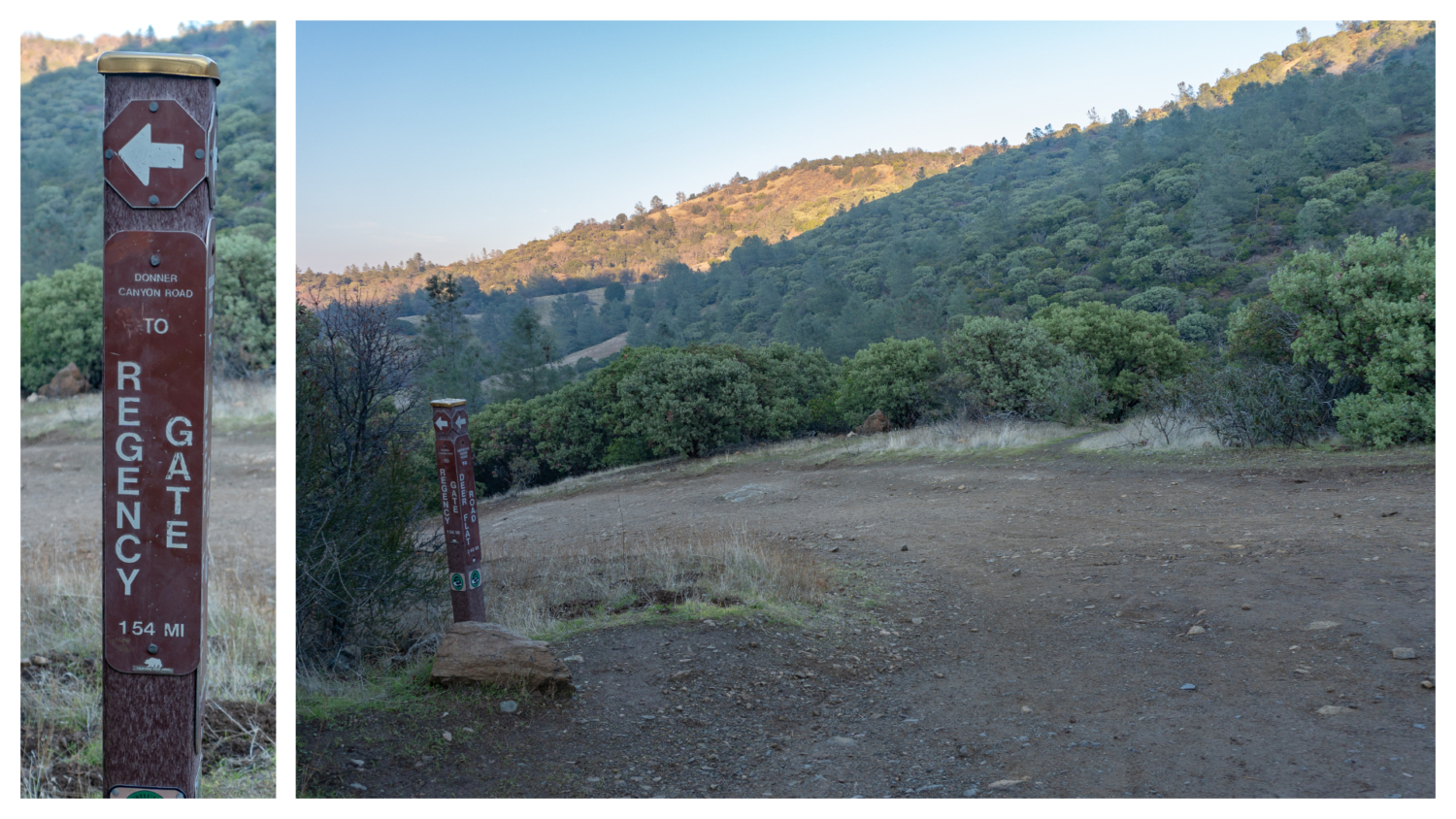
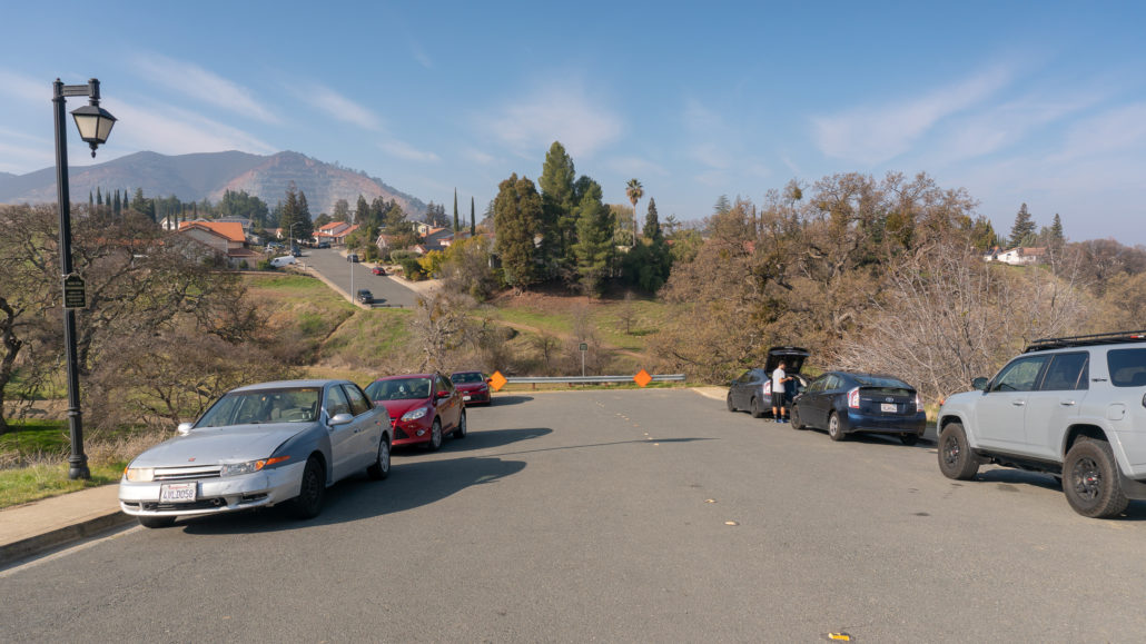
Note: As of January 2019, the trash, noise, and street parking issues from hikers on Regency Drive has led to the possibility of limiting access to the Regency Gate trailhead. If you do start from the Regency Gate trailhead, please pack out all your trash, keep driveways clear, and keep your voice at a respectful level. Alternative access to this hike is also possible via the Mitchell Canyon entrance: Take Oak Road east to Murchio Road east for 1.2 miles to Donner Canyon Road. Turn right to join the loop.
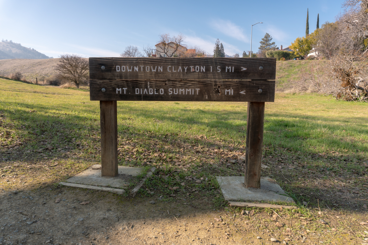
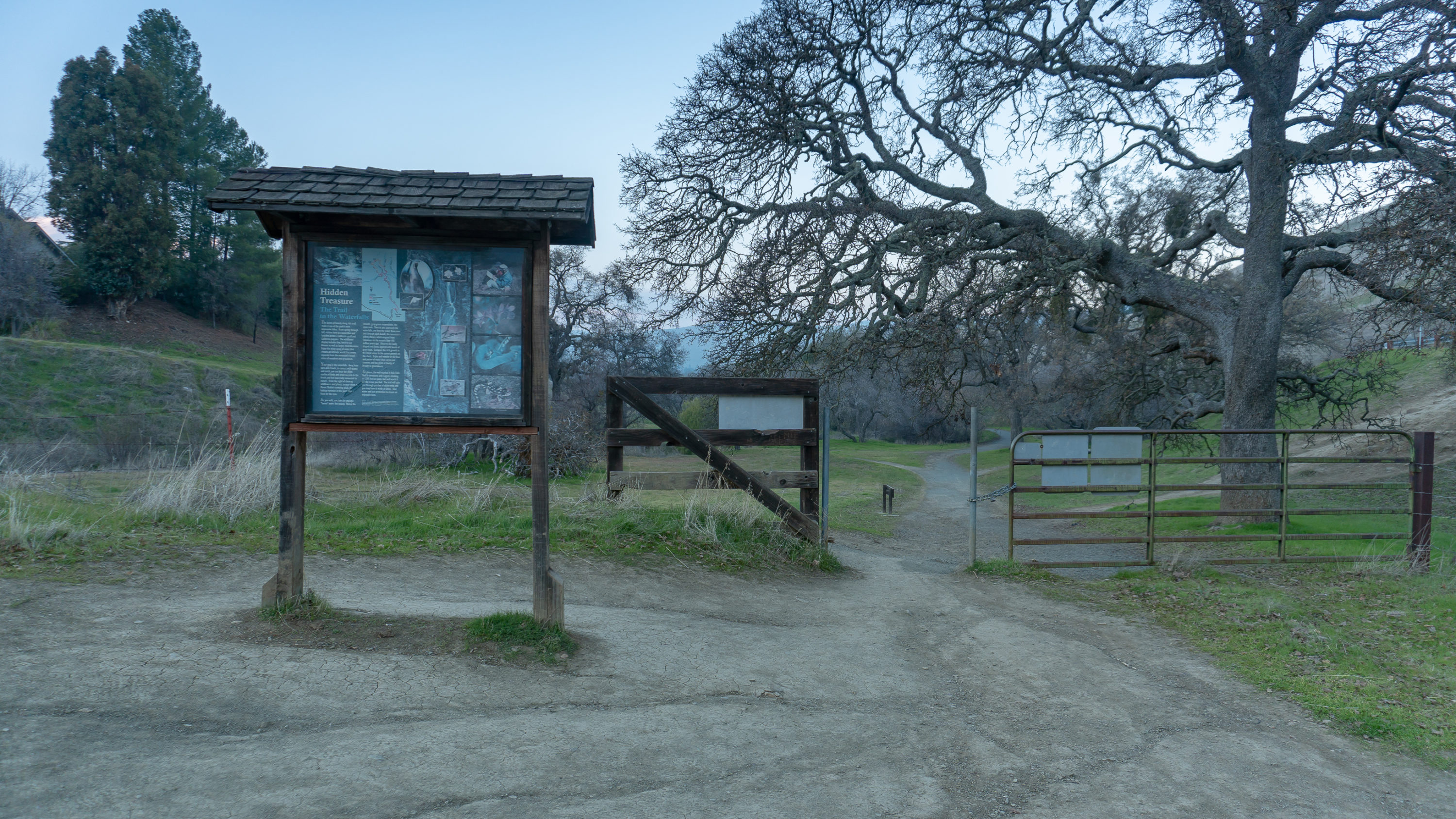
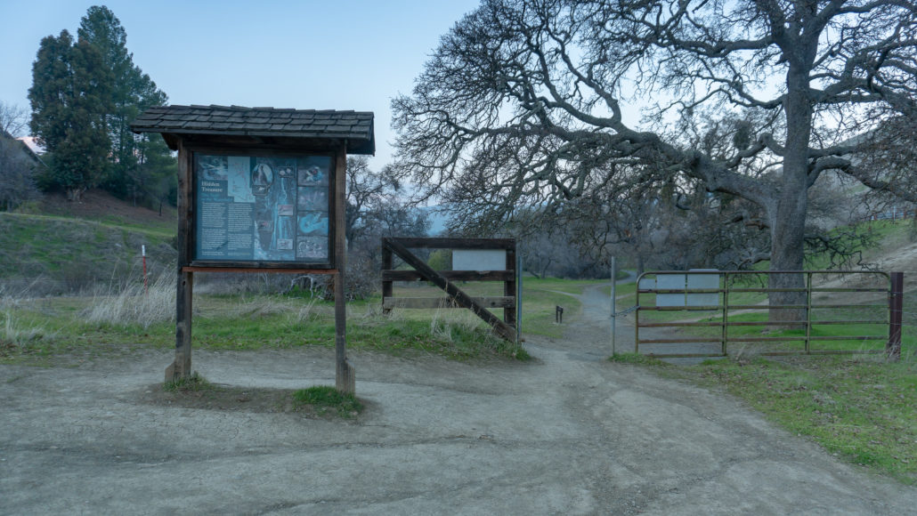
From the barrier at the end of Regency Road, head down the hillside to the Mount Diablo State Park entrance on your left. Although there are no facilities here, there is a kiosk with a topo map and information about the Falls Trail on the other side.
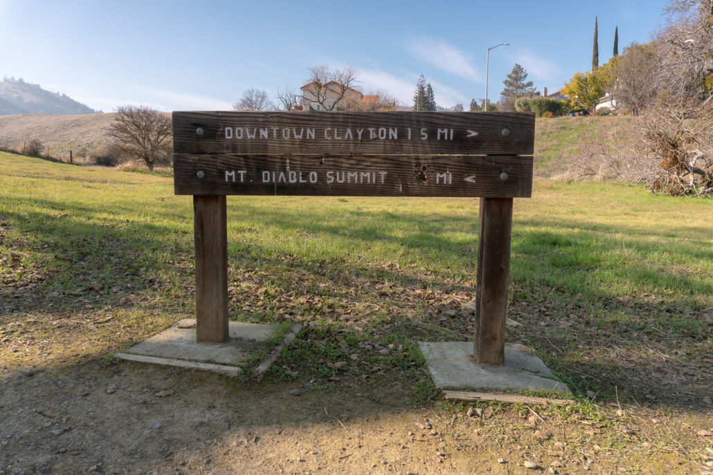

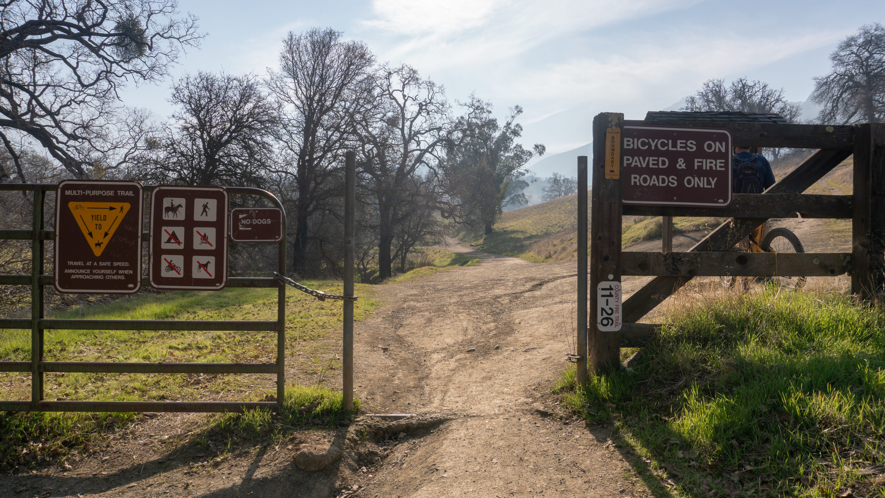
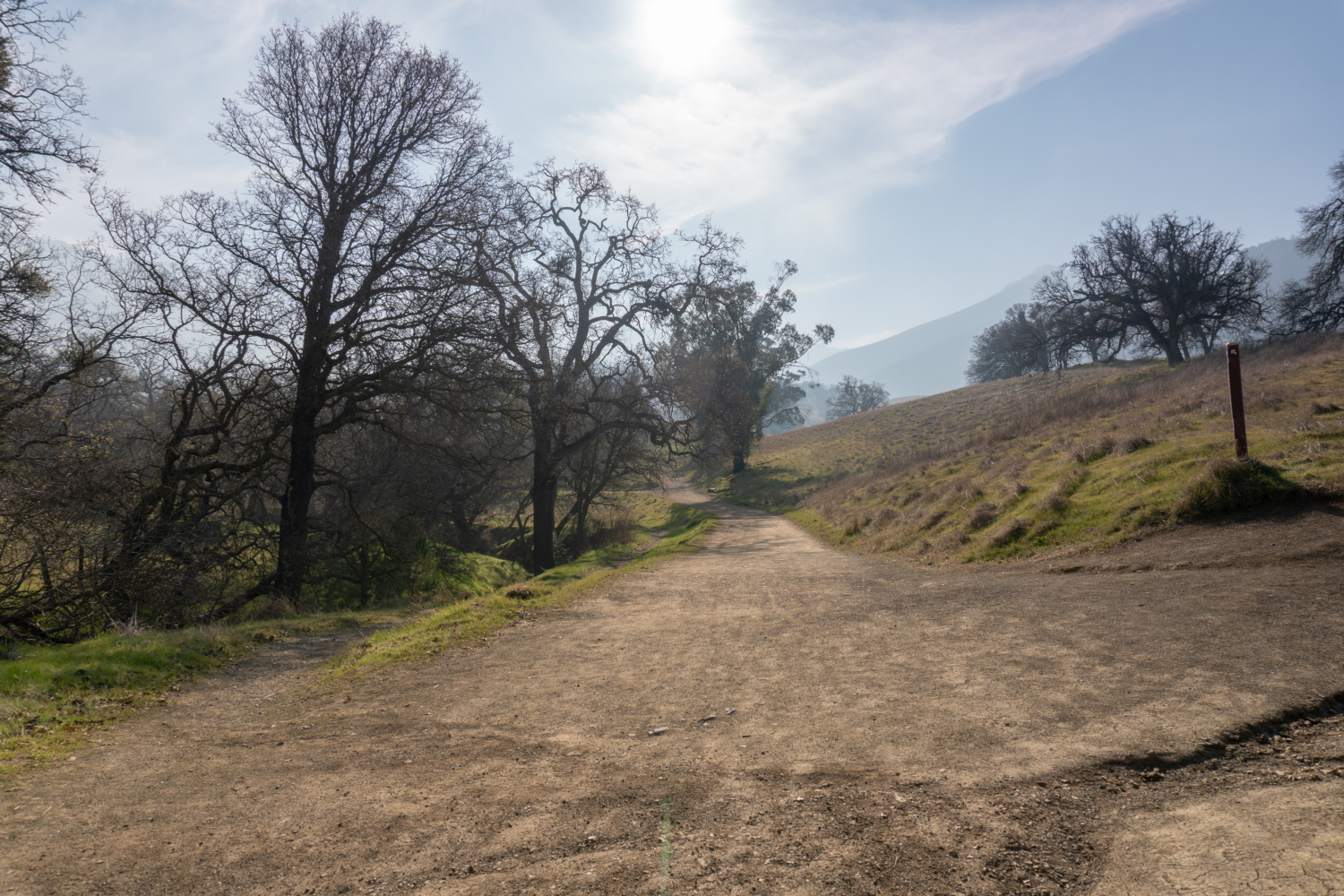
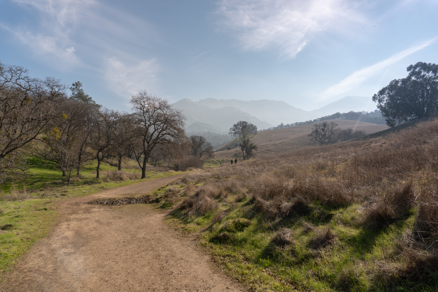
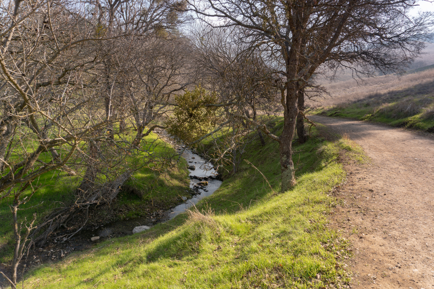
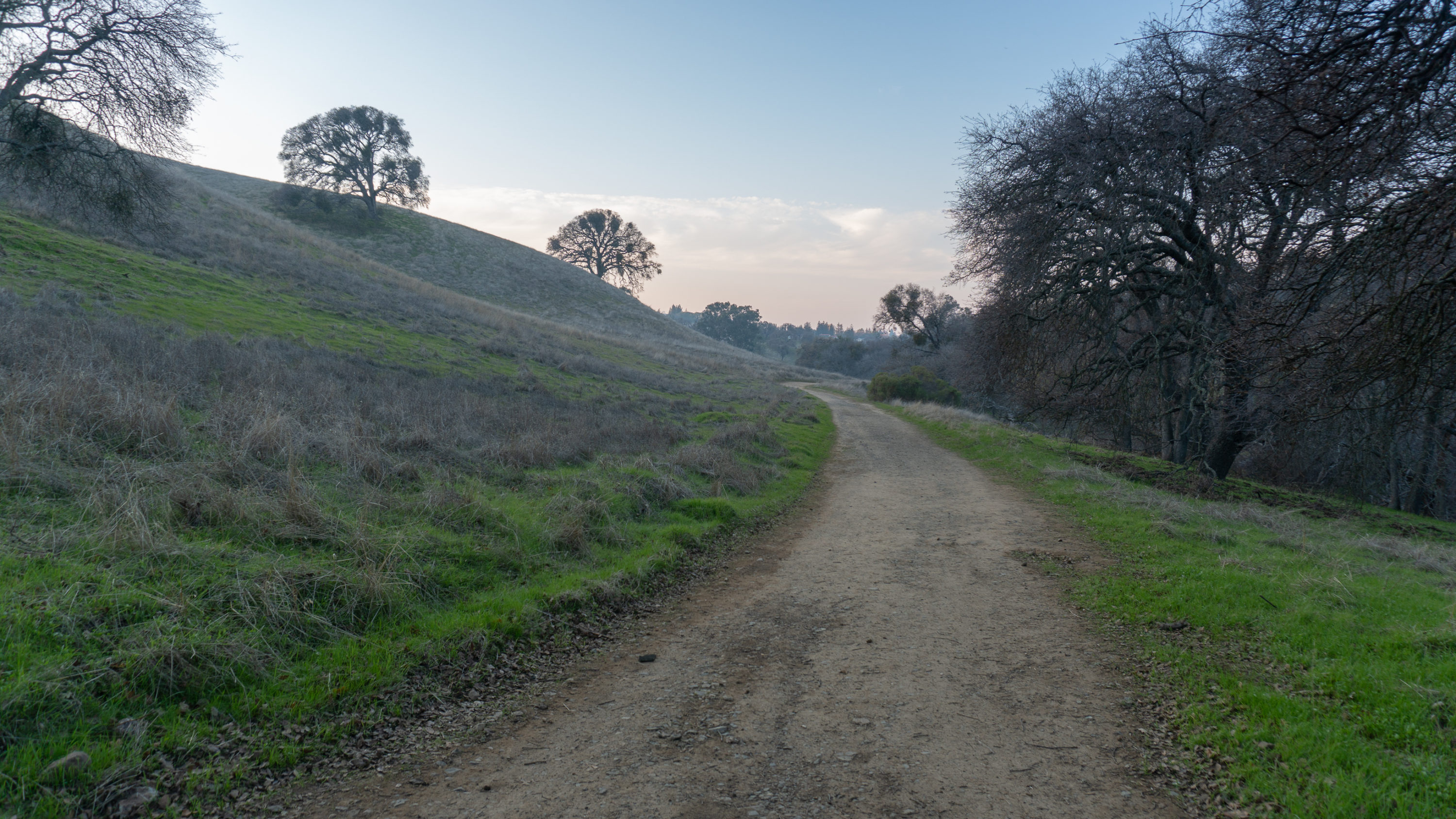
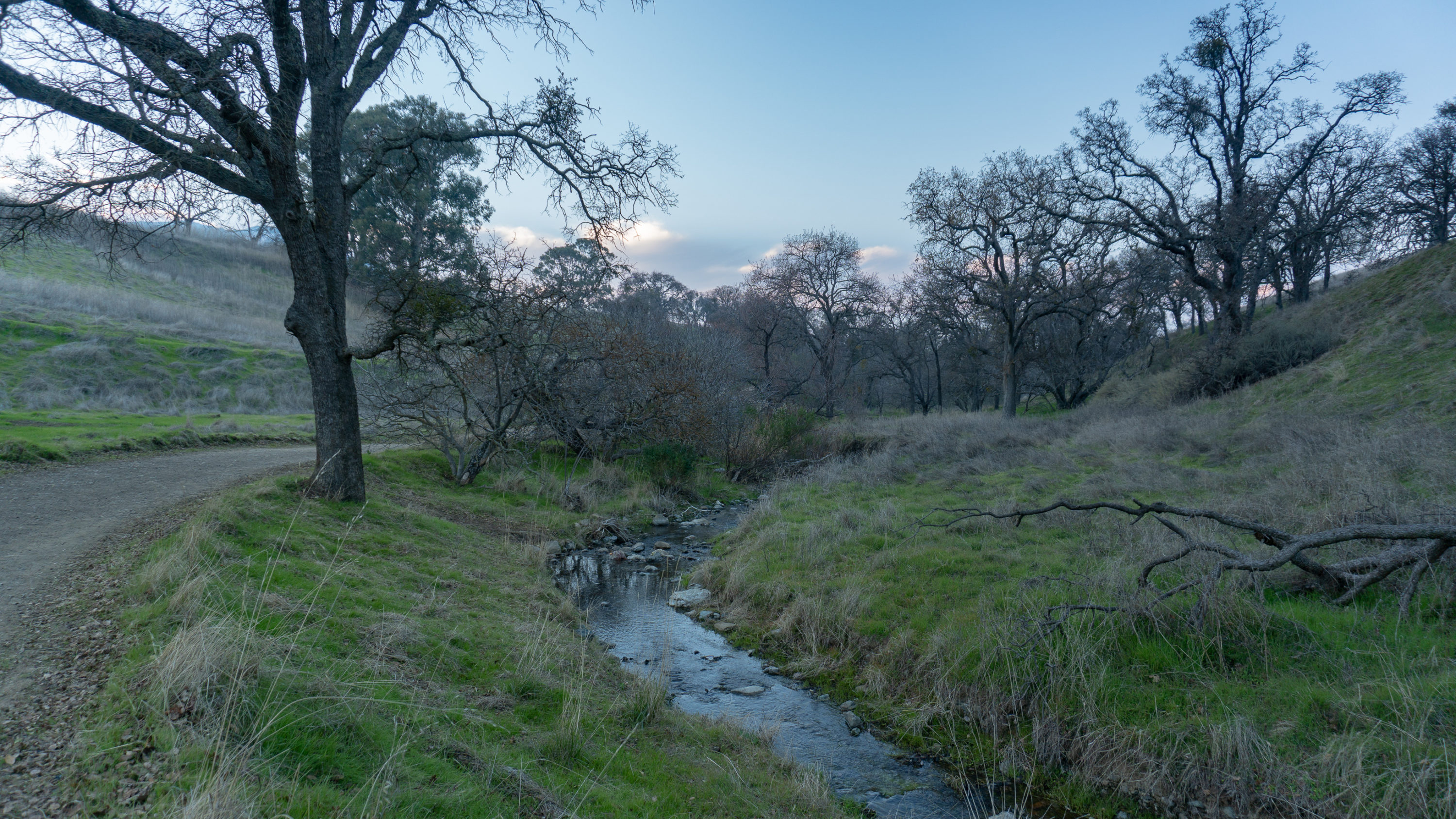
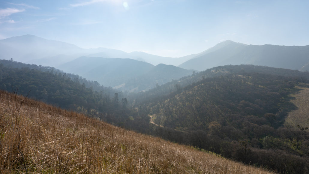
Past the gate and kiosk, hike south on Donner Canyon Road, a flat and sunny dirt fire road that is also open to mountain bikers. Donner Canyon Road parallels Donner Creek, with pretty views of the creek and sprouting green grass after winter rains. Grasslands and oak savannah—grassy areas punctuated with deciduous and evergreen oaks—surround the valley floor, with the major peaks of Mount Diablo rising above the canyon floor: Mount Olympia, North Peak, Mount Diablo, Eagle Peak, and Twin Peaks.

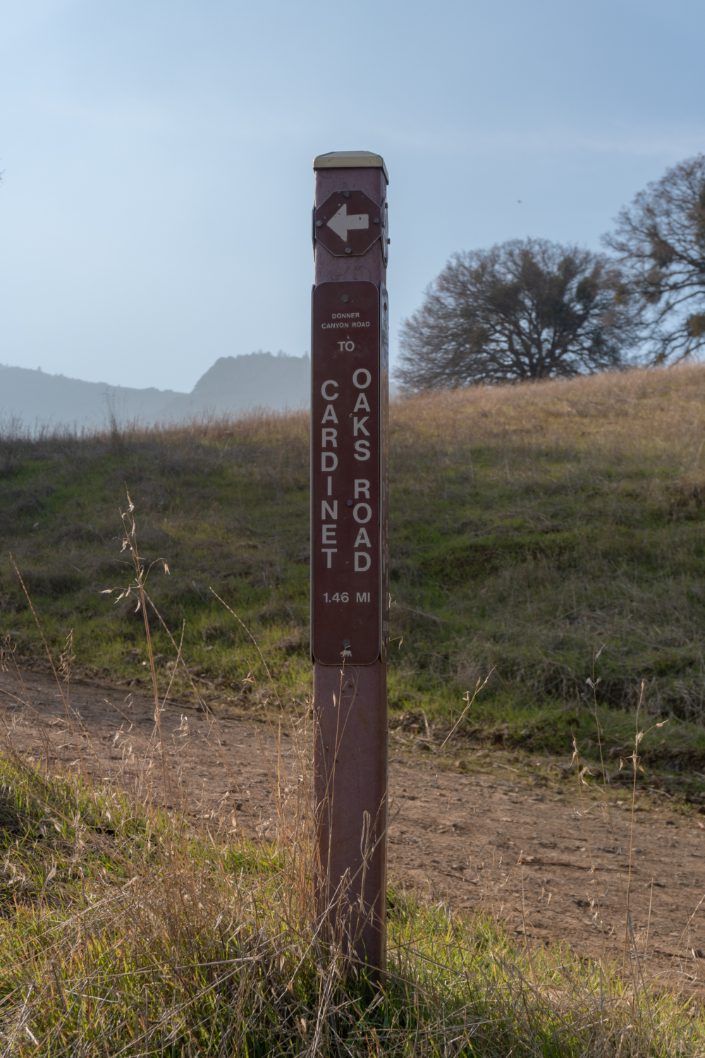
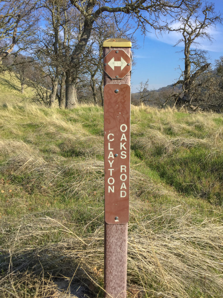
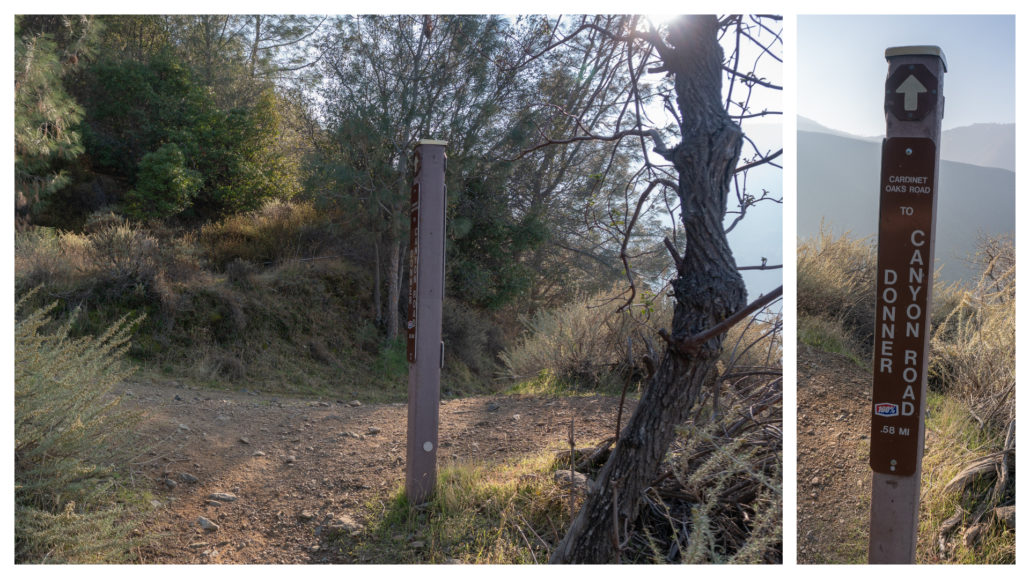
Bear left at first two junctions to stay on Donner Canyon Road towards Cardinet Oaks Road. Hiking in the wintertime and early spring is a wonderful break from hiking in late spring and early summer in Mount Diablo State Park, when soaring temperatures and sun exposure makes it feel like you are hiking in the Mojave Desert. If you are new to Mount Diablo, it is good to know how the signposts here work: The trail you are on is listed in small print at the top of the trail sign, while the trail you are heading towards is the larger print in the middle. The numbers at the bottom tell you the distance between the two.

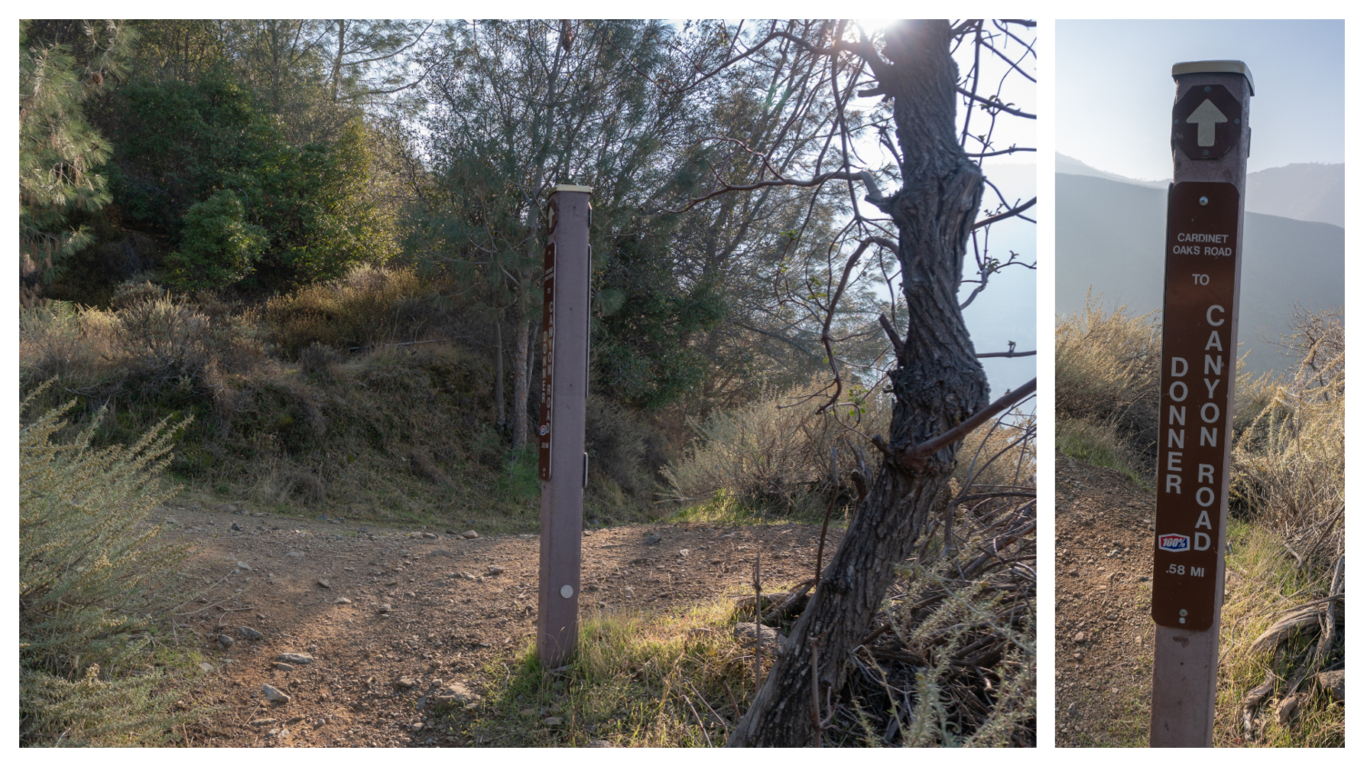
At the 0.3-mile mark, it is decision time. You can turn left onto Clayton Oak Road or bear right to stay on Donner Canyon Road. Compared to the Clayton Oak Road route described below, the traditional Donner Canyon Road route is 0.2 miles shorter, is a couple hundred feet less elevation gain, and is a more straightforward way to get to the Falls Trail (ahem, fewer junctions). You can do either. Personally, I like leaving behind the foot and bike traffic on Donner Canyon Road for the quiet mountain and valley views on Clayton Oaks Road. It also creates more of a full loop hike versus a balloon-shape hike on the traditional route.

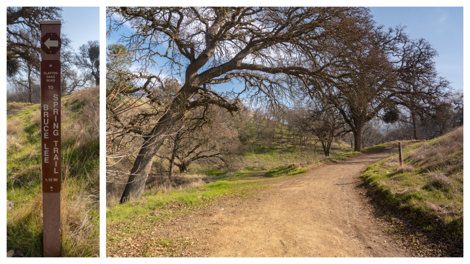
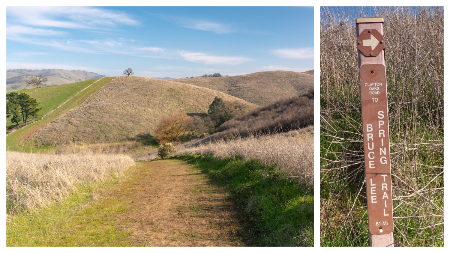
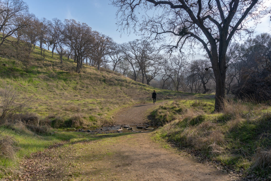
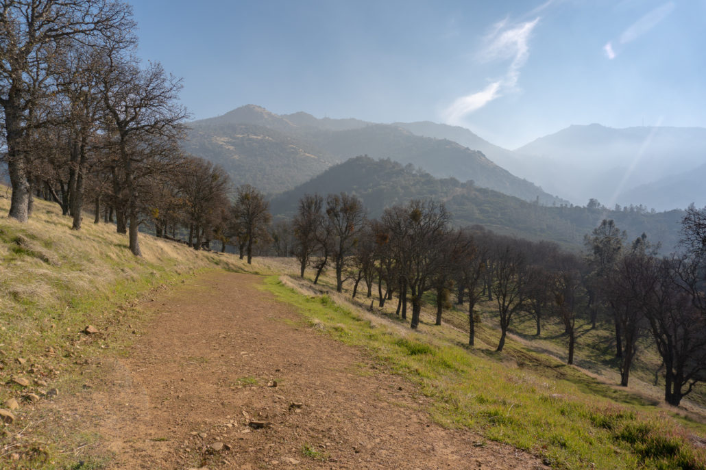
Turning left, take Clayton Oaks Road towards the Bruce Lee Spring Trail at the 0.3-mile mark. Cross Donner Creek and begin climbing 300 feet over the next 0.7 miles towards a western ridgeline in Mount Diablo State Park. The view is serene as you climb and descend through grasslands studded with tufts of bunchgrass, gnarled blue oak, and foothill pine.
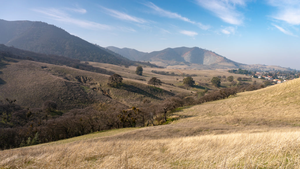
Bear right at the next two junctions, staying on Clayton Oaks Road towards the Bruce Lee Spring Trail. You will hike near a housing development on your left and then turn southeast back toward the canyon.

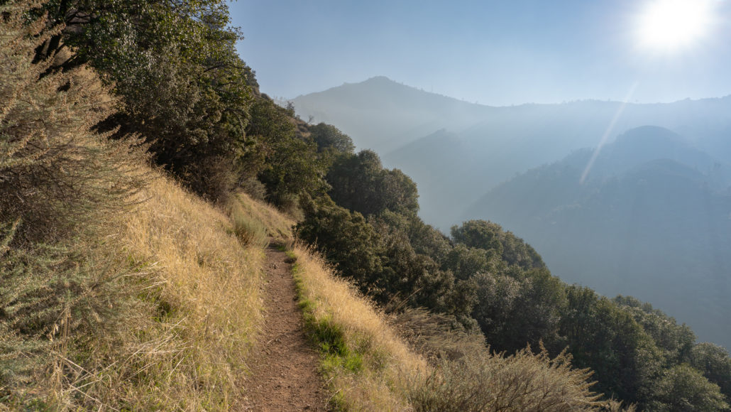
At the 1.0-mile mark is a 180-degree panorama of peaks stretching from Mount Olympia to the southeast to Mount Zion’s diabase layers in the northwest. Look down to see Donner Canyon Road slicing through Donner Canyon below. Clayton Oaks Road roughly parallels Donner Canyon Road as you head south.
Bear right towards the Bruce Lee Spring Trail at the next Y-junction. A steep but mercifully short climb is just ahead, gaining 135 feet in 0.11 miles. After grunting through that section, the trail gentles back into a rolling grade with more mountain views.
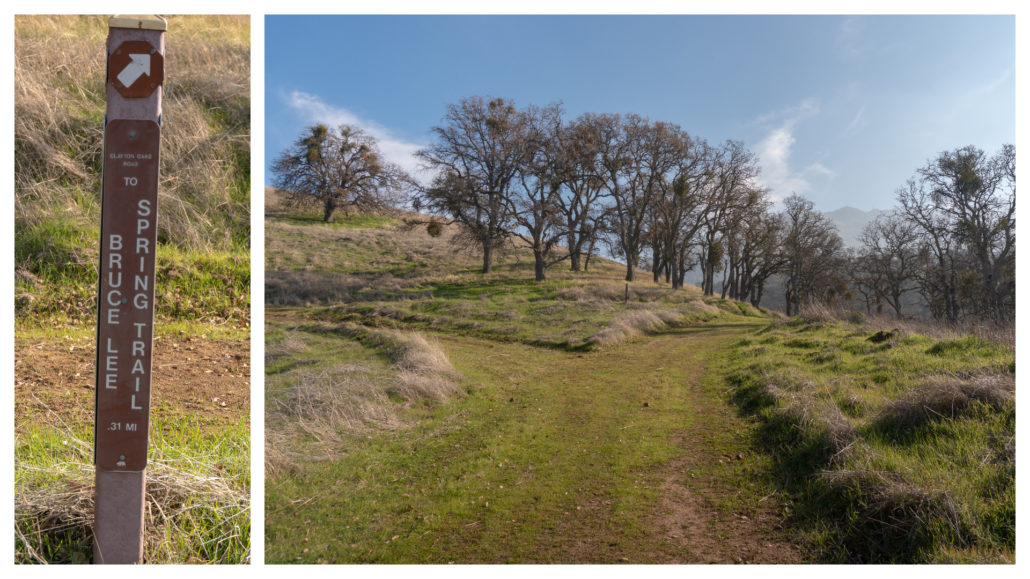
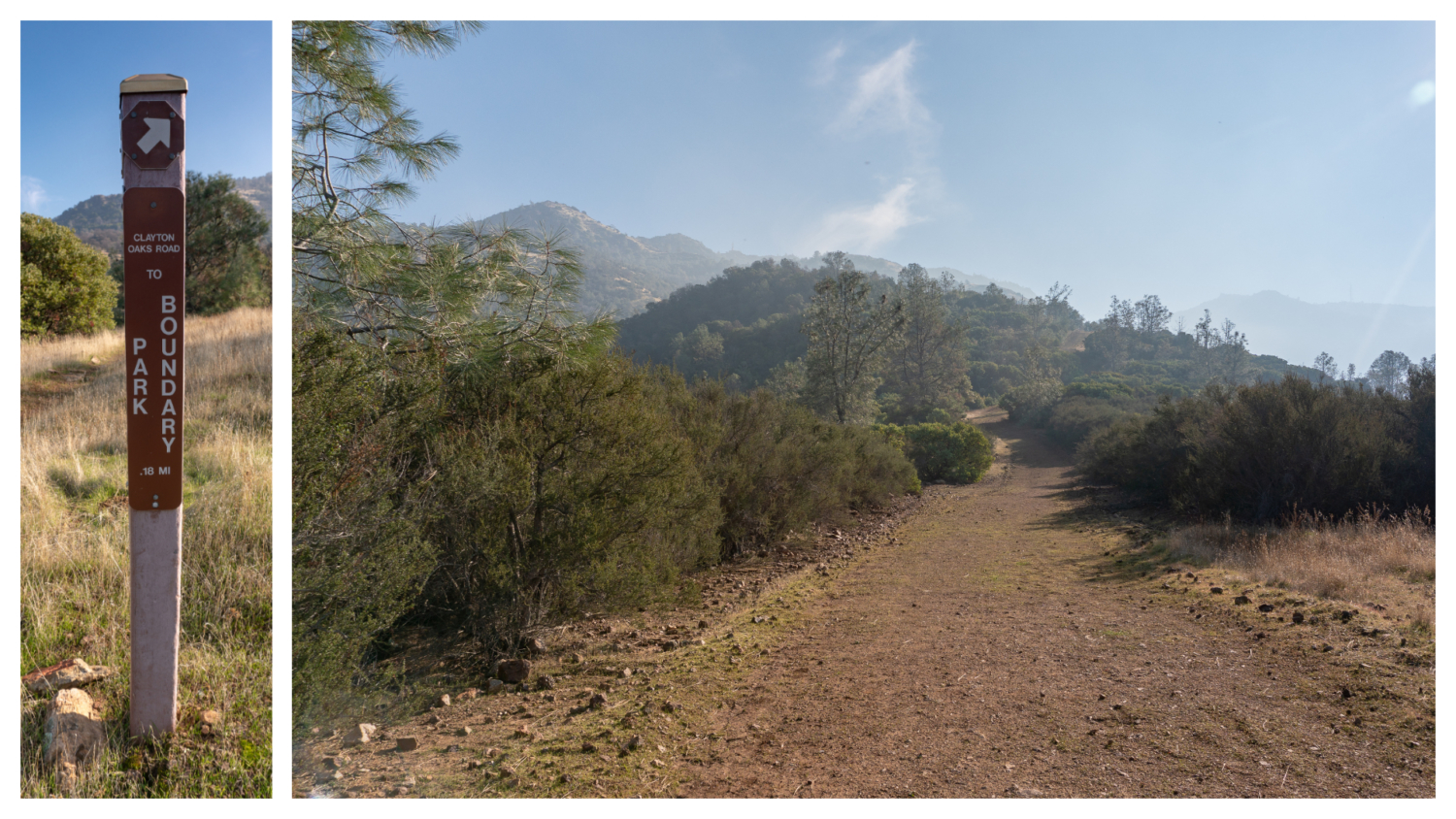
Past a Clayton Oaks Road sign, the character of the trail abruptly shifts from grassland and oaks to chamise and manzanita shrubs. This is your cue to start looking for the Bruce Lee Spring Trail on your right. It’s easy to miss. The sign is tucked off to the side of the trail, just before a Clayton Oaks Road / Park Boundary sign. If you see this sign (below left), you have gone too far. Turn back and keep a sharp eye out.

At the 1.5-mile mark, turn right onto the Bruce Lee Spring Trail toward the Hetherington Trail. You are now on a cozy single-track trail surrounded by chamise, with robins flitting among the canopy.
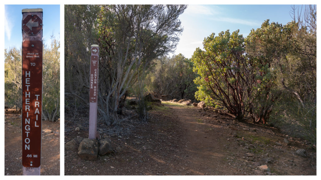
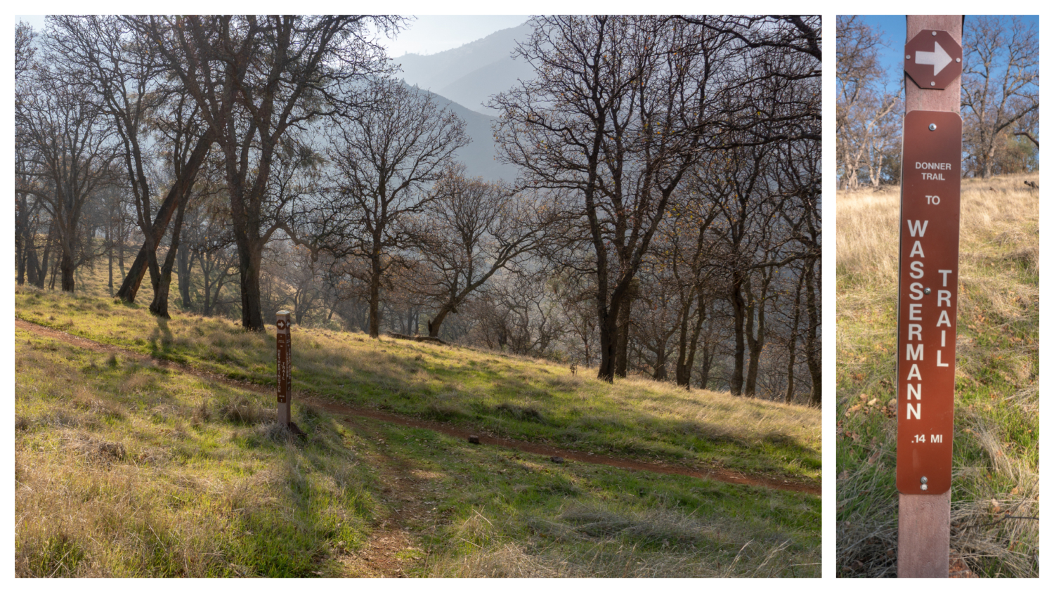
After descending 75 feet in 0.3 miles, arrive at a T-junction. Turn left onto Donner Trail towards the Wassermann Trail. To the right, the Bruce Lee Spring Trail descends towards the Hetherington Trail. This lovely stretch of single-track continues south through grassy slopes with hints of pine and oak.
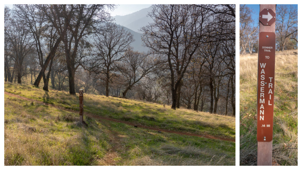
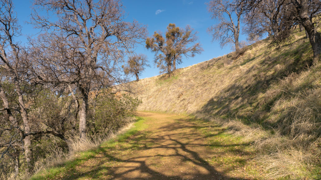
At the 1.9-mile mark, stay straight to continue uphill on the Wassermann Trail towards Cardinet Oaks Road. To the right, Donner Trail descends to the Hetherington Trail. This was the last of the closely grouped junctions: You will stay on Wassermann for the next 0.7 miles to Cardinet Oaks Road. The trail climbs 430 feet in elevation through this section, weaving in and out of the sun through dense shrubs of toyon and manzanita.
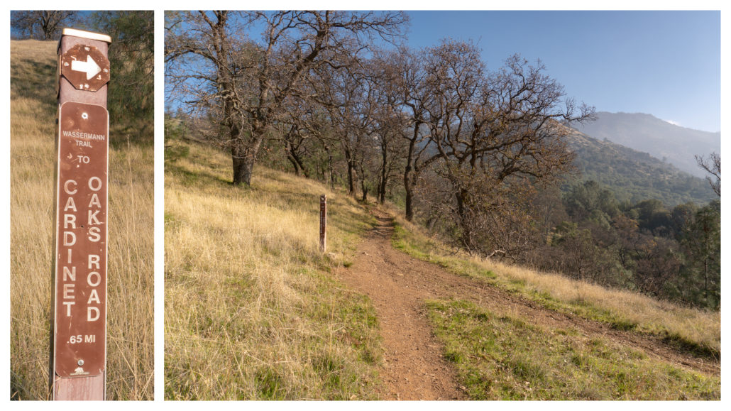
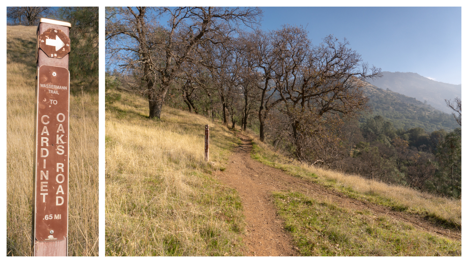
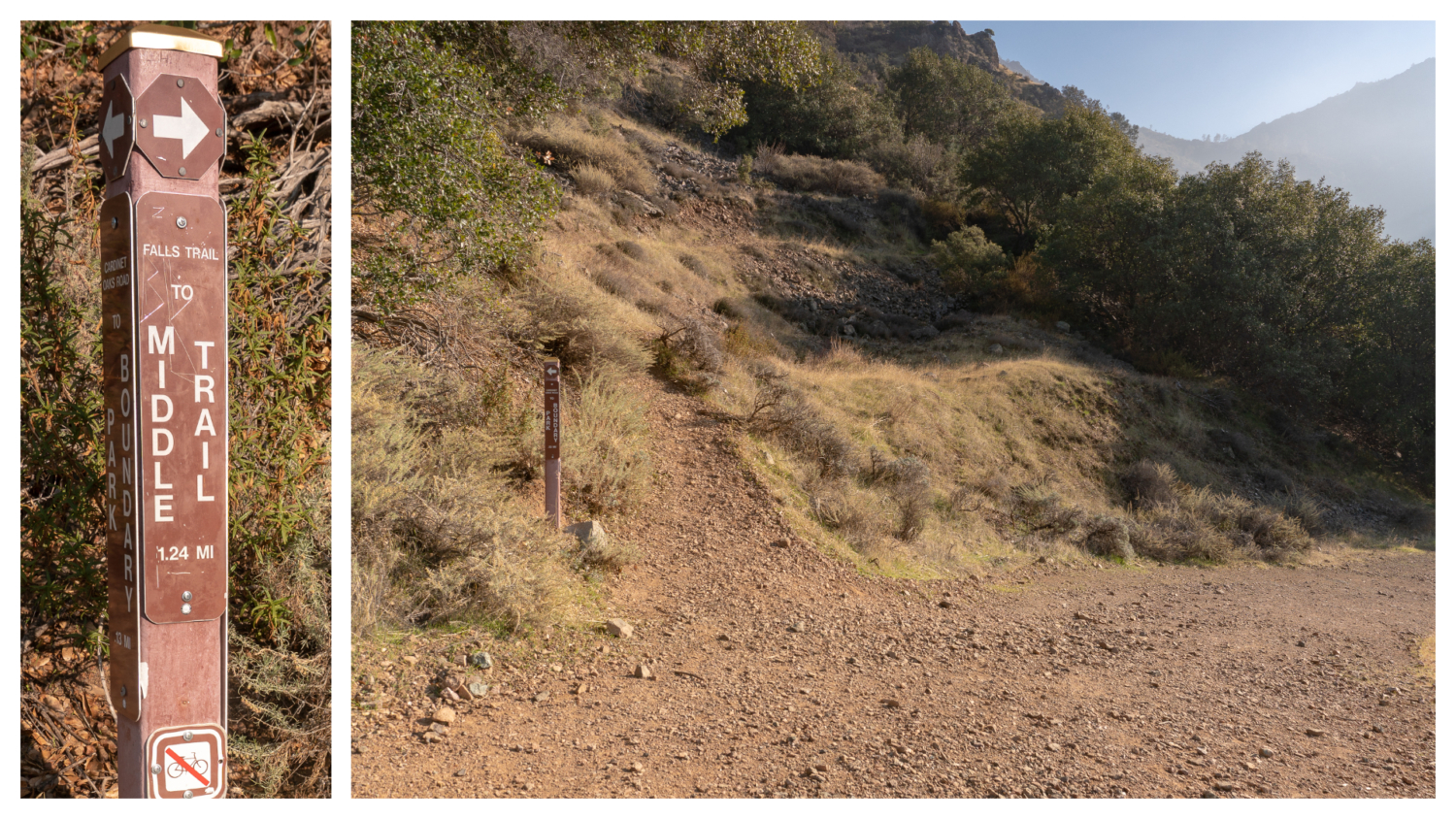
At 2.6 miles, reach the end of Wassermann at Cardinet Oaks Road. Turn right onto Cardinet Oaks Road and descend 0.1 miles to the Falls Trail on your left.
In just under 0.1 miles, turn left onto the Falls Trail towards Middle Trail, leaving the wide dirt fire road behind for the unassuming, rocky trail up the mountainside.

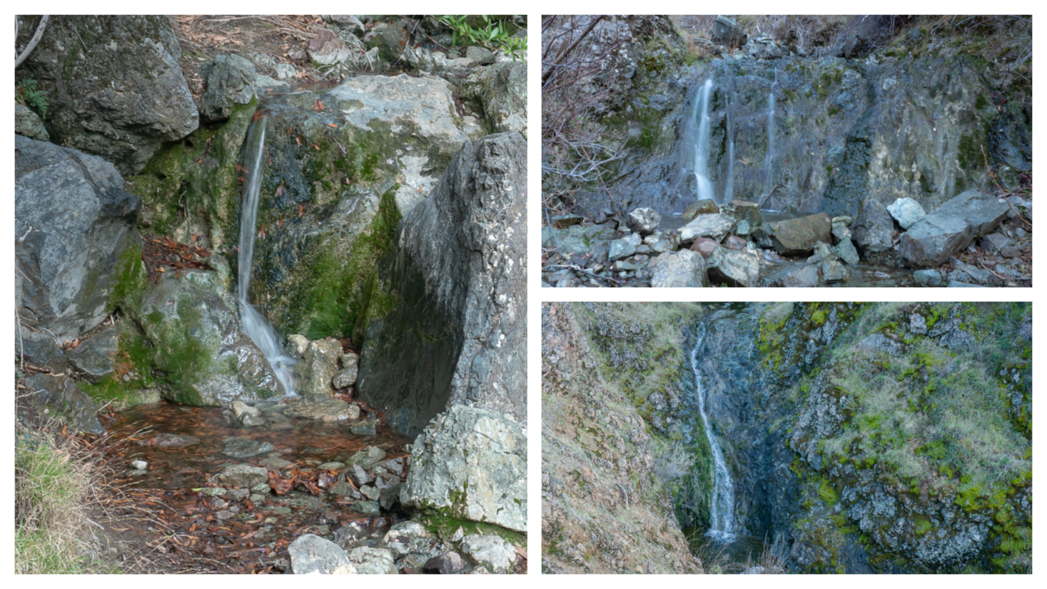
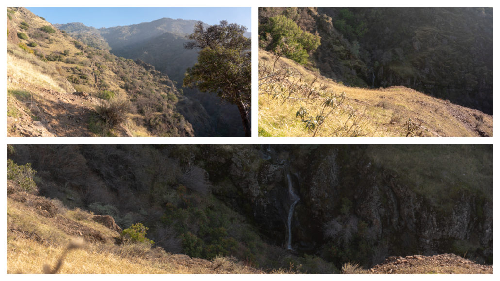
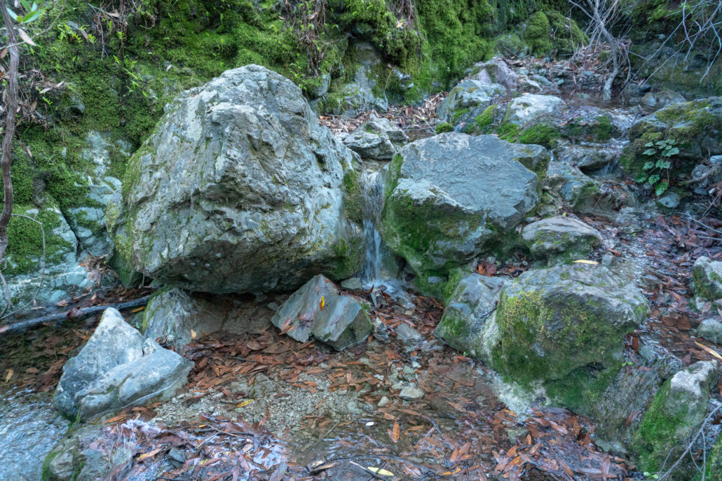
The next 1.2 miles are a fun climb back into the deep crevasses of Wild Oat Canyon beneath slices of red chert and peaks in Mount Diablo State Park. Waterfalls plunge steeply northward as you cross their paths and make a U-shape hiking around the canyon. The springs here are tributaries of Donner Creek.
At the 3.0-mile mark, pull up at a rocky outcrop overlooking two waterfalls down in the canyon. This is a nice spot for a picnic break, with a stunning view of the falls below, the peaks above, and the trail into Wild Oat Canyon beyond.
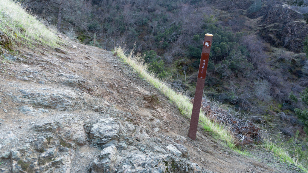
Continuing on, bear left at a Trail sign, climbing up a rocky slope and avoiding the eroded trails on the right. Views of the springs below alternate with stream-side plants and rocky cliffs overhead.
At 3.2-miles, encounter two small waterfalls in quick succession. The falls flow down modest-sized rock faces that look like steep drops in a creek: very pretty and picture-worthy. In another 0.2 miles is an overlook to a view of a tall, narrow waterfall dropping chute-like down a basalt rock face, fanning into a plunge pool below.
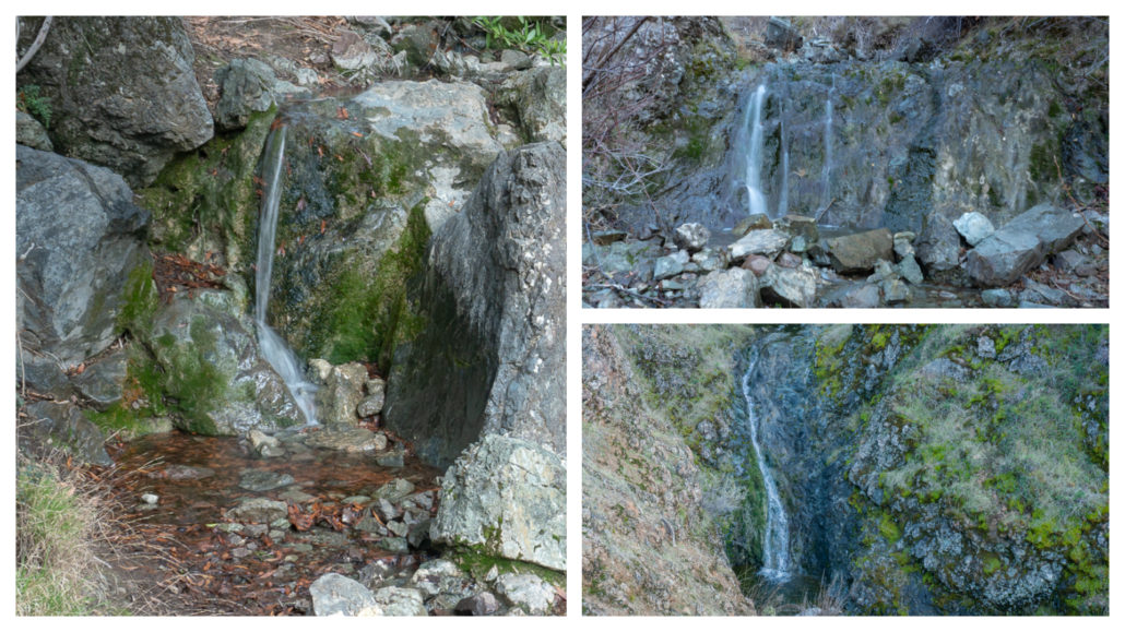
One more climb above this waterfall and you have reached the high point of your hike at 1650 feet. Past that hurdle, enjoy the descent beside juniper, bay laurel, pine, and manzanita. A tiny little cascade along Big Spring is your last waterfall hurrah.
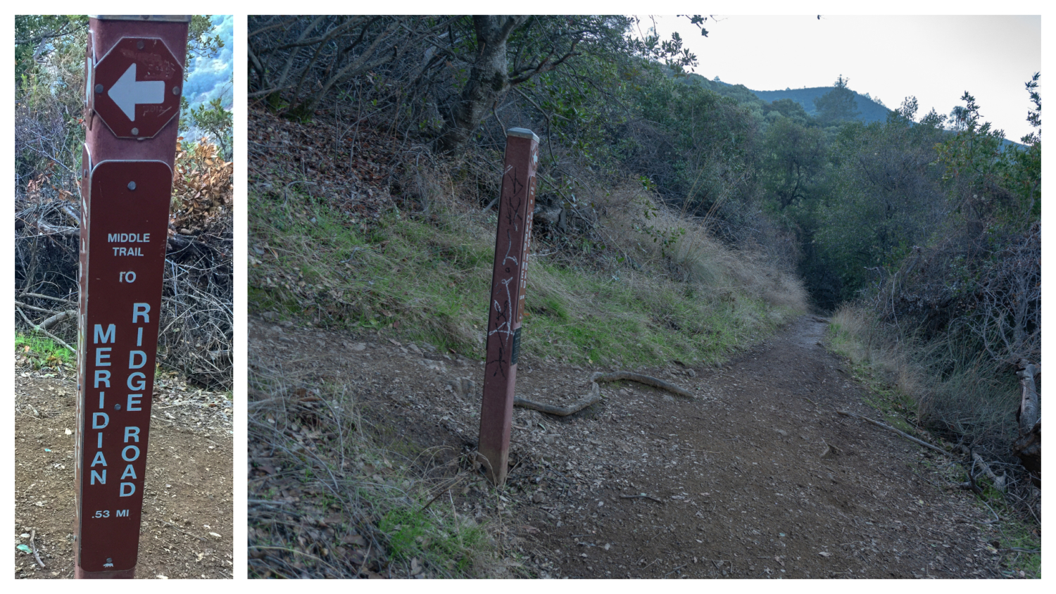
At the 3.9-mile mark, stay straight onto Middle Trail, heading north towards Meridian Ridge Road. The left-hand trail is also Middle Trail, climbing south up to Prospectors Gap Road. A beautiful stretch of manzanita surrounds the trail for the next 0.5 miles.

At 4.4 miles, turn right onto Meridian Ridge Road towards Donner Canyon Road, back on fire roads for the rest of the hike.
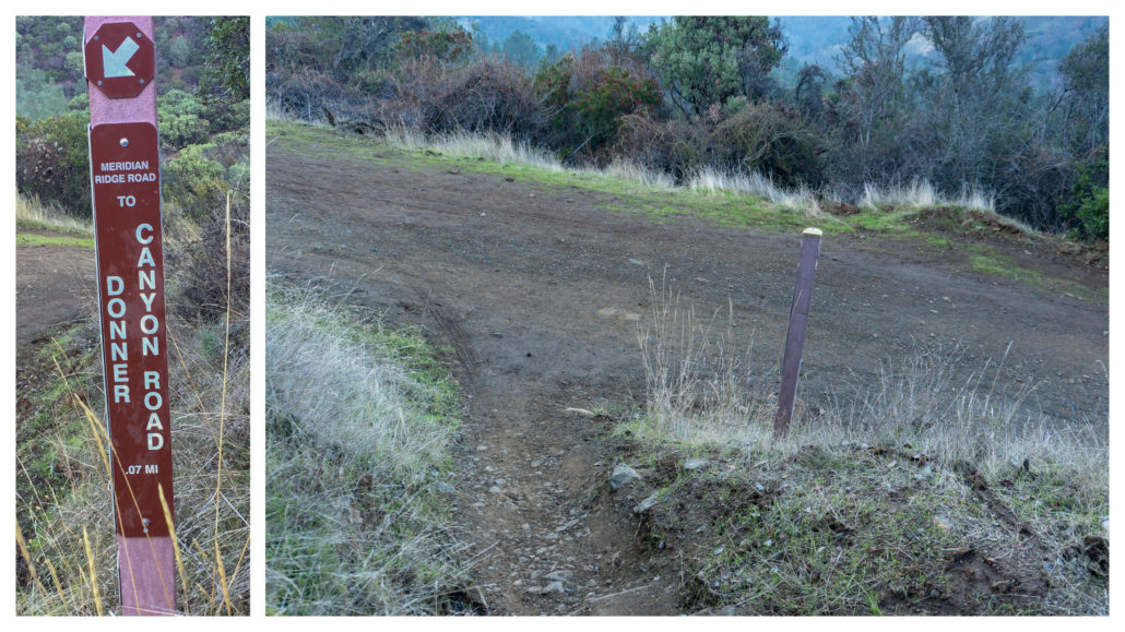
In 425 feet, turn left onto Donner Canyon Road, heading north towards Regency Gate, the trailhead you started from. Straight ahead is Cardinet Oaks Road. This is the junction you would have come to if you had taken Donner Creek Road all the way south at the beginning of the hike.

Descend next to Donner Creek once again, surrounded by red-berried toyon, coyote brush, and coast live oak. Pass junctions on your right for the Hetherington Trail, staying straight on the fire road as you transition back into the open grasslands and tall oaks that greeted you at the start. Take one more gaze at Donner Creek, finishing your hike back on Regency Road at the 6.0-mile mark.
Notes:
- Dogs are not allowed on trails or fire roads in Mount Diablo State Park. They are allowed in developed areas.
- Mountain bikes are allowed on fire roads, paved roads, and some single-track trails. Check the Mount Diablo State Park trail map by the Mount Diablo Interpretive Association for a list of trails, or call the park office at (925) 837-2525.
- Park hours are 8:00 a.m. – sunset.
- There is no fee for parking at the end of Regency Road, however; please park respectfully on this neighborhood road.
- There are no restrooms or trash bins at the Regency entrance. Please leave no trace and pack out all of your trash.
- The Mount Diablo Interpretive Association has an excellent trail map for Mount Diablo State Park. You can purchase it online or in retail stores. They also have wonderful resources on their website, such as free wildflower guides.
- Save Mount Diablo has a free, detailed trail map on the Avenza Maps app called “Mount Diablo and Surrounding Parks – Mount Diablo Regional Trail Map.” If you are going to use it, I would recommend downloading it before you go; cell service unreliable as you climb deeper into Mount Diablo State Park.
Tags: east bay, east bay regional park district, Mount Diablo, Mount Diablo State Park, san francisco, Waterfall, waterfall hikes