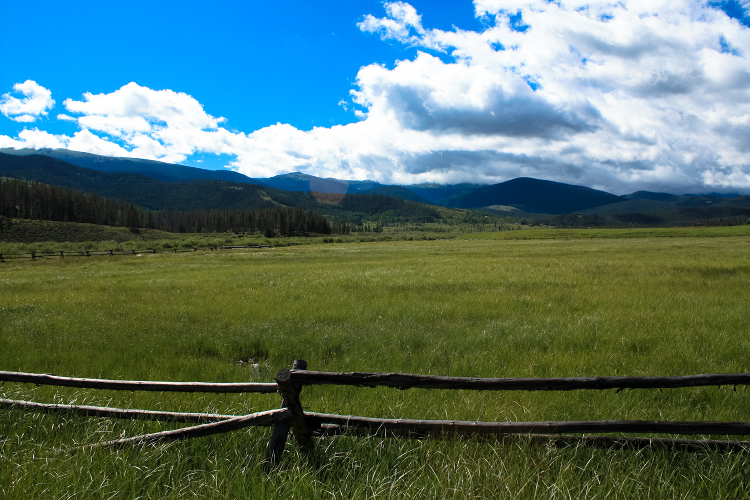
The Devil’s Thumb Ranch Resort and Spa is a beautiful property at the base of the Rocky Mountains, just outside the boundaries of the Arapaho National Forest and the Continental Divide. Formerly a ranch homestead and dairy, Devil’s Thumb Ranch quickly found a second life as a vacation getaway. In 1946 it operated both as a dude ranch and a vacation area, and it became well-known for a series of Nordic ski trails designed by a 1964 Olympian.
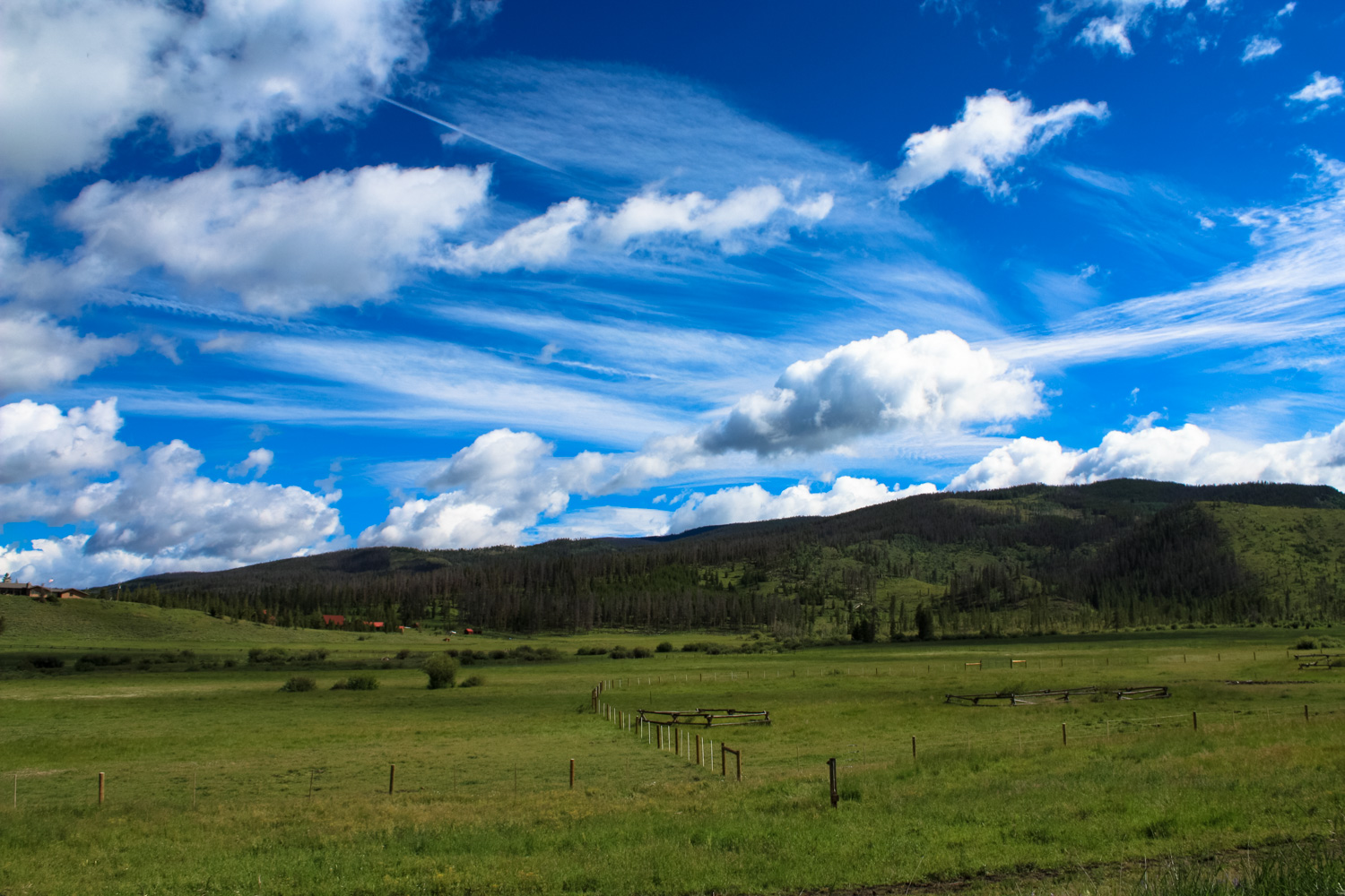
 In 2001 the 6000-acre ranch property was being eyed by developers who wanted to build a golf course and permanent residences, but instead the owners decided to keep the ranch’s open charm and instead chart a course for a more conservative and artful expansion, focusing on renewable energy, historic preservation, and a unique use of reclaimed materials (and even full buildings). The property uses solar power and geothermal heat, landscapes with native plants, has a water filtration and purification system that feeds the local aquifers, and sources all of their food from local farmers and ranchers. Today the Ranch is something that can really only be described as “rustic swank” – it’s definitely on the higher end of the luxury scale, but the property still focuses on old-fashioned Rocky Mountain outdoor activities – horseback riding, mountain biking, and hiking. (They also do stand up paddleboarding, zip-lining, yoga, fly fishing, disc golf, and archery in the summer; winter is for cross country skiing, snowshoeing, fatbiking, and tubing). If you’re not staying at the Resort itself, you’ll have to purchase a $5 day-use pass at Zach’s Mercantile (open from 8:30am to 5:00pm Sunday – Thursday and 8:30am to 6:00pm Friday – Saturday.) Once you’ve got that all settled, head toward the main lodge and walk along the paved road toward the cabin area and stables. You’ll have sweeping views of the ranch property along the way.
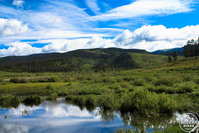
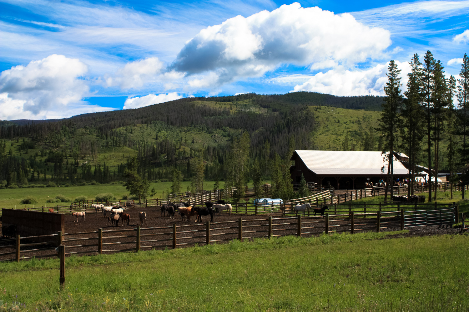
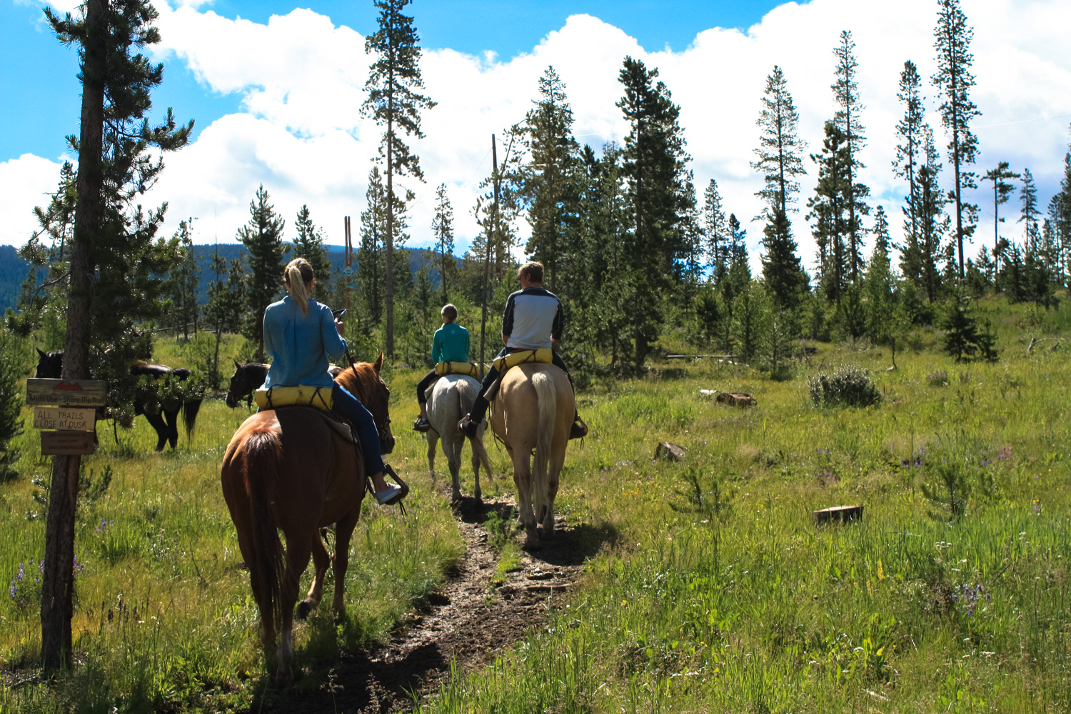
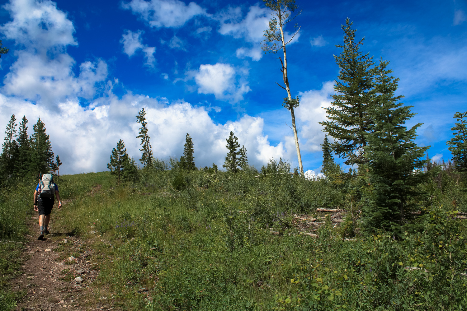
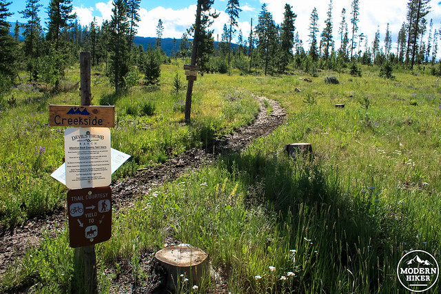
At 0.4 miles, look for the signed Creekside Trail near the horse stables.
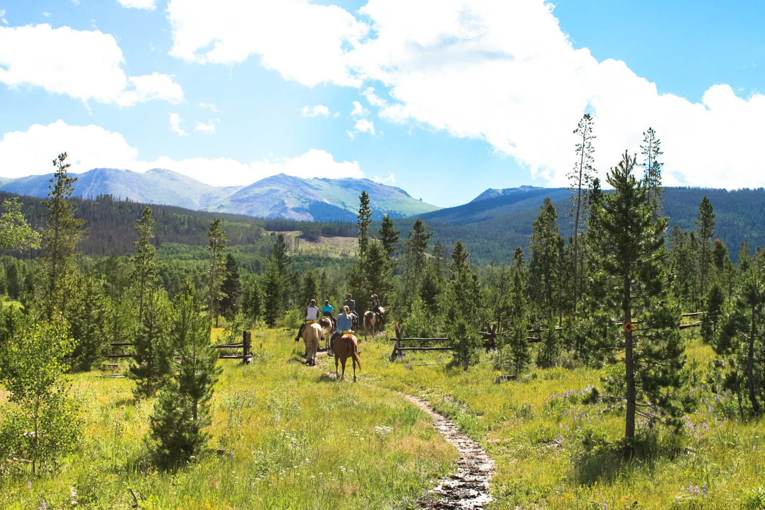
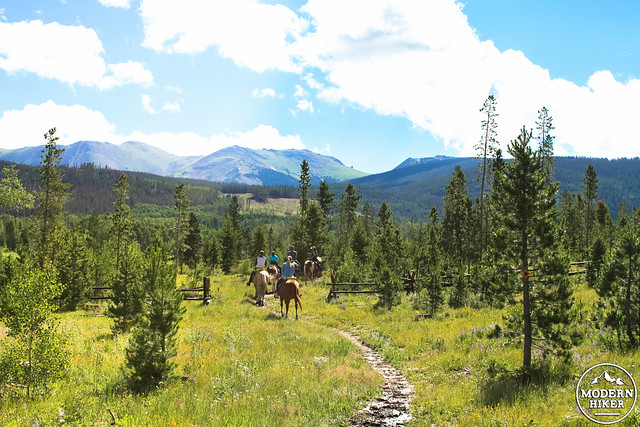
 Since this is so close to the horse stables, odds are you may be caught up in a group ride at some point along this stretch of the hike. If that does happen, let the equestrians go ahead of you for a bit or try to get the attention of the group leader so they can stop while you go around them (exercising caution and giving them a wide berth if they give you the OK to pass). On our hike, we had to do a little maneuvering near the stables but pretty much had the trail to ourselves once we got off the Creekside Trail. The horses did make for some really nice photos, though!
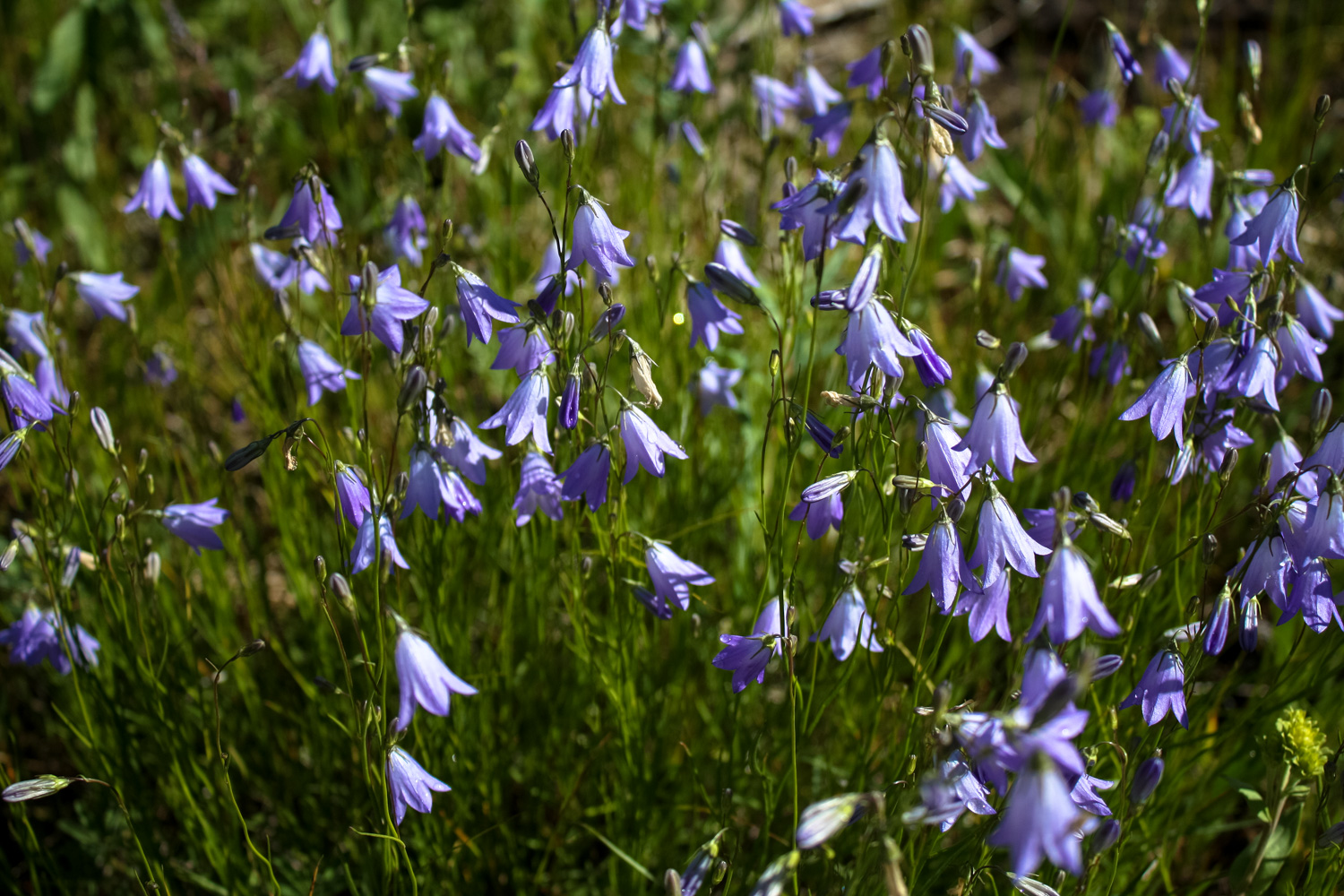
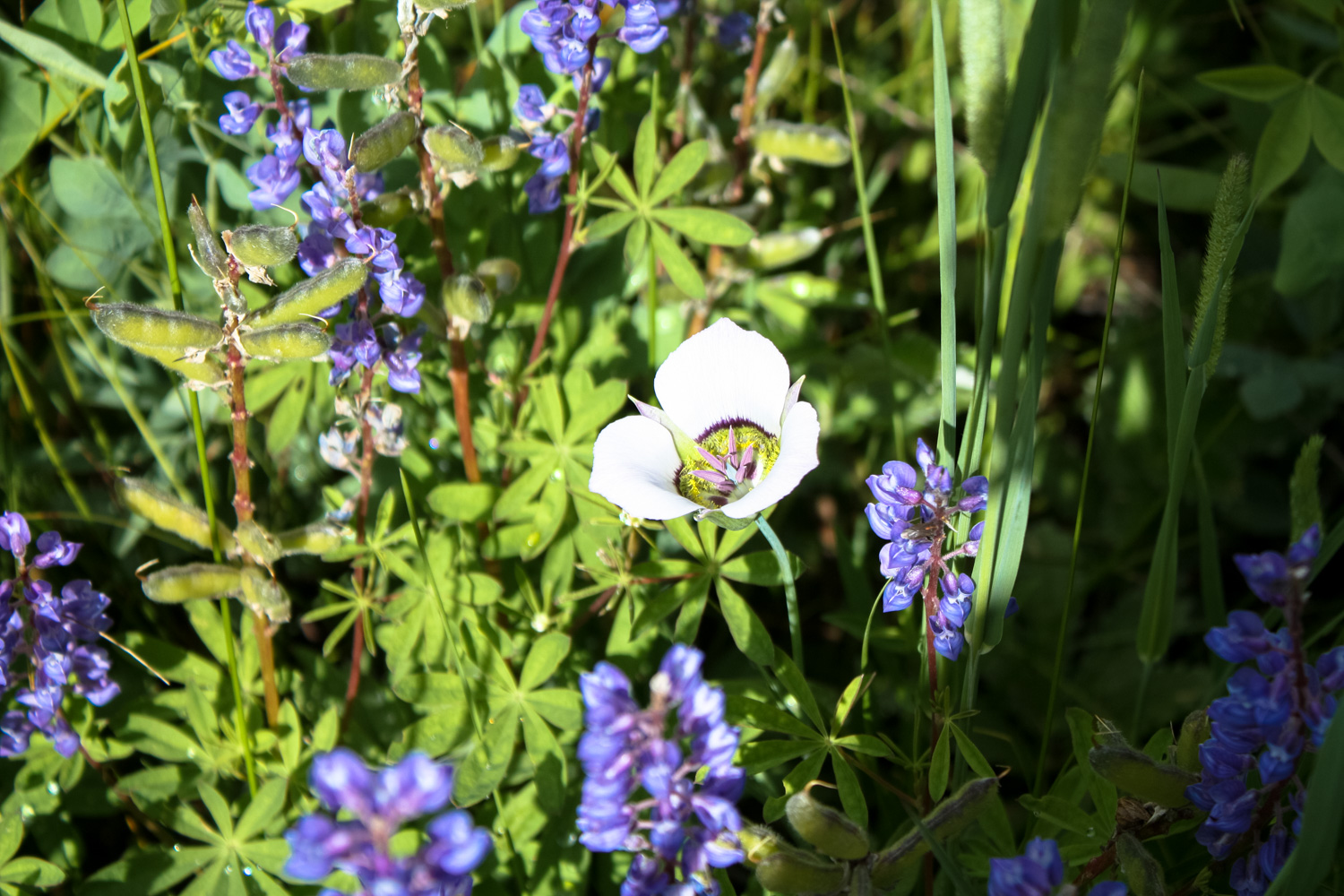
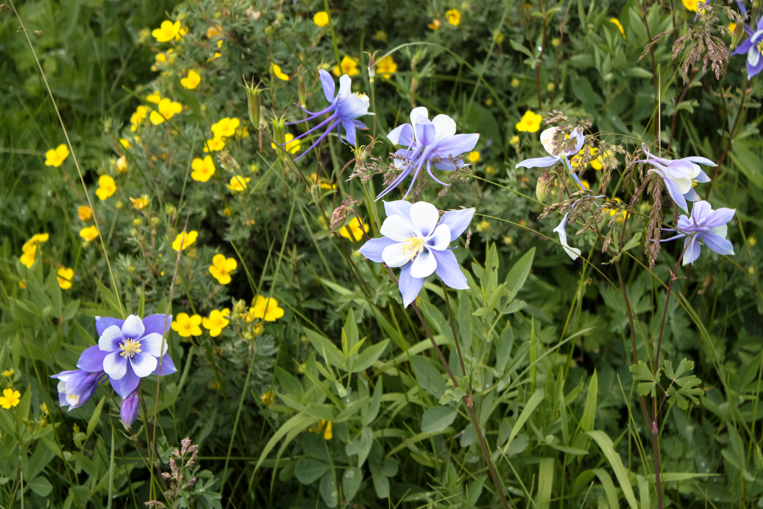
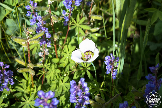
 As did some local wildflowers:
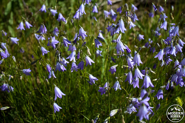
As you hike to the north, you’ll also have great view’s of the iconic Devil’s Thumb – a distinctive tower formation in the mountains above you. The Thumb is in the Indian Peaks Wilderness and can be hiked to and climbed with the proper permits and equipment.
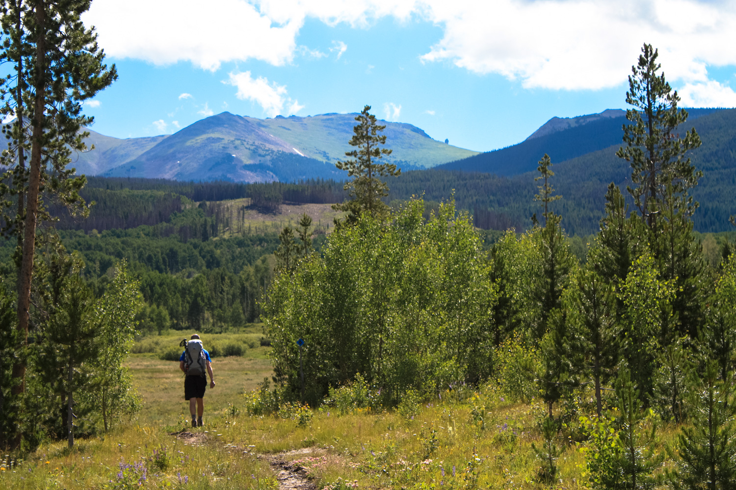
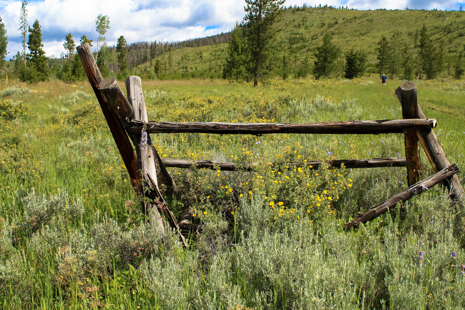
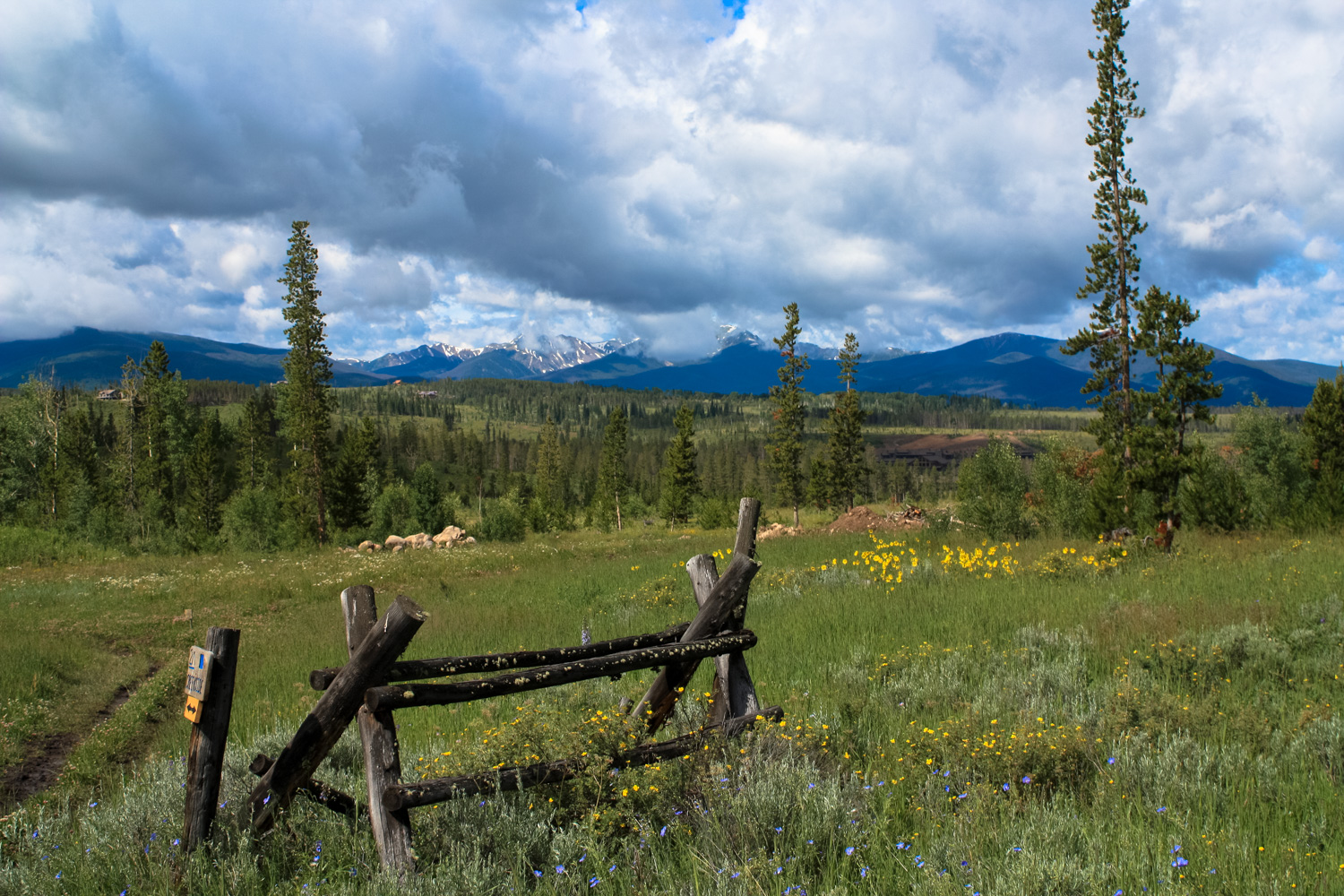
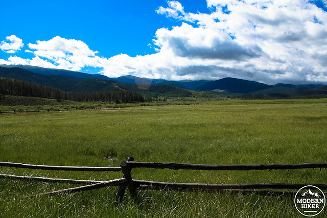
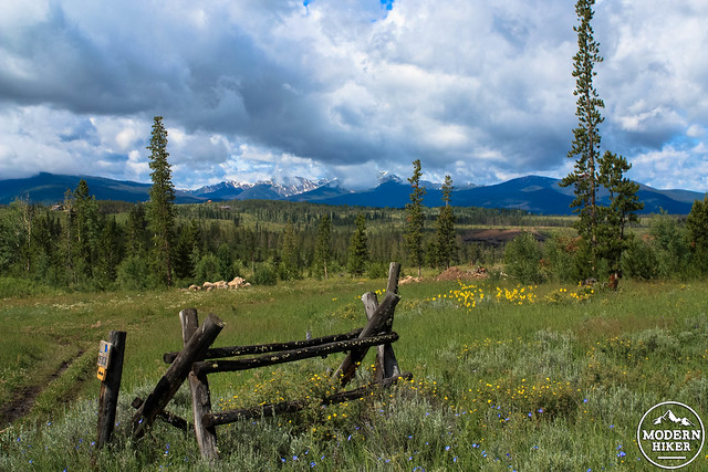
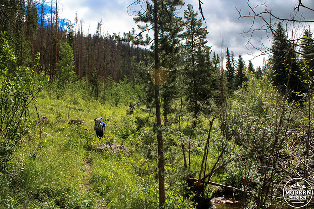
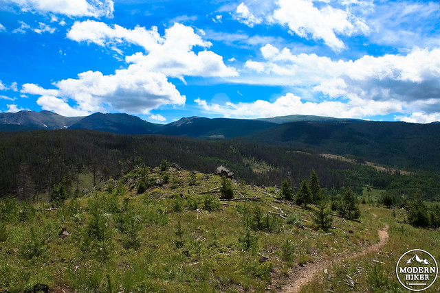
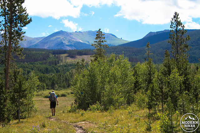 The Creekside Trail roughly parallels the road past the stables but is generally a much nicer walk. At the mile mark (Trail Junction 9), turn left on the Marker Hill Trail toward Marker Hill (easy to remember, right?). The Trail heads west through some meadows and drops next to a small bike skill park before making a sharp turn north at 1.3 miles. Cross Cabin Creek here and the trail begins to make a slow but steady climb around the southwest slope of Marker Hill. Meadows and old ranch fences provide a phenomenally photogenic landscape here.
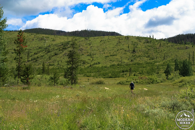
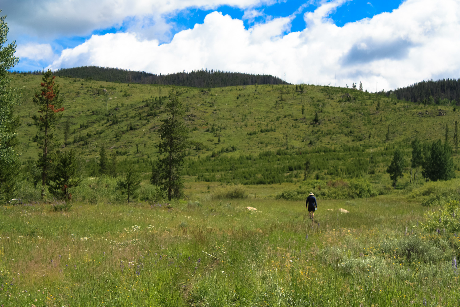
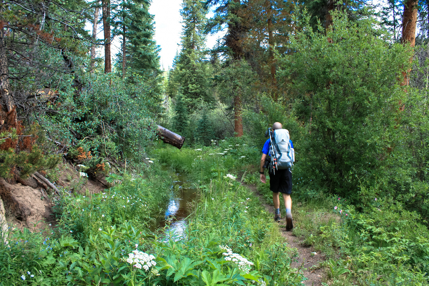
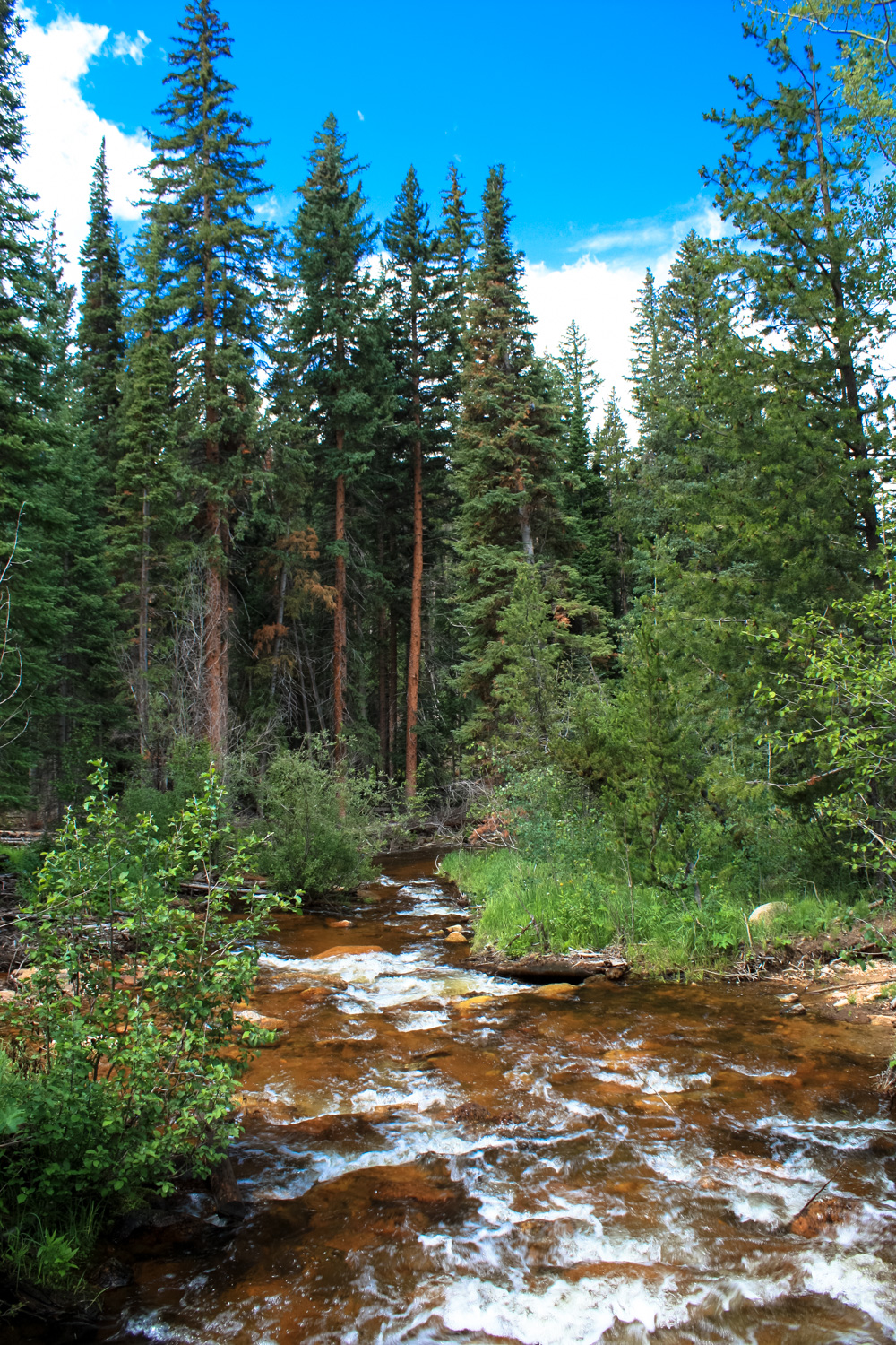
As the trail gains elevation and heads north, you’ll gradually leave the meadows and fields and transition into the forest. At 1.8 miles, keep to the right to continue toward Marker Hill. In this area, you’ll be hiking alongside an irrigation diversion for the creek and there’s one spot where you’ll have to duck under some trees and skirt one of the banks to make it along the trail. You may get your boots a little wet but it’s an easy transition.
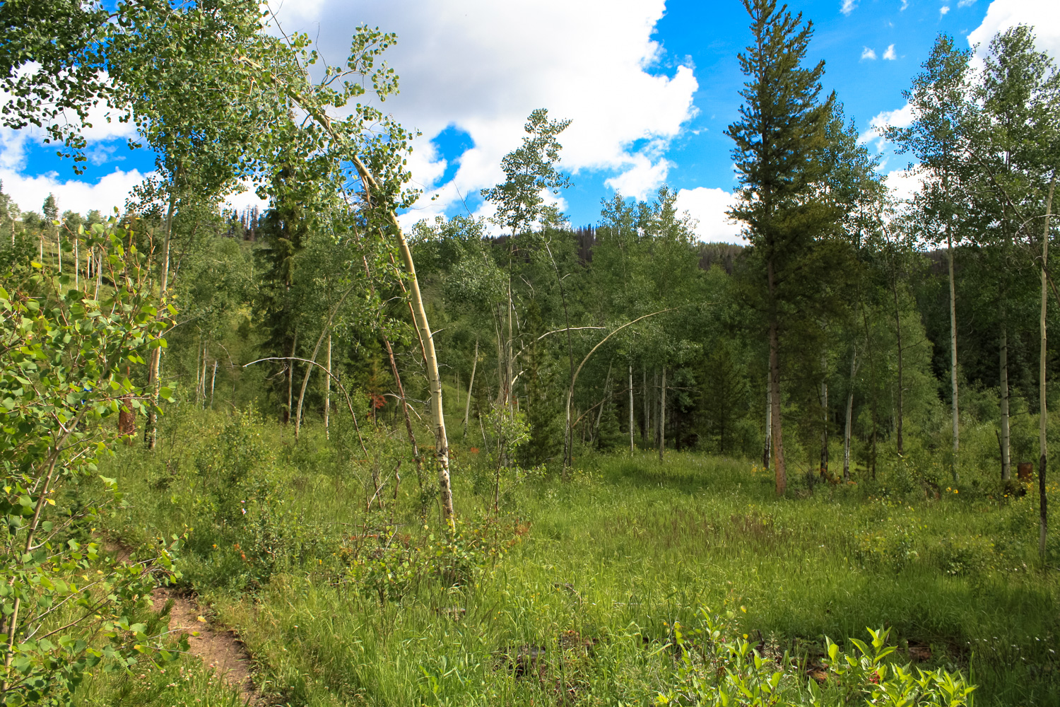
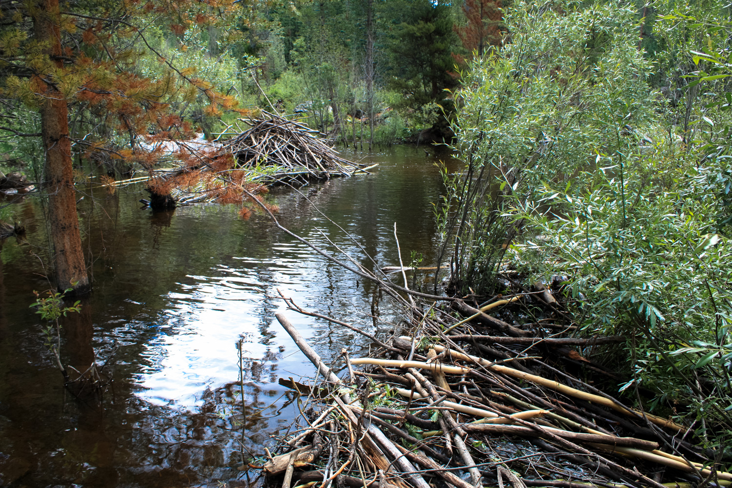
 Past this point, the pines will temporarily give way to an extensive grove of aspen trees and open meadows – and you’ll also pass a small beaver pond on the right hand side of the trail (keep an eye out for the little guys swimming near their lodge!).
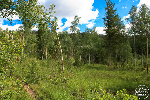
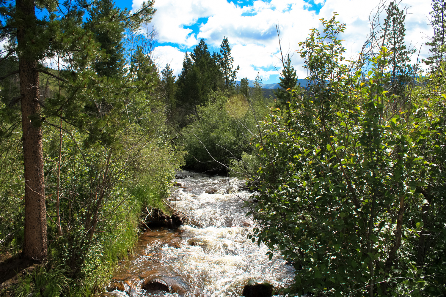
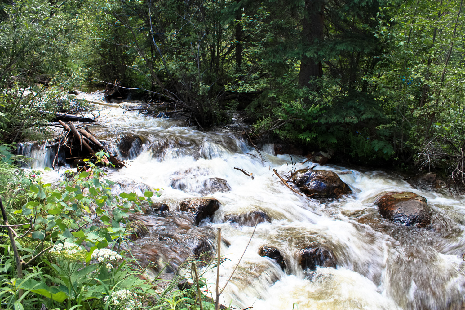
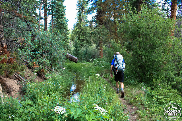
 The trail gets a tad rougher here as the elevation starts to pick up. At around the 2 mile mark you’ll have a short rest before the climb starts up again. At 2.1 miles, the trail hugs the side of Cabin Creek and provides some great opportunities to just sit and enjoy the sounds of the rushing water.
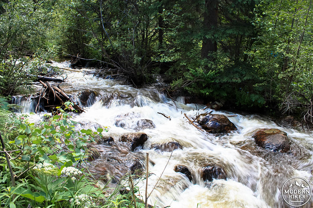
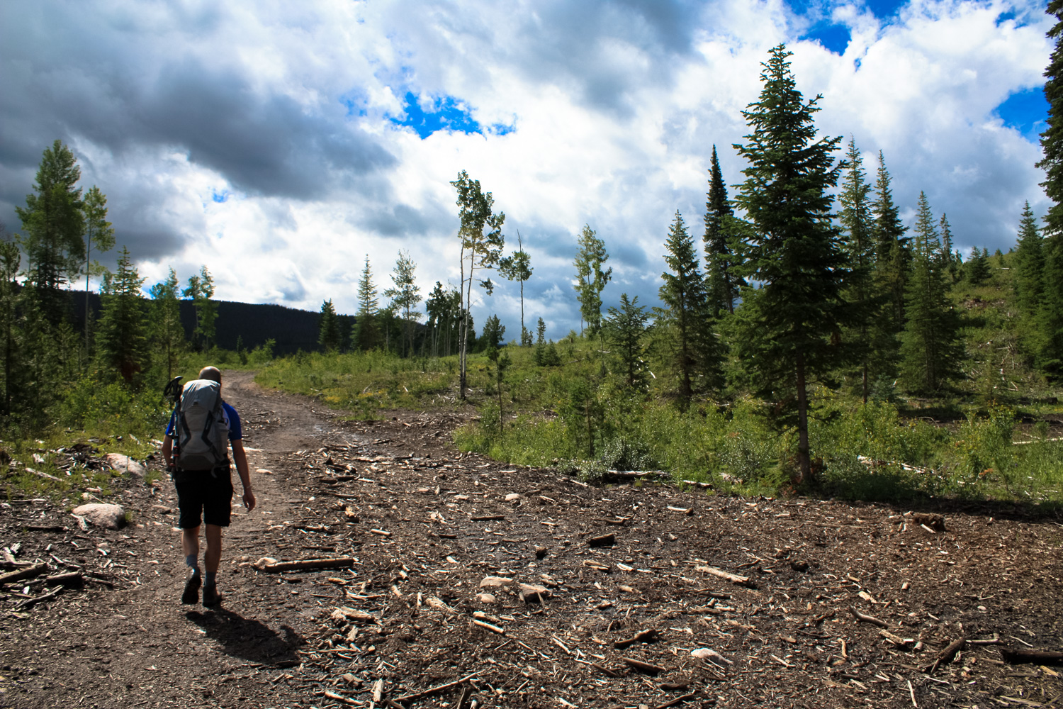
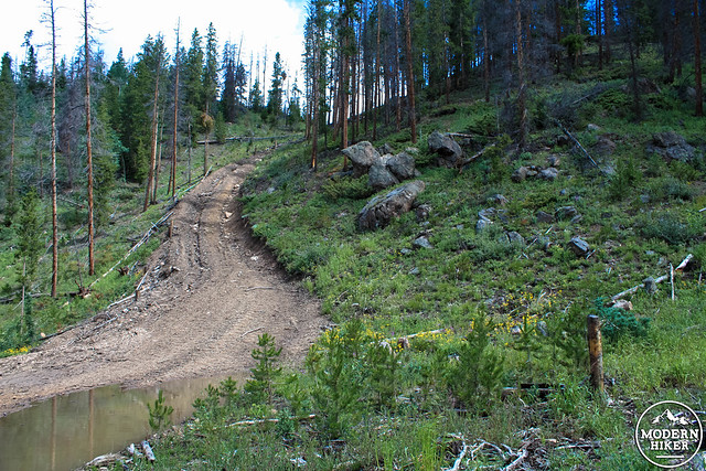
By now, you are well within the boundaries of the Arapaho National Forest, which means you’ll start to see some old fire and logging roads alongside the trail, too. For the most part they are either very well signed or clearly NOT meant for hikers, as in this impossibly steep road heading west from the trail:
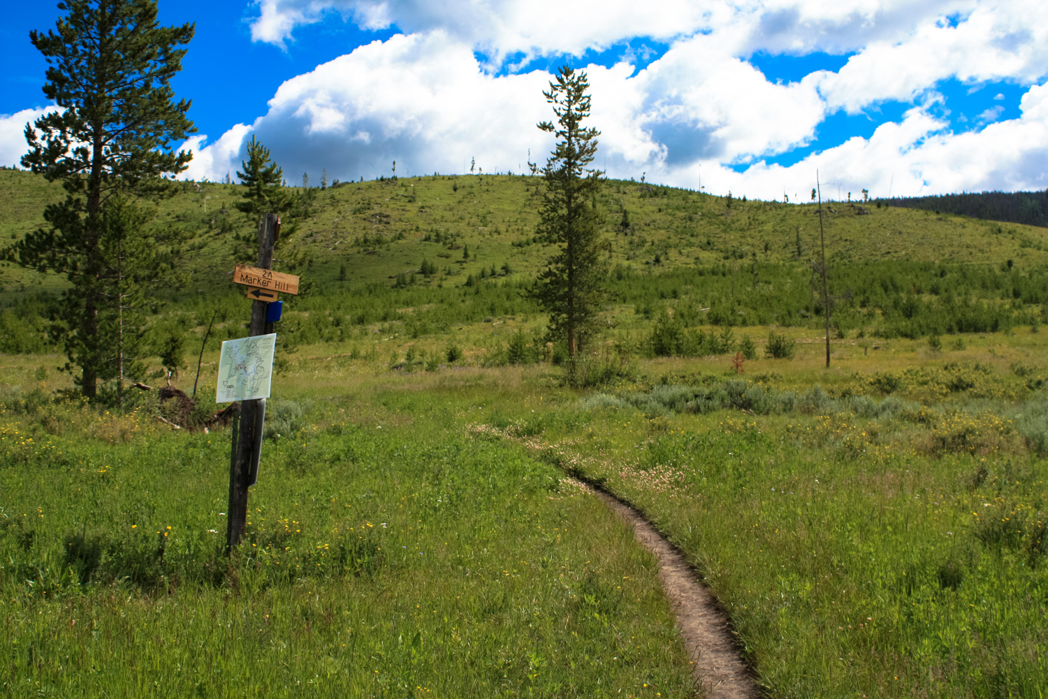
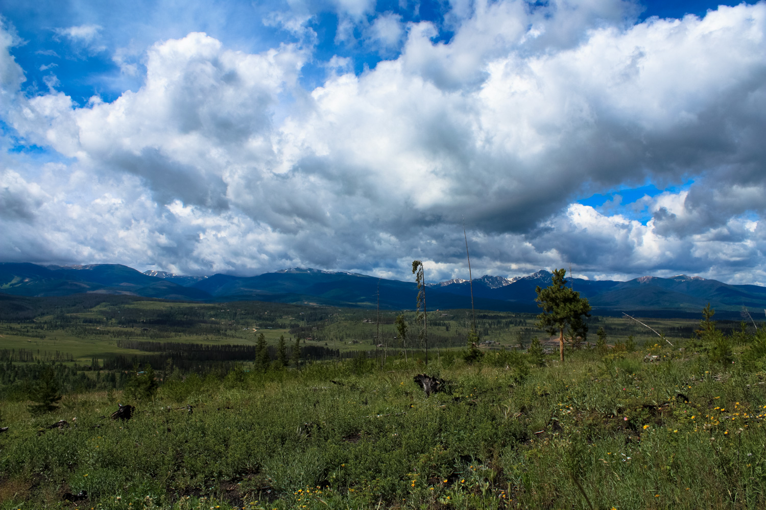
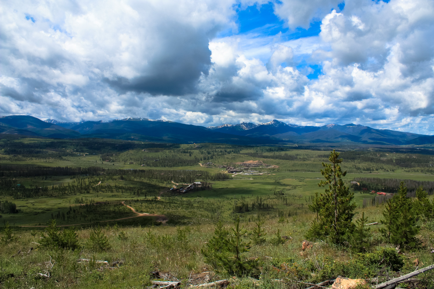
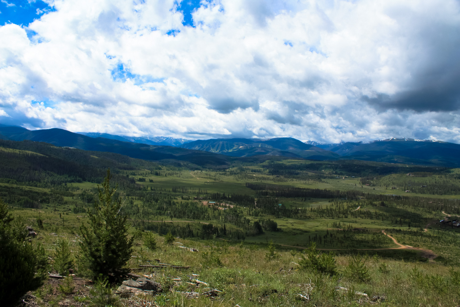
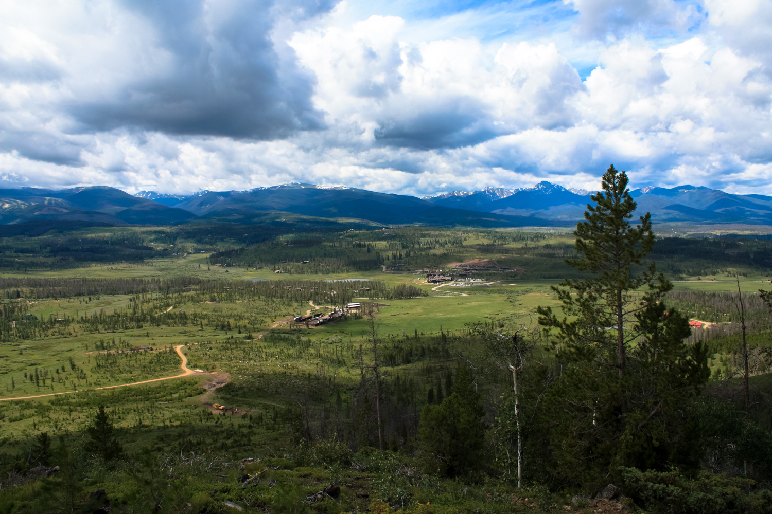
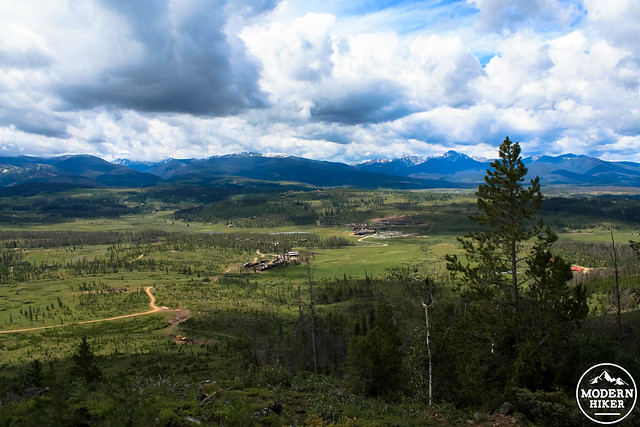
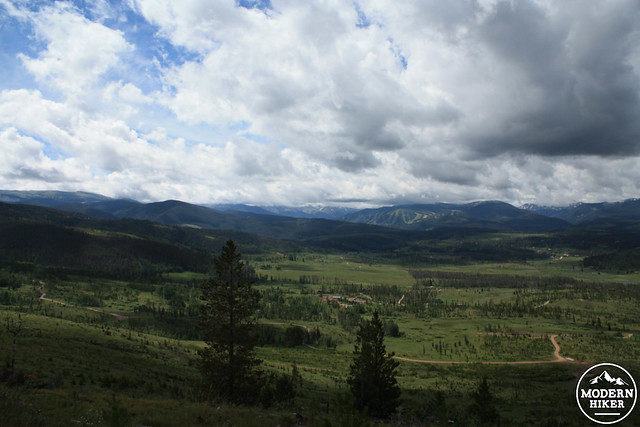
 Continue along the Marker Hill Trail until the 2.5 mile mark, then take a right onto the signed trail to the Marker Hill Vista Point. This ascent is steep but showcases some truly stellar views in almost every direction. The Ranch itself is particularly beautiful from this angle, and when you reach the summit just before 2.8 miles, you may want to sit down for a while just to soak it all in.
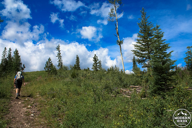
Backtrack to the Marker Hill Trail and head to the right, staying on the broad Forest Service road as it follows a fairly steep downhill. You will likely be able to see the Friends Trail in the woods to the east. Stay to the right at the junction with Elk Walk at 3.3 miles and return south on the Creekside Trail or – if you miss it like we did – you can follow the service road past the Stables back to the main lodge, too.
If you’ve worked up an appetite, consider stopping in at Heck’s for some refueling. The hexagonal dining area is a replica of a room at the Timberline Lodge near Oregon’s Mount Hood and offers great local food (including ranch beef) and expansive views of the surrounding landscape.
Tags: Arapaho National Forest, Colorado, Devil's Thumb Ranch, Fraser, Marker Hill, Winter Park