Prepare to run out of superlatives on this stunning hike on the Maple Pass Loop in the heart of the North Cascades. Start in a dense forest and soon enter a subalpine wonderland of jewel-like lakes and mountain passes. At Maple Pass, the hike’s highest point, spin around and see nothing but peaks in every direction. This is one of the state’s most beautiful hikes, especially in mid-October when the larches dust the slopes with gold.
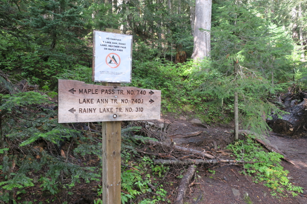
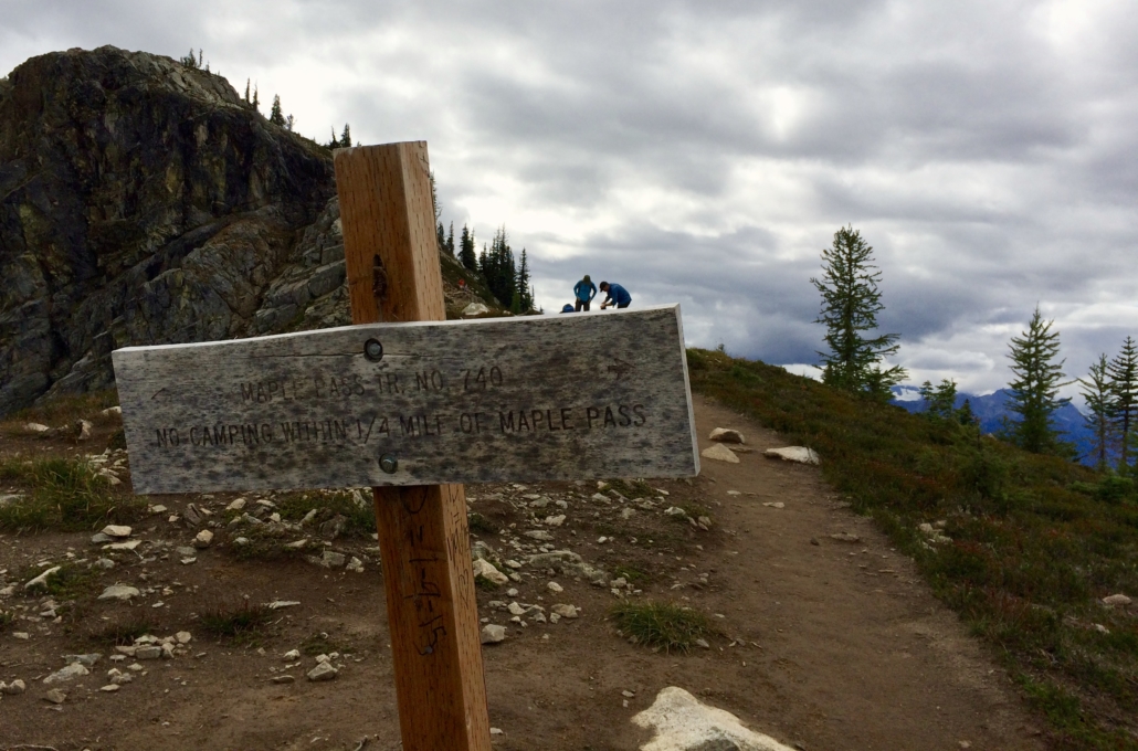
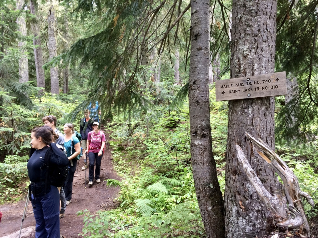
Although this hike is a bit farther from Seattle, it’s worth the effort. On a fall weekend, the parking lot will be full by midmorning and cars will be lined up along Highway 20 in both directions. Camp nearby the night before or plan to arrive early in the morning. Park and find the trailhead kiosk. Several trails leave from here–Maple Pass, Lake Ann, and Rainy Lake–and the Pacific Crest Trail crosses the highway. Follow signs for Maple Pass and head counterclockwise (to the right when you’re facing the sign) on the trail. This direction is gentler going up and steeper coming down, and guarantees you’ll have enough breath to enjoy the views.
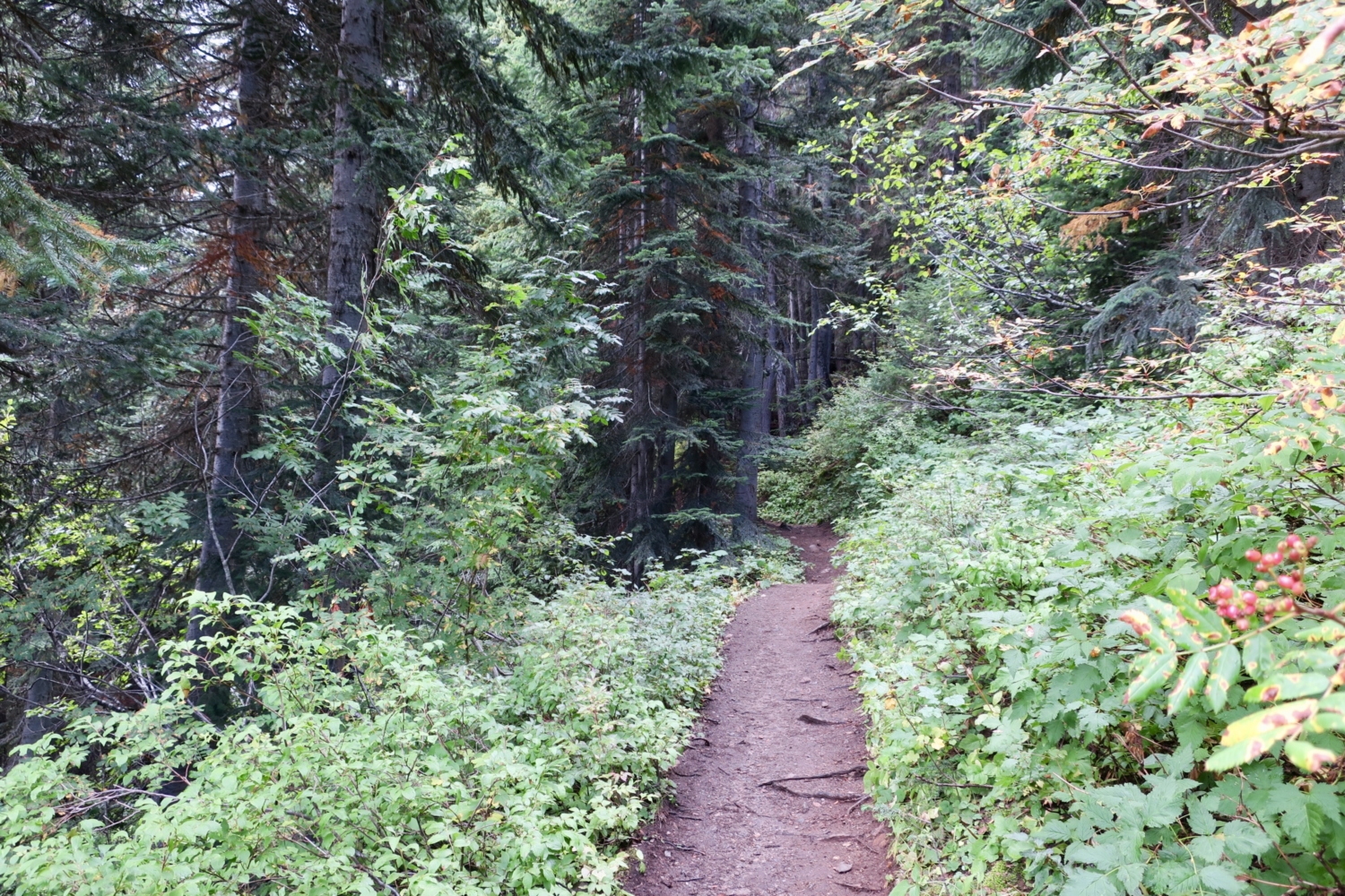
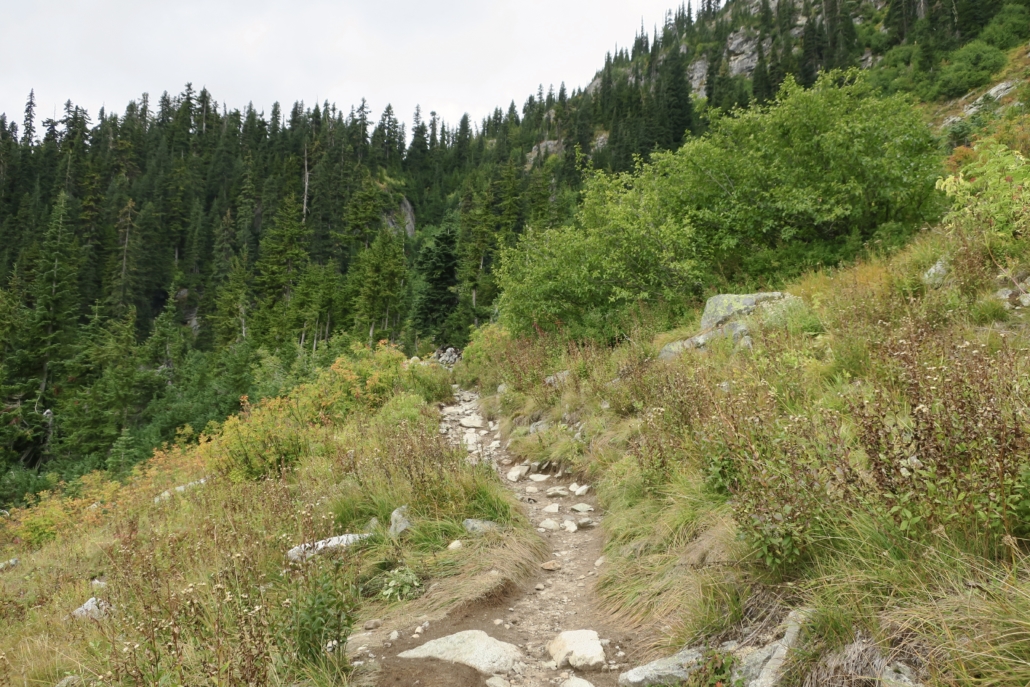
The first mile climbs moderately through evergreen forest. By late August, the vine maples will be turning red and many understory shrubs will have berries. Unless you know what’s safe, wait until you reach the huckleberry patches to come. As you gain elevation, look for western larch trees appearing on the slopes. These deciduous conifers sport needles that turn vibrant gold each autumn before dropping off the branch. Maple Pass Loop is one of the best hikes to see these unusual trees, which in summer have light green needles and a loose, wavy branch pattern when compared to the darker, stiffer subalpine firs.

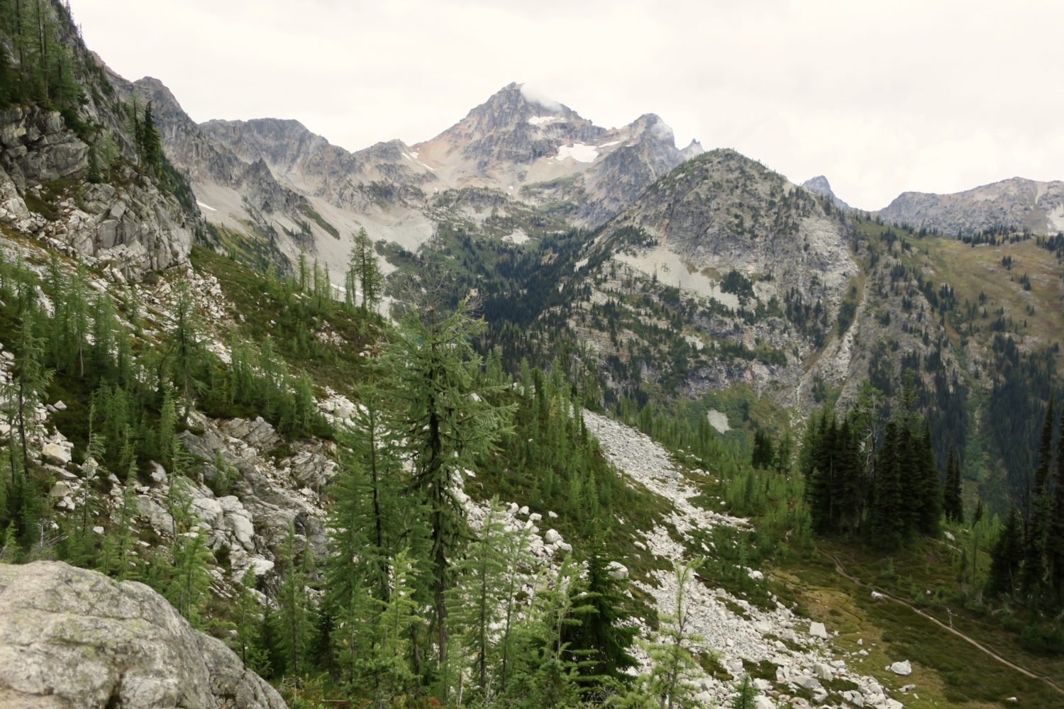
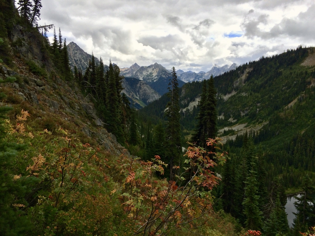
In about a half-mile, reach an open area with Crooked Burn peak above you and a rock-filled slope below. Distant peaks hint at the glories to come. Listen and look for pikas squeaking among the rocks; if you stand still for a minute or two, one will likely make an appearance to check you out.
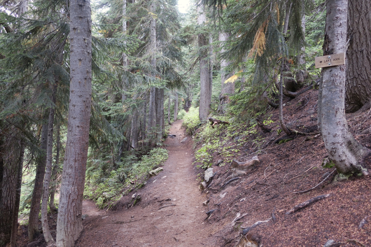
Head back into the forest for a few hundred feet, and at 1.1 miles, reach the junction for the Lake Ann trail, branching downhill to the left. This 1-mile out-and-back detour is worth it if you aren’t feeling up to the whole loop, but otherwise keep going uphill.

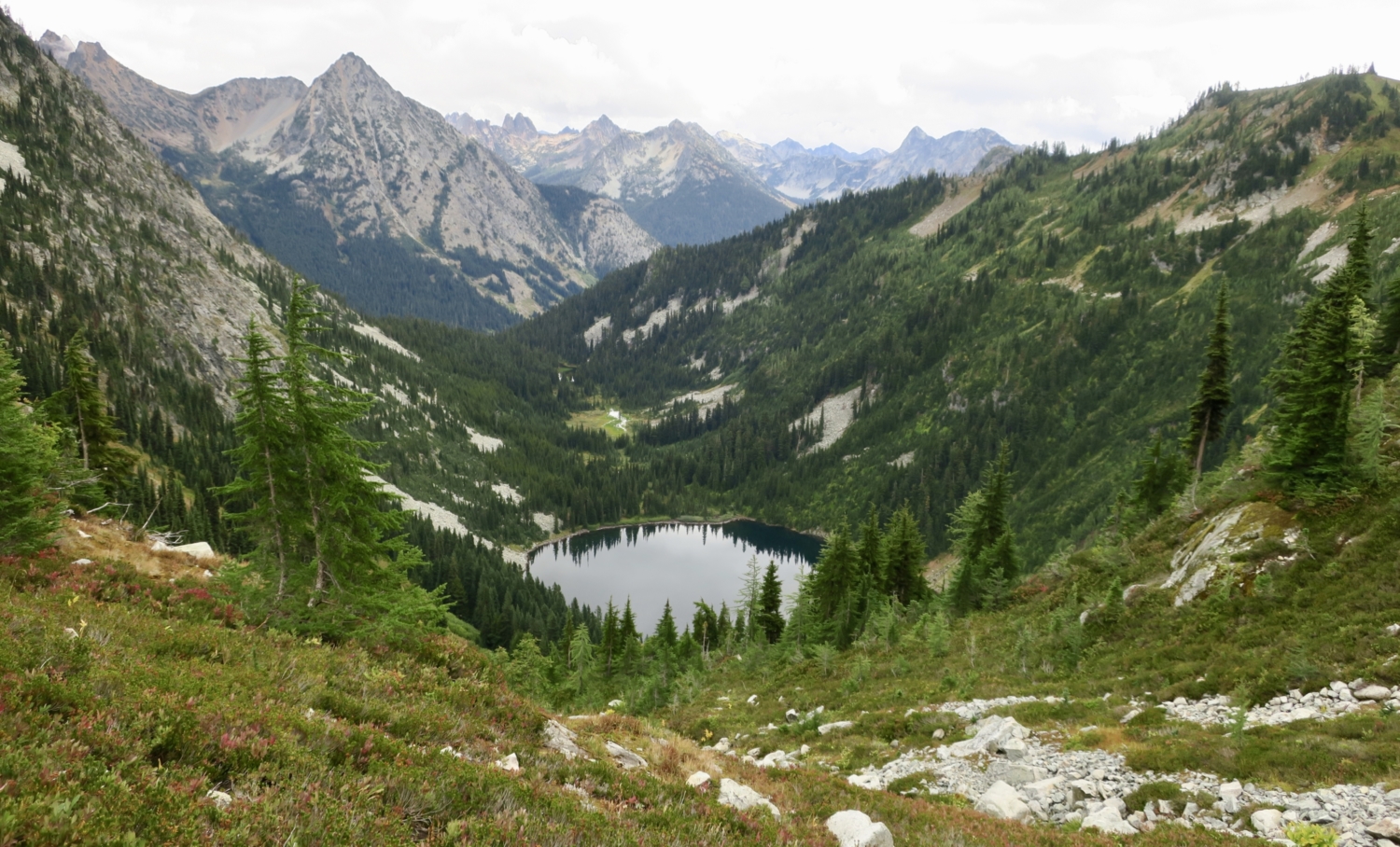
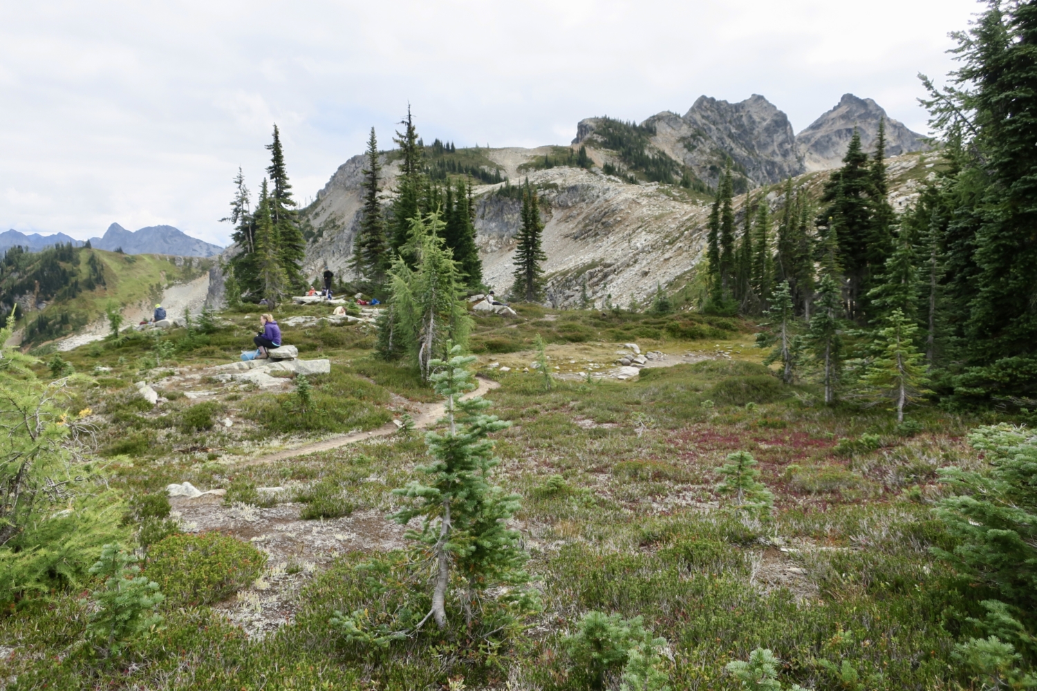
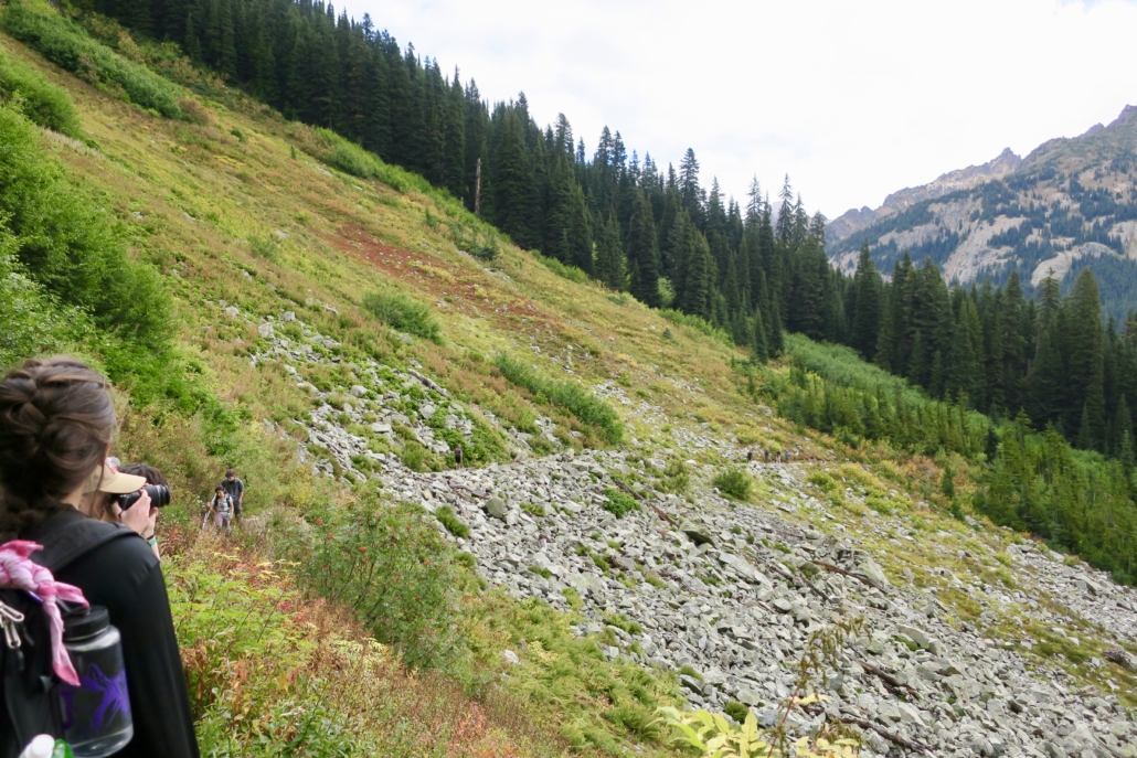
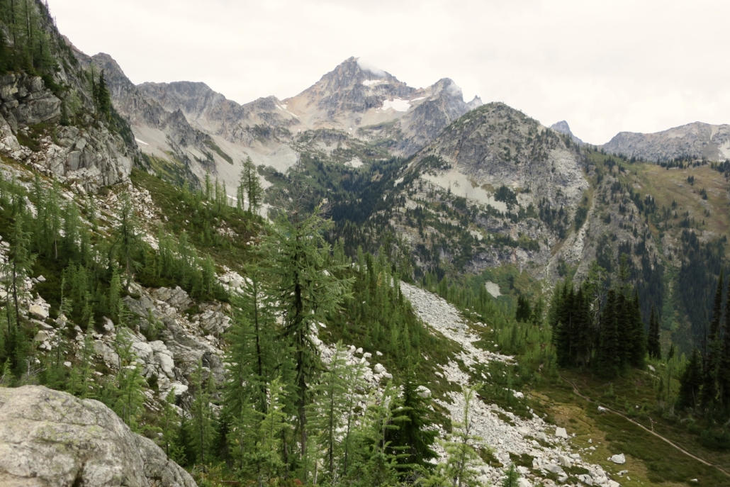
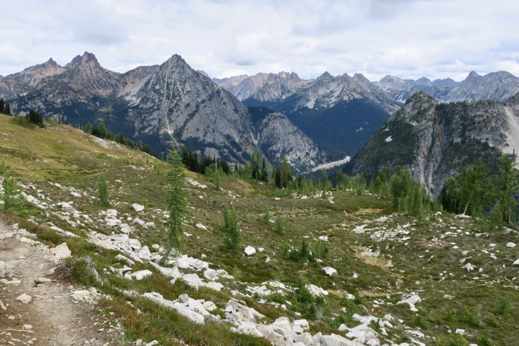
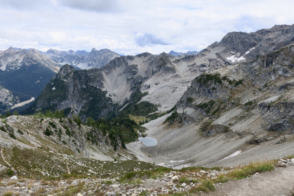
Very soon, the forest thins and you step into a subalpine wonderland. You’re on the side of a large bowl with Lake Ann shimmering at the bottom and the trail visible as it climbs up and around. The scenery is gorgeous, and it’s only going to get better. More talus fields equals more pikas, too, and maybe a mountain goat if you’re lucky.
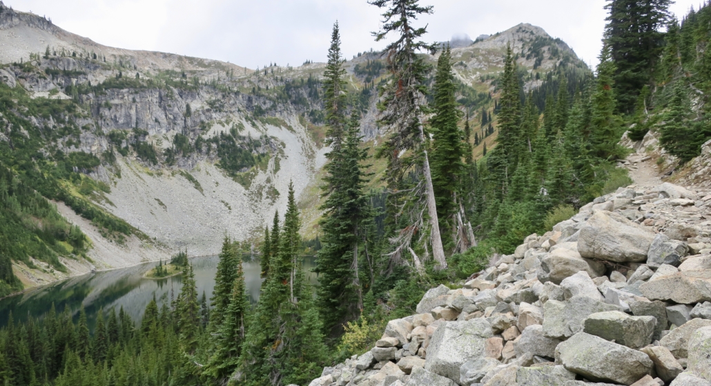
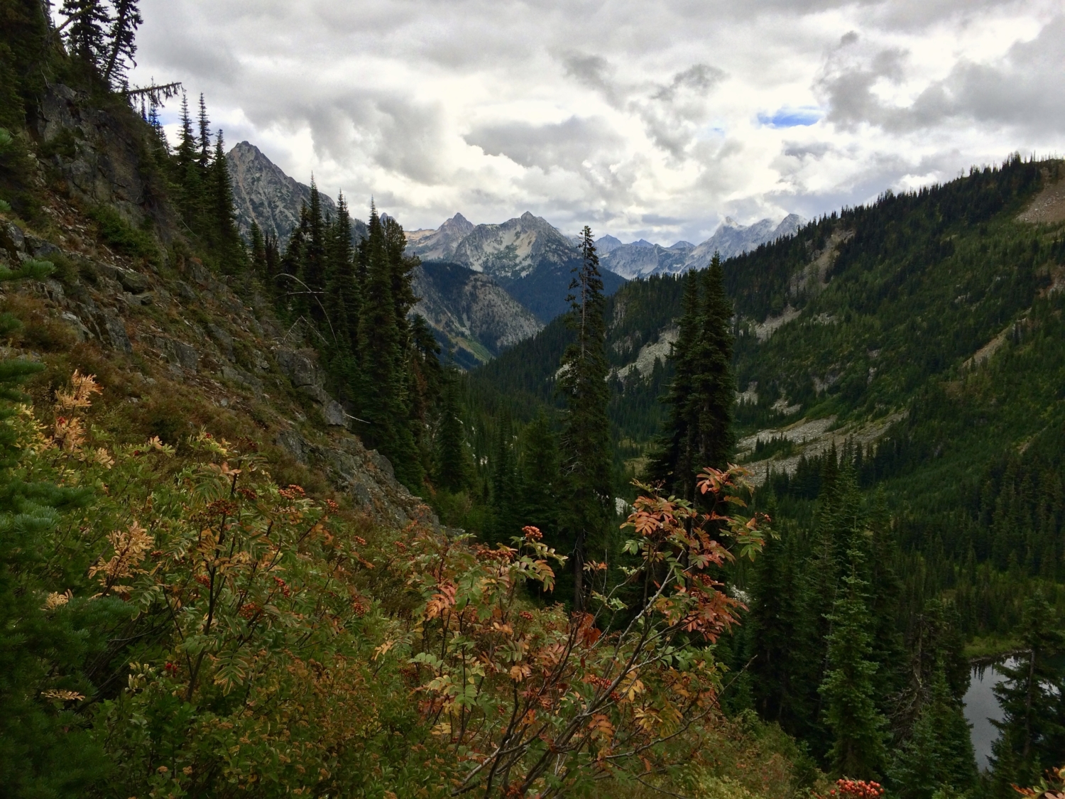
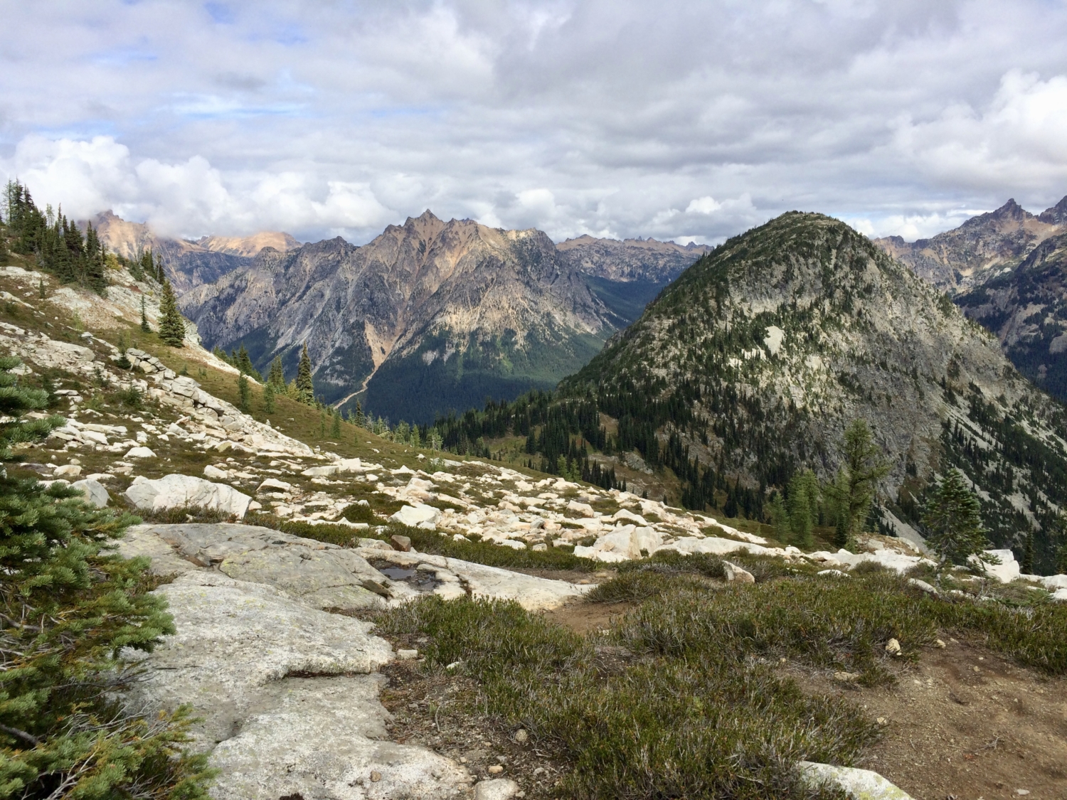
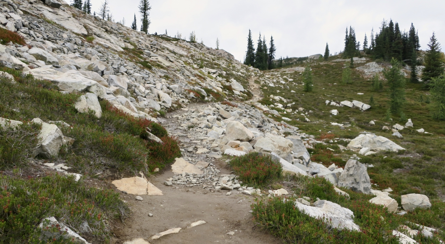
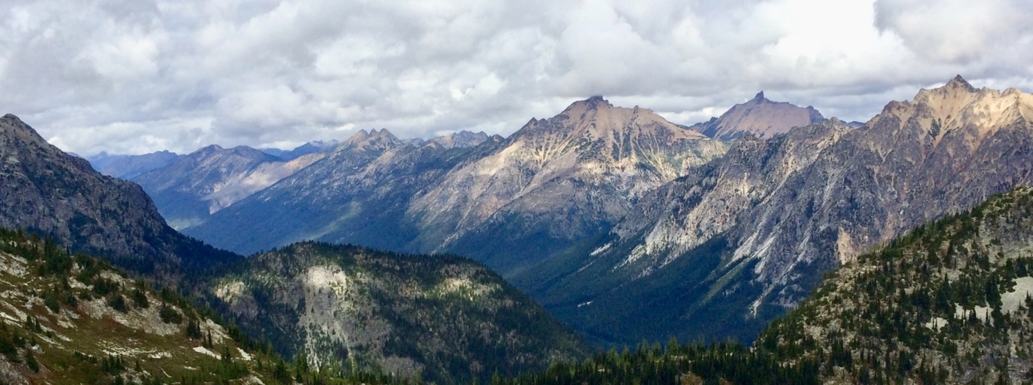
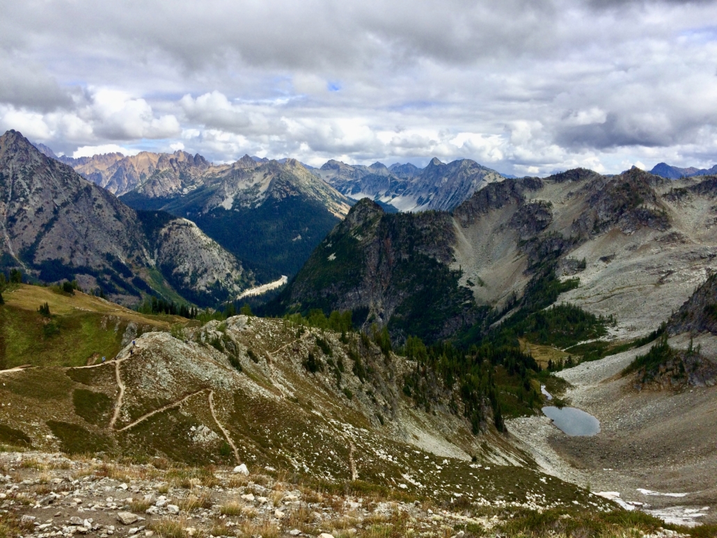
At 2.2 miles, climb a short series of switchbacks to Heather Pass, crossing the invisible boundary between Chelan and Skagit counties a few times as you continue. Due to overuse and damage to the fragile alpine heather that gives the pass its name, camping is not allowed here, and rope is strung between short poles to encourage hikers to stay on the trail. Respect the revegetation program and keep your boots out of the meadows. From the viewpoint, you’re looking at the crest of the Cascade Range and triangular Black Peak in the distance. The trail far below leads to Wing Lake, an excellent overnight destination about 2.5 miles farther. This is a good place for a swig of water before the next, steep section.
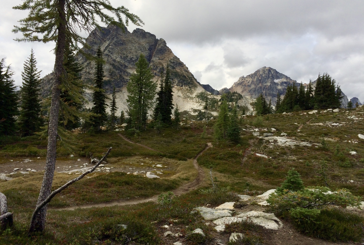
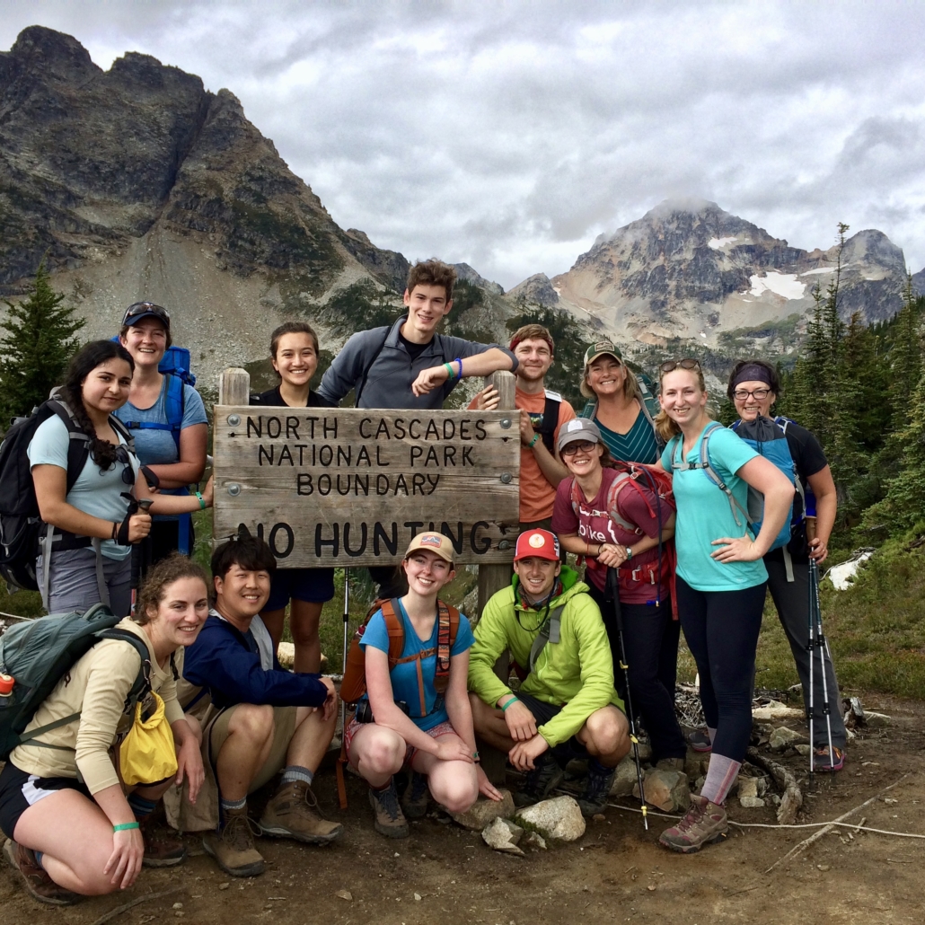
Keep climbing, stopping along the way to munch on huckleberries lining the trail, and in another steep half-mile reach a high saddle in a rock field. A sign delineates the boundary of North Cascades National Park and provides an opportunity for a group shot, like this one of University of Washington students studying national parks in the field.
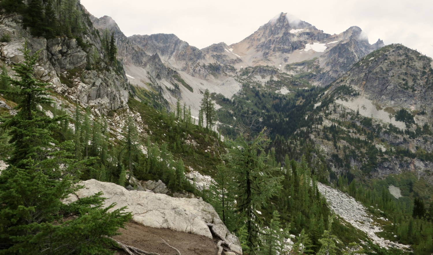
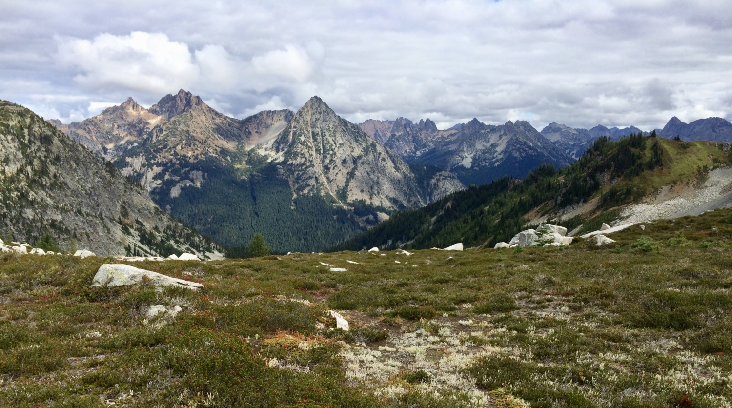
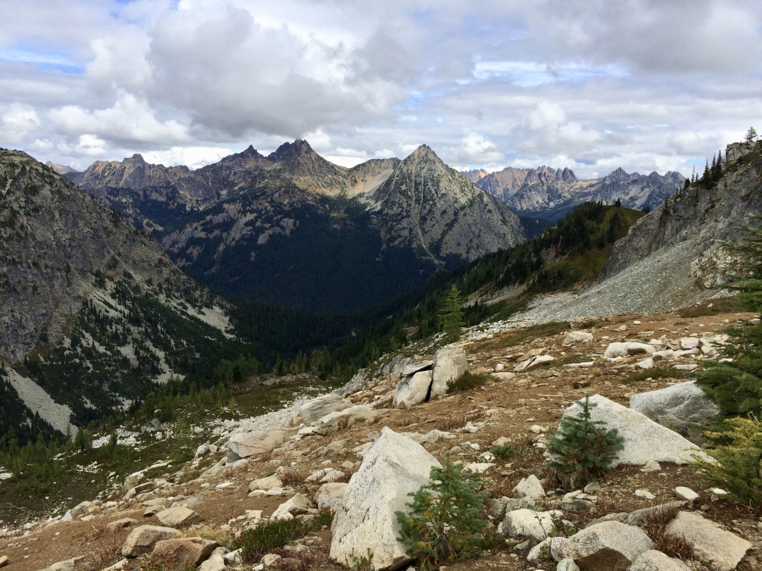
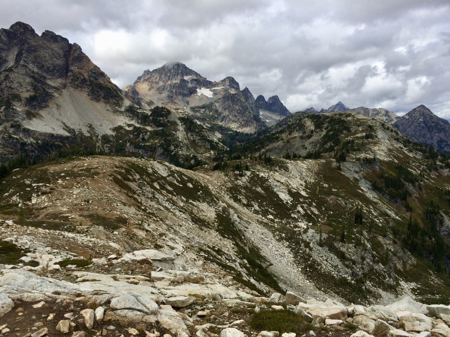
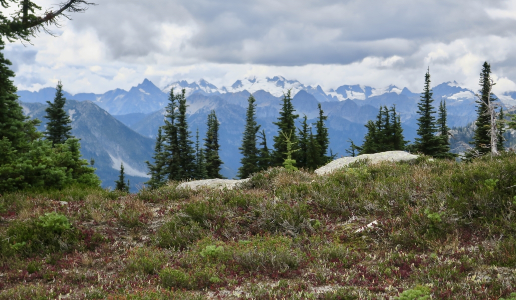
The views are amazing here, but the cold breeze coming off the mountains might encourage you to keep going. Just ahead is a broader ridge section with lots of places to stretch out on a rock, have a snack, and marvel at the mountains. In the far distance, the snow-covered Eldorado Peaks create an imposing barrier. Closer in, the views show why the North Cascades are protected in a national park, national recreation areas, and wilderness areas. This is one of the most splendid vistas in a state jam-packed with scenery.


The trail bumps in and out of the national park along this section, and park rules prohibit dogs. Nonetheless, you may spot some well-behaved, leashed dogs on this hike. Given the lack of boundary markers, it’s difficult to determine when you’re in the no-dogs national park (rarely) and when you’re in the yes-dogs national forest (most of the hike).
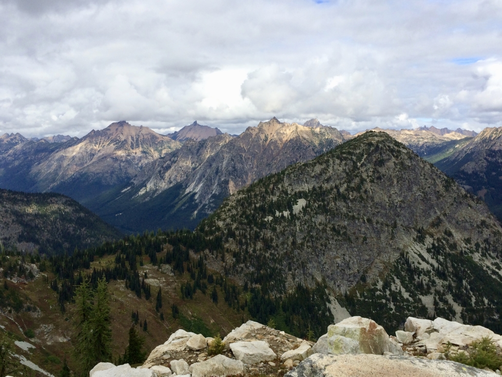
Push up one more short, steep uphill section, and you’ve reached Maple Pass and another national park boundary sign. A climber’s trail leads up the nearby peak, but you’re headed downhill, perhaps reluctantly. Tell your knees to get ready.

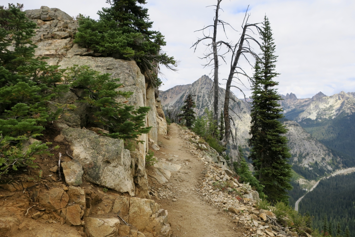
Angle down the side of the pass through several switchbacks as you descend the subalpine zone. About a mile from Maple Pass, the forest thickens, though you’ll still catch some views in open areas. This section is steep. Trekking poles help.
In another 1.4 miles, the trail intersects with the paved, accessible Rainy Lake trail, which runs 1.6 miles out-and-back from the parking area and is a good option for those seeking an accessible hike. From that junction it’s an easy 0.3 mile back to the trailhead, where the exhilaration of wandering high in the North Cascades will likely stay with you for a good while.

Tags: alpine lakes, berries, forest, Hiking, huckleberry, mountains, National Forest, North Cascades, North Cascades National Park, Okanogan-Wenatchee National Forest, subalpine, trees, views, wilderness