
If you are searching for not one, not two, but three truly epic waterfalls hidden away in a dense, mossy forest of cedar and old growth fir, you will absolutely want to put a hike to Lewis River Falls on your hiking list. In addition to those three spectacular cascades, you’ve also got lots of river access and shade on those hot summer days, an idyllic campground, and a relatively moderate trail that’s not only dog-friendly (on leash), but also good for outdoorsy kids. And there are lots of options just in case the kiddos get cranky or tired, too.
But first, let’s talk about getting there …
Getting to Lewis River Falls
The first thing you should know about getting to Lewis River Falls is that cell service is zero, and you will be without connection for a long time before you reach the trailhead, too. Download maps for offline use, print some out to take with you, and make sure you read the directions and if there’s been inclement weather or we’re near the shoulder seasons, give the Mount Adams Ranger District of the Gifford Pinchot National Forest a call to check for the latest updates.
I’ve provided some directions coming from I-5 in the trail guide here. You can also access this route from I-84 by crossing the Bridge of the Gods at Cascade Locks (toll both ways), then taking Route 14 east before heading north on the Wind River Highway. Follow Wind River Road to the Carson National Fitch Hatchery, then take a slight right as it turns into NF-30 / Meadow Creek Road / Wind River Road. This road climbs and winds past several Sno-Park areas, and after McClellan Meadows Sno-Park, turn left onto Curly Creek Road. This road descends, passing the McClellan Viewpoint before reaching the intersection with NF-90 described in the directions attached to this trail guide.
An additional note on NF-90: it is mostly paved, but even the paved sections are rough. Drive more slowly than you think you need to, because deep dips and divots will appear without much warning, and the risk of bottoming out is real. The road is passable for passenger cars but you will want to exercise caution. Just past the intersection with Curly Creek and NF-90, you will see a sign pointing toward the Lewis River Trail at a sharp left–this is not the way you want to go. Stay on NF-90. You will enter the National Recreation Area and after you cross the Lewis River, you will come upon clearly marked signs for the Lower Falls Campground.
Permits for Lewis River Falls
Year-round, you will need a pass that allows access to National Forest land to hike at Lewis River Falls. A Northwest Forest Pass is $5 per day for one car or $30 for an annual pass. If you have the America the Beautiful annual pass, that works here, too. A Discover Pass–which is good for Washington State Parks–is NOT usable here. Find more info and purchase passes online here.
If you are hiking during the peak summer months (usually beginning mid-June), you will also need to reserve a day-use pass for a specific trailhead inside the Lewis River Recreation Area. These are applicable to six different sites in the area and can be reserved on Recreation.gov for $2, and the permits MUST be printed and displayed on your dashboard. Learn more about this permitting process here. To follow this guide, get a permit for Lower Falls, but the hiking route for Lewis River Falls as written here can be accessed from all of the available parking areas.
Hiking Lewis River Falls
OK! Wow, that’s a whole lot of words before you even get to the trailhead, right? It’s OK. I promise it’s not really as complicated as it looks, but there are a few barriers to entry on this route and I wanted to make sure you had all the information available.
The good news is that once you get to the Lower Falls Campground / day use area, you really do not have to put in much work before you start getting blown away by waterfalls. From the parking area, pass the outhouse and it’s less than 0.2 mile to an epic view of Lower Lewis River Falls.

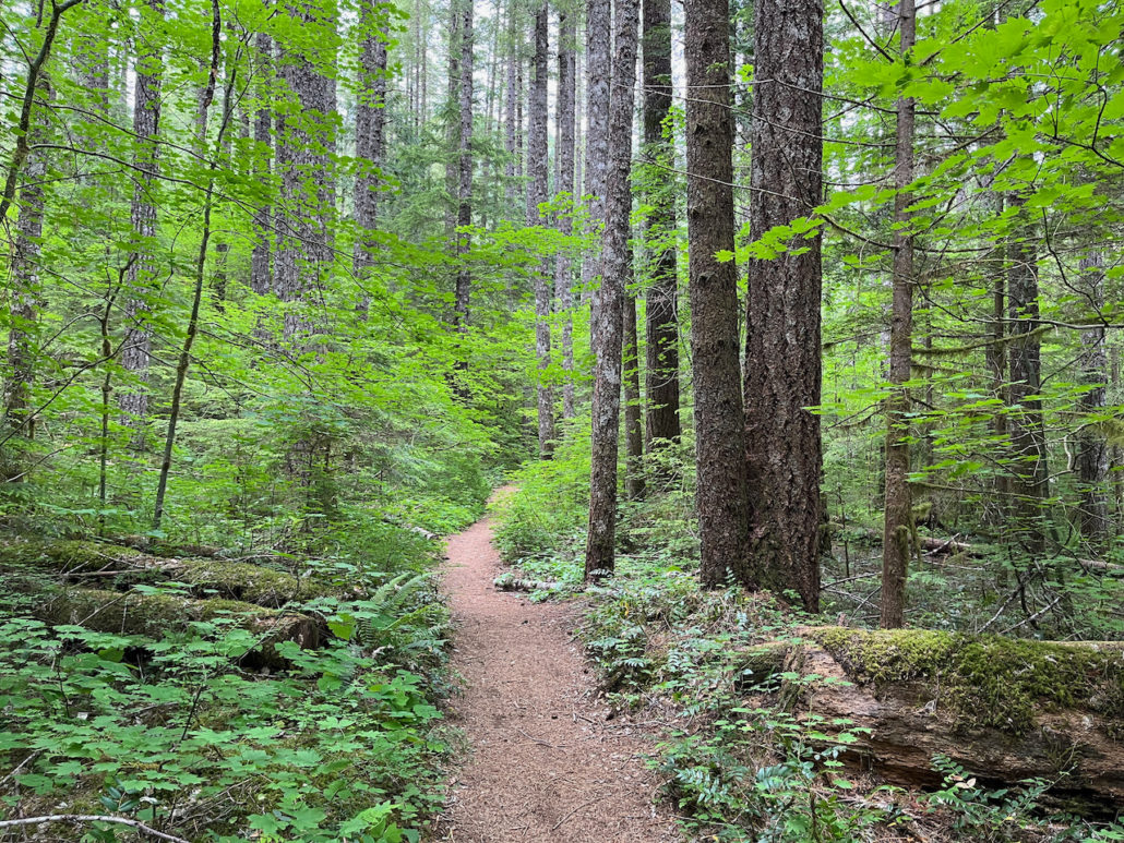
Most of the hike will be through scenery like this
At 0.1 mile, keep right at the junction to head toward an overlook of Lower Lewis River Falls. It’s a bit cliche, but it still bears repeating that photographs really do not do any of these waterfalls much justice. Lower Lewis River Falls is 200 feet wide and 43 feet high, and especially in the spring and early summer, the water really roars here.

This is how the hike STARTS.
Odds are, your drive here was not an insignificant one, so if you want to take a pre-hike meal or snack break, you would honestly be hard-pressed to find a nicer spot than this one. Take it all in and stretch out, and when you’re ready to continue just backtrack north on the Lewis River Trail toward the campground.
The trail hugs the eastern edge of the quite idyllic-looking campground, and on your right hand side you will see some stairs down toward sections of boardwalk that will bring you to the riverside. If you’re camping here on a hot summer day, I imagine that easy access is a huge selling point, and there are some access points at various points all along this trail. You’ll see one staircase down to a boardwalk just before the 0.5 mile mark, which you can take or skip.

The trail gets a few more quick glimpses of the Lewis River as it loops around the north side of the campground through dense forest of fir and cedar. Look for trillium in early spring and summer and blooming Western bunchberry and thimbleberry later in June.

Western bunchberry is abundant on the forest floor
One of my favorite plants here is the vine maple, which grows very differently depending on the available light. When it grows beneath dense forest cover like it does here, it tends to stretch out into incredibly delicate formations, with branches showing up in almost perfectly parallel layers. In the shade, the leaves appear a bright neon green–and during autumn they’ll glow bright orange and red.
Past the campground, the trail gains a fair amount of elevation but it’s always in fits and starts, so if you begin huffing and puffing you’re never too far from a nice little break of downhill or flat stretch of trail.
At 1.6 miles, stay to the right at the intersection with the Wright Meadows Trail to continue northeast along the river. At 1.8 miles, you’ll hit a sharp switchback that will have you climbing up toward the parking area for the the Middle Falls.


Near the 2 mile mark, the trail climbs up a bit of loose rock that’s a sunny departure from much of the forest you’ve been swaddled in for the hike so far. The trail makes a short bypass around the parking area for Middle Falls before diving back into the tree cover.

Just after the parking area is one of the high points of elevation on this route, and the trail heads back into the woods to cross a bridge over Copper Creek, just near a lovely 32-foot tall cascade. You’ll get a better view of the falls itself just past the bridge, so don’t worry too much about straining for a look.

Copper Creek Falls
At 2.6 miles, the trail descends back toward Lewis River and you will see a junction for Middle Lewis River Falls. On this particular hike, we opted to visit Upper Lewis River Falls before coming back to the Middle Falls, but you can do this in whatever order you’d like. Of the three, Middle Falls is the lowest and is more a rolling series of cascades. If the water level is high, it’s also a bit tough to get a good view of the waterfall, but the 0.1 mile spur trail here takes you down to the riverside pretty efficiently.
If you want to continue to Upper Lewis River Falls, continue north on the Lewis River Trail as it threads between the Lewis River on the east and a series of large volcanic outcroppings on the west. These overhangs will provide extra shade, as well as great opportunities to spot vibrant mosses and maidenhair and lady ferns clinging to the cliffsides as water seeps from the topsoil above.

You’ll be able to spot Upper Lewis River Falls through the trees before this, but by 3.6 miles you’ll cross another bridge and pass a spur trail on your left before coming to a truly spectacular place to sit and watch this massive and beautiful waterfall for as long as you’d like.

Upper Lewis River Falls
Upper Lewis River Falls is 175 feet wide and 58 feet tall, and again, photos really do not capture the scale and beauty of this landscape. So you’ll just have to head out for yourself!
Enjoy sitting at the base of this waterfall for as long as you’d like. If you want to get an additional vantage point, that spur trail you passed just before you arrived will take you up and above Upper Lewis River Falls and to the smaller Taitnapum Falls, though you should know the trail is very steep.
When you’re done, head back the way you came.
Tags: Gifford Pinchot National Forest, lewis river falls, Mount Adams, washington, waterfalls


