Gallatin National Forest’s Lee Metcalf Wilderness in the Greater Yellowstone region has no shortage of great trails leading to beautiful destinations. Countless canyons, creeks, waterfalls, lakes, and glacial basins surround the ski resort community of Big Sky, providing a summer destination that’s every bit as appealing as the downhill runs at Lone Mountain are during winter. One of the best introductions to this vast region includes a little bit of everything that makes the Gallatin great, including one of its largest and most beautiful lakes: Lava Lake.
Hikers can reach Lava Lake by way of a moderately steep 5.1 mile out-and-back route that follows the course of Cascade Creek. Sections of this trail are a bit steep and lie at an elevation that may provoke some symptoms of altitude sickness for hikers who haven’t acclimated. Another safety consideration includes bears, which are common throughout the Gallatin. Hikers are advised to carry bear spray as a means of deterring any aggression from bears. Hiking in groups is also a wise proposition, as group hikers tend to make a lot more noise. This noise warns bears in advance, allowing them to evade unruly humans.

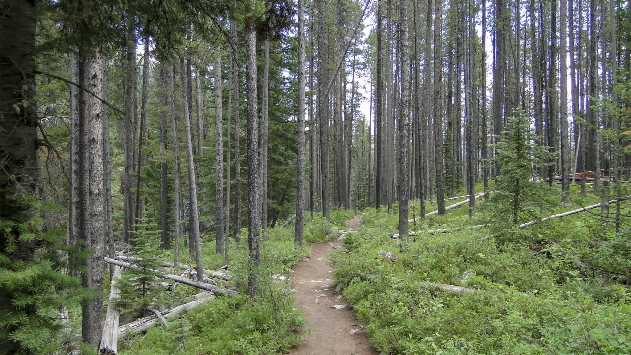
The trailhead lies just north of the confluence of Cascade Creek and the Gallatin River along US-191 as it runs north to south from Bozeman to Yellowstone National Park. The trail initially heads due south as it makes its way around a ridge and into Cascade Creek’s densely forested canyon. The creek rumbles below on your right (south) as you pass through a dense forest of lodgpole pines.
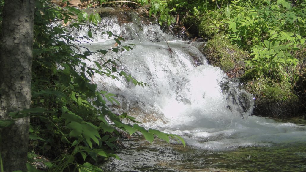
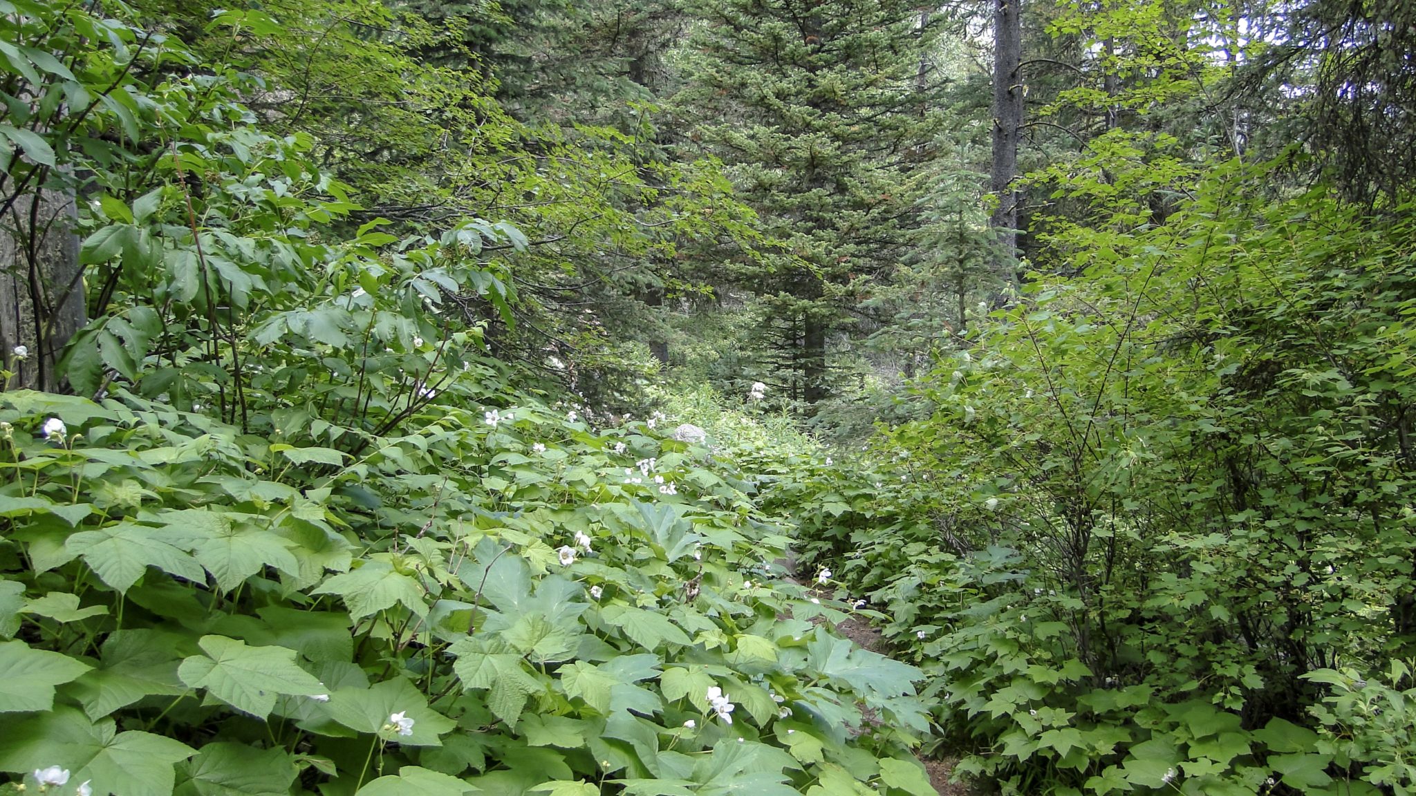
After entering Cascade Creek’s canyon, the trail settles into a southeasterly course paralleling the creek. The ascent remains moderate throughout the first 1.5 miles. At this point, the trail descends toward the creek and crosses over along a makeshift bridge at 1.8 miles. The crossing lies just below Hoodoo Cascade, and you’ll get plenty of good looks at the cascade as you continue the ascent now on the south side of the creek. The switchbacking climb quickens and becomes fairly steep in some spots. This north-facing slope aspect also harbors dense thickets of berries and other understory plants that can become pretty overgrown in some spots.
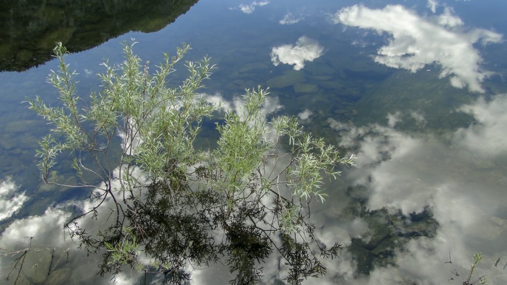
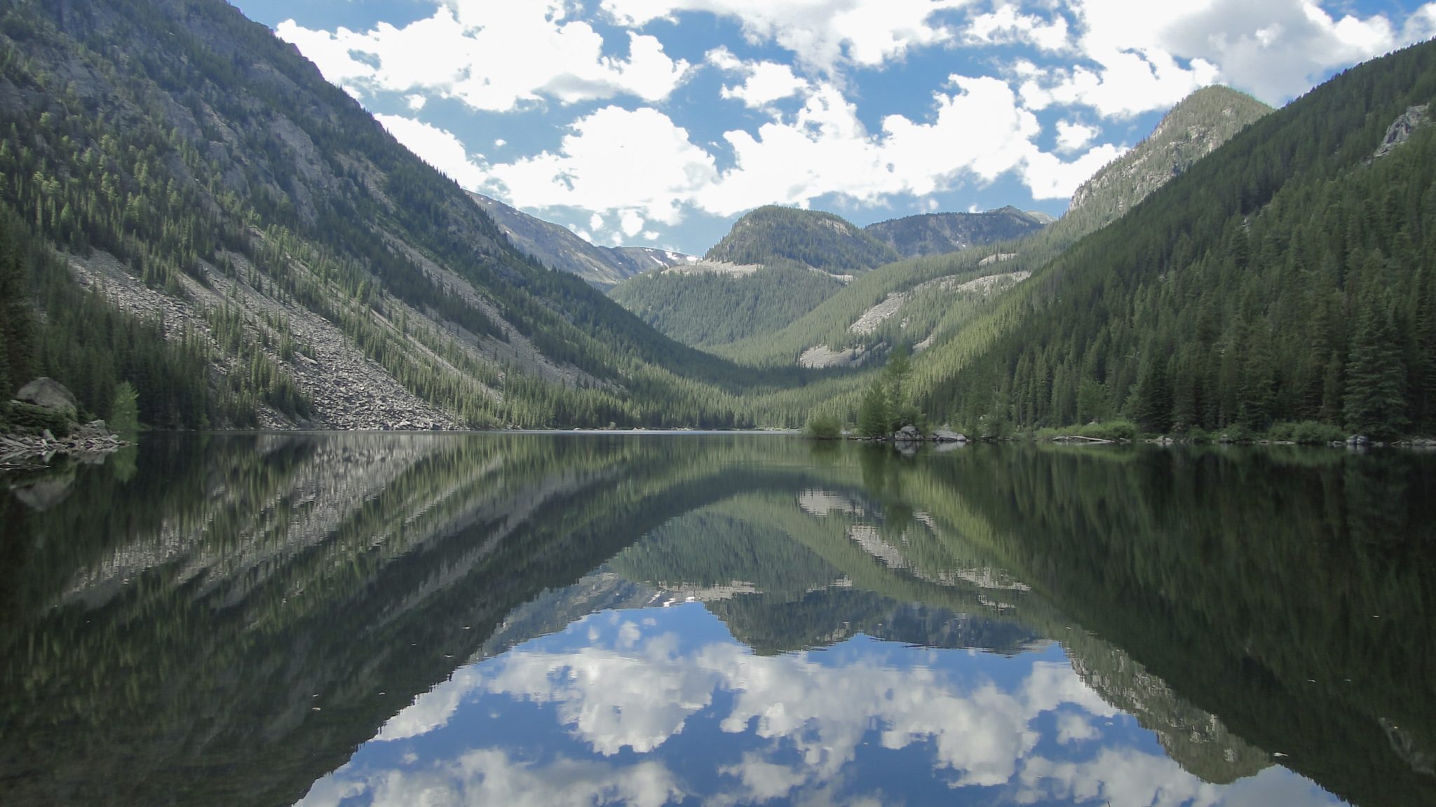
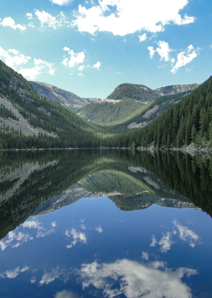
At 2.3 miles and after a few final gasps on the climb, the trail passes a junction with a lightly traveled trail that traverses the Spanish Peaks and Table Mountain. Just beyond that junction, the trail reaches the northern end and outlet for Lava Lake. This oblong lake occupies a deep basin bound by the Spanish Peaks to the southeast and Jumbo Mountain’s massif to the southwest. Views directly across the lake take in this deep, forested basin. On clear days, the mirror image of the lake’s still waters reflect the Montana sky with crystal clarity.

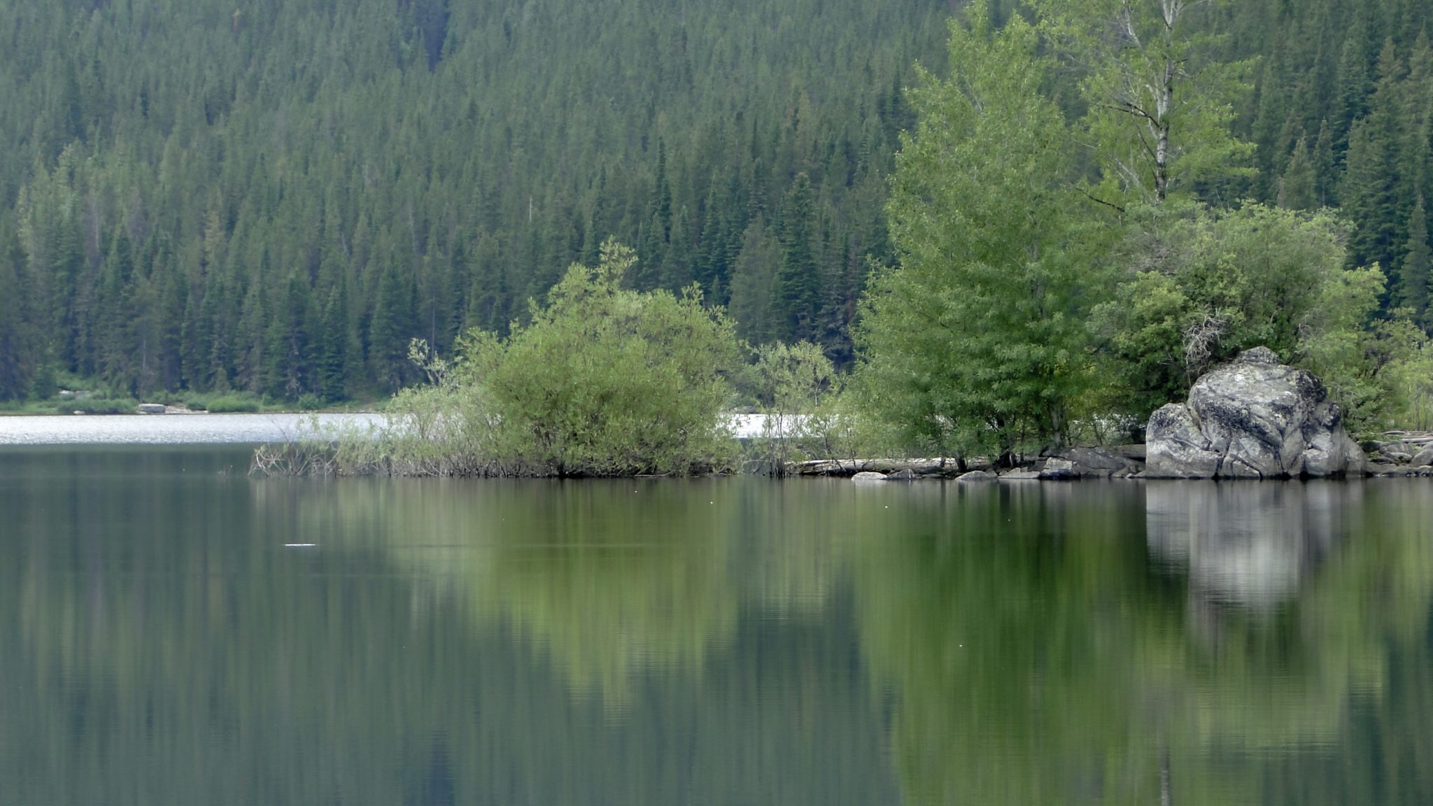
After crossing over the inlet on an unimproved crossing, the trail continues around the northwestern bank of the lake on a nearly level grade. The path arcs toward a small peninsula studded with aspens and spruce that juts out a way into the lake’s western bank. A few campsites can be found near this peninsula, but be sure to camp more than 200 feet away from the water. If you’re backpacking, also be sure to use a sturdy bear canister as bears both black and grizzly roam these forests.
Tags: Big Sky, Cascade Creek, Gallatin National Forest, Gallatin River, Hiking, Hoodoo Cascade, Lava Lake, Lee Metcalf Wilderness, Montana