As with most trails in Hawaii Volcanoes National Park, we highly recommend you check the park’s What’s Going On With the Volcano? page before you make your plans. It should go without saying, but when you’re hiking around lava and poisonous gasses, it’s probably best to be informed on where, exactly, those threats are likely to be present. You may also wish to contact the County of Hawaii Civil Defense, which will limit or close access via this route depending on the volcanic activity.
USGS Hawaiian Volcano Observatory
by phone at: (808) 967-8862
by web at: http://hvo.wr.usgs.gov/activity/kilaueastatus.php
County of Hawai’i Civil Defense
by phone at: (808) 935-0031 (7:45 am – 4:30 pm)
by web at: http://www.hawaiicounty.gov/active-alerts/
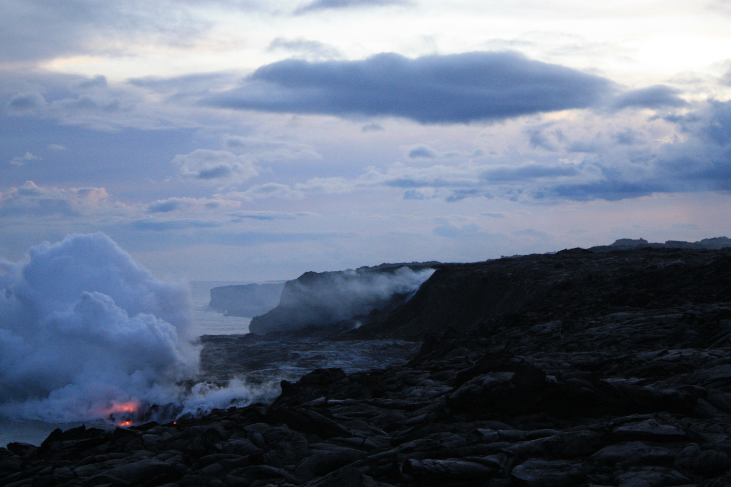
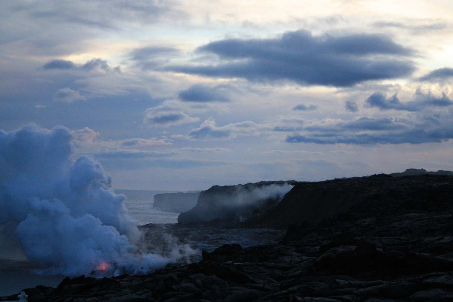
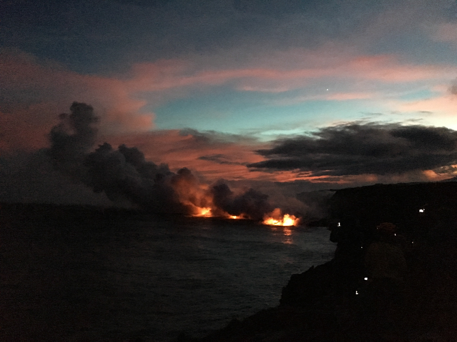
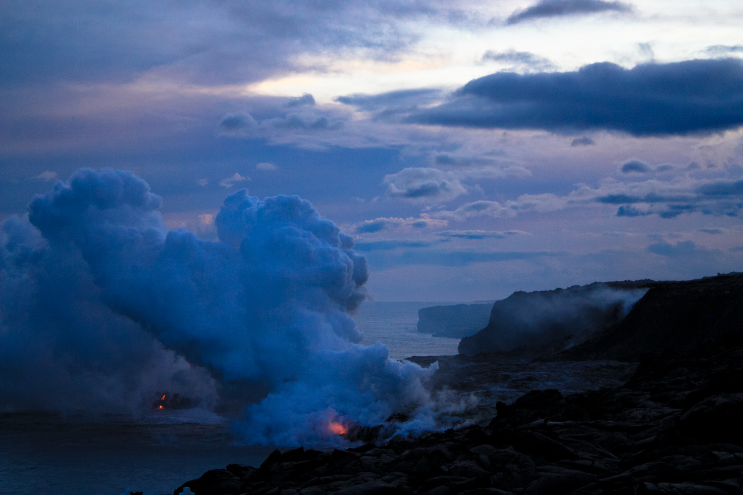
Hawaii Volcanoes National Park is one of the most fascinating units of the National Park system, mostly because you can literally watch new land being formed right before your very eyes. This hike to the Kamokuna lava flow (event 61G) is an unforgettable trek through a desolate lava flow area to a viewpoint where you can watch molten lava entering the Pacific Ocean. It is an experience unlike any other I have ever had on a hike and one that can take on an almost magical feeling if you time your hike for sunset, when the glow from the lava illuminates the vapor clouds coming off the ocean.
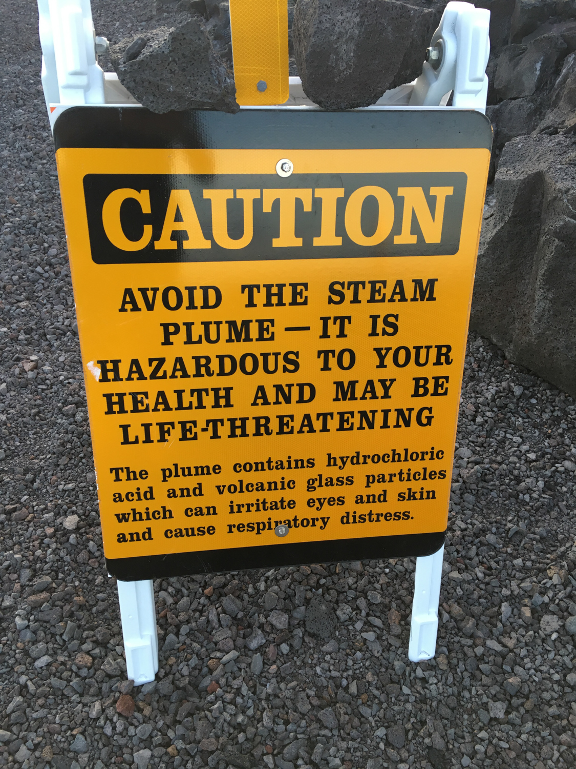
Needless to say, this is a hike with some very specific safety concerns. This is a place where you most definitely want to pay attention to warnings, signs, and marked trails — because the ground could literally explode in your face or sink into the ocean in a matter of minutes.
I recommend timing this trek for the late day and into the sunset. Not only will you get some stunning views of the lava entering the ocean, but you’ll also avoid some of the brutal daytime heat. For the entire hike, you’re walking across a mostly barren lava flow in full sun, so expect it to be hot. Pack more water than you think you’ll need and definitely make sure your headlamp or flashlight are charged with extra batteries.
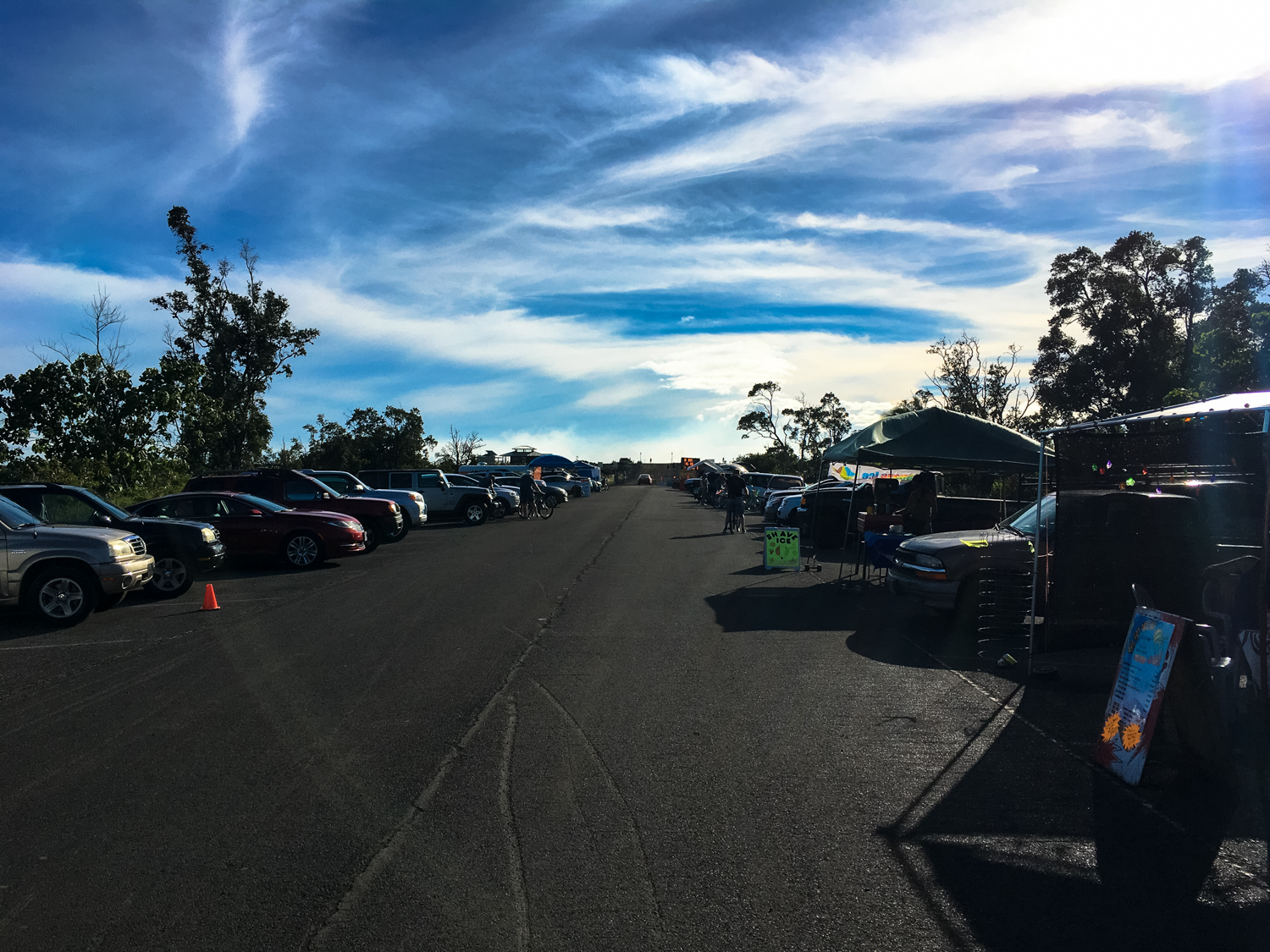
The trek begins at the end of the Chain of Craters Road. Vendors will likely be set up near the parking area, where you can load up on cold drinks, shave ice, and souvenirs. You can also rent a fat tire bicycle if you’re not in the mood to walk the roadway or you’re short on time but still want to see the flows.

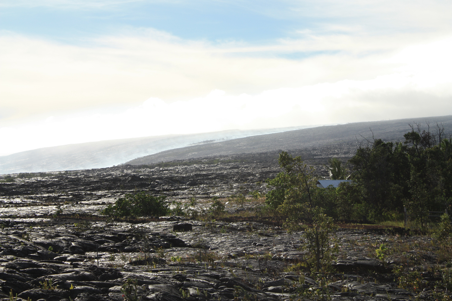
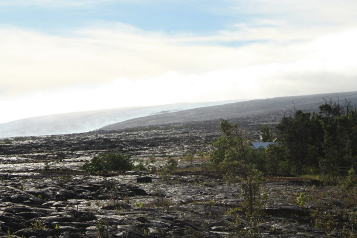
Hike past the vendors (or maybe snag some shave ice for the road) and you’ll pass some port-a-potties, followed by a gate. The dense forest near Kalapana Gardens soon gives way to a barren, blackened moonscape.

It may be hard to believe, but there used to be a town here.
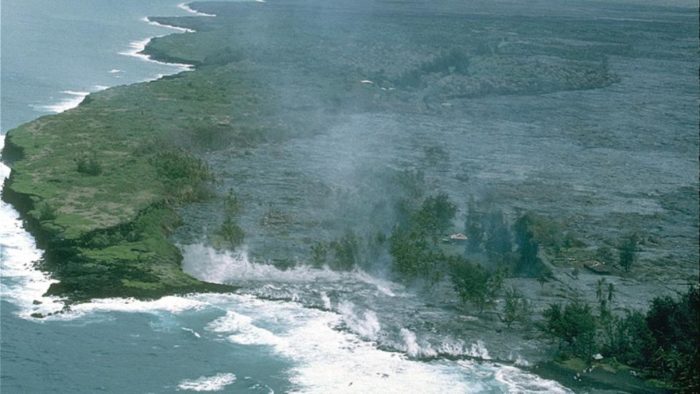
The town of Kalapana and the subdivision of Royal Gardens hugged the coastline in tropical forest in this spot, until the Kīluaea eruption’s lava flows turned in its direction. In 1983, a vent from Kīlauea opened up nearby and destroyed 16 houses in Royal Gardens. Another flow in 1986 destroyed 14 more homes on the outskirts of Kalapana, but spared the majority of the historic fishing village.
By 1990, however, those lava tubes had become blocked up, and from April 3, 1990 through February, 1991, slow moving lava made its way into the streets of Kalapana, burying most of the village under up to 85 feet of volcanic rock, completely destroying the black sand beach at Kaimu and building a new coastline that extended an extra 1000 feet into the ocean. More than 150 homes were destroyed, but no lives were lost. More photos and history of this event can be found at the USGS web site and here.
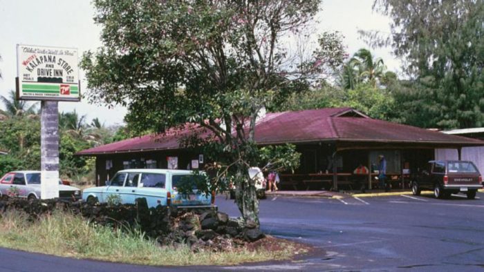
Walter’s Kalapana Store and Drive Inn, April 23, 1990. Photo by USGS.
Walter’s Kalapana on June 13, 1990. Photo by USGS.
Kalapana, April 3, 1990. Photo by USGS.
Kalapana, June 3, 1990. Photo by USGS.
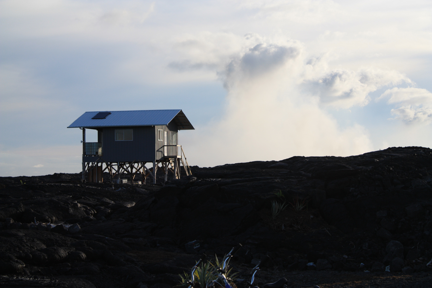
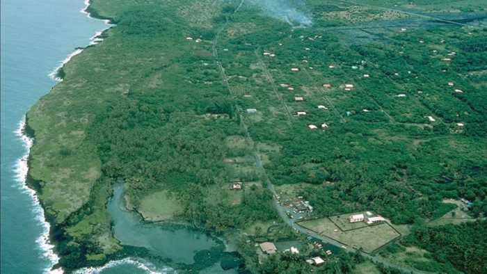
Somewhat unbelievably, deeds to the land are still being honored, so some residents moved back into the devastated landscape and built replacement homes. The land is, understandably, very affordable, but all the homes you’ll see here are entirely off-the-grid, as the area is still under heavy threat from eruptions. A 2011 lava flow destroyed one new home in the neighborhood already.
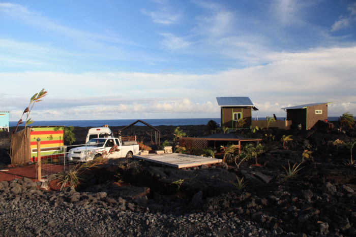
New homes, 2016.
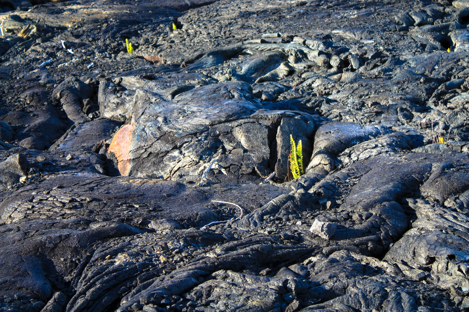
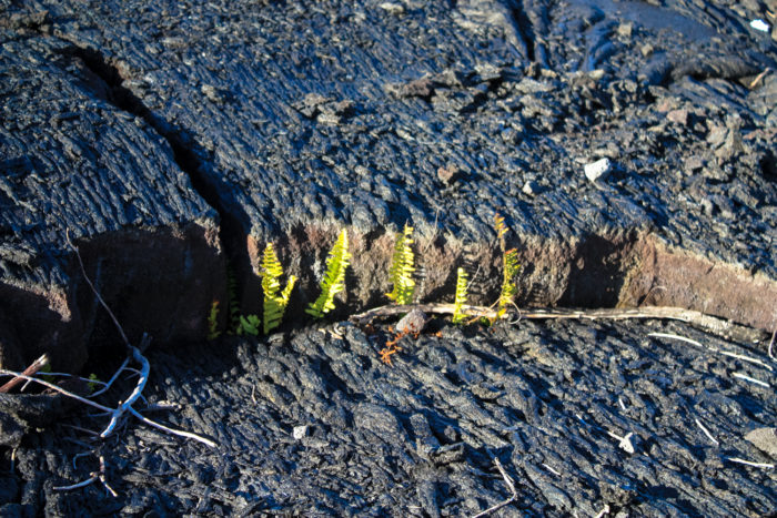
The first gate is about 0.7 mile from the trailhead, while a second gate is about 2.4 miles in. As you walk along this unique and fascinating landscape, be sure to keep an eye out for the rugged plant life making toeholds in the relatively fresh lava flows.

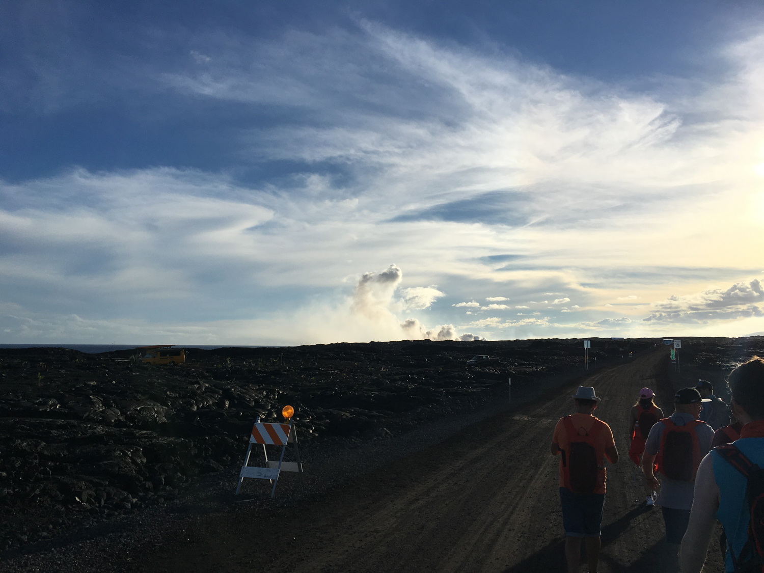
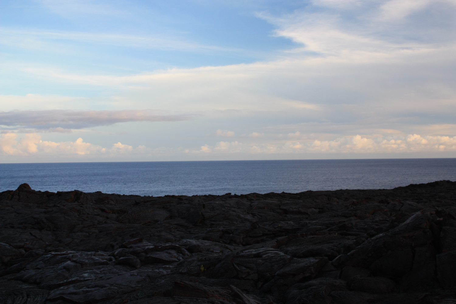
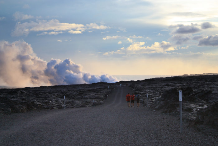
As you approach the lava flows, you’ll likely start to see some of the clouds of smoke and steam off in the distance. The whole experience has a “journey to Mordor” sort of feel to it.
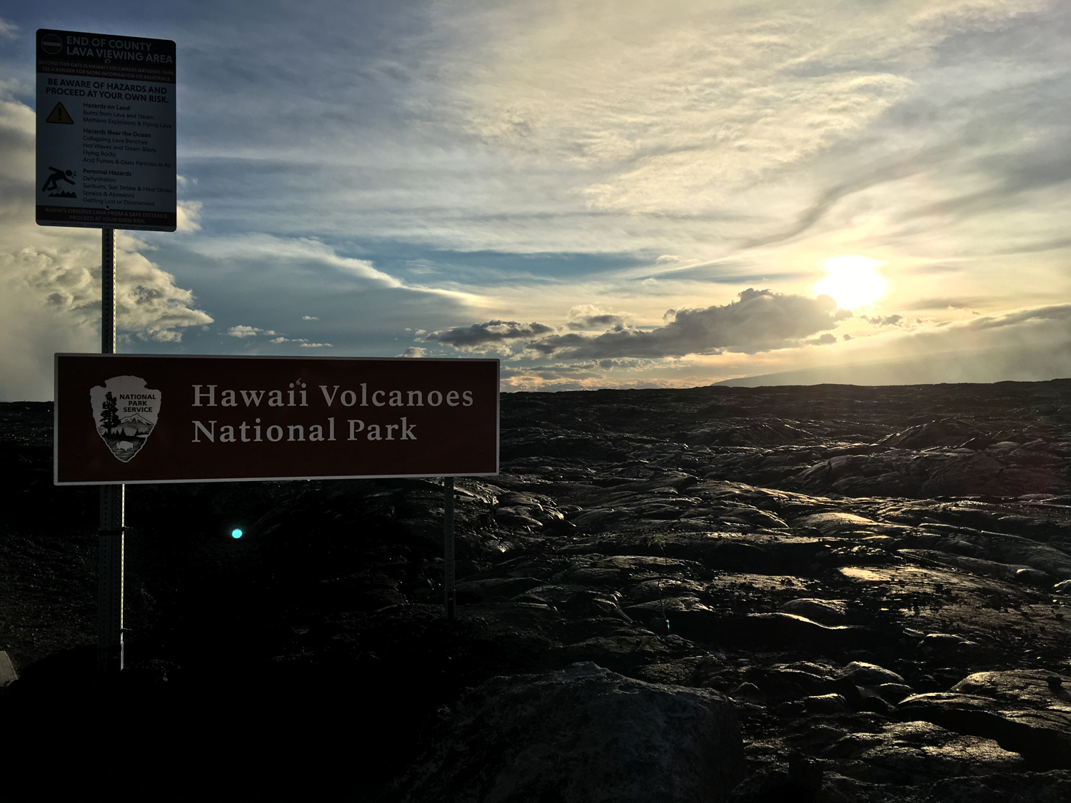
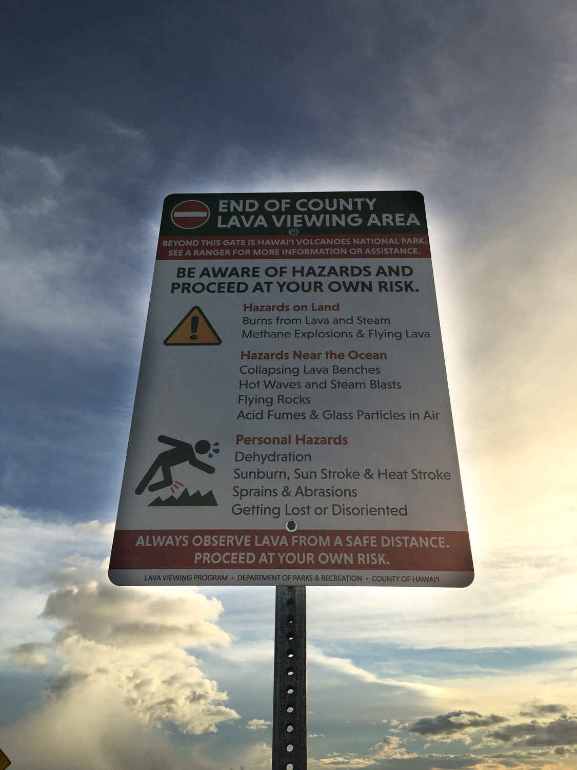
There’s another port-a-potty at 2.7 miles, and at 2.9 miles you’ll enter the boundary of Hawaii Volcanoes National Park. As is the case with the rest of the park’s entrances, be on the lookout for very specific safety signs depending on the recent volcanic activity.


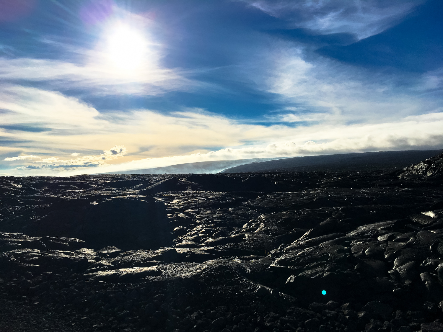
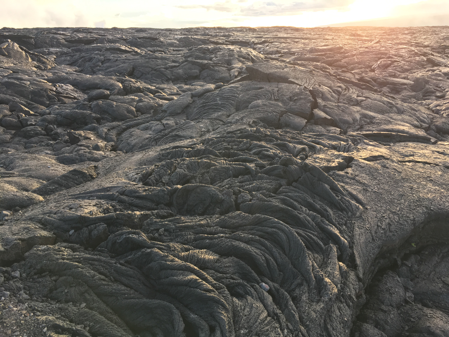
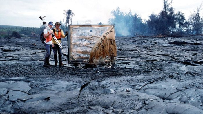
The location and strength of the lava flow may obviously change from day to day — for me, the marked trail to the viewing area was about 4.2 miles into the hike. Here, you’ll leave the gravel road and walk along the flow itself on a very rough, unmaintained route.
There may or may not be a marked trail or areas roped off for your protection. The ground is extremely uneven once you leave the gravel road, and the cooled lava can be full of jagged edges and glass particles that can really do a number on your skin if you happen to fall onto it. Hikers on the Big Island told me that this type of terrain chews up the tread on hiking boots something fierce — but if you’re just on it for a short while you likely won’t have to worry too much about replacing your boots.
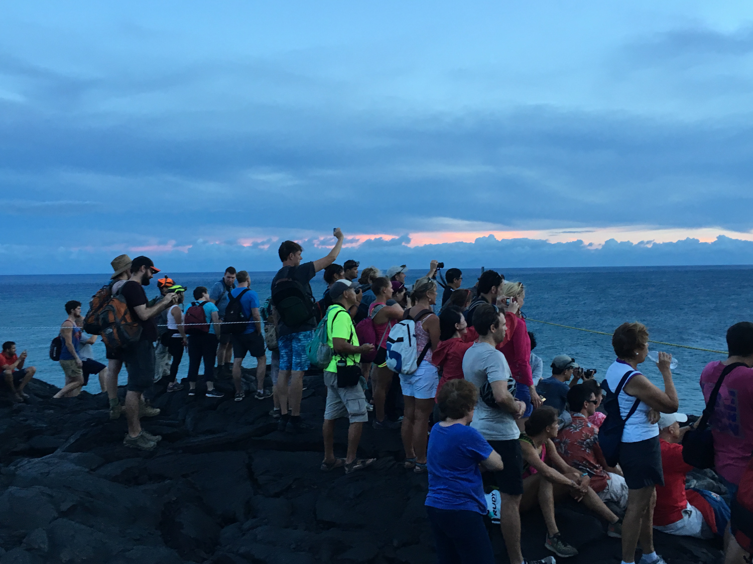
If you’re visiting the lava flow at sunset, it’s especially important to pay close attention to your surroundings once the sun starts to set. There aren’t any sources of light around for a long, long distance, which makes the scenery drop dead gorgeous but also means that it will get really dark really quickly.
Join your fellow lava-peepers at the viewing area and try to set up a good telephoto lens to get solid shots … or just enjoy the incredibly rare experience of getting to literally watch new land forming on an active volcano. Although there was a small crowd when I was visiting, it never felt too crowded, and I was able to get a good view of the volcanic action.


Again, a word of warning — if areas are roped off, they’re roped off for a reason. The edges of these cliffs near the ocean can be incredibly unstable, and are prone to just dropping into the water or exploding without much notice. When you’re done soaking in this unbelievable scene, return back the way you came.