This loop trail around Tent Ridge in Spray Lakes Provincial Park is a challenging day hike with some light technical sections, steep exposures, and absolutely epic views of the Spray Lakes, Kananaskis area, and southeastern Banff National Park. This is a stunning trail that belongs on every hiker’s must-do list.
Towering some 8,000 feet above the deep valleys of Kananaskis Country, the looping horseshoe-ridge of the Tent Ridge Track provides an exemplary opportunity to soak in the deep, remote feeling of wilderness in the Canadian Rockies. You’ll trek through meadows, gaze at blazing orange larch forests in the fall, scramble up loose scree slopes, traverse narrow and exposed ridges, and spot shimmering lakes and towering peaks in an unforgettable panorama from the summit. In an area rich with majestic landscapes and trails, it’s tough to think of one that can top this one.
The Tent Ridge Track is rated by most Canadian hikers and guidebooks as a moderate trek, but most hikers would likely consider this on the upper end of strenuous. The high elevation and exposed slopes will definitely sap your energy resources along the way, and although the scrambling sections are short and pretty mild, they may deter hikers who aren’t used to those sorts of challenges on their hikes.
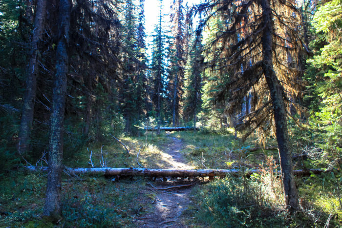
This trek begins at an unmarked but popular trailhead along Mount Shark Road. You’ll park your car near the end of this trail, which means the hike begins with a short 0.1 mile backtrack along the gravel road. Look for a wide area cut into the dense pine forest and begin hiking west.

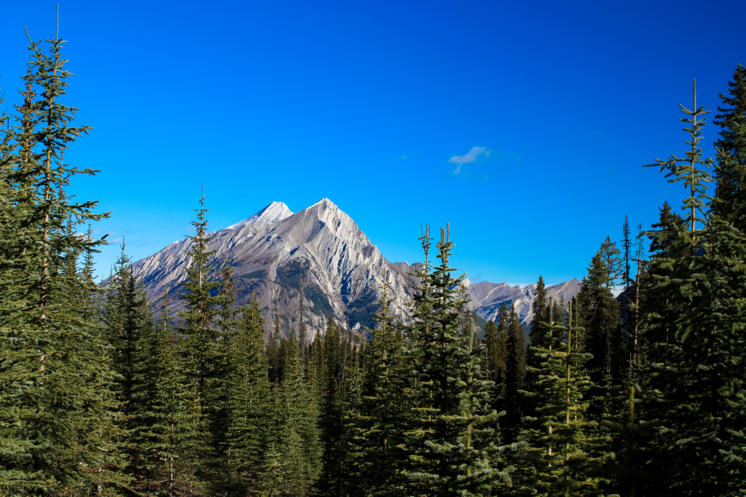
The trail makes a mild but steady incline here and makes a sharp turn to the south at 0.3 mile. Although the forest is fairly dense here, you will be able to see some inspiring mountain peaks poking through breaks in the tree cover.
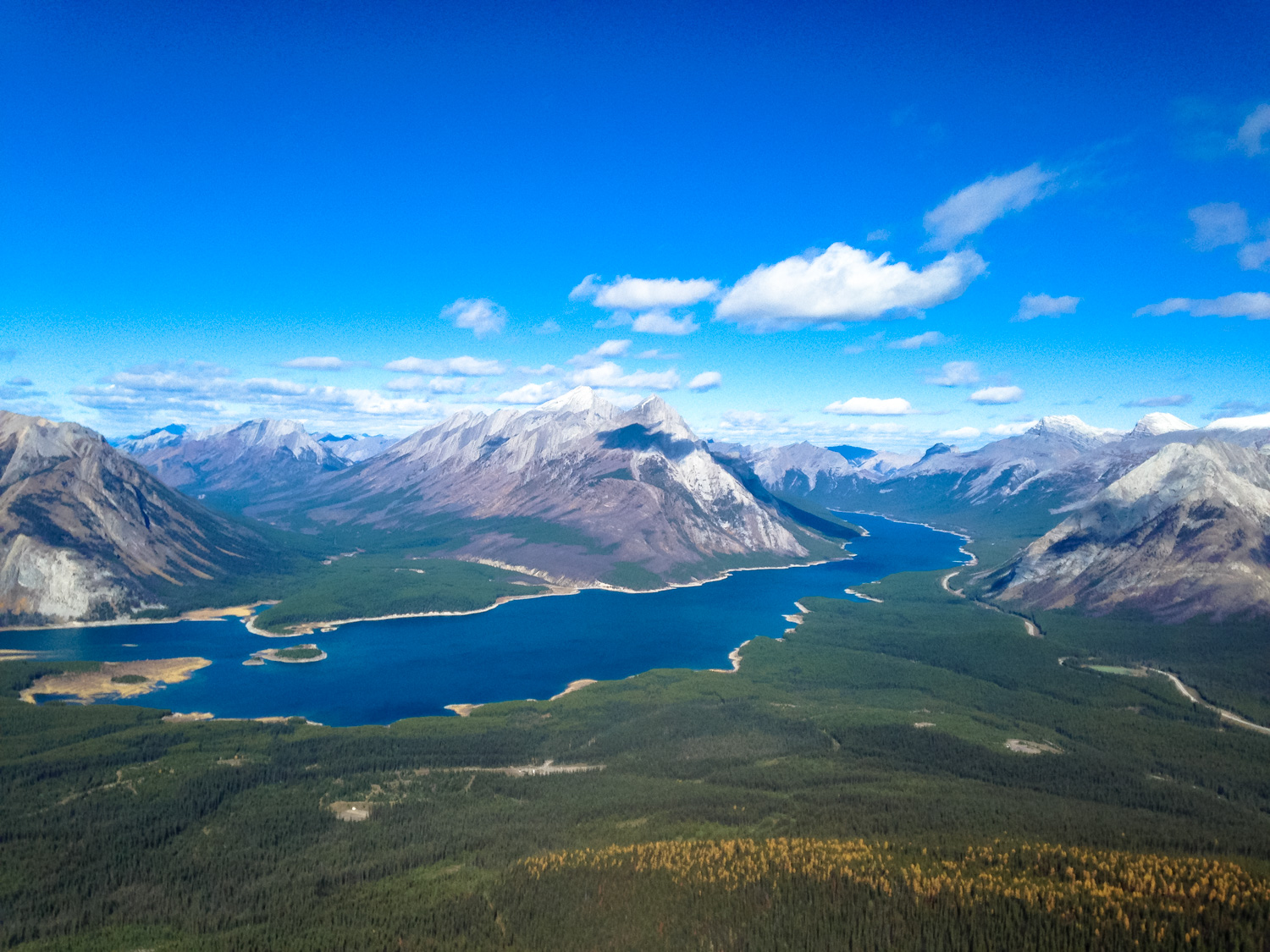
The official hiking trail becomes a bit faint here, and there is supposedly a route that branches to the southwest at around the 0.5 mile mark, but we weren’t able to see it when we were hiking the trail. If you do miss this rough trail, don’t worry – there’s a more visible and clearly much-more-traveled connector trail that will join the Tent Ridge Track at 0.7 mile. Take a sharp right hand turn and the trail will continue its climb, offering up your first view of the azure ribbon of the Spray Lake Reservoir snaking its way between Mounts Engadine, Buller, and Fortune.

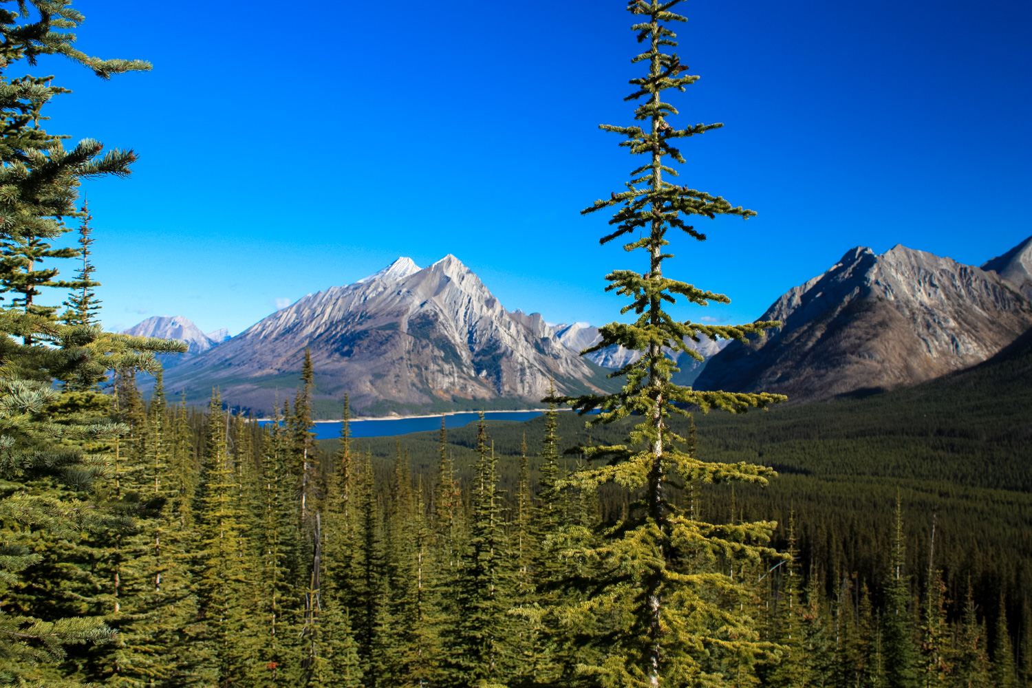
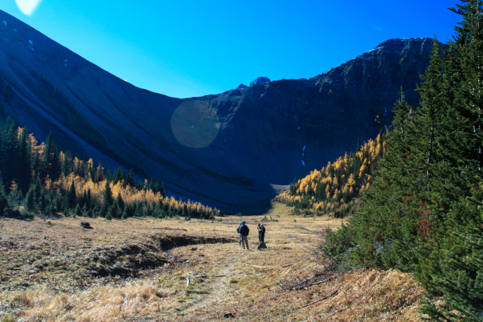
At 0.9 mile, the trail bends to the southwest again, entering a wide valley formed by snow-fed creek flowing from the bowl of the Tent Ridge area north to the Spray Lakes Reservoir. Here the trail is once again hemmed in by the forest, and as it continues heading south you’ll see the towering Tent Ridge just to your west.
Soon, you’ll be standing up on that ridge looking down.

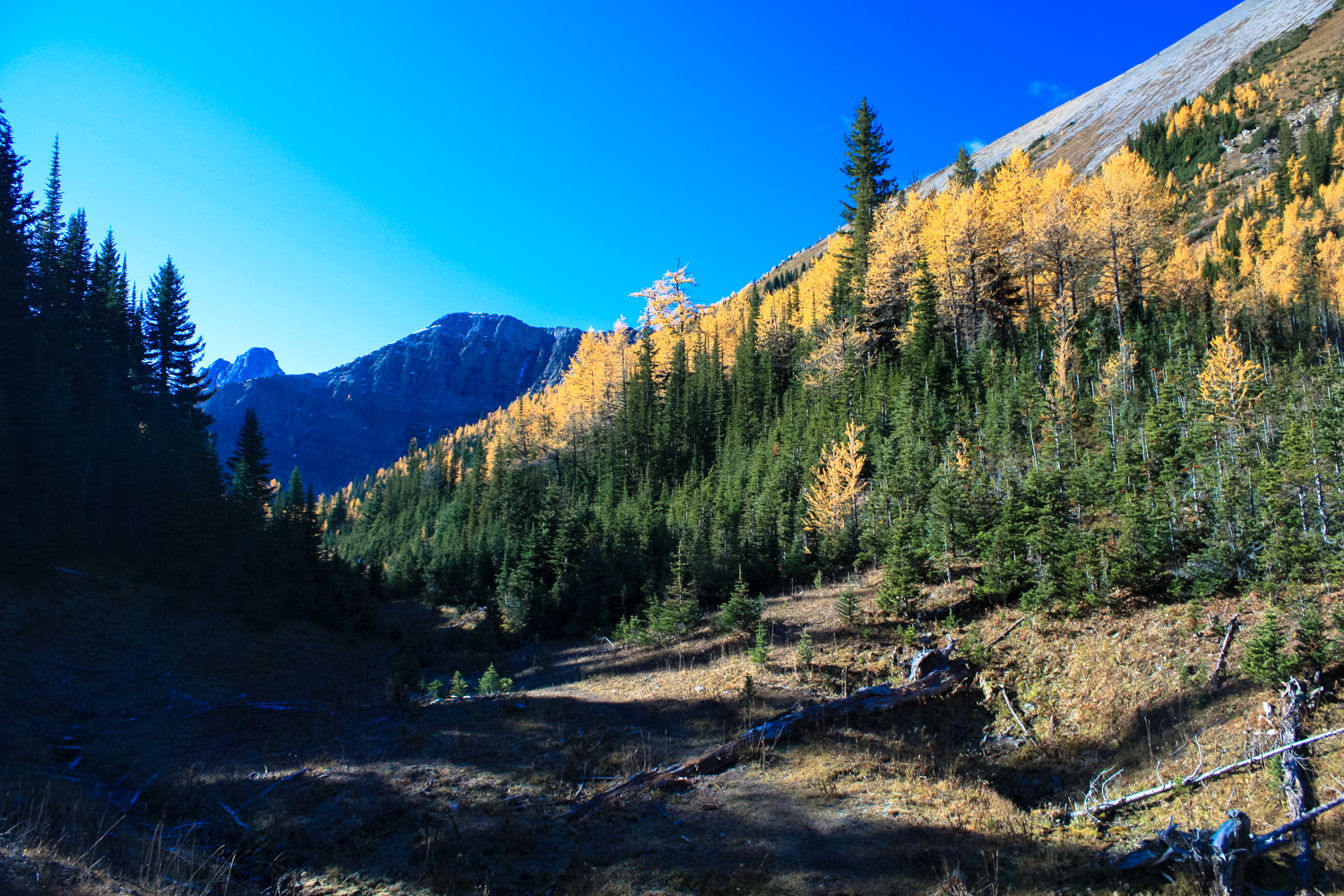
The eastern slope of Tent Ridge looms on the right, covered in larch trees.
At the 2 mile mark, the easy, established part of the trail ends, and the route you’ve been following just sort of dissolves into the meadow that’s nestled into the backwards-J confines of Tent Ridge. This is a great place to stop for a quick snack — or just steel yourself for the next part of the hike … which is significantly more difficult than the hike you’ve been enjoying so far.
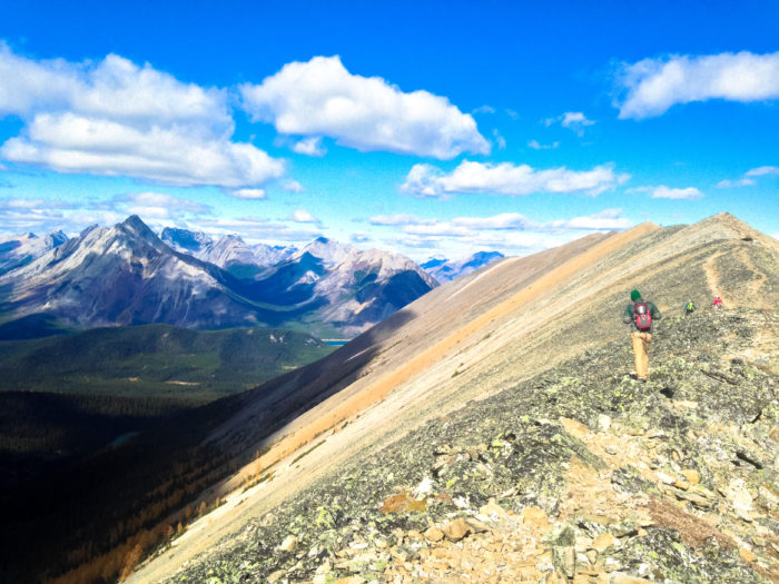
Look for a faint use trail heading east. This route takes you to the edge of that backwards J and from here, you basically just start climbing up the ridge. You may be able to see your fellow hikers further along on the route, ascending the ridgeline as tiny, backpack-wearing dots.

hikers ascending the first ridge
This incline begins as a semi-established use trail meandering its way up the ridgeline. You don’t have to worry too much about losing the trail here, as the ridgeline is fairly narrow and the route is well-traveled. Although most of this part of the trail is just tough, steep hiking, there are a few short sections which will require some Class 3 scrambling – with one section climbing about 10 feet or so at once. If you are not used to scrambling with steep exposures, this may be a difficult part of the journey. Exercise caution and don’t be afraid to turn around if you feel unsure — but know that this is the most technical part of the entire loop and after this you’ll be back to good ol’ boots-on-the-ground hiking for the remainder of the trek.
And while there is a big incline on this part of the trip, that also means that your views are going to get exponentially better here as you climb above the tree line.

So far from where you came, so much left to hike

After a tough climb, you’ll reach a weather station outpost at 2.8 miles perched on a tiny, rocky summit overlooking Tryst Lake just to the south. You’re at about 8140 feet here and if you’re planning on stopping for a snack or rest you’ll likely want to bundle up a bit – the breeze seems to be constant and strong.
But the views from here … Oh man the views!

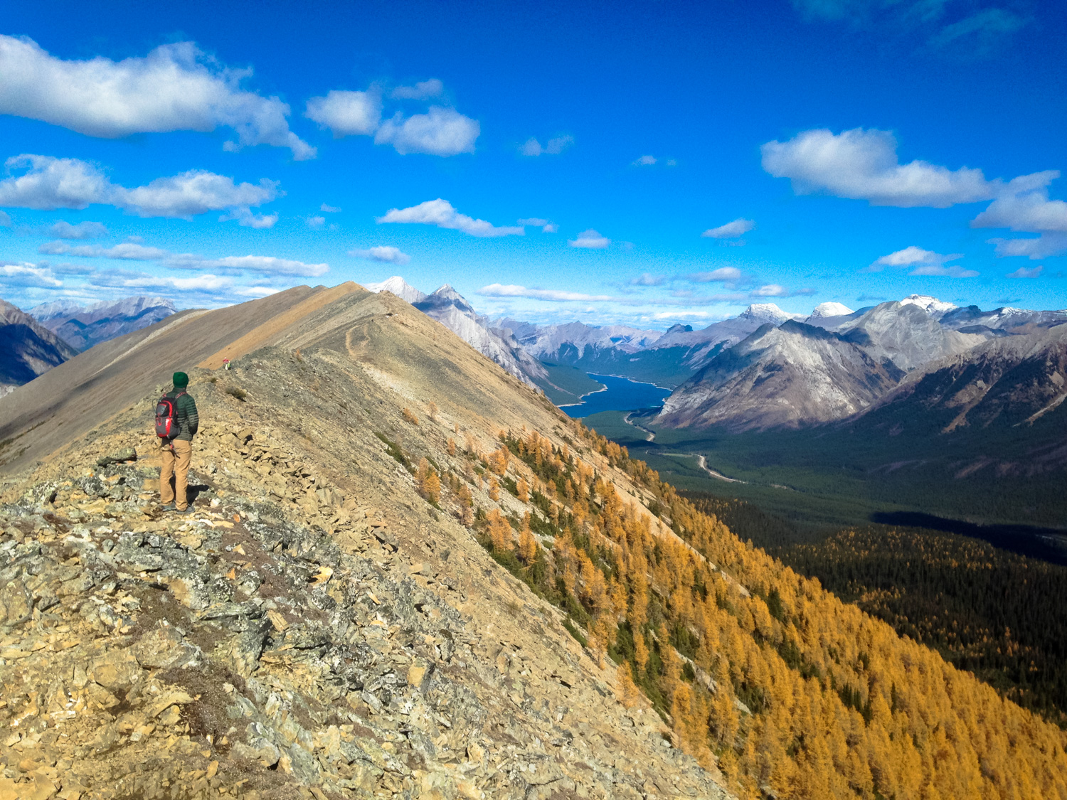
the saddle and ridgeline to the next part of the hike

approaching the weather station

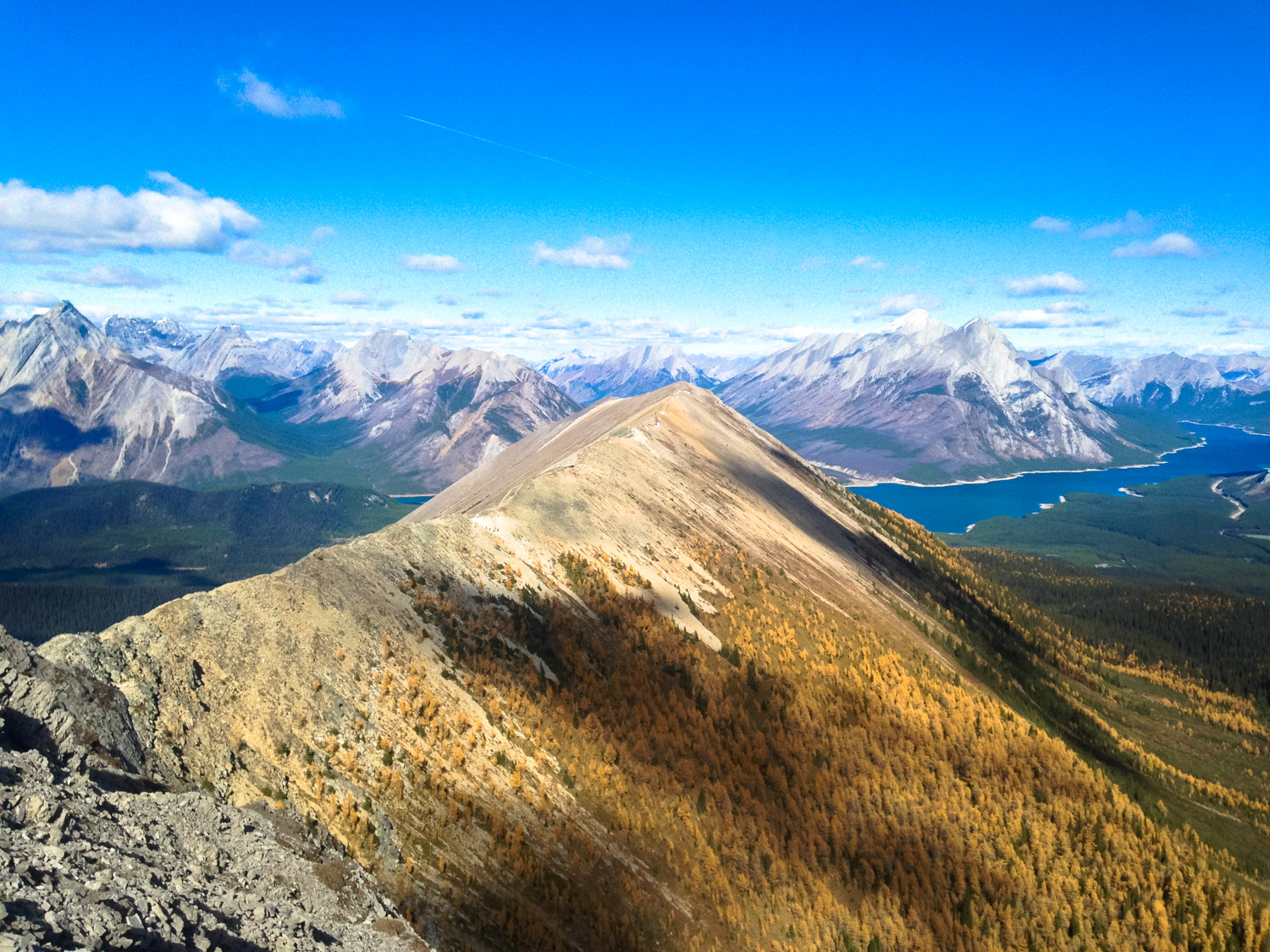
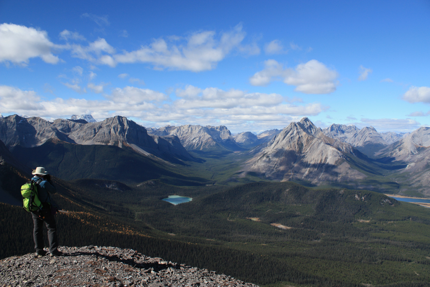
looking south toward Commonwealth Peak, Mount Birdwood, and Mount Smuts

Spray Lakes in the distance and the approach valley in the foreground
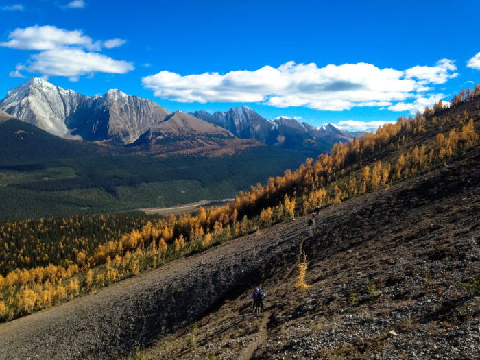
After the summit break, get ready for another workout. The trail drops down nearly 340 feet in 0.2 mile, then climbs another 525 feet in 0.3 mile — much of it on loose scree slope.

a faint footpath provides slightly stronger traction on the decline to the saddle
At the saddle, another steep use trail heads down the scree slope and will take you to Tryst Lake, where you can follow a trail east along a creek, then turn north onto the Mount Smutwood Route and rejoin Mount Shark Road — another fine loop option if you feel like you’ve had your fill of peaks. But for this route, you’ll continue west, heading straight up the ridgeline that bottoms out that backwards J you’ve been looking at the entire time.
 The climb begins on loose dirt and light scree before transitioning to more solid rock at the higher elevations. By the 3.3 miles you’ll have hit the high point of the loop (at about 8314 feet), where even chunkier boulders provide more solid footing and handholds if you need them.

Your next destination

Looking back – the tiny weather station is visible on the peak in the center
After a short decline, the trail maintains a relatively level approach as it swings north here. There are a few places where you may want to watch your footing but nothing really worth being too worried about.
The trail stays on the ridge before dropping down just below it — which will be an especially welcome change of pace if you’re getting hammered by wind on the ridge.

It’s relatively smooth sailing until you hit 4.56 miles. This is the end of the ridge route, and on a promontory on the north side of the ridge you’ll have a stellar place to soak in some panoramic views of Spray Valley.
Sit down, pull out the camera, and enjoy it!


On the northeast side of this small ledge, look for a steep trail of switchbacks. This is your way back down.
This route is very steep. While the ground may be loose and slippery, it isn’t as technical as the route you climbed up on. Just take your time and watch your step and you’ll be fine. If you packed some trekking poles with you, now is a very good time to take them out — your knees will thank you later.
Follow this well-defined route as it makes its way back down into the treeline

The grade remains fairly steep until the 5.2 mile mark, when the decline becomes a little more gentle. There are still some rugged parts of this route, though, including some steep and slippery steps over tree roots and itinerant streams.
Somewhat unbelievably, we encountered some mountain bikers coming UP this trail on our way down while we were hiking … so also be aware of who is coming down behind you — because they’re probably going to be coming down pretty quickly.
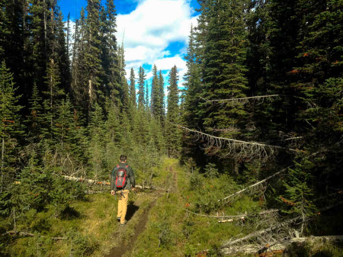
Eventually the trail reconnects with what appears to be an old logging road grade at about 5.6 miles. Follow this trail, keeping right at a junction at 6.3 miles, and you’ll emerge on Mount Shark Road again at 6.6 miles. The trailhead is just to the south.
If you’re looking for a killer post-hike meal, be sure to stop in at the Mount Engadine Lodge. They serve a fantastic Afternoon Tea and also offer an incredible and extremely filling three-course dinner menu that changes nightly. Call 403-678-4080 for reservations.
Tags: alberta, Canmore, Kananaskis Country, Mount Engadine, Spray Lakes, Spray Valley Provincial Park, Tent Ridge Track